

Ride along with me...


Thread Starter
|
Captain

Joined: Oct 2005
Posts: 570
Likes: 8
From: The Summit, Queensland, Australia
Resuming on the drive from New York City through Connecticut...
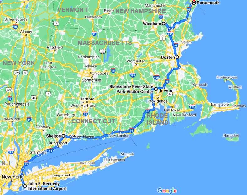
After leaving my stepson at the airport and spending two and a half hours in the 'rush hour' traffic getting to Connecticut I had a nice little visit with Nick Tiberio.
Nick has a passion for old Chryslers and has been keen to help us with my nephew, Ben, and his project. He phoned me back just in time for me to drop off the freeway and go to his place. He and his wife, Theresa, were very welcoming.
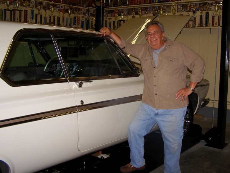
Nick and his toys. Nick Tiberio is a real 'good guy' and a very keen man when it comes to showing his Plymouth at the local car shows. Note the trophies around the walls? And there's lots more you can't see!
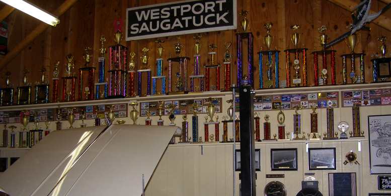
Trophy case. I did say Nick likes to show his car... just a small selection of the trophies he's won, plus some of the other little nick-knacks he's picked up along the way. Love the high ceiling in the garage!
Nick's Poly. Nick sent me this photo he took of myself with one of his Poly engines.
Even though there's a mass of trophies there, Nick told me he won't allow his car to be judged once he's won that particular event at some time. He still displays it, however, and he told me there's at least a dozen car shows on within fifty miles every week!
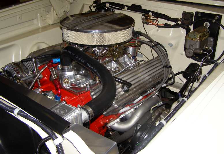
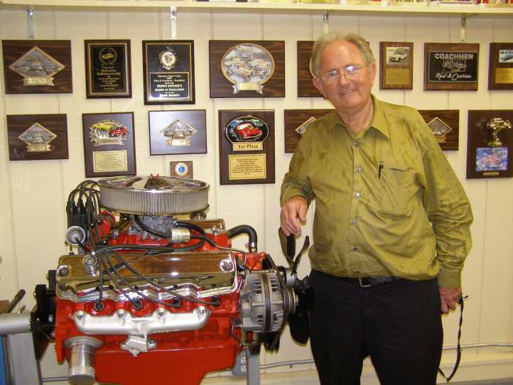
Full house. Built for show and go, Nick's Poly 318 engine looks good in the Plymouth's engine bay, carburetion, exhausts, distributor and intake manifold show that there's more in this than meets the eye!
I was still feeling quite unwell in the stomach and when I camped for the night I certainly hoped that I'd wake up feeling better. I didn't.*
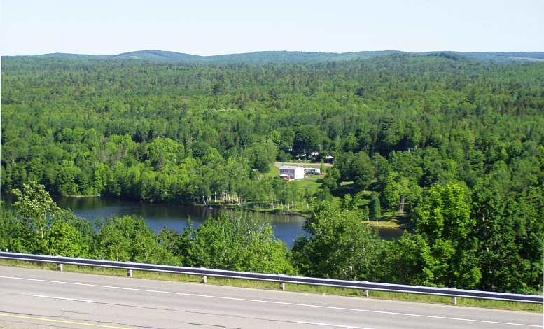
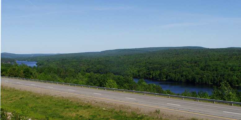
Nevertheless, I pressed on through Eastern Connecticut and made it into Rhode Island. This was my first 'new state' in a couple of weeks, but as I looked at the time and the distance I still had to be at Moncton in New Brunswick the following day I was quite concerned about making my goal.
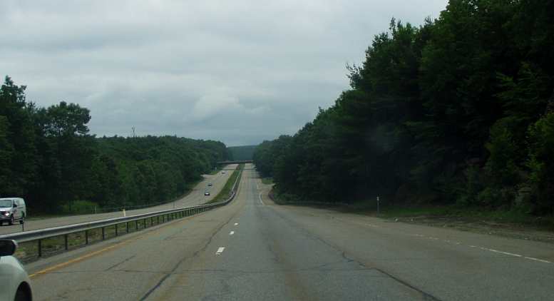
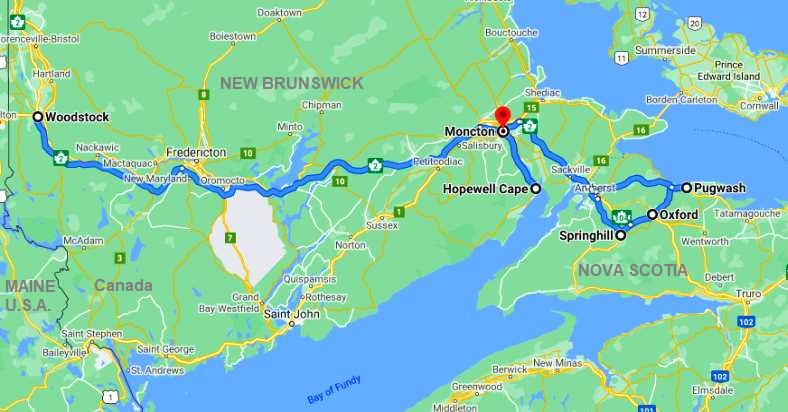
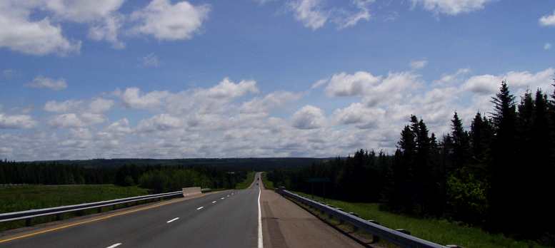
Easy running. Great roads, I needed that the way I felt this day!
I reached Rhode Island…
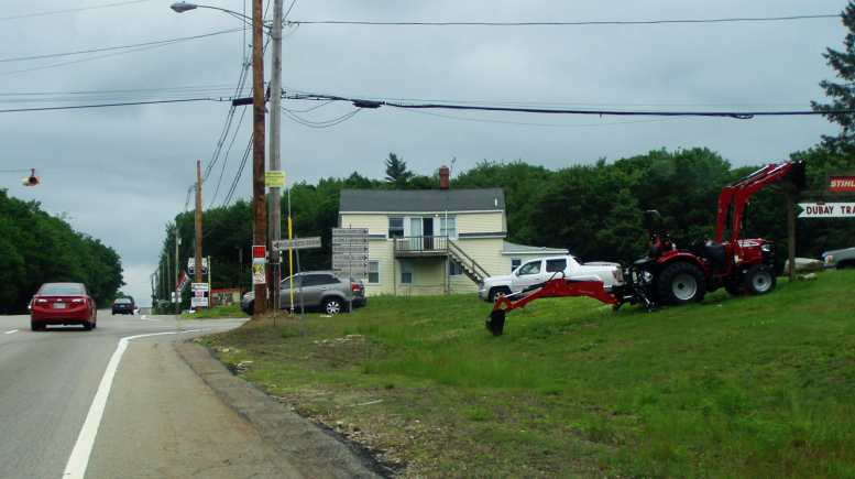
Entering Rhode Island. Cucumber Hill Road spelled the beginning of Rhode Island, nothing much seemed to change compared to my run through Connecticut.
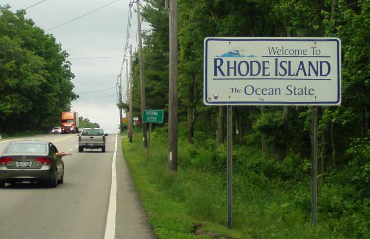
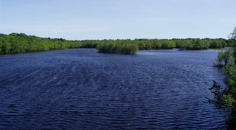
"Ocean State" Well, yes, it's on the Atlantic. But so are a lot of other states (twelve of them, I believe). Nevertheless, I was treading new ground.
…and this had me wondering. I didn't know exactly what claim Rhode Island might have to call itself the 'Ocean State', but they do that. It's the smallest state of the USA, of course, and ironic that we'd been within just a few miles of it last time when we spent a night in Salem, New Hampshire.
A little further on I found a garage sale and a flea market which would give me a break from the discomfort of driving the way I felt. At the garage sale…
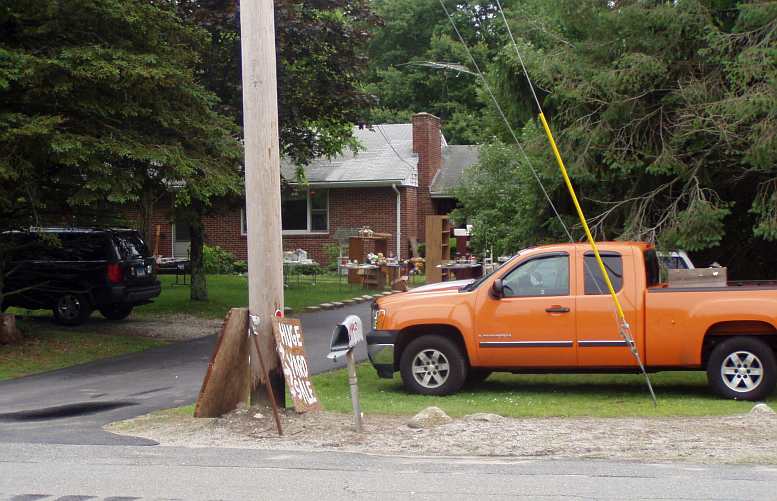
But there was a garage sale! That's right, it was Saturday. When I saw the 'Yard Sale' sign I pulled up, I needed a break anyway the way I felt, but when the seller offered to fill my van if I backed it up I lost interest to some degree. Yes, I bought a handful of tools... dirt cheap!
…I was invited to drive the van in and fill it up, which I didn't do, while at the flea market I found someone selling old drink bottles and bought some for Bob Abberfield back home. He collects these things.
By this time I simply knew I wasn't going to make it to Moncton in time so I decided to just do what I could that day.
A shortage of 'Welcome Centers' was hitting me with my needs of the day, I tried one only to find out it was something to do with the forestry in the area...
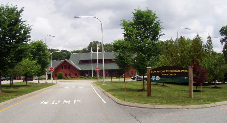
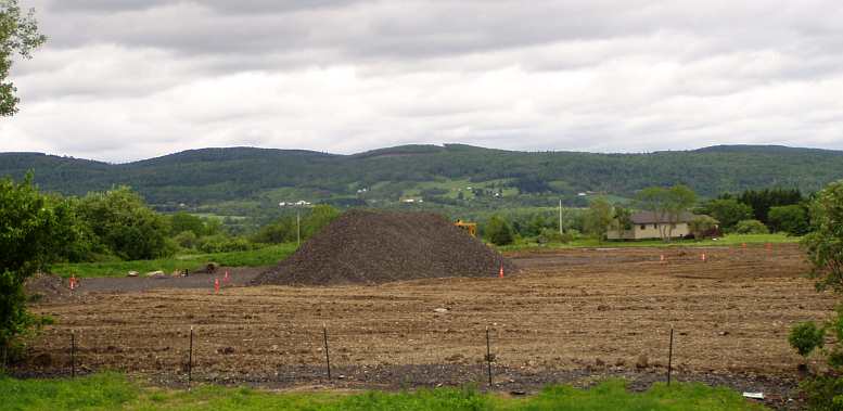
Blackstone River State Park. A sign drew me in here, a visitor's centre would be a good place to take a break and look around. But it was closed, which I didn't understand.
…so I wasn't all that interested. But I took photos of the details of the display and the next day learned it was father’s day, that was news to me.
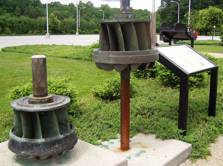
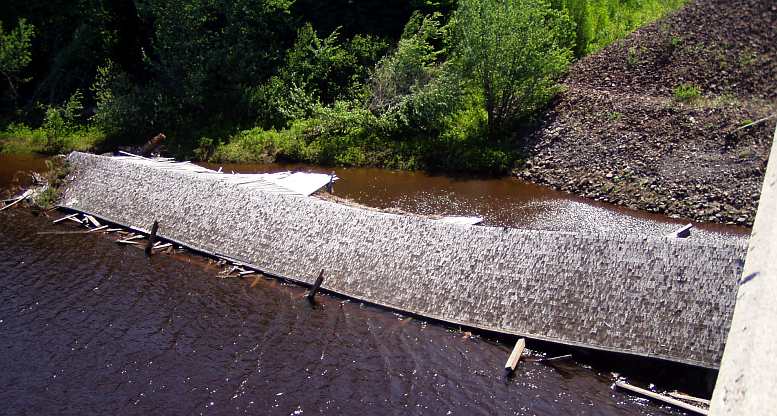
Water turbines. A display outside the visitors' centre told of the history of these water turbines generating power for the forestry.
On a day when I took very few photos, it seems that Boston caught my attention when I entered Massachusetts:
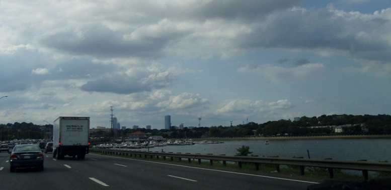
Boston in view. The boats tied up here made for a holiday type of atmosphere. Except for the traffic!
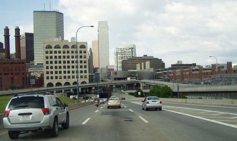
City skyline. I know, there's a lot more to than Boston... but this was the kind of photo I took that day. Remember, I wasn't very well.
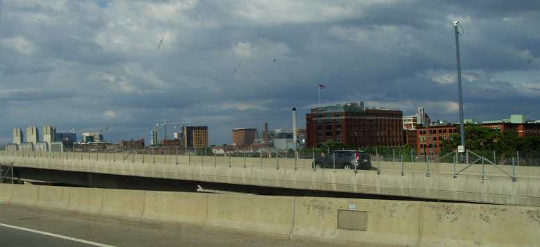
Into the tunnel. In the middle of Boston the road dives underground for a time, emerging onto a mass of bridges, over- and underpasses and a forest of directional signs. How did we get on before GPS?
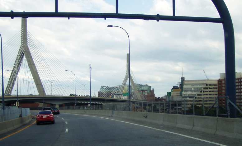
Boston's bridges. A number of bridges of all different types have been built to cope with crossing the waterways around the city.
Finally, it being almost the end of the long day, I decided to make a little detour in New Hampshire to visit Neil Peckham. He's a contact I have for my parts importing and he's been through some trying times lately.
Lost his job... had to have a hip replacement... etc.And then Neil recommended (as had others) that I had to have some of the shellfish available in that part of the world. I struck out from Neil's towards Portsmouth and as I went through Hampton I found a restaurant still open. Open and packed, also running low on supplies and there was little left for me except some mussels. After eating them I retired to the van to go online using the restaurant's WiFi, checked my e-mails and some forums.
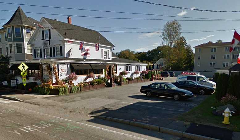
401 Tavern. I was happy to find this place still open and parked in about the spot the van with the ladder is shown in this Street View image. Right opposite the main entry.
The van was parked directly opposite the main door in their carpark and the WiFi worked well, but I was still sick, I was tired and so I lay down in the bed. A little while later I was disturbed as the van started rocking and there were clumping noises. Half-asleep, I wondered what was going on, then I realised two or three people had climbed the ladder on the back of the van!
"What do I do about this?" I wondered. Then there was a bright flash of light, clump clump clump again and they went away! I wonder if I'll ever see the selfie of them on my van somewhere on the net?
I think I went back to sleep, as I know I bought fuel at the Hess gas station…
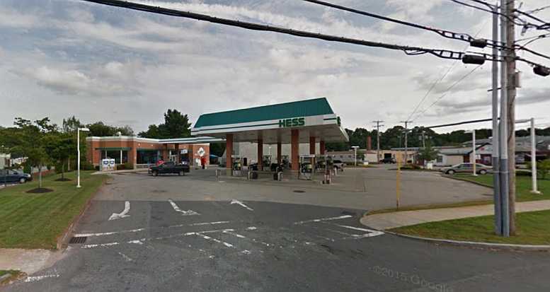
Gas at 5am. Street View again, and not at 5am, which was the time I paid for the 18.6 gallons I’d put in the van’s tank.
…which was only a matter of a few hundred yards along the road.
Maine was now only a couple of miles away and would be the seventh new state for me to enter…
After leaving my stepson at the airport and spending two and a half hours in the 'rush hour' traffic getting to Connecticut I had a nice little visit with Nick Tiberio.
Nick has a passion for old Chryslers and has been keen to help us with my nephew, Ben, and his project. He phoned me back just in time for me to drop off the freeway and go to his place. He and his wife, Theresa, were very welcoming.
Nick and his toys. Nick Tiberio is a real 'good guy' and a very keen man when it comes to showing his Plymouth at the local car shows. Note the trophies around the walls? And there's lots more you can't see!
Trophy case. I did say Nick likes to show his car... just a small selection of the trophies he's won, plus some of the other little nick-knacks he's picked up along the way. Love the high ceiling in the garage!
Nick's Poly. Nick sent me this photo he took of myself with one of his Poly engines.
Even though there's a mass of trophies there, Nick told me he won't allow his car to be judged once he's won that particular event at some time. He still displays it, however, and he told me there's at least a dozen car shows on within fifty miles every week!
Full house. Built for show and go, Nick's Poly 318 engine looks good in the Plymouth's engine bay, carburetion, exhausts, distributor and intake manifold show that there's more in this than meets the eye!
I was still feeling quite unwell in the stomach and when I camped for the night I certainly hoped that I'd wake up feeling better. I didn't.*
Nevertheless, I pressed on through Eastern Connecticut and made it into Rhode Island. This was my first 'new state' in a couple of weeks, but as I looked at the time and the distance I still had to be at Moncton in New Brunswick the following day I was quite concerned about making my goal.
Easy running. Great roads, I needed that the way I felt this day!
I reached Rhode Island…
Entering Rhode Island. Cucumber Hill Road spelled the beginning of Rhode Island, nothing much seemed to change compared to my run through Connecticut.
"Ocean State" Well, yes, it's on the Atlantic. But so are a lot of other states (twelve of them, I believe). Nevertheless, I was treading new ground.
…and this had me wondering. I didn't know exactly what claim Rhode Island might have to call itself the 'Ocean State', but they do that. It's the smallest state of the USA, of course, and ironic that we'd been within just a few miles of it last time when we spent a night in Salem, New Hampshire.
A little further on I found a garage sale and a flea market which would give me a break from the discomfort of driving the way I felt. At the garage sale…
But there was a garage sale! That's right, it was Saturday. When I saw the 'Yard Sale' sign I pulled up, I needed a break anyway the way I felt, but when the seller offered to fill my van if I backed it up I lost interest to some degree. Yes, I bought a handful of tools... dirt cheap!
…I was invited to drive the van in and fill it up, which I didn't do, while at the flea market I found someone selling old drink bottles and bought some for Bob Abberfield back home. He collects these things.
By this time I simply knew I wasn't going to make it to Moncton in time so I decided to just do what I could that day.
A shortage of 'Welcome Centers' was hitting me with my needs of the day, I tried one only to find out it was something to do with the forestry in the area...
Blackstone River State Park. A sign drew me in here, a visitor's centre would be a good place to take a break and look around. But it was closed, which I didn't understand.
…so I wasn't all that interested. But I took photos of the details of the display and the next day learned it was father’s day, that was news to me.
Water turbines. A display outside the visitors' centre told of the history of these water turbines generating power for the forestry.
On a day when I took very few photos, it seems that Boston caught my attention when I entered Massachusetts:
Boston in view. The boats tied up here made for a holiday type of atmosphere. Except for the traffic!
City skyline. I know, there's a lot more to than Boston... but this was the kind of photo I took that day. Remember, I wasn't very well.
Into the tunnel. In the middle of Boston the road dives underground for a time, emerging onto a mass of bridges, over- and underpasses and a forest of directional signs. How did we get on before GPS?
Boston's bridges. A number of bridges of all different types have been built to cope with crossing the waterways around the city.
Finally, it being almost the end of the long day, I decided to make a little detour in New Hampshire to visit Neil Peckham. He's a contact I have for my parts importing and he's been through some trying times lately.
Lost his job... had to have a hip replacement... etc.And then Neil recommended (as had others) that I had to have some of the shellfish available in that part of the world. I struck out from Neil's towards Portsmouth and as I went through Hampton I found a restaurant still open. Open and packed, also running low on supplies and there was little left for me except some mussels. After eating them I retired to the van to go online using the restaurant's WiFi, checked my e-mails and some forums.
401 Tavern. I was happy to find this place still open and parked in about the spot the van with the ladder is shown in this Street View image. Right opposite the main entry.
The van was parked directly opposite the main door in their carpark and the WiFi worked well, but I was still sick, I was tired and so I lay down in the bed. A little while later I was disturbed as the van started rocking and there were clumping noises. Half-asleep, I wondered what was going on, then I realised two or three people had climbed the ladder on the back of the van!
"What do I do about this?" I wondered. Then there was a bright flash of light, clump clump clump again and they went away! I wonder if I'll ever see the selfie of them on my van somewhere on the net?
I think I went back to sleep, as I know I bought fuel at the Hess gas station…
Gas at 5am. Street View again, and not at 5am, which was the time I paid for the 18.6 gallons I’d put in the van’s tank.
…which was only a matter of a few hundred yards along the road.
Maine was now only a couple of miles away and would be the seventh new state for me to enter…
Last edited by Ray Bell; May 8, 2023 at 05:59 AM.
Thread Starter
|
Captain
Joined: Oct 2005
Posts: 570
Likes: 8
From: The Summit, Queensland, Australia
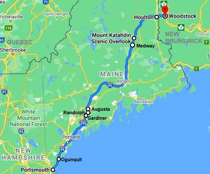
Sunday, June 15, 2014… my path for the day:
I was still in Hampton when people started moving around, possibly I had breakfast before starting off for the day. It wasn’t long before I spotted a Limo hire place called ‘Great Bay Limousine’ I noticed particularly because there was a stretched 300C out front and I knew a place near home which builds these:
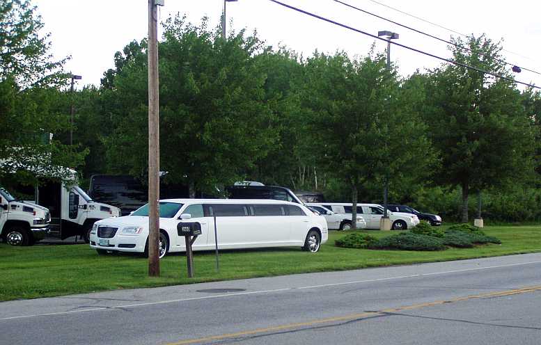
Stretched Chrysler 300C. Just one of many types of limousine and campers at this address.
Still sick and very disappointed that I wouldn't be meeting up with the people I had intended to meet in Moncton, I plied my way from New Hampshire into Maine…
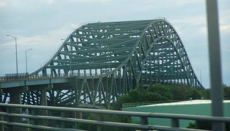
The bridge into Maine. This is a familiar style to Australians, of course. But it's a huge bridge and spelled the end of my short visit to New Hampshire.
I stuck to the old road along the coast for much of the morning. I did, however, need some 'tourist information' to give me confidence, but in the USA it was…
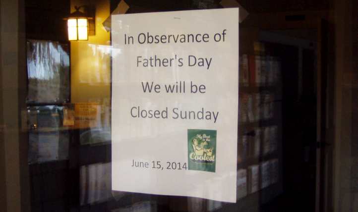
Sign of the times. No Welcome Centers, no Tourist Information places open... and I found out why at one of them! I thought Fathers' Day was in September?
...a holiday!
The road had very little traffic early on Sunday morning and running was easy. I still felt bad and didn't have a lot of surplus energy. But I took some shots along the way:
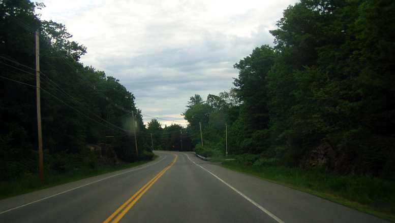
Along the coastal road. I was following the old coast road for a long time, it's similar to the Princes Highway at home. Sometimes it's on the water's edge, sometimes it's off in the bush somewhere. Sunday morning it was easy driving.
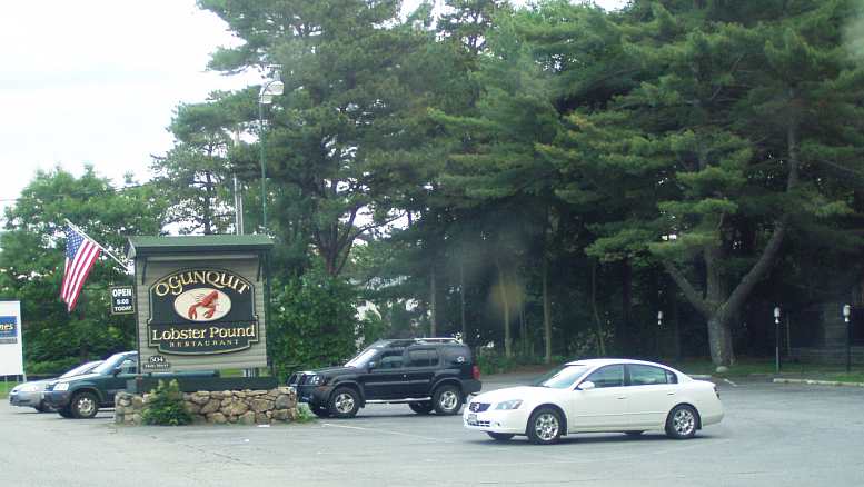
Seafood prevails. The whole of this coastline is dedicated to eating out on shellfish. I still had to try clams... but that had to wait.
Little towns came and went, lots of shellfish restaurants for which the area is famous too. You could see as you drove along how the whole area has grown up as a holiday resort over many years, aging places looking aged, others revamped, some new establishments scattered among them.
Motels along here were like at home, small, single storey. Not so many of the bigger type that I've become accustomed to seeing in this country. Opposite one of these I saw the Wells branch of the People’s Choice Credit Union:
Credit Union. Spotting this drive-through branch as I drove along US1 I went through and took out $500 in cash to help me along on my journey.(GE)
In the next small town, Biddeford, I was taken by the rapidly-flowing waters…
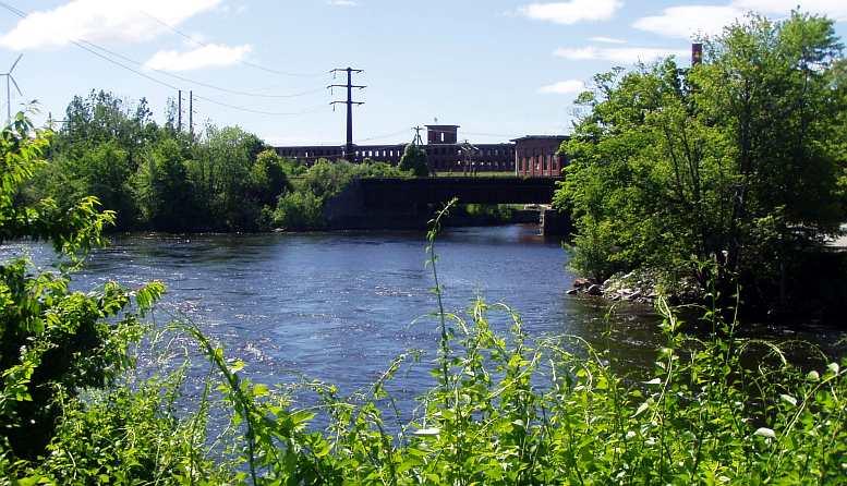
By many waters. This is in the middle of Biddeford, the fast-running waters of the Saco River rejoining after flowing each side of an island in the town.
...and I appreciated the beauty of some of the inlets and bays that the road wound its way past. Many didn't present photo opportunities, but some did:
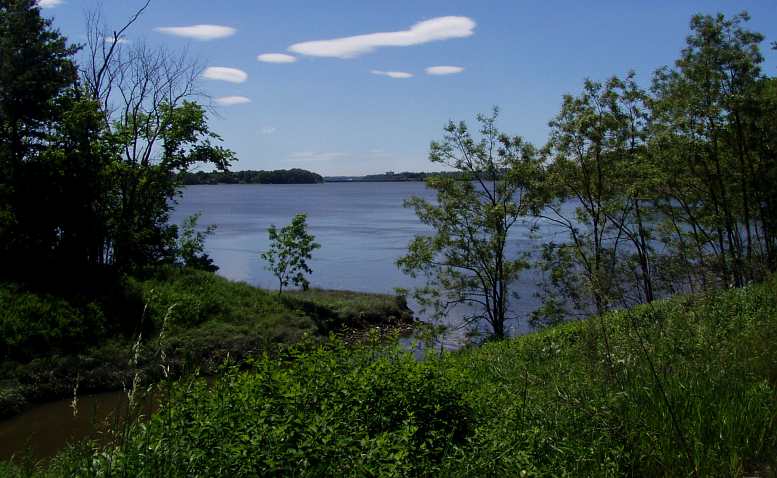
Pretty inlet. Sometimes the road would wind around some kind of inlet from the ocean, it was really very picturesque.
As the afternoon came I settled into putting some faster miles behind me on the I95. This heads into New Brunswick in Canada, but it's quite a distance as you pass by or through places like Hampden, Milford and Bangor. Well, it is the 'New England', isn't it?
Gardiner. As I was avoiding the toll road, I covered about a hundred miles on a secondary road, this put me in a little traffic, but I saw some local towns. This is Gardiner.
Bridge to Randolph. The GPS then took me over the river to Randolph, where I got something to eat. Note the railings on the bridge looking South...
Randolph bridge railings. ...are different to those looking North.
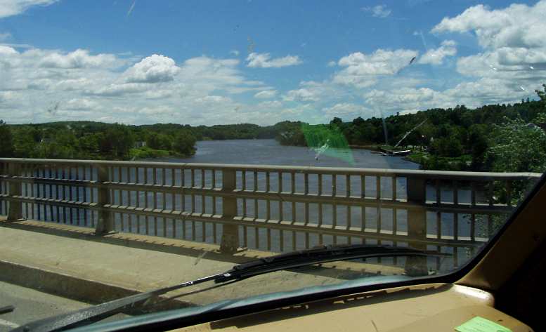
More big rivers. Fed by melting snows and heavy recent rains, this is the kind of river that prevails in the area, this one at Augusta where there's a rail bridge in the distance. Their colour is very attractive.
It was from Augusta I was back onto the Interstate, The Garmin having helped me avoid the toll road to that point. The Penobscot River near Medway was another of those large rivers which flow out of the lakes and mountains in the US and Canada, but I didn't get any photos of that.
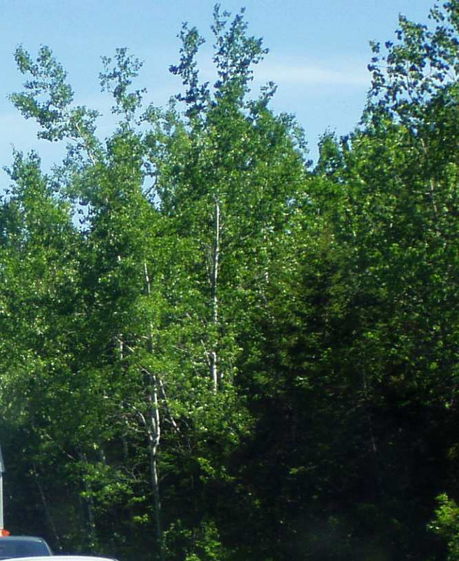
The flat country with little to see but the trees was not helpful in giving new vistas to take one's attention, but then there was the odd occasion where the Interstate would climb a hill and give me a view of the country ahead.
Seeing in the distance. One problem with travelling this time of the year is that the foliage on roadside trees is so thick that it's all you see. And then you go over a hill and see something more like this.
Even better came a little later:
Katahdin. A rare roadside lookout was provided for the viewing of this mountain as the miles in Maine were starting to run out. The name apparently means 'to be forever wild'. Mount Katahdin is the Northern end of the 2,200mile Appalachian Trail, a walking trail stretching all the way To Georgia and crossing 14 states.
While there hadn't been much traffic in this much less remote area, a couple of others pulled up at this lookout and enjoyed a minute or two taking in the view.
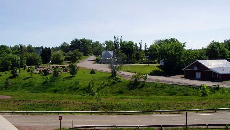
The next stop would be Houlton. Though things didn't change much, there was a little farming activity to break the monotony as the last town in Maine got closer.
Farming near Houlton. There was a change in the scenery as I approached Houlton and a few farms such as this one.
Of course, I was counting on Houlton to provide me with cheap fuel for the border crossing, prices going from around $3.70 a gallon to over $5.00 on the other side of the boom gates. And seeing as I wanted to fill the tank I decided to look around Houlton so I was sure to get the best price. And so I saw some of the sights:
Stately homes. I had a bit of a look around Houlton. There were some very stately old homes there..
And not so... But just around the block some homes were not so big or attractive.
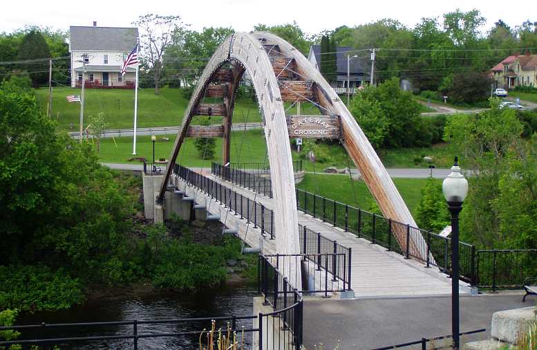
Using more timber. Yet another laminated timber bridge. Even though this one is only for pedestrians, it's of a significant span and its use of timber makes it more interesting.I got my fuel and ate at the same place, which was a Shell gas station with a Dunkin' Donuts store built in. At first I was reluctant to believe that a place with a name like "Dunkin' Donuts" could deliver a substantial meal, but they came through fairly well.
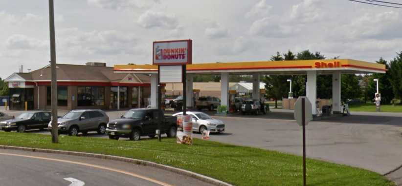
Dinner at Houlton. I hadn’t tried their fare before and was somewhat surprised that a donut shop offered things more substantial.(GE)
McDonalds was just down the road a half-mile or so…
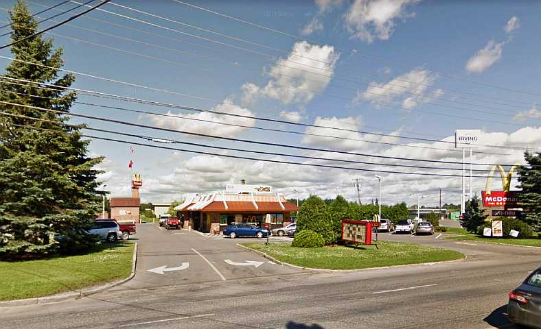
McDonalds Houlton. This was intended to be where I’d start Monday with my breakfast.(GE)
…and I had already decided to camp outside McDonalds so I could breakfast there in the morning - as had become my practice - before driving across into Canada. I sat for a short time in the van catching up with e.mails and then lay down for a quiet sleep.
The best laid plans, right?
Well, you already know that the map for the day extends to Woodstock, New Brunswick…
I was still in Hampton when people started moving around, possibly I had breakfast before starting off for the day. It wasn’t long before I spotted a Limo hire place called ‘Great Bay Limousine’ I noticed particularly because there was a stretched 300C out front and I knew a place near home which builds these:
Stretched Chrysler 300C. Just one of many types of limousine and campers at this address.
Still sick and very disappointed that I wouldn't be meeting up with the people I had intended to meet in Moncton, I plied my way from New Hampshire into Maine…
The bridge into Maine. This is a familiar style to Australians, of course. But it's a huge bridge and spelled the end of my short visit to New Hampshire.
I stuck to the old road along the coast for much of the morning. I did, however, need some 'tourist information' to give me confidence, but in the USA it was…
Sign of the times. No Welcome Centers, no Tourist Information places open... and I found out why at one of them! I thought Fathers' Day was in September?
...a holiday!
The road had very little traffic early on Sunday morning and running was easy. I still felt bad and didn't have a lot of surplus energy. But I took some shots along the way:
Along the coastal road. I was following the old coast road for a long time, it's similar to the Princes Highway at home. Sometimes it's on the water's edge, sometimes it's off in the bush somewhere. Sunday morning it was easy driving.
Seafood prevails. The whole of this coastline is dedicated to eating out on shellfish. I still had to try clams... but that had to wait.
Little towns came and went, lots of shellfish restaurants for which the area is famous too. You could see as you drove along how the whole area has grown up as a holiday resort over many years, aging places looking aged, others revamped, some new establishments scattered among them.
Motels along here were like at home, small, single storey. Not so many of the bigger type that I've become accustomed to seeing in this country. Opposite one of these I saw the Wells branch of the People’s Choice Credit Union:
Credit Union. Spotting this drive-through branch as I drove along US1 I went through and took out $500 in cash to help me along on my journey.(GE)
In the next small town, Biddeford, I was taken by the rapidly-flowing waters…
By many waters. This is in the middle of Biddeford, the fast-running waters of the Saco River rejoining after flowing each side of an island in the town.
...and I appreciated the beauty of some of the inlets and bays that the road wound its way past. Many didn't present photo opportunities, but some did:
Pretty inlet. Sometimes the road would wind around some kind of inlet from the ocean, it was really very picturesque.
As the afternoon came I settled into putting some faster miles behind me on the I95. This heads into New Brunswick in Canada, but it's quite a distance as you pass by or through places like Hampden, Milford and Bangor. Well, it is the 'New England', isn't it?
Gardiner. As I was avoiding the toll road, I covered about a hundred miles on a secondary road, this put me in a little traffic, but I saw some local towns. This is Gardiner.
Bridge to Randolph. The GPS then took me over the river to Randolph, where I got something to eat. Note the railings on the bridge looking South...
Randolph bridge railings. ...are different to those looking North.
More big rivers. Fed by melting snows and heavy recent rains, this is the kind of river that prevails in the area, this one at Augusta where there's a rail bridge in the distance. Their colour is very attractive.
It was from Augusta I was back onto the Interstate, The Garmin having helped me avoid the toll road to that point. The Penobscot River near Medway was another of those large rivers which flow out of the lakes and mountains in the US and Canada, but I didn't get any photos of that.
The flat country with little to see but the trees was not helpful in giving new vistas to take one's attention, but then there was the odd occasion where the Interstate would climb a hill and give me a view of the country ahead.
Seeing in the distance. One problem with travelling this time of the year is that the foliage on roadside trees is so thick that it's all you see. And then you go over a hill and see something more like this.
Even better came a little later:
Katahdin. A rare roadside lookout was provided for the viewing of this mountain as the miles in Maine were starting to run out. The name apparently means 'to be forever wild'. Mount Katahdin is the Northern end of the 2,200mile Appalachian Trail, a walking trail stretching all the way To Georgia and crossing 14 states.
While there hadn't been much traffic in this much less remote area, a couple of others pulled up at this lookout and enjoyed a minute or two taking in the view.
The next stop would be Houlton. Though things didn't change much, there was a little farming activity to break the monotony as the last town in Maine got closer.
Farming near Houlton. There was a change in the scenery as I approached Houlton and a few farms such as this one.
Of course, I was counting on Houlton to provide me with cheap fuel for the border crossing, prices going from around $3.70 a gallon to over $5.00 on the other side of the boom gates. And seeing as I wanted to fill the tank I decided to look around Houlton so I was sure to get the best price. And so I saw some of the sights:
Stately homes. I had a bit of a look around Houlton. There were some very stately old homes there..
And not so... But just around the block some homes were not so big or attractive.
Using more timber. Yet another laminated timber bridge. Even though this one is only for pedestrians, it's of a significant span and its use of timber makes it more interesting.I got my fuel and ate at the same place, which was a Shell gas station with a Dunkin' Donuts store built in. At first I was reluctant to believe that a place with a name like "Dunkin' Donuts" could deliver a substantial meal, but they came through fairly well.
Dinner at Houlton. I hadn’t tried their fare before and was somewhat surprised that a donut shop offered things more substantial.(GE)
McDonalds was just down the road a half-mile or so…
McDonalds Houlton. This was intended to be where I’d start Monday with my breakfast.(GE)
…and I had already decided to camp outside McDonalds so I could breakfast there in the morning - as had become my practice - before driving across into Canada. I sat for a short time in the van catching up with e.mails and then lay down for a quiet sleep.
The best laid plans, right?
Well, you already know that the map for the day extends to Woodstock, New Brunswick…
Last edited by Ray Bell; May 9, 2023 at 09:54 PM.
Thread Starter
|
Captain
Joined: Oct 2005
Posts: 570
Likes: 8
From: The Summit, Queensland, Australia
A quiet night, it would have been good, but It didn't work out that way. I quickly drifted off, but a short time later there was banging on the door of the van. “Police!” they announced as they woke me up.
I opened the door. “What are you doing here?” they asked. “Waiting for breakfast,” I replied.A quiet night, it would have been good, but It didn't work out that way. I quickly drifted off, but a short time later there was banging on the door of the van. “Police!” they announced as they woke me up.
I opened the door. “What are you doing here?” they asked. “Waiting for breakfast,” I replied.
“Where are you going?” came their retort. “Canada.”
“Go now!” they demanded. I was being chucked out of America!
So I crossed the border in the middle of the night…
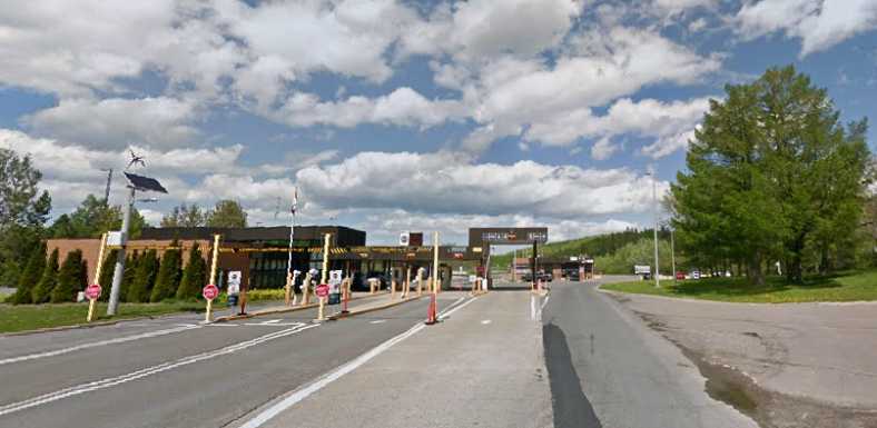
Border entry. It as about midnight when I passed through here, still wondering about what had happened in Houlton.(GE)
…and awaited the opening of the McDonalds in Woodstock…
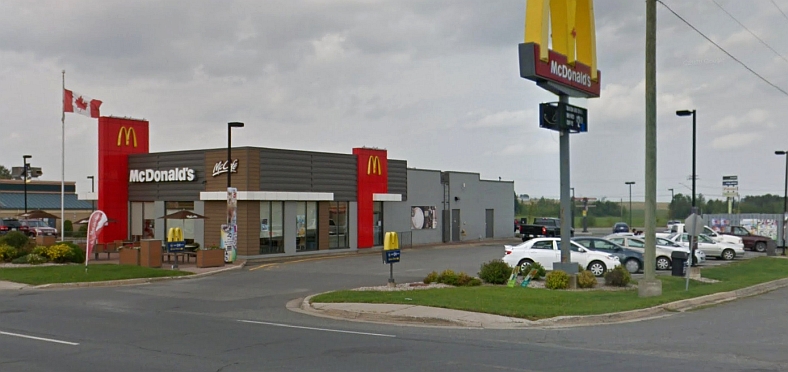
Breakfast in Canada. Woodstock’s McDonalds was a nice new store and I slept soundly until breakfast time in their carpark.(GE)
…for breakfast. And then I had a very refreshing shower at a truck stop before driving out into the beauty of New Brunswick.
Little did I know what the day had in store for me!
I opened the door. “What are you doing here?” they asked. “Waiting for breakfast,” I replied.A quiet night, it would have been good, but It didn't work out that way. I quickly drifted off, but a short time later there was banging on the door of the van. “Police!” they announced as they woke me up.
I opened the door. “What are you doing here?” they asked. “Waiting for breakfast,” I replied.
“Where are you going?” came their retort. “Canada.”
“Go now!” they demanded. I was being chucked out of America!
So I crossed the border in the middle of the night…
Border entry. It as about midnight when I passed through here, still wondering about what had happened in Houlton.(GE)
…and awaited the opening of the McDonalds in Woodstock…
Breakfast in Canada. Woodstock’s McDonalds was a nice new store and I slept soundly until breakfast time in their carpark.(GE)
…for breakfast. And then I had a very refreshing shower at a truck stop before driving out into the beauty of New Brunswick.
Little did I know what the day had in store for me!
Last edited by Ray Bell; Aug 9, 2022 at 10:07 PM.
Thread Starter
|
Captain
Joined: Oct 2005
Posts: 570
Likes: 8
From: The Summit, Queensland, Australia
Monday, June 16, 2014…
When Janet and I were planning this trip, we needed to go to Rhode Island and Maine because they were US states we had to add to ensure we'd been to all the contiguous states. We had been to New Hampshire to see Squam Lake, it was the furthest we got from home.
But what 'excuse' did I have for going into Maine? There was nothing there to hang my hat on!
The other side of Maine, of course, is New Brunswick and then Nova Scotia. 'New Scotland'. That would provide me with my excuse. A big day (I was starting to feel better) so let's get started…
Canada! This part of the trip would be my biggest diversion into Canada. I would travel through or into four provinces and spend three nights here. New Brunswick beckons!
The truck stop where I had my welcome shower is only a few miles further on as we look towards the forested distance in New Brunswick driving out of Woodstock. I was ready for this.
The only breaks in the scenery come when there is elevation changes to the highway or when there's a bridge over a river allowing you to see off to the sides. Otherwise it's a wall of bright green trees making up the view.
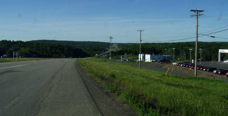
The rivers are beautiful! Look at the colour of the water... look at the marshlands out of the main channel in times of low flow rates... look at the trees down to the water's edge! There were a few to be crossed that looked just like this - or even more so.
The rivers were very picturesque. You can tell by the picture they are are postcard-quality scenes. Though the road authorities post warnings about travel here…
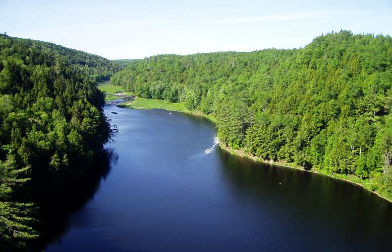
Danger! The word is spelled the same in both English and French, the moose is a nemesis on these roads at night. Hit one and you push its legs out from under it and the whole body comes into the car via the windscreen. Well, that's a 'worst case scenario' but a true one.
Sadly, I wasn't to see a moose myself. And I certainly didn't want to hit one! Even through Maine the warning signs had just that, the word 'Warning!' in a red panel on the normal yellow sign background.
Near Nackawic the Saint John River is huge and runs close to the highway. This gave me the chance to get a couple of scenic shots, one of a house beside it…
Riverside living. There wasn't any clues about what the people living here did... but they live in a paradise...
...and another of the river stretching back alongside the highway:
Along the River. This is looking back from the point where the house is tucked into the bush.
Until I checked Google Earth I thought this must have been a lake, hence the file names of the pics. Further along on this bright sunny day the highway did cross a lake which presented this sight:
Water, islands... Again, the colour of the water is brilliant, the freshness of the late-spring foliage growth on the trees, the little island out there breaking up the blue with a bit of green.
In the median strip as I crossed the road I snapped this shot, too:
Wildflowers. Right in the median strip, lots of different colours out to capture the bees' attention as the year warms up.
The day rolled on. I had missed out badly on seeing the people I wanted to see in Moncton, though I still hoped I'd see them but it was such a nice sunny day. And there were heavy wind gusts that blew the van about a bit, but these winds were also affecting the trees.
It set me thinking as I looked at these green walls each side of the highway...
Those trees were soaking up the nutrients from the ground moist from the last of the melting snows and the heavy rains of the previous week, they were pumping up the moisture through the sapwood and feeding it into the limbs that reached out for the sun to transpire into the atmosphere. That's how it all works.
But on this day they were celebrating, I thought. Look at the trees (from another pic) that abound in this countryside…
The trees are alive! I don't know what kind of trees they are, but they're tall and straight and green in the summer sun and waving about in the wind gusts.
...and picture them blowing about in the wind as they soaked up the sun on this beautiful day. They were doing this like they were joyous, their new growth was their answer to the return of the warm days and they were shaking off the cold and stilted days of winter when there was no life for them. Hibernation, cold, no growth.
But not so now and it made me happy to be able to think about them that way. And there was more to come. At Jemseg on the Salmon River I thought this scene looked nice too:
Jemseg on the Salmon. At the foot of Grand Lake the Trans-Canada Highway crosses the Salmon River at the town of Jemseg. I thought this looked nice as I came off that bridge.
Then as I crossed the Canaan River the campsite looked pretty idyllic…
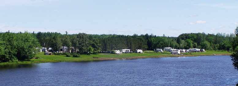
Camping by the river. The Canaan River has this great little campsite visible from the Trans-Canada Highway. But when I took the photo I was very surprised by what I saw in the water below the bridge...
But I noticed something else in the river:
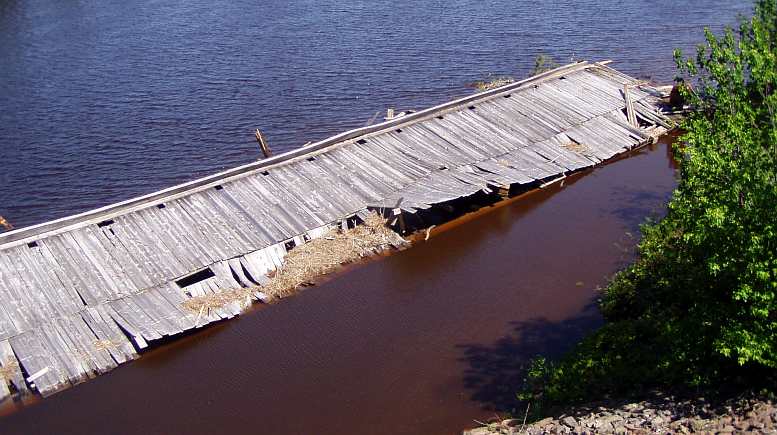
Rotting away. Strangely, this is not visible on Google Earth, but it's an old covered bridge that's been washed down from somewhere. Or once stood in this same spot to take the traffic across the Canaan...
A roof in the water. This is from the other side, the roof being visible as the whole structure seems anchored to the shore and is caught up on the piers under the new highway bridge.
Further along there was some elevation so some distant scenery came into view. This was still a rare thing, as it had been in Maine, but who's compaining on such a beautiful day (and when one is starting to feel better as well)?
But when there's no water to see... The road stretches out before you. Like in Maine, occasionally you get a view ahead as you cross a taller hill. But the beauty is everywhere.
At Salisbury I headed south from the highway. I'd been advised to go down to Hopewell Cape and have a look at the bay there, where tides are enormous. I noted on the way down that winter continues to take a heavy toll on buildings here…
More destruction. South of Salisbury this barn has reached the end of its life.
Just like in many parts of the US, it seems that buildings that start to collapse are left to continue on that path. But this one was more immediate:
And worse! The heavy winter has obviously been too much for the roof structure on this garage. A local I spoke to said, "And under that roof will be their classic car or their boat or their motorhome!"
Reaching Hopewell Cape I was moved to rename it 'Hopeless Case'. The scope for photographing the wonder of the waters there is very limited, there's nowhere to get enough elevation to see over the waterside trees and buildings to the extent you'd like to get a nice clear shot.
This was the best I could do:
Mud! People on the way through told me I should drive down to Hopewell Cape. The tides there are reputed to be the biggest in the world, "You can walk on the ocean floor!"; they were saying. All I saw was muddy water.
And as I drove back towards Moncton:
Filling the bay. Shepody Bay is long and shallow. The water rushes in as the tide rises, out as it falls, the water travels rapidly and silt turns the ocean water to a muddy colour.
There were other things to take note of, everyday things:
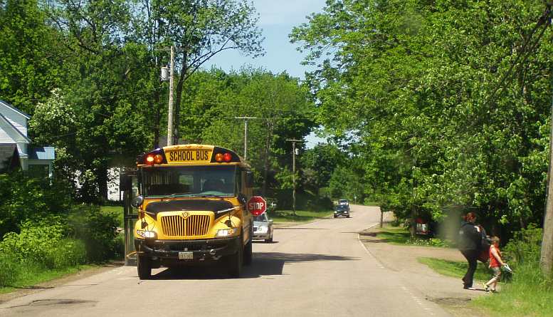
Life as normal. A mother escorts her child from the school bus. That 'stop' sign means all traffic stops to allow kids to cross.
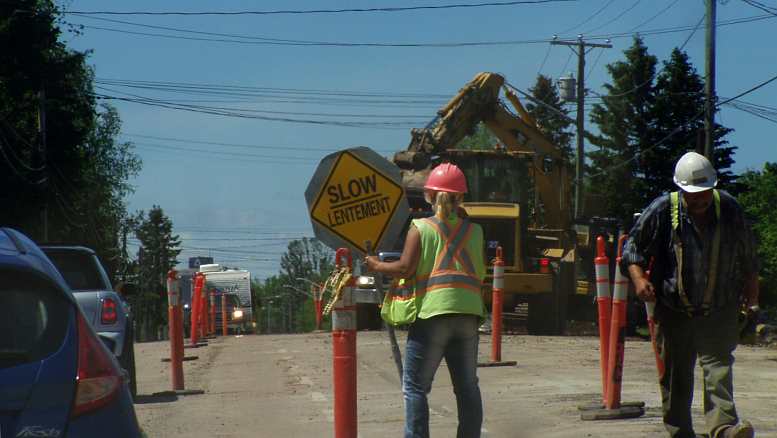
Roadworks here too. You can't get away from them, but not everywhere do they have the signs in two languages!
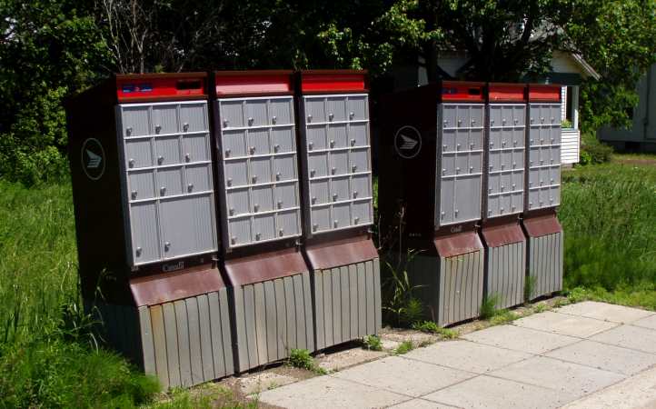
Gathering the mail. Rural Canada is apparently cutting down mail services to areas like this. A bunch of mail boxes is installed to service a number of homes in the area, it's easier for the mailman.
And keep up with the news:
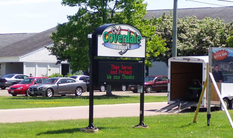
A sign of the times. This club's sign gave messages about upcoming acts and so on, but at the same time it thanked the Mounties for the great job they do.
This sign pays tribute to the RCMP, who had a week or so earlier had three of their number murdered in Moncton. Someone had ambushed them and wounded two others. He was caught, but the rash of public support for the Mounties was shown in these signs:
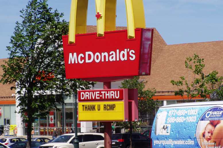
McDonalds too... The message was about, the Mounties got lots of support.
Back at Riverview, just across the 'Chocolate River' from Moncton, I'd been hoping to shoot a pic of the channels that were showing as I drove through there an hour earlier on my way south.
But now all I could photograph was the seawater rushing in to fill the river!
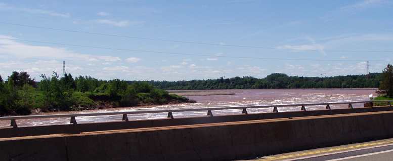
Inrushing chocolate! This is the river at Riverview, just south of Moncton. The water is rushing in, pushed by the rising tide from the ocean 50kms away. It's covering the channels in the silt that had been exposed an hour earlier and it's no wonder there are signs about that say 'Chocolate River'.
It was now time to remember my 'excuse' for being in this part of the world...
When Janet and I were planning this trip, we needed to go to Rhode Island and Maine because they were US states we had to add to ensure we'd been to all the contiguous states. We had been to New Hampshire to see Squam Lake, it was the furthest we got from home.
But what 'excuse' did I have for going into Maine? There was nothing there to hang my hat on!
The other side of Maine, of course, is New Brunswick and then Nova Scotia. 'New Scotland'. That would provide me with my excuse. A big day (I was starting to feel better) so let's get started…
Canada! This part of the trip would be my biggest diversion into Canada. I would travel through or into four provinces and spend three nights here. New Brunswick beckons!
The truck stop where I had my welcome shower is only a few miles further on as we look towards the forested distance in New Brunswick driving out of Woodstock. I was ready for this.
The only breaks in the scenery come when there is elevation changes to the highway or when there's a bridge over a river allowing you to see off to the sides. Otherwise it's a wall of bright green trees making up the view.
The rivers are beautiful! Look at the colour of the water... look at the marshlands out of the main channel in times of low flow rates... look at the trees down to the water's edge! There were a few to be crossed that looked just like this - or even more so.
The rivers were very picturesque. You can tell by the picture they are are postcard-quality scenes. Though the road authorities post warnings about travel here…
Danger! The word is spelled the same in both English and French, the moose is a nemesis on these roads at night. Hit one and you push its legs out from under it and the whole body comes into the car via the windscreen. Well, that's a 'worst case scenario' but a true one.
Sadly, I wasn't to see a moose myself. And I certainly didn't want to hit one! Even through Maine the warning signs had just that, the word 'Warning!' in a red panel on the normal yellow sign background.
Near Nackawic the Saint John River is huge and runs close to the highway. This gave me the chance to get a couple of scenic shots, one of a house beside it…
Riverside living. There wasn't any clues about what the people living here did... but they live in a paradise...
...and another of the river stretching back alongside the highway:
Along the River. This is looking back from the point where the house is tucked into the bush.
Until I checked Google Earth I thought this must have been a lake, hence the file names of the pics. Further along on this bright sunny day the highway did cross a lake which presented this sight:
Water, islands... Again, the colour of the water is brilliant, the freshness of the late-spring foliage growth on the trees, the little island out there breaking up the blue with a bit of green.
In the median strip as I crossed the road I snapped this shot, too:
Wildflowers. Right in the median strip, lots of different colours out to capture the bees' attention as the year warms up.
The day rolled on. I had missed out badly on seeing the people I wanted to see in Moncton, though I still hoped I'd see them but it was such a nice sunny day. And there were heavy wind gusts that blew the van about a bit, but these winds were also affecting the trees.
It set me thinking as I looked at these green walls each side of the highway...
Those trees were soaking up the nutrients from the ground moist from the last of the melting snows and the heavy rains of the previous week, they were pumping up the moisture through the sapwood and feeding it into the limbs that reached out for the sun to transpire into the atmosphere. That's how it all works.
But on this day they were celebrating, I thought. Look at the trees (from another pic) that abound in this countryside…
The trees are alive! I don't know what kind of trees they are, but they're tall and straight and green in the summer sun and waving about in the wind gusts.
...and picture them blowing about in the wind as they soaked up the sun on this beautiful day. They were doing this like they were joyous, their new growth was their answer to the return of the warm days and they were shaking off the cold and stilted days of winter when there was no life for them. Hibernation, cold, no growth.
But not so now and it made me happy to be able to think about them that way. And there was more to come. At Jemseg on the Salmon River I thought this scene looked nice too:
Jemseg on the Salmon. At the foot of Grand Lake the Trans-Canada Highway crosses the Salmon River at the town of Jemseg. I thought this looked nice as I came off that bridge.
Then as I crossed the Canaan River the campsite looked pretty idyllic…
Camping by the river. The Canaan River has this great little campsite visible from the Trans-Canada Highway. But when I took the photo I was very surprised by what I saw in the water below the bridge...
But I noticed something else in the river:
Rotting away. Strangely, this is not visible on Google Earth, but it's an old covered bridge that's been washed down from somewhere. Or once stood in this same spot to take the traffic across the Canaan...
A roof in the water. This is from the other side, the roof being visible as the whole structure seems anchored to the shore and is caught up on the piers under the new highway bridge.
Further along there was some elevation so some distant scenery came into view. This was still a rare thing, as it had been in Maine, but who's compaining on such a beautiful day (and when one is starting to feel better as well)?
But when there's no water to see... The road stretches out before you. Like in Maine, occasionally you get a view ahead as you cross a taller hill. But the beauty is everywhere.
At Salisbury I headed south from the highway. I'd been advised to go down to Hopewell Cape and have a look at the bay there, where tides are enormous. I noted on the way down that winter continues to take a heavy toll on buildings here…
More destruction. South of Salisbury this barn has reached the end of its life.
Just like in many parts of the US, it seems that buildings that start to collapse are left to continue on that path. But this one was more immediate:
And worse! The heavy winter has obviously been too much for the roof structure on this garage. A local I spoke to said, "And under that roof will be their classic car or their boat or their motorhome!"
Reaching Hopewell Cape I was moved to rename it 'Hopeless Case'. The scope for photographing the wonder of the waters there is very limited, there's nowhere to get enough elevation to see over the waterside trees and buildings to the extent you'd like to get a nice clear shot.
This was the best I could do:
Mud! People on the way through told me I should drive down to Hopewell Cape. The tides there are reputed to be the biggest in the world, "You can walk on the ocean floor!"; they were saying. All I saw was muddy water.
And as I drove back towards Moncton:
Filling the bay. Shepody Bay is long and shallow. The water rushes in as the tide rises, out as it falls, the water travels rapidly and silt turns the ocean water to a muddy colour.
There were other things to take note of, everyday things:
Life as normal. A mother escorts her child from the school bus. That 'stop' sign means all traffic stops to allow kids to cross.
Roadworks here too. You can't get away from them, but not everywhere do they have the signs in two languages!
Gathering the mail. Rural Canada is apparently cutting down mail services to areas like this. A bunch of mail boxes is installed to service a number of homes in the area, it's easier for the mailman.
And keep up with the news:
A sign of the times. This club's sign gave messages about upcoming acts and so on, but at the same time it thanked the Mounties for the great job they do.
This sign pays tribute to the RCMP, who had a week or so earlier had three of their number murdered in Moncton. Someone had ambushed them and wounded two others. He was caught, but the rash of public support for the Mounties was shown in these signs:
McDonalds too... The message was about, the Mounties got lots of support.
Back at Riverview, just across the 'Chocolate River' from Moncton, I'd been hoping to shoot a pic of the channels that were showing as I drove through there an hour earlier on my way south.
But now all I could photograph was the seawater rushing in to fill the river!
Inrushing chocolate! This is the river at Riverview, just south of Moncton. The water is rushing in, pushed by the rising tide from the ocean 50kms away. It's covering the channels in the silt that had been exposed an hour earlier and it's no wonder there are signs about that say 'Chocolate River'.
It was now time to remember my 'excuse' for being in this part of the world...
Last edited by Ray Bell; Aug 9, 2022 at 10:35 PM.
Thread Starter
|
Captain
Joined: Oct 2005
Posts: 570
Likes: 8
From: The Summit, Queensland, Australia
Recall what I said about not going anywhere for no reason? As in North Dakota to see the erection claiming it to be the centre of the North American continent? Most places it was easy, but North Dakota was difficult and Maine was impossible. I knew nothing in Maine that I would go to see. But then I recalled something about Nova Scotia.
It all dated back about 28 years to when I heard a John Laws interview while I was working. The interviewee was singer, Anne Murray, whose song 'You Needed Me' I really like. And during that interview she said that she lives in Nova Scotia on twelve acres. John Laws then said to her, "I hear it's very pretty there?" And Anne Murray responded by saying, "Yes, we have twelve acres and it's beautiful!"
My 'excuse' was to see if she was lying, so I headed for Nova Scotia, it wasn't far from Moncton. But there was room for this road-blocking garden shed delivery to get in the way…
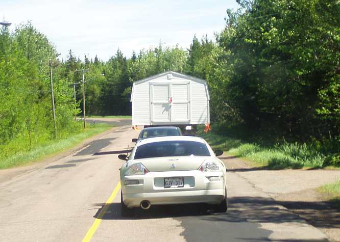
Road block. Australian garden sheds come in flat packs, made of sheet metal and rivetted and screwed together. Not so those in North America, usually pre-fabricated timber structures like this one.
Like a no-man's land between New Brunswick and Nova Scotia, this area had a nice wind farm going:
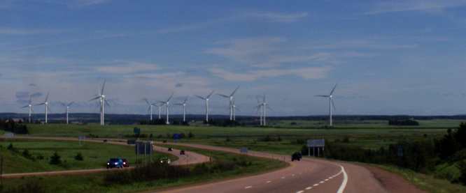
Wind farm. I'm sure the little valley here channels a lot of wind through those giant rotors.
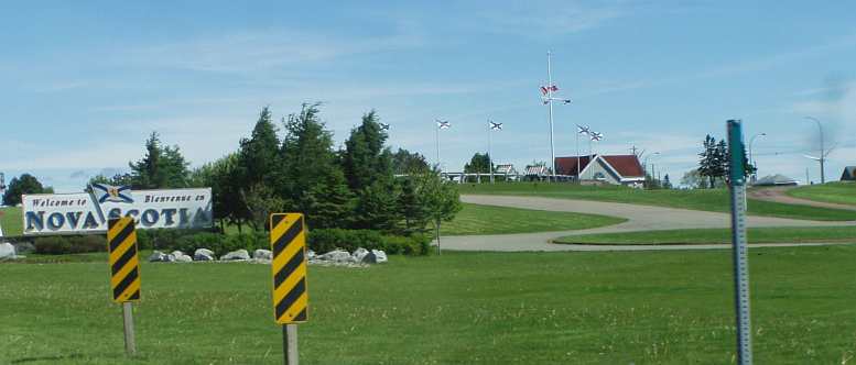
Welcome to Nova Scotia. The Welcome Centre (note they spell 'centre' correctly in Canada!) was one of the nicest I've seen.
I made enquiries at the Welcome Centre about where I might find her twelve acres. I was told she came from Spring Hill, so I drove there... and found the Anne Murray Centre…
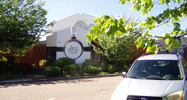
Anne Murray Centre. Coming from a family with a medical background, it's probably no surprise that Anne Murray (yes, the singer!) has set up a foundation to aid the medical world. This is in Spring Hill, where she grew up, her father was a doctor.
Inside there I was advised that her summer home is at a place so awkwardly named Pugwash, so I pointed the van in that direction. Along the way I went through Oxford…
Through Oxford. Still the English names abound... Oxford is a little town off the main highway.
Famous for blueberries. So says the sign! Oxford's blueberry farms are all hot houses, however.
Eventually I made it to the northern shoreline and found someone who could direct me to the locality in which the home is located. I had several tries at this, by the way, one at a seafood shop…
Chase’s Lobster. At least I could buy some lunch while I asked directions here and left eager to get on with the search.(GE)
…which was actually on a road going the wrong way. When I left there I was headed in the right direction. Then I had the awful experience of discovering I'd forgotten Canadians drive on the right-hand side of the road, something that led to an oncoming car pulling off the road thinking I was out of control or something.
But back to finding Anne Murray's house, you can't, after all, have any obsessions like this and not follow them through!
I got to the area, called the Gulf Shore out of Pugwash... and it is beautiful…
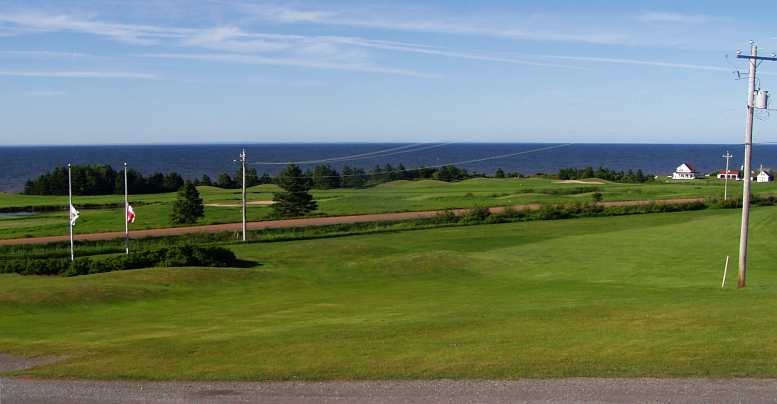
The Gulf Shore. Looking out into the Northumberland Strait, this beach is a part of the shoreline near Pugwash. You can see Prince Edward Island from here if you look to the north.
My final enquiry about the actual location of the singer's home was made at the golf club along this road... and the view from there was also magnificent:
The Gulf from the Golf. This is the view from the clubhouse of the golf club. What a day!
And I found her home:
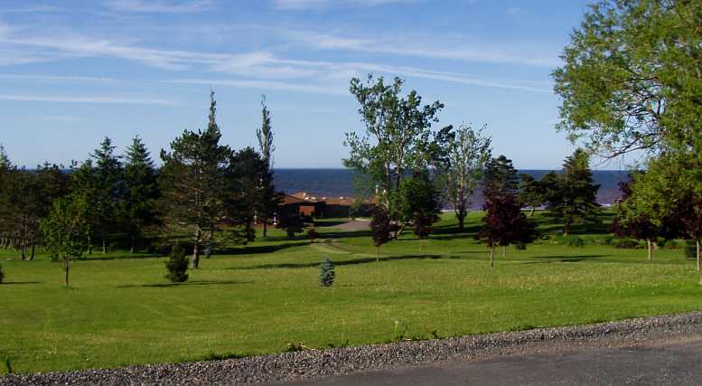
The sought-after house. Anne Murray's summer residence. Right on the Gulf shoreline, plenty of trees and...
A tennis court next to the house, the shoreline and the view of Prince Edward Island right there... and the lake in the 'front yard':
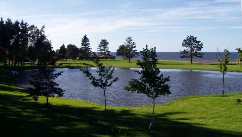
Her own lake. A part of the twelve acres is this lake that gives yet more character to Anne Murray's home.
So I now knew she wasn't lying. I'd accomplished my task and headed back to Moncton and dinner and a sleep. Along the way I was curious about this setup:
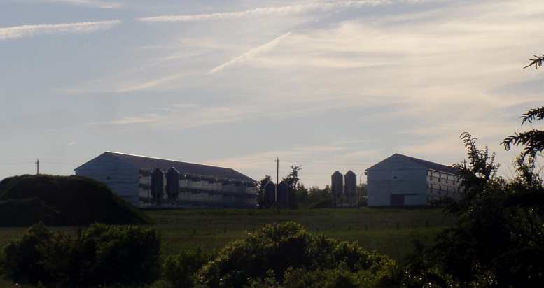
Three storeys! This captivated me. Is it pigs or chooks? I couldn't tell, but I suspect it's chicken farming using multi-storey sheds to keep heating costs down.
So, with all of this beauty filling my senses (just think of John Denver there...) I had to think about tomorrow's trek... Prince Edward Island and a start on the drive through Quebec along the St Lawrence shoreline.
At the risk of repeating myself, I had no idea what nice surprises were in store for me...
* * * * * * * * * * * * * * * * * * * * * * * * * * * * * * * * * * * * * * * * * * * * * * * * * * * * * * * * * *
As I had now reached the most distant place I had ever been from home, it might be a good time to take a little break from the travel description and discuss how the van was going.
It was, generally speaking. just fine. It wasn't using fluids, it was keeping air in the tyres (I had fitted a full set of used 16" wheels and tyres back in Spokane because someone had put 16�" wheels on it prior to my purchase, we figured they'd be too hard to find if I needed them), brakes were working well and it wasn't excessively thirsty for fuel.
One problem was that the inhibitor switch on the starter had found a way to work. As previously described, in Wisconsin I'd been unable to start it with the key and I jury-rigged a wire from the battery into the driver's footwell and had another from there onto the starter motor. To fire it up I touched the wires. Crude but effective.
Just why this happened I don't know. The inhibitor switch was normally worked by the column shifter for the automatic that was no longer there, we'd left that in Park to avoid this but the problem arose anyway. Later it went away and hasn't been a problem ever since!
Attempts at making sure the timing was right were always fruitless because you simply can't get in anywhere to see the timing marks. But, timed by ear and guesswork, it was still going well.
It all dated back about 28 years to when I heard a John Laws interview while I was working. The interviewee was singer, Anne Murray, whose song 'You Needed Me' I really like. And during that interview she said that she lives in Nova Scotia on twelve acres. John Laws then said to her, "I hear it's very pretty there?" And Anne Murray responded by saying, "Yes, we have twelve acres and it's beautiful!"
My 'excuse' was to see if she was lying, so I headed for Nova Scotia, it wasn't far from Moncton. But there was room for this road-blocking garden shed delivery to get in the way…
Road block. Australian garden sheds come in flat packs, made of sheet metal and rivetted and screwed together. Not so those in North America, usually pre-fabricated timber structures like this one.
Like a no-man's land between New Brunswick and Nova Scotia, this area had a nice wind farm going:
Wind farm. I'm sure the little valley here channels a lot of wind through those giant rotors.
Welcome to Nova Scotia. The Welcome Centre (note they spell 'centre' correctly in Canada!) was one of the nicest I've seen.
I made enquiries at the Welcome Centre about where I might find her twelve acres. I was told she came from Spring Hill, so I drove there... and found the Anne Murray Centre…
Anne Murray Centre. Coming from a family with a medical background, it's probably no surprise that Anne Murray (yes, the singer!) has set up a foundation to aid the medical world. This is in Spring Hill, where she grew up, her father was a doctor.
Inside there I was advised that her summer home is at a place so awkwardly named Pugwash, so I pointed the van in that direction. Along the way I went through Oxford…
Through Oxford. Still the English names abound... Oxford is a little town off the main highway.
Famous for blueberries. So says the sign! Oxford's blueberry farms are all hot houses, however.
Eventually I made it to the northern shoreline and found someone who could direct me to the locality in which the home is located. I had several tries at this, by the way, one at a seafood shop…
Chase’s Lobster. At least I could buy some lunch while I asked directions here and left eager to get on with the search.(GE)
…which was actually on a road going the wrong way. When I left there I was headed in the right direction. Then I had the awful experience of discovering I'd forgotten Canadians drive on the right-hand side of the road, something that led to an oncoming car pulling off the road thinking I was out of control or something.
But back to finding Anne Murray's house, you can't, after all, have any obsessions like this and not follow them through!
I got to the area, called the Gulf Shore out of Pugwash... and it is beautiful…
The Gulf Shore. Looking out into the Northumberland Strait, this beach is a part of the shoreline near Pugwash. You can see Prince Edward Island from here if you look to the north.
My final enquiry about the actual location of the singer's home was made at the golf club along this road... and the view from there was also magnificent:
The Gulf from the Golf. This is the view from the clubhouse of the golf club. What a day!
And I found her home:
The sought-after house. Anne Murray's summer residence. Right on the Gulf shoreline, plenty of trees and...
A tennis court next to the house, the shoreline and the view of Prince Edward Island right there... and the lake in the 'front yard':
Her own lake. A part of the twelve acres is this lake that gives yet more character to Anne Murray's home.
So I now knew she wasn't lying. I'd accomplished my task and headed back to Moncton and dinner and a sleep. Along the way I was curious about this setup:
Three storeys! This captivated me. Is it pigs or chooks? I couldn't tell, but I suspect it's chicken farming using multi-storey sheds to keep heating costs down.
So, with all of this beauty filling my senses (just think of John Denver there...) I had to think about tomorrow's trek... Prince Edward Island and a start on the drive through Quebec along the St Lawrence shoreline.
At the risk of repeating myself, I had no idea what nice surprises were in store for me...
* * * * * * * * * * * * * * * * * * * * * * * * * * * * * * * * * * * * * * * * * * * * * * * * * * * * * * * * * *
As I had now reached the most distant place I had ever been from home, it might be a good time to take a little break from the travel description and discuss how the van was going.
It was, generally speaking. just fine. It wasn't using fluids, it was keeping air in the tyres (I had fitted a full set of used 16" wheels and tyres back in Spokane because someone had put 16�" wheels on it prior to my purchase, we figured they'd be too hard to find if I needed them), brakes were working well and it wasn't excessively thirsty for fuel.
One problem was that the inhibitor switch on the starter had found a way to work. As previously described, in Wisconsin I'd been unable to start it with the key and I jury-rigged a wire from the battery into the driver's footwell and had another from there onto the starter motor. To fire it up I touched the wires. Crude but effective.
Just why this happened I don't know. The inhibitor switch was normally worked by the column shifter for the automatic that was no longer there, we'd left that in Park to avoid this but the problem arose anyway. Later it went away and hasn't been a problem ever since!
Attempts at making sure the timing was right were always fruitless because you simply can't get in anywhere to see the timing marks. But, timed by ear and guesswork, it was still going well.
Last edited by Ray Bell; Aug 10, 2022 at 03:41 AM.
Thread Starter
|
Captain
Joined: Oct 2005
Posts: 570
Likes: 8
From: The Summit, Queensland, Australia
This is the map for Tuesday, June 17, 2014, however I will break the day into two posts as there is a lot of photos:
After my day driving across to Nova Scotia, I didn't know what to expect as I checked out Prince Edward Island and the St Lawrence shoreline. And the country in between, more of New Brunswick.
I awoke fairly early and set off on my journey, which would involve some back-tracking. As I headed towards the road that accesses the island I indulged myself to take this picture:
My Fetish. Ever since I first started to notice buildings falling down and 'returning to nature' during my first trip through New York this sort of thing has captivated me.
Along the way I also passed by some inlets that have been developed to provide high-class water-frontages for people able to afford them. They certainly were attractive…
The lap of luxury. This is one of the inlets along the shoreline heading for Prince Edward Island. The homes look pretty flash and I'm sure they're occupied by people who are paying to appreciate these beautiful surroundings.
And back on the other side of the bridge, on the upper reaches of the same inlet, older houses that would appear to attract far less money got at least something of the atmosphere:
And the other side of the road... On the same inlet, but the other side of the road, these places are older, smaller and more like the typical 'weekenders' we used to see up and down the NSW coast.
As I neared the new bridge I carefully read the huge sign that indicated what tolls would be charged for crossing it. For my vehicle, like any regular car, the toll was…
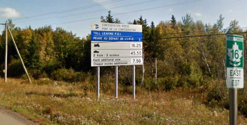
Toll heartbreaker. I simply wasn't read for a toll that high. But there was a way around the problem.(GE)
...$45.50!*
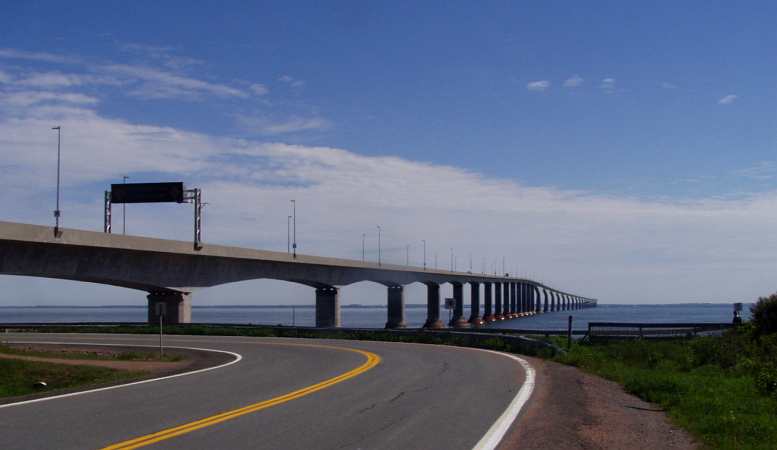
The billion dollar bridge. That's right, a billion dollars it's said to have cost to build. It also carries all the services (power, phone lines etc) to the island inside the massive concrete box section under the roadway.
Now this was a problem! Quite apart from the extravagance of it all, there was the issue of me not having a great deal of Canadian currency and I still had a couple of days to survive in Canada. I decided I'd miss out on going across the massive new 12km long bridge.
But i did go to the tourist information office near the bridge. There I was informed that if I didn't want to pay the toll I could get on a shuttle bus for the trip over and it was only $4.25. Ah, that was more like it, so I asked how I would do that. “Just pick up the phone and book a seat,” I was told.
When the phone was answered, I was told to find a young man with a bicycle and wait with him, the bus was on its way to get him. Easy, it wasn’t very long before the bus drove in to the parking lot.
Just two of us boarded the shuttle, which came with a trailer to handle bicycles. The other passenger had ridden his bike from Montreal - a 1000km trek – and was to continue riding it across Prince Edward Island, where he’d catch the ferry to his waiting girlfriend who would drive him hom. His bike was duly laced onto the trailer for the voyage. I sat up front with the driver.
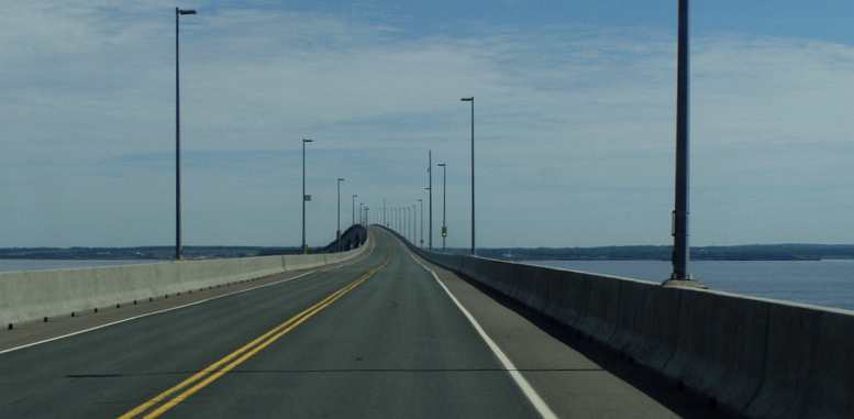
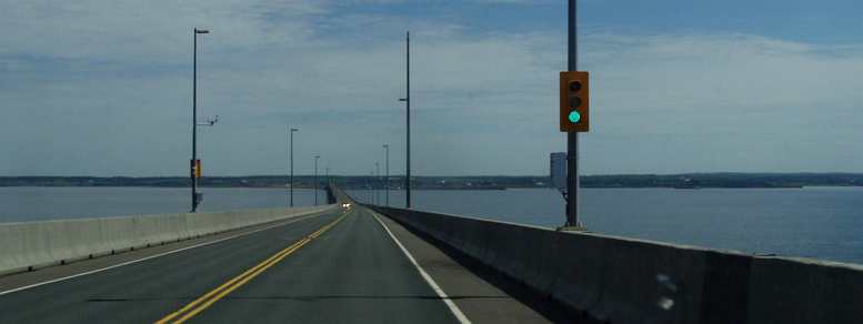
Out to the island... From the shuttle bus we can see the island well enough, and the hump in the bridge for taller ships to pass.
The bridge is only two lanes, but I guess it will never really get all that busy. Even without a toll, there's unlikely to ever be a need to amplify it as the island has so few inhabitants.
It's called the 'Confederation Bridge' by the way. It was only built after a referendum in which almost 60% of the people said they wanted it. That means that a hefty 40% were against it, wishing to retain the ferry service that existed previously. Think about that in icy waters.
Fishing industry. It was at about this point that I asked the driver if there was a big fishing industry on the island - based on what we were seeing on the foreshores. "Yes," he said, "and agriculture." "What agriculture?" I asked. "Mostly potato growing," came the reply. "Oh, right, fish and chips!" I said.
My trip to the island was just that... a trip across the bridge, step out of the bus for a few minutes and then get back in for the trip back to the mainland. Oh, yes, then I found out that every charge is one way only.
The shuttle fare is only one way, the bridge toll is only one way. Not that it would have made any difference as I needed every dollar of the Canadian currency I had to keep me going until I re-entered the USA.
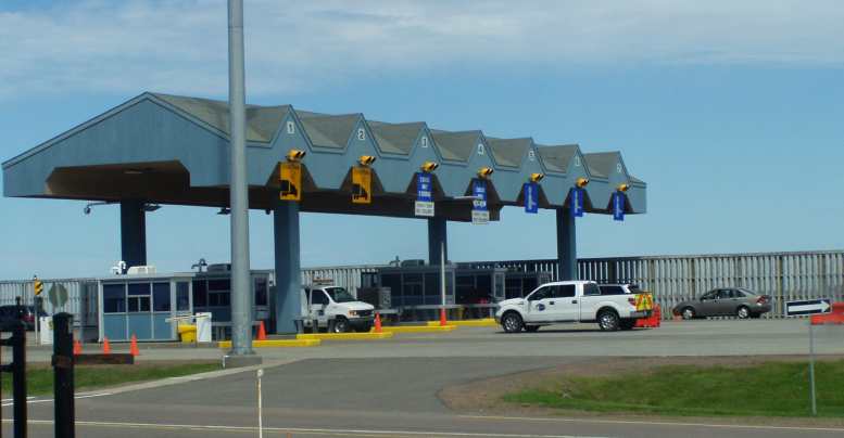
Collecting the billion. The toll booths where the $45 per car is collected for every trip to the mainland. Incoming vehicles don't have to pay.
A personal highlight to me was the end result of the conversation I had with the bus driver. As mentioned, I sat up beside him for the journey both ways and we had a good chat. He was wearing a uniform and on it there was a lapel badge with a picture of the bridge on it. When I left him back on the mainland he gave me the badge!
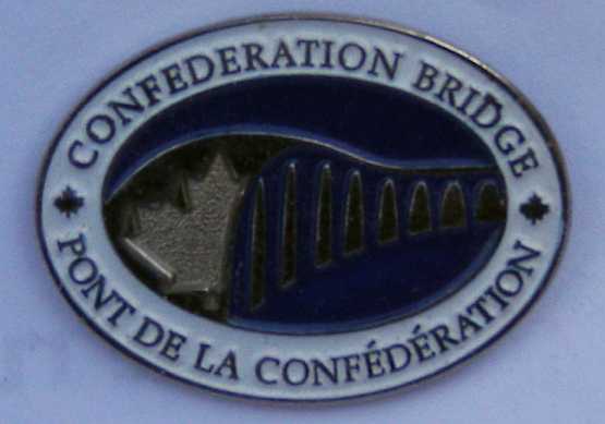
Surprise gift. I have always regarded this as the best memento of the trip, the badge from the shuttle bus driver’s uniform.
One of the other features of New Brunswick is the number of marshlands that are signposted. New Brunswick also has an official policy (like most Canadian provinces) of equally accepting French and English, the two official languages of Canada.
Every sign displays both languages and the marsh signs were no different…
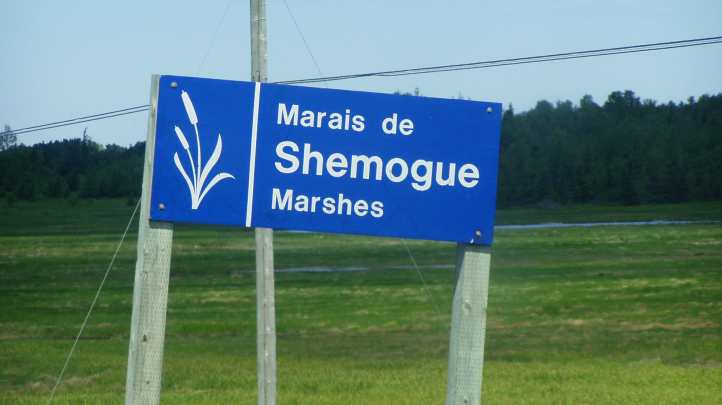
Marshy country. Many areas are marked as marshes in New Brunswick, with these signs being yet another example of the equal treatment the province gives to the French and English languages.
And I was intrigued by the method used to keep power poles vertical when sunk into the marshy ground:
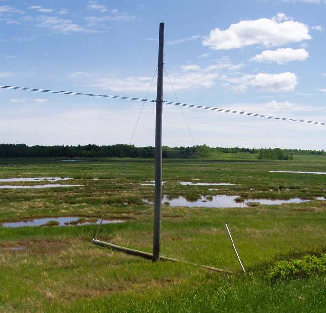
Keeping poles vertical. The soft ground presents a challenge but there's always an answer, I thought this one was clever.
Something that wasn't signposted was the method used to keep moose off the main roads. Fences are high and strong, but there is always a chance that one will get out so they have devised this method of dealing with the problem:
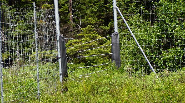
Moose traps! In places where fences have been put up to control moose - to keep them off the roads - these traps have been built to guide them back behind the fences should they find a way out and to keep them there. They can easily walk through the sprung steel gates to get behind the fences, but it doesn't work the other way.
Everywhere there was another stretch of water, another island or inlet. It's truly a delight to travel in places like this and if only one had the time to do it slowly! Not that I mind skimming a bit for the sake of seeing more.
And there was an opportunity, as the morning turned to midday, for me to try some clams. I pulled up at a small shop opposite some water and bought some to sample for my lunch.
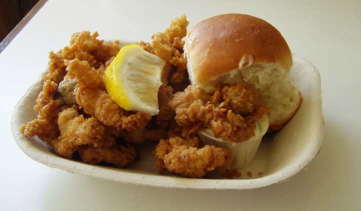
Clams. As I had been told I should try them, and as I would now be leaving that section of coastline where they abound, a plate full of clams became my lunch.
Now I would be ready for the afternoon drive, which would turn out longer than expected...
* The bridge toll was $45.00 when I was there in June, 2014. It seems that it's linked to CPI or something as in 2009 it was $42.50, this Google Earth pics of the sign was dated October 2015 and in 2019 it was $47.
After my day driving across to Nova Scotia, I didn't know what to expect as I checked out Prince Edward Island and the St Lawrence shoreline. And the country in between, more of New Brunswick.
I awoke fairly early and set off on my journey, which would involve some back-tracking. As I headed towards the road that accesses the island I indulged myself to take this picture:
My Fetish. Ever since I first started to notice buildings falling down and 'returning to nature' during my first trip through New York this sort of thing has captivated me.
Along the way I also passed by some inlets that have been developed to provide high-class water-frontages for people able to afford them. They certainly were attractive…
The lap of luxury. This is one of the inlets along the shoreline heading for Prince Edward Island. The homes look pretty flash and I'm sure they're occupied by people who are paying to appreciate these beautiful surroundings.
And back on the other side of the bridge, on the upper reaches of the same inlet, older houses that would appear to attract far less money got at least something of the atmosphere:
And the other side of the road... On the same inlet, but the other side of the road, these places are older, smaller and more like the typical 'weekenders' we used to see up and down the NSW coast.
As I neared the new bridge I carefully read the huge sign that indicated what tolls would be charged for crossing it. For my vehicle, like any regular car, the toll was…
Toll heartbreaker. I simply wasn't read for a toll that high. But there was a way around the problem.(GE)
...$45.50!*
The billion dollar bridge. That's right, a billion dollars it's said to have cost to build. It also carries all the services (power, phone lines etc) to the island inside the massive concrete box section under the roadway.
Now this was a problem! Quite apart from the extravagance of it all, there was the issue of me not having a great deal of Canadian currency and I still had a couple of days to survive in Canada. I decided I'd miss out on going across the massive new 12km long bridge.
But i did go to the tourist information office near the bridge. There I was informed that if I didn't want to pay the toll I could get on a shuttle bus for the trip over and it was only $4.25. Ah, that was more like it, so I asked how I would do that. “Just pick up the phone and book a seat,” I was told.
When the phone was answered, I was told to find a young man with a bicycle and wait with him, the bus was on its way to get him. Easy, it wasn’t very long before the bus drove in to the parking lot.
Just two of us boarded the shuttle, which came with a trailer to handle bicycles. The other passenger had ridden his bike from Montreal - a 1000km trek – and was to continue riding it across Prince Edward Island, where he’d catch the ferry to his waiting girlfriend who would drive him hom. His bike was duly laced onto the trailer for the voyage. I sat up front with the driver.
Out to the island... From the shuttle bus we can see the island well enough, and the hump in the bridge for taller ships to pass.
The bridge is only two lanes, but I guess it will never really get all that busy. Even without a toll, there's unlikely to ever be a need to amplify it as the island has so few inhabitants.
It's called the 'Confederation Bridge' by the way. It was only built after a referendum in which almost 60% of the people said they wanted it. That means that a hefty 40% were against it, wishing to retain the ferry service that existed previously. Think about that in icy waters.
Fishing industry. It was at about this point that I asked the driver if there was a big fishing industry on the island - based on what we were seeing on the foreshores. "Yes," he said, "and agriculture." "What agriculture?" I asked. "Mostly potato growing," came the reply. "Oh, right, fish and chips!" I said.
My trip to the island was just that... a trip across the bridge, step out of the bus for a few minutes and then get back in for the trip back to the mainland. Oh, yes, then I found out that every charge is one way only.
The shuttle fare is only one way, the bridge toll is only one way. Not that it would have made any difference as I needed every dollar of the Canadian currency I had to keep me going until I re-entered the USA.
Collecting the billion. The toll booths where the $45 per car is collected for every trip to the mainland. Incoming vehicles don't have to pay.
A personal highlight to me was the end result of the conversation I had with the bus driver. As mentioned, I sat up beside him for the journey both ways and we had a good chat. He was wearing a uniform and on it there was a lapel badge with a picture of the bridge on it. When I left him back on the mainland he gave me the badge!
Surprise gift. I have always regarded this as the best memento of the trip, the badge from the shuttle bus driver’s uniform.
One of the other features of New Brunswick is the number of marshlands that are signposted. New Brunswick also has an official policy (like most Canadian provinces) of equally accepting French and English, the two official languages of Canada.
Every sign displays both languages and the marsh signs were no different…
Marshy country. Many areas are marked as marshes in New Brunswick, with these signs being yet another example of the equal treatment the province gives to the French and English languages.
And I was intrigued by the method used to keep power poles vertical when sunk into the marshy ground:
Keeping poles vertical. The soft ground presents a challenge but there's always an answer, I thought this one was clever.
Something that wasn't signposted was the method used to keep moose off the main roads. Fences are high and strong, but there is always a chance that one will get out so they have devised this method of dealing with the problem:
Moose traps! In places where fences have been put up to control moose - to keep them off the roads - these traps have been built to guide them back behind the fences should they find a way out and to keep them there. They can easily walk through the sprung steel gates to get behind the fences, but it doesn't work the other way.
Everywhere there was another stretch of water, another island or inlet. It's truly a delight to travel in places like this and if only one had the time to do it slowly! Not that I mind skimming a bit for the sake of seeing more.
And there was an opportunity, as the morning turned to midday, for me to try some clams. I pulled up at a small shop opposite some water and bought some to sample for my lunch.
Clams. As I had been told I should try them, and as I would now be leaving that section of coastline where they abound, a plate full of clams became my lunch.
Now I would be ready for the afternoon drive, which would turn out longer than expected...
* The bridge toll was $45.00 when I was there in June, 2014. It seems that it's linked to CPI or something as in 2009 it was $42.50, this Google Earth pics of the sign was dated October 2015 and in 2019 it was $47.
Last edited by Ray Bell; Aug 10, 2022 at 03:34 AM.
Thread Starter
|
Captain
Joined: Oct 2005
Posts: 570
Likes: 8
From: The Summit, Queensland, Australia
It wasn’t long before I was back in the swing of things and wondering about the numberplate of this car, compared to its brand:
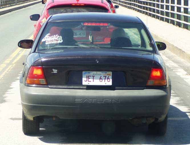
Rocket or jet? I probably would have preferred if this thing had gone into orbit.
This pic was taken on the Miramichi bridge, quite a large bridge, which was in the process of having some makeover work done…
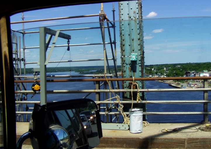
Miramichi. The name apparently means, "Land of the Mi'kmaq", the original native tribes of the area. They didn't build this massive bridge, though, another arch structure which was being renovated as we drove over.

A substantial bridge. Here's the bridge in all its splendour. My photo was taken on the arch section, under which large ships pass.
This stretch took me into Bathurst, where I diverted from the highway to go into the town and buy some fruit. I wasn't very pleased, either, as the price displayed was 'per lb' while the weights were in kilograms. All with very small lettering!
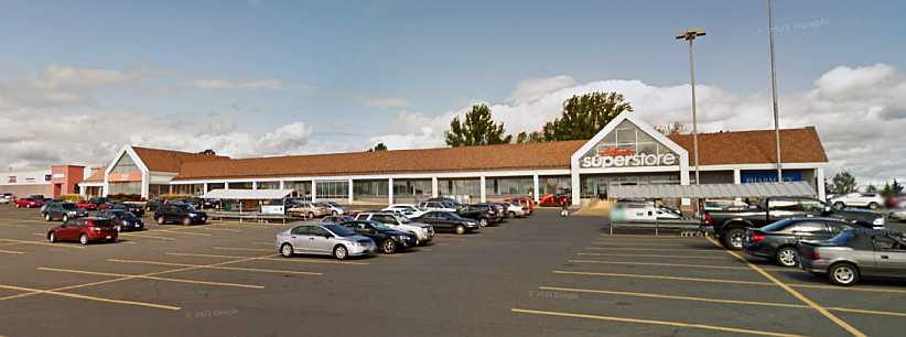
Atlantic Superstore. I bought some grapes to nibble on as I drove here and wondered at their marketing methods.(GE)
Canada has been metric as long as Australia, and that's forty years now. How they can justify this I don't know. But, with more country to cover, I wasn't going to hang around arguing with them.
Across that stretch there was plenty of sights to see. Periodically the shoreline and opposite shorelines would be visible, such as here at Dalhousie Junction:
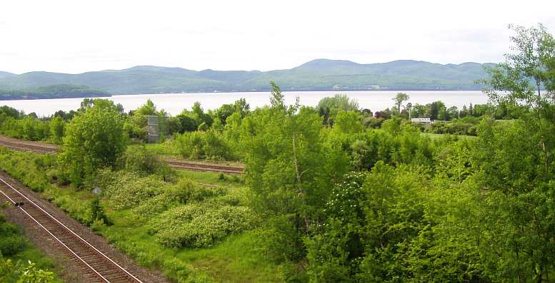
Shoreline vistas. All along the road there were chances to see the shoreline, the water and distant land. Here the Canadian Pacific railway takes up some of the foreground.
Driving into the afternoon alongside Chaleur Bay the sights continued. With the water to my right and forests to my left, these landforms added to the charm as I neared Campbelltown:
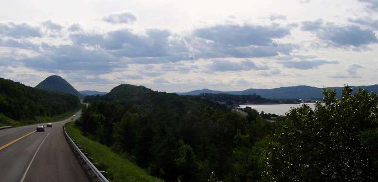
Campbelltown hills. Such beautiful scenery made the drive worthwhile.
Campbelltown, by the way, along with Bathurst, are well-known town names where I came from. And there was Newcastle and Chatham as well, former names of locales absorbed by Miramichi. But the scenery was nothing like it!
Canada has the very worst of signage on their roads. It's utterly abysmal at times (recall that out of Windsor heading for Toronto I found myself in back streets when I thought I was going onto a freeway?) and so it was no surprise to find I was headed back towards Maine.
Enquiries with locals fixed that up and I headed across the Matapedia valley quite by accident. And wasn't I glad I did... have a look at this:
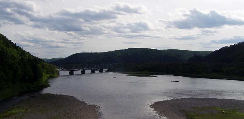
Matapedia magic. Around Matapedia I came to the conclusion that someone could come here and take twenty photos a day for six months and have all calendar-quality scenic pics with none of them being the same. The railway bridge is, of course, for the Canadian Pacific Railroad.
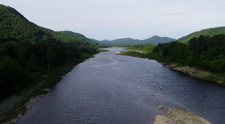
Looking back. Across the other side of the bridge from which I took that picture i got this one. But even these scenes were eclipsed by what I found when I drove through the town of Matapedia...
Isn't that the stuff great scenery is made of? And just through the other side of the town of Matapedia there was more:
Even more! Across the crest and this scene awaited me. It was all too much, I couldn't stop every half a mile to take more pictures, I had to keep moving!
The day was running out, light was fading in these valleys and I simply couldn't keep stopping to take photos if I was ever going to get somewhere. There's a Matapedia Lake too, I think, but I never explored that because of the foregoing issues.
My love of covered bridges caused me to do a double take when this one hove into view…
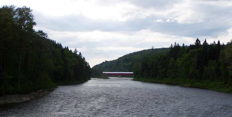
Covered bridge. Further down the valley I did take this picture because I like the old covered bridges.
It's a substantial old thing with a nicely appropriate sag in the middle. I didn't drive across, but I did take a picture of these anglers just a little upstream:
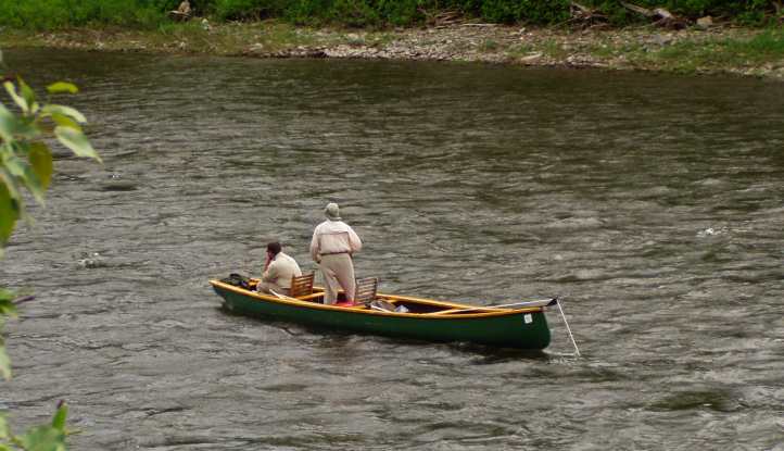
Are they biting? Intrepid anglers in the river near the covered bridge, they looked like they were very experienced, too.
Then the country opened up as the St Lawrence drew closer and open farmlands added their own charm to the vista…
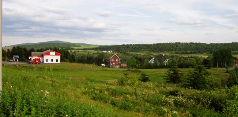
Farmlands. As I got nearer to the St Lawrence there was more open country and more farms.
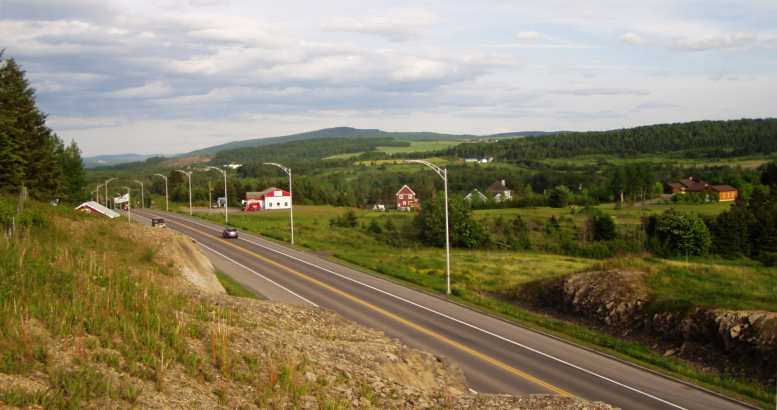
Pretty as a picture. A wider view, looking back over the country I'd covered, it was certainly something to remember... even as darkness drew near.
Now firmly in the Quebec province I no longer had signs I could read. There is not a word of English on any sign there, apparently by Government decree. Maybe on a few advertising signs or hoardings, but nothing else!
The next day I would deal with more of that, but for this night I needed to find a spot to pull up and sleep. I went into the town of Rimouski, bought something to eat, used the McDonalds wi-fi very briefly and camped nearby for the night. By the end of the Wednesday I needed to be back in upstate New York.
Rocket or jet? I probably would have preferred if this thing had gone into orbit.
This pic was taken on the Miramichi bridge, quite a large bridge, which was in the process of having some makeover work done…
Miramichi. The name apparently means, "Land of the Mi'kmaq", the original native tribes of the area. They didn't build this massive bridge, though, another arch structure which was being renovated as we drove over.
A substantial bridge. Here's the bridge in all its splendour. My photo was taken on the arch section, under which large ships pass.
This stretch took me into Bathurst, where I diverted from the highway to go into the town and buy some fruit. I wasn't very pleased, either, as the price displayed was 'per lb' while the weights were in kilograms. All with very small lettering!
Atlantic Superstore. I bought some grapes to nibble on as I drove here and wondered at their marketing methods.(GE)
Canada has been metric as long as Australia, and that's forty years now. How they can justify this I don't know. But, with more country to cover, I wasn't going to hang around arguing with them.
Across that stretch there was plenty of sights to see. Periodically the shoreline and opposite shorelines would be visible, such as here at Dalhousie Junction:
Shoreline vistas. All along the road there were chances to see the shoreline, the water and distant land. Here the Canadian Pacific railway takes up some of the foreground.
Driving into the afternoon alongside Chaleur Bay the sights continued. With the water to my right and forests to my left, these landforms added to the charm as I neared Campbelltown:
Campbelltown hills. Such beautiful scenery made the drive worthwhile.
Campbelltown, by the way, along with Bathurst, are well-known town names where I came from. And there was Newcastle and Chatham as well, former names of locales absorbed by Miramichi. But the scenery was nothing like it!
Canada has the very worst of signage on their roads. It's utterly abysmal at times (recall that out of Windsor heading for Toronto I found myself in back streets when I thought I was going onto a freeway?) and so it was no surprise to find I was headed back towards Maine.
Enquiries with locals fixed that up and I headed across the Matapedia valley quite by accident. And wasn't I glad I did... have a look at this:
Matapedia magic. Around Matapedia I came to the conclusion that someone could come here and take twenty photos a day for six months and have all calendar-quality scenic pics with none of them being the same. The railway bridge is, of course, for the Canadian Pacific Railroad.
Looking back. Across the other side of the bridge from which I took that picture i got this one. But even these scenes were eclipsed by what I found when I drove through the town of Matapedia...
Isn't that the stuff great scenery is made of? And just through the other side of the town of Matapedia there was more:
Even more! Across the crest and this scene awaited me. It was all too much, I couldn't stop every half a mile to take more pictures, I had to keep moving!
The day was running out, light was fading in these valleys and I simply couldn't keep stopping to take photos if I was ever going to get somewhere. There's a Matapedia Lake too, I think, but I never explored that because of the foregoing issues.
My love of covered bridges caused me to do a double take when this one hove into view…
Covered bridge. Further down the valley I did take this picture because I like the old covered bridges.
It's a substantial old thing with a nicely appropriate sag in the middle. I didn't drive across, but I did take a picture of these anglers just a little upstream:
Are they biting? Intrepid anglers in the river near the covered bridge, they looked like they were very experienced, too.
Then the country opened up as the St Lawrence drew closer and open farmlands added their own charm to the vista…
Farmlands. As I got nearer to the St Lawrence there was more open country and more farms.
Pretty as a picture. A wider view, looking back over the country I'd covered, it was certainly something to remember... even as darkness drew near.
Now firmly in the Quebec province I no longer had signs I could read. There is not a word of English on any sign there, apparently by Government decree. Maybe on a few advertising signs or hoardings, but nothing else!
The next day I would deal with more of that, but for this night I needed to find a spot to pull up and sleep. I went into the town of Rimouski, bought something to eat, used the McDonalds wi-fi very briefly and camped nearby for the night. By the end of the Wednesday I needed to be back in upstate New York.
Last edited by Ray Bell; Aug 10, 2022 at 09:48 AM.
Thread Starter
|
Captain
Joined: Oct 2005
Posts: 570
Likes: 8
From: The Summit, Queensland, Australia
Awakening in Rimouski on the Wednesday morning I had no idea what the day would bring. I knew one thing, that signposts would mean very little to me! I could have tried harder in my French lessons at school, couldn't I?
This day, June 18, 2014, was all about the St Lawrence foreshore. I had the subsidiary goal of making it into upstate New York to check out a car I was wanting to buy, so there was a definite destination planned. Here’s the path the now well-travelled Dodge would take:
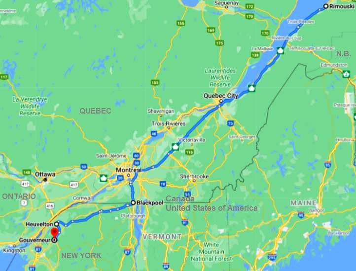
Once I got underway in the morning I was seriously captivated by the beauty of the St Lawrence.
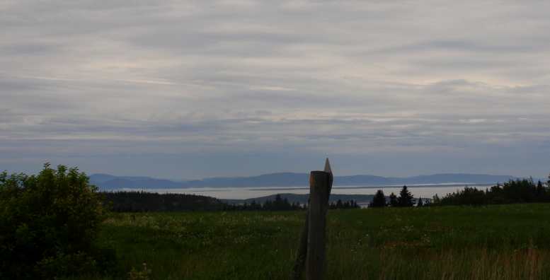
Sighting the St Lawrence. I knew from the first sight that this was nice. It was a cloudy day and haze prevented pics from being particularly good, but the delight of seeing this scenery was still great.
You wouldn't miss that for the world, would you?
Driving through what was essentially grazing and cropping country, always to my right there was the St Lawrence. There was haze and it was overcast to start with, also a spot of rain, but it's even hard to say that those weren't the best conditions in which to see it. Check these photos:
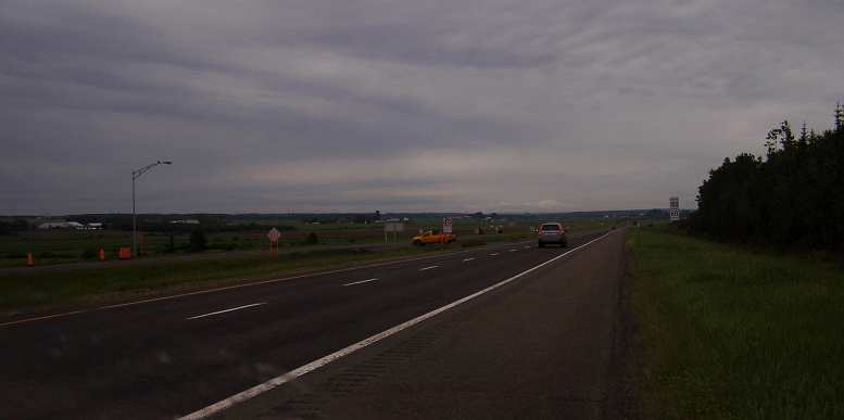
Good road. After a while the 2-lane led to a new freeway, which made things easier.
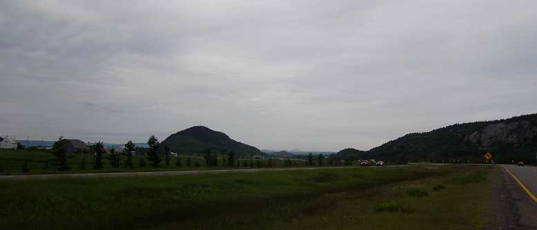
Hills and farms. Sights like this came and went, such a pleasant drive.
Lucky cows! They get to enjoy this view all the time!
Farms, factories, Frenchmen. Into the mix dropped the odd village, some factories at times too, but mostly it was farming country with the view across the river always predominant.
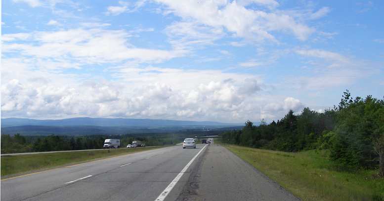
Distant hills too. Sometimes the highway got some elevation and allowed more distant views, this one with the mountains ahead looked nice.
Canada's cold, right? The rest areas came up about every 40kms or so, there was always a nice grassy and shaded area to take a stroll (or walk your dog) and the toilets were usually clean. But note the ice cream vendor... in cold Canada there was only one such rest area I saw without the ice cream vendor!
.
I drove through the morning and into the early afternoon relishing this. I think you really have to have an appreciation for the abundance of natural beauty with you at all times, be ready to take it in and - dare I quote John Denver again? - fill up your senses with it.
As mentioned, the better roads weren't there at the beginning of the day, early on the road was pretty ordinary...
Old road. Like all old roads, this one didn't bypass the towns.
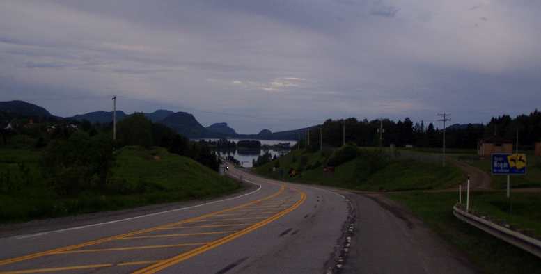
Scenery still good. Even so, the countryside couldn't hide from it, I still had an unexpectedly beautiful part of the world revealing itself as I drove.
...but that didn't alter the fact that this was a very pretty part of the world, and a part of the world I've never heard of being so pretty before. After a while I found I was travelling on a well-built freeway which bypassed the little towns.
At the various rest areas, and I was stopping at a lot of them just to keep fresh (and in the hope that they'd have some travel information there, which they never did), I'd meet people from many parts of Canada. The ones who spoke English, of course.
Whether they were from Vancouver or New Brunswick, there was always someone travelling through with whom you could have a brief chat.
The season was good, a harsh winter had gone and late spring had brought nice rains. Green was everywhere.
And there were wildflowers is you looked closely:
Wildflowers. As the river narrowed it was time to notice other things... like the simple existence of wildflowers in the paddocks.
And other things to notice...
Essential services. At one of the rest areas the septic tank was being pumped out. As I have a good friend at home who does this work I took some pics for her.
After the city of Quebec, which I didn't drive into, the highway diverged from the river and was no longer so scenic. I made a navigational error as I neared Montreal (which I really feared - the GPS didn't work in Canada and all signs were in French) and I spent a long time on back roads until I worked out where I was. I had to turn at these lights, actually:
Unusual lights. Most high level Canadian traffic lights were mounted horizontally like this. The square lights are unusual, however.Then I needed to get onto the Interstate to take me southward. I'd been careful with my Canadian cash and with my fuel purchasing, I wanted to be near empty of fuel when I crossed the border because of the huge difference in price.
I think I went backwards for a while, unable to follow signs and without the GPS, and before I found the main road I was on a back-road following the Richeleau River South from McMasterville when I saw yet another sign unique to this part of the world:
A sign for all seasons. Unique to this part of the world, snowmobiles cross here in Winter, dirt bikes in Summer, reminding me of Jerry Entin’s ‘stock transfer’ job for Babbitt’s on the previous trip.
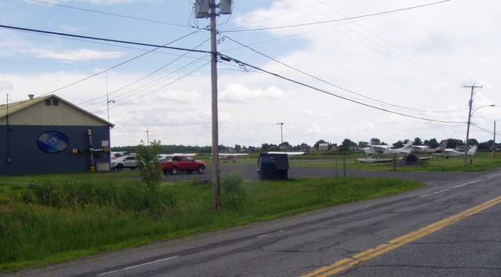
BL Aviation. Something more or less worthy of note on the same stretch of road at St Mathias sur Richelieu.
Before I crossed the border I also wanted some Canadian souvenirs for friends back home, so when a souvenir shop came up I scrambled through my meagre supply of leftover cash and got a few things for them. Then I bought something to eat at a truck stop just four kilometres short of the border…
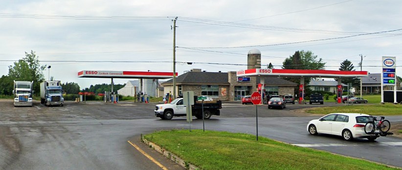
Last stop in Canada. This Esso truckstop/roadhouse at Saint Bernard de Lacolle provided me with a meal and enough fuel to absorb the last of my Canadian cash.(GE)
…and used exactly the amount of Canuck cash I had left on fuel. An amount like $7.61 or similar...
Leaving the service station I was delighted to see this evidence that I would soon have phone, GPS and internet available to me…
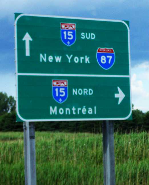
New York straight ahead! Putting Canada behind me, Upstate New York beckoned – and I had to get cracking to look at the Dodge Monaco.
Time now to reflect on some of the things I’d notice in this part of Canada…
This day, June 18, 2014, was all about the St Lawrence foreshore. I had the subsidiary goal of making it into upstate New York to check out a car I was wanting to buy, so there was a definite destination planned. Here’s the path the now well-travelled Dodge would take:
Once I got underway in the morning I was seriously captivated by the beauty of the St Lawrence.
Sighting the St Lawrence. I knew from the first sight that this was nice. It was a cloudy day and haze prevented pics from being particularly good, but the delight of seeing this scenery was still great.
You wouldn't miss that for the world, would you?
Driving through what was essentially grazing and cropping country, always to my right there was the St Lawrence. There was haze and it was overcast to start with, also a spot of rain, but it's even hard to say that those weren't the best conditions in which to see it. Check these photos:
Good road. After a while the 2-lane led to a new freeway, which made things easier.
Hills and farms. Sights like this came and went, such a pleasant drive.
Lucky cows! They get to enjoy this view all the time!
Farms, factories, Frenchmen. Into the mix dropped the odd village, some factories at times too, but mostly it was farming country with the view across the river always predominant.
Distant hills too. Sometimes the highway got some elevation and allowed more distant views, this one with the mountains ahead looked nice.
Canada's cold, right? The rest areas came up about every 40kms or so, there was always a nice grassy and shaded area to take a stroll (or walk your dog) and the toilets were usually clean. But note the ice cream vendor... in cold Canada there was only one such rest area I saw without the ice cream vendor!
.
I drove through the morning and into the early afternoon relishing this. I think you really have to have an appreciation for the abundance of natural beauty with you at all times, be ready to take it in and - dare I quote John Denver again? - fill up your senses with it.
As mentioned, the better roads weren't there at the beginning of the day, early on the road was pretty ordinary...
Old road. Like all old roads, this one didn't bypass the towns.
Scenery still good. Even so, the countryside couldn't hide from it, I still had an unexpectedly beautiful part of the world revealing itself as I drove.
...but that didn't alter the fact that this was a very pretty part of the world, and a part of the world I've never heard of being so pretty before. After a while I found I was travelling on a well-built freeway which bypassed the little towns.
At the various rest areas, and I was stopping at a lot of them just to keep fresh (and in the hope that they'd have some travel information there, which they never did), I'd meet people from many parts of Canada. The ones who spoke English, of course.
Whether they were from Vancouver or New Brunswick, there was always someone travelling through with whom you could have a brief chat.
The season was good, a harsh winter had gone and late spring had brought nice rains. Green was everywhere.
And there were wildflowers is you looked closely:
Wildflowers. As the river narrowed it was time to notice other things... like the simple existence of wildflowers in the paddocks.
And other things to notice...
Essential services. At one of the rest areas the septic tank was being pumped out. As I have a good friend at home who does this work I took some pics for her.
After the city of Quebec, which I didn't drive into, the highway diverged from the river and was no longer so scenic. I made a navigational error as I neared Montreal (which I really feared - the GPS didn't work in Canada and all signs were in French) and I spent a long time on back roads until I worked out where I was. I had to turn at these lights, actually:
Unusual lights. Most high level Canadian traffic lights were mounted horizontally like this. The square lights are unusual, however.Then I needed to get onto the Interstate to take me southward. I'd been careful with my Canadian cash and with my fuel purchasing, I wanted to be near empty of fuel when I crossed the border because of the huge difference in price.
I think I went backwards for a while, unable to follow signs and without the GPS, and before I found the main road I was on a back-road following the Richeleau River South from McMasterville when I saw yet another sign unique to this part of the world:
A sign for all seasons. Unique to this part of the world, snowmobiles cross here in Winter, dirt bikes in Summer, reminding me of Jerry Entin’s ‘stock transfer’ job for Babbitt’s on the previous trip.
BL Aviation. Something more or less worthy of note on the same stretch of road at St Mathias sur Richelieu.
Before I crossed the border I also wanted some Canadian souvenirs for friends back home, so when a souvenir shop came up I scrambled through my meagre supply of leftover cash and got a few things for them. Then I bought something to eat at a truck stop just four kilometres short of the border…
Last stop in Canada. This Esso truckstop/roadhouse at Saint Bernard de Lacolle provided me with a meal and enough fuel to absorb the last of my Canadian cash.(GE)
…and used exactly the amount of Canuck cash I had left on fuel. An amount like $7.61 or similar...
Leaving the service station I was delighted to see this evidence that I would soon have phone, GPS and internet available to me…
New York straight ahead! Putting Canada behind me, Upstate New York beckoned – and I had to get cracking to look at the Dodge Monaco.
Time now to reflect on some of the things I’d notice in this part of Canada…
Last edited by Ray Bell; Mar 18, 2023 at 09:46 AM.
Thread Starter
|
Captain
Joined: Oct 2005
Posts: 570
Likes: 8
From: The Summit, Queensland, Australia
With the kilometres I’d covered in Canada, I guess it wasn’t surprising that I’d see something to remind me of home…
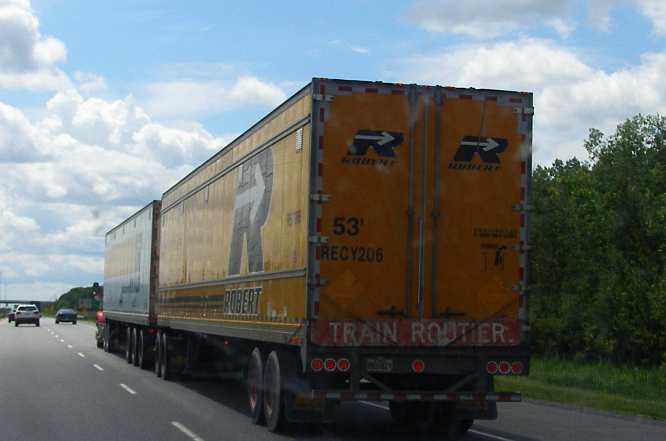
Road Train. ...a road train. We have lots of these, often three or more trailers, in our remote areas.
...and to see a ‘fun’ road sign:
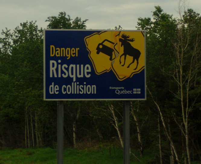
Imaginative! At least you could be impressed with the artwork even if you can’t read it. Not that it’s so hard, of course, to understand.
And before we delve into the bit over the border, I would like to present some evidence that Quebec doesn't like the rest of Canada... or at least their language.
Customs is waiting for you! Still in French only, this is a sign that the border's not far away. USA here we come, but will they search the van? Most times I crossed the border on this drive the van got searched. I must look suspicious or something!
After having seen the lengths the New Brunswick people go, and also having seen the bilingual signs in parts of Canada thousands of miles from the French-speaking Quebec, it really struck home that they don't want to know anything about English.
Further to that, to avoid having to risk using English, a lot is done with illustrations:
Stop! Still no English! Note that the sign explains which roads have the 'Stop' signs.
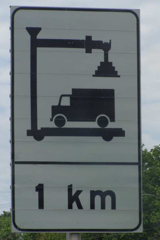
Simple. Graphic picture here... but the real scales don't actually look like that.
Well... it is a freeway! I can just imagine what problems there would be with non-French speaking folk if this wasn't an illustrated sign.
There were others, of course. But I wasn't stopping to get photos of everything, just a smattering to show a bit of what it was like travelling in this foreign land.
Quebec really did seem like a foreign land.
But it was beautiful and I was tempted to think that, perhaps, the beauty is wasted on them.
And maybe this one indicates a sense of humour?
Old fashioned! Well, when did you last see a can opened like this?
Once I got over the line I phoned the man who was waiting for me to get there to check out his car. No phone in Canada either... I'd had no phone, no GPS and very little internet for three days, to be back in touch with the world (let's also include with English-speaking people in that) was very pleasant.
Unfortunately I didn't stop to look at the map or set the GPS until I'd headed a little way South. Actually, my GPS had died on me and I needed to buy a new one, which meant it was a good thing I’d deviated so far South as I found a Walmart at Plattsburgh and bought another Garmin. The route became firmed up then.
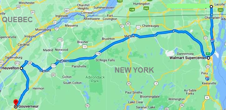
It wasn't so bad, really, and when I called he told me which way to go and which place had the best fuel price. I just started romping through the countryside following the GPS' instructions.
Along the way I got a picture of this little pickup, deteriorating in a paddock between two old barns:
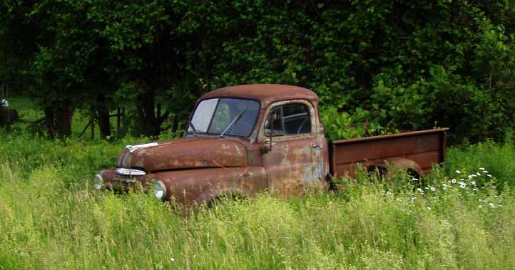
Rusty pickup. I think the split screen means it’s pre-1953. I don’t think it will last much longer if left in the long grass like this.
It was a good quick run through to Heuvelton, really. Roads like this…
Good driving country. Smooth roads, not much traffic and pleasant conditions made for a quick trip.
…made for good driving, there was hardly anyone else on the road to help that along, soon I was heading into the sunset…
Sunset came... With the encroaching darkness the need to keep up the pressure on the right foot became greater.
...and I felt it would make checking the car out more difficult.
I fuelled up at an Indian reservation service station as had been recommended to me, apparently they don't have such high taxes on their fuel, and kept on going. It was getting dark... it got dark, I didn't notice the speed limit as I hit one little village and a very official-looking SUV turning on its lights and following me for a while had me worried. Yes, I slowed down then.
Finally I arrived, but I quickly ascertained that the deal wasn't going to work. The car, a 1965 Dodge Monaco, had rust ready to burst asunder in a few places and that was something I couldn't fix myself. I tried to explain to him that the cost of shipping, the cost of getting the trim done and then the potential of a 5-year wait while someone charging me $8000 or more took their time to clear out the rust and paint it meant it simply wasn't a deal I could go with.
1965 Dodge Monaco. A fairly special model, the first year of the Monaco and only sold as a 383 automatic 2-door that year.
I felt bad about it, the man really needs to sell this car due to his personal situation and he's been waiting for me to get there for months. Apparently he only bought it to get the little repeater light and trim from the top of the driver’s side fender. I had found (and bought!) those bits expecting to buy the car and turn it over quickly. But it's not up to me to risk my finances just to help him out... I drove on...
Just to add in a little about the countryside encountered, the roads through this area lend themselves to enjoyable driving. The settings change all the time, but the early summer brings out some nice scenery. Autumn, I learned last time, is even nicer!
To show yet another difference between the way we do things:
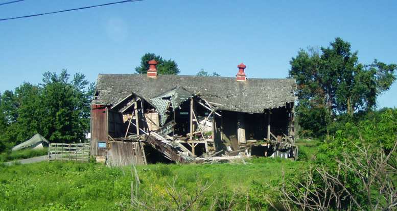
Hard winters. My fascination with collapsing buildings was well-fed in upstate New York. The decaying buildings are left to rot and collapse, a hard winter brings the final blow to them.
Garden sheds. No flat pack of thin galvanised tin here... These prefabricated sheds are sold complete and, as can be seen, in a wide range of styles. They're delivered on trailers and in one piece.
It was already dark, which meant after 9pm. I drove on into the town of Gouvernuer and got something to eat. I camped in the McDonalds car park there for the night before striking out the next day to keep a long-awaited appointment...
.
Road Train. ...a road train. We have lots of these, often three or more trailers, in our remote areas.
...and to see a ‘fun’ road sign:
Imaginative! At least you could be impressed with the artwork even if you can’t read it. Not that it’s so hard, of course, to understand.
And before we delve into the bit over the border, I would like to present some evidence that Quebec doesn't like the rest of Canada... or at least their language.
Customs is waiting for you! Still in French only, this is a sign that the border's not far away. USA here we come, but will they search the van? Most times I crossed the border on this drive the van got searched. I must look suspicious or something!
After having seen the lengths the New Brunswick people go, and also having seen the bilingual signs in parts of Canada thousands of miles from the French-speaking Quebec, it really struck home that they don't want to know anything about English.
Further to that, to avoid having to risk using English, a lot is done with illustrations:
Stop! Still no English! Note that the sign explains which roads have the 'Stop' signs.
Simple. Graphic picture here... but the real scales don't actually look like that.
Well... it is a freeway! I can just imagine what problems there would be with non-French speaking folk if this wasn't an illustrated sign.
There were others, of course. But I wasn't stopping to get photos of everything, just a smattering to show a bit of what it was like travelling in this foreign land.
Quebec really did seem like a foreign land.
But it was beautiful and I was tempted to think that, perhaps, the beauty is wasted on them.
And maybe this one indicates a sense of humour?
Old fashioned! Well, when did you last see a can opened like this?
Once I got over the line I phoned the man who was waiting for me to get there to check out his car. No phone in Canada either... I'd had no phone, no GPS and very little internet for three days, to be back in touch with the world (let's also include with English-speaking people in that) was very pleasant.
Unfortunately I didn't stop to look at the map or set the GPS until I'd headed a little way South. Actually, my GPS had died on me and I needed to buy a new one, which meant it was a good thing I’d deviated so far South as I found a Walmart at Plattsburgh and bought another Garmin. The route became firmed up then.
It wasn't so bad, really, and when I called he told me which way to go and which place had the best fuel price. I just started romping through the countryside following the GPS' instructions.
Along the way I got a picture of this little pickup, deteriorating in a paddock between two old barns:
Rusty pickup. I think the split screen means it’s pre-1953. I don’t think it will last much longer if left in the long grass like this.
It was a good quick run through to Heuvelton, really. Roads like this…
Good driving country. Smooth roads, not much traffic and pleasant conditions made for a quick trip.
…made for good driving, there was hardly anyone else on the road to help that along, soon I was heading into the sunset…
Sunset came... With the encroaching darkness the need to keep up the pressure on the right foot became greater.
...and I felt it would make checking the car out more difficult.
I fuelled up at an Indian reservation service station as had been recommended to me, apparently they don't have such high taxes on their fuel, and kept on going. It was getting dark... it got dark, I didn't notice the speed limit as I hit one little village and a very official-looking SUV turning on its lights and following me for a while had me worried. Yes, I slowed down then.
Finally I arrived, but I quickly ascertained that the deal wasn't going to work. The car, a 1965 Dodge Monaco, had rust ready to burst asunder in a few places and that was something I couldn't fix myself. I tried to explain to him that the cost of shipping, the cost of getting the trim done and then the potential of a 5-year wait while someone charging me $8000 or more took their time to clear out the rust and paint it meant it simply wasn't a deal I could go with.
1965 Dodge Monaco. A fairly special model, the first year of the Monaco and only sold as a 383 automatic 2-door that year.
I felt bad about it, the man really needs to sell this car due to his personal situation and he's been waiting for me to get there for months. Apparently he only bought it to get the little repeater light and trim from the top of the driver’s side fender. I had found (and bought!) those bits expecting to buy the car and turn it over quickly. But it's not up to me to risk my finances just to help him out... I drove on...
Just to add in a little about the countryside encountered, the roads through this area lend themselves to enjoyable driving. The settings change all the time, but the early summer brings out some nice scenery. Autumn, I learned last time, is even nicer!
To show yet another difference between the way we do things:
Hard winters. My fascination with collapsing buildings was well-fed in upstate New York. The decaying buildings are left to rot and collapse, a hard winter brings the final blow to them.
Garden sheds. No flat pack of thin galvanised tin here... These prefabricated sheds are sold complete and, as can be seen, in a wide range of styles. They're delivered on trailers and in one piece.
It was already dark, which meant after 9pm. I drove on into the town of Gouvernuer and got something to eat. I camped in the McDonalds car park there for the night before striking out the next day to keep a long-awaited appointment...
.
Last edited by Ray Bell; May 8, 2023 at 05:52 AM.
Registered User
Joined: Oct 2019
Posts: 2
Likes: 0
From: Lawrence, Kansas
I love seeing these posts! I am really new to the car and truck scene so I lurk here and on the ram forum to learn and I love looking at pictures and reading the stories of where you folks have been!