

Ride along with me...


Thread Starter
|
Captain

Joined: Oct 2005
Posts: 570
Likes: 8
From: The Summit, Queensland, Australia
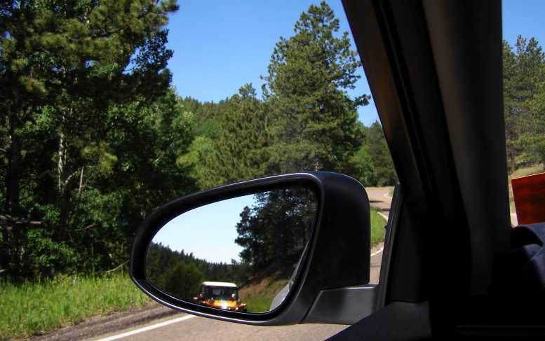
Eager to see what was going on along the Iowa foreshores of the river I drove down to where teams were sandbagging to protect low-lying parts of the town. Already a restaurant and other buildings were inundated and cut off from dry ground, while railway lines also ran into the river.
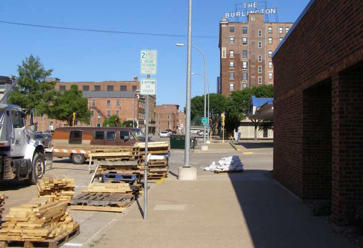
Chaotic riverside. Trucks, pallets, barricades show that lots of work is going on here.
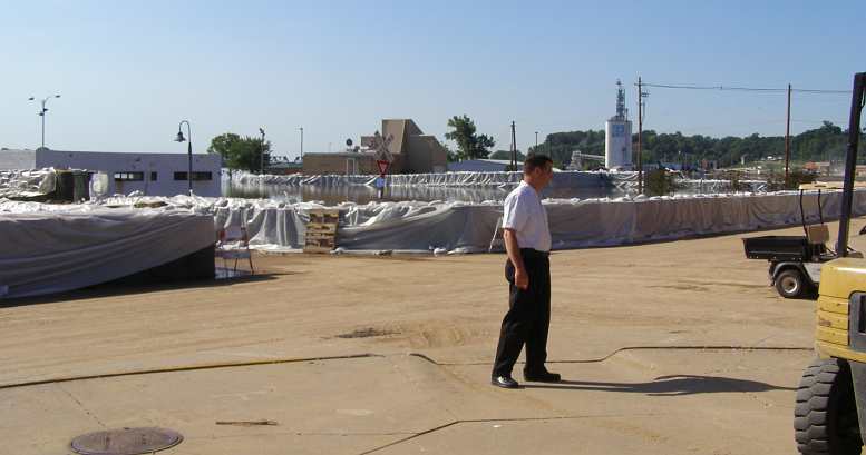
Organising the chaos. Trying hard to do a good job of organising, this bloke was directing operations.
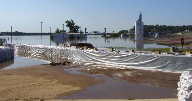
Rail to River. At this point even the railway goes into the flooded river.
Not so welcome! The Port of Burlington Welcome Center must be a good spot for visitors to stop when the river isn’t flooded.
flooded.
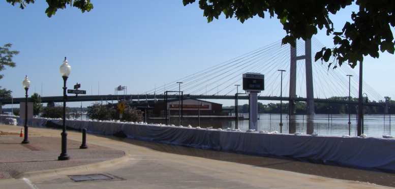
I don't know how often the flooding at Burlington gets this high - or higher - but I'm sure they're well used to it and have systems and plans in place to deal with it when it comes.
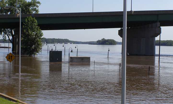
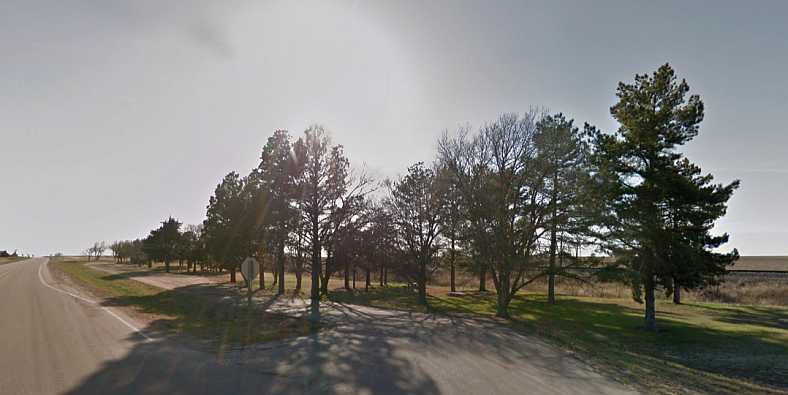
Walks awash. Riverside walkways completely hidden by the flooded Mississippi.
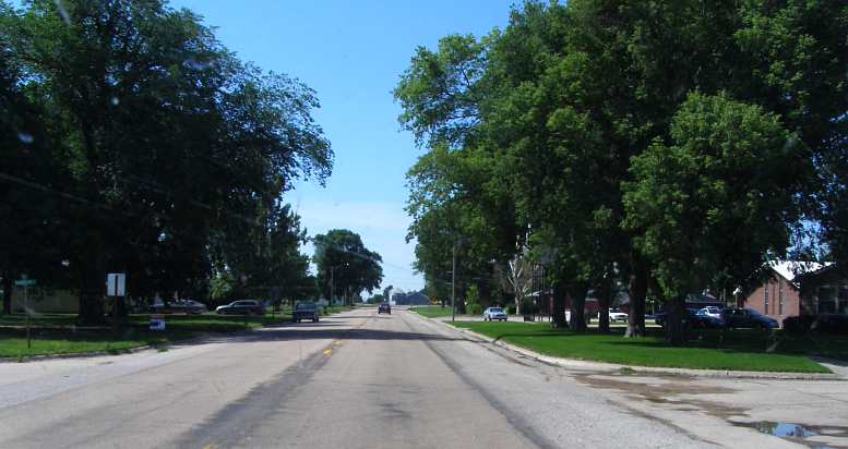
Before I left Burlington I was distracted by this sight:
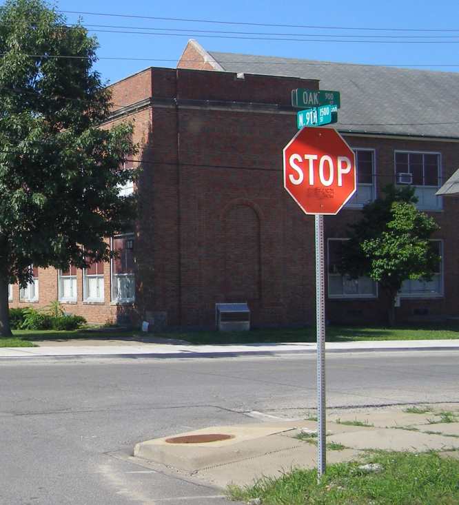
Right turn or left at Oak Street?
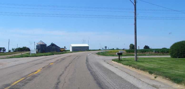
But this wasn't getting me any closer to John's place, so I phoned him and got final instructions. Among those was to watch out for an abandoned shop along the road…

Abandoned shop. One of the landmarks on the way to John’s place.
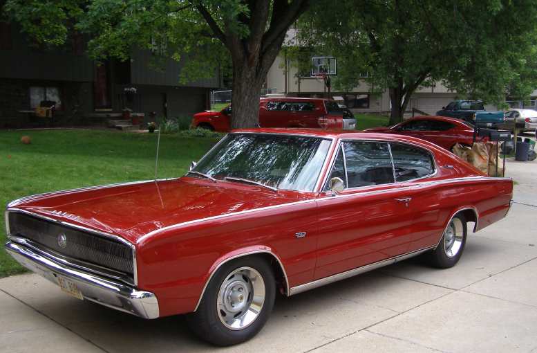
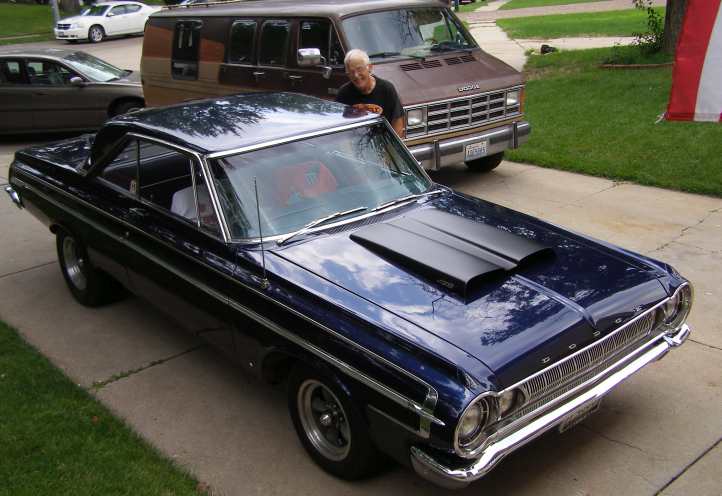
...and so on. In the end it wasn't hard to pick his place as there were many Mopar vehicles out the front…
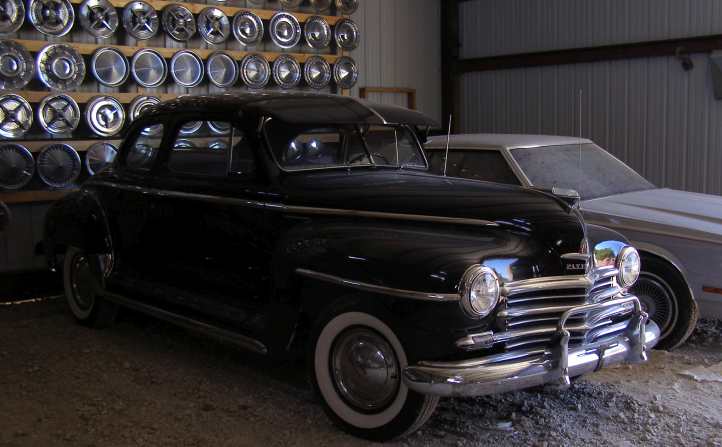
Mopars. I found John’s place quite easily.
Plymouth. This Forward Look Plymouth certainly helped.
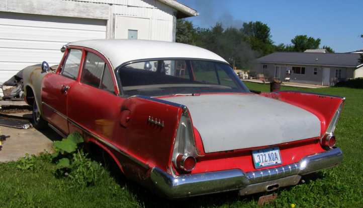
Others were away in the shed:
Old girl. Just one of the cars John prizes in his shed.
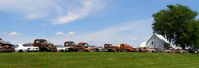
And in another paddock he had a whole host of them in varying stages of disrepair or dismantling…
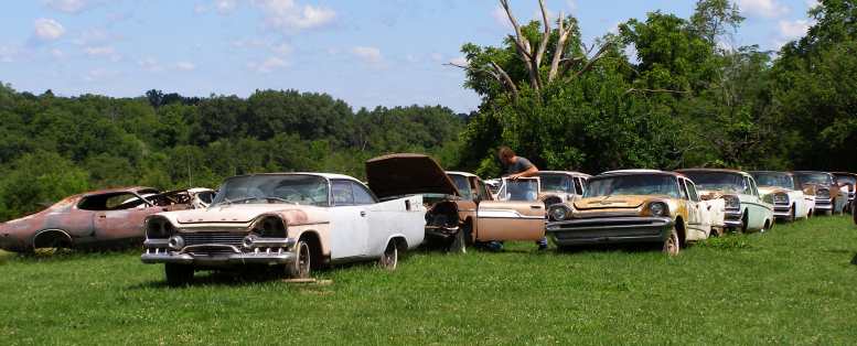
Forward Looks. Plenty of the finned-era cars for parts.
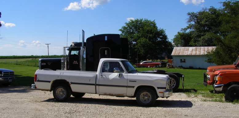
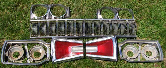
The main things I was to pick up were a tailgate (complete with wind-up window) for a '57 Plymouth wagon (a model not sold in Australia) and a rear window for a 2-door Plymouth of similar vintage. We got those packed in the van and had a good chat and look around. I also bought a grille from one of the pickups.
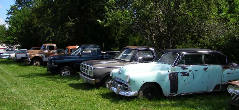
Another line-up. Not all his collection is Forward Look, however.
A lot of Dodge Chargers, which seem to have been a personal favourite of his, while the Forward Look (1956-1961) vehicles were mostly Dodges. Not that this prevented him having cars from earlier periods, nor a number of pickups.
Chargers. John seems to favour the Chargers in the ’60s-’70s cars.
I also left the Dodge Monaco bits with John in case there was a sale available for them:
Bits for sale. Having bought these and not the car they were wanted for, I left them with John so they’d be somewhere in America if someone wanted them.
John then gave me a pile of 'Good Guys' magazines and told me that there was a large gathering of the 'Good Guys' for an annual hot-rod show at Des Moines that day. And that another contact would be there from whom I was to get more stuff for Glendon.
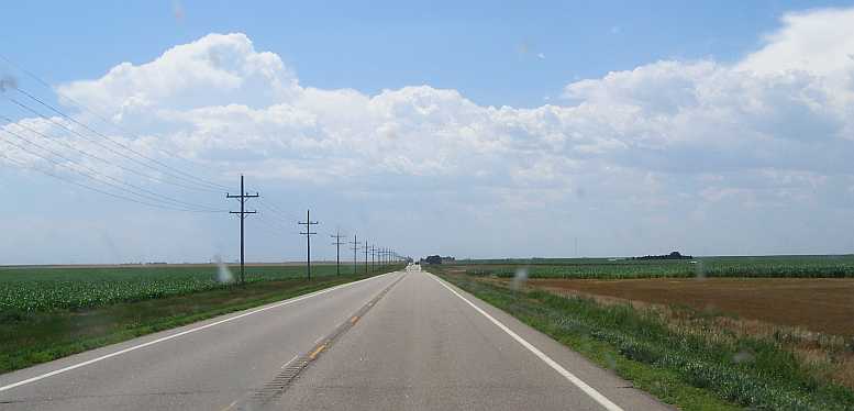
As I headed for Des Moines, taking a couple of rough-ish back roads at first, past more cornfields…
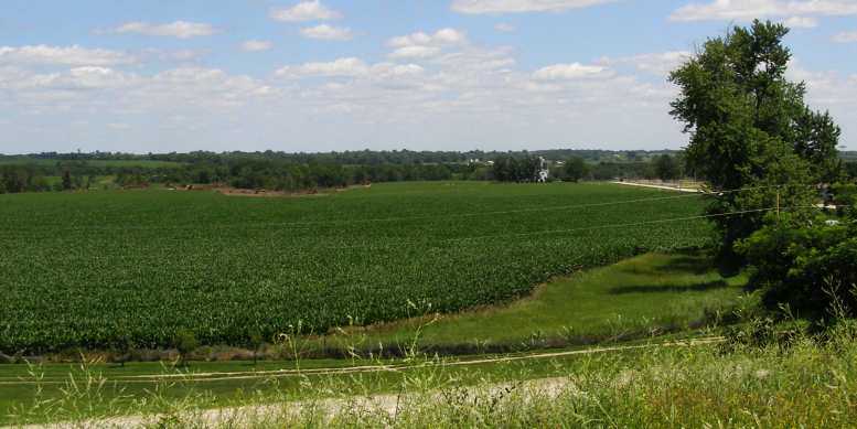
Iowa corn. Isn’t Iowa famous for cornfields? Here are some now.
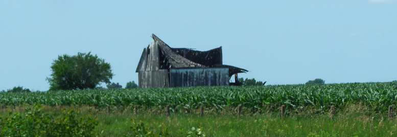
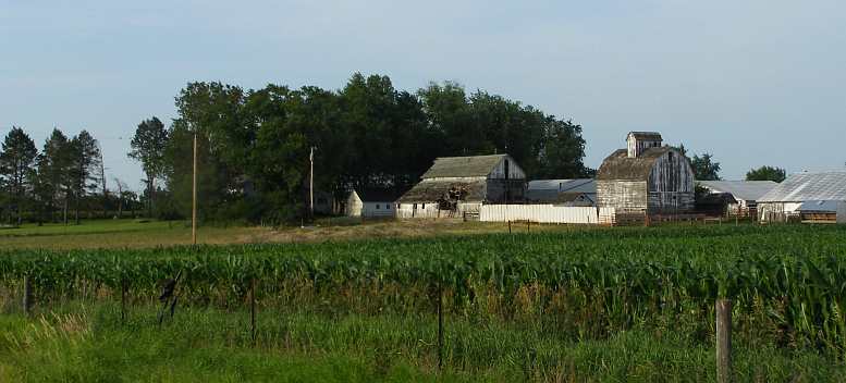
Among the corn. Still I’m fascinated by buildings falling down!
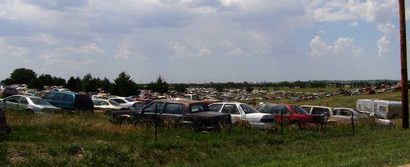
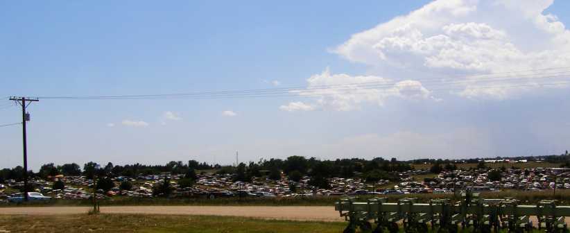
…and then on the main road, I saw this lot at Pella:
Doug’s 4 Wheelers. This is only part of the line facing the road at Pella.
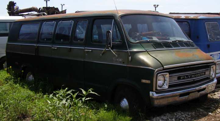
Plymouth Voyager. Not in bad shape for its model (mid '70s), this is just one of hundreds of vehicles in Doug’s yard.
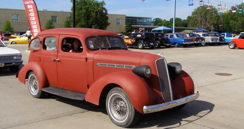
But the main event was at Des Moines. Did John say it was 'large'? 'Huge' was more like it, literally thousands of cars on static display, or circling the grounds of the State Fair Grounds. It's an annual event and this was July 4, it was very much an eye-opener for me…
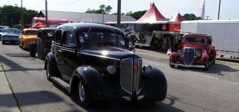
Driving around. And endless stream of cars drove round and round the Fairgrounds, this ’38 Dodge is ahead of a highly rodded Dodge pickup, a Ford Custom and a ’64 Plymouth.
More parading. Is this a Studebaker, or a Nash? The cars of all makes and models just kept coming.
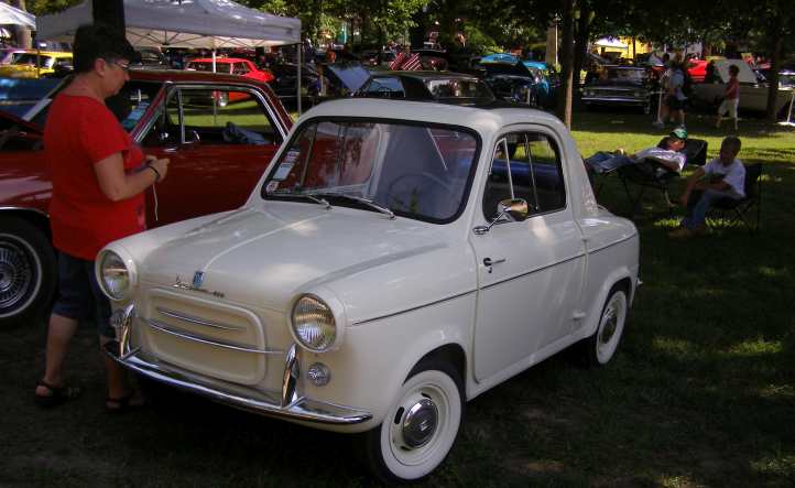
In the shade. Cool crowds in the shade with this very rare Vespa.
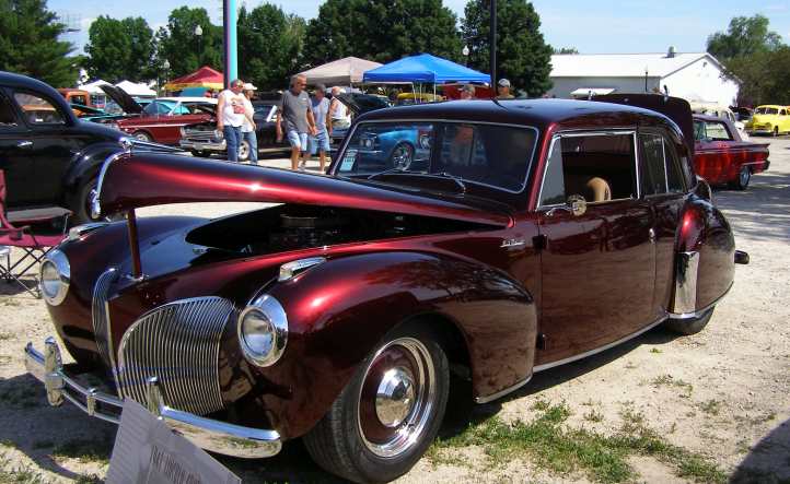
Lincoln. My vote for the most stunning, this Lincoln looked great.
I made contact with the other bloke and drove out to his place a way out of town…
More old buildings.On the way out of town I couldn’t resist getting a shot of another old barn heading towards rack and ruin.
Plymouth at home. John’s friend had arrived home in his ‘show’ Plymouth.
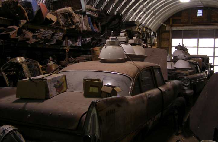
In the shed. There was a large storehouse of Forward Look parts.
…I actually bought a couple of things from him myself, but a bundle of stainless steel trim pieces for a 2-door Plymouth (remember, not sold in Australia) was the critical parcel I was to pick up for Glendon and it took a bit of wrapping up to keep it safe.
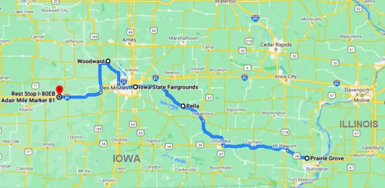
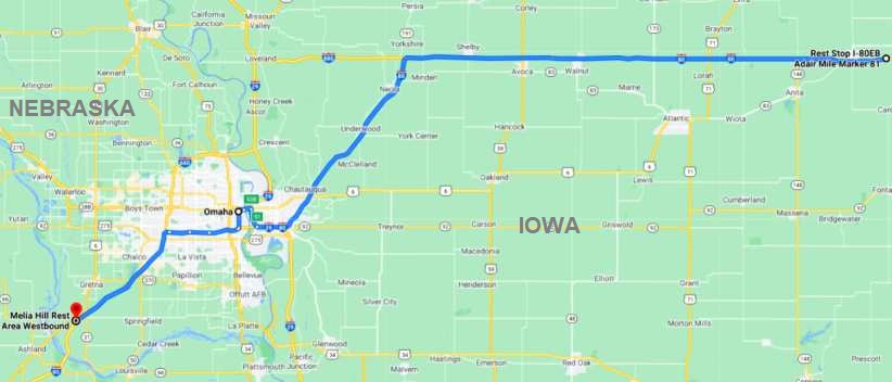
The day was evaporating fast as I left there. In the morning I had to be in Omaha, Nebraska to catch up with Rich Kinsley and a number of other '62 to '65 Mopar owners who were all arranged to welcome me as I passed through. I found the McDonalds, right on the I80 at Stuart, ate there and used their wi-fi, then went on a little further to the Adair Rest area to sleep the night.
Oh, yeah, going into Iowa this day meant I only had two states left to enter to accomplish what Janet had wanted to do. Nebraska and Colorado, neither was all that far away…
And by the way, if anyone wants to see more of the cars at Pella or the Des Moines Good Guys show, just ask, I’ll post them for you.
Oh, and here's a link to Right Turn or Left at Oak Street:
Chaotic riverside. Trucks, pallets, barricades show that lots of work is going on here.
Organising the chaos. Trying hard to do a good job of organising, this bloke was directing operations.
Rail to River. At this point even the railway goes into the flooded river.
Not so welcome! The Port of Burlington Welcome Center must be a good spot for visitors to stop when the river isn’t flooded.
flooded.
I don't know how often the flooding at Burlington gets this high - or higher - but I'm sure they're well used to it and have systems and plans in place to deal with it when it comes.
Walks awash. Riverside walkways completely hidden by the flooded Mississippi.
Before I left Burlington I was distracted by this sight:
Right turn or left at Oak Street?
But this wasn't getting me any closer to John's place, so I phoned him and got final instructions. Among those was to watch out for an abandoned shop along the road…
Abandoned shop. One of the landmarks on the way to John’s place.
...and so on. In the end it wasn't hard to pick his place as there were many Mopar vehicles out the front…
Mopars. I found John’s place quite easily.
Plymouth. This Forward Look Plymouth certainly helped.
Others were away in the shed:
Old girl. Just one of the cars John prizes in his shed.
And in another paddock he had a whole host of them in varying stages of disrepair or dismantling…
Forward Looks. Plenty of the finned-era cars for parts.
The main things I was to pick up were a tailgate (complete with wind-up window) for a '57 Plymouth wagon (a model not sold in Australia) and a rear window for a 2-door Plymouth of similar vintage. We got those packed in the van and had a good chat and look around. I also bought a grille from one of the pickups.
Another line-up. Not all his collection is Forward Look, however.
A lot of Dodge Chargers, which seem to have been a personal favourite of his, while the Forward Look (1956-1961) vehicles were mostly Dodges. Not that this prevented him having cars from earlier periods, nor a number of pickups.
Chargers. John seems to favour the Chargers in the ’60s-’70s cars.
I also left the Dodge Monaco bits with John in case there was a sale available for them:
Bits for sale. Having bought these and not the car they were wanted for, I left them with John so they’d be somewhere in America if someone wanted them.
John then gave me a pile of 'Good Guys' magazines and told me that there was a large gathering of the 'Good Guys' for an annual hot-rod show at Des Moines that day. And that another contact would be there from whom I was to get more stuff for Glendon.
As I headed for Des Moines, taking a couple of rough-ish back roads at first, past more cornfields…
Iowa corn. Isn’t Iowa famous for cornfields? Here are some now.
Among the corn. Still I’m fascinated by buildings falling down!
…and then on the main road, I saw this lot at Pella:
Doug’s 4 Wheelers. This is only part of the line facing the road at Pella.
Plymouth Voyager. Not in bad shape for its model (mid '70s), this is just one of hundreds of vehicles in Doug’s yard.
But the main event was at Des Moines. Did John say it was 'large'? 'Huge' was more like it, literally thousands of cars on static display, or circling the grounds of the State Fair Grounds. It's an annual event and this was July 4, it was very much an eye-opener for me…
Driving around. And endless stream of cars drove round and round the Fairgrounds, this ’38 Dodge is ahead of a highly rodded Dodge pickup, a Ford Custom and a ’64 Plymouth.
More parading. Is this a Studebaker, or a Nash? The cars of all makes and models just kept coming.
In the shade. Cool crowds in the shade with this very rare Vespa.
Lincoln. My vote for the most stunning, this Lincoln looked great.
I made contact with the other bloke and drove out to his place a way out of town…
More old buildings.On the way out of town I couldn’t resist getting a shot of another old barn heading towards rack and ruin.
Plymouth at home. John’s friend had arrived home in his ‘show’ Plymouth.
In the shed. There was a large storehouse of Forward Look parts.
…I actually bought a couple of things from him myself, but a bundle of stainless steel trim pieces for a 2-door Plymouth (remember, not sold in Australia) was the critical parcel I was to pick up for Glendon and it took a bit of wrapping up to keep it safe.
The day was evaporating fast as I left there. In the morning I had to be in Omaha, Nebraska to catch up with Rich Kinsley and a number of other '62 to '65 Mopar owners who were all arranged to welcome me as I passed through. I found the McDonalds, right on the I80 at Stuart, ate there and used their wi-fi, then went on a little further to the Adair Rest area to sleep the night.
Oh, yeah, going into Iowa this day meant I only had two states left to enter to accomplish what Janet had wanted to do. Nebraska and Colorado, neither was all that far away…
And by the way, if anyone wants to see more of the cars at Pella or the Des Moines Good Guys show, just ask, I’ll post them for you.
Oh, and here's a link to Right Turn or Left at Oak Street:
Last edited by Ray Bell; Sep 29, 2022 at 01:50 AM.
Grand Champion


Joined: May 2019
Posts: 5,159
Likes: 724
From: S.W. Indiana
We know about the rivers now, but 200+ years ago, we didn't have aircraft and satellite mapping. I always marvel at how well the surveyors of years past did their job. The government was resurveying some boundaries a few years back and went to put a boundary marker in place. The old one had disappeared years before. As they were sinking it, they hit something. Digging down they found the old marker.
Thread Starter
|
Captain
Joined: Oct 2005
Posts: 570
Likes: 8
From: The Summit, Queensland, Australia
A very good point...
They had some sophisticated equipment all the same. What amazes me is how so much of Australia got surveyed in the first hundred years, there were so few people here.
A surveyor would have been a well-paid person in those days, they would have been in big demand and been highly skilled.
They had some sophisticated equipment all the same. What amazes me is how so much of Australia got surveyed in the first hundred years, there were so few people here.
A surveyor would have been a well-paid person in those days, they would have been in big demand and been highly skilled.
Thread Starter
|
Captain
Joined: Oct 2005
Posts: 570
Likes: 8
From: The Summit, Queensland, Australia
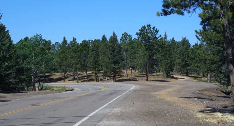
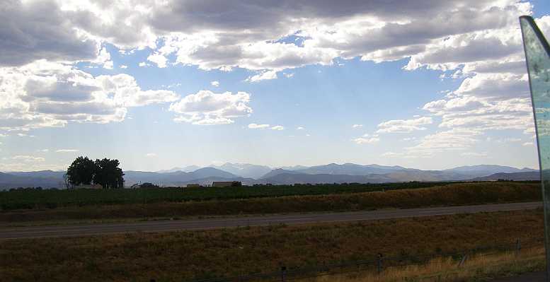
It would be a fairly short run for the fifth of July, 2014, I would barely cover more than 100 miles:
I had awoken about sixty miles West of Des Moines…
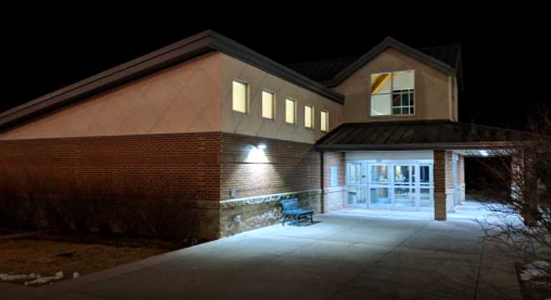
Adair’s amenities. Well-lit amenities were a feature of the Adair Rest Area, inside there were plenty of displays and vending machines. MikeAbrams
…with rain falling around me. I'd been looking forward to this day as Rich Kinsley had gone to some trouble to arrange for four of the local Omaha group of '62 to '65 Mopar owners to put time aside to meet me. Together we would enjoy a barbecue lunch.
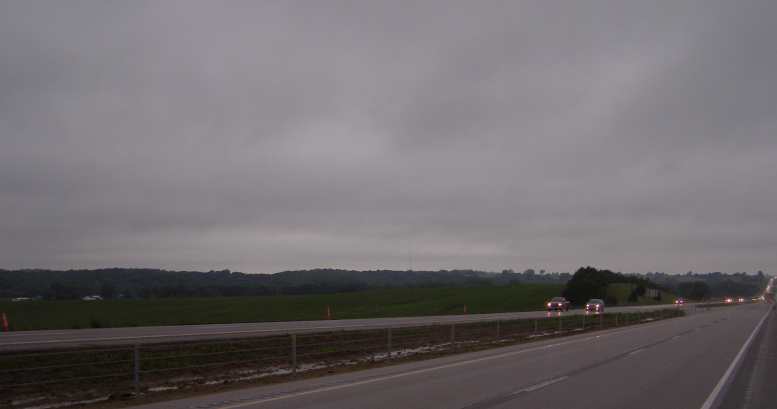
Wet start. Rain had not been a big problem on this trip, but this morning there was some about.
With a nice early start, now I was experiencing some wet-weather driving on this section, named Grand Army of the Republic Highway, and some of the Interstate was down to two lanes due to roadworks…
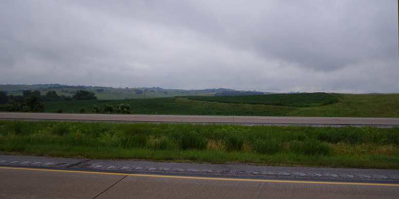
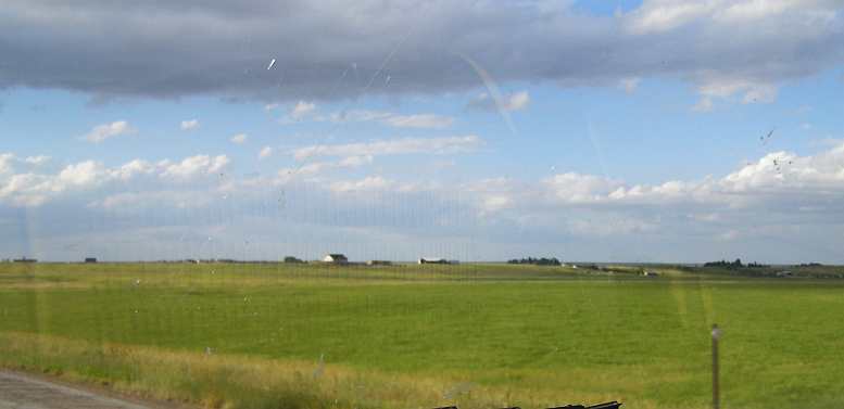
Surrounded. Little had changed in the agricultural outlook. Corn to the South of me…
Faltering? …and to the North of me. But is this a sign that the crops are weakening?
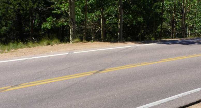
Just two lanes. Traffic was moderate so this was little inconvenience at this time on the Saturday morning.
…I stopped near Avoca to take more pics of some distant views…
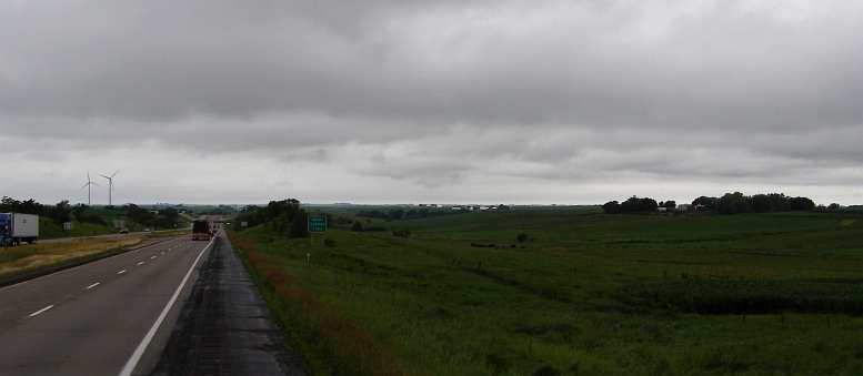
Weather clearing. These distant views merited my attention, so did the clearing skies.
...and very shortly after that snapped the odometer clicking over the 80,000 miles. It had been 77,777 as I drove across Louisiana, so I'd done 2,223 miles since that time.
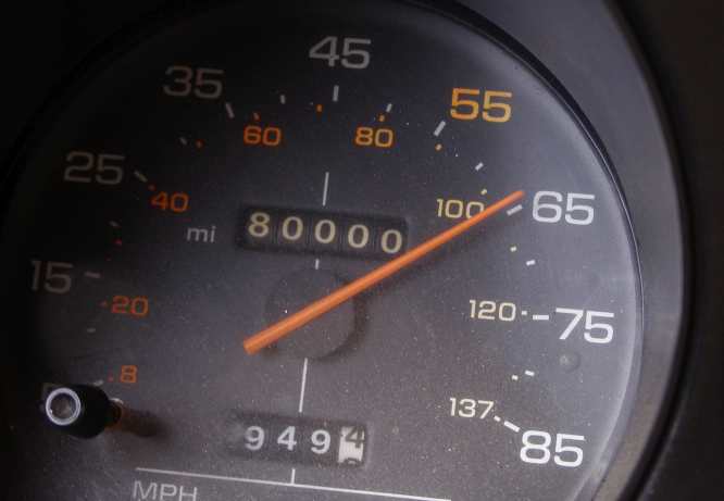
80,000miles. I still find it amazing that this van had done so few miles.
Then the new roadworks heralded a lot of development as I came to the Nebraska border and the 47th state of the USA I had visited.
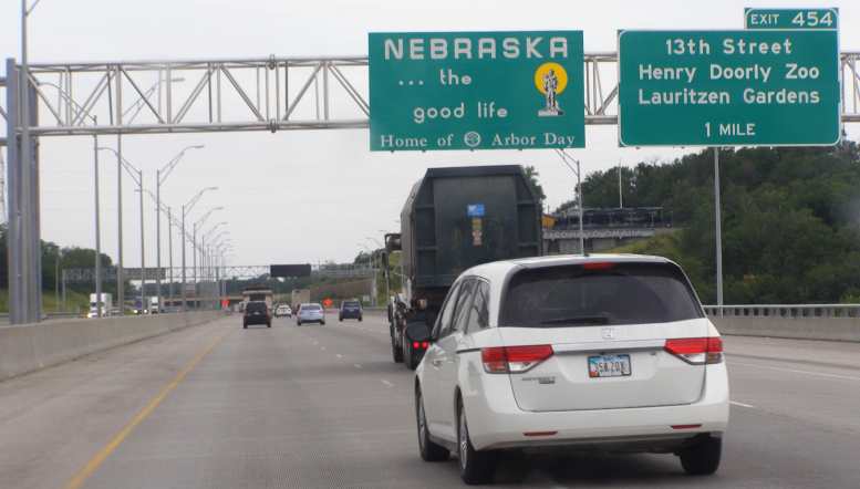
Welcome to Nebraska. Yet another state to add to my personal list.
Council Bluffs is nearly as large as Omaha, but on the Iowa side of the border, which is the Missouri River. The GPS soon had me landing in Rich's driveway and he was directing me where to park the van so his friends had room for their cars. He kindly allowed me to have a shower before they got there, which was a very good thing!
It wasn’t long after that that the boys started to arrive, this Charger came first:
Charger. Immaculately kept, it arrived fairly early and…
Riding in the Charger. …I got a ride around some Omaha streets in it.
This ‘64 Polara looked great, no doubt it also went well:
Polara. With all the trick stuff, quite a car!
Dodger, Mo, Paul Lenneman, and George Smith were the ones who joined us. Rich is second from the left and I’m behind the camera:
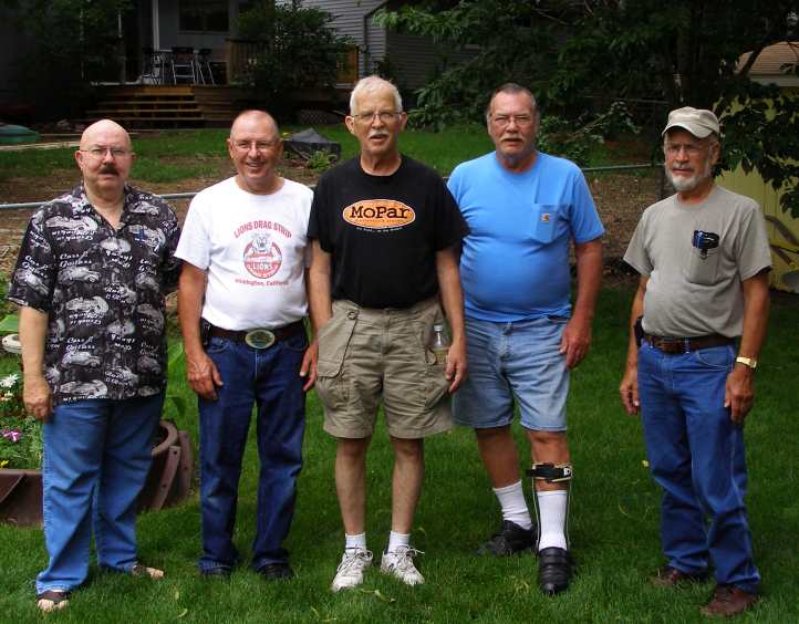
The Omaha Squad. We all had a pleasant afternoon, fine food, good company, good conversation.
This day passed very smoothly. I went for a ride in a Dodge Charger and we spent time looking over the various car and had the barbecue and talked about all sorts of things automotive. We had an intruder, which Rich's dog flushed out while we were eating. I thought it was a chipmunk, Rich referred to it as a 'ground squirrel' and anyway I got a pic:
Intruder. Chipmunk or ground squirrel? Whichever it was, it got our attention briefly.
After the day had run its course and all had gone, Rich offered to let me stay the night, but I wanted to put some more miles behind me in my quest to get to Pikes Peak and declined the offer. Instead I got him to direct me to somewhere I could get fuel at the right price and drove a short way out along the highway before camping. In this way I would get an unhampered very early start the next morning.
As I recall it was a BP gas station not far from his place and not far from the Interstate as well. So at the end of yet another 25-hour day* I slept at the Melia Hill Rest Area out on the prairie…
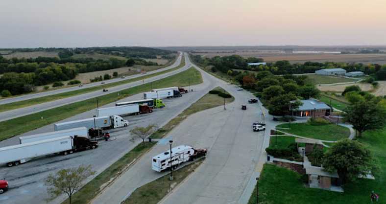
Melia Hill overview. Thanks to a drone, Vitaliy Gergov has shot this great picture of the Melia Hill Rest Area. It shows how complete a lot of US Rest Areas are with easy parking for both cars and trucks as well as good amenities.
* Heading West in the USA confronts you with this. As you cross from time zone to time zone you have to deal with another hour in your day, if you're travelling through one after another it becomes fatiguing.
I had awoken about sixty miles West of Des Moines…
Adair’s amenities. Well-lit amenities were a feature of the Adair Rest Area, inside there were plenty of displays and vending machines. MikeAbrams
…with rain falling around me. I'd been looking forward to this day as Rich Kinsley had gone to some trouble to arrange for four of the local Omaha group of '62 to '65 Mopar owners to put time aside to meet me. Together we would enjoy a barbecue lunch.
Wet start. Rain had not been a big problem on this trip, but this morning there was some about.
With a nice early start, now I was experiencing some wet-weather driving on this section, named Grand Army of the Republic Highway, and some of the Interstate was down to two lanes due to roadworks…
Surrounded. Little had changed in the agricultural outlook. Corn to the South of me…
Faltering? …and to the North of me. But is this a sign that the crops are weakening?
Just two lanes. Traffic was moderate so this was little inconvenience at this time on the Saturday morning.
…I stopped near Avoca to take more pics of some distant views…
Weather clearing. These distant views merited my attention, so did the clearing skies.
...and very shortly after that snapped the odometer clicking over the 80,000 miles. It had been 77,777 as I drove across Louisiana, so I'd done 2,223 miles since that time.
80,000miles. I still find it amazing that this van had done so few miles.
Then the new roadworks heralded a lot of development as I came to the Nebraska border and the 47th state of the USA I had visited.
Welcome to Nebraska. Yet another state to add to my personal list.
Council Bluffs is nearly as large as Omaha, but on the Iowa side of the border, which is the Missouri River. The GPS soon had me landing in Rich's driveway and he was directing me where to park the van so his friends had room for their cars. He kindly allowed me to have a shower before they got there, which was a very good thing!
It wasn’t long after that that the boys started to arrive, this Charger came first:
Charger. Immaculately kept, it arrived fairly early and…
Riding in the Charger. …I got a ride around some Omaha streets in it.
This ‘64 Polara looked great, no doubt it also went well:
Polara. With all the trick stuff, quite a car!
Dodger, Mo, Paul Lenneman, and George Smith were the ones who joined us. Rich is second from the left and I’m behind the camera:
The Omaha Squad. We all had a pleasant afternoon, fine food, good company, good conversation.
This day passed very smoothly. I went for a ride in a Dodge Charger and we spent time looking over the various car and had the barbecue and talked about all sorts of things automotive. We had an intruder, which Rich's dog flushed out while we were eating. I thought it was a chipmunk, Rich referred to it as a 'ground squirrel' and anyway I got a pic:
Intruder. Chipmunk or ground squirrel? Whichever it was, it got our attention briefly.
After the day had run its course and all had gone, Rich offered to let me stay the night, but I wanted to put some more miles behind me in my quest to get to Pikes Peak and declined the offer. Instead I got him to direct me to somewhere I could get fuel at the right price and drove a short way out along the highway before camping. In this way I would get an unhampered very early start the next morning.
As I recall it was a BP gas station not far from his place and not far from the Interstate as well. So at the end of yet another 25-hour day* I slept at the Melia Hill Rest Area out on the prairie…
Melia Hill overview. Thanks to a drone, Vitaliy Gergov has shot this great picture of the Melia Hill Rest Area. It shows how complete a lot of US Rest Areas are with easy parking for both cars and trucks as well as good amenities.
* Heading West in the USA confronts you with this. As you cross from time zone to time zone you have to deal with another hour in your day, if you're travelling through one after another it becomes fatiguing.
Last edited by Ray Bell; Sep 29, 2022 at 03:05 AM.
Thread Starter
|
Captain
Joined: Oct 2005
Posts: 570
Likes: 8
From: The Summit, Queensland, Australia
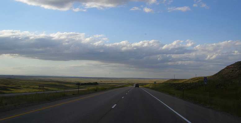
The I80 follows a path blazed by wagon trains taking settlers into the 'Wild West' and towards California through this part of the country. It's a long way and the I80 covers 450 miles crossing Nebraska. A state with an abundance of farming country, good grasses and croplands. No doubt this was the habitat of huge buffalo herds a couple of hundred years ago.
But I wasn't going all that way across on this road on Sunday, July 6, 2014. I'd decided that I would drop down into Kansas at some point so I'd head across directly to Colorado Springs via the I70 and some minor highway after that Interstate veers North-West to head into Denver. This would also enable me to see more of Kansas, a state in which I'd only done 30 or 40 miles on our previous trip. I had an early start to my day.
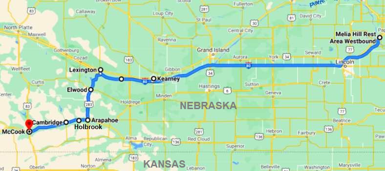
Foggy start. Underway early, fog surrounded us but it wasn’t thick.
And while it was a day which brought a lot of very little in travelling, I certainly covered some distance and experienced some fatigue. It was another case of long days one after the other, having crossed a couple of time zones as I headed West, each one giving me a 25-hour day.
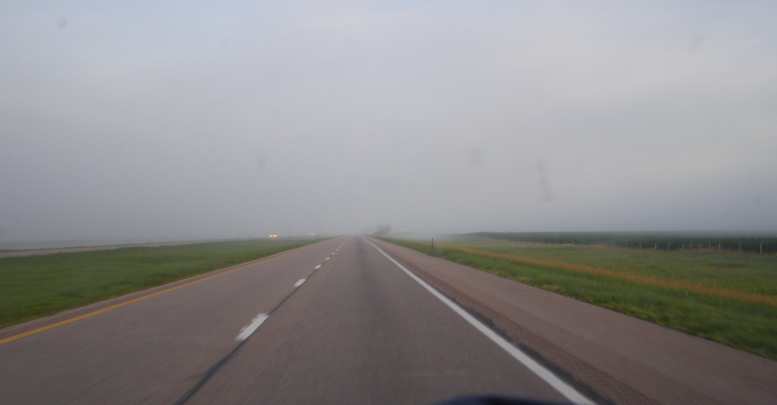
One of the highlights was the Platte River tribute to those pioneers in the wagon trains.
Platte River Archway. Dedicated to the pioneers who passed this way.
It's a bridge across the highway which is, I gather called the Archway, a museum of sorts. I didn't feel I had time to stop so I know no more. That's near Kearney, and shortly after that, at Lexington…
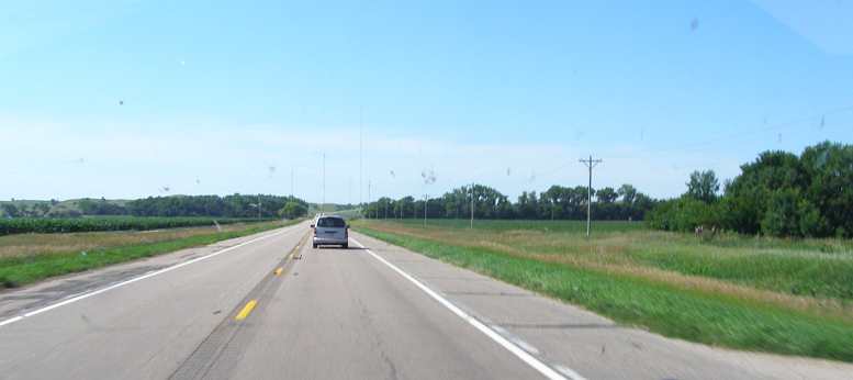
Onto the 2-lane. Heading South from Lexington I left the Interstate and went onto 2-lane roads.
…I headed South to Arapahoe and on to McCook, where I had some lunch at Arby's (they make nice roast beef rolls) and turned South into Kansas. Pictorially:
Elwood. Light traffic and cars in the church carpark, sure signs it was a Sunday.
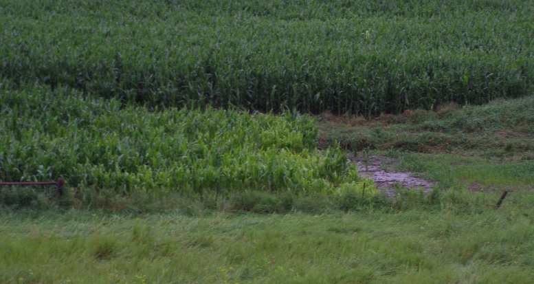
Corn and countryside. Between the towns, countryside and corn rolled out.
Big view South. The open nature of the country was seen whenever there was a decent hill.
Turning West. The wide street out of Arapahoe still has flags out from July 4 as it started me heading West again.
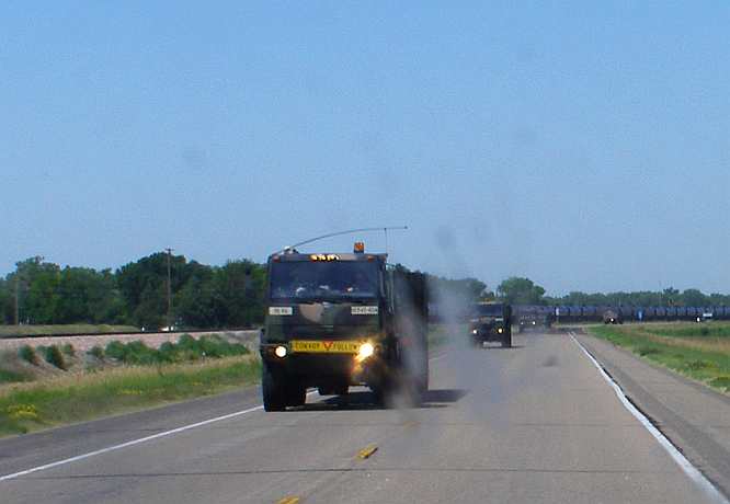
Army and a train. Between Arapahoe and McCook the road ran alongside a railway, between Holbrook and Cambridge I drove by both a train and some army vehicles heading East in convoy.And once I crossed the border into Kansas
At McCook I would have to swing South to get into Kansas and began the final run-in to Colorado Springs and Pikes Peak…
…I became aware that the cornfields were no longer as rich and green:
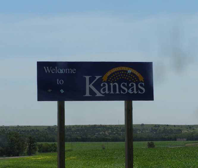
Into Kansas. The thirty-sixth state visited on this trip.

Corn not so lush. Still corn growing, but not much from here on.
Some might wonder about me noting the crop growing, but to explain, at this point I had come – in straight line terms – about 1300 miles from where I left the Atlantic coast at Jacksonville, Florida, and an extra hundred miles from New York city. By comparison, travelling that far inland in Australia would see you well into our biggest deserts, half that distance puts you into fairly arid country, while serious cropping is pretty much over and done once you’ve got about 300 miles from the East Coast.
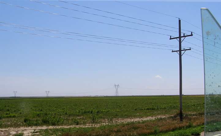
America has just so much more water than Australia, both in rain and snowfalls and in rivers. This is more like you’ll see in Australia two or three hundred miles inland including, ironically, the power lines:
Pastureland. The scene was changing as I headed West towards Selden.
At the point along here where I had to turn West after travelling so far South, I was so exhausted with the heat that I opened all the windows of the van and parked under a roadside tree in a little rest area to get some sleep, this being at Selden.
Shady rest. It wasn’t much of a Rest Area at Selden, but the shade of the trees in the early afternoon sun kept me cool enough to have a good rest. This Google Earth picture is from a later time in the day.
I'd also become aware that in this heat the van was suffering from a bit of fuel starvation, which meant it was going further on every gallon of fuel (around 17.5mpg), but it wasn't so keen to restart when hot.
The shade of that tree, and with all the windows open to catch any breeze that was about, the short sleep I had was refreshing...
But I wasn't going all that way across on this road on Sunday, July 6, 2014. I'd decided that I would drop down into Kansas at some point so I'd head across directly to Colorado Springs via the I70 and some minor highway after that Interstate veers North-West to head into Denver. This would also enable me to see more of Kansas, a state in which I'd only done 30 or 40 miles on our previous trip. I had an early start to my day.
Foggy start. Underway early, fog surrounded us but it wasn’t thick.
And while it was a day which brought a lot of very little in travelling, I certainly covered some distance and experienced some fatigue. It was another case of long days one after the other, having crossed a couple of time zones as I headed West, each one giving me a 25-hour day.
One of the highlights was the Platte River tribute to those pioneers in the wagon trains.
Platte River Archway. Dedicated to the pioneers who passed this way.
It's a bridge across the highway which is, I gather called the Archway, a museum of sorts. I didn't feel I had time to stop so I know no more. That's near Kearney, and shortly after that, at Lexington…
Onto the 2-lane. Heading South from Lexington I left the Interstate and went onto 2-lane roads.
…I headed South to Arapahoe and on to McCook, where I had some lunch at Arby's (they make nice roast beef rolls) and turned South into Kansas. Pictorially:
Elwood. Light traffic and cars in the church carpark, sure signs it was a Sunday.
Corn and countryside. Between the towns, countryside and corn rolled out.
Big view South. The open nature of the country was seen whenever there was a decent hill.
Turning West. The wide street out of Arapahoe still has flags out from July 4 as it started me heading West again.
Army and a train. Between Arapahoe and McCook the road ran alongside a railway, between Holbrook and Cambridge I drove by both a train and some army vehicles heading East in convoy.And once I crossed the border into Kansas
At McCook I would have to swing South to get into Kansas and began the final run-in to Colorado Springs and Pikes Peak…
…I became aware that the cornfields were no longer as rich and green:
Into Kansas. The thirty-sixth state visited on this trip.
Corn not so lush. Still corn growing, but not much from here on.
Some might wonder about me noting the crop growing, but to explain, at this point I had come – in straight line terms – about 1300 miles from where I left the Atlantic coast at Jacksonville, Florida, and an extra hundred miles from New York city. By comparison, travelling that far inland in Australia would see you well into our biggest deserts, half that distance puts you into fairly arid country, while serious cropping is pretty much over and done once you’ve got about 300 miles from the East Coast.
America has just so much more water than Australia, both in rain and snowfalls and in rivers. This is more like you’ll see in Australia two or three hundred miles inland including, ironically, the power lines:
Pastureland. The scene was changing as I headed West towards Selden.
At the point along here where I had to turn West after travelling so far South, I was so exhausted with the heat that I opened all the windows of the van and parked under a roadside tree in a little rest area to get some sleep, this being at Selden.
Shady rest. It wasn’t much of a Rest Area at Selden, but the shade of the trees in the early afternoon sun kept me cool enough to have a good rest. This Google Earth picture is from a later time in the day.
I'd also become aware that in this heat the van was suffering from a bit of fuel starvation, which meant it was going further on every gallon of fuel (around 17.5mpg), but it wasn't so keen to restart when hot.
The shade of that tree, and with all the windows open to catch any breeze that was about, the short sleep I had was refreshing...
Last edited by Ray Bell; Sep 29, 2022 at 08:02 PM.
Thread Starter
|
Captain
Joined: Oct 2005
Posts: 570
Likes: 8
From: The Summit, Queensland, Australia
After that rest I pressed on, with US Hwy 83 taking me past Rexford and then the Garmin told me to turn onto Hwy 24…
Heading due West. The heat of the sun through the windscreen, the power poles heading into Colby could have been mesmerising.
…where irrigation created a greener environment nearing Colby.
A highlight of the afternoon was the huge wrecking yard near Colby, which is getting close to the Colorado border. Cars were scattered everywhere, the place covered many acres and was on both sides of the highway. I was surprised to see a couple of Peugeots, a Renault Dauphine, some Fiats and even a Simca Aronde among all the American cars. I didn't enter the place but got some pics from the road:
Colby wrecking yard. Wagoner and Sons wrecking yard is huge and seems to have a lot of older cars…
More down the back. ...and this is the view down the road to the side of the yard...
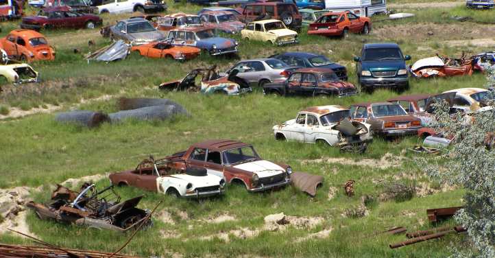
Wide variety. …and it includes many European cars. This place can be seen on Google Earth just East of Colby, KS.
Shortly after that I got a reminder that I hadn't been taking notice. One of the rules in the US, at least in some states, is that you must move away from the right lane if there's a police car or emergency vehicle with lights flashing on the side of the road. I had a police officer step out and signal to me, so I pulled up. After waiting a while he came along and asked why I had stopped. "I was only signalling to you to change to the left lane!" he told me.
The town of Colby has a population of about 5,400 people and the usual mix of businesses. One which had a strong advertising presence to passing traffic was the Colby Canvas Company:
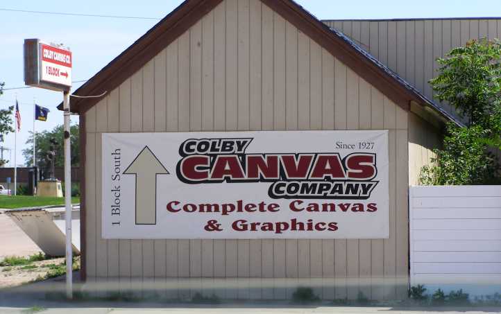
Colby Canvas Company. Apparently counting on business from passers-by, this local business advertises on the main highway.
In the background of this picture there’s a statue evident. It’s called Spirit of the Prairie and I rather wish I had noticed it when I was there and driven down to take a picture of it. Even Google’s image is pretty poor, but you can find anything on the internet, right?
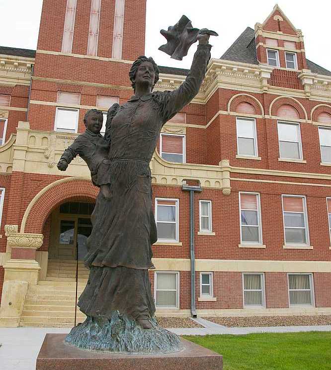
Spirit of the Prairie. One can immediately capture the meaning of this by looking at the woman with her son, apparently waving her husband ‘goodbye’ as he heads off somewhere. Thomas County photo.
One site. Roadside America. tells how it was created in 1985 by Charlie Norton, using his wife and son as models.
At Colby there was also some evidence it really was hot…

Hot enough? The local bank reminded all that it was!
And I took a couple of pics of this watercourse on the edge of the town where they've obviously filled it over the years with rubbish to hold it together and now all sorts of old cars are appearing as it erodes again.
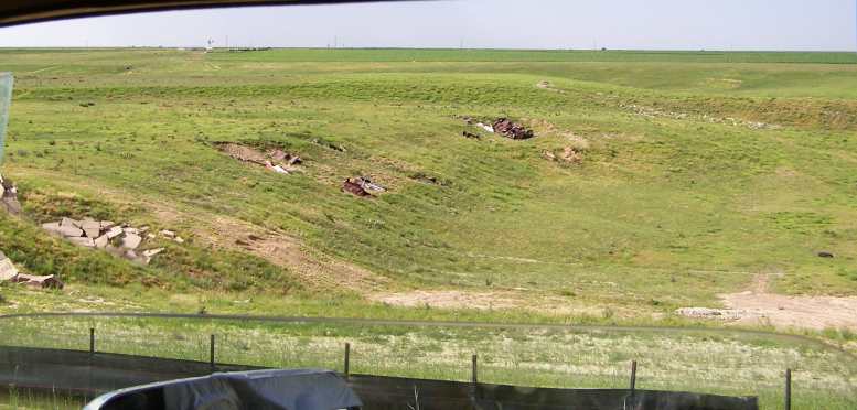
Exposed. Various fillings have been used to shore up this gully…
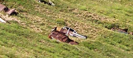
1960 Bel Air. …including cars, this is clearly a 1960 Chevrolet.
And then came the border...
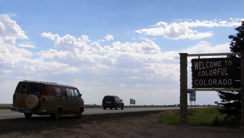
Colourful Colorado. Finally I accomplished my mission, to enter every Continental state of the USA.
...and I entered my 48th state. I had accomplished what Janet had wanted to do.
Shortly after crossing into Colorado I pulled up at Bethune, a small town like several others just off the Interstate. With signs of the weather changing I shut some of those windows I’d opened at Selden.
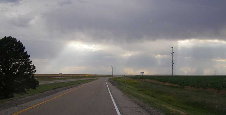
Change of weather. Between the border and Bethune the clouds quickly rolled in and there was clearly going to be rain in my path.

Celebratory display? This grand display of light, cloud and green fields, now I wonder if it was celebrating my accomplishment?
I drove towards my destination, Colorado Springs, which is the home of Pikes Peak. I had wanted to ascend this famous mountain on the first trip but we didn't get close enough. Rain was present in the atmosphere as I cruised through the farmlands. The I80 swung to the North and I went off to the South East as the day started to expire.
The lush green fields full of corn were now a memory. Grasslands surrounded me as I concluded this day's drive and looked forward to an exciting drive on the Monday. Pikes Peak was now in full view…
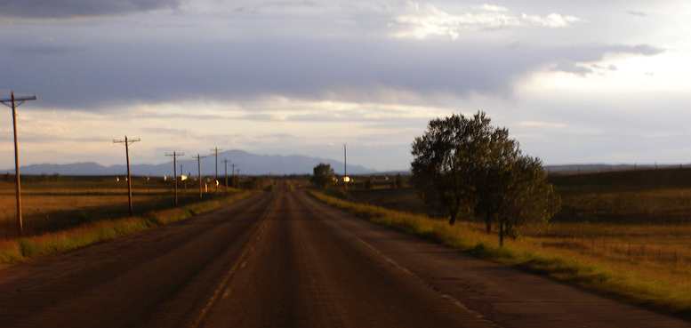
Heading for the Rockies. Finally I could see the Rockies as I motored on towards Colorado Springs. And the high point was to be a high point of my entire trip, Pikes Peak.
I had put over 560 miles behind me this day – all in daylight – and, even though I had that snooze in the middle of the day in Kansas, I was tired. More tired than I thought, apparently...
Heading due West. The heat of the sun through the windscreen, the power poles heading into Colby could have been mesmerising.
…where irrigation created a greener environment nearing Colby.
A highlight of the afternoon was the huge wrecking yard near Colby, which is getting close to the Colorado border. Cars were scattered everywhere, the place covered many acres and was on both sides of the highway. I was surprised to see a couple of Peugeots, a Renault Dauphine, some Fiats and even a Simca Aronde among all the American cars. I didn't enter the place but got some pics from the road:
Colby wrecking yard. Wagoner and Sons wrecking yard is huge and seems to have a lot of older cars…
More down the back. ...and this is the view down the road to the side of the yard...
Wide variety. …and it includes many European cars. This place can be seen on Google Earth just East of Colby, KS.
Shortly after that I got a reminder that I hadn't been taking notice. One of the rules in the US, at least in some states, is that you must move away from the right lane if there's a police car or emergency vehicle with lights flashing on the side of the road. I had a police officer step out and signal to me, so I pulled up. After waiting a while he came along and asked why I had stopped. "I was only signalling to you to change to the left lane!" he told me.
The town of Colby has a population of about 5,400 people and the usual mix of businesses. One which had a strong advertising presence to passing traffic was the Colby Canvas Company:
Colby Canvas Company. Apparently counting on business from passers-by, this local business advertises on the main highway.
In the background of this picture there’s a statue evident. It’s called Spirit of the Prairie and I rather wish I had noticed it when I was there and driven down to take a picture of it. Even Google’s image is pretty poor, but you can find anything on the internet, right?
Spirit of the Prairie. One can immediately capture the meaning of this by looking at the woman with her son, apparently waving her husband ‘goodbye’ as he heads off somewhere. Thomas County photo.
One site. Roadside America. tells how it was created in 1985 by Charlie Norton, using his wife and son as models.
At Colby there was also some evidence it really was hot…
Hot enough? The local bank reminded all that it was!
And I took a couple of pics of this watercourse on the edge of the town where they've obviously filled it over the years with rubbish to hold it together and now all sorts of old cars are appearing as it erodes again.
Exposed. Various fillings have been used to shore up this gully…
1960 Bel Air. …including cars, this is clearly a 1960 Chevrolet.
And then came the border...
Colourful Colorado. Finally I accomplished my mission, to enter every Continental state of the USA.
...and I entered my 48th state. I had accomplished what Janet had wanted to do.
Shortly after crossing into Colorado I pulled up at Bethune, a small town like several others just off the Interstate. With signs of the weather changing I shut some of those windows I’d opened at Selden.
Change of weather. Between the border and Bethune the clouds quickly rolled in and there was clearly going to be rain in my path.
Celebratory display? This grand display of light, cloud and green fields, now I wonder if it was celebrating my accomplishment?
I drove towards my destination, Colorado Springs, which is the home of Pikes Peak. I had wanted to ascend this famous mountain on the first trip but we didn't get close enough. Rain was present in the atmosphere as I cruised through the farmlands. The I80 swung to the North and I went off to the South East as the day started to expire.
The lush green fields full of corn were now a memory. Grasslands surrounded me as I concluded this day's drive and looked forward to an exciting drive on the Monday. Pikes Peak was now in full view…
Heading for the Rockies. Finally I could see the Rockies as I motored on towards Colorado Springs. And the high point was to be a high point of my entire trip, Pikes Peak.
I had put over 560 miles behind me this day – all in daylight – and, even though I had that snooze in the middle of the day in Kansas, I was tired. More tired than I thought, apparently...
Last edited by Ray Bell; Oct 8, 2022 at 10:14 PM.
Thread Starter
|
Captain
Joined: Oct 2005
Posts: 570
Likes: 8
From: The Summit, Queensland, Australia
Having got a night's sleep just outside of Colorado Springs I drove into town and looked for somewhere to get breakfast. I found a diner…
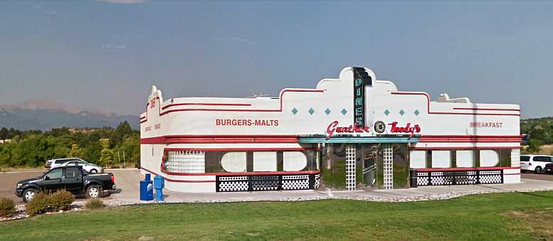
Gunther Toody’s Diner. Themed to look like an old-style cinema, this diner in N Powers Boulevarde attracted my attention.(GE)
…on the Eastern side of the city called Gunther Toody’s Diner’ and was presented in the style of the kind of movie theatres built in their heyday, and…
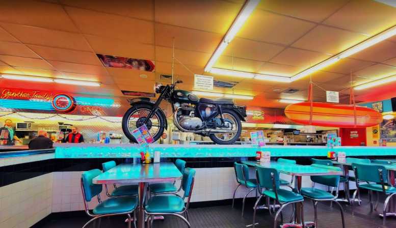
Interior themes. Motorcycles, movie stars of the fifties, surfboards, pinball machines and even specifications of many models of Corvettes were on display inside. (Myzterious93)
…which had a good view of the famous Pikes Peak and also a display of motorcycles among the tables.
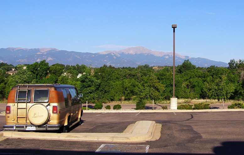
Pikes Peak in view. The van in the carpark at the rear of the diner. Pikes Peak dominating the skyline.
I also found a pretty unhappy local there who didn't want to get involved in conversation, something totally unlike my experiences everywhere else. Americans I’ve met seem to be almost universally friendly enough to be able to engage in some kind of light discussion.
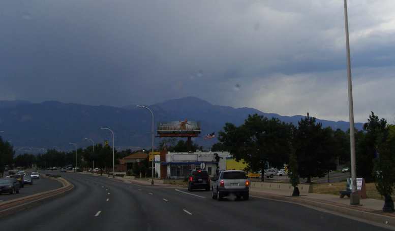
The streets of Colorado Springs. Just another town, but outside the town were amazing things.

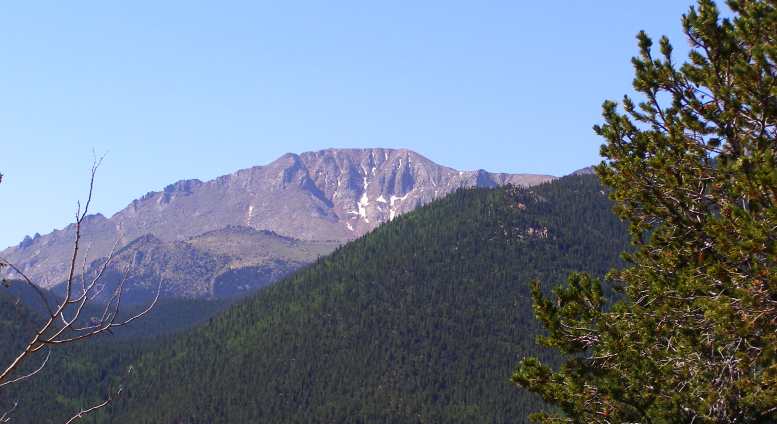
The Bare Patch. Devoid of vegetation because of the altitude, this helps Pikes Peak stand out.
I had made the decision that I couldn't really trust the van to ascend the mountain. That fuel vaporisation problem would only get worse at higher altitudes and problems could be trying and costly up there. So I went into a car rental place and told them I wanted something to drive up the hill.
"Yeah, sure," the young bloke said. "We've got a RAM pickup there with a 5.9 Hemi in it, that will take you up there just fine!"
My reaction was that it would, but it wasn't necessary, nor was the cost. "I just want a small car, pretty much anything will do, I'm sure that even the smallest car in your fleet would make it all right."
"Okay... we've just had a Camry come back in, you can use that," he responded. And so I rented a Camry for my drive into the clouds. And set off intent on having it back there by midday.
Driving through Colorado Springs I was unaware that there was a beautiful rock formation called the 'Garden of the Gods' just outside of town. That would become the focus of another trip, today I watched on the horizon as the peak was in view and just found my way to the Pikes Peak 'highway'. And also found myself to be feeling remarkably tired.
Maybe it was another case of long days crossing the country from East to West, as I'd experienced on the 2012 trip? Each day crossing another time zone so that for three or four days in a row you have 25-hour days. Anyway, I had barely started my ascent when I decided I just had to pull to the side of the road and have a bit of a nap.
Nap time. The 25-hour day thing caught up with me again! I got a brief rest here.
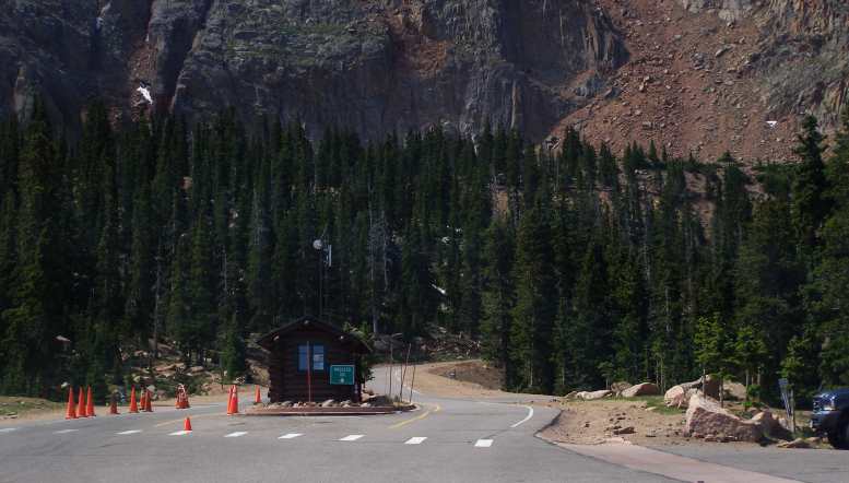
I paid the toll at the toll gate…
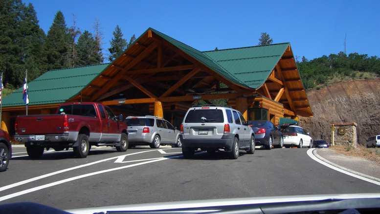
Toll gate. Here’s where you pay for your trip up the Pikes Peak Highway.
…and started to enjoy the scenery and take photos. A lake, signs of the start of the hillclimb, a bunch of VW-based buggies driving together, more signs of the hillclimb with skid marks off the road.
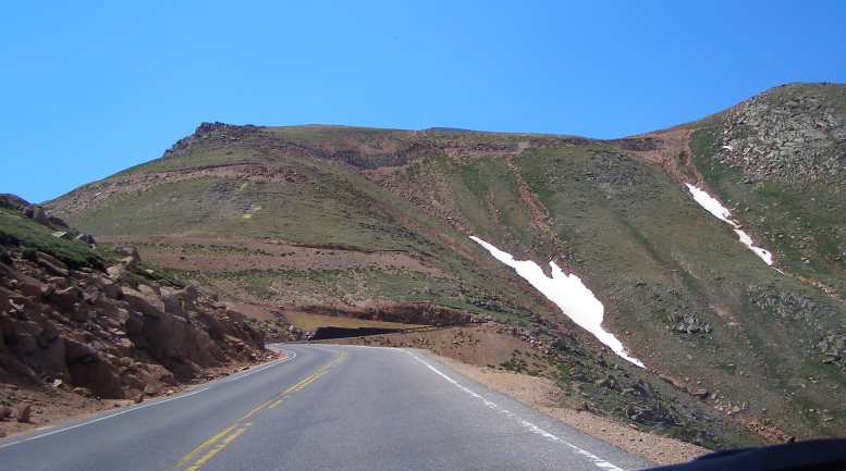
Climbing. Well before the start of the Hillclimb you are aware you’re gaining altitude.
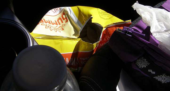
Chips opened! In my case, even the chips knew we were climbing! Note also the heavy jacket I took with me on this bright and sunny day.
Company. While there were plenty of ordinary cars ascending, a buggy seemed a bit different.
Lake. A part of the scenery is this lake.
Warnings and snow. Some bossy people put up these signs, I’d venture. And look at the snow high up in the distance.
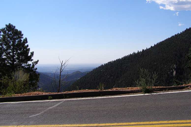
High peak in view. Much of the ascent was spent trying to work out where the actual peak lay.
Startline. This is where the actual hillclimb begins.
Signs of trouble. Not unusual on these roads, especially a couple of weeks after the main event.
And then past the tree line, long views of a climb ahead all barren and rocky, some residual ice from the winter snows. What did that bloke back in Colorado Springs tell me? It might be 20 below up there and I'd need a good jacket!
Climb we did, the Camry and I. My packet of Frito Lay chips was in the sun and suddenly burst as the combination of heat and lack of outside air pressure became too much for it. We were way higher than any part of Australia here and heading to a peak almost twice as high as the highest place back home. 14,110ft, though it was only 9,000ft about the surrounding countryside.
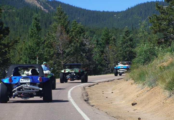
More buggies. It must have been a club outing for these chaps.
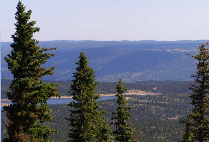
Getting higher. Now that lake is very distant...
Brake Checkpoint. Everybody must stop here on the way down to have brake temperatures checked.
The Camry features in this pic, principally taken to show the late-braking marks of cars competing here a couple of weeks earlier...
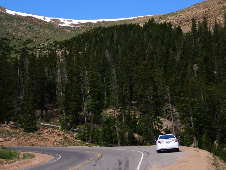
The Camry and marks of Competition. There were a number of places where tyre marks showed that competitors in the Pikes Peak International Hill Climb were sometimes over-stepping the mark.
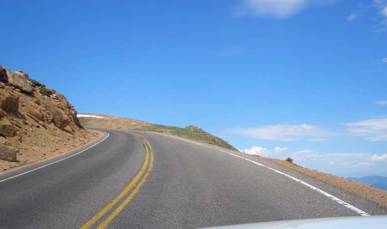
More to come. One thing about Pikes Peak is that there always seems to be more to come. Look at the road carved into the hills ahead.
At some point the absence of fencing became really obvious, maybe that was at the point where there was a short stretch of Armco? And there were signs relating to wildlife…
No room for error. Fences are rare on this road, drops like this are common.
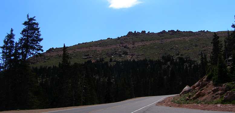
Scars on the mountainside. Still more evidence that there are more bends and climbs to go.
Survival. Living at this altitude, around 13,500’, must be tough.

Great view. Finally, from the top you can see fabulous views encompassing everything.
...but the most outstanding thing was the number of bicycles. They were everywhere as people pedalled furiously to keep them going at speeds slower than a baby crawling up the steep slope. We'd gone through the half-way point where traffic on the return lane has to stop, we'd climbed a long way, and then we were rounding a big bend where the bitumen went right to the edge.
Looking across the dash out there past the edge of the road, all I could see was blue sky and the tops of clouds! Ultimately, as I made my way past ever more bicycles I decided that this drive was daunting.
The warning about it being cold at the summit proved unfounded this day, but I'm sure the prospect that it might be freezing up here when it's a nice warm day in Colorado Springs held true and it's good to be prepared.
Ultimately I reached the carpark which adjoined the tourist shop at the top of the mountain. Around me were magnificent views of country many miles away, tens and probably hundreds of miles, and I was able to look down on adjacent peaks in the Rocky Mountains, as Pikes Peak towers above all of them for some distance. A rack railway ran to the top as well, and I went inside looking for appropriate souvenirs.
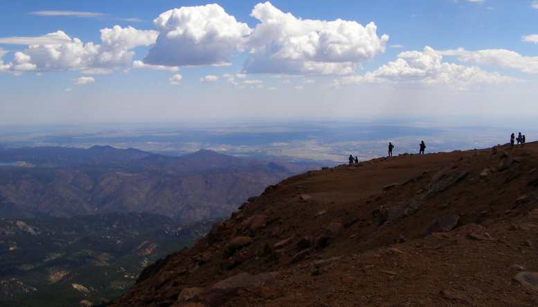
And more! In every direction there was much to see.
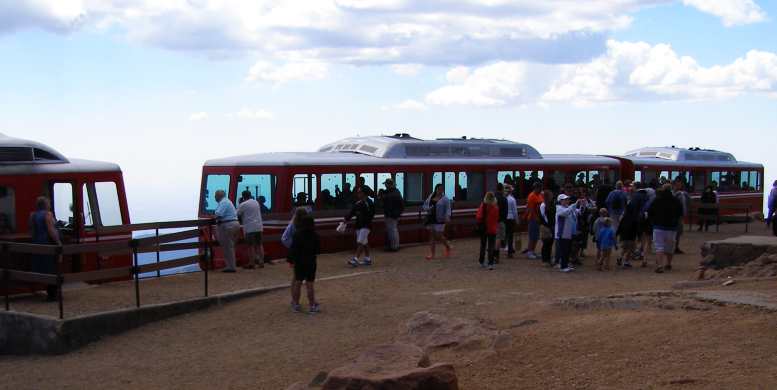
Rail station. For those unwilling to drive there is a rack railway to take them to the top.
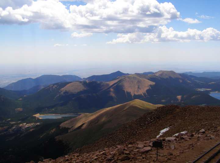
Looking down on the Rockies. One of the main points to grasp about the view, that you look down on so many local peaks of the Rockies.
Because of the haze which predominates all over the US, I wanted some nice clear photos of the scenery from the Peak. I looked in vain. There were plenty of postcards and touristy pictorials about the building of the railway, the hillclimb, the woman who went there and was inspired to write a song and everything else. But nothing with the scenery!
There were warning signs, too, about altitude sickness. The symptoms were spelled out and I realised I had a mild bout. And the only cure was to get back down to less dizzy heights. Now the bicycles were shooting past me as I kept to moderate speeds for my descent. I was avoiding using my brakes for a good reason.
And I had now most assuredly been into every Continental state of the USA. But my trip was far from being over...
Gunther Toody’s Diner. Themed to look like an old-style cinema, this diner in N Powers Boulevarde attracted my attention.(GE)
…on the Eastern side of the city called Gunther Toody’s Diner’ and was presented in the style of the kind of movie theatres built in their heyday, and…
Interior themes. Motorcycles, movie stars of the fifties, surfboards, pinball machines and even specifications of many models of Corvettes were on display inside. (Myzterious93)
…which had a good view of the famous Pikes Peak and also a display of motorcycles among the tables.
Pikes Peak in view. The van in the carpark at the rear of the diner. Pikes Peak dominating the skyline.
I also found a pretty unhappy local there who didn't want to get involved in conversation, something totally unlike my experiences everywhere else. Americans I’ve met seem to be almost universally friendly enough to be able to engage in some kind of light discussion.
The streets of Colorado Springs. Just another town, but outside the town were amazing things.
The Bare Patch. Devoid of vegetation because of the altitude, this helps Pikes Peak stand out.
I had made the decision that I couldn't really trust the van to ascend the mountain. That fuel vaporisation problem would only get worse at higher altitudes and problems could be trying and costly up there. So I went into a car rental place and told them I wanted something to drive up the hill.
"Yeah, sure," the young bloke said. "We've got a RAM pickup there with a 5.9 Hemi in it, that will take you up there just fine!"
My reaction was that it would, but it wasn't necessary, nor was the cost. "I just want a small car, pretty much anything will do, I'm sure that even the smallest car in your fleet would make it all right."
"Okay... we've just had a Camry come back in, you can use that," he responded. And so I rented a Camry for my drive into the clouds. And set off intent on having it back there by midday.
Driving through Colorado Springs I was unaware that there was a beautiful rock formation called the 'Garden of the Gods' just outside of town. That would become the focus of another trip, today I watched on the horizon as the peak was in view and just found my way to the Pikes Peak 'highway'. And also found myself to be feeling remarkably tired.
Maybe it was another case of long days crossing the country from East to West, as I'd experienced on the 2012 trip? Each day crossing another time zone so that for three or four days in a row you have 25-hour days. Anyway, I had barely started my ascent when I decided I just had to pull to the side of the road and have a bit of a nap.
Nap time. The 25-hour day thing caught up with me again! I got a brief rest here.
I paid the toll at the toll gate…
Toll gate. Here’s where you pay for your trip up the Pikes Peak Highway.
…and started to enjoy the scenery and take photos. A lake, signs of the start of the hillclimb, a bunch of VW-based buggies driving together, more signs of the hillclimb with skid marks off the road.
Climbing. Well before the start of the Hillclimb you are aware you’re gaining altitude.
Chips opened! In my case, even the chips knew we were climbing! Note also the heavy jacket I took with me on this bright and sunny day.
Company. While there were plenty of ordinary cars ascending, a buggy seemed a bit different.
Lake. A part of the scenery is this lake.
Warnings and snow. Some bossy people put up these signs, I’d venture. And look at the snow high up in the distance.
High peak in view. Much of the ascent was spent trying to work out where the actual peak lay.
Startline. This is where the actual hillclimb begins.
Signs of trouble. Not unusual on these roads, especially a couple of weeks after the main event.
And then past the tree line, long views of a climb ahead all barren and rocky, some residual ice from the winter snows. What did that bloke back in Colorado Springs tell me? It might be 20 below up there and I'd need a good jacket!
Climb we did, the Camry and I. My packet of Frito Lay chips was in the sun and suddenly burst as the combination of heat and lack of outside air pressure became too much for it. We were way higher than any part of Australia here and heading to a peak almost twice as high as the highest place back home. 14,110ft, though it was only 9,000ft about the surrounding countryside.
More buggies. It must have been a club outing for these chaps.
Getting higher. Now that lake is very distant...
Brake Checkpoint. Everybody must stop here on the way down to have brake temperatures checked.
The Camry features in this pic, principally taken to show the late-braking marks of cars competing here a couple of weeks earlier...
The Camry and marks of Competition. There were a number of places where tyre marks showed that competitors in the Pikes Peak International Hill Climb were sometimes over-stepping the mark.
More to come. One thing about Pikes Peak is that there always seems to be more to come. Look at the road carved into the hills ahead.
At some point the absence of fencing became really obvious, maybe that was at the point where there was a short stretch of Armco? And there were signs relating to wildlife…
No room for error. Fences are rare on this road, drops like this are common.
Scars on the mountainside. Still more evidence that there are more bends and climbs to go.
Survival. Living at this altitude, around 13,500’, must be tough.
Great view. Finally, from the top you can see fabulous views encompassing everything.
...but the most outstanding thing was the number of bicycles. They were everywhere as people pedalled furiously to keep them going at speeds slower than a baby crawling up the steep slope. We'd gone through the half-way point where traffic on the return lane has to stop, we'd climbed a long way, and then we were rounding a big bend where the bitumen went right to the edge.
Looking across the dash out there past the edge of the road, all I could see was blue sky and the tops of clouds! Ultimately, as I made my way past ever more bicycles I decided that this drive was daunting.
The warning about it being cold at the summit proved unfounded this day, but I'm sure the prospect that it might be freezing up here when it's a nice warm day in Colorado Springs held true and it's good to be prepared.
Ultimately I reached the carpark which adjoined the tourist shop at the top of the mountain. Around me were magnificent views of country many miles away, tens and probably hundreds of miles, and I was able to look down on adjacent peaks in the Rocky Mountains, as Pikes Peak towers above all of them for some distance. A rack railway ran to the top as well, and I went inside looking for appropriate souvenirs.
And more! In every direction there was much to see.
Rail station. For those unwilling to drive there is a rack railway to take them to the top.
Looking down on the Rockies. One of the main points to grasp about the view, that you look down on so many local peaks of the Rockies.
Because of the haze which predominates all over the US, I wanted some nice clear photos of the scenery from the Peak. I looked in vain. There were plenty of postcards and touristy pictorials about the building of the railway, the hillclimb, the woman who went there and was inspired to write a song and everything else. But nothing with the scenery!
There were warning signs, too, about altitude sickness. The symptoms were spelled out and I realised I had a mild bout. And the only cure was to get back down to less dizzy heights. Now the bicycles were shooting past me as I kept to moderate speeds for my descent. I was avoiding using my brakes for a good reason.
And I had now most assuredly been into every Continental state of the USA. But my trip was far from being over...
Last edited by Ray Bell; Oct 9, 2022 at 06:12 PM.
Thread Starter
|
Captain
Joined: Oct 2005
Posts: 570
Likes: 8
From: The Summit, Queensland, Australia
Having been to the top and learned what I wanted to about Pikes Peak, it was time to descend.
I was in no rush and, along with lots of bicycles, the garbage truck and the sullage truck…
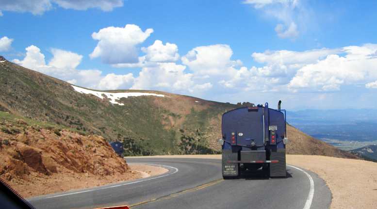
Following the trucks. They’re carting all the waste from the top of the mountain and not sparing the brakes on their descent!
…went by me too. I didn't stop anywhere to take a look, though maybe I should have stopped here...

Good viewing spot? I noticed people stopped at this little viewing point both on the way up and on the way down.
...as this was probably where this photo was taken by a member of a Subaru forum I use...
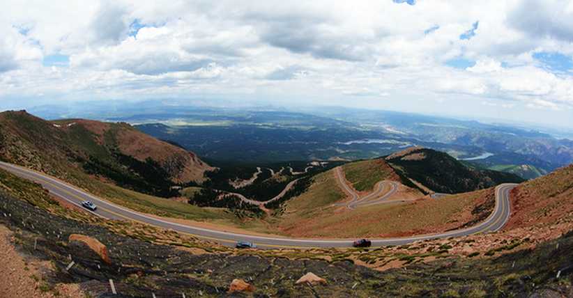
A striking view! Here is a good panorama of the Pikes Peak Highway, don't you agree?
When I got to the point where everyone has to pull up I saw that the trucks carting the tons of waste didn't. The purpose of this stop is for the authorities to check your brake temperature, and if they're too hot you have to pull over and let them cool down. I had deliberately avoided using the brakes so mine were COLD.
But I had to ask why the garbage and sullage trucks didn't have to pull up for a check too. "They work here," I was told.
As if that made any difference to the capacity of their brakes to keep working as they transported their loads of garbage and effluent to lower altitudes. I mused over this as I headed back to the car rental place, there was still half a day of travel left as I headed North through Denver and into Wyoming on Interstate 25.
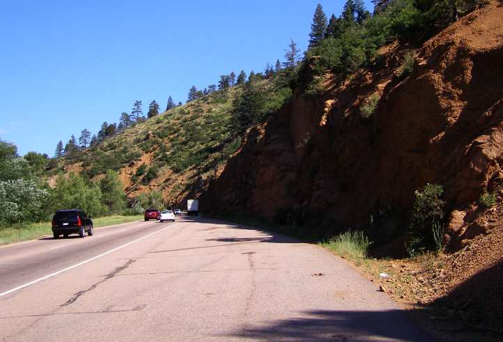
Road to Colorado Springs. This road carries a lot of traffic.
During that drive down from Pikes Peak I spotted yet another sullage removal truck, not one operating on Pikes Peak, and which I photographed for Sue at home. Sue operates such a truck, though she doesn't do the dirty work herself, her truck also has amusing signs on the back. Then I returned the rented Camry and once again boarded the van for the trip North.

Excellence. Taken principally for a friend at home, this pic shows a certain sense of humour.
I had a couple of days to get to Spokane, where I'd be transferring all the stuff I had on board so I still had a little time for sightseeing as I left Colorado Springs. North through Denver, then Fort Collins, I was still feeling a bit of a headache from the altitude sickness of Pikes Peak.
Originally, of course, I wasn't going to be going this way at all. The plan was for me to drive from Pikes Peak through to Utah and to go to the Bonneville Salt Flats for the speed trials that were on there at that time. Jon, from Spokane, was to drive the pickup I'd bought down to meet me, we'd spend some time together watching the cars doing 200+mph across the salt and transfer everything I needed to take with me to the pickup and Jon would drive the van back to Spokane to await my next trip while I took the pickup through to California.
But Jon encountered problems with jobs required by the authorities to be done to his pizza shops and couldn't make it, so I added a whole host of miles to my driving and missed out on the salt flats.
In fact, this was the second change of plans. Originally I was going to take David Young, the cancer victim in Belen, New Mexico, with me up Pikes Peak. But he'd advised me some time earlier he wouldn't be well enough to make it. A shame as we had been talking about it online for over a year.
So my short hop this day, July 6, 2014:
Cloud on the mountain. A final look…
But there were many more mountains to see in this state, they are just everywhere:

More mountains. See what I mean? Colorado is so full of such things.
Before long I would see one called Castle Rock, which lies between Colorado Springs and Denver, where the traffic density again increased as the I25 went right through the middle.
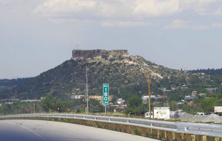
180 marker. And again I was rolling on the miles, with scenery like this making it interesting and enjoyable.
Of course the traffic settled down a little after Denver, but there was still activity and things to see as I drove North.
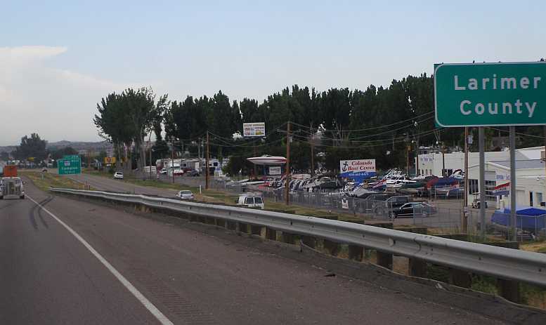
Boat sales. Lots of little lakes locally mean there’s a call for boats, this is at Johnstown, near Campion, about 45 miles North of Denver.
Through this section it was possible to catch glimpses of the Rocky Mountain National Park to the West of the Interstate…
Rockies still in view. The Rocky Mountain National Park covers 415 square miles and includes peaks slightly higher than Pikes Peak.
…before the high plains country started to dominate the view.

Plains too, And it has some plainer country as well. Variety everywhere.
Just before the Wyoming border, I stopped at Wellington at the Loaf 'n' Jug for fuel for both myself and the van...
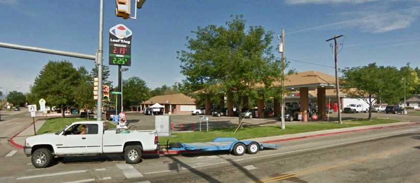
Loaf 'n' Jug I satisfied the needs of both the van's fuel tank and my stomach at this place near the Wyoming border.(Google Earth Street View picture)
...I had a discount card for this chain of gas stations - which I'd picked up at Spearfish in South Dakota and used when possible - and while I was there I found their diner more attractive than the McDonalds across the road. The afternoon sun was throwing shadows as the altitude effects waned and I started to feel better and I soon crossed the border into Wyoming near Cheyenne.
Outside of Cheyenne, for several miles after passing the town, there was a lot of new-ish homes on rural allotments…
Rural living. There were many of these homes outside of Cheyenne, living in the country and working in the city no doubt.
…in country which was devoid of trees but had plenty of grass. I drew the conclusion that lots of 'city folk' have decided on rural living out there.
Making easy miles up the I25 I was able to get some good views of some Mesa-type scenery near Chugwater.
Changing scenery. Further into Wyoming this landscape marked the beginning of a new style of scenery.
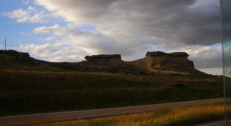
Mesa materials. Going past Chugwater the I25 deviated around this formation, which shows how Mesas are formed.
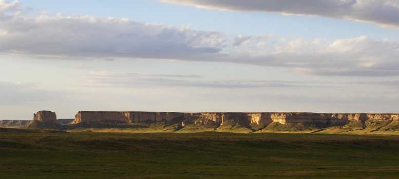
Striking landform. Thousands of years went into creating this scene, it was well worthy of a pic as the sun settled in the West.
It was pretty spectacular, I felt, and I spent a little time getting what I thought might be good shots. The angle of the late afternoon sun certainly made these more spectacular.
And then there was a great sunset scene with some mountains giving it some nice texture. That soon evaporated, as sunsets do, and I carried on for a short time to ultimately pull up near Douglas at a rest area.
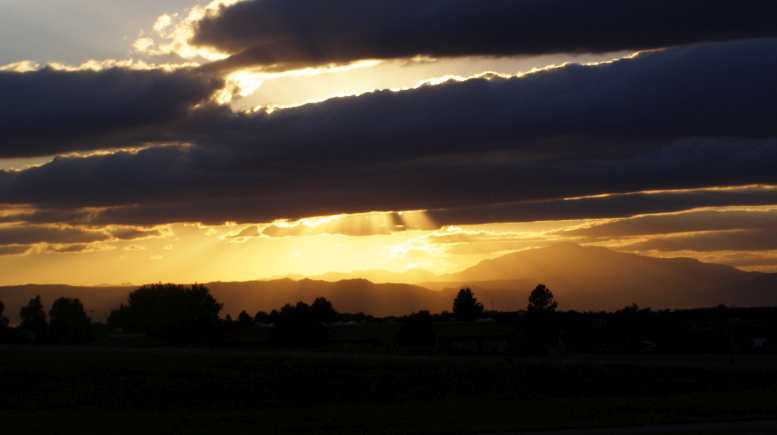
Day’s end. A sunset made all the more spectacular by the setting and the cloud.
I was getting close to half-way across Wyoming by that time. Montana beckoned and I saw an opportunity to see some different scenery there to my previous two trips across that state by plotting a course away from the Interstate. But those discoveries were for Tuesday.So I slept on the hilltop Orin Junction Rest Area…
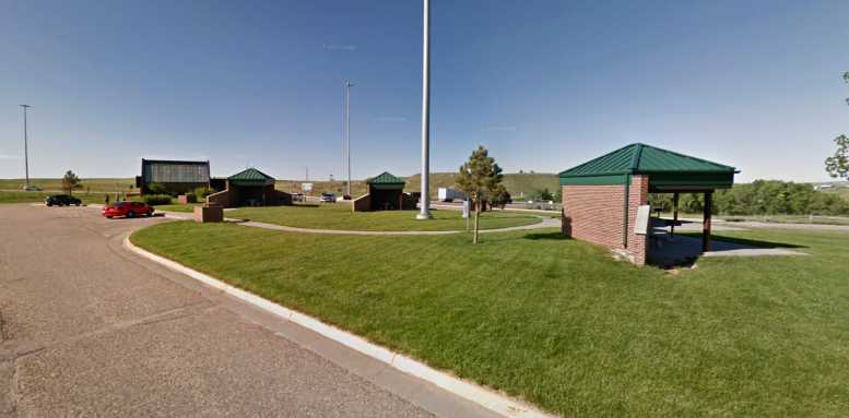
Orin Junction Rest Area. The hilltop location makes it a good spot to pick up prevailing winds, the picnic tables are therefore well-protected by those brick walls.
…just before Douglas. This was typically well-equipped though not as big as some others. I would think that in windy seasons this would be a mighty exposed place to be, but it was midsummer now and daytime temperatures had been in the nineties.
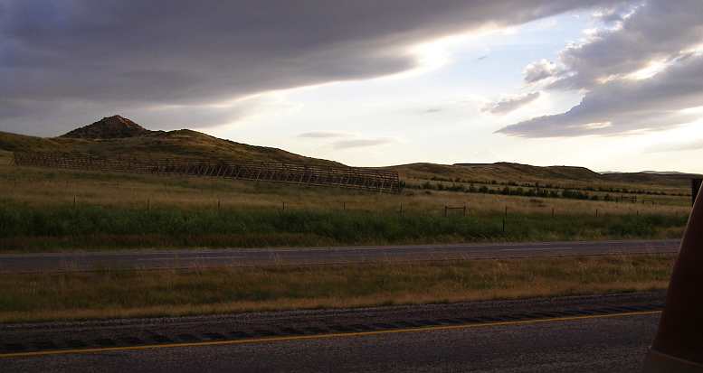
Snow fence? I saw a couple of these fence structures and wondered what their purpose might be.
It had been a long day and I'd seen some great sights. The altitude sickness was now gone, really only having amounted to a bit of a headache.
And I'd had that great - even unforgettable - experience of driving up that daunting road to the top of Pikes Peak...
I was in no rush and, along with lots of bicycles, the garbage truck and the sullage truck…
Following the trucks. They’re carting all the waste from the top of the mountain and not sparing the brakes on their descent!
…went by me too. I didn't stop anywhere to take a look, though maybe I should have stopped here...
Good viewing spot? I noticed people stopped at this little viewing point both on the way up and on the way down.
...as this was probably where this photo was taken by a member of a Subaru forum I use...
A striking view! Here is a good panorama of the Pikes Peak Highway, don't you agree?
When I got to the point where everyone has to pull up I saw that the trucks carting the tons of waste didn't. The purpose of this stop is for the authorities to check your brake temperature, and if they're too hot you have to pull over and let them cool down. I had deliberately avoided using the brakes so mine were COLD.
But I had to ask why the garbage and sullage trucks didn't have to pull up for a check too. "They work here," I was told.
As if that made any difference to the capacity of their brakes to keep working as they transported their loads of garbage and effluent to lower altitudes. I mused over this as I headed back to the car rental place, there was still half a day of travel left as I headed North through Denver and into Wyoming on Interstate 25.
Road to Colorado Springs. This road carries a lot of traffic.
During that drive down from Pikes Peak I spotted yet another sullage removal truck, not one operating on Pikes Peak, and which I photographed for Sue at home. Sue operates such a truck, though she doesn't do the dirty work herself, her truck also has amusing signs on the back. Then I returned the rented Camry and once again boarded the van for the trip North.
Excellence. Taken principally for a friend at home, this pic shows a certain sense of humour.
I had a couple of days to get to Spokane, where I'd be transferring all the stuff I had on board so I still had a little time for sightseeing as I left Colorado Springs. North through Denver, then Fort Collins, I was still feeling a bit of a headache from the altitude sickness of Pikes Peak.
Originally, of course, I wasn't going to be going this way at all. The plan was for me to drive from Pikes Peak through to Utah and to go to the Bonneville Salt Flats for the speed trials that were on there at that time. Jon, from Spokane, was to drive the pickup I'd bought down to meet me, we'd spend some time together watching the cars doing 200+mph across the salt and transfer everything I needed to take with me to the pickup and Jon would drive the van back to Spokane to await my next trip while I took the pickup through to California.
But Jon encountered problems with jobs required by the authorities to be done to his pizza shops and couldn't make it, so I added a whole host of miles to my driving and missed out on the salt flats.
In fact, this was the second change of plans. Originally I was going to take David Young, the cancer victim in Belen, New Mexico, with me up Pikes Peak. But he'd advised me some time earlier he wouldn't be well enough to make it. A shame as we had been talking about it online for over a year.
So my short hop this day, July 6, 2014:
Cloud on the mountain. A final look…
But there were many more mountains to see in this state, they are just everywhere:
More mountains. See what I mean? Colorado is so full of such things.
Before long I would see one called Castle Rock, which lies between Colorado Springs and Denver, where the traffic density again increased as the I25 went right through the middle.
180 marker. And again I was rolling on the miles, with scenery like this making it interesting and enjoyable.
Of course the traffic settled down a little after Denver, but there was still activity and things to see as I drove North.
Boat sales. Lots of little lakes locally mean there’s a call for boats, this is at Johnstown, near Campion, about 45 miles North of Denver.
Through this section it was possible to catch glimpses of the Rocky Mountain National Park to the West of the Interstate…
Rockies still in view. The Rocky Mountain National Park covers 415 square miles and includes peaks slightly higher than Pikes Peak.
…before the high plains country started to dominate the view.
Plains too, And it has some plainer country as well. Variety everywhere.
Just before the Wyoming border, I stopped at Wellington at the Loaf 'n' Jug for fuel for both myself and the van...
Loaf 'n' Jug I satisfied the needs of both the van's fuel tank and my stomach at this place near the Wyoming border.(Google Earth Street View picture)
...I had a discount card for this chain of gas stations - which I'd picked up at Spearfish in South Dakota and used when possible - and while I was there I found their diner more attractive than the McDonalds across the road. The afternoon sun was throwing shadows as the altitude effects waned and I started to feel better and I soon crossed the border into Wyoming near Cheyenne.
Outside of Cheyenne, for several miles after passing the town, there was a lot of new-ish homes on rural allotments…
Rural living. There were many of these homes outside of Cheyenne, living in the country and working in the city no doubt.
…in country which was devoid of trees but had plenty of grass. I drew the conclusion that lots of 'city folk' have decided on rural living out there.
Making easy miles up the I25 I was able to get some good views of some Mesa-type scenery near Chugwater.
Changing scenery. Further into Wyoming this landscape marked the beginning of a new style of scenery.
Mesa materials. Going past Chugwater the I25 deviated around this formation, which shows how Mesas are formed.
Striking landform. Thousands of years went into creating this scene, it was well worthy of a pic as the sun settled in the West.
It was pretty spectacular, I felt, and I spent a little time getting what I thought might be good shots. The angle of the late afternoon sun certainly made these more spectacular.
And then there was a great sunset scene with some mountains giving it some nice texture. That soon evaporated, as sunsets do, and I carried on for a short time to ultimately pull up near Douglas at a rest area.
Day’s end. A sunset made all the more spectacular by the setting and the cloud.
I was getting close to half-way across Wyoming by that time. Montana beckoned and I saw an opportunity to see some different scenery there to my previous two trips across that state by plotting a course away from the Interstate. But those discoveries were for Tuesday.So I slept on the hilltop Orin Junction Rest Area…
Orin Junction Rest Area. The hilltop location makes it a good spot to pick up prevailing winds, the picnic tables are therefore well-protected by those brick walls.
…just before Douglas. This was typically well-equipped though not as big as some others. I would think that in windy seasons this would be a mighty exposed place to be, but it was midsummer now and daytime temperatures had been in the nineties.
Snow fence? I saw a couple of these fence structures and wondered what their purpose might be.
It had been a long day and I'd seen some great sights. The altitude sickness was now gone, really only having amounted to a bit of a headache.
And I'd had that great - even unforgettable - experience of driving up that daunting road to the top of Pikes Peak...
Last edited by Ray Bell; Oct 10, 2022 at 12:27 AM.
Grand Champion
Joined: May 2019
Posts: 5,159
Likes: 724
From: S.W. Indiana
Snow fences slow down drifting of snow across the road. It doesn't stop it but plows can keep up with the drifting where they couldn't otherwise. When the wind is right and there's enough moisture, they get snow up there in feet, not inches. That's why you see some houses, especially in the mountains with doors on the second story. That's how you get in and out in the winter sometimes.
Thread Starter
|
Captain
Joined: Oct 2005
Posts: 570
Likes: 8
From: The Summit, Queensland, Australia
Thanks for that information...
I figured it was something like that, but we don't have that sort of thing here so I had to ask.
Would they be built (and maintained) by the farmer or by the highway people?
I figured it was something like that, but we don't have that sort of thing here so I had to ask.
Would they be built (and maintained) by the farmer or by the highway people?