

Ride along with me...


Thread Starter
|
Captain

Joined: Oct 2005
Posts: 571
Likes: 9
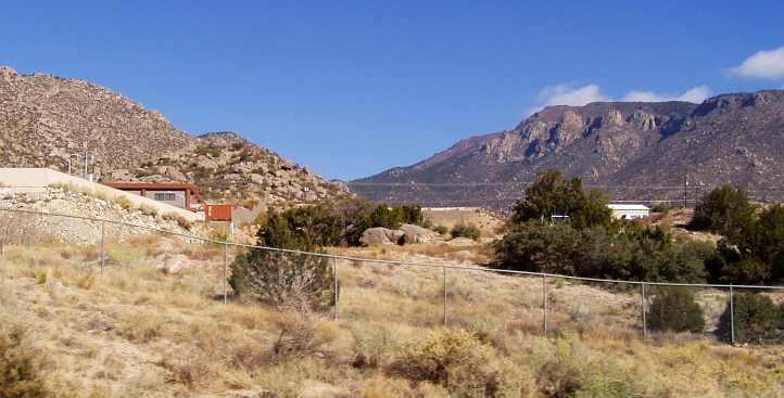
From: The Summit, Queensland, Australia
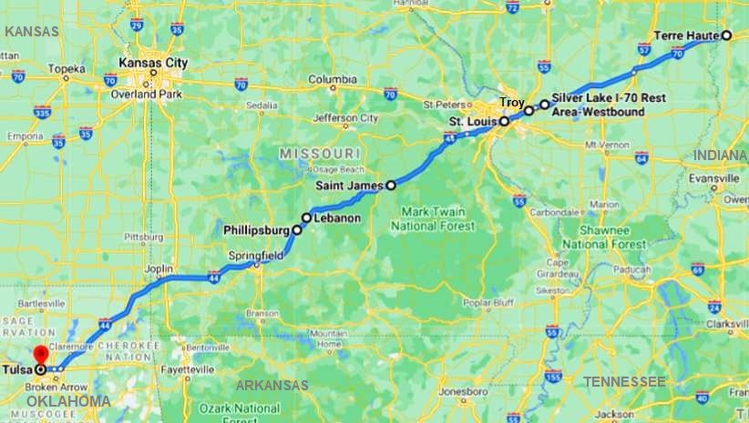
As we begin our headlong rush to the west, this is the planned route for Wednesday, October 24, 2012:
Breakfast being included by the Days Inn, so we made our passage down the external stairs of the motel we regarded them as a bit dodgy, timber treads on a steel frame that have been bolted together and were showing their age. Before leaving we'd have to carry our bags down these, as Janet noted:
It was an early start. The Sunbeam kettle had filled the Thermos, I cranked the truck over and moved it forward from the tree at the side of the carpark that provided security for what was in the back. Loaded up, we headed down the road ready for a long day at our intended 55-60mph cruising speed. The I70 to St Louis, then the I44 to Tulsa was our goal, but we wanted to see anything that we could easily reach as we went.
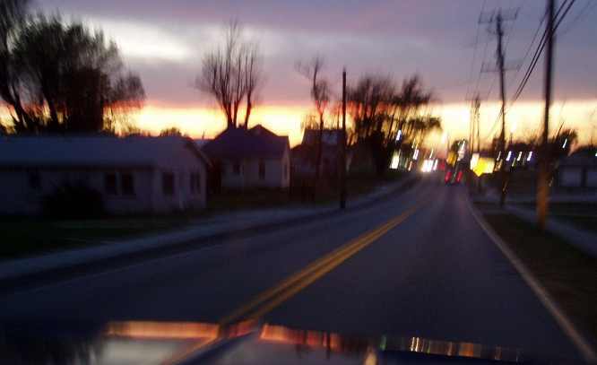
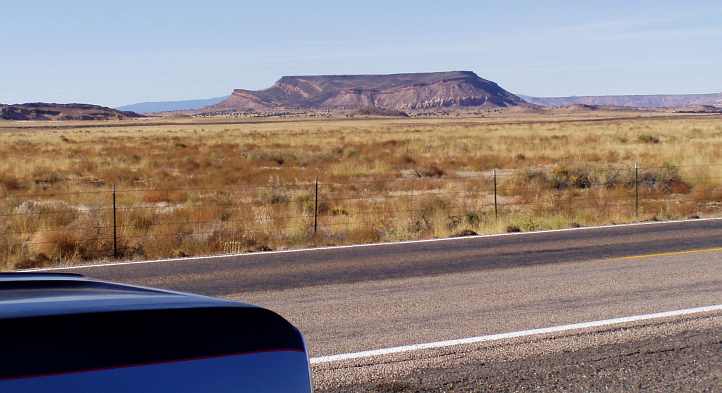
It was about 160 miles to the first major point on the day's run, St Louis, I was looking forward to seeing the Mississippi there. Immediately we got going our day got longer, the time zone change giving us an extra hour in our plight to cover the distance necessary. The reasons for taking this pic...
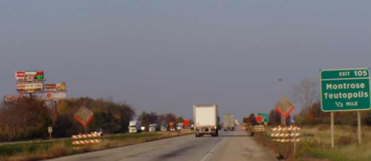
...were to show (1) the colour of the roadworks signs; (2) the abundance of 'signs in the sky' for businesses waiting for us at exits like this one at Montrose, and (3) to show that the gas station signs have the prices up in coloured lights. The red is for petrol, I think it reads $3.79 a gallon, diesel is a bit over $4.00.
What I didn't get a pic of was that sign. We'd seen similar signs with different penalties in other states, particularly in New Hampshire.
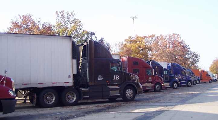
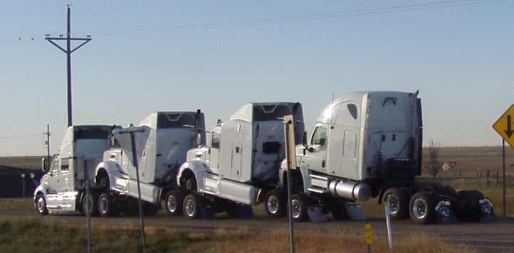
Effingham was about 70 miles into the day, a further 70 miles after that we pulled up at the Highland Silver Lake rest area. The trucks lined up there were amazing:
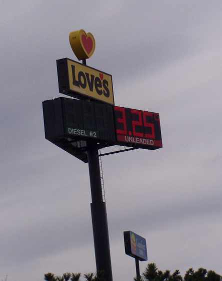
It was easy running, giving Janet a chance to write in her diary while I drove, and muse about things which came into her mind, mainly about things different to what we know at home: At Troy we refuelled and for the first time acquainted ourselves with the huge roadhouses, Pilot and Love's being the main ones we'd now see everywhere as we crossed the country.
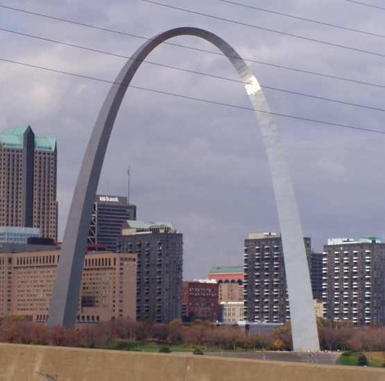
Janet got this photo as we crossed the Mississippi, it must be a big river because she hasn't got all of it in:
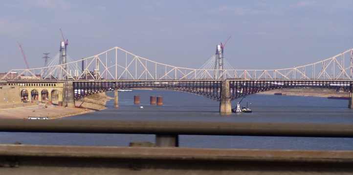
Bridges everywhere, one behind the camera, one under us and two in the picture. We'd also been told about the wonders of an arch that has recently been built in St Louis, when we were told about it asked if there was one arch or two. "One," came the reply, so I asked if McDonalds are going broke. A bad joke, but Janet’s photo captured it.
Obviously, it's not ideal getting these pictures as you're flashing past on the Interstate at 60mph, but we got a picture and it suited the purpose for the time. Then we got off the right trail in our effort to avoid the city traffic, finishing up down an exit we shouldn't have gone down and doing battle for a few minutes with traffic lights before we regained the freeway.
A new state for us, Missouri... the 18th state we'd visited since our arrival at Indianapolis. With Illinois behind us and Oklahoma still a long way ahead, we reached a point where we started thinking about our regular 'morning tea' stop. A sign came up for a visitor's centre where the I44 crossed the Meramec River just before Eureka... just outside of St Louis.
To our surprise, this was a State Park dedicated to the heritage of Route 66, something I hadn't been thinking of at all, but which was to become very prevalent in our travels over the next few days. Janet's note reads:
Thoughts of the interests of kids and grandchildren back home dominated the souvenir search and this was really the beginning of Janet's many purchases of things as gifts for them and other friends. She further notes as we hit the road from there on:
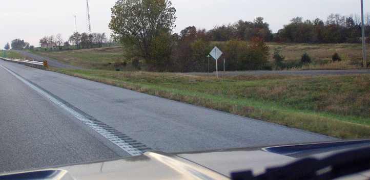
The rumble strips are worth mentioning because they are unlike the ones we have in Australia. At home they glue plastic lumps onto the road surface, but in the US they seem to have a machine that comes along and grinds a small groove into the surface. Just another of the small differences you notice.
As we travelled we saw plenty of evidence of the old Route 66 running alongside the Interstate:
Sometimes you'd see this cut where a bridge had been taken out, but there was plenty of the old road to see.
Around St James we saw one of those overhead information signs, an ‘Amber Alert’, we took note...
And further reflecting on the tedium setting in on this stretch and the things seen across the I44 in Missouri:
Lunch on the side of the road – we had some provisions on board that enabled us to do that, then pressed on. It was the Mark Twain National Forest where we noted similarities in the terrain to what we see in the Blue Mountains at home.
And it was about this time that she started talking about detouring through Kansas. Wizard of Oz territory. "I want to be able to say, 'I don't think we're in Kansas any more...’"
Apart from that she wanted to get another state into our tally of those traversed, so we began to plot a slight diversion:
This would add perhaps 30 miles to the trip, a small price to pay for this indulgence.
At Phillipsburg we went to 'the World's Largest Gift Store'... or at least Janet did while I got a little fuel. We met up with another Australian couple at the (somewhat seedy) tourist centre there who put our trip into the shade…
The gift store was a huge place...
...but I don't think much was spent there. We headed off again with Springfield finally not too far away - 40 miles or so - and the long hot day starting to tell on both of us. The gas price at Phillipsburg was higher than I liked so I had to fill up again here...
Unlike Australia, where you fill up then go inside to pay, in the US you put your card and pin into the bowser before you can start filling. Sometimes, however, the ANZ Travel Card (on which I had most of my cash) wasn't acceptable at the bowser and I'd have to go inside first. Rarely, but still a likelihood, they wouldn't take the ANZ card at all because the numbers on it aren't raised. On these occasions I'd use my BOQ Passport Mastercard.
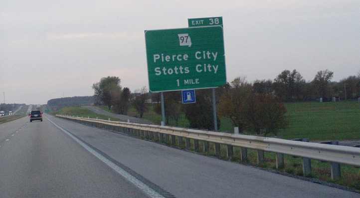
There's not all that much to see on these roads, I was thinking, and we had deadlines to meet in New Mexico and Las Vegas, and we needed time to see the Grand Canyon. It still wasn't nice driving into the sun at that time of day. A day that was now starting to dim, this exit sign telling us that there was only 38 miles to go in Missouri:
By now it was 6:30pm and I'd agreed that we'd stop at Coffeyville for the night, there was a Motel 6 there and we'd get there in the dark anyway.
That pic I took at Webb City. We turned off the I44 before Joplin and rolled into Kansas in the gathering darkness, we recognised the farming areas to be a lot like some at home, and Janet snapped this shot coming into Oswego...
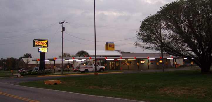
We drove into Coffeyville with the GPS set for the Motel 6. But it wasn't there! No sign of it despite Mr Garmin telling us we were 'arriving at Motel 6 Coffeyville' from both directions. We had seen a large motel on the way into town, we could come back to that, but we had to first think about getting something to eat and we spied the Sonic outlet...
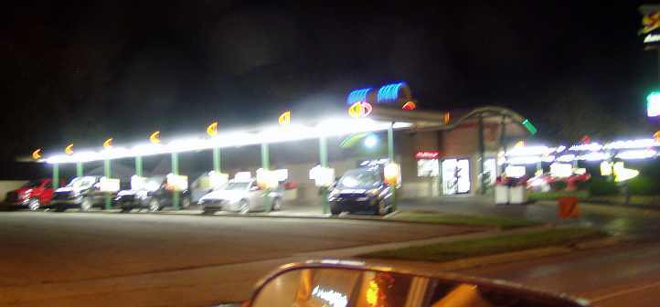
We had probably seen Sonic signs before, but this time we understood what it was about... a drive-in hamburger joint!
I drove up to one of the outlet points and started looking at the menu...
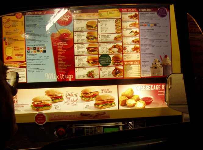
The eftpos outlet and all at every stand, plenty of variety, but I had so much trouble understanding over the intercom that the girl came out to take our order. It wasn't the kind of meal I would want, but these trips tend to do that to you and it was edible.
There were a lot of pickups in the parking lot, it seems that many workers were staying there, it wasn't as economical as the Motel 6s and Super 8s etc. It was a good motel and we did have a ground floor room, however, right next to the white car in this Google Earth pic:

Some time during the Wednesday either I phoned Bill or he phoned me. Probably I phoned him from Kansas to tell him we were getting along all right. Bill apologised (after all he'd done to help us!) that he hadn't been available to help on the Tuesday.
He explained that duty had come first, and that as a police officer in charge of a particular investigation he'd had to do some serious work and also hold a press conference about the matter.
"While that was on I got to talking to one of the newspaper writers," he told me, "and she asked if I knew anyone who could give her a bit of a story for her regular Saturday feature called 'My Favourite Ride'..."
He told her about us and our pickup and the trip we were on, she was interested and so I told Bill he could put her in touch. "Yes, I have photos of the pickup," I told him, "and you can let her know I'll put together a story for her so she's got something to work with." I settled down to do that but didn't hear from her until the end of the week.
Subsequently I e-mailed the story and photos to her and our tale was in the Bloomington paper the next Saturday. She re-wrote it, of course, and she upset Bill by revealing he is a police officer.
When it comes to playing with cars, Bill doesn't want to be associated with the police and he had told her that, and anyway, he was due to retire in January.
Just another task for me before I bunked down for the night...
Breakfast being included by the Days Inn, so we made our passage down the external stairs of the motel we regarded them as a bit dodgy, timber treads on a steel frame that have been bolted together and were showing their age. Before leaving we'd have to carry our bags down these, as Janet noted:
Had a complimentary breakfast, Ray had blueberry pancakes and I had my usual cereal and orange juice. We were in an upstairs room, the stairs were uneven and rickety, thought we’d fall carrying the bags up and down them.
It was about 160 miles to the first major point on the day's run, St Louis, I was looking forward to seeing the Mississippi there. Immediately we got going our day got longer, the time zone change giving us an extra hour in our plight to cover the distance necessary. The reasons for taking this pic...
...were to show (1) the colour of the roadworks signs; (2) the abundance of 'signs in the sky' for businesses waiting for us at exits like this one at Montrose, and (3) to show that the gas station signs have the prices up in coloured lights. The red is for petrol, I think it reads $3.79 a gallon, diesel is a bit over $4.00.
Signs on the side of the road when there’s roadworks warn, “If you hit a road worker, $10,000 fine and 14 years prison”
Just went past a big NIKE factory at Effingham and also on the opposite side of the highway the biggest concrete cross, it must be lit up at night. Grotesque.
Wherever you travel you see people living in trailers (relocatable homes) of varying degrees of trashiness. Another thing noticed that is prevalent is the same style of plastic letterboxes with a flag that indicates there’s mail. Beside the letterbox at some houses is another container with the newspaper they want delivered printed on it.
Another interesting sign as you drive out of each nicely-maintained rest area is ‘Click it or ticket’, referring, of course, to the need to be wearing a seatbelt.
Effingham was about 70 miles into the day, a further 70 miles after that we pulled up at the Highland Silver Lake rest area. The trucks lined up there were amazing:
It was easy running, giving Janet a chance to write in her diary while I drove, and muse about things which came into her mind, mainly about things different to what we know at home: At Troy we refuelled and for the first time acquainted ourselves with the huge roadhouses, Pilot and Love's being the main ones we'd now see everywhere as we crossed the country.
There are so many enormous young people, so sad, and of course, older people. It must be because junk food is so cheap. Food is about the only thing that isn’t taxed.
When you buy anything – clothes I’ve noticed mainly – but also motel rooms, when they advertise the price it is always before tax. So when you go to pay for it the extra is added on.
There is much more variety of clothing for bigger people over here.
We’ve had to put our watches back an hour as we left this morning, so the morning is dragging. We are now at what looked like a small place called Troy. There is everything you’d need and more – heaps of food outlets and gas, what a busy place.
Drove towards St Louis, trying to avoid the city itself. There is an enormous concrete arch – took a photo – hope it is okay...
Got a bit off track, missed a turn, cars and trucks going everywhere and of course the dreaded traffic lights.
Bridges everywhere, one behind the camera, one under us and two in the picture. We'd also been told about the wonders of an arch that has recently been built in St Louis, when we were told about it asked if there was one arch or two. "One," came the reply, so I asked if McDonalds are going broke. A bad joke, but Janet’s photo captured it.
Obviously, it's not ideal getting these pictures as you're flashing past on the Interstate at 60mph, but we got a picture and it suited the purpose for the time. Then we got off the right trail in our effort to avoid the city traffic, finishing up down an exit we shouldn't have gone down and doing battle for a few minutes with traffic lights before we regained the freeway.
A new state for us, Missouri... the 18th state we'd visited since our arrival at Indianapolis. With Illinois behind us and Oklahoma still a long way ahead, we reached a point where we started thinking about our regular 'morning tea' stop. A sign came up for a visitor's centre where the I44 crossed the Meramec River just before Eureka... just outside of St Louis.
To our surprise, this was a State Park dedicated to the heritage of Route 66, something I hadn't been thinking of at all, but which was to become very prevalent in our travels over the next few days. Janet's note reads:
Stopped at a tourist info centre which ended up being Route 66 State Park situated on a section of the original Route 66.
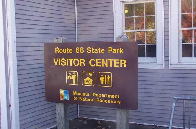
So we did the real touristy thing and bought a few souvenirs - we only originally stopped there to make a coffee.
So we did the real touristy thing and bought a few souvenirs - we only originally stopped there to make a coffee.
It is getting warmer and warmer as we drive south-west through Missouri. 80�F, apparently, according to the weather channel this morning. Most places are experiencing way above-average temperatures, +20�F in most areas, even Chicago (way up north!), but Friday it will be the opposite with temperatures 15�F below average. Nothing like variety to keep you on your toes, I think it is quite unseasonable.
The big trucks going past at such a fast pace nearly run you off the road, the corrugated line on the side of the road is getting a real workout with us.
The big trucks going past at such a fast pace nearly run you off the road, the corrugated line on the side of the road is getting a real workout with us.
As we travelled we saw plenty of evidence of the old Route 66 running alongside the Interstate:
Sometimes you'd see this cut where a bridge had been taken out, but there was plenty of the old road to see.
Around St James we saw one of those overhead information signs, an ‘Amber Alert’, we took note...
Coming up for Salem, there’s a large winery. A sign lit up – Amber Alert, then described the car giving rego plate number and all, whatever that is about. I have seen something similar once before in our travels.
It is incredible how animals are so welcome in motels here, there is usually an extra charge of $10 per pet. Also surprising that there are rooms for smokers in the motels.
I’m definitely not dressed for the heat, not prepared at all. The car is quite hot too. I think it might be taking its toll on Ray driving, he pulled up ahead of time to walk around, we did have lunch on the side of the road.
We’ve had to drink more water today, which won’t do us any harm.
We have come into hilly country, very reminiscent of the Blue Mountains, though with different sorts of trees covering them.
Around Lebanon out in the open on the side of the highway were hundreds of brand new power boats – over-production or the downturn of the economy I guess.
Apart from that she wanted to get another state into our tally of those traversed, so we began to plot a slight diversion:
This would add perhaps 30 miles to the trip, a small price to pay for this indulgence.
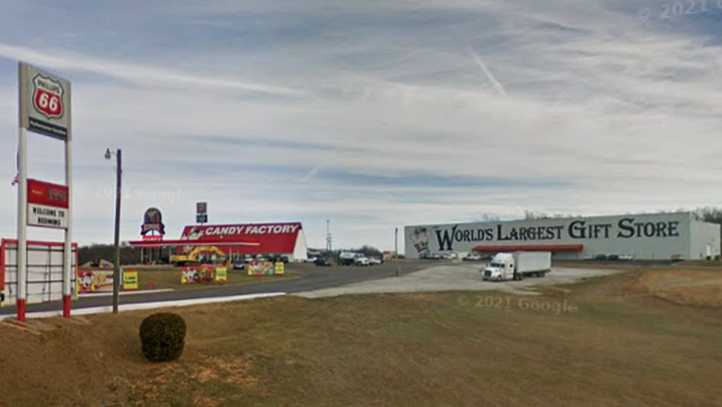
At Phillipsburg we went to 'the World's Largest Gift Store'... or at least Janet did while I got a little fuel. We met up with another Australian couple at the (somewhat seedy) tourist centre there who put our trip into the shade…
I went to the ‘World’s Largest Gift Store’ while Ray got petrol nine miles West of Lebanon. Heaps of souvenirs and other things. Too dear. It was at a place called Phillipsburg.
We went into the tourist centre and another Australian couple were there from Brisbane. They were travelling on a 3-wheeler motorbike. They were doing quite a number of countries – 29 already and 30 to go or something like that.
We went into the tourist centre and another Australian couple were there from Brisbane. They were travelling on a 3-wheeler motorbike. They were doing quite a number of countries – 29 already and 30 to go or something like that.
...but I don't think much was spent there. We headed off again with Springfield finally not too far away - 40 miles or so - and the long hot day starting to tell on both of us. The gas price at Phillipsburg was higher than I liked so I had to fill up again here...
Finally reached Springfield. They seem to love their fireworks in America, there are enormous outlets just for them.
We’ve stopped at a gas station called ‘Kum & Go’ - they have some funny names, the only ones I’ve seen like home are BP and Mobil, which don’t seem to be common.
Ray is getting used to paying at the bowser, they all seem to have that facility, only a few times he has had to pay inside.
We’ve stopped at a gas station called ‘Kum & Go’ - they have some funny names, the only ones I’ve seen like home are BP and Mobil, which don’t seem to be common.
Ray is getting used to paying at the bowser, they all seem to have that facility, only a few times he has had to pay inside.
It is now 5:15pm and we’re driving into the sun, not pleasant. Ray wants to drive on for another three to four hours, I’m trying to talk him out of it, it has been a hot exhausting day.
By now it was 6:30pm and I'd agreed that we'd stop at Coffeyville for the night, there was a Motel 6 there and we'd get there in the dark anyway.
I’ve just seen a Shell sign for petrol too. We haven’t seen many coaches in our travels, which is surprising, you think of Greyhound as being everywhere. I haven’t seen one of them but I just saw a ‘Crossroads Tours’ coach.
Just saw a sing, ‘Boondocks Country’, reminds me of the song. It is amazing how many songs come to mind of places in the USA.
So many signs today, big billboards for Adult Shops and Super Stores, what have we come into? Only in Missouri. Another sign, ‘Drive sober or get pulled over’.
Seen more livestock, horses and cows, in the last 30 minutes than in the last few days. Fertiliser smells are around too – more farming is obvious.
Plenty of trucks and enormous motorhomes going by. The speed limit is 70 but we can only go 55 or 60, just as well these roads are dual carriageways all the way.
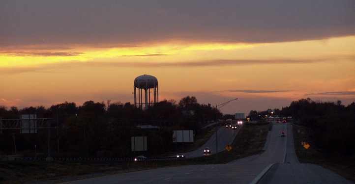
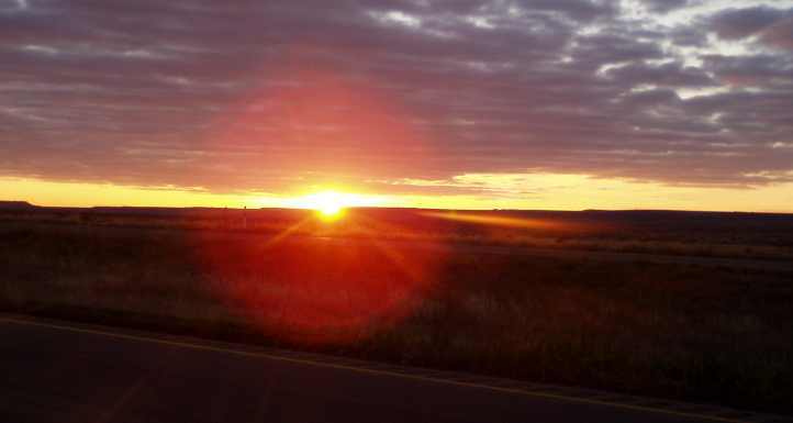
Another beautiful sunset at 6:30pm, not far from the Kansas/Missouri border. There are a lot of religious messages on billboards.
At the moment Ray has stopped the car to take a sunset and a religious billboard is right next to a political billboard – typical.
Just saw a sing, ‘Boondocks Country’, reminds me of the song. It is amazing how many songs come to mind of places in the USA.
So many signs today, big billboards for Adult Shops and Super Stores, what have we come into? Only in Missouri. Another sign, ‘Drive sober or get pulled over’.
Seen more livestock, horses and cows, in the last 30 minutes than in the last few days. Fertiliser smells are around too – more farming is obvious.
Plenty of trucks and enormous motorhomes going by. The speed limit is 70 but we can only go 55 or 60, just as well these roads are dual carriageways all the way.
Another beautiful sunset at 6:30pm, not far from the Kansas/Missouri border. There are a lot of religious messages on billboards.
At the moment Ray has stopped the car to take a sunset and a religious billboard is right next to a political billboard – typical.
Crossed the Missouri/Kansas border at last – Kansas seems a real farming state, a few harvesters and the like being worked in the dark with headlights on.
We didn’t get as far as Ray wanted to, it was getting too late so we stopped instead still in Kansas at what just looked like a dot on the map but is quite a large place by the look of it. Quite a few tall buildings all lit up at a distance – Coffeyville.
We didn’t get as far as Ray wanted to, it was getting too late so we stopped instead still in Kansas at what just looked like a dot on the map but is quite a large place by the look of it. Quite a few tall buildings all lit up at a distance – Coffeyville.
We had probably seen Sonic signs before, but this time we understood what it was about... a drive-in hamburger joint!
I drove up to one of the outlet points and started looking at the menu...
The eftpos outlet and all at every stand, plenty of variety, but I had so much trouble understanding over the intercom that the girl came out to take our order. It wasn't the kind of meal I would want, but these trips tend to do that to you and it was edible.
We had tea at a fast-food place with a difference – it was a drive-in – you drive to your own bay, beside you is a selection of foods listed, you give your order and can pay for it then. When it’s ready a girl comes out with your mean and you can eat it there.
The ‘eating it there’ was about the only thing we did normally. Ray couldn’t understand what to do or what he could eat so the poor girl offered to come out to explain – very nice about it.
Got into a motel, dearer than we wanted, $80 with a complimentary breakfast.
The ‘eating it there’ was about the only thing we did normally. Ray couldn’t understand what to do or what he could eat so the poor girl offered to come out to explain – very nice about it.
Got into a motel, dearer than we wanted, $80 with a complimentary breakfast.
Some time during the Wednesday either I phoned Bill or he phoned me. Probably I phoned him from Kansas to tell him we were getting along all right. Bill apologised (after all he'd done to help us!) that he hadn't been available to help on the Tuesday.
He explained that duty had come first, and that as a police officer in charge of a particular investigation he'd had to do some serious work and also hold a press conference about the matter.
"While that was on I got to talking to one of the newspaper writers," he told me, "and she asked if I knew anyone who could give her a bit of a story for her regular Saturday feature called 'My Favourite Ride'..."
He told her about us and our pickup and the trip we were on, she was interested and so I told Bill he could put her in touch. "Yes, I have photos of the pickup," I told him, "and you can let her know I'll put together a story for her so she's got something to work with." I settled down to do that but didn't hear from her until the end of the week.
Subsequently I e-mailed the story and photos to her and our tale was in the Bloomington paper the next Saturday. She re-wrote it, of course, and she upset Bill by revealing he is a police officer.
When it comes to playing with cars, Bill doesn't want to be associated with the police and he had told her that, and anyway, he was due to retire in January.
Just another task for me before I bunked down for the night...
Last edited by Ray Bell; May 10, 2022 at 08:45 PM.
Thread Starter
|
Captain
Joined: Oct 2005
Posts: 571
Likes: 9
From: The Summit, Queensland, Australia
This is the story I wrote for the jouno in Bloomington...
I also sent through a few photos, she used the one of the truck beside the waterfall near Watkins Glen.
I live in Queensland, Australia, about a hundred miles inland from Brisbane, our third-largest city. I have been a car oriented person for most of my life and a few years ago I swung my allegience to older Mopars.
The primary reason for this was that my nephew began building a road race car using a '64 Dodge sedan. I wanted to help him with the project and started buying components for him and also for sale to others online. I set up shipping methods and developed a circle of contacts in the US.
I also have a son living in Bloomington. Justin found the love of his life due to his over-use of the internet while at university in Australia. At the age of 21 he flew to America and married her - he's basically only been back to Australia once in the ensuing 19 years.
This year I found myself in the position to make the trip myself. But it had to be a multi-purpose trip to be worthwhile. I had to use the trip to make contacts and develop relationships with suppliers for an engine project I have going, while chasing after more old Mopar parts was a given.
The biggest difference for me, however, was that I decided that I should buy a vehicle in which I could drive around the country and into which I could stack the parts I purchased. The aim would then be to ship it to Australia and sell it to recoup the money.
The choice of vehicle had to be framed around a few ideals. The first of these was age - if a car is over 30 years old, it doesn't have to be converted to right hand drive for use in Australia. This is a huge cost saving.
A pickup would naturally carry more cargo, while it would also be an attractive vehicle for Australian buyers. I started my search with these things in mind and soon found a 1975 Dodge D100 that was, coincidentally, only 25 miles from Bloomington. With Justin able to help out with checking out the title, I committed my cash to the purchase.
However, not all was as it might have been. When it was delivered to Justin's place it wouldn't start or run. Searching through the forums I use on the internet I found an invaluable helper in Bill Parker, who assessed the situation with the pickup and provided me with somewhere to work on it as well as making time and tools available to get it running when I flew in during early October.
My wife and I then commenced our tour, driving down through Kentucky, across to visit an old friend in West Virginia and then on to Virginia to see someone there I wanted to catch up with. From there we drove through Connecticut to Massachusetts, where my partner in the engine project lives, across New Jersey to New York City and then headed for the New England.
Where we live at home is called the 'New England' as well, but the breathtaking fall colors of Vermont and New Hampshire inspired us. Squam Lake, the setting for the movie "On Golden Pond," was the furthest we got from home. Then we went to Watkins Glen's International Motor Racing Research Center where I presented them with a copy of my recently-released book on Formula 5000 racing in Australia and New Zealand.
This area was simply stunning, but we had to press on and spent a day at Niagara Falls before driving down through the top end of Ohio and across the top of Indiana to South Bend. There I loaded up some parts for transport to Australia before venturing into Michigan to meet yet another internet acquaintance.
Throughout this time the old Slant 6 in the pickup kept slogging away, though it was thirstier than I'd hoped. The truck used to serve as a vehicle used for fishing, hunting and camping expeditions but had been refurbished by the original owner's son before he decided to sell it.
We re-entered Indiana and gave it a brief service before heading west. Three weeks of our allotted six had passed, we'd already covered over 4,000 miles and we had a lot of destinations yet to reach. The pickup will take us to the Grand Canyon, Las Vegas, up to Spokane and Seattle before we come back down the California coast and put it in to be shipped from Long Beach.
My wife, Janet, has been finding the long hours in the passenger seat somewhat numbing to her legs and buttocks, but appreciating the sights we've seen and people we've met has helped her to put those factors aside.
She made the comment, as we drove away from Bloomington, that the immediate region was among the most diverse and attractive we had seen during the whole trip. It's nice to know that Justin and his wife have a nice place in which to live.
But that wasn't the end of our journey, and the truck still has to get us to the West Coast!
With the help of the Dodge, which is incidentally the first American vehicle I have ever owned, we are making this trip into the adventure of a lifetime. I do have to offer my most sincere thanks to Bill for helping me out with things and I hope I can come back again some time and do it all again!
Last edited by Ray Bell; Oct 24, 2019 at 02:41 AM.
Thread Starter
|
Captain
Joined: Oct 2005
Posts: 571
Likes: 9
From: The Summit, Queensland, Australia
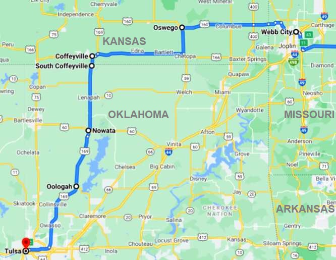
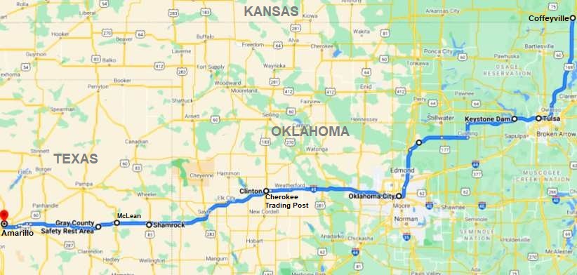
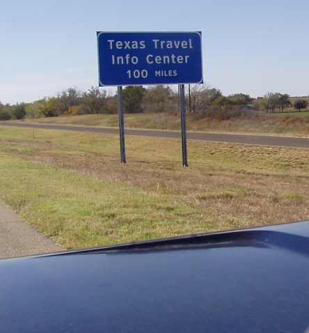
We wanted to get a fair length of day behind us on the Thursday. David Young, a member of another forum who has cancer, lives about forty miles south of Albuquerque and I wanted to get to his place and pay him a visit. On Friday, when we'd be there, he had a doctor's appointment at 1pm and so we needed to get close enough to him that we'd be able to be there late in the morning on Friday. So we set our day's goal as Amarillo, this is the course we'd follow:
We were up early, it was still dark when we struck out from Coffeyville, breakfasting at the motel before we left. At South Coffeyville I was delighted to see fuel for sale for $2.97 a a gallon (the cheapest we bought on the trip), so the tank was filled to the brim and we drove into northern Oklahoma still feeling that this was a kind of country we seen in places like western NSW and South Australia. Farming was everpresent on the flat countryside.
We also crossed that border with Janet forgetting why she said she wanted to go that way. I had to remind her about not being in Kansas any more!
I photographed the Sonic for clarity of explanation to people back home... and I also saw another business there that's not at all unknown in Australia:
There was quite a lot of traffic as we headed closer to Tulsa on this 2-lane road…
And again she had time to make more notes on her observations of the trip:
Avoiding those toll roads put us onto a back-road which crossed the Keystone dam, but the Garmin still directed us right to the I35 to continue into Oklahoma City.
At Oklahoma City it was time for our mid-morning stop and we found a rest area with a nice souvenir shop conveniently located as we drove into town...
The free coffee was most welcome and we used their facilities as we looked around there. And down the road we saw further evidence here that you can advertise anything if you can put it up on a steel pole...
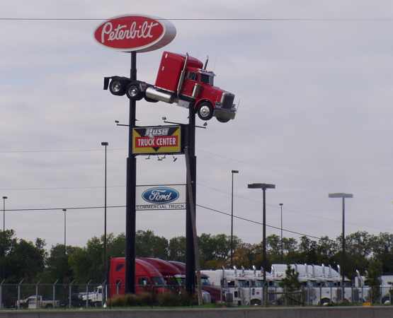
It seems, though, that this Peterbilt needed more than one pole!
Leaving there we were to run into a 'mobile carpark' before very long…
It got moving again for a brief time, but then stopped again before we again came to a halt. Ultimately it cleared and we cruised on, not stopping again until we'd gone through El Reno.
I don't recall that we bought anything there, Janet's note is, "I controlled myself,” so that means we didn’t. She took enough money to spend $100 a week while we were on this journey, though she did have a credit card for ‘special things’ and used it a few times.
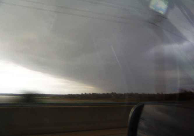
The many windfarms we were seeing were getting plenty of assistance from the breezes. There was rain threatening, too:
We were anxious to cross this border as we were looking for a motel coupon book for our stop this night. As we drove out of Oklahoma we were scanning the horizon for the tell-tale blue sign that would indicate a 'Welcome Centre' or tourist information centre was looming. Imagine our surprise, when after spotting a blue sign, it was just this message on it:
As the day was getting along, we were in need of a bit of a break and we stopped at Shamrock, about 15 miles further on. We went into the store there, it seemed to sell a bit of everything (nothing new in that...) and we found the restrooms in the back and then went shopping. My eye caught sight of a table full of cheap tools, I remember getting a hammer and tape measure there, while when we headed for the checkout Janet wondered about the jingling of the cowboy-hatted bloke in front of us. Then she spotted his spurs!
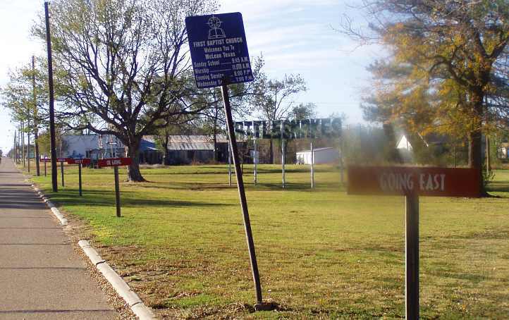
Convinced that this meant we were truly in cowboy country, though she was somewhat surprised that he left in a pickup rather than on a horse, she joined me in the pickup and we drove on. At McLean, another little town that remembers the glory days of Route 66, we found a little park that was inviting enough for us to pull up and pour hot water from the Thermos. Tea for Janet, coffee for me, a snack for both of us while I took a couple more pics... the signs give particular reference to Route 66:
More cotton growing persisted on terrain that was getting flatter, then between Alanreed and Groom there was the Gray County Safety Rest Area which was very big on its Texan heritage:
Indoors there was a lot of information about how the local area was settled and farmed, the progress they'd made and so on. And the sign on the toilets in this very solid building said that was the tornado shelter!
A bit over forty miles from Amarillo we saw this…

…water tower, which must have been leaning for a long time as it appears to be one of the most-photographed water towers on the internet! This is at Britten.
We were by this time looking at how much further we'd travel this day. I was keen, because of the need to get to Belen to see David by about 11am the next day, to go further than Amarillo. But it presented a dilemma because we didn't know if there were suitable motels at places west of Amarillo, where only a few towns were showing on the map and only one, Adrian, was far enough past Amarillo to make it worthwhile. We really needed some more hotel coupons.
After that, should there not be anything suitable, we'd be committed to at least another hour on the road. In the meantime, we were still seeing sights in this part of Texas... I got a pic of something I'd been wanting to photograph since our first day driving through Kentucky:
We did have some information on Amarillo's accommodation offerings, we must have got something from a gas station or somewhere, and we were able to go straight to the Sleep Inn towards the western side of town.
We booked in there and Janet's desire to have a Chinese meal was about to be realised as there was a restaurant just a couple of doors down the road…
Of course, there was nothing for me there except they would make a very plain batch of boiled rice to which I could add something from somewhere else. It's times like this that my allergy is a real pain, but while Janet awaited the meal there I drove down to McDonalds and got a burger, on my return I pulled the meat out and dined on that with the rice in our room.
We were committed to a very early morning the next day...
We were up early, it was still dark when we struck out from Coffeyville, breakfasting at the motel before we left. At South Coffeyville I was delighted to see fuel for sale for $2.97 a a gallon (the cheapest we bought on the trip), so the tank was filled to the brim and we drove into northern Oklahoma still feeling that this was a kind of country we seen in places like western NSW and South Australia. Farming was everpresent on the flat countryside.
Didn’t sleep very well, my cough has come back with a vengeance since Kansas.
A lot of workmen must either work away from home or live in motels because there is usually quite a few pickups (utes) in the carpark. Particularly the one we stayed at last night. There would have been at least 20 of them.
The night before last we stayed at a motel and met a fellow who stayed in the motel all week, went home weekends, couldn’t get a job closer to home.
Had breakfast, left and a mile down the road ‘I don’t think we’re in Kansas any more (Toto)’ we crossed into Oklahoma on our way to Tulsa. Got petrol for I think the cheapest price we’ve had, $2.97 per gallon.
At Nowata we saw the first public toilet in a park on the side of the road that we’ve seen in all of our travels. “Amazing what you notice when in a foreign country,” said Ray.
Another Sonic drive-in restaurant like where we had tea last night. Ray has pulled up to take a photo in daylight…
Another Sonic drive-in restaurant like where we had tea last night. Ray has pulled up to take a photo in daylight…
There was quite a lot of traffic as we headed closer to Tulsa on this 2-lane road…
Traffic galore and it is quite a narrow road by American standards for a main road. Oklahoma is very much like Kansas, farms with cattle grazing, very much like you’d see at home. Tulsa is 50 more miles.
The elections must be such a rigmarole for the public. They have to vote for a judge, sheriffs, mayor etc, so all the way through America we’ve seen ‘vote such and such for judge, sheriff etc’.
An interesting name for a dental clinic, ‘All Smiles’ at Oolagah. Went past a power station, reminding me of Lithgow. A Methodist church with flashing neon sign advertising something not spiritual.
The road has widened considerably, so faster cars and trucks can get past so they won’t be sitting on our backsides. They like to dedicate their roadways to certain people – fallen servicemen or policemen – this one is called ‘Pearl Harbor Memorial Expressway.’
We are travelling nearer to the minimum speed limit of 40mph than the maximum of 70mph. It is funny they have a sign with maximum and minimum on highways.
Twenty miles North of Tulsa there was a subdivision with tiny box-type homes on top of each other, surprisingly enough most were fenced off from neighbours – terrible.
Coming in to heavy traffic, commuters to work in Tulsa I suppose. 8:30am. At a standstill, reminds me of the Bruce Highway. Americans don’t know how to merge either, that is all the hold-up was, merging traffic.
Coming over cloudy, just set the GPS for Amarillo, Texas – 391 miles. Joy, oh joy. Tulsa seems a big place, good place to bypass. Went over Keystone Dam on the Arkansas River avoiding toll roads, a big body of water.
Driving into rain, it stops and now experiencing gusty winds. A bit more hilly, so we can see better the scrub below. An eagle was soaring above, probably his flight made easier with the wind.
Went through Yale, a run-down town, saw a sign, ‘Yale Housing Authority’ surrounded by Housing Commission-type homes. They still managed to have a number of churches.
Seems to be drier here and we’ve seen a few pumps going. Thought at first they were oil, but more likely water-well pumps. We’ve noticed they don’t keep you appraised of the distances to towns by road signs. Now a sign, 30 miles to Oklahoma City.
A bit if money around – a big horse stud and enormous homes.
The Tourist Information Center here even offered free coffee. I bought a couple of T-shirts.
So many motorhomes with a car towed behind them everywhere we go - ‘flying South for the winter.’
So many motorhomes with a car towed behind them everywhere we go - ‘flying South for the winter.’
It seems, though, that this Peterbilt needed more than one pole!
Leaving there we were to run into a 'mobile carpark' before very long…
Held up by roadworks? It’s a carpark. All of a sudden everything’s moving, And once again we’re stopped, trucks surrounding us.
The country is very flat and the wind is blowing us around something shocking. It was a real sight seeing a motorhome with car on the back swinging around, must be hard to control.
More windfarms on the horizon, good place for them obviously. Just West of Reno. Real red dirt.
Stopped at a 'Cherokee Trading Post' – really beautiful things – I controlled myself.
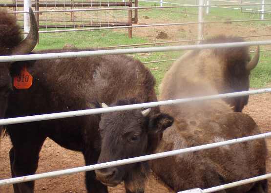
Saw and took photos of buffalo, enormous creatures.
More windfarms on the horizon, good place for them obviously. Just West of Reno. Real red dirt.
Stopped at a 'Cherokee Trading Post' – really beautiful things – I controlled myself.
Saw and took photos of buffalo, enormous creatures.
2:10pm – 54�F, blowing a gale, cold, a far cry from yesterday, dressed for the first time in summery clothes, froze when I got out of the car.
More windfarms left and right and in front, all doing their job. They only turn slowly even with the wind so fierce, now we have them right beside the road.
Cotton growing in fields near the road, not far from the Texas border. Very scrubby country, reminiscent of South Australia.
More windfarms left and right and in front, all doing their job. They only turn slowly even with the wind so fierce, now we have them right beside the road.
Cotton growing in fields near the road, not far from the Texas border. Very scrubby country, reminiscent of South Australia.
We were anxious to cross this border as we were looking for a motel coupon book for our stop this night. As we drove out of Oklahoma we were scanning the horizon for the tell-tale blue sign that would indicate a 'Welcome Centre' or tourist information centre was looming. Imagine our surprise, when after spotting a blue sign, it was just this message on it:
Crossed the Texas border, 3:40pm. Tourist Information Center not for 100 miles, I can’t believe it!
Will have to stop soon to stretch our legs at Shamrock – more scrub like South Australia except much better road.
There was real proof that we’re now in Texas when, on stopping at a shop, the fellow in front of us at the check-out was wearing a cowboy hat and spurs. Everyone has the real Southern drawl.
Convinced that this meant we were truly in cowboy country, though she was somewhat surprised that he left in a pickup rather than on a horse, she joined me in the pickup and we drove on. At McLean, another little town that remembers the glory days of Route 66, we found a little park that was inviting enough for us to pull up and pour hot water from the Thermos. Tea for Janet, coffee for me, a snack for both of us while I took a couple more pics... the signs give particular reference to Route 66:
More cotton growing persisted on terrain that was getting flatter, then between Alanreed and Groom there was the Gray County Safety Rest Area which was very big on its Texan heritage:
Indoors there was a lot of information about how the local area was settled and farmed, the progress they'd made and so on. And the sign on the toilets in this very solid building said that was the tornado shelter!
We saw our first windmill of the trip, even though it’s so windy it wasn’t turning any more. What open spaces with nothing but an occasional enormous irrigation sprinkler system.
Another huge cross, this time in the middle of a paddock – are they trying to say that the USA is a Christian nation? That is at least the third one that I’ve seen, over 20 metres high.
Cotton can be seen growing and silos too are a common sight. But not many homes. It just seems to get flatter and flatter, unlike anywhere else we’ve been (this trip). Loves service stations are the most common and they usually have a Subway attached to them. Subway is everywhere, haven’t had it here yet, Ray doesn’t like it and says the stores always stink of onion.
…water tower, which must have been leaning for a long time as it appears to be one of the most-photographed water towers on the internet! This is at Britten.
We were by this time looking at how much further we'd travel this day. I was keen, because of the need to get to Belen to see David by about 11am the next day, to go further than Amarillo. But it presented a dilemma because we didn't know if there were suitable motels at places west of Amarillo, where only a few towns were showing on the map and only one, Adrian, was far enough past Amarillo to make it worthwhile. We really needed some more hotel coupons.
After that, should there not be anything suitable, we'd be committed to at least another hour on the road. In the meantime, we were still seeing sights in this part of Texas... I got a pic of something I'd been wanting to photograph since our first day driving through Kentucky:
A windfarm can be seen on the horizon, 24 miles from Amarillo. I would like to stop there for the night but Ray has other ideas. It is now 6:10pm. The Tourist Information Center has already closed which is a real shame.
Ray decided to stay at Amarillo – a nice early night, 6:30pm, so we’'ll get away early in the morning.
Ray decided to stay at Amarillo – a nice early night, 6:30pm, so we’'ll get away early in the morning.
We booked in there and Janet's desire to have a Chinese meal was about to be realised as there was a restaurant just a couple of doors down the road…
Went next door to a Chinese restaurant and got fried rice with beef. They did a steamed rice, carrots and beans for Ray especially, really nice of them. He went off and got a beef and mushroom burger from McDonalds and took it out of its bun.
The meat at the Chinese restaurant was all marinated.
The meat at the Chinese restaurant was all marinated.
We were committed to a very early morning the next day...
Last edited by Ray Bell; May 12, 2022 at 07:56 AM.
Thread Starter
|
Captain
Joined: Oct 2005
Posts: 571
Likes: 9
From: The Summit, Queensland, Australia
Our rush across the southern USA was showing good progress...
Terre Haute IN to Coffeyville KS was about 520 miles, Coffeyville to Amarillo TX was 440 miles, now we had about 320 miles to go to visit David in Belen NM, and we'd be there in the late morning with all the afternoon still available to travel. Barring incidents, of course.
There's a lot of photos to cover this day and I'll do the day in two parts because of the events of the day. Interesting and even dramatic events.
The Sleep Inn had breakfast from very early. I don't know what time it was, but it was still well and truly dark outside when we emerged to fire up the pickup after our scrambled eggs. As we drove west out of town we looked ahead at blinking red lights to our right, all blinking in unison, and wondered what they were, they didn't seem to have anything to do with any airports and there was a lot of them.
After a while we stopped for fuel. Maybe 10 miles out, the lights were still in view, it was still dark, we went inside and looked over their tee shirts and other souvenirs. The attendant didn't know what we were talking about when we asked about those blinking red lights! But another customer heard...
The prices on the tee shirts was incredibly low, I think it was three for $10, so we spent $20 if I recall and then jumped back into the Dodge to start making the miles pass by. This was the route to Belen:

We were nearing New Mexico with the rising sun behind us. To our left…
Behind us the rising sun was showing its indomitable self, it was catching up stride by stride, mile by mile...
It was a cool morning, naturally enough, and once again we would be looking for a visitor's centre once we crossed the border. We had our Thermos full of hot water for a stop later in the morning and I was very keen not to waste too much time so we'd be able to spend some with David. The slant 6 was cranking along, the Dodge was cruising nicely, the day was dawning from behind and we crossed the border.
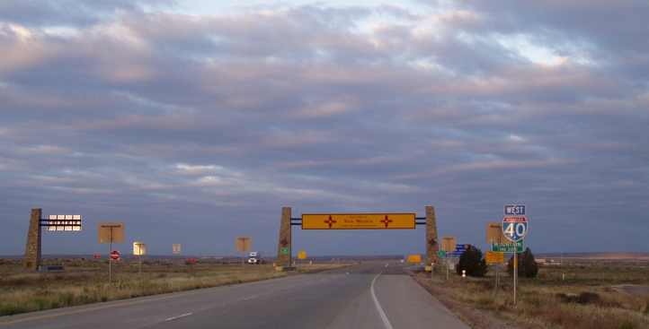
New Mexico made itself abundantly obvious as we rushed on in, then we found the visitor's centre and...
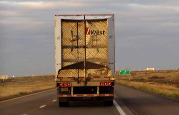
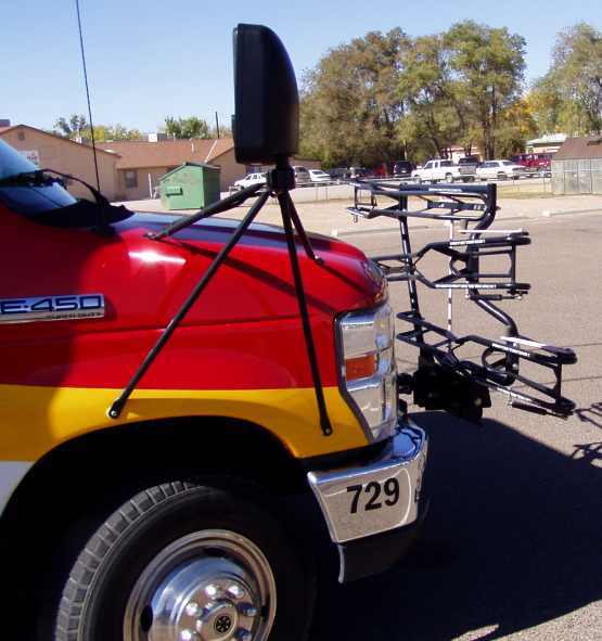
...we were too early! This was three in a row we'd missed, but we couldn't wait as we had places to go and people to see. And things to notice along the way, like this truck's hinged extensions on the back that were intended to give it some smoother airflow and presumably save a bundle of fuel on the long high-speed hauls of the Interstates:
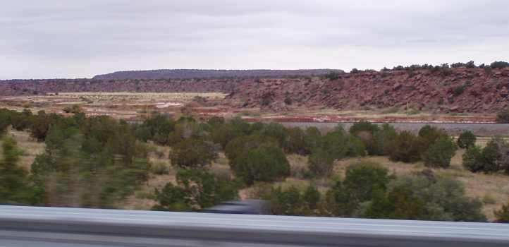
This landform stood off to the south, it was a bit eye-catching so I tried to get a good shot of it...
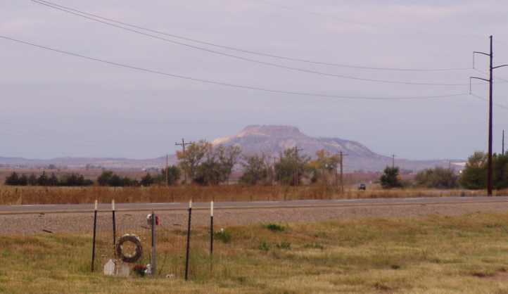
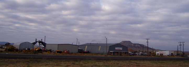
In the first there also appears to be a bit of an impromptu monument to someone, perhaps as people erect little crosses where fatalities occur on our roads at home? The second shows a foreground of industry out in the desert just off the Interstate.
We were beginning to notice how many people live in the desert in the US. There are towns and people everywhere! What are they doing there? At home we'd drive for a hundred or hundred and fifty miles in country like this before reaching some moderate-size town, but here there's nowhere like that.
It's also the country through which some of the great railways opened up America 150 years ago. They're still there, and still carrying a lot of freight...
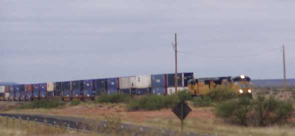
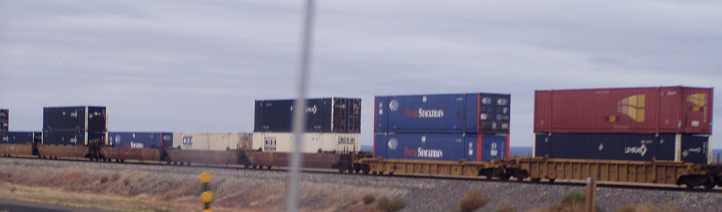
Containers stacked two-high just as they are between Darwin and Parkes at home, nice long trains as well... and plenty of them. We ran alongside the railway for some time, for a while there was a creek in there too, with this resultant mix of scenery occurring:
Tucumcari came and went, a town with lots of amenities for travellers. Santa Rosa also had us wondering about the sizes of the towns and what all these people were doing out here. Once again the long miles meant Janet had time to think and write:
At Newkirk we stopped to refuel and Janet took a couple of pictures of the somewhat bleak scene...
The old church has certainly seen better days! And this sign on the bowser made me wonder...
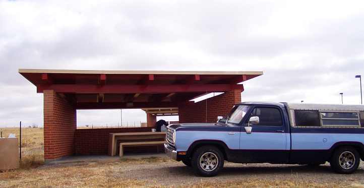
A while later we stopped for our coffee at a rest area which had a number of shelters for the purpose:
We were nearing Albuquerque and I phoned David to let him know, he was happy to hear from us. It wasn't uncommon at all for trucks to be passing us, though...
New Mexico goes to some trouble with these structures and they're finished in a patterned colouring. I have a pic of one in Arizona that's similar, I'll be posting that soon, this one doesn't really show up at all.
Finally we were into our headlong rush down 'the canyon'... the descent into Albuquerque, where the Interstate winds its way downhill for many miles with some of the outer suburb (if they can be called that) dwellings being visible through the fences.
I would go white thinking about what might have been later in the day, we were sweeping through the bends here at 70mph, swinging along with the traffic and totally unaware what the afternoon would bring. We descended to the city and then carefully followed the GPS instructions to avoid going the wrong way as we picked our way to the road south. Before too long we were looking for David's house in the southern part of Belen. Along the way we saw pumpkins being picked and haybales being transported in a somewhat precarious manner on trucks.
David's little house is in a less prosperous part of town and his Javelin, the reason I know him, was in the driveway:

He's been enlisting the help of people on a Chrysler forum as he fits a small block Mopar engine into this car. We ultimately went inside to sit down and chat over an iced tea...
Our discussions covered many subjects, including meeting Fred back in Massachusetts. Fred is one of those who's been taking an interest in David's project and as a health professional also takes an interest in his illness.
Afraid that we might keep him from making his appointment in Albuquerque in time, we suggested that we really should let him go... but no!
"I don't get International guests every day!" he said, "The doctor can wait." But we didn't hang around, though we took some directions from him regarding a thrift shop in the neighbourhood and drove off in that direction after bidding him farewell. On the way to the thrift shop we stopped off at the flea market we'd seen on the way to Davids, but we made far more purchases at the thrift shop. Parked there I also took note of this on a bus:
I asked the driver about it, he quickly explained that it's a rack for bicycles. Passengers put their bikes in there when they board the bus. We were to see more of these as time went on, particularly on bigger buses.
We went off in the direction of Los Lunas, refuelling the truck and getting ourselves something to eat on the way. After a brief look around we turned right at this intersection:
This was the way to a short-cut that would save us about fifteen miles getting back onto the I40. We drove off along the 2-lane road at an easy pace, no need to rush now as we had time on our hands. About twenty miles out of Los Lunas we pulled up among some old windblown land formations to have another hot drink...
I'd noticed the brakes had got a bit spongy and topped up the fluid, noting that there'd been some splashing around the engine bay.
"Odd," I thought, "I wonder what's caused that?" Naturally I said nothing to Janet about this, she'd have panicked.
After cleaning up we jumped in again and drove on. The Interstate was just five or six miles ahead of us when suddenly the steering started to jump all over the shop and I pulled up.
A quick look under the front confirmed that the left front wheel bearing had failed. I told Janet this and quickly said, "I'm going to have to go and get parts to fix it!"
That's how she came to take this photo:

Terre Haute IN to Coffeyville KS was about 520 miles, Coffeyville to Amarillo TX was 440 miles, now we had about 320 miles to go to visit David in Belen NM, and we'd be there in the late morning with all the afternoon still available to travel. Barring incidents, of course.
There's a lot of photos to cover this day and I'll do the day in two parts because of the events of the day. Interesting and even dramatic events.
The Sleep Inn had breakfast from very early. I don't know what time it was, but it was still well and truly dark outside when we emerged to fire up the pickup after our scrambled eggs. As we drove west out of town we looked ahead at blinking red lights to our right, all blinking in unison, and wondered what they were, they didn't seem to have anything to do with any airports and there was a lot of them.
After a while we stopped for fuel. Maybe 10 miles out, the lights were still in view, it was still dark, we went inside and looked over their tee shirts and other souvenirs. The attendant didn't know what we were talking about when we asked about those blinking red lights! But another customer heard...
More flat country and how! Had breakfast of scrambled eggs, drove away still in the dark. Red flashing lights everywhere on our right. When we stopped shortly after to buy some Texas T-shirts at a service station we asked a lady what they were. “Wind turbines.”
We were nearing New Mexico with the rising sun behind us. To our left…
A few gullies and what they call mesa, like tablelands, with the sunrise behind it, quite pretty – what a fabulous photo opportunity.
It was a cool morning, naturally enough, and once again we would be looking for a visitor's centre once we crossed the border. We had our Thermos full of hot water for a stop later in the morning and I was very keen not to waste too much time so we'd be able to spend some with David. The slant 6 was cranking along, the Dodge was cruising nicely, the day was dawning from behind and we crossed the border.
Crossed into New Mexico on way to Albuquerque. Not many houses visible at all from the road. Roads still good, real good.
...we were too early! This was three in a row we'd missed, but we couldn't wait as we had places to go and people to see. And things to notice along the way, like this truck's hinged extensions on the back that were intended to give it some smoother airflow and presumably save a bundle of fuel on the long high-speed hauls of the Interstates:
This landform stood off to the south, it was a bit eye-catching so I tried to get a good shot of it...
In the first there also appears to be a bit of an impromptu monument to someone, perhaps as people erect little crosses where fatalities occur on our roads at home? The second shows a foreground of industry out in the desert just off the Interstate.
We were beginning to notice how many people live in the desert in the US. There are towns and people everywhere! What are they doing there? At home we'd drive for a hundred or hundred and fifty miles in country like this before reaching some moderate-size town, but here there's nowhere like that.
Tucumcari – a town in the middle of nowhere with all mod-cons, heaps of motels and eateries, a trainline running beside the road, not a common sight, seems quite rocky country and scrubby.
More hills now, but not much habitation. For the last couple of days we have been running beside the original Route 66, still going in varying grades of disrepair. Just took a photo of a train only carrying goods.
More hills now, but not much habitation. For the last couple of days we have been running beside the original Route 66, still going in varying grades of disrepair. Just took a photo of a train only carrying goods.
Containers stacked two-high just as they are between Darwin and Parkes at home, nice long trains as well... and plenty of them. We ran alongside the railway for some time, for a while there was a creek in there too, with this resultant mix of scenery occurring:
Tucumcari came and went, a town with lots of amenities for travellers. Santa Rosa also had us wondering about the sizes of the towns and what all these people were doing out here. Once again the long miles meant Janet had time to think and write:
Had to change our watches again, gained another hour, going to make it a long day. Another big town in the middle of nowhere, incredible, Santa Rosa.
114 miles to Albuquerque. Rocks all around. We’re climbing a bit, when we look at the GPS’ display of our elevation it’s surprising, 5,000ft and climbing.
Went through what they call a ‘safety corridor’ where speeding fines doubled, roadworks being done. Elevation 5,500ft.
Looks like a New Mexico touch, on an overhead bridge, patterns have been formed in the concrete.
Back to scrubby country, barren, unwelcoming. More advertising billboards than I’ve seen in one place, once again in the middle of nowhere. Advertising Mexican import wares, moccasins, belts, jewellery etc – it must be to wake you up, it is such a monotonous ride. 6,500ft elevation, not much to see.
I wonder what it is with Americans spitting, males and females alike. Ray thinks it might be something to do with when they chewed tobacco.
The old church has certainly seen better days! And this sign on the bowser made me wonder...
A while later we stopped for our coffee at a rest area which had a number of shelters for the purpose:
We were nearing Albuquerque and I phoned David to let him know, he was happy to hear from us. It wasn't uncommon at all for trucks to be passing us, though...
New Mexico goes to some trouble with these structures and they're finished in a patterned colouring. I have a pic of one in Arizona that's similar, I'll be posting that soon, this one doesn't really show up at all.
It looks like we’re coming into some bad weather. Nearer Albuquerque, looks quite grey and misty. Billboards advertising fireworks. A lot of trailer homes around and a lot of dilapidated buildings and houses. Moriarty.
An oversize load (overly wide) just passed, had to get right over, just as well the roads are so good. Nice homes up on the hill, as we go over the hill things are looking more civilised, actually. There must be some money around, mansions dot the landscape – mountains are ahead of us and I don’t think it was bad weather we could see from a distance, it could have been dust or even smog because there’s nothing but blue skies. What a change in scenery.
Just drove through what is locally known as ‘the canyon’ - houses nestled wherever possible, a great contrast between the haves and the have nots – very visible.
I would go white thinking about what might have been later in the day, we were sweeping through the bends here at 70mph, swinging along with the traffic and totally unaware what the afternoon would bring. We descended to the city and then carefully followed the GPS instructions to avoid going the wrong way as we picked our way to the road south. Before too long we were looking for David's house in the southern part of Belen. Along the way we saw pumpkins being picked and haybales being transported in a somewhat precarious manner on trucks.
Driving out of Albuquerque South it is amazing, the visible line between the built-up area of the city, a border of yellow trees and then nothingness beyond.
We are driving a bit South to a place called Belen for Ray to meet a fellow he has been corresponding with on a car forum, David Young. He has cancer, undergoing treatment including chemo, doing up cars is his interest.
We crossed the Rio Grande River and were in wide open spaces again. Sign warning of dust storms, understandable. Pumpkins growing alongside road, seemed to be Mexicans harvesting them, or picking them. A big truck loaded down with bales of haywent by, just strapped on, seemed precarious and yet another one.
We arrived at Belen, went to see David and his car...
He's been enlisting the help of people on a Chrysler forum as he fits a small block Mopar engine into this car. We ultimately went inside to sit down and chat over an iced tea...
Our discussions covered many subjects, including meeting Fred back in Massachusetts. Fred is one of those who's been taking an interest in David's project and as a health professional also takes an interest in his illness.
He lives in a Housing Commission style house, only fairly young. He told us the trees with the yellow leaves are cottonwood trees that can cause a real problem in spring if they shed cotton – it blocks up everything around.
He gave us a tea, had no coffee, but it seems to be more common when you want black tea for it to be given cold, which he did. I don’t think Ray enjoyed it.
We saw a flea market on the way into Belen, we might go to it if it is still open when we leave. David has Multiple Myeloma, brought back memories of mum. He has had two bone marrow transplants and is on the same chemo treatment as mum was. He had secondary cancers growing too.
"I don't get International guests every day!" he said, "The doctor can wait." But we didn't hang around, though we took some directions from him regarding a thrift shop in the neighbourhood and drove off in that direction after bidding him farewell. On the way to the thrift shop we stopped off at the flea market we'd seen on the way to Davids, but we made far more purchases at the thrift shop. Parked there I also took note of this on a bus:
I asked the driver about it, he quickly explained that it's a rack for bicycles. Passengers put their bikes in there when they board the bus. We were to see more of these as time went on, particularly on bigger buses.
We went off in the direction of Los Lunas, refuelling the truck and getting ourselves something to eat on the way. After a brief look around we turned right at this intersection:
This was the way to a short-cut that would save us about fifteen miles getting back onto the I40. We drove off along the 2-lane road at an easy pace, no need to rush now as we had time on our hands. About twenty miles out of Los Lunas we pulled up among some old windblown land formations to have another hot drink...
I'd noticed the brakes had got a bit spongy and topped up the fluid, noting that there'd been some splashing around the engine bay.
"Odd," I thought, "I wonder what's caused that?" Naturally I said nothing to Janet about this, she'd have panicked.
Stopping on the side of the road to have lunch in the middle of nowhere and looking at the landscape and the tabletop mountains, I half-expected to see Indians appear. It was real Western movie country here, with canyons as well.
We’re driving a short-cut back to the main road to take us to Flagstaff, close to the Grand Canyon.
We’re driving a short-cut back to the main road to take us to Flagstaff, close to the Grand Canyon.
Driving along and something happened to the steering, as I said, we’re in the middle of nowhere...
That's how she came to take this photo:
Last edited by Ray Bell; Jun 12, 2021 at 08:45 AM.
Thread Starter
|
Captain
Joined: Oct 2005
Posts: 571
Likes: 9
From: The Summit, Queensland, Australia
When I spoke to Bill Parker a couple of days later, he lamented that we never repacked those front wheel bearings... but they were obviously very old and it had been a long time since anyone had looked at them…
But back to our dramas on this warm desert day October 26, 2012...
After hurriedly telling Janet what I was doing, I put my hand out to flag down the first car that came along. I had quickly decided that I had to hitch hike to the nearest town and get some bearings and some grease so I could hitch hike back with them and get this fixed before it got dark. I understood that the town of Grants was not far along the I 40 from where this road fed into it, but I didn't have a good enough map to check that and I wasn't wasting time.
This was the spot – years later and at a different time of year when Google Earth photographed it – where we pulled up, just before that gate and entryway:
The first car went by... the second car went by... I was just thinking, "This might take a while..." when the first car, a Chrysler Grand Voyager, came back and pulled up opposite where we were stopped. The woman in the passenger seat enquired about our situation and we discussed how far it was to a town where there might be a parts shop and so on. Finally she said, "Okay, I'll get in the back with the children and you ride in the front."
All the while we believed it was only twelve miles or so to Grants, but the twelve miles or so led to a much smaller town, Mesita. We ascertained that Grants would be the next place with a spare parts shop (NAPA) and that it was a further 26 miles.
The children in the back of the Chrysler won with this stop as they got ice creams, we headed off and indulged in interesting conversation about where these people had come from and where I'd been.At Grants the NAPA store…

...had all that I needed. $33 covered the bearings and the grease, I said to my newfound friends, "If you just drop me back to the Interstate I'll hitch hike back."
"Noo-o-o!" came the response from the back seat. "We'll drive you back. Your wife's been out there on her own for too long!"
"It seems you've made up your minds about that," I replied, "so if that's the case, at least pull into a gas station and I'll fill your tank."
"Noo-o-o!" was the repeated message from the back seat. "This is American hospitality!"
So, interrupted only by me making a quick call to ask David to bring a punch and some rags up to our 'repair site', these being the only things I needed after buying that hammer yesterday at Shamrock, we had a lot more conversation.
Kimberley did a lot of the talking, but some of the stuff Rob told me was entrhralling. For instance, he said that there were some incredibly tough people up in the hills outside El Paso. El Paso is where Rob works at a hospital reading the X-rays and scans and interpreting them.
"Sometimes," he said, "someone will come in and they'll shoot the X-rays up to me. I'll look them over and call the emergency room... 'do you have Mr Gomez on life support?' I'll ask. 'No, he just walked in..." they'll reply.'"
This couple were great and they seemed to appreciate learning more about Australia from me too. They were on their way to Colorado with mountain bikes for a long weekend with the kids. And in due course we arrived back at the pickup and disembarked.
Janet had been very worried the whole time I was gone. Her diary for the period reads:
I duly moved the pickup into a position so I could work on it safely and started dismantling. I was just at the point where I needed the punch when David pulled up. It wasn't all that long before we had it all back together and I decided to at least put a bit of grease into the outer bearing on the right hand side.
I didn't pull it all apart, just took off the nut and washer and slipped out the outer race to grease it. I cleaned up and repacked the tools, we once again said our farewells to David and we slipped away into the fast-fading light of the New Mexico afternoon.
The course from Belen, with this delay, had to be foreshortened. But there wasn't many places from which to choose. In the end, it was Gallup where we would stop much later that night..
.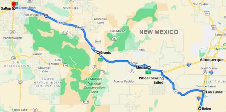
Even as we made our way along the I40 towards Gallup, fatigue was setting in for me. Janet's suggestion that I try to grab half an hour's sleep in a gas station was a good idea, we'd had something to eat by this time (McDonalds again... at Grants) and having had two 25-hour days in the past three as well as the late nights and long days at the wheel, I was tired.
I don't remember anything of Gallup. But we did get a room there and slept off the rest of the night. We didn't really have all that far to drive the next day. If we got an early start we'd have most of the afternoon at the Grand Canyon.
But back to our dramas on this warm desert day October 26, 2012...
After hurriedly telling Janet what I was doing, I put my hand out to flag down the first car that came along. I had quickly decided that I had to hitch hike to the nearest town and get some bearings and some grease so I could hitch hike back with them and get this fixed before it got dark. I understood that the town of Grants was not far along the I 40 from where this road fed into it, but I didn't have a good enough map to check that and I wasn't wasting time.
Ray is trying to get a lift, no success, into the next town to get the part necessary to fix it. He thinks it’s a wheel bearing.
The first car went by... the second car went by... I was just thinking, "This might take a while..." when the first car, a Chrysler Grand Voyager, came back and pulled up opposite where we were stopped. The woman in the passenger seat enquired about our situation and we discussed how far it was to a town where there might be a parts shop and so on. Finally she said, "Okay, I'll get in the back with the children and you ride in the front."
All the while we believed it was only twelve miles or so to Grants, but the twelve miles or so led to a much smaller town, Mesita. We ascertained that Grants would be the next place with a spare parts shop (NAPA) and that it was a further 26 miles.
The children in the back of the Chrysler won with this stop as they got ice creams, we headed off and indulged in interesting conversation about where these people had come from and where I'd been.At Grants the NAPA store…
...had all that I needed. $33 covered the bearings and the grease, I said to my newfound friends, "If you just drop me back to the Interstate I'll hitch hike back."
"Noo-o-o!" came the response from the back seat. "We'll drive you back. Your wife's been out there on her own for too long!"
"It seems you've made up your minds about that," I replied, "so if that's the case, at least pull into a gas station and I'll fill your tank."
"Noo-o-o!" was the repeated message from the back seat. "This is American hospitality!"
So, interrupted only by me making a quick call to ask David to bring a punch and some rags up to our 'repair site', these being the only things I needed after buying that hammer yesterday at Shamrock, we had a lot more conversation.
Kimberley did a lot of the talking, but some of the stuff Rob told me was entrhralling. For instance, he said that there were some incredibly tough people up in the hills outside El Paso. El Paso is where Rob works at a hospital reading the X-rays and scans and interpreting them.
"Sometimes," he said, "someone will come in and they'll shoot the X-rays up to me. I'll look them over and call the emergency room... 'do you have Mr Gomez on life support?' I'll ask. 'No, he just walked in..." they'll reply.'"
This couple were great and they seemed to appreciate learning more about Australia from me too. They were on their way to Colorado with mountain bikes for a long weekend with the kids. And in due course we arrived back at the pickup and disembarked.
Janet had been very worried the whole time I was gone. Her diary for the period reads:
Being stranded is not a nice feeling. Ray's got a lift, hopefully there's a town close by to get something for it - fun and games. Here I sit on my own feeling unsafe, maybe it would have been a good thing if there were Indians on them there hills.
Two helicopters fly overhead, unusual sight. It is now 3:45pm and a few cars are going by to break the monotony, there’s a few hours before dark - comforting thought.Trains are constantly going back and forth, the longest trains I've ever seen…
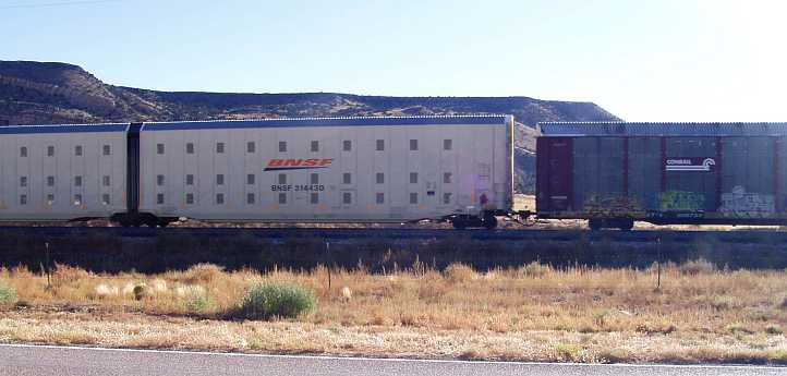
...A small plane flies across - there are things to keep me amused - it is now 4:30, hope Ray is all right and can organise something, maybe a tow truck but then that would cost money - it will have to be done, because if it gets dark he won't be able to fix the car even if he gets the part.
I am not getting angry, which shocks me, not yet anyway - things could change as I'm left on my own longer. I am more concerned than anything about Ray's and my welfare. The police pulled up to see whether everything is all right. He rang up another policeman to check up on me in 45 minutes. It is now 5pm. He told me the closest tow truck is one hour away. That's one hour there and one hour back, not counting the organising to take place.
Two more helicopters flying over. Hopefully I've found Ray's mobile phone number so the policeman, when he comes, can ring him for me.
It is now 5:30, Ray is back with the most beautiful people from El Paso - they were on their way for holidays - took Ray to where he had to go, 80 miles all up, brought him all the way back with the part, couldn't be nicer. They wanted a photo of us and the daughter gave me a bracelet she made. They wouldn’t accept any money but said it was a part of American hospitality.
Ray didn’t have all the tools necessary for the job so he rang David and he drove 28 miles to help, so lovely.
Such great helpful people. The other policeman came to check on us, giving me his business card, he offered help any time.
Two helicopters fly overhead, unusual sight. It is now 3:45pm and a few cars are going by to break the monotony, there’s a few hours before dark - comforting thought.Trains are constantly going back and forth, the longest trains I've ever seen…
...A small plane flies across - there are things to keep me amused - it is now 4:30, hope Ray is all right and can organise something, maybe a tow truck but then that would cost money - it will have to be done, because if it gets dark he won't be able to fix the car even if he gets the part.
I am not getting angry, which shocks me, not yet anyway - things could change as I'm left on my own longer. I am more concerned than anything about Ray's and my welfare. The police pulled up to see whether everything is all right. He rang up another policeman to check up on me in 45 minutes. It is now 5pm. He told me the closest tow truck is one hour away. That's one hour there and one hour back, not counting the organising to take place.
Two more helicopters flying over. Hopefully I've found Ray's mobile phone number so the policeman, when he comes, can ring him for me.
It is now 5:30, Ray is back with the most beautiful people from El Paso - they were on their way for holidays - took Ray to where he had to go, 80 miles all up, brought him all the way back with the part, couldn't be nicer. They wanted a photo of us and the daughter gave me a bracelet she made. They wouldn’t accept any money but said it was a part of American hospitality.
Ray didn’t have all the tools necessary for the job so he rang David and he drove 28 miles to help, so lovely.
Such great helpful people. The other policeman came to check on us, giving me his business card, he offered help any time.
I didn't pull it all apart, just took off the nut and washer and slipped out the outer race to grease it. I cleaned up and repacked the tools, we once again said our farewells to David and we slipped away into the fast-fading light of the New Mexico afternoon.
After a couple of hours the car was fixed and we were on our way. By the way, where I was left with the car was part of an Indian reservation!
Ray said he could drive on, we had tea at McDonalds on the way to Gallup – 120 miles from where the car was fixed. After he’d eaten he looked tired, I was concerned so I said he should stop at a service station and sleep, no motels for ages.
Ray said he could drive on, we had tea at McDonalds on the way to Gallup – 120 miles from where the car was fixed. After he’d eaten he looked tired, I was concerned so I said he should stop at a service station and sleep, no motels for ages.
.
Even as we made our way along the I40 towards Gallup, fatigue was setting in for me. Janet's suggestion that I try to grab half an hour's sleep in a gas station was a good idea, we'd had something to eat by this time (McDonalds again... at Grants) and having had two 25-hour days in the past three as well as the late nights and long days at the wheel, I was tired.
He slept for half an hour and then drove on to Gallup where we had been warned of a lot of Indians drunk and causing trouble. Things seem all right here – at Comfort Inn – too expensive ($87) but nice.
Ray is on the computer while I watch the weather channel about Hurricane Sandy.
Ray is on the computer while I watch the weather channel about Hurricane Sandy.
Last edited by Ray Bell; May 12, 2022 at 08:21 AM.
Thread Starter
|
Captain
Joined: Oct 2005
Posts: 571
Likes: 9
From: The Summit, Queensland, Australia
Should I have had a closer look at the map?
I wondered that on the day and I still wonder today. Would I have been better off going back to Los Lunas?

It was a little closer, it was a road I'd just covered, I'm sure they would have had the parts there too. Looking now, I see that NAPA, O'Reillys and Autozone are there.
But I wouldn't have met that lovely family from El Paso nor learned about their experiences. But, then again, I would have met other people instead.
I've done a lot of hitch-hiking in my time and you really do meet some nice people and learn great things from them.
I wondered that on the day and I still wonder today. Would I have been better off going back to Los Lunas?
It was a little closer, it was a road I'd just covered, I'm sure they would have had the parts there too. Looking now, I see that NAPA, O'Reillys and Autozone are there.
But I wouldn't have met that lovely family from El Paso nor learned about their experiences. But, then again, I would have met other people instead.
I've done a lot of hitch-hiking in my time and you really do meet some nice people and learn great things from them.
Last edited by Ray Bell; Jun 12, 2021 at 08:48 AM.
Grand Champion


Joined: May 2019
Posts: 5,164
Likes: 724
From: S.W. Indiana
The flaps on the rear of a semi trailer are designed to reduce drag. Follow a regular flat tailed trailer and you'll feel a lot of buffeting in the dirty air back there. With the self deploying flaps, it drastically reduces drag. It pays for itself after about 10,000 miles from what I've heard from owner/operators
Thread Starter
|
Captain
Joined: Oct 2005
Posts: 571
Likes: 9
From: The Summit, Queensland, Australia
Yes, I well understood their purpose, grouch...
Though I never thought of the buffeting for cars behind the truck. But the streamlining to save fuel, a real positive factor. I wonder what that saving works out at in dollars?
10,000 miles would only be a month, even less on some runs. And then pure profit.
I also noted the windcheating things underneath some of the trailers. I've hunted through my pics looking for one that shows them well, but this is the only one that's clear and I don't think it's a good example:
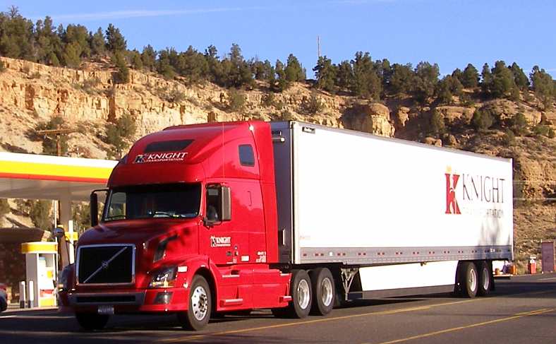
Do you know how effective these are?
Though I never thought of the buffeting for cars behind the truck. But the streamlining to save fuel, a real positive factor. I wonder what that saving works out at in dollars?
10,000 miles would only be a month, even less on some runs. And then pure profit.
I also noted the windcheating things underneath some of the trailers. I've hunted through my pics looking for one that shows them well, but this is the only one that's clear and I don't think it's a good example:
Do you know how effective these are?
Thread Starter
|
Captain
Joined: Oct 2005
Posts: 571
Likes: 9
From: The Summit, Queensland, Australia
Our first stretch on Saturday morning was from Gallup to Flagstaff...

It was about 185 miles across the desert, again we were looking for the tourist information centre as we crossed the border but were too early!
There was a stack of trucks pulled up at this rest area when we were there at 7:45am, the early morning sun was etching out the colours towards the tops of the hills, I thought this was picturesque:
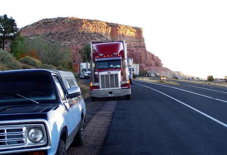
So we went on. It was a very cold morning, as predicted earlier in the week. Many signs indicated that Indian art and jewellery were major industries through this area, it was Navajo country and after a couple of hours on the road we were in Navajo County too…
Containers double-decked, there was a lot of freight going east and west on those rails.
I thought I really had to get something from Holbrook, the town which seems to be the seat of that county, as it has the same name as a town on the Hume Highway at home.
This is the main street...
And when we saw the museum in the old 'Navajo County Courthouse'...
...we decided to have a look around. One of the attractions was the petrified wood that's a common thing in the area. We had driven past signs pointing to a petrified forest, but here there was enough on display to satisfy me... at the gate there were two of these:
Inside some were sliced up to show the colours they hide...
It was a diverse collection of things on display…
There were cells to look at, small and cramped and very uninviting... and many old artifacts had been collected to show how things used to be. This desk seems to show both old and new:
...and this machine defies my comprehension:
We took a sample of the petrified wood (there was a 'please take one' sign over a binful of them) to give to my mother and went off to get some fuel and resume travelling. This sign at the service station caught our eyes:
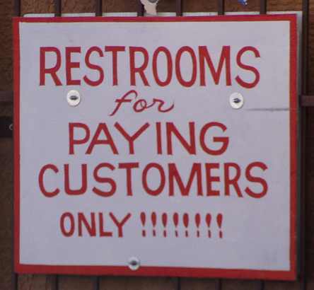
Apart from spotting trains and taking odd photos as we drove, we saw this installation. I don't know what it is, perhaps a power station?
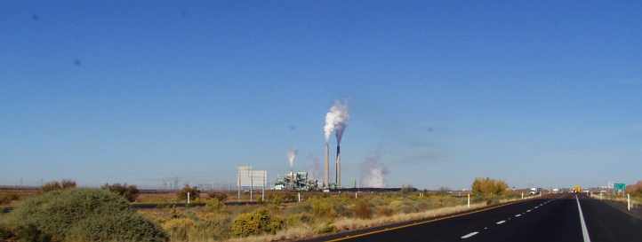
More different rock formations greeted us as we drove on...
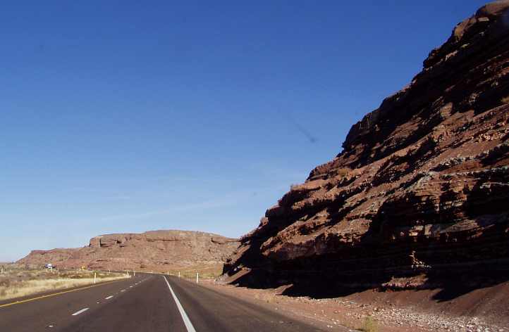
...until eventually we stopped for our morning break at a rest area which overlooked miles of nothingness... and the railway line... somewhere out there in the vast expanse of Arizona. It was just over 20 miles West of Winslow and named the Meteor Crater Rest Area There were warning signs...
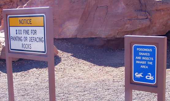
...but no staff on hand. Though I can verify that the toilets worked. This RAM...
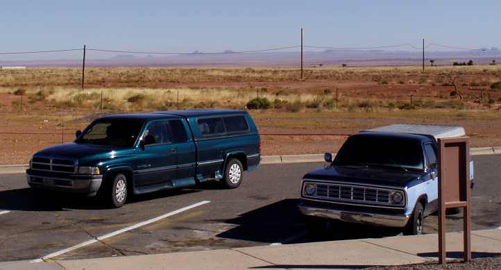
...pulled up near our Dodge and we had a bit of a chat with the couple travelling in it. They had come from Michigan, so we had something in common, but their trip was nearly over. Each winter they escape the cold of the north and go to their holiday home in Arizona to keep warm. They walked their dog, I took a photo of these rocks:

Then we left the rest area only to find a mile up the road there was a turnoff just up the road to the site of a meteorite crashing into the earth a long time ago. Some fanciful signs on the road into the site showed someone had imagination...
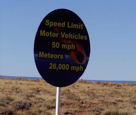
...but the admission charge was high and there was a lot of walking to be done to see the full extent of the depression. We opted to keep going as the Grand Canyon was our main goal on this day. The Interstate was mostly straight and the sign in this pic...
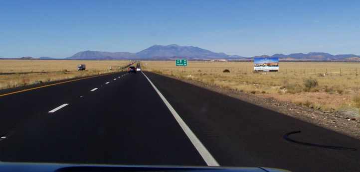
...indicates that Flagstaff is getting ever-closer.
At Flagstaff it was time to get some more fuel, but the first place I went to wouldn't accept my ANZ travel card. This was both at the bowser and in the office. We simply drove to the next service station, only a few yards up the road, and filled up there. A quick bite to eat and we turned up the I89...
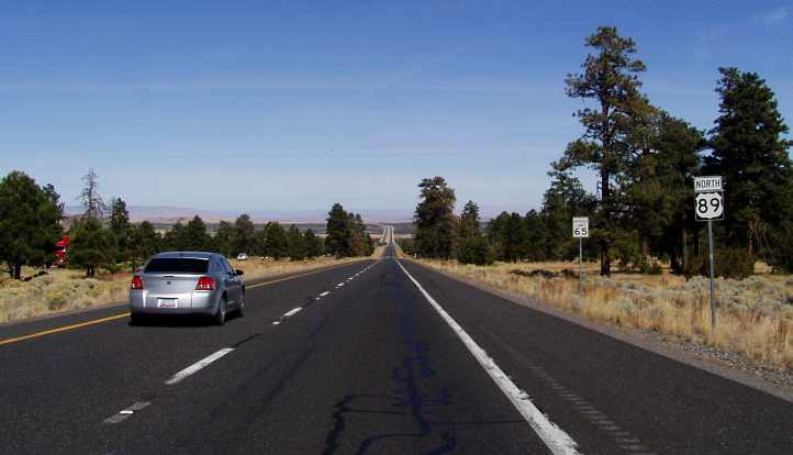
...which climbs steeply out of Flagstaff and led us to Cameron, which is a settlement of somewhat rag-tag places apparently mostly for Indians. More jewellery and art on offer, we didn't stop. Here's the map of this stretch:
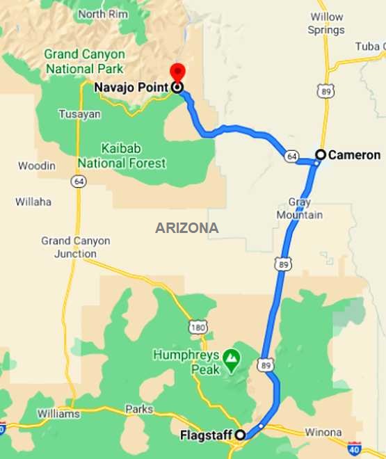
It was about 80 miles to the first vantage point at the Grand Canyon, but just out of Cameron there was a smaller canyon - or gorge - called the Little Colorado River Gorge and we stopped to look at that. This, in fact, forms what is effectively an extension of the Grand Canyon and it very plainly shows how the formative stages of such a landform are created by the weathering of the terrain.
It was in the care of the local Indians, who had an abundance of jewellery stalls all set up to make sales to tourists like... like... well, like us!
Many of the different stalls, probably all of them, had identical items for sale by the hundreds. "We make these at night by hand." we were told. I thought the appearance was more like that of an Asian sweatshop production. Janet pored over a lot of it and really would like to have bought some, but each seller stressed the 'spiritual' side of the jewellery and this turned Janet right off it all. We jumped back into the Dodge and headed for the main show...
Along the way we climbed. Lots of climbing was done that day, and as we looked back over where the Little Colorado River Gorge snaked its way across the scenery...
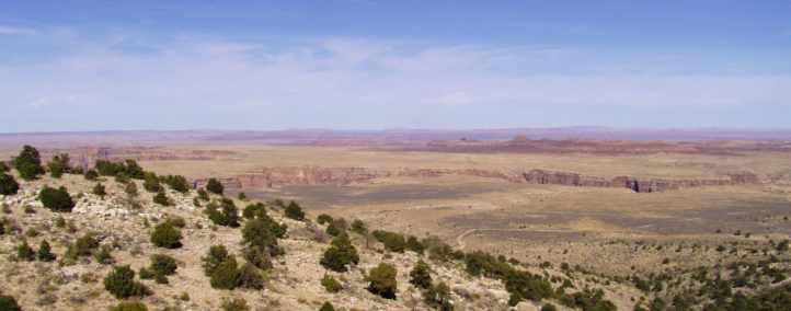
...we were intrigued to finally see the great wonder that lay ahead. We were not to be disappointed.
It was about 185 miles across the desert, again we were looking for the tourist information centre as we crossed the border but were too early!
There was a stack of trucks pulled up at this rest area when we were there at 7:45am, the early morning sun was etching out the colours towards the tops of the hills, I thought this was picturesque:
So we went on. It was a very cold morning, as predicted earlier in the week. Many signs indicated that Indian art and jewellery were major industries through this area, it was Navajo country and after a couple of hours on the road we were in Navajo County too…
Drove into Arizona, we’re in Navajo country, a lot of commercialism, jewellery, art etc. Scrubby country, a lot of humpies, trailer dwellers.
It was the coldest I have felt this morning, probably, thinking about it, comparable to the Niagara Falls at night. My face was burning when we stepped out at a tourist information place which wasn’t open.
Miles of nothing, just flat ground. Now looking out on rocky outcrops. A cave earlier had been made into a tourist attraction. More tabletop mountains can be seen at a distance and canyons seen clearly from the road.
Trains are constantly seen on the track, apparently it is the main rail line in the Southern states. In good times 100 goods trains a day go along, now about 75 according to David, the local we visited yesterday.
I thought I really had to get something from Holbrook, the town which seems to be the seat of that county, as it has the same name as a town on the Hume Highway at home.
This is the main street...
And when we saw the museum in the old 'Navajo County Courthouse'...
...we decided to have a look around. One of the attractions was the petrified wood that's a common thing in the area. We had driven past signs pointing to a petrified forest, but here there was enough on display to satisfy me... at the gate there were two of these:
Inside some were sliced up to show the colours they hide...
It was a diverse collection of things on display…
Called at the Arizona Information Centre at Holbrook. The fellow running the info centre looked a real cowboy wannabe – Texan hat and a gun in his holster.
A lot of memorabilia and a lot about petrified forests, for which this area is known.
A lot of memorabilia and a lot about petrified forests, for which this area is known.
...and this machine defies my comprehension:
We took a sample of the petrified wood (there was a 'please take one' sign over a binful of them) to give to my mother and went off to get some fuel and resume travelling. This sign at the service station caught our eyes:
Outside an apartment complex, very ordinary, a sign said $390 a month, utilities included, free internet.
Ray’s gone to take a photo of a decorated overpass bridge, very prevalent in New Mexico, but didn’t get a chance to get a good shot here.
Ray’s gone to take a photo of a decorated overpass bridge, very prevalent in New Mexico, but didn’t get a chance to get a good shot here.
More different rock formations greeted us as we drove on...
...until eventually we stopped for our morning break at a rest area which overlooked miles of nothingness... and the railway line... somewhere out there in the vast expanse of Arizona. It was just over 20 miles West of Winslow and named the Meteor Crater Rest Area There were warning signs...
...but no staff on hand. Though I can verify that the toilets worked. This RAM...
...pulled up near our Dodge and we had a bit of a chat with the couple travelling in it. They had come from Michigan, so we had something in common, but their trip was nearly over. Each winter they escape the cold of the north and go to their holiday home in Arizona to keep warm. They walked their dog, I took a photo of these rocks:
Then we left the rest area only to find a mile up the road there was a turnoff just up the road to the site of a meteorite crashing into the earth a long time ago. Some fanciful signs on the road into the site showed someone had imagination...
...but the admission charge was high and there was a lot of walking to be done to see the full extent of the depression. We opted to keep going as the Grand Canyon was our main goal on this day. The Interstate was mostly straight and the sign in this pic...
...indicates that Flagstaff is getting ever-closer.
A sign says it all, ‘Blowing Dust Area’, a dusty bowl. Doesn’t seem too bad today, it’s quite windy though. All we need now is the dust.
We have met a number of people driving South for the winter, most have a summer and winter home, leaving the summer home up North about now and not going back up till April, for the most part. Retirees, of course.
We have met a number of people driving South for the winter, most have a summer and winter home, leaving the summer home up North about now and not going back up till April, for the most part. Retirees, of course.
...which climbs steeply out of Flagstaff and led us to Cameron, which is a settlement of somewhat rag-tag places apparently mostly for Indians. More jewellery and art on offer, we didn't stop. Here's the map of this stretch:
It was about 80 miles to the first vantage point at the Grand Canyon, but just out of Cameron there was a smaller canyon - or gorge - called the Little Colorado River Gorge and we stopped to look at that. This, in fact, forms what is effectively an extension of the Grand Canyon and it very plainly shows how the formative stages of such a landform are created by the weathering of the terrain.
Turned off for Grand Canyon, 76 miles to go from Flagstaff, surprisingly enough it’s the first time I have seen solar panels in the US, a fenced area with heaps, like a farm. Also houses with them on the roof.
Conifers growing prolifically here. Finally got a picture of an ‘Elk next 15 miles’ sign…

Can see snow on mountain peaks as we climb, good road. After the climb the topography changed dramatically, trees a lot shorter and look like bushes and a large expanse of nothingness, just a few hills dotted around, looking very dry.
Red dirt everywhere, no vegetation except spindly grass. A decent-sized school in the middle of nothing and a couple of jewellery stalls set up. A settlement with similar to Housing Commission homes, probably an Indian reservation. What a place to live, a real dust bowl.
The name was Cameron, a decent enough name. Got to the Little Colorado River Gorge, lovely.
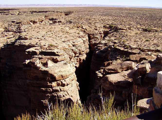
Looked at Indian pottery and jewellery in stalls there...
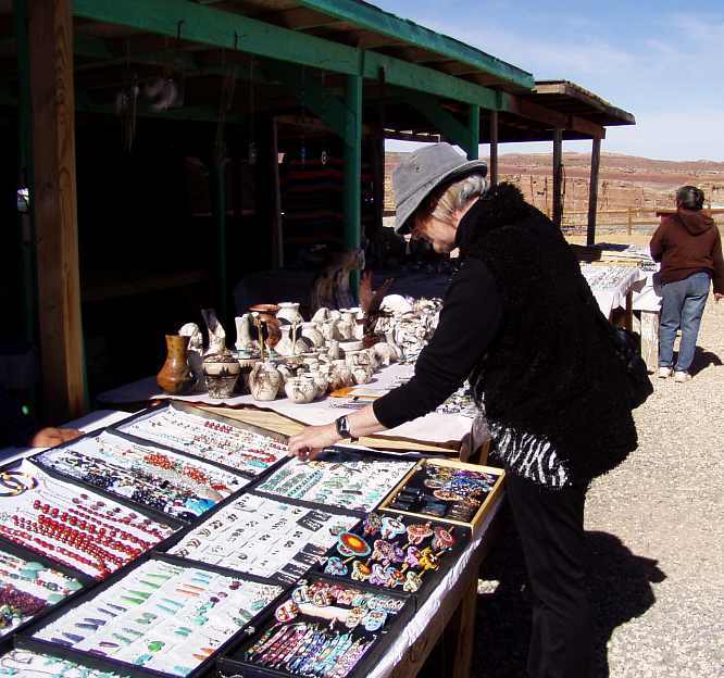
...didn’t buy anything.
Conifers growing prolifically here. Finally got a picture of an ‘Elk next 15 miles’ sign…
Can see snow on mountain peaks as we climb, good road. After the climb the topography changed dramatically, trees a lot shorter and look like bushes and a large expanse of nothingness, just a few hills dotted around, looking very dry.
Red dirt everywhere, no vegetation except spindly grass. A decent-sized school in the middle of nothing and a couple of jewellery stalls set up. A settlement with similar to Housing Commission homes, probably an Indian reservation. What a place to live, a real dust bowl.
The name was Cameron, a decent enough name. Got to the Little Colorado River Gorge, lovely.
Looked at Indian pottery and jewellery in stalls there...
...didn’t buy anything.
Many of the different stalls, probably all of them, had identical items for sale by the hundreds. "We make these at night by hand." we were told. I thought the appearance was more like that of an Asian sweatshop production. Janet pored over a lot of it and really would like to have bought some, but each seller stressed the 'spiritual' side of the jewellery and this turned Janet right off it all. We jumped back into the Dodge and headed for the main show...
Along the way we climbed. Lots of climbing was done that day, and as we looked back over where the Little Colorado River Gorge snaked its way across the scenery...
...we were intrigued to finally see the great wonder that lay ahead. We were not to be disappointed.
Last edited by Ray Bell; Jun 12, 2021 at 08:55 AM.
Thread Starter
|
Captain
Joined: Oct 2005
Posts: 571
Likes: 9
From: The Summit, Queensland, Australia
So on to the Grand Canyon...
For many years I've believed this was the only thing I really wanted to see in the USA. Certainly, it hasn't lost any impact on me, but now I know there are so many other things I can't say it's the only thing any more.
We drove up the hill from the Little Colorado River, the souvenir stalls and their preview of the canyon, ultimately coming to the parking lot of the first viewing point reached from that direction. As we arrived we noted the unfamiliarity of a couple of signs that many Australians would recognise as different to what we have at home:
We found a parking spot and walked towards the rim of the canyon. Oh, yeah, 'rim' is the word familiarly used for the edge of the precipice. Our first view of the grandeur of it all had us wanting to see more...
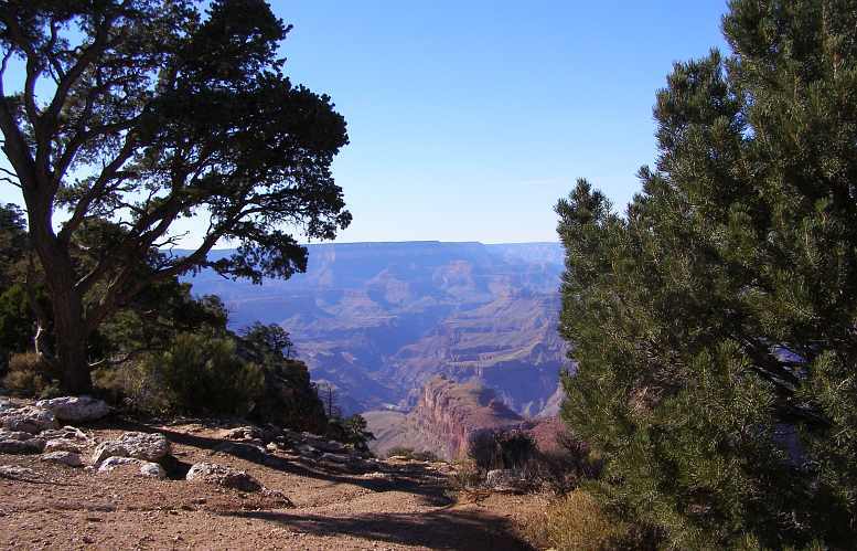
Note that I've increased the photo size a little because of the importance of the subject matter. All the same, I have to say that this is like a lot of things we saw in America - too big for any camera!
Janet was impressed, too:
We soon twigged that we had to go over towards the tower built near the rim a bit to our right, watching as we walked the great vista spreading out before us...
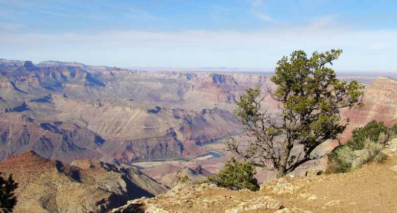
The tower looks old and weatherbeaten, but it serves its purpose well today with souvenirs, high vantage points from its upstairs levels and a central point for tourists in this part of the canyon viewing area.
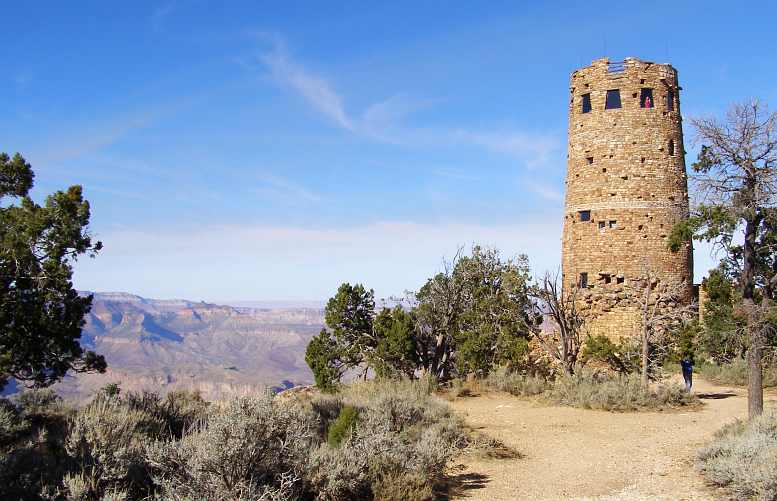
From the tower I tried to capture the soaring of some birds. Some of them were down in the canyon, some were over the rim, they flitted about effortlessly, totally at home in one of the world's great marvels:
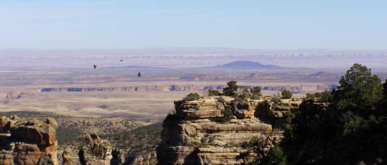
There were hundreds of others looking into this gaping hole in the earth at the same time as we were... seeing the inspiring colours, wondering how it all came about, marvelling at the enormity of it all...
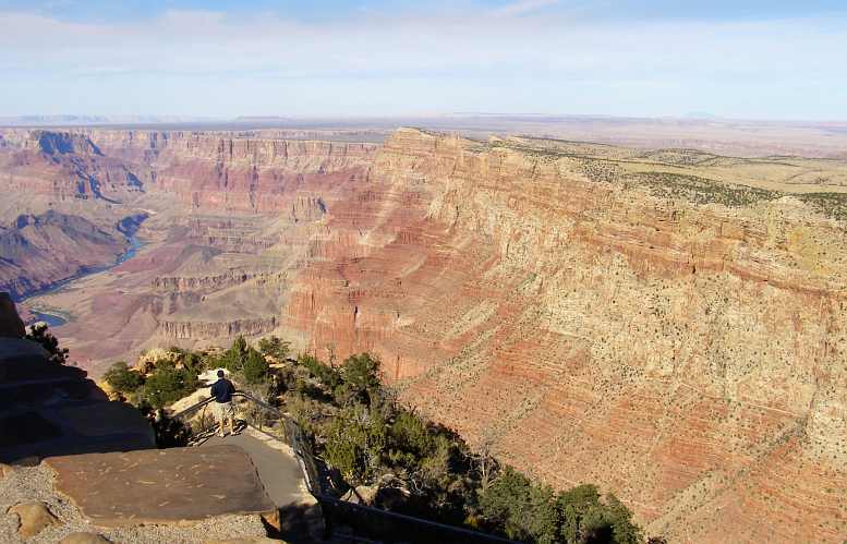
...at some points, but probably not this one, the canyon is up to a mile deep. It etches its way deep into the pores of the earth with what appears to be random selection of the paths the channels, valleys and ridges take...
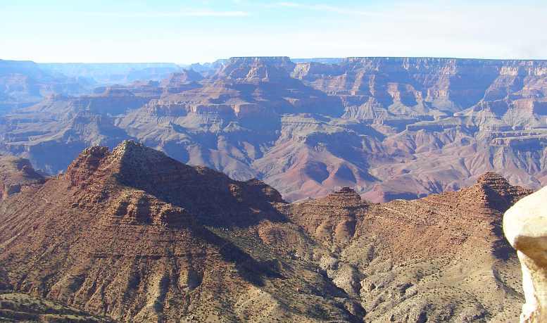
There are many places where you can see that the formation is still taking place, this section looks like it's about to break off, but it may well be a century or two before it actually decides to fall.
There's a white spot to the right of centre in this picture... the Hance Rapids... so far away that without good binoculars you have no concept whatever of how big they are...
...but you have to grasp the enormity of all that spreads out before you here. Time has formed a magnificent spectacle in this place and it's even amazing to learn that people once lived down in the canyon. This signboard tells about their lives here:
Yes, it's all a long time ago. After an hour or more looking down from the rim and visiting the tower displays, we walked off in the direction of the carpark.
We decided to have a bite to eat and while we snacked, and we discussed this wondrous place in relation to the bible passage about how one day the deserts 'will blossom like the rose'. Could the magnificence of this edifice be improved upon?
But the reality was we had barely scratched the surface thus far. The canyon is 270 miles long, where we are looking down and thinking it's perhaps several hundred feet to the bottom it is in fact something like 3000 feet. Or 4000 feet. The canyon's average depth is 4000 feet, which is over a kilometre, with a maximum depth of about a mile!
We would, by the end of the day, progress about 30 miles along its length, seeing into the distance perhaps twice that length of the canyon. Nearly a quarter of it. Only a quarter!
I tried to get a closer shot of the rapids:
...while the signs told the story...
...and all the while our movement along the rim from one vantage point to another gave different angles, different settings, different sights and different lights. Not to mention that the sun was sinking as the day was getting along. Noting here the visible display of the constant collapse of the earth that once formed a great plateau here:
Many visitors are well-versed in the moods of the canyon. It changes during the day, obviously, and different vantage points have different attitudes to those changes. Some come prepared to just sit and await the climax of these changes, the sunset:
Occasional vantage points jutting out into the canyon have been developed to provide a safe viewing point...
...though it's easy to find places where there is no safety at all on this giant rim, where one can walk right up to the unprotected edge. On our way we went to the Tusayan display but it was closing, further evidence that you need to spend more time that we'd allowed to have a look around here.
At one lookout we learned more about the 'discovery' of the Grand Canyon, too...
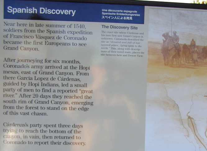
Note in particular the detail in this part about the perceived distances down the canyon:
So very easy to understand! The vastness of this place is really hard to embrace. All we could hope to do was capture some of its changing mood and let the background tell of its scope...
Note that the curvature across the horizon is there in almost every picture. This is because virtually all were taken on maximum wide angle with the horizon well above the centreline of the picture. I look at this shot and I think, "This place is just endless!"
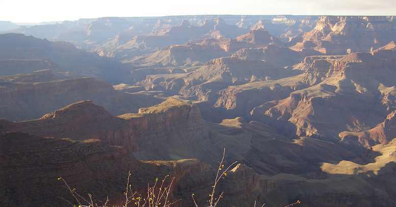
Sometimes, particularly on a pathway in to a lookout, or looking into the canyon from the roadway, there is the prospect for some 'character' framing the shot:
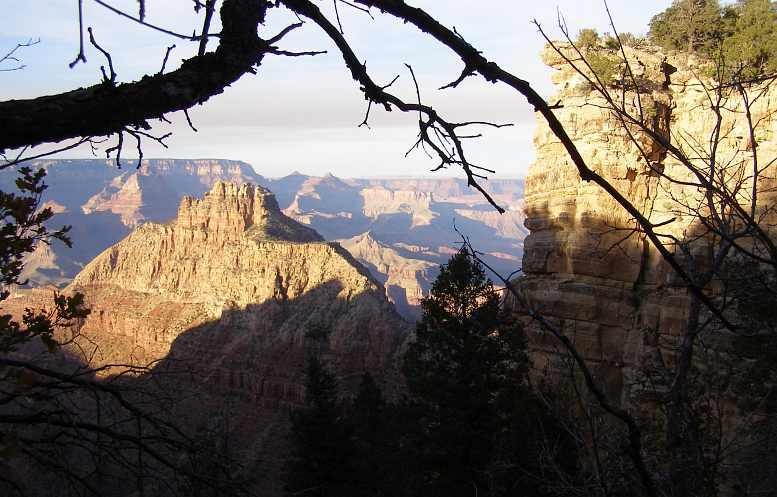
Pink Jeeps were something that captured Janet's imagination:
And all the while, as we moved along the rim, the sun was going down to cast long shadows in the canyon and light up the faces looking west:
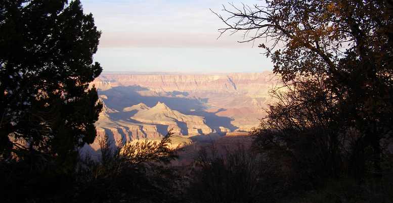
All sorts of people were sitting on what looked like precarious spots on the rim...
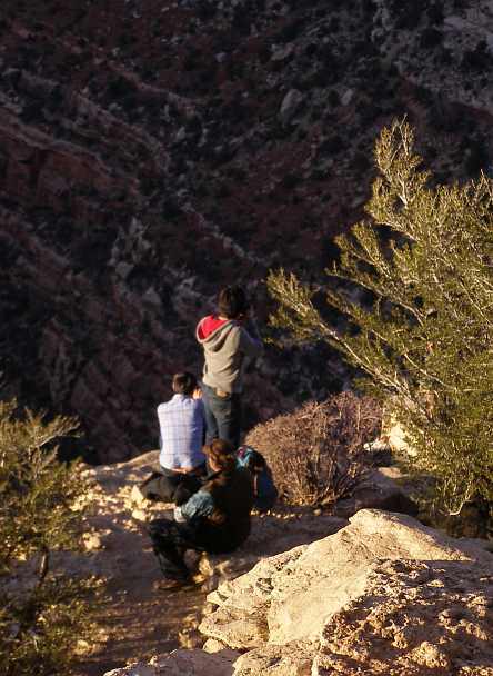
...but why wouldn't they?
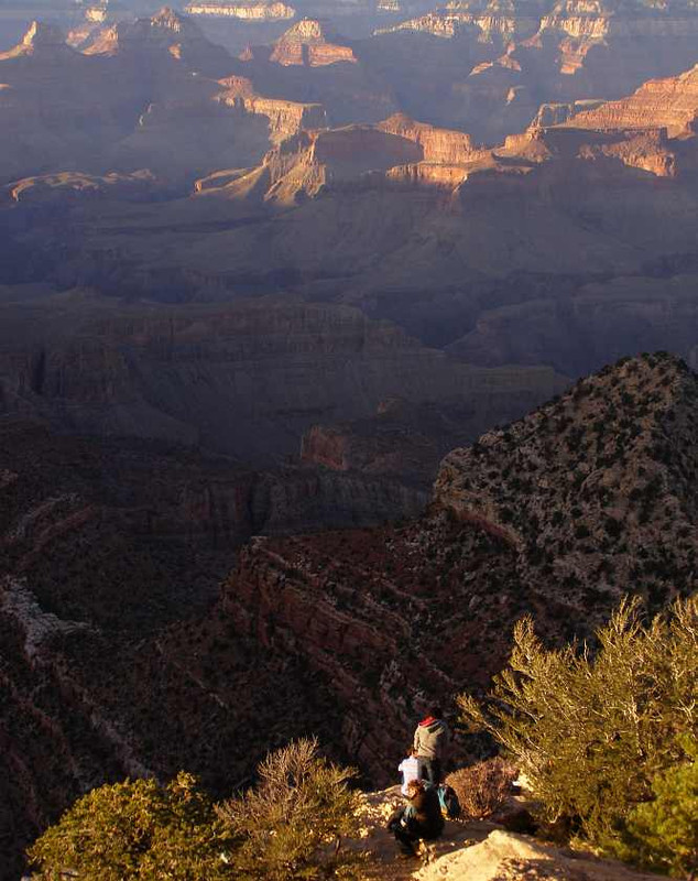
More of the recent history was set out before us:
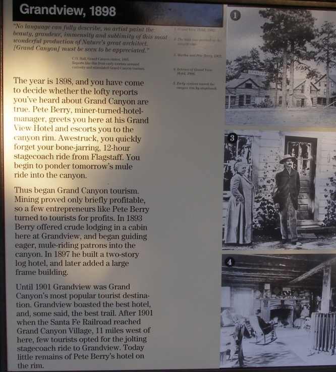
And the sun kept getting lower in the western sky:
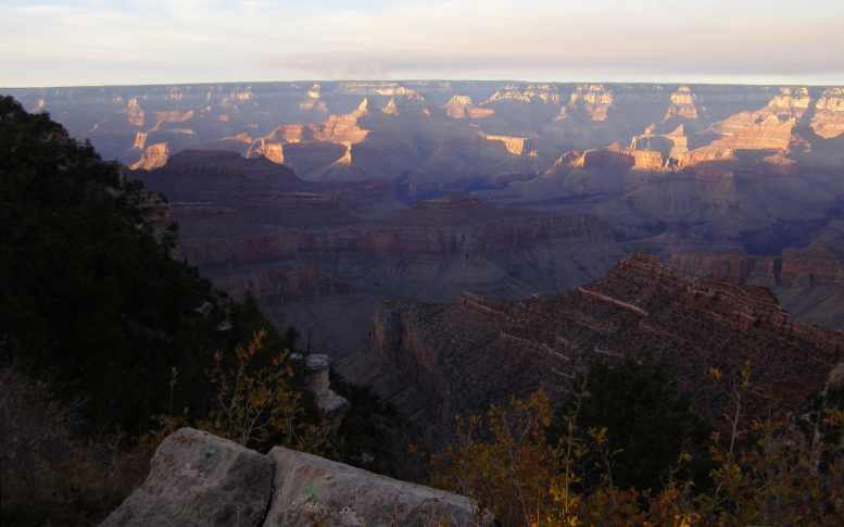
One landform that it lit up clearly was this pointed standout:
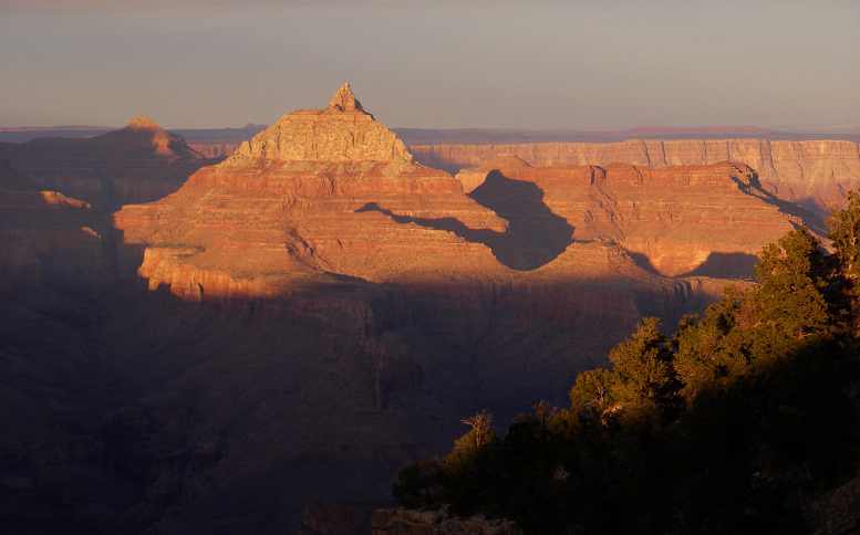
I couldn't help noticing the parts where there are signs that one day another piece is going to cave in and join the rubble down the bottom. This was right alongside the road:
Of course there has been attempts to get minerals of some value out of the canyon, this board told us about that:
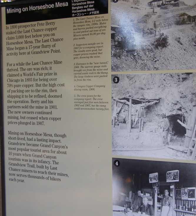
That was of little moment to this girl, it seems. She sat awaiting the changing colours with her baby rugged up against the autumn evening chill...
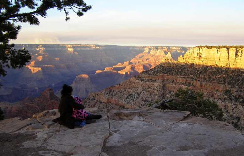
...while the picture around her changed all the while:
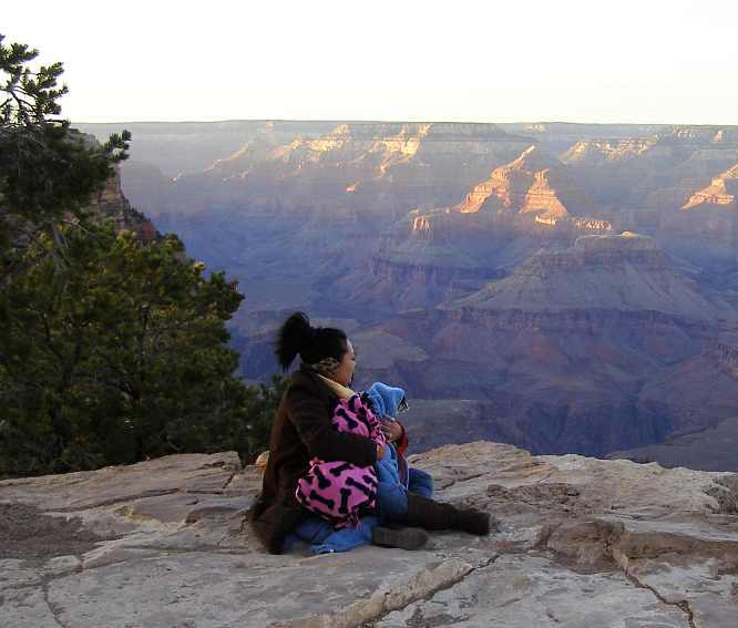
Finally we reached the main tourist area, packed with people and parked cars. Despite the onset of darkness, we were still looking to see sights, though Janet was starting to use the phrase 'I'm all canyoned out' pretty regularly...
Again I took interest in collapsing ground, or rocks, this one appearing to have toppled back into the groove eroded behind it. It waits until further erosion unseats it again, then it will tumble to the canyon floor...
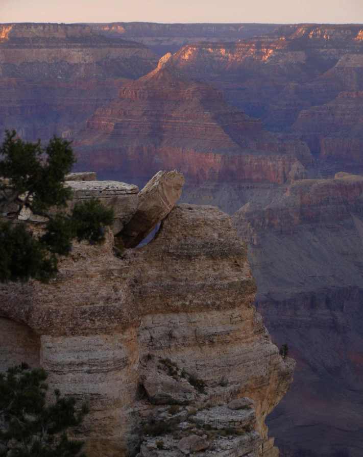
And then we went to join the crowd at Mather Point. This goes well out and is obviously a popular spot at the close of day:
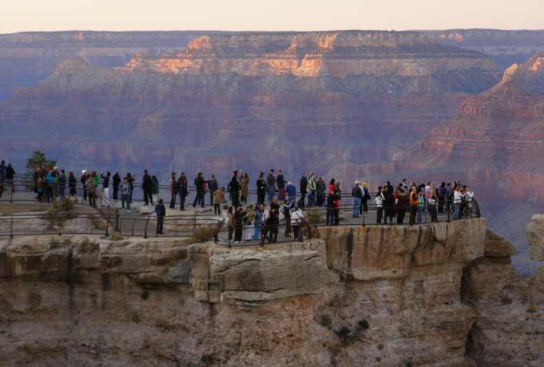
From here I noted the moon taking its place in the eastern sky...
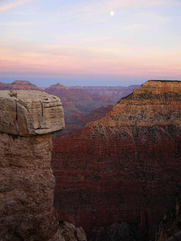
...but in the end there wasn't enough left to see and everyone turned to talk about what they'd seen, or simply turned to leave...
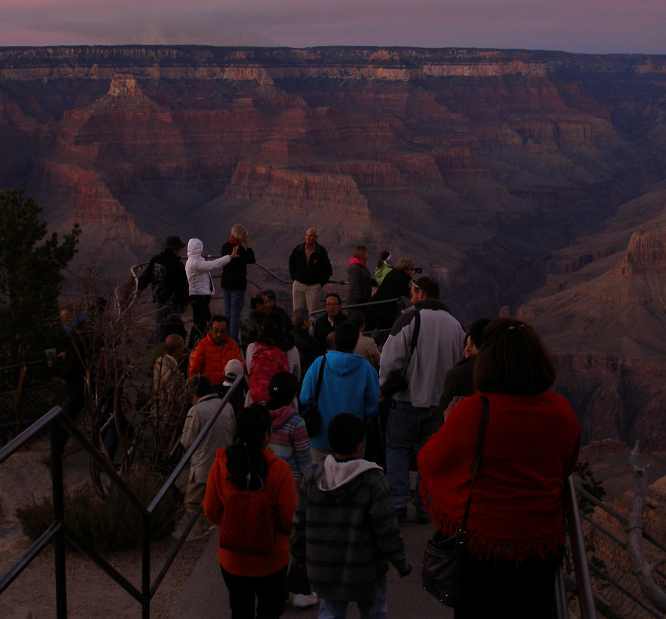
We went to the main tourist information building but they were now closed. Fortunately I was able to photograph the relief display of the canyon through the glass door:
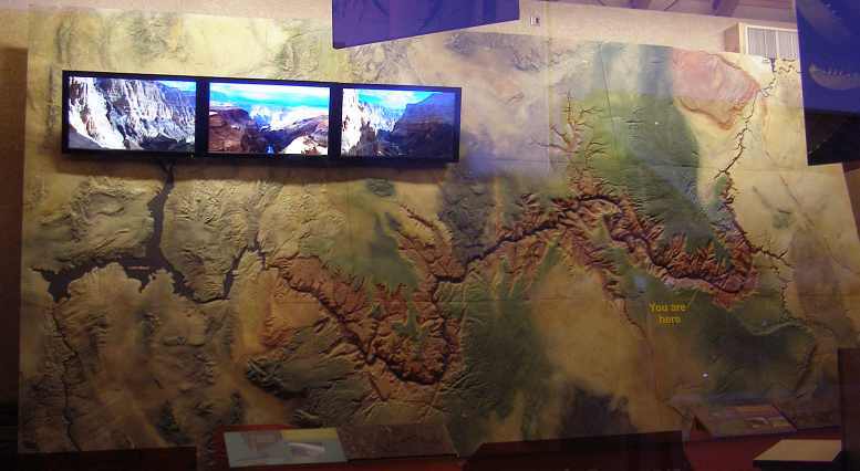
You can see from this (note the yellow marking) that we'd come such a short distance along the rim from the eastern side to this building. We didn't even see the great glass-floored outlook, it must be further westward.
What remained for us now was to leave the canyon and go to Williams to spend the night...
* Very conservatively, I'm sure!
For many years I've believed this was the only thing I really wanted to see in the USA. Certainly, it hasn't lost any impact on me, but now I know there are so many other things I can't say it's the only thing any more.
We drove up the hill from the Little Colorado River, the souvenir stalls and their preview of the canyon, ultimately coming to the parking lot of the first viewing point reached from that direction. As we arrived we noted the unfamiliarity of a couple of signs that many Australians would recognise as different to what we have at home:
We found a parking spot and walked towards the rim of the canyon. Oh, yeah, 'rim' is the word familiarly used for the edge of the precipice. Our first view of the grandeur of it all had us wanting to see more...
Note that I've increased the photo size a little because of the importance of the subject matter. All the same, I have to say that this is like a lot of things we saw in America - too big for any camera!
Janet was impressed, too:
Drove on to the Grand Canyon – breathtaking! A lot of people there, climbed a tower for a better look. Saw the Colorado River.
The tower looks old and weatherbeaten, but it serves its purpose well today with souvenirs, high vantage points from its upstairs levels and a central point for tourists in this part of the canyon viewing area.
From the tower I tried to capture the soaring of some birds. Some of them were down in the canyon, some were over the rim, they flitted about effortlessly, totally at home in one of the world's great marvels:
There were hundreds of others looking into this gaping hole in the earth at the same time as we were... seeing the inspiring colours, wondering how it all came about, marvelling at the enormity of it all...
...at some points, but probably not this one, the canyon is up to a mile deep. It etches its way deep into the pores of the earth with what appears to be random selection of the paths the channels, valleys and ridges take...
There are many places where you can see that the formation is still taking place, this section looks like it's about to break off, but it may well be a century or two before it actually decides to fall.
There's a white spot to the right of centre in this picture... the Hance Rapids... so far away that without good binoculars you have no concept whatever of how big they are...
...but you have to grasp the enormity of all that spreads out before you here. Time has formed a magnificent spectacle in this place and it's even amazing to learn that people once lived down in the canyon. This signboard tells about their lives here:
Yes, it's all a long time ago. After an hour or more looking down from the rim and visiting the tower displays, we walked off in the direction of the carpark.
Bought postcards and had lunch there. Bought my first hot-dog – okay, not fatty like I expected. Ray had toasted grilled cheese and chips.
But the reality was we had barely scratched the surface thus far. The canyon is 270 miles long, where we are looking down and thinking it's perhaps several hundred feet to the bottom it is in fact something like 3000 feet. Or 4000 feet. The canyon's average depth is 4000 feet, which is over a kilometre, with a maximum depth of about a mile!
We would, by the end of the day, progress about 30 miles along its length, seeing into the distance perhaps twice that length of the canyon. Nearly a quarter of it. Only a quarter!
I tried to get a closer shot of the rapids:
...while the signs told the story...
...and all the while our movement along the rim from one vantage point to another gave different angles, different settings, different sights and different lights. Not to mention that the sun was sinking as the day was getting along. Noting here the visible display of the constant collapse of the earth that once formed a great plateau here:
Many visitors are well-versed in the moods of the canyon. It changes during the day, obviously, and different vantage points have different attitudes to those changes. Some come prepared to just sit and await the climax of these changes, the sunset:
Occasional vantage points jutting out into the canyon have been developed to provide a safe viewing point...
...though it's easy to find places where there is no safety at all on this giant rim, where one can walk right up to the unprotected edge. On our way we went to the Tusayan display but it was closing, further evidence that you need to spend more time that we'd allowed to have a look around here.
At one lookout we learned more about the 'discovery' of the Grand Canyon, too...
Note in particular the detail in this part about the perceived distances down the canyon:
So very easy to understand! The vastness of this place is really hard to embrace. All we could hope to do was capture some of its changing mood and let the background tell of its scope...
Note that the curvature across the horizon is there in almost every picture. This is because virtually all were taken on maximum wide angle with the horizon well above the centreline of the picture. I look at this shot and I think, "This place is just endless!"
Sometimes, particularly on a pathway in to a lookout, or looking into the canyon from the roadway, there is the prospect for some 'character' framing the shot:
Pink Jeeps were something that captured Janet's imagination:
And all the while, as we moved along the rim, the sun was going down to cast long shadows in the canyon and light up the faces looking west:
All sorts of people were sitting on what looked like precarious spots on the rim...
...but why wouldn't they?
More of the recent history was set out before us:
And the sun kept getting lower in the western sky:
One landform that it lit up clearly was this pointed standout:
I couldn't help noticing the parts where there are signs that one day another piece is going to cave in and join the rubble down the bottom. This was right alongside the road:
Of course there has been attempts to get minerals of some value out of the canyon, this board told us about that:
That was of little moment to this girl, it seems. She sat awaiting the changing colours with her baby rugged up against the autumn evening chill...
...while the picture around her changed all the while:
Finally we reached the main tourist area, packed with people and parked cars. Despite the onset of darkness, we were still looking to see sights, though Janet was starting to use the phrase 'I'm all canyoned out' pretty regularly...
Again I took interest in collapsing ground, or rocks, this one appearing to have toppled back into the groove eroded behind it. It waits until further erosion unseats it again, then it will tumble to the canyon floor...
And then we went to join the crowd at Mather Point. This goes well out and is obviously a popular spot at the close of day:
From here I noted the moon taking its place in the eastern sky...
...but in the end there wasn't enough left to see and everyone turned to talk about what they'd seen, or simply turned to leave...
We went to the main tourist information building but they were now closed. Fortunately I was able to photograph the relief display of the canyon through the glass door:
You can see from this (note the yellow marking) that we'd come such a short distance along the rim from the eastern side to this building. We didn't even see the great glass-floored outlook, it must be further westward.
We’ve been looking at it from different vantage points, over a dozen of them. In a lot of the areas there’s not much in the way of safety rails.
It is the most awe-inspiring, breathtaking scene. No picture could do it justice.
So many people were there, unbelievable, at least 10,000* a day I should think. One family brought their chairs and were sitting there waiting for sunset. That was spectacular.
It is the most awe-inspiring, breathtaking scene. No picture could do it justice.
So many people were there, unbelievable, at least 10,000* a day I should think. One family brought their chairs and were sitting there waiting for sunset. That was spectacular.
* Very conservatively, I'm sure!
Last edited by Ray Bell; Oct 25, 2019 at 08:12 AM.