
Ride along with me...
#51
 10-26-2019, 06:47 PM


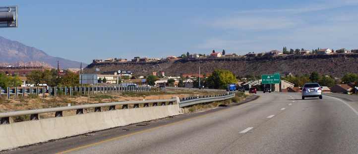
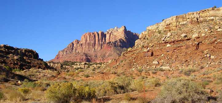
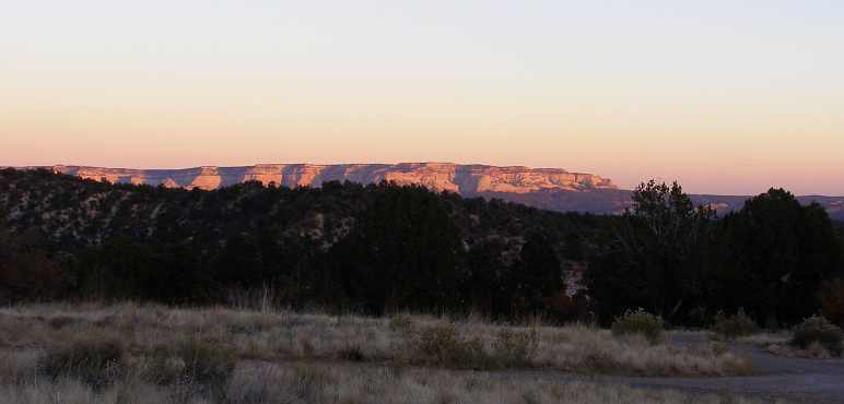
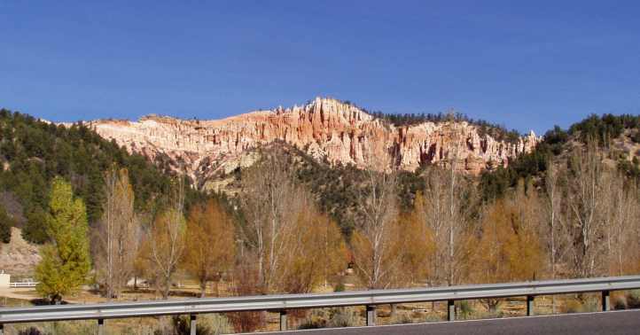
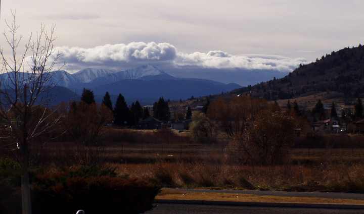
As the day warmed we saw St George through the hills...

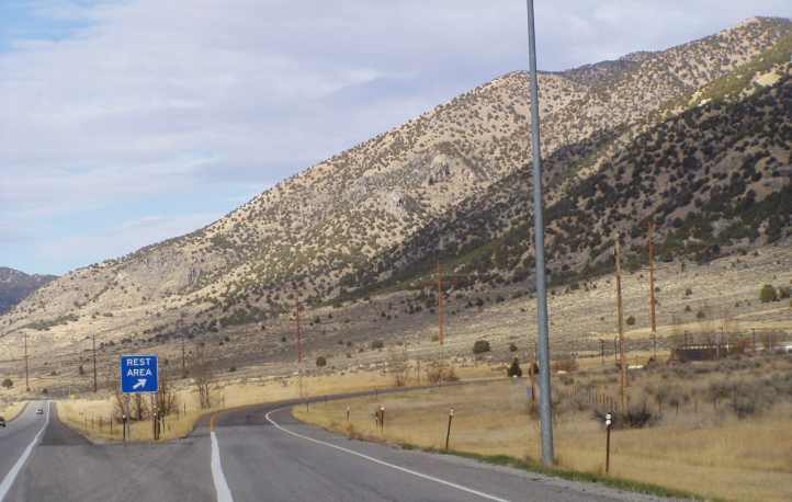
...the usual signs greeted us with all the information we needed as we descended into the town:

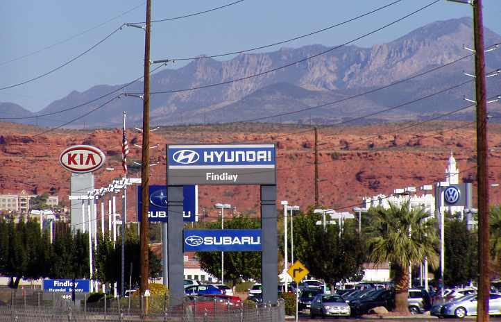
I was struck by this line-up of (imported) car dealers with the backdrop of the surrounding mountains:
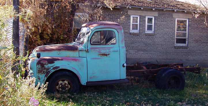
I also finally got a chance to get a shot of one of these little Chevys...

...which mimic the mid-forties Chevs in the same way that the PT Cruiser mimics some thirties and forties designs.
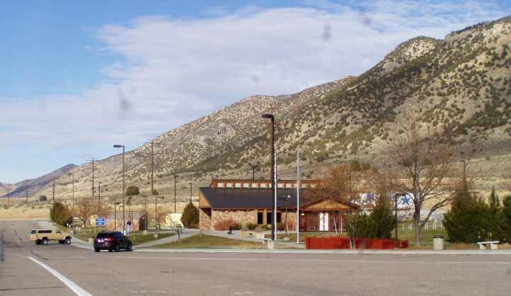
We found the information centre and had a look around. They had a lot of little exhibitions and we looked them over briefly before going out into a shaded corner of the carpark across the road and setting up for our morning coffee.
By this stage in the trip we were well-equipped for this sort of thing... we had bought a picnic set somewhere back in the early states for a mere $4 and into that we put the mugs and cutlery we got at the Goodwill Store in Virginia. We had the coffee, sugar was there from our motel rooms, we'd bought a couple of lots of creamer by this time (though there were sachets of that in the motel rooms too) and our big Thermos was doing a good job having been filled each morning from the Sunbeam 'kettle' (I think it says 'coffee maker' underneath it) so it was just a matter of putting down the truck's tailgate and picking out what we wanted to eat and drink.

(note that these pics were taken at home six months later when this stuff arrived in the truck, and that brown cord is an extension cord that was under the seat in the truck, it's actually a double adaptor as well)
As we started to move off after our refreshments we heard a buzzing noise and looked up to see this:

Janet noted:
As we drove out of town we noted the effort that has been put into placing homes in a good spot to get a view...
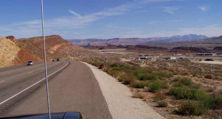
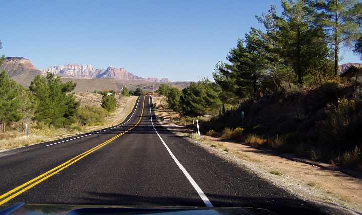
We struck out into the desert landscape headed for Hurricane en route to Zion National Park... industry was seen alongside the road...
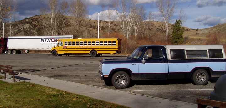
At a set of traffic lights I got a pic of one of a number of caravan and fifth-wheeler sales yards:

Janet's notes continue:
As we neared Hurricane Janet was insistent that there was something wrong with the car - again. I could hear or feel nothing unusual at that time and anyway, I was well-equipped to handle anything, wasn't I?
The tools I had to hand, mostly bought in Indy and Bloomington:

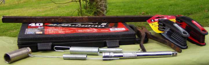
Among that stuff is the broken throttle spring and other spares, while that rusty spike at the top we still hadn't acquired... it was a part of this day's story. Anyway, we had so much of this stuff, and spare fluids, that Janet found a basket to put it all in:

Out there in the desert, about five miles before Hurricane, we saw another RV sales yard off to our left, then we came to a red light at the entry to a Walmart (yes, out there in the desert!) and a service station. As we pulled up I heard a ticking sound in the front...
Yes, having checked the right hand wheel I found it was the other wheel bearing gone, I walked across to the servo and there was a bloke there making hamburgers - I think it might have been some kind of charity thing - on the forecourt. I told him we needed to find a spare parts shop, he replied:
"Well, there's an O'Reillys about four miles down the road on the right, and if they don't have what you need there's a NAPA another mile along on the right, they will. I've got that blue '92 Olds just down there, here's the key, you can take that."
I really didn't want to impose that much, and as there'd been no wobbling as we'd had in New Mexico I concluded it might not be that bad yet. But should I chance it for the four or five miles?
I went back to the truck. By this time, incidentally, I had noticed that rusty spike in the pic above lying on the side of the road and thrown it in the back to use as a punch to remove the bearings. I fired it up and drove gently forward, we hadn't gone a hundred yards and it started to manifest the problem, so I wheeled around and drove it onto an unused part of the forecourt.
I explained to my newfound friend that I would appreciate the use of his car and I drove it into Hurricane and spent another thirty-something dollars on bearings and grease. It was a pleasant thing to drive, but it suffered badly (as he had told me) from electrical malfunctions... windows and that sort of thing.

Not only had I parked so Janet wouldn't be sitting in the sun, I'd parked so I'd be working on the shaded side. It didn't take long to dismantle and the spike did the job of punching out the old bearings... the new ones were soon fitted...
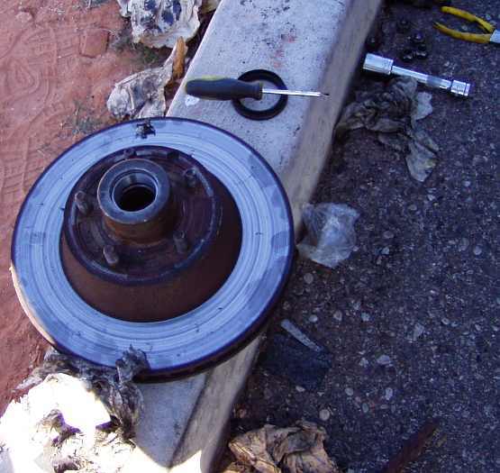
If you look closely you'll see that I've used a lot of paper towel to degrease things... I'd gone to the servo's toilet and retrieved a stack of that from the waste bins, it was very handy.

Notice here, also, that all that separates a good working surface from square miles of desert sand and sparse vegetation is that concrete gutter!
The hamburger man got a sale too, we needed lunch before this was all done... and Janet went shopping instead of waiting:
The wheel bearing had cost us about an hour and a half, which was to hamper our look at Zion National Park a little, but we were once again mobile and enjoying the drive.
...the usual signs greeted us with all the information we needed as we descended into the town:
I was struck by this line-up of (imported) car dealers with the backdrop of the surrounding mountains:
I also finally got a chance to get a shot of one of these little Chevys...
...which mimic the mid-forties Chevs in the same way that the PT Cruiser mimics some thirties and forties designs.
We found the information centre and had a look around. They had a lot of little exhibitions and we looked them over briefly before going out into a shaded corner of the carpark across the road and setting up for our morning coffee.
By this stage in the trip we were well-equipped for this sort of thing... we had bought a picnic set somewhere back in the early states for a mere $4 and into that we put the mugs and cutlery we got at the Goodwill Store in Virginia. We had the coffee, sugar was there from our motel rooms, we'd bought a couple of lots of creamer by this time (though there were sachets of that in the motel rooms too) and our big Thermos was doing a good job having been filled each morning from the Sunbeam 'kettle' (I think it says 'coffee maker' underneath it) so it was just a matter of putting down the truck's tailgate and picking out what we wanted to eat and drink.
(note that these pics were taken at home six months later when this stuff arrived in the truck, and that brown cord is an extension cord that was under the seat in the truck, it's actually a double adaptor as well)
As we started to move off after our refreshments we heard a buzzing noise and looked up to see this:
Janet noted:
We came into Utah at St George, went to the welcome centre and then had coffee. Saw person hang-gliding with a propellor. Nice not to see a casino - I don't think Utah has any - 67�F at the moment, feels warmer.
We struck out into the desert landscape headed for Hurricane en route to Zion National Park... industry was seen alongside the road...
At a set of traffic lights I got a pic of one of a number of caravan and fifth-wheeler sales yards:
Janet's notes continue:
The landscape is so unique - strange shaped mountains. People are living in their nice big houses on barren land - new subdivisions everywhere...

Dentistry seems to be a big thing, billboards with ads for wisdom teeth and porcelain whatevers.
Dentistry seems to be a big thing, billboards with ads for wisdom teeth and porcelain whatevers.
The tools I had to hand, mostly bought in Indy and Bloomington:
Among that stuff is the broken throttle spring and other spares, while that rusty spike at the top we still hadn't acquired... it was a part of this day's story. Anyway, we had so much of this stuff, and spare fluids, that Janet found a basket to put it all in:
Out there in the desert, about five miles before Hurricane, we saw another RV sales yard off to our left, then we came to a red light at the entry to a Walmart (yes, out there in the desert!) and a service station. As we pulled up I heard a ticking sound in the front...
There's a bad noise under the car again, Ray's checking it's not the same thing as before on the other side - a wheel bearing - something like it, it seems. We're not that isolated this time, still not good - poor Ray has to walk over in the heat to ask at the service station where he can pick up parts, across a busy main road.
Hoping we can get five miles down the road to a spare parts place without doing any more damage, Ray seems to think so.
A fellow offered to lend Ray his car, but we are trying to limp into town. No go! It sounds like we have done more damage so we may take him up on the offer if it still goes.
Yes, he's taking the car! I can't believe it - who would do that in Australia?
Apparently a lot of people have the mentality that it could happen to them.
I am sitting again in the car, waiting, at least it is more civilised here, even a Walmart across the road. I can't leave the truck because of not being able to lock the back. Ray at least has moved the car where it is not facing the sun, so that is a good thing.
"Well, there's an O'Reillys about four miles down the road on the right, and if they don't have what you need there's a NAPA another mile along on the right, they will. I've got that blue '92 Olds just down there, here's the key, you can take that."
I really didn't want to impose that much, and as there'd been no wobbling as we'd had in New Mexico I concluded it might not be that bad yet. But should I chance it for the four or five miles?
I went back to the truck. By this time, incidentally, I had noticed that rusty spike in the pic above lying on the side of the road and thrown it in the back to use as a punch to remove the bearings. I fired it up and drove gently forward, we hadn't gone a hundred yards and it started to manifest the problem, so I wheeled around and drove it onto an unused part of the forecourt.
I explained to my newfound friend that I would appreciate the use of his car and I drove it into Hurricane and spent another thirty-something dollars on bearings and grease. It was a pleasant thing to drive, but it suffered badly (as he had told me) from electrical malfunctions... windows and that sort of thing.
Not only had I parked so Janet wouldn't be sitting in the sun, I'd parked so I'd be working on the shaded side. It didn't take long to dismantle and the spike did the job of punching out the old bearings... the new ones were soon fitted...
If you look closely you'll see that I've used a lot of paper towel to degrease things... I'd gone to the servo's toilet and retrieved a stack of that from the waste bins, it was very handy.
Notice here, also, that all that separates a good working surface from square miles of desert sand and sparse vegetation is that concrete gutter!
The hamburger man got a sale too, we needed lunch before this was all done... and Janet went shopping instead of waiting:
Ray got back with the parts and started working on the car. After I helped a little I went off to Wallmart (sic) to buy some fruit, singlets for Ray and a pair of jeans for Merv (a friend at home). I came back and Ray was just about finished.
We got on our way...

...to Zion National Park. What magnificent majestic views, each bend took our breath away�
We got on our way...
...to Zion National Park. What magnificent majestic views, each bend took our breath away�
#52
10-27-2019, 08:39 AM
Driving towards the Zion National Park took us down a sometimes spectacular 2-lane blacktop road... with, as Janet mentions above, houses sitting everywhere in the desert and landscapes that would make you look again.

This road would take us to Rockville and then Springdale before we entered the National Park. Again, the diary says a lot:
Some homes were down on the flat country, dwarfed by the hills that shade them at times during the day...

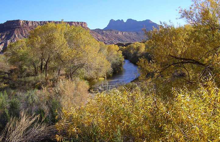
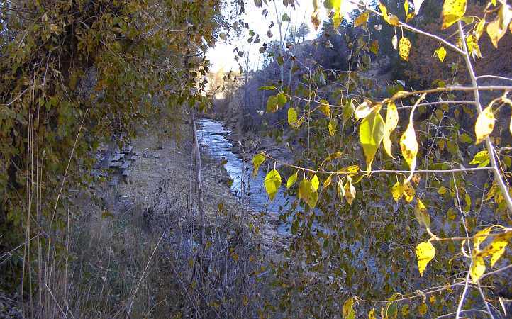
...and yes, there is some greenery out here if you look in the right places!
I tried to get a good pic of the roadside river, but this was the best I could do:
And then entering the town Janet asked me to get this picture for a friend of ours who seems to live in fear of rocks tumbling down on his (much safer) house...

Further through town I shot this monument to barreness and erosion:
And then this B & B came into sight with its own view of the time-hewn landscapes:

Another quick stop to get the pixels exposed to the raw scenery of Utah... note the house down below the road, tucked away as if it's trying to hide:

We were now very close to Zion National Park... driving up to the entrance our pass purchased back at the Grand Canyon gained us entry. Unfortunately, it was to prove rather less spectacular than it could have been because of the hour of the day.
The sun was going behind the hills, the light was starting to dim, we were paying the real price for having that wheel bearing pack it in on us near Hurricane.
This road would take us to Rockville and then Springdale before we entered the National Park. Again, the diary says a lot:
People living in houses that make the most of the view, trying to get their own piece of paradise - horselovers, even an orchard where you would think nothing would grow - rocks, rocks and more rocks - many Bed & Breakfasts. All you can say is, "Wow!"


A little village called Rockville, very aptly named. Motel, restaurants, gift and gem shops line the street.
A little village called Rockville, very aptly named. Motel, restaurants, gift and gem shops line the street.
...and yes, there is some greenery out here if you look in the right places!
I tried to get a good pic of the roadside river, but this was the best I could do:
And then entering the town Janet asked me to get this picture for a friend of ours who seems to live in fear of rocks tumbling down on his (much safer) house...
Further through town I shot this monument to barreness and erosion:
And then this B & B came into sight with its own view of the time-hewn landscapes:
Another quick stop to get the pixels exposed to the raw scenery of Utah... note the house down below the road, tucked away as if it's trying to hide:
We were now very close to Zion National Park... driving up to the entrance our pass purchased back at the Grand Canyon gained us entry. Unfortunately, it was to prove rather less spectacular than it could have been because of the hour of the day.
The sun was going behind the hills, the light was starting to dim, we were paying the real price for having that wheel bearing pack it in on us near Hurricane.
#53
10-27-2019, 08:58 AM
Despite the lateness and failing light down there in the deep valley, we had to make the most of this one chance to enjoy this park.
I walked down to the bridge over the river from a parking spot too far away at this time of the day. With some post-processing this shot of the river might be acceptable...

...and as I walked back to the car from the bridge I got this rather patchy one looking in the direction of our travel:

I caught up to the couple ahead of me in this shot. They were from Japan and were driving one of those crazy little Chevys, they were also heading to Australia a few months later.
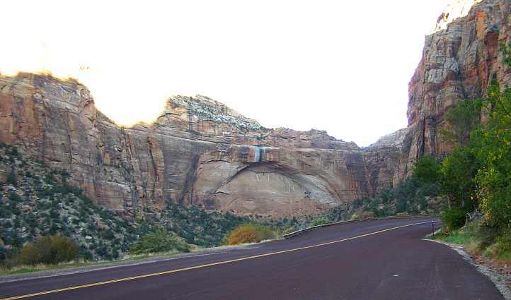
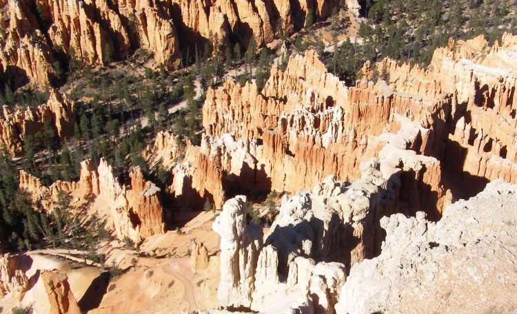
One of the really interesting things in the cliffs and walls around this valley (or canyon?) is this formation which is very much like a stone-arch bridge:
We drove up the steep climb... perhaps it's better in Janet's words, written as we drove:
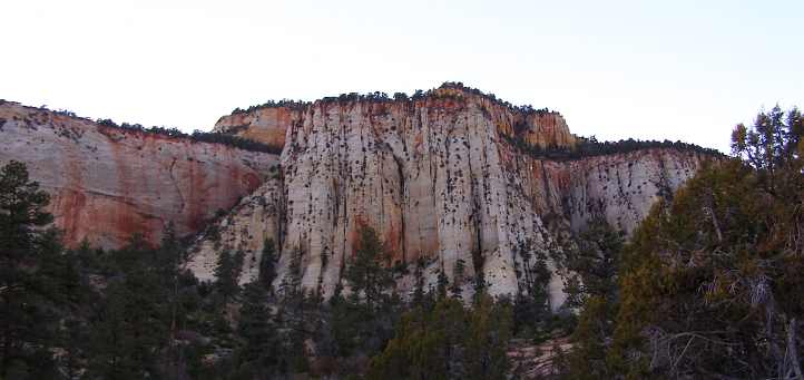
After that second tunnel we stopped and looked around briefly. It was well past ideal photo time, but some of the patterns on the rocks just begged being photographed:


There was even a small display of autumn colours, the sights we'd been enjoying daily just a couple of weeks earlier in the more eastern states...

Different shapes came at every turning:
And we were reminded at the tops of the hills that the contrast between shadow and sunlit was getting greater all the time...

Yet another arch formation...

...and from a lookout this one looks like it has a little derby on it:
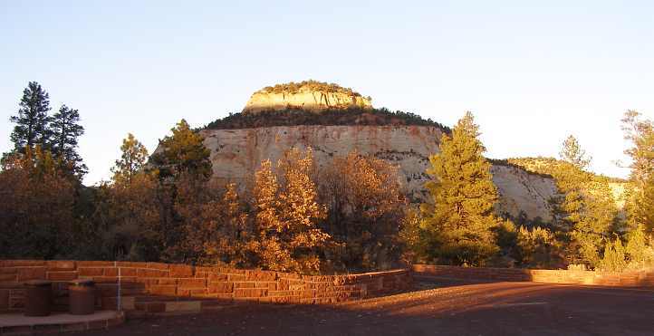
One of the highlighted features of the area is the Checkerboard Mesa:

And a little closer to see why it is so named:

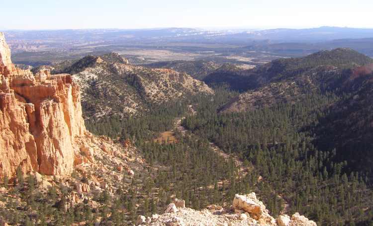
The day was way too short... we drove on through an area which seems to consist of very large ranches. Names like 'Clear Creek Ranch', 'Zion Mountain Ranch' and 'Rocky Top Ranch' show up on the online map, while our consultation of the Rand McNally map we were carrying showed that it would be practical for us to head to the next junction, Mt Carmel Junction, to seek out accommodation for the night.
We drove past a field with many bison...

...and yet another canyon that didn't photograph at all well in the failing light. But a bit of the setting sun was shining on some distant cliffs a little further along and that didn't look too bad...
Before too long we saw the approaching lights of Mt Carmel Junction and slipped into the small town between the Shell and Chevron service stations and headed for the little motel opposite.
The place was awash with gemstones and other souvenirs, After taking our needs for the night into the room I took her hand and said we were walking to the restaurant. "How far is it, I don't want to walk far!" she said, but it was actually attached to the motel.
There was a lot more gemstones and displays in there, and at the tables there were interesting things to read, historical items etc, as we awaited our meal. There was only one other table for them to serve that night so it all took place quite conveniently.
We slept in comfort in that room, in a motel that was the one most like the ones we have at home that we struck on the trip. I'd done my usual bit of parking with the rear up against a tree, even though it put the truck further from our room. There was an Oldsmobile Toronado in primer sitting outside another room, the car belonged to the owner's son and was the source of some grief if I'm not mistaken.
As we slept a frosty morning came in on Mt Carmel...

We show our National Parks pass that we bought at the Grand Canyon and go to the visitors' centre. It was closed, but we have a look at many boards of information.


It is a popular area for camping and people bring their pushbikes to ride around. It is beautiful everywhere you look...
It is a popular area for camping and people bring their pushbikes to ride around. It is beautiful everywhere you look...
...and as I walked back to the car from the bridge I got this rather patchy one looking in the direction of our travel:
I caught up to the couple ahead of me in this shot. They were from Japan and were driving one of those crazy little Chevys, they were also heading to Australia a few months later.
One of the really interesting things in the cliffs and walls around this valley (or canyon?) is this formation which is very much like a stone-arch bridge:
We drove up the steep climb... perhaps it's better in Janet's words, written as we drove:
...You drive or wind your way up the canyon, seeing caves and enormous rocks you hope don't fall down today - or ever - it's incredible how plants and trees can grow on and between the rocks.
What we thought was a cave...

...was actually part of a man-made tunnel through the rock. We drove 1.1 miles through this tunnel, incredible, and a bit scary...
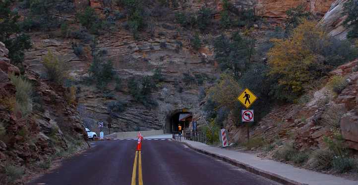
...only narrow, then another smaller one...

The road wound up the canyon for about eight miles. Driving out of the Zion National Park the scenery changes - more vegetation but still stunning rock formations.
What we thought was a cave...
...was actually part of a man-made tunnel through the rock. We drove 1.1 miles through this tunnel, incredible, and a bit scary...
...only narrow, then another smaller one...
The road wound up the canyon for about eight miles. Driving out of the Zion National Park the scenery changes - more vegetation but still stunning rock formations.
There was even a small display of autumn colours, the sights we'd been enjoying daily just a couple of weeks earlier in the more eastern states...
Different shapes came at every turning:
And we were reminded at the tops of the hills that the contrast between shadow and sunlit was getting greater all the time...
Yet another arch formation...
...and from a lookout this one looks like it has a little derby on it:
One of the highlighted features of the area is the Checkerboard Mesa:
And a little closer to see why it is so named:
The day was way too short... we drove on through an area which seems to consist of very large ranches. Names like 'Clear Creek Ranch', 'Zion Mountain Ranch' and 'Rocky Top Ranch' show up on the online map, while our consultation of the Rand McNally map we were carrying showed that it would be practical for us to head to the next junction, Mt Carmel Junction, to seek out accommodation for the night.
We drove past a field with many bison...
...and yet another canyon that didn't photograph at all well in the failing light. But a bit of the setting sun was shining on some distant cliffs a little further along and that didn't look too bad...
Before too long we saw the approaching lights of Mt Carmel Junction and slipped into the small town between the Shell and Chevron service stations and headed for the little motel opposite.
It is 5:45 and Ray has gone into a 'motel', a bit delapidated, to see how much rooms are, he must want a break from driving. We are at Mt Carmel Junction, only a small place. I think I saw a Subway so I might finally get it.
The room is $38 so what can we expect? Ray informs me he is taking me to a restaurant for tea so it must be cheap.
The room is quite decent, even has a flat screen TV and a nice gas heater, it is quite cool now. It even has a fridge and microwave - only seen at the better motels
The room is $38 so what can we expect? Ray informs me he is taking me to a restaurant for tea so it must be cheap.
The room is quite decent, even has a flat screen TV and a nice gas heater, it is quite cool now. It even has a fridge and microwave - only seen at the better motels
There was a lot more gemstones and displays in there, and at the tables there were interesting things to read, historical items etc, as we awaited our meal. There was only one other table for them to serve that night so it all took place quite conveniently.
Had tea at the restaurant attached to the motel, it was quite expensive, but nice.
As we slept a frosty morning came in on Mt Carmel...
Last edited by Ray Bell; 03-23-2020 at 11:59 AM.
#54
10-27-2019, 10:29 AM
Saturday morning, it was now November 3, 2012...
As mentioned, it was definitely a frosty morning. What Janet had recorded as looking like a less than worthy place to stay finally turned out to be good, even very good...
We went for a walk to look around Mt Carmel Junction, after all it wasn't a big place and I also wanted to get a picture of the creek running behind the motel. I tried to get a good shot of the lighting effects of the morning sun through the trees, but that didn't work. Life, meanwhile, was going on as per usual...

A truck or two rumbled through...

...the gift shop was open (we looked, I don't think we bought anything)...
...the creek rippled past the motel...

...a speed trap was ready for business...

...and the Toronado sat there continuing to disturb the motel owner.
The visit to the Bryce Canyon was one Janet was particularly keen to make. Friends of hers had told her it was more appealing than the Grand Canyon and she allowed that to overcome her feelings of being 'all canyoned out', I think she was almost excited about going there this day.
We set out along the road that led in that direction...
Through Orderville and on to Glendale, where I spotted some vehicles that I'd like to photograph. Janet noted this in her diary:
First there was a bunch of old cars in a yard, and - yes - a truck with some rust showing:
But I think the unfamiliarity of this Plymouth grabbed me, too...
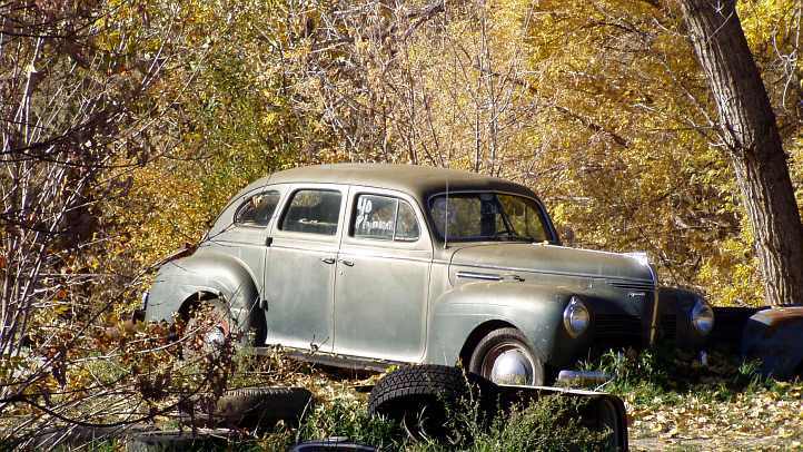
By 1940 there weren't many cars coming into Australia.
Just a little further up the road there was a garage sale sign and a paddock full of cars behind the house next door... Janet went to the garage sale while I looked around the paddock at the more interesting specimens lying there.
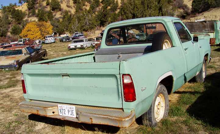
A shortbed version of the '75 model we were driving:
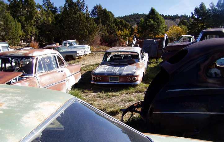
A burned Corvair flanked by a '46 Ford and an early fifties Ford 2-door:
Even a Falcon ute:


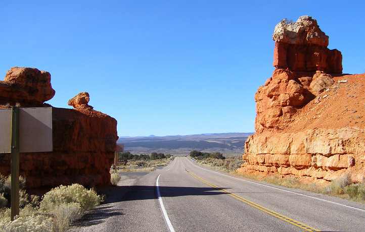
This was but a portent of the things to come... we were approaching the Red Canyon...

...with its colourful appearance, visible as we got closer...

The entry was almost dramatic... yes it was dramatic:

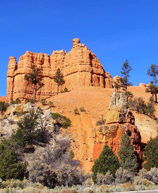
Looking back on it from inside the canyon...
...or even further in...

...we saw clearly how the upper crust was the key to the retention of the soil below as the weathering has taken place over the centuries. This shot near the entry points it up nicely:

But it's really more beneficial to just admire the grandeur of this kind of place... sights like these:


A beautiful little place. Yes, it's a small canyon, almost a nothing alongside what we'd seen before and what we were about to see, but it has a beauty of its own.
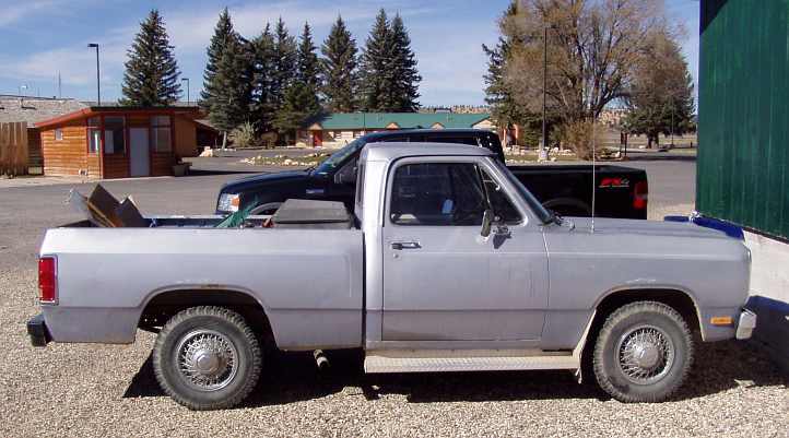
She didn't mention the two places we pulled up at on the way through looking for something to eat and didn't find anything. The Chevron fuel place wouldn't take our cards, the little shop just before the Bryce turnoff was utterly hopeless for selection and price, then the prices at Bryce City were atrociously high. We did get fuel there before doubling back down the road to the Rt 12 and Rt 63 junction where the Subway was located (opposite the Bryce Canyon Airport).
I have to say that this was the first I'd heard about her desire to get Subway in the US. It is true that I hate the brand, I really cannot walk into their shops (and I have to hold my breath if I walk past one) because of the stench of the onions. But I did take this opportunity to photograph the lady's little Dodge pickup while I waited outside:
Also the airport across the road:

It was a very late breakfast. We made ourselves a coffee to go with our food and dined in the shade of a nearby tree before we headed back up the road that led to the Bryce Canyon, a real showpiece...
As mentioned, it was definitely a frosty morning. What Janet had recorded as looking like a less than worthy place to stay finally turned out to be good, even very good...
The motel we stayed at has some unusual features - quite nice. It looks nothing from the outside but it has what looks like an antique handbasin in the bathroom and an older-type heater made to look like a wood fireplace, very effective - heater lights in the bathroom - nice added things - artwork, ornament (old ship) and big wooden vase - all nice touches.
A truck or two rumbled through...
...the gift shop was open (we looked, I don't think we bought anything)...
...the creek rippled past the motel...
...a speed trap was ready for business...
...and the Toronado sat there continuing to disturb the motel owner.
The visit to the Bryce Canyon was one Janet was particularly keen to make. Friends of hers had told her it was more appealing than the Grand Canyon and she allowed that to overcome her feelings of being 'all canyoned out', I think she was almost excited about going there this day.
We set out along the road that led in that direction...
Through Orderville and on to Glendale, where I spotted some vehicles that I'd like to photograph. Janet noted this in her diary:
Travelling towards Bryce Canyon before having breakfast - lost another hour, had to put watches forward, it's now 10:30. Rock shops galore at little villages and there must be a number of horsey people around.
We're driving through canyon-like country, rocky mountains surround us as we drive through quaint villages, selling rocks and souvenirs including much Indian wares - lovely but pricey and I'm a bit wary of the spiritistic background - 'dream catchers, sungods' are a few things mentioned.
Ray has stopped to take a photo of I don't know what, probably an old car or something in someone's yard, maybe it's the old rusty truck I've just seen.
But I think the unfamiliarity of this Plymouth grabbed me, too...
By 1940 there weren't many cars coming into Australia.
Just a little further up the road there was a garage sale sign and a paddock full of cars behind the house next door... Janet went to the garage sale while I looked around the paddock at the more interesting specimens lying there.
A shortbed version of the '75 model we were driving:
A burned Corvair flanked by a '46 Ford and an early fifties Ford 2-door:
Even a Falcon ute:
I went into a yard sale next door to a wreckers where Ray wanted to go. Bought a picture, an old one, of an American cereal ad. The lady wanted to give it to me, but I gave her $1 anyway. Ray got the business card of the wrecker.
We now started the climb - 6520 feet and climbing. Some horses in what I'd call a corral. Conifer trees all over and a flashing deer sign - it's all happening. At elevation 7424 feet stopped for petrol. Wouldn't take the card so we had to go on.
Saw alpacas (or llamas) grazing in a paddock. Houses dot the landscape taking advantage of the views - a river or creek has been winding its way around for many miles adding to the beauty.
This was but a portent of the things to come... we were approaching the Red Canyon...
...with its colourful appearance, visible as we got closer...
The entry was almost dramatic... yes it was dramatic:
Looking back on it from inside the canyon...
...or even further in...
...we saw clearly how the upper crust was the key to the retention of the soil below as the weathering has taken place over the centuries. This shot near the entry points it up nicely:
But it's really more beneficial to just admire the grandeur of this kind of place... sights like these:
A beautiful little place. Yes, it's a small canyon, almost a nothing alongside what we'd seen before and what we were about to see, but it has a beauty of its own.
The red soiled rocks were amazing making up the canyon and against the brilliant blue sky it was exquisite. A concrete bike track runs alongside the road into the canyon for miles. We see climbers climbing up the canyon wall - they have to be keen! - there are walking tracks everywhere.
Finally, this time it's for real! I got a Subway 6" ham and all salads, Ray got a ham, cheese and tomato toasted, he doesn't like Subway but there was no choice at Bryce Canyon City (not a city, but it had everything needed - gas, accommodation, food places.).
Also the airport across the road:
It was a very late breakfast. We made ourselves a coffee to go with our food and dined in the shade of a nearby tree before we headed back up the road that led to the Bryce Canyon, a real showpiece...
Last edited by Ray Bell; 06-12-2021 at 09:00 AM.
#55
10-27-2019, 06:35 PM
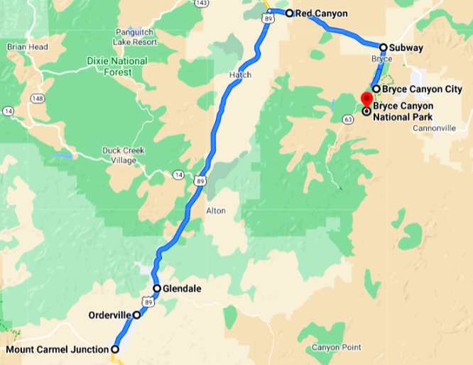
After lunch we went to Bryce Canyon, afterwards we would follow this route:
Once again, 'All Canyoned Out' or not, Bryce Canyon was a definite must see for Janet. She had heard all about it from a hairdressing client of hers and would not miss it for the world.
Once again we drove through the tourist area, past the souvenir shops and restaurants, heading next to the tourist information area a bit further along the road. Our first pic from the canyon rim is of this warning sign:

Not a surprise after seeing how loose safety arrangements were (and have to be...) at the Grand Canyon.
Sights like these:


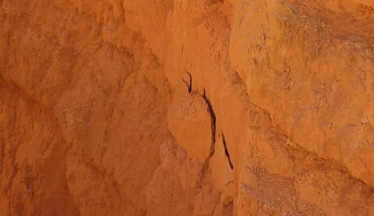
Evidence that it's still eroding:
A multitude of different angles that show the different shapes...

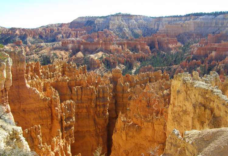
As can be seen, it's nothing like the scale of the Grand Canyon, much more contained, but loaded down with weathered rock that forms shapes and displays colours of many kinds. Down in the canyon could be seen trails where you are welcome to walk for a closer look, and to see things from different angles, some of these shots show the steep walkways to get down there too.

Here's one of those pathways:


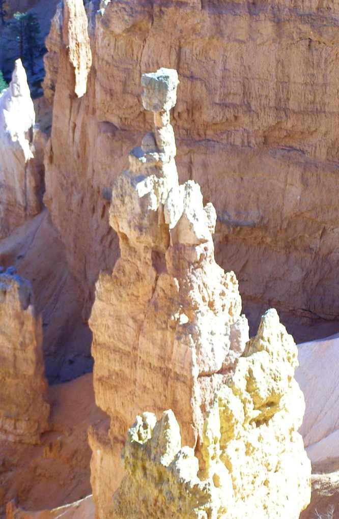
Playing a balancing act, you have to wonder when this will topple:
A good view of the steep pathways:

And looking forward to the elevated position of the next lookout:

This was one of the two or three lookouts Janet bailed on. There was a lot of walking involved, even though we drove from point to point in the Dodge. To me, I think it was worth checking them all:

It's the same canyon, the same formations inside it, but from different angles it all changes... and this was from the next lookout... known as the Grottos if I'm not mistaken:

And more of the weatherbeaten earth...

This signboard explains the Grottos and 'windows'...

This lookout was a bit of a walk away from the parking area, once again Janet didn't come along on this one...

The young man standing at this lookout had walked around all the lookouts. He wasn't aware you could drive from point to point, but he wasn't too upset about all the energy and time he'd put into it (though I recall he made some comment about shoe wear!) as it was all most memorable.
Another signboard...

One can just picture living in those conditions, to which we'd all say, "No thanks!" Maybe it was well sheltered from the winds down there in the canyon, but the rising sun would come in late and the setting sun would be elsewhere when dwellers were stoking their winter fires. Even more rigorous than some of the early settlers in Australia had it because of the extremes of temperature changes, by the time we'd finished driving to the last lookout here we were higher than any point in Australia.
Clearly seen here are some of those trails down in the canyon...
...while the majesty of the eternally different shapes stand as sentinels above:

Here's another one showing how things are still forming, the rock having collapsed and fallen into a gap in the sandstone below. Time will erode its seat and it will topple the rest of the way to the canyon floor...

Looking further afield we could see a town. I believe this was Panguitch, where we were to stop off on our way to Salt Lake City:
I snapped this sign as we were driving out of the National Park...
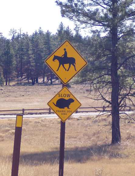
...but we saw neither prairie dogs or horse riders.
Outside that thrift shop was a Plymouth Voyager...

...we never saw this model in Australia, it seems a lot smaller than the later models, but it did have a V6 engine. Once we hit the Interstate it was clear we had to keep on rolling to get to Salt Lake City at any semblance of a good time. I did get a shot of one of these on the way...

...and we saw this on a hill:

Closer:

We were now to wonder (for a day or two...) what this was all about, as we'd see more as we headed north. I don't think these cows noticed our passing, but the photo was to record the grazing country through which we were passing:
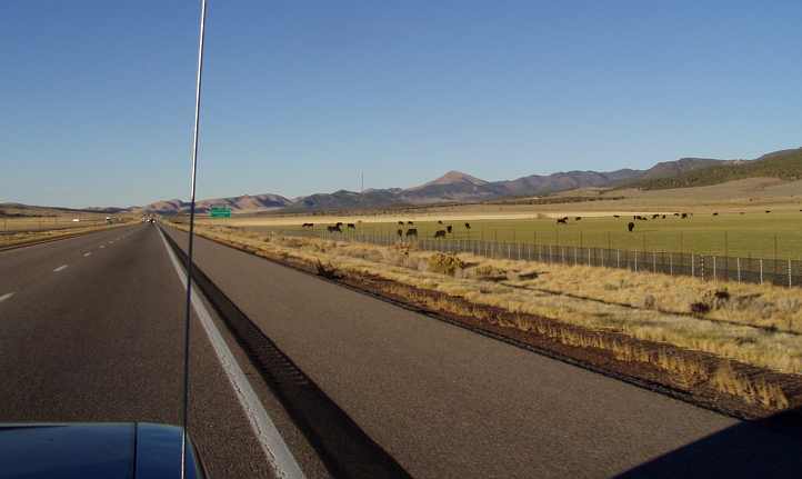
We would soon see less of it...
We got something to eat too, then looked at our position. I decided that Provo would be good enough, only 40 miles south of Salt Lake City, we could make up a bit of time in the morning.
At the Super 8 we did have a problem, though. Their machine wouldn't take a payment on my ANZ Travel Card, I got Janet to pay with her credit card, I figured I'd finally run out of the $6,000 I'd loaded onto this card, it was a good thing we had her credit card for backup.
As I looked for a parking spot I realised I had yet another problem. Apart from having to park a long way from the door, there was nowhere I could back up against a fence or tree or anything to keep the back of the truck secure. I found a spot where there was a big old pallet lying nearby and propped that up against the fence in a way that it couldn't be moved once I reversed into position... and it protected our unlockable cargo space.
Time to rest and think about tomorrow's travels into Idaho...
Once again, 'All Canyoned Out' or not, Bryce Canyon was a definite must see for Janet. She had heard all about it from a hairdressing client of hers and would not miss it for the world.
Once again we drove through the tourist area, past the souvenir shops and restaurants, heading next to the tourist information area a bit further along the road. Our first pic from the canyon rim is of this warning sign:
Not a surprise after seeing how loose safety arrangements were (and have to be...) at the Grand Canyon.
Conifers galore as we went through the checkpoint into the National Park. We went to all the lookouts - fantastic...
Evidence that it's still eroding:
A multitude of different angles that show the different shapes...
As can be seen, it's nothing like the scale of the Grand Canyon, much more contained, but loaded down with weathered rock that forms shapes and displays colours of many kinds. Down in the canyon could be seen trails where you are welcome to walk for a closer look, and to see things from different angles, some of these shots show the steep walkways to get down there too.
...you can walk right into the canyon, it looked like a lot of walking up hill so we didn't go. So many were going, though.
Here's one of those pathways:
Playing a balancing act, you have to wonder when this will topple:
A good view of the steep pathways:
And looking forward to the elevated position of the next lookout:
This was one of the two or three lookouts Janet bailed on. There was a lot of walking involved, even though we drove from point to point in the Dodge. To me, I think it was worth checking them all:
It's the same canyon, the same formations inside it, but from different angles it all changes... and this was from the next lookout... known as the Grottos if I'm not mistaken:
And more of the weatherbeaten earth...
This signboard explains the Grottos and 'windows'...
This lookout was a bit of a walk away from the parking area, once again Janet didn't come along on this one...
The young man standing at this lookout had walked around all the lookouts. He wasn't aware you could drive from point to point, but he wasn't too upset about all the energy and time he'd put into it (though I recall he made some comment about shoe wear!) as it was all most memorable.
Another signboard...
One can just picture living in those conditions, to which we'd all say, "No thanks!" Maybe it was well sheltered from the winds down there in the canyon, but the rising sun would come in late and the setting sun would be elsewhere when dwellers were stoking their winter fires. Even more rigorous than some of the early settlers in Australia had it because of the extremes of temperature changes, by the time we'd finished driving to the last lookout here we were higher than any point in Australia.
Clearly seen here are some of those trails down in the canyon...
...while the majesty of the eternally different shapes stand as sentinels above:
Here's another one showing how things are still forming, the rock having collapsed and fallen into a gap in the sandstone below. Time will erode its seat and it will topple the rest of the way to the canyon floor...
Looking further afield we could see a town. I believe this was Panguitch, where we were to stop off on our way to Salt Lake City:
I snapped this sign as we were driving out of the National Park...
...but we saw neither prairie dogs or horse riders.
It is now 3:35 and we're going back to the road that will eventually, in a roundabout way, get us to Salt Lake City. Hopefully we'll get there tonight...
We have to backtrack through Red Canyon - we have to go back through what they call tunnels, but it is really only two arches cut through rocks.
It's amazing how starkly the landscape changes when out of Red Canyon. More farmlike country now with cows grazing - even signs warning of cows on the road. We saw a thrift shop in a small town - open until 6pm Saturday! - found nothing. Ray saw some cars, old ones, he wanted a closer look at them.
Climbing again, sun in our eyes, slow going, speed limit 65mph, only doing 37mph. Summit - 7920ft, Ray taking some photos...

...Lights on top of mountain powered by solar, might be for air navigation. There was an airport at Bryce Canyon. Once again high tension power lines are there, this time going across the road - hanging way down.
We finally reach the Interstate that takes us right into Salt Lake City. It is now 5pm - 214 miles to go - that will take us about 3� - 4 hours without any stops. We will have to stop for tea, I guess.
We have to backtrack through Red Canyon - we have to go back through what they call tunnels, but it is really only two arches cut through rocks.
It's amazing how starkly the landscape changes when out of Red Canyon. More farmlike country now with cows grazing - even signs warning of cows on the road. We saw a thrift shop in a small town - open until 6pm Saturday! - found nothing. Ray saw some cars, old ones, he wanted a closer look at them.
Climbing again, sun in our eyes, slow going, speed limit 65mph, only doing 37mph. Summit - 7920ft, Ray taking some photos...
...Lights on top of mountain powered by solar, might be for air navigation. There was an airport at Bryce Canyon. Once again high tension power lines are there, this time going across the road - hanging way down.
We finally reach the Interstate that takes us right into Salt Lake City. It is now 5pm - 214 miles to go - that will take us about 3� - 4 hours without any stops. We will have to stop for tea, I guess.
...we never saw this model in Australia, it seems a lot smaller than the later models, but it did have a V6 engine. Once we hit the Interstate it was clear we had to keep on rolling to get to Salt Lake City at any semblance of a good time. I did get a shot of one of these on the way...
...and we saw this on a hill:
Closer:
We were now to wonder (for a day or two...) what this was all about, as we'd see more as we headed north. I don't think these cows noticed our passing, but the photo was to record the grazing country through which we were passing:
We would soon see less of it...
A couple of mountains to our right have snow on them, must be the highest peaks. A sign for a rest stop in 9 miles is a welcome one as Ray needs a coffee and I'd like a tea. We stop for a break and then further on there were all these dead-like trees, some still standing, others lying down.
I thought it was only in Salt Lake City that the Mormons were, but it seems they're all over Utah - the fellow who loaned Ray the car yesterday and the woman who was running the yard sale were both Mormons. He told me he went to England for 18 months for his 'ministry' back in the '80s. There are also so many Mormon churches we've seen, all but two churches - one Baptist and one Catholic - have been Mormon.
Many hay bales are seen, large ones, probably getting ready for winter feed. Eight foot ones according to Ray, row on row, stacked really high in tight bales. Now we're going past irrigated ground. The sun is setting on the mountains, they look lovely...


It is now 6:30pm, we have to get petrol - I hope they take Ray's card - Texaco and Chevron and there is only one other, it doesn't look promising. Ray is going up to the shop so the machine at the bowser hasn't taken the card. I'm wrong, it has taken it.
I thought it was only in Salt Lake City that the Mormons were, but it seems they're all over Utah - the fellow who loaned Ray the car yesterday and the woman who was running the yard sale were both Mormons. He told me he went to England for 18 months for his 'ministry' back in the '80s. There are also so many Mormon churches we've seen, all but two churches - one Baptist and one Catholic - have been Mormon.
Many hay bales are seen, large ones, probably getting ready for winter feed. Eight foot ones according to Ray, row on row, stacked really high in tight bales. Now we're going past irrigated ground. The sun is setting on the mountains, they look lovely...
It is now 6:30pm, we have to get petrol - I hope they take Ray's card - Texaco and Chevron and there is only one other, it doesn't look promising. Ray is going up to the shop so the machine at the bowser hasn't taken the card. I'm wrong, it has taken it.
At the Super 8 we did have a problem, though. Their machine wouldn't take a payment on my ANZ Travel Card, I got Janet to pay with her credit card, I figured I'd finally run out of the $6,000 I'd loaded onto this card, it was a good thing we had her credit card for backup.
As I looked for a parking spot I realised I had yet another problem. Apart from having to park a long way from the door, there was nowhere I could back up against a fence or tree or anything to keep the back of the truck secure. I found a spot where there was a big old pallet lying nearby and propped that up against the fence in a way that it couldn't be moved once I reversed into position... and it protected our unlockable cargo space.
Time to rest and think about tomorrow's travels into Idaho...
Last edited by Ray Bell; 06-12-2021 at 09:06 AM.
#56
10-28-2019, 12:53 AM
Our next goal was to get to Spokane in time to spend a day there with my contact, Jon Duncan...
Jon supplies me with various Mopar bits and pieces and gets axle shafts shortened for me. When we knew we had a problem with the carburettor before I flew over, it was Jon who located a carburettor to suit the slant 6, put it onto a truck to try it, then shipped it overnight to Indiana so we'd be sure to have it there in time to get rolling.
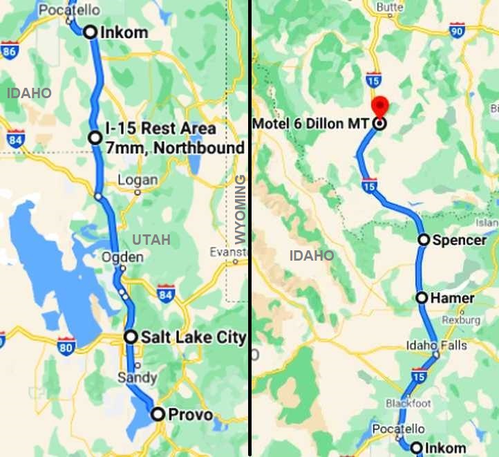
There were two logical paths to take to get to Spokane... up into Idaho and across through Boise and north from there, some of which was on highways rather than Interstates... or straight up the I15 through Idaho, into Montana, then pick up the I90 which runs west all the way to Seattle via Spokane. It seemed like the distances were very similar, but the latter course took us through Missoula.
Remembering that this was early November and snowfalls were possible, David Blair from Pennsylvania had been warning me from early in the trip-planning stages to watch out for the potential holdup we might strike if it snowed. Talking to him as we headed up this way he again warned us, but the forecasts weren't showing any snow for a few days.
Our map for the day:
We were at Provo at the start of the day, about 40 miles south of Salt Lake City... and we didn't plan to drive into Montana until Monday morning. Other forces were to come into play, however, and as you read on you'll see how the day panned out.
Looking across the motel's portico in the morning...

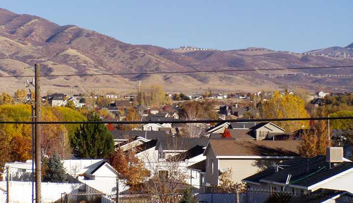
...showed up the rugged range that seems to run a short distance from the eastern shore of the Great Salt Lake. Provo itself is on the shore of the Utah Lake, which is similarly south of the Great Salt Lake. We got the Dodge fired up and drove out of there, working our way along towards Salt Lake City and taking in the morning settings... a change from the desert, small towns and canyons of the previous two days:

No cars yet in the shopping centre carpark:

We turned down towards the lake...

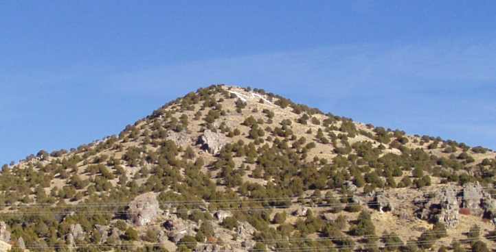
...and we saw yet more of those barren-looking mountains:

Notable was the efforts to which many residents had gone to build up on the ridges, presumably to enjoy the view:
There was some large-scale mining or quarrying going on in the area, too...

...and still plenty of shopping centres:

And more mountains:

Having had a brief look around we got underway. Janet's notes to this point were fairly short:
With the Interstate ahead and the day wasting away, I got her to snap this shot:

It shows the size of the hills to our east, but it also shows some strange looking damage to the tailgate of the Voyager. Note the equal dents both sides? It certainly aroused my curiosity. The sign also indicates that we're 322 miles into Utah
We were driving more or less alongside the lake, there was all the usual types of traffic...

...and I'm sure we were below the level of the lake as we drove along some parts here:

As we drove through these last miles of Utah, Jon Duncan gave me a call. He'd called me regularly during the trip, maybe once a week, keeping tabs on our progress.
"How's it going, Ray? Is that truck still going?" he asked.
"Yes, Jon, it's going great, we're just coming out of Salt Lake City and heading into Idaho," I replied.
"You are? That's great! Are you coming to Spokane?"
"We'll be in Spokane tomorrow night, Jon, I've set aside Tuesday to spend with you," I told him.
"Hey, Ray, that's fantastic! I really didn't think you'd make it this far, let me know when you're getting closer, won't you?"
Jon then made his arrangements for our visit. He owns a pizza shop, which his wife runs for him, while he enjoys his life keeping an eye on the new additions coming into the U-Pull wrecking yards, he has a range of items he buys, cleans up and sells on eBay. Which is how I met him.
What he was to do for us on the Tuesday really made a difference to our trip.
Around Honeyville the I15 diverges from the I84, this being the point where we headed north towards Montana rather than taking the north-westerly route.
There was nobody there to welcome us at the rest area. We set up our gear at a table in the cool afternoon breeze and used the facilities. A snack and a coffee was nice, and I noticed a truck hauling a wrecked truck in the truck parking area of the amenity:

Refreshed, we pressed on...
Another letter up on a hill:
And further evidence that we're out of desert and into productive farming country...

...more vegetation on the hills, and we're seeing (as noted) haystacks:

These were of particular interest to us as we don't have much in the way of haystacks in Australia. We don't have vast areas where snow prevents cattle getting winter feed, but here we were seeing what has to happen in a land where that certainly is the case.
I was beginning to feel very happy about travelling through this country. Productive, pretty despite the onset of the cold season, we were also imagining hillsides covered in snow in the coming months and the skiing that might take place out here.
I identified that 'quaint little village' as being on West Walker Creek Road, just south of Inkom, while the rocks were alongside the road as we went around Inkom. Not surprisingly, the map shows a town named 'Basalt' about 15 miles north.
The haystacks were getting serious as we kept on going...

...noting round bales, big squared bales and in some places some of the traditional smaller bales.
The day was coming to a close and we were experiencing that frustrating loss of light that the early autumn evening brings:

We weren't alone, but we weren't seeing as many towns as we were used to in places we'd been earlier in the trip. The headlights were coming on as the day faltered...

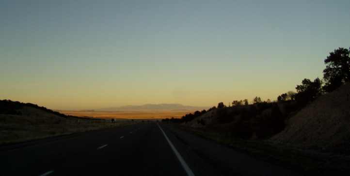
...and I was determined to capture some of the beauty of this sunset that was happening over our left shoulders!
The final attempt at capturing the beauty of this sunset resulted in this picture, it must have been somewhere near Hamer with the Lemhi Range silhouetted:

Only seeing such a grand display of colour, and as we'd seen it over about thirty miles, can give you a full appreciation of the beauty there is in the setting sun. It truly fortified us to experience this for so long, I guess it made up for what was about to overcome us.
It being dark, we started looking for somewhere to stay. Dubois and Spencer proved fruitless...
It was important for us to get a 'Welcome to Montana' photo for a friend...

As can be seen it was well dark by that time. And then she was disappointed as her name is spelled 'Montanna'!
At Lima we pulled in to a motel, there was a vacancy sign out front, I walked into the office as two others walked out. "They got the last room!" I was told. It was quite dispiriting as this was countryside I wanted to see in daylight. Dillon was over forty miles further and there was nothing in between.
At least there was a Motel 6 there, it seemed to be a thriving little place, but the motel was way around the back of the town and it took a bit of finding. It seemed new, the room was nice, we had a parking spot with 'security' and I drove back to get that McDonalds salad for Janet. I had the Swiss Cheese and Mushroom third of a pounder...
Jon supplies me with various Mopar bits and pieces and gets axle shafts shortened for me. When we knew we had a problem with the carburettor before I flew over, it was Jon who located a carburettor to suit the slant 6, put it onto a truck to try it, then shipped it overnight to Indiana so we'd be sure to have it there in time to get rolling.
There were two logical paths to take to get to Spokane... up into Idaho and across through Boise and north from there, some of which was on highways rather than Interstates... or straight up the I15 through Idaho, into Montana, then pick up the I90 which runs west all the way to Seattle via Spokane. It seemed like the distances were very similar, but the latter course took us through Missoula.
Remembering that this was early November and snowfalls were possible, David Blair from Pennsylvania had been warning me from early in the trip-planning stages to watch out for the potential holdup we might strike if it snowed. Talking to him as we headed up this way he again warned us, but the forecasts weren't showing any snow for a few days.
Our map for the day:
We were at Provo at the start of the day, about 40 miles south of Salt Lake City... and we didn't plan to drive into Montana until Monday morning. Other forces were to come into play, however, and as you read on you'll see how the day panned out.
Looking across the motel's portico in the morning...
...showed up the rugged range that seems to run a short distance from the eastern shore of the Great Salt Lake. Provo itself is on the shore of the Utah Lake, which is similarly south of the Great Salt Lake. We got the Dodge fired up and drove out of there, working our way along towards Salt Lake City and taking in the morning settings... a change from the desert, small towns and canyons of the previous two days:
No cars yet in the shopping centre carpark:
We turned down towards the lake...
...and we saw yet more of those barren-looking mountains:
Notable was the efforts to which many residents had gone to build up on the ridges, presumably to enjoy the view:
There was some large-scale mining or quarrying going on in the area, too...
...and still plenty of shopping centres:
And more mountains:
Having had a brief look around we got underway. Janet's notes to this point were fairly short:
After staying at Provo, about 40 miles south of Salt Lake City, and having a complimentary breakfast at the Super 8 Motel, we drove north to Salt Lake City. We got petrol, we only got five gallons last night as we didn't know how much was on the card, hopefully we're filling up now. I had to pay for the motel last night because they wouldn't take Ray's card, he thinks it might be empty.
It shows the size of the hills to our east, but it also shows some strange looking damage to the tailgate of the Voyager. Note the equal dents both sides? It certainly aroused my curiosity. The sign also indicates that we're 322 miles into Utah
There's a fair bit of snow on the mountains surrounding us - snow showing more, so pretty. We stopped to take a photo...

...pulled into an aerospace complex to take it, hope it's not a restricted area or that they don't think we're spying on them with the camera. 66�F according to a sign. We see more fancy concrete bridges, this time with skiers engraved on them, or carved, better word.
...pulled into an aerospace complex to take it, hope it's not a restricted area or that they don't think we're spying on them with the camera. 66�F according to a sign. We see more fancy concrete bridges, this time with skiers engraved on them, or carved, better word.
...and I'm sure we were below the level of the lake as we drove along some parts here:
As we drove through these last miles of Utah, Jon Duncan gave me a call. He'd called me regularly during the trip, maybe once a week, keeping tabs on our progress.
"How's it going, Ray? Is that truck still going?" he asked.
"Yes, Jon, it's going great, we're just coming out of Salt Lake City and heading into Idaho," I replied.
"You are? That's great! Are you coming to Spokane?"
"We'll be in Spokane tomorrow night, Jon, I've set aside Tuesday to spend with you," I told him.
"Hey, Ray, that's fantastic! I really didn't think you'd make it this far, let me know when you're getting closer, won't you?"
Jon then made his arrangements for our visit. He owns a pizza shop, which his wife runs for him, while he enjoys his life keeping an eye on the new additions coming into the U-Pull wrecking yards, he has a range of items he buys, cleans up and sells on eBay. Which is how I met him.
What he was to do for us on the Tuesday really made a difference to our trip.
Around Honeyville the I15 diverges from the I84, this being the point where we headed north towards Montana rather than taking the north-westerly route.
1:05pm and finally out of Salt Lake City and its outskirts, it must go for at least 100 miles - it's only a fairly narrow strip between lakes and mountains I suppose.
Some places like to put initials on the mountains, we can now see a big 'BR' on one...

...we think it's for Brigham City, which we've just gone past. We've seen quite a few others. Now we've come to real farming/agricultural country, the nicest we've seen for some time.
Drove across the border into Idaho, an enormous shed totally full of haybales, plus more beside it, then a sign for visitor information, Rest Area...
...very welcome, we need a cuppa. It has been 106 miles since the centre of Salt Lake City, it's now 2:05pm.
Some places like to put initials on the mountains, we can now see a big 'BR' on one...
...we think it's for Brigham City, which we've just gone past. We've seen quite a few others. Now we've come to real farming/agricultural country, the nicest we've seen for some time.
Drove across the border into Idaho, an enormous shed totally full of haybales, plus more beside it, then a sign for visitor information, Rest Area...
...very welcome, we need a cuppa. It has been 106 miles since the centre of Salt Lake City, it's now 2:05pm.
Refreshed, we pressed on...
Undulating hills, a reservoir, quite a few nice houses - old and new - make for (an appearance of) a successful farming community. Idaho is known for its potato-growing. Piles of coal beside the road, a bit further on the mine is visible close to the road. More stacks of haybales - covered in preparation for a long, cold winter - mainly cows but some horses, alpacas or llama.
Sign, 'lambs for sale'. We haven't seen much in the way of sheep over here, nothing actually.
Sign, 'lambs for sale'. We haven't seen much in the way of sheep over here, nothing actually.
And further evidence that we're out of desert and into productive farming country...
...more vegetation on the hills, and we're seeing (as noted) haystacks:
These were of particular interest to us as we don't have much in the way of haystacks in Australia. We don't have vast areas where snow prevents cattle getting winter feed, but here we were seeing what has to happen in a land where that certainly is the case.
I was beginning to feel very happy about travelling through this country. Productive, pretty despite the onset of the cold season, we were also imagining hillsides covered in snow in the coming months and the skiing that might take place out here.
Volcanic type rocks forming wall-like structures, not tall but interesting...


...and a quaint little village nestled between the hills about 50 miles into Idaho...

...probably a very popular area when it snows.
Two trains cross paths at Inkom. A colourful display of leaves changing colour - a willow tree turning bright gold. Pocatello - so much train activity - not a conspicuous town, all nestled into the trees - 51,666 population.
...and a quaint little village nestled between the hills about 50 miles into Idaho...
...probably a very popular area when it snows.
Two trains cross paths at Inkom. A colourful display of leaves changing colour - a willow tree turning bright gold. Pocatello - so much train activity - not a conspicuous town, all nestled into the trees - 51,666 population.
The haystacks were getting serious as we kept on going...
...noting round bales, big squared bales and in some places some of the traditional smaller bales.
We seem to have lost the mountains - the topography has changed dramatically, there's more irrigated land. And the first sight of a casino since Nevada.
A visitors' centre attached to a Mormon temple - I don't think so! Another casino, they're making up for lost time. We can see a wind farm in the distance and more volcanic rock each side of the road. 200 miles since Salt Lake City.
Green crops are a welcome sight after all the desert we've seen. Tilled ground, too - very busy farmers around. It looks and smells to be dairy country too. Sheep! Finally saw a big flock of them - a few black mixed in with white - first time I've seen them in the USA. It's only taken 4� weeks.
Once again we see snow-capped mountains in the distance along with a beautiful sunset at 5:10pm. The sunset behind the snow-capped mountains was glorious, unfortunately can't be captured by the camera. Ray stopped to try...
We weren't alone, but we weren't seeing as many towns as we were used to in places we'd been earlier in the trip. The headlights were coming on as the day faltered...
...and I was determined to capture some of the beauty of this sunset that was happening over our left shoulders!
The sunset is just getting more beautiful, nicest I've ever seen, we keep on stopping to get the perfect photo, only God can make something that pretty...


...we'll never get to our allocated stopping point for the night - that sounds too organised for us.
...we'll never get to our allocated stopping point for the night - that sounds too organised for us.
Only seeing such a grand display of colour, and as we'd seen it over about thirty miles, can give you a full appreciation of the beauty there is in the setting sun. It truly fortified us to experience this for so long, I guess it made up for what was about to overcome us.
It being dark, we started looking for somewhere to stay. Dubois and Spencer proved fruitless...
Went across into Montana searching for somewhere to stay - nowhere. Drove on further than we wanted to, Ray wanted to see more of Idaho in daylight but we couldn't find anywhere to stay so we went on to Dillon in Montana. Had McDonalds salad for tea.
As can be seen it was well dark by that time. And then she was disappointed as her name is spelled 'Montanna'!
At Lima we pulled in to a motel, there was a vacancy sign out front, I walked into the office as two others walked out. "They got the last room!" I was told. It was quite dispiriting as this was countryside I wanted to see in daylight. Dillon was over forty miles further and there was nothing in between.
At least there was a Motel 6 there, it seemed to be a thriving little place, but the motel was way around the back of the town and it took a bit of finding. It seemed new, the room was nice, we had a parking spot with 'security' and I drove back to get that McDonalds salad for Janet. I had the Swiss Cheese and Mushroom third of a pounder...
Last edited by Ray Bell; 02-03-2021 at 06:09 AM.
#57
10-28-2019, 07:32 AM
We awoke to a nice crisp morning in the Motel 6 at Dillon Montana. It was Monday morning, we had gone much further than I had liked in the dark on Sunday night, but we'd found that distances between towns (particularly towns with motels...) had increased since we left the desert. We looked around us and saw a great deal we couldn't see that night when we drove in.
First we saw the letters on the hills. What are they? Janet asked the people at the motel and they said they had something to do with the local schools... but I'd like to know more. Here they are, with the motel in the foreground:


A further look around, now at ground level, showed that the motel was built right next to some trailer-dwellers...

...who even had a Dodge the same model as ours. But it looked rather unused.
First port of call was to top up the fuel at the service station next to McDonalds, which had this little warning on the bowser:

With the fuel tank full, we got back onto the I15 and headed north. Around us we saw signs of the coming winter, snow on the nearby mountains but enough blue sky to give promise of a good travelling day:

There was pastureland to our east, too, with more ragged hilltops not too far away...

This start to the day gave us plenty of confidence that we'd get through the dreaded Missoula Pass and across the top part of Idaho into Washington and our appointment with Jon in Spokane. We'd even have time, we reckoned, to detour the few miles to the east required to call in at Butte, which looked by the map to be a decent-sized place where we could get a few supplies. And have a late breakfast. So our planned route for the day was so:

Janet's notes began early:
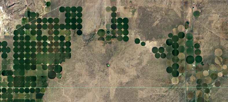
Along with the size of the haystacks, the irrigation setups had me quite interested. I'd seen them running in straight lines at home, but I had never noticed them going in circles. Subsequently I have seen them, and learned that they're called 'centre pivot' systems. What's more, checking Google Earth to find the names of places on this stretch (the I15 as it heads out of Idaho and into Montana) shows a multitude of green circles as these efficient watering devices feed the grasses and crops. These are South of Dubois:
As for haystacks...

...there's no end of them. And we went through as they were still building them.
Covering the miles we enjoyed the ever-unravelling views of this great part of the USA. Food production in full swing, I really did like to see it all at work, but Janet had a different appreciation:
Yes, those '52 (or thereabouts) De Sotos did catch my eye as we came around the ramp from the I15 to the I90. Odd numbers adorn the Interstates heading North/South, even numbers are on the East/West Interstates.
As I walked back to the car from looking at the De Sotos I caught yet another UPS rig going by, this one with the triple-trailer configuration:

And then we went into the service centre which included the McDonalds for which we'd seen that sign. We were still a few miles from Butte.
It was still very much election season and the proliferation of signs in some places was just as great as it was in other parts of the country. But this one really made me wonder:

Clerk and Recorder? Back home you'd apply for that job, go for an interview and show your qualifications. How can that sort of position possibly justify being part of the election craziness?
As mentioned, I bought some oil for the truck after we drove through the spread out environs of Butte...


The second pic was taken near the tourist information office, showing more snow-capped peaks in the distance while there is signs of mining in the foreground. This shot concentrates more on the aesthetic grandeur of the mountains at this time of year:
After visiting K-Mart and a few other places we strapped ourselves back into the Dodge and took the I90 to head west towards Spokane... not too far along the road...
Surprisingly, she left out the fact that we stopped at a rest area prior to this and had a chat with the driver of one of those yellow school buses...
...he was delivering it across three states as I recall. We'd been interested in these from the beginning, especially seeing the huge amount of overhang they have at the back of them. This rest area wasn't as well-equipped as many we'd seen, but we managed to comfortably have our (late) morning coffee and use the facilities.
As we headed further Montana continued to throw beauty at us.
First we saw the letters on the hills. What are they? Janet asked the people at the motel and they said they had something to do with the local schools... but I'd like to know more. Here they are, with the motel in the foreground:
A further look around, now at ground level, showed that the motel was built right next to some trailer-dwellers...
...who even had a Dodge the same model as ours. But it looked rather unused.
First port of call was to top up the fuel at the service station next to McDonalds, which had this little warning on the bowser:
With the fuel tank full, we got back onto the I15 and headed north. Around us we saw signs of the coming winter, snow on the nearby mountains but enough blue sky to give promise of a good travelling day:
There was pastureland to our east, too, with more ragged hilltops not too far away...
This start to the day gave us plenty of confidence that we'd get through the dreaded Missoula Pass and across the top part of Idaho into Washington and our appointment with Jon in Spokane. We'd even have time, we reckoned, to detour the few miles to the east required to call in at Butte, which looked by the map to be a decent-sized place where we could get a few supplies. And have a late breakfast. So our planned route for the day was so:
Janet's notes began early:
After a good night's sleep we went and got petrol from a Safeway Station near a Safeway supermarket - like Woolworths at home. We won't have breakfast yet at this McDonalds, but wait for another 65 miles at Butte.
There is a B and a W marked on the hills at Dillon, I asked the motel receptionist about them - 'B' for Beaverhead school and 'W' for Weston University.
There's much more snow visible - I got out to take a photo while Ray topped up the oil and water - it's absolutely freezing, a cold wind building up too. Montana is similar in terrain to Idaho at first observation - farming, cows grazing and haybales prevalent. They are experiencing a very dry spell according to Google. Irrigation machinery is everywhere.
We're getting closer to the snow-covered mountains, it makes you feel cold. Volcanic activity seems evident on the mountains. Typical pretty farm scene - farm house, tractor, cows, haybales, river and the train track is with us again. Horses out in the cold without coats on at 9am - they must be built of tougher stuff than ours at home.
The place we've just passed is Melrose, Ray stopped to take a photo of irrigation watering system which stays stationary one end while the other goes in a circular motion, like a geometry compass. There are big black clouds in front of us as we start our climb.
As for haystacks...
...there's no end of them. And we went through as they were still building them.
Covering the miles we enjoyed the ever-unravelling views of this great part of the USA. Food production in full swing, I really did like to see it all at work, but Janet had a different appreciation:
There looks to be really good snow-skiing country here - treeless hills and mountains for beginners and advanced skiers. We saw our first beehives, too.
There was a twin drive-in theatre beside the highway not far before the junction where we turned towards Butte...

... We're going there for breakfast, a McDonalds sign, promising for breakfast - we've been having a muesli-type thing and orange juice from them which is quite nice.
Ray has stopped to take photos of old cars in a yard...

...a lot of that goes on, much to Ray's delight. Waiting, waiting... I have learned patience on this trip. A lot of cars are passing going into Butte, it is 9:40am.
There was a twin drive-in theatre beside the highway not far before the junction where we turned towards Butte...
... We're going there for breakfast, a McDonalds sign, promising for breakfast - we've been having a muesli-type thing and orange juice from them which is quite nice.
Ray has stopped to take photos of old cars in a yard...
...a lot of that goes on, much to Ray's delight. Waiting, waiting... I have learned patience on this trip. A lot of cars are passing going into Butte, it is 9:40am.
As I walked back to the car from looking at the De Sotos I caught yet another UPS rig going by, this one with the triple-trailer configuration:
And then we went into the service centre which included the McDonalds for which we'd seen that sign. We were still a few miles from Butte.
The breakfast is more of a porridge with fruit filling, it's cheap, $6.50 for both of us with juice. A couple of small casinos on either side of the road, one next to McDonalds is a good welcome to Butte, a couple of miles down the road.
[In Butte] I went to a Goodwill store and bought a few things. Ray needed to buy oil for the car. It has come up very windy.
[In Butte] I went to a Goodwill store and bought a few things. Ray needed to buy oil for the car. It has come up very windy.
Clerk and Recorder? Back home you'd apply for that job, go for an interview and show your qualifications. How can that sort of position possibly justify being part of the election craziness?
As mentioned, I bought some oil for the truck after we drove through the spread out environs of Butte...
The second pic was taken near the tourist information office, showing more snow-capped peaks in the distance while there is signs of mining in the foreground. This shot concentrates more on the aesthetic grandeur of the mountains at this time of year:
After visiting K-Mart and a few other places we strapped ourselves back into the Dodge and took the I90 to head west towards Spokane... not too far along the road...
The country looks very dry, but ducks have found a dam to be on. A levy beside the road indicates a dam behind it and now we see glimpses of a large body of water, it must be a good place for fishing - we see a couple of people with fishing rods. Missoula - 97 miles to go.
A huge flock of ducks are disturbed when Ray stops to take yet another photo of the irrigation system...
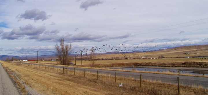
...they fly so high and so far for so long, not something I'm familiar with.
We seem to be leaving the snow-capped mountains behind and in their place are undulating hills and a few really good ski mountains again. Not many trees on them near a place called Deer Lodge.
Fences built around piles of haybales is a new concept in the middle of fields. And another sighting of sheep near Drummond.
There's a large storage shed complex near the road, they seem very popular in America - there's a TV program here where the contents of unclaimed sheds get auctioned off. The people buying it are given only a tertiary (sic) glance at the contents and take pot luck that it will be worth what they bid - the winners are the ones who make the most money on resale of the items.
We just drove over a bridge with rapids underneath, where, according to the previous advertising sign they canoe down. For a state that's going through a dry spell, we've seen more dams, rivers, creeks and lakes today than for a long time.
Now going through gorge-like country, but between us and the mountains are rapids. Quite dramatic, Ray's stopped (at my urging) to take a couple of photos...

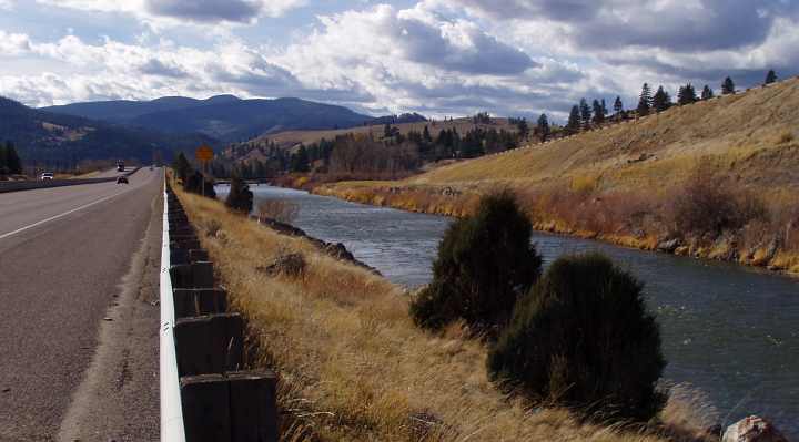
There's a train going in the opposite direction beside the road, it's a good half-mile long...
A huge flock of ducks are disturbed when Ray stops to take yet another photo of the irrigation system...
...they fly so high and so far for so long, not something I'm familiar with.
We seem to be leaving the snow-capped mountains behind and in their place are undulating hills and a few really good ski mountains again. Not many trees on them near a place called Deer Lodge.
Fences built around piles of haybales is a new concept in the middle of fields. And another sighting of sheep near Drummond.
There's a large storage shed complex near the road, they seem very popular in America - there's a TV program here where the contents of unclaimed sheds get auctioned off. The people buying it are given only a tertiary (sic) glance at the contents and take pot luck that it will be worth what they bid - the winners are the ones who make the most money on resale of the items.
We just drove over a bridge with rapids underneath, where, according to the previous advertising sign they canoe down. For a state that's going through a dry spell, we've seen more dams, rivers, creeks and lakes today than for a long time.
Now going through gorge-like country, but between us and the mountains are rapids. Quite dramatic, Ray's stopped (at my urging) to take a couple of photos...
There's a train going in the opposite direction beside the road, it's a good half-mile long...
...he was delivering it across three states as I recall. We'd been interested in these from the beginning, especially seeing the huge amount of overhang they have at the back of them. This rest area wasn't as well-equipped as many we'd seen, but we managed to comfortably have our (late) morning coffee and use the facilities.
As we headed further Montana continued to throw beauty at us.
Last edited by Ray Bell; 02-03-2021 at 06:17 AM.
#58
10-28-2019, 08:16 AM
Into the Tuesday afternoon, the Interstate carved its way through this beautiful country...
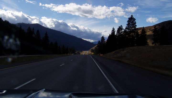
...in such a way that it was sheer pleasure driving through the area. Janet's notes tell more:
For a long time we'd been following Clark Fork, a river that winds its way westwards. We'd cross Clark Fork here and there, but when Janet pointed out this old bridge...

...I just had to stop and get a shot.
The railway bridge has its triangulated structure quite tall, so the road bridge actually goes inside it as they converge on the western end. Quite a sight. Not that the modern replacement for the road bridge is lacking in spectacle...
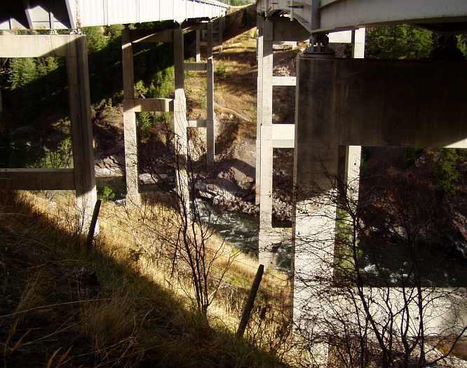
...and ever westward the road beckoned us:

This was a delightful little moment in the day, too. I went by a garbage bin and noticed there was a little fellow sitting there...

I imagine it's a chipmunk, one of which totally eluded me back in New York when I tried to get a picture of it. They are so quick to get away! And this one ran away too, our attempts to see where he'd gone were totally in vain.
There was some information there about the building of the original road through this country...
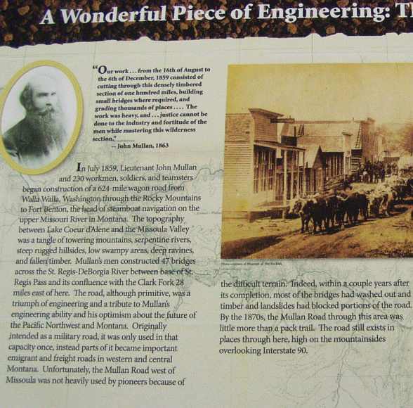
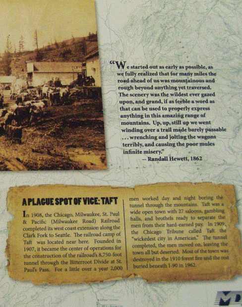
Thankfully we didn't have to endure the rigors the roadbuilders had to put up with! But we did have a need to keep on moving.This was one part of our trip which we�d been warned about by David Blair. Like Jon, I was in regular contact with him throughout and he kept telling me that the mountains we had to cross at Missoula might stop us if there�d been snow.
We got into the Super 8 motel and unloaded all of our bags into the room after booking in. As we'd be there for two nights it was an opportunity to repack things for convenience over the coming few days, but apart from that it left the back of the truck clear for my pursuit of bits and pieces with Jon at the wrecking yards the next day.
We decided to have dinner at the Dennys next to the motel...
This was one really important part of the trip for me. It was also one that had at times promised to be hard to keep due to the distances and the time it would take to get to Spokane. But we made it and I happily showed Jon the truck before he and Gina went home after dinner. As usual, it was reversed up against something for security purposes, in this case the wall of the motel.
...in such a way that it was sheer pleasure driving through the area. Janet's notes tell more:
What lovely country - farms, rivers, lush mountains. Near Bearmouth, 1:15pm - campground and a tiny waterfall, just adds to the beauty.
Lots of letterboxes together on the side of the road, many people must live up in the mountains because we only saw a couple of houses. Signs of quite a bit of logging being done here in the past to our right, not that many trees on the mountains (conifers) but to the left the mountains are totally covered with them.
A 'hunting and fishing' sign - it really looks like that kind of country -'Grizzly Adams' country!
What a junkyard! Now we see such a mess around what could, at one time, have been a nice home. Clinton, a little village nestled between the mountains, some trailer-dwellers. First signs of graffiti on the train carriages standing motionless on the track, and on a concrete wall next to the track. Yet another village nestled amongst conifers and mountains. Another willow tree, brilliant yellow.
Ray's stopped to take a photo of an old bridge at [East] Missoula�
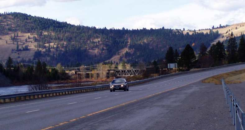
...I think we've finally reached there - 202 miles still to go to our destination for today, Spokane, where Ray has a fellow to meet up with. They're going to a few wreckers together, what a dream for Ray.
Freightown - so many people living among the forest - I can understand how they could get caught up with bad bushfires. We're starting to climb. Alberton, saw cows with the longest horns, they looked abnormal. It is coming over very overcast as we continue to climb, there's evidence of a bushfire happening, dead burnt-looking trees on the mountain coming down to the road.
Ray has stopped to take a photo of a car bridge going under a train bridge visible from the road (Interstate) after Alberton, 66 miles from the border.
Lots of letterboxes together on the side of the road, many people must live up in the mountains because we only saw a couple of houses. Signs of quite a bit of logging being done here in the past to our right, not that many trees on the mountains (conifers) but to the left the mountains are totally covered with them.
A 'hunting and fishing' sign - it really looks like that kind of country -'Grizzly Adams' country!
What a junkyard! Now we see such a mess around what could, at one time, have been a nice home. Clinton, a little village nestled between the mountains, some trailer-dwellers. First signs of graffiti on the train carriages standing motionless on the track, and on a concrete wall next to the track. Yet another village nestled amongst conifers and mountains. Another willow tree, brilliant yellow.
Ray's stopped to take a photo of an old bridge at [East] Missoula�
...I think we've finally reached there - 202 miles still to go to our destination for today, Spokane, where Ray has a fellow to meet up with. They're going to a few wreckers together, what a dream for Ray.
Freightown - so many people living among the forest - I can understand how they could get caught up with bad bushfires. We're starting to climb. Alberton, saw cows with the longest horns, they looked abnormal. It is coming over very overcast as we continue to climb, there's evidence of a bushfire happening, dead burnt-looking trees on the mountain coming down to the road.
Ray has stopped to take a photo of a car bridge going under a train bridge visible from the road (Interstate) after Alberton, 66 miles from the border.
...I just had to stop and get a shot.
The railway bridge has its triangulated structure quite tall, so the road bridge actually goes inside it as they converge on the western end. Quite a sight. Not that the modern replacement for the road bridge is lacking in spectacle...
...and ever westward the road beckoned us:
The wind has dropped, which is good. Conifers are everywhere you look. We've been running alongside Clark Fork nearly all day with its rapids and calm waters. Experiencing winding roads through the valley, surrounded by tall conifer-covered mountains, how puny are we?
We stopped for roadworks in the front of a queue - mainly women on the team, driving equipment, holding the stop/slow sign etc. It looks like it's been raining here, not much, a little bit of moisture on the road.
Stopped for a coffee at a rest area...
We stopped for roadworks in the front of a queue - mainly women on the team, driving equipment, holding the stop/slow sign etc. It looks like it's been raining here, not much, a little bit of moisture on the road.
Stopped for a coffee at a rest area...
I imagine it's a chipmunk, one of which totally eluded me back in New York when I tried to get a picture of it. They are so quick to get away! And this one ran away too, our attempts to see where he'd gone were totally in vain.
There was some information there about the building of the original road through this country...
Thankfully we didn't have to endure the rigors the roadbuilders had to put up with! But we did have a need to keep on moving.This was one part of our trip which we�d been warned about by David Blair. Like Jon, I was in regular contact with him throughout and he kept telling me that the mountains we had to cross at Missoula might stop us if there�d been snow.
We are now in a 'chain area,' we'd need to have chains on the car to continue, I guess, if it snowed. No snow at the moment but we are climbing - 'Steep Grades Next 5 Miles' and '6% Maximum' say the signs, and another says 'Welcome to Idaho' a few feet later. There's beautiful scenery from the top of the mountain...

...and another sign says 'Chain Removal'.
We see a big mining concern while going down the mountain. An old historical village of Wallace is nestled between the mountains, amongst conifers, it is now 4:45pm and we have 75 miles to go to our destination of Spokane. There are more storage sheds in a little village.
We've had to turn our watches back an hour, we were just informed by Jon who rang us up. He's the one Ray is visiting. It is now 4:05 pm and we're climbing again, it's quite steep, the truck's only doing 37mph - 3060 feet, what goes up must come down, so that's what we're doing now.
A house being transported going in the opposite direction - up hill, doing a decent speed.
Now we're 35 miles from Spokane, I took a photo of a 'Harrison' sign. Lake Coeur d'Alene on our left, very pretty, lovely houses taking advantage of it. They have their own boat ramps, what a gorgeous spot!

The village is named the same as the lake, Coeur d'Alene. There's lots of traffic, it must be peak time.
Just been welcomed to Washington State at 4:55pm - now it is dark and we have eleven miles to our accommodation.
...and another sign says 'Chain Removal'.
We see a big mining concern while going down the mountain. An old historical village of Wallace is nestled between the mountains, amongst conifers, it is now 4:45pm and we have 75 miles to go to our destination of Spokane. There are more storage sheds in a little village.
We've had to turn our watches back an hour, we were just informed by Jon who rang us up. He's the one Ray is visiting. It is now 4:05 pm and we're climbing again, it's quite steep, the truck's only doing 37mph - 3060 feet, what goes up must come down, so that's what we're doing now.
A house being transported going in the opposite direction - up hill, doing a decent speed.
Now we're 35 miles from Spokane, I took a photo of a 'Harrison' sign. Lake Coeur d'Alene on our left, very pretty, lovely houses taking advantage of it. They have their own boat ramps, what a gorgeous spot!
The village is named the same as the lake, Coeur d'Alene. There's lots of traffic, it must be peak time.
Just been welcomed to Washington State at 4:55pm - now it is dark and we have eleven miles to our accommodation.
We decided to have dinner at the Dennys next to the motel...
Jon and his wife Gina joined us with their son Rees. Gina is going to take me thrift-shopping tomorrow, possibly with her mother, while Ray goes with Jon to the wreckers.
Last edited by Ray Bell; 06-23-2022 at 05:32 PM.
#59
10-28-2019, 11:11 AM
Spokane, Washington... a full day there and things to enjoy...
Tuesday, November 6. We had breakfast at the motel first and set the Garmin for Jon's address and drove out on a misty morning. Along the way I snapped this pic:

We found Jon's easily enough and Gina took charge of Janet as Jon started ushering me into his shed and through the piles of parts in his garage. Soon enough the girls were off for their day, I was gathering bits that I could use and Jon was showing me over his project cars and so on.
I was quite taken by the way Jon had things organised, he had good amenities for wrapping parts, various sizes of zip-type plastic bags and he really knew how things went together. Of course, this was a reflection of his methods used in marketing components he gets from the wrecking yards.
Then we got into his pickup and headed off to a shed and yard he uses in another part of town. But first he took me to look briefly at Costco, and I was again in trouble with my glasses and needed a hand from an optometrist or similar. Rapidly he guided us to such a place and there was some further effort went into making the things stay in one piece.
In the meantime, Gina and Janet had gone their way...
Jon once ran the Pete's Pizza business himself, two shops with a speciality in Calzone pizzas, one had been his mother's business. But when medical issues intervened for him he handed the shops over to Gina.
As for us, we reached the storage yard Jon shares with a couple of other people, the place was littered with trucks and cars and the shed was packed with stuff. This Coronet...

...was a model we didn't get in Australia and belonged to one of the other guys, he had a spare car too. And these trucks...

...were also quite foreign to my eyes. One of the objects of our visit to this yard was for me to get a set of pedals to convert my pickup to a manual. I'd got the gearbox from Jon's place and I only really needed a few other pieces to enable me to make the conversion when I get it home. We did get the pedal assembly, but some of the linkages were missing.
Other pickups in the yard...

...and other cars and gear...

...and more...

...most of which are for sale, though some will be wrecked out. The truck on the left in this pic:

...has done an incredible amount of work, Jon told me. It was driven until the old Poly 318 would take it no further. Good rebuild material.
The one on the left here...
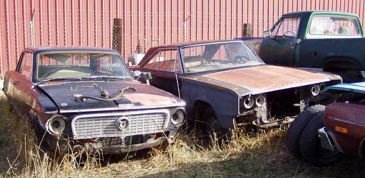
...is another model we never saw, the coupe on the right likewise. We couldn't dawdle too much, though, the day was starting to run away and we had to get to the wrecking yards, stopping on the way for a quick bite to eat.
Meanwhile...
Yes, we'd had some success at the U-Pull yards. The first one had delivered up a lot of wheel studs, a spare set of front brakes - hubs/discs and calipers - for my pickup, an internal rear vision mirror that might be more sound and some other small stuff. Jon got a few bits that he can tidy up and sell on eBay, but the bits we needed to complete the conversion to manual weren't there.
We hit the second yard, a little further across town. I wasn't supposed to have my camera with me, but it just happened to be in my pocket when I got to this place, and despite the lateness in the day (we had to rush a bit, it was getting near closing time) I got a shot of what was really a rare old thing to be in there:

We worked together here. Again, Jon found a few things he could use, he also located a pickup with the linkage bits I needed. I found yet another pair of good discs/hubs and then we remembered we had to get the door rubber for the driver's door of my pickup.
I looked at the rubber on the truck we were raiding for bits and found it wasn't too good. "Check the passenger's side, it will fit the driver's door too," Jon said, and indeed there was a good rubber there that quickly found its way into the barrow the yard lets you use to haul your parts out.
We left there as it was getting dark, and there was one more thing we had to do before returning to Jon's place. The retired machinist who shortens and resplines axles for him, Don, was finishing his dinner when we called in, he got up and took us out to his workshop and I saw the mill he uses for cutting the splines:

And I got a shot that included Jon and Don:

We picked up two pairs of axles he had waiting for us there and went back to Jon's place, and to continue the story from Janet's point of view:
We'd tallied up all the parts, deducted the money I'd sent him from home and came to a figure I still don't think was right, I'm sure I owe him a few dollars and I'll have to sort it out and send that to him. He was such a help with regard to getting the carby for the truck at the start of our trip and we've been able to work together well on deals with a number of parts purchases over the past five or six years.
I noticed a Credit Union with an ATM not far away and I went there to pull out some money from my Credit Union card to replenish Janet's cash supply. Joy of joys... the ATM only charged us $1 for the privilege!
From my point of view this day had helped tidy up a number of loose ends and given me a chance to get to know more about how Jon operates. This will help in the future as I continue to buy things from him, I now know more about his sources and the range of stuff he can get.
At the motel we settled in to checking e-mails and forums and repacking bags ready for the next few days. Our destination for Wednesday with less than a week left of our stay, was Seattle.
Tuesday, November 6. We had breakfast at the motel first and set the Garmin for Jon's address and drove out on a misty morning. Along the way I snapped this pic:
We found Jon's easily enough and Gina took charge of Janet as Jon started ushering me into his shed and through the piles of parts in his garage. Soon enough the girls were off for their day, I was gathering bits that I could use and Jon was showing me over his project cars and so on.
I was quite taken by the way Jon had things organised, he had good amenities for wrapping parts, various sizes of zip-type plastic bags and he really knew how things went together. Of course, this was a reflection of his methods used in marketing components he gets from the wrecking yards.
Then we got into his pickup and headed off to a shed and yard he uses in another part of town. But first he took me to look briefly at Costco, and I was again in trouble with my glasses and needed a hand from an optometrist or similar. Rapidly he guided us to such a place and there was some further effort went into making the things stay in one piece.
In the meantime, Gina and Janet had gone their way...
Met with Gina at her place. she took me to Costco�s - big store, sells everything, I didn't find it cheap. You have to show your Costco card before you can go in.
We then met up with Gina's mother and went to a few thrift shops, I didn't buy much. Ray, in the meantime, went to a few wreckers with Jon.
Gina, her mum and I went to one of Gina's pizza shops for lunch, very nice.
We then met up with Gina's mother and went to a few thrift shops, I didn't buy much. Ray, in the meantime, went to a few wreckers with Jon.
Gina, her mum and I went to one of Gina's pizza shops for lunch, very nice.
As for us, we reached the storage yard Jon shares with a couple of other people, the place was littered with trucks and cars and the shed was packed with stuff. This Coronet...
...was a model we didn't get in Australia and belonged to one of the other guys, he had a spare car too. And these trucks...
...were also quite foreign to my eyes. One of the objects of our visit to this yard was for me to get a set of pedals to convert my pickup to a manual. I'd got the gearbox from Jon's place and I only really needed a few other pieces to enable me to make the conversion when I get it home. We did get the pedal assembly, but some of the linkages were missing.
Other pickups in the yard...
...and other cars and gear...
...and more...
...most of which are for sale, though some will be wrecked out. The truck on the left in this pic:
...has done an incredible amount of work, Jon told me. It was driven until the old Poly 318 would take it no further. Good rebuild material.
The one on the left here...
...is another model we never saw, the coupe on the right likewise. We couldn't dawdle too much, though, the day was starting to run away and we had to get to the wrecking yards, stopping on the way for a quick bite to eat.
Meanwhile...
We picked Rees up and took him to music practice, then went to another thrift shop before retrieving him and going back to Gina's place - the boys were home with much more junk.
We hit the second yard, a little further across town. I wasn't supposed to have my camera with me, but it just happened to be in my pocket when I got to this place, and despite the lateness in the day (we had to rush a bit, it was getting near closing time) I got a shot of what was really a rare old thing to be in there:
We worked together here. Again, Jon found a few things he could use, he also located a pickup with the linkage bits I needed. I found yet another pair of good discs/hubs and then we remembered we had to get the door rubber for the driver's door of my pickup.
I looked at the rubber on the truck we were raiding for bits and found it wasn't too good. "Check the passenger's side, it will fit the driver's door too," Jon said, and indeed there was a good rubber there that quickly found its way into the barrow the yard lets you use to haul your parts out.
We left there as it was getting dark, and there was one more thing we had to do before returning to Jon's place. The retired machinist who shortens and resplines axles for him, Don, was finishing his dinner when we called in, he got up and took us out to his workshop and I saw the mill he uses for cutting the splines:
And I got a shot that included Jon and Don:
We picked up two pairs of axles he had waiting for us there and went back to Jon's place, and to continue the story from Janet's point of view:
I had to give Ray $100 to pay Jon for parts...
I noticed a Credit Union with an ATM not far away and I went there to pull out some money from my Credit Union card to replenish Janet's cash supply. Joy of joys... the ATM only charged us $1 for the privilege!
We had Burger King for tea, went to the motel again. Don't get their 'Angry Angus' or whatever they call it here again. So spicy, so hot, so fatty!
At the motel we settled in to checking e-mails and forums and repacking bags ready for the next few days. Our destination for Wednesday with less than a week left of our stay, was Seattle.
Last edited by Ray Bell; 06-24-2022 at 07:58 PM.
#60
10-28-2019, 04:48 PM
It was Wednesday, November 7, 2012 when we headed for the West Coast...
Janet's notes on the start of the day:
Spokane to Seattle, not an exceptional distance...
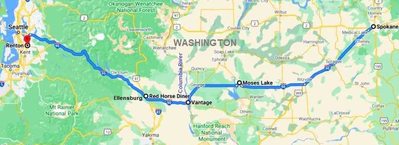
...but it was to turn out to be very picturesque and I'll break it into two instalments. Mind you, we didn't hit the road straight away...
And we must remember that all of our trip so far had been through the 2012 election campaign, but Janet observed that there was now a change of pace:
We were now at Moses Lake, this is part of the rest area, and this...
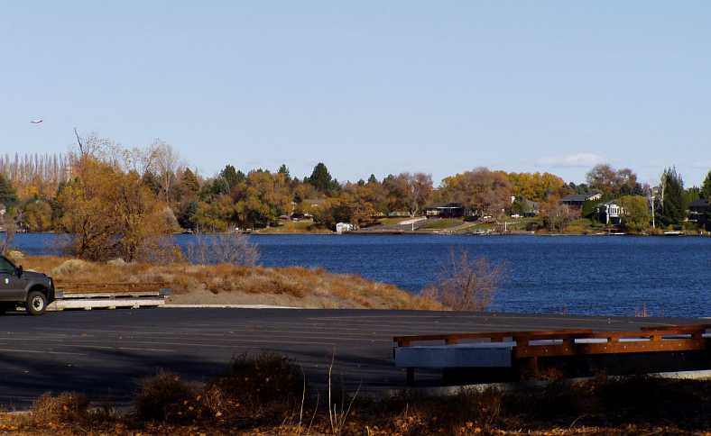
...is one of the boat ramps and some of the expensive lakeside homes. It all made the Dodge...
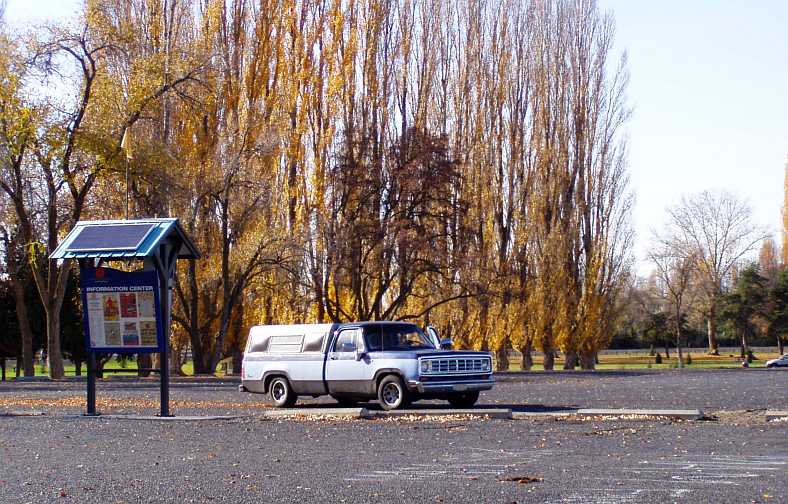
...look a bit out of place. But we were here, we were enjoying our drive, and more was yet to come. Note also the solar panels on that notice board, I wonder what they do?
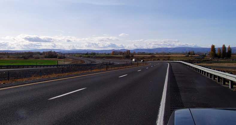
Over a long distance it was an ever-changing scene, a lot of variety in the unfolding vistas.
I remember at this time Janet pointed to our right, "Look, a lake!"
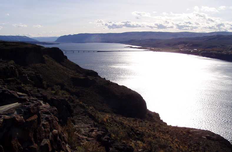
Well, to our eyes it was a huge body of water, it could only be a lake. But not in this country, where the snows feed huge rivers. And I'm sure this is the biggest of them all... the Columbia River, which brings those waters down out of Canada to emerge near Portland in Oregon and help keep the Pacific Ocean full.
It certainly is magnificent. And huge! The lookout had stone walls and a couple of plaques with information about the area. One plaque was about yet another petrified forest, the other told a sad tale of Indians who didn't want to go to war:
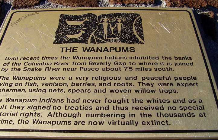
There must be a moral somewhere in there. And yet another, which appealed to Janet...
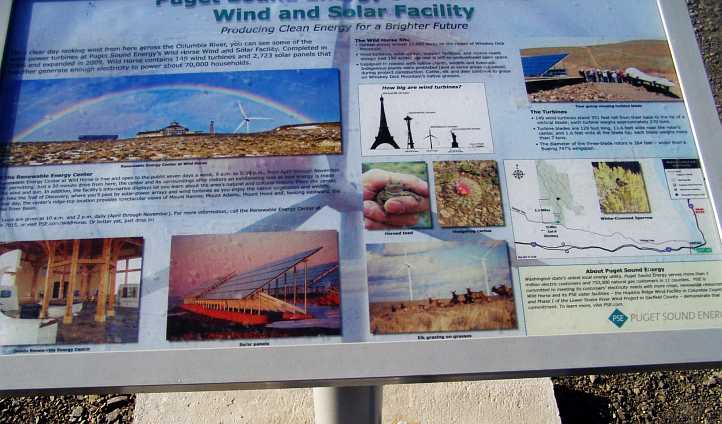
...as we departed this point to cross the river at Vantage.
Just before Ellensburg was Kittitas, where this disused railway bridge suspended itself over the I90:

Did I ever? Look at this place:
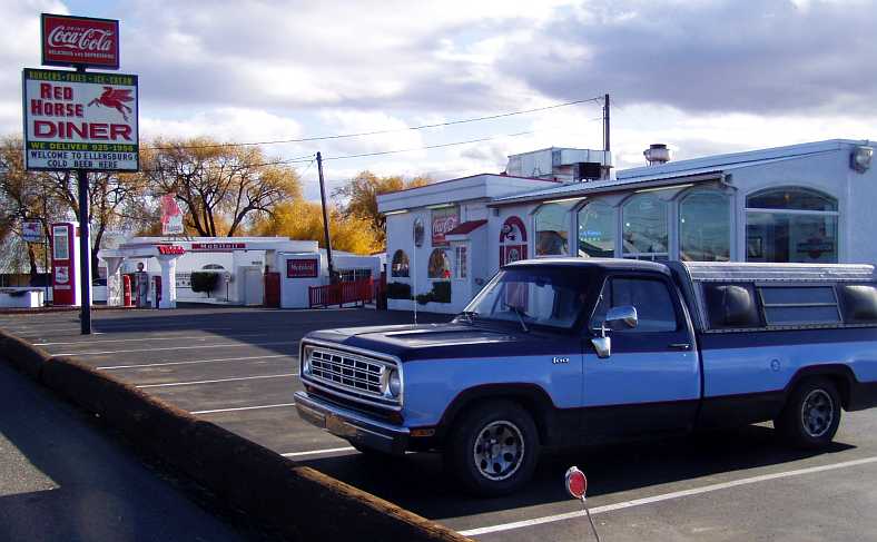
Under the 'sign of the flying red horse', and the old world stuff on the driveway was amazing...
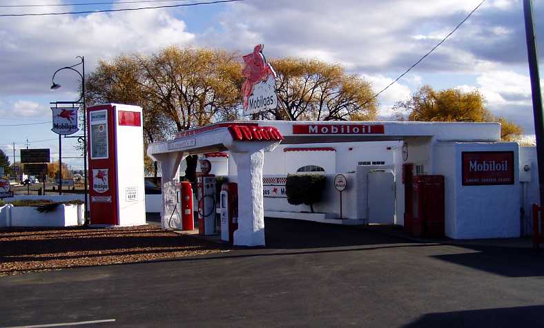
But it wasn't as amazing as the stuff inside the diner. That will come in the next instalment, and believe me you won't regret coming back to look at it.
Janet's notes on the start of the day:
A beautiful sunny, but cold, day. We've been warned it may snow on the passes through to Seattle, it's supposed to be raining in Seattle, which isn't unusual, it's just a matter of how much.
After the complimentary breakfast we began packing the car, quite a feat as we had taken all our bags into the motel to sort them out. It is now 8:55 and we still haven't finished packing. We left at 9:15.
After the complimentary breakfast we began packing the car, quite a feat as we had taken all our bags into the motel to sort them out. It is now 8:55 and we still haven't finished packing. We left at 9:15.
...but it was to turn out to be very picturesque and I'll break it into two instalments. Mind you, we didn't hit the road straight away...
Spokane's a big place, we went to a shop called 'Dollar Tree' - everything's a dollar, amazing. Spokane's population is 500,000.
The election's over, thank goodness. Now we probably have to put up with victory speeches instead of policy speeches.
Just one week to go of our American trip until we fly home, so now we travel down the West coast, starting with Seattle today, all being well.
Driving past a lake just out of Spokane, going west, another small lake and undulating hills with an eagle, I think, hovering overhead. Ducks on yet another small lake look cold, and an irrigation system perched on a hill.
A bigger lake, glistening in the sun, Sprague Lake:
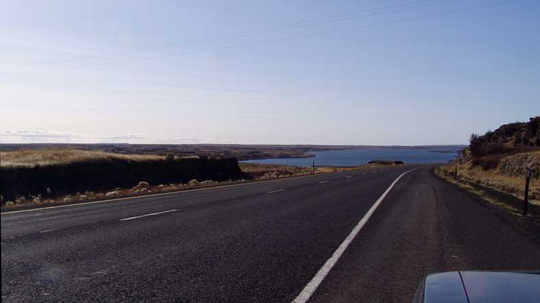
Irrigated farmland after we stop for coffee at a rest area 90 miles out of Spokane, hay bales all covered up. A sign announced it's the largest potato-producing county in the country.
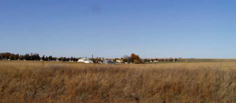
The village of Ritzville, in potato country,
Poplar trees seem to have taken over from conifers. We've seen miles of dead corn plants still standing. There must be an Air Force base close by as there are quite a few planes flying around, as well as an airport.
Now there is row on row of apartments (or condominiums, Jon explained to Ray that apartments are rented, condominiums are owned) and we just went over a massive lake, very pretty at Mae Valley, 100 miles from Spokane. We stopped to take photos, there are more planes, both civilian and Air Force, flying over. Autumn leaves cover the ground.
Just one week to go of our American trip until we fly home, so now we travel down the West coast, starting with Seattle today, all being well.
Driving past a lake just out of Spokane, going west, another small lake and undulating hills with an eagle, I think, hovering overhead. Ducks on yet another small lake look cold, and an irrigation system perched on a hill.
A bigger lake, glistening in the sun, Sprague Lake:
Irrigated farmland after we stop for coffee at a rest area 90 miles out of Spokane, hay bales all covered up. A sign announced it's the largest potato-producing county in the country.
The village of Ritzville, in potato country,
Poplar trees seem to have taken over from conifers. We've seen miles of dead corn plants still standing. There must be an Air Force base close by as there are quite a few planes flying around, as well as an airport.
Now there is row on row of apartments (or condominiums, Jon explained to Ray that apartments are rented, condominiums are owned) and we just went over a massive lake, very pretty at Mae Valley, 100 miles from Spokane. We stopped to take photos, there are more planes, both civilian and Air Force, flying over. Autumn leaves cover the ground.
We were now at Moses Lake, this is part of the rest area, and this...
...is one of the boat ramps and some of the expensive lakeside homes. It all made the Dodge...
...look a bit out of place. But we were here, we were enjoying our drive, and more was yet to come. Note also the solar panels on that notice board, I wonder what they do?
Hay bales for domestic and export use, 'Hiawatha Road' sounds a bit Indian. It looks like we are coming into mountain country, we see them in the distance.
High tension lines coming from Bonneville power sub-station. Now there are crop names written on the fencelines...
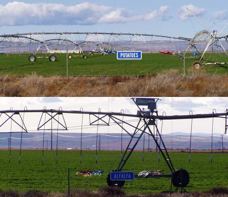
...'beans, potatoes, potatoes, canola seed, sweet corn, sweet corn, potatoes, sweet corn, timothy.' Whatever that is. And we just noticed that the signs are on the other side of the road too, saying 'alfalfa' - they must be proud of their produce with tinsel beside the signs. 'Wheat, timothy, hay, alfalfa, potatoes, alfalfa, field corn, alfalfa, grain corn, beans, alfalfa, potato, peas, timothy, field corn'.
The area reminds me of Muswellbrook and Scone. 'Alfalfa, paint horses.'
Windfarms way up on the hills (or mountains), and the brightest coppery-coloured crop. The Wanatchee Mountains are ahead of us, between them and us there is the Columbia Basin.
High tension lines coming from Bonneville power sub-station. Now there are crop names written on the fencelines...
...'beans, potatoes, potatoes, canola seed, sweet corn, sweet corn, potatoes, sweet corn, timothy.' Whatever that is. And we just noticed that the signs are on the other side of the road too, saying 'alfalfa' - they must be proud of their produce with tinsel beside the signs. 'Wheat, timothy, hay, alfalfa, potatoes, alfalfa, field corn, alfalfa, grain corn, beans, alfalfa, potato, peas, timothy, field corn'.
The area reminds me of Muswellbrook and Scone. 'Alfalfa, paint horses.'
Windfarms way up on the hills (or mountains), and the brightest coppery-coloured crop. The Wanatchee Mountains are ahead of us, between them and us there is the Columbia Basin.
Over a long distance it was an ever-changing scene, a lot of variety in the unfolding vistas.
I remember at this time Janet pointed to our right, "Look, a lake!"
Well, to our eyes it was a huge body of water, it could only be a lake. But not in this country, where the snows feed huge rivers. And I'm sure this is the biggest of them all... the Columbia River, which brings those waters down out of Canada to emerge near Portland in Oregon and help keep the Pacific Ocean full.
Pulling up at a lookout, a magnificent enormous body of water and mountains...
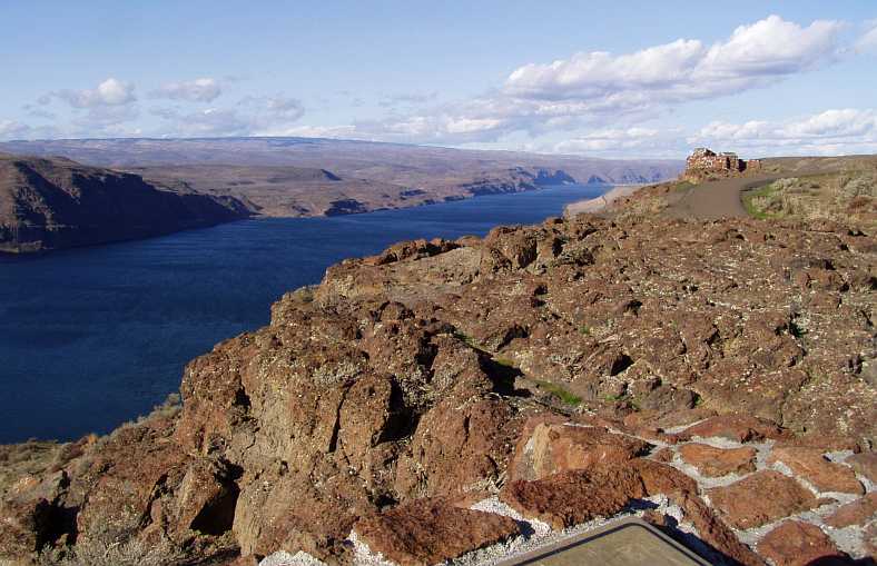
There must be a moral somewhere in there. And yet another, which appealed to Janet...
...as we departed this point to cross the river at Vantage.
We went over the bridge...
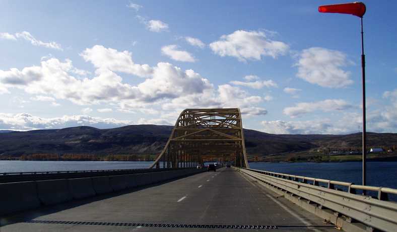
...nice view...
]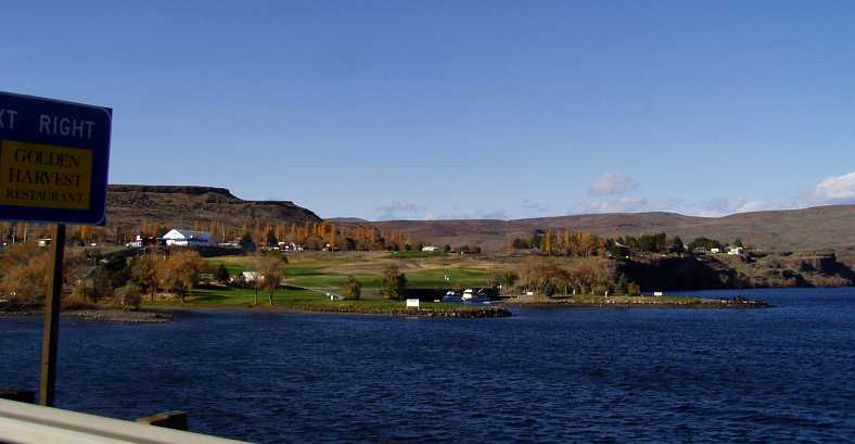 [
[
...and climbed to those windfarms on the mountains, such a massive achievement to get them up there. The blades are enormous.
We stopped at Ryegrass rest area, took a couple of photos of wind turbines, now we're on a downhill stretch,
Another brilliantly coloured crop growing, positioned for shelter by the mountain. A really lush area, Yakima and Ellensburg, but we have to keep on going to Seattle, another 107 miles with mountains ahead and yet more wind farms. And even more bales of hay, stored and covered up...
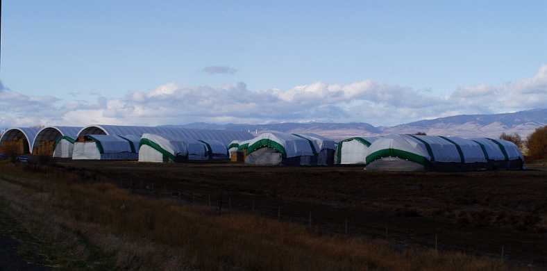
...it's everywhere! Reminds me of the storehouses spoken about by Jesus. The most hay Ray's seen in his life - his words.
...nice view...
]
[...and climbed to those windfarms on the mountains, such a massive achievement to get them up there. The blades are enormous.
We stopped at Ryegrass rest area, took a couple of photos of wind turbines, now we're on a downhill stretch,
Another brilliantly coloured crop growing, positioned for shelter by the mountain. A really lush area, Yakima and Ellensburg, but we have to keep on going to Seattle, another 107 miles with mountains ahead and yet more wind farms. And even more bales of hay, stored and covered up...
...it's everywhere! Reminds me of the storehouses spoken about by Jesus. The most hay Ray's seen in his life - his words.
We stopped for fuel and lunch, had fish and chips at a cafe (diner) with interesting signs on the walls. Ray took photos.
Under the 'sign of the flying red horse', and the old world stuff on the driveway was amazing...
But it wasn't as amazing as the stuff inside the diner. That will come in the next instalment, and believe me you won't regret coming back to look at it.
Last edited by Ray Bell; 03-22-2022 at 04:23 AM.