

Ride along with me...


Thread Starter
|
Captain

Joined: Oct 2005
Posts: 570
Likes: 8
From: The Summit, Queensland, Australia
I really wanted to get underway early the next morning. This was because I wanted to get the effects of the sunrise on the rock formations at the �Garden of the Gods� near Colorado Springs. I�d only just come to know this beautiful place existed and I just had to plan it into my 3-day drive around the state.
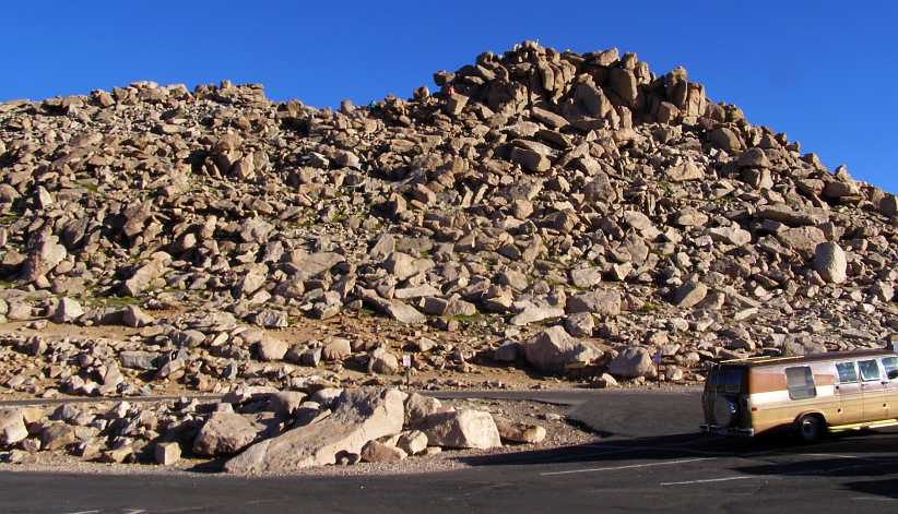
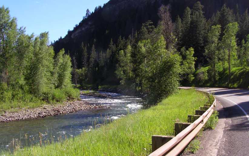
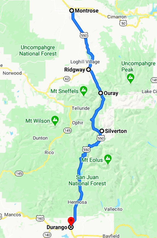
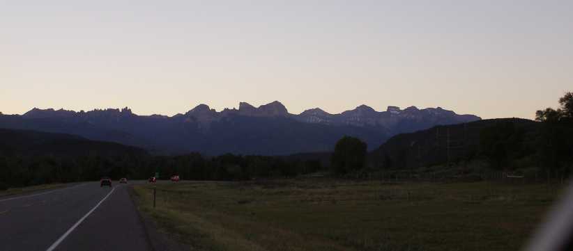
Although I had been to Pikes Peak on the previous trip, I still had to see more of this picturesque state, in particular the drive down the back of the Rockies that was recommended to me during my first trip (by that lovely couple from El Paso who helped me out when I had the wheel bearing failure out in the desert) down to Durango.
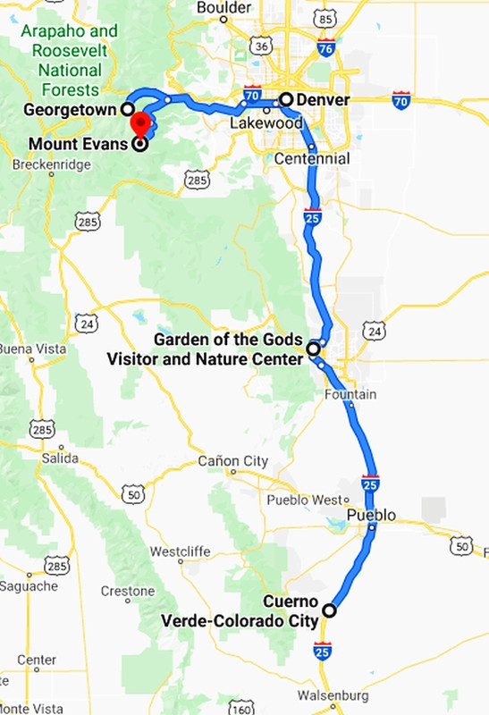
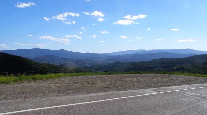
I was now moving in that general direction and had allowed time for this adventure, the course for this day was as shown�
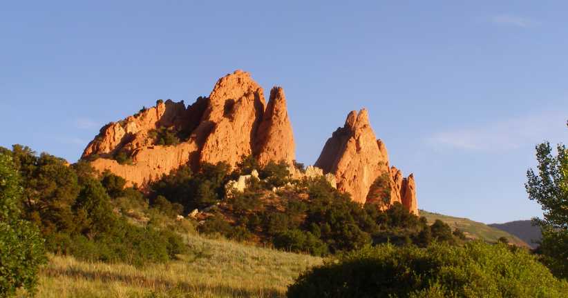
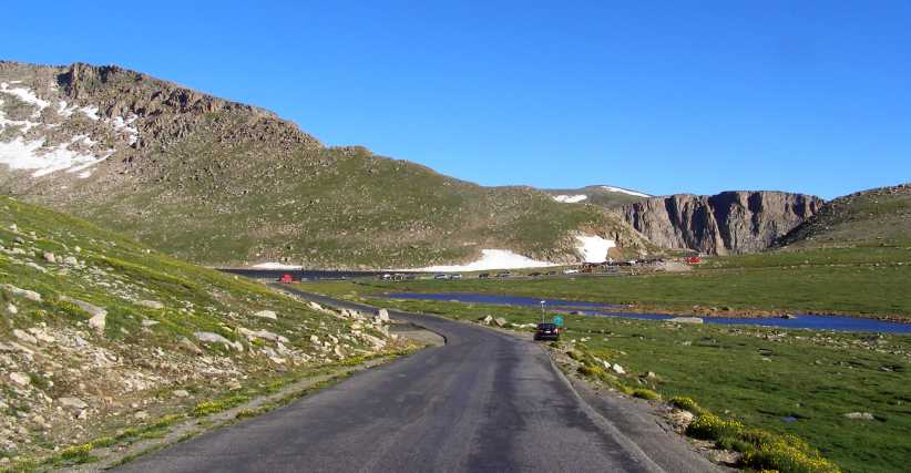
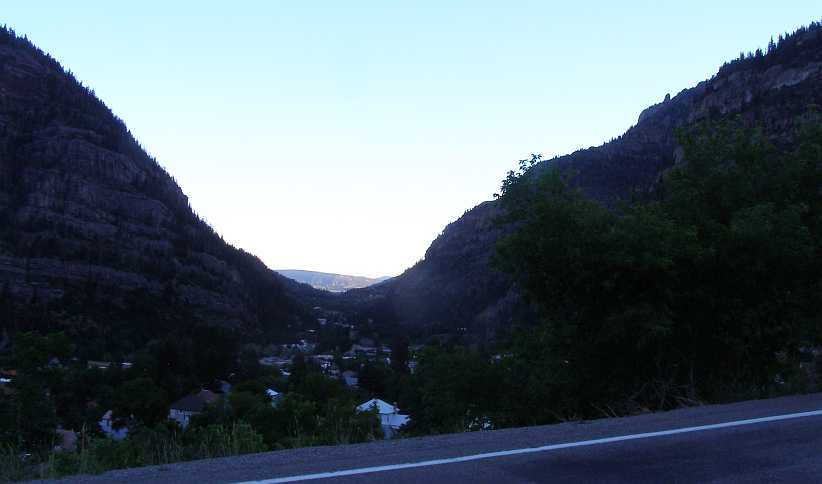
The day did get started early and I reached the Garden of the Gods after a drive of 72 miles. It was beginning to get spectacular as I found my way around the vantage points.
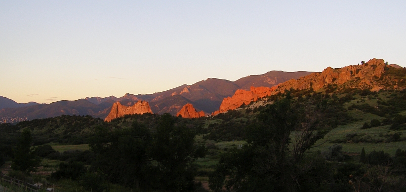
Colours in the morning sun. That orange glow added a little colour to the formations as the sun�s strength started to come through.
Just how these formations came into being I don�t know. The Rockies are described as �fold� mountains and thus I guess these rocks have been thrust into a more or less vertical plane and erosion has then exposed them more.
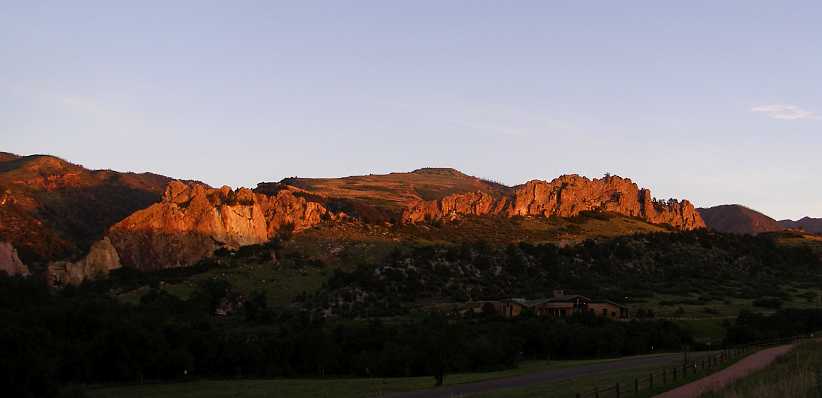
To the North. This view is of the formations to the North of the array, with quite a difference in the impression they make.
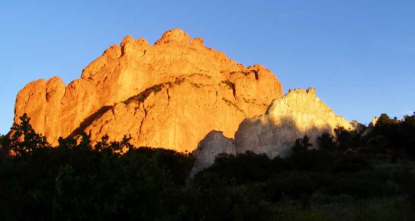
Without the sun the rocks look quite different, and I�m sure an early afternoon view, when the sun would shine on these faces, would be spectacular in a different way. Later, of course, the sun would be gone as Pikes Peak began to throw its shadow over the garden.
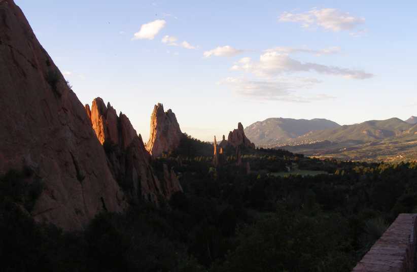
Shade and sharp shapes. Getting this view helps appreciate more about the shapes and the random placement of the formations.
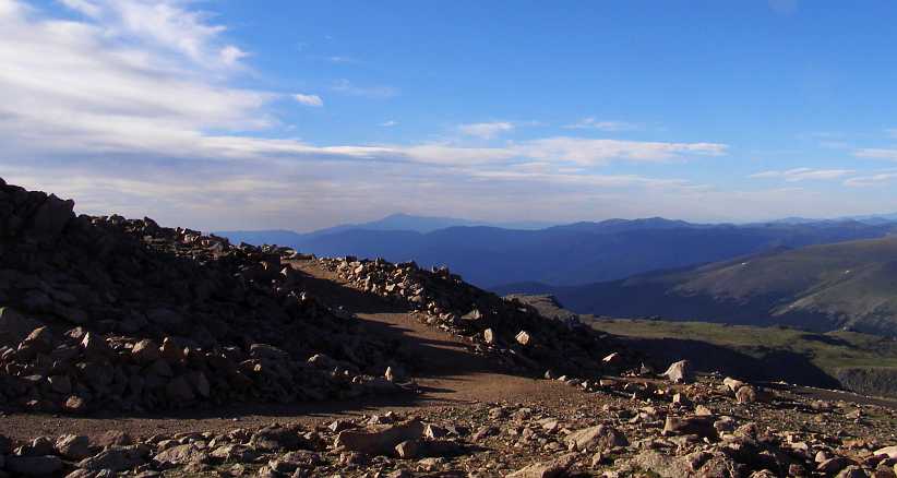
And speaking of Pikes Peak, it�s in the background of this shot. The peak stands about 7,000ft higher than the area in which the garden lies. The Rockies certainly are magnificent, something I would learn more about the next day:
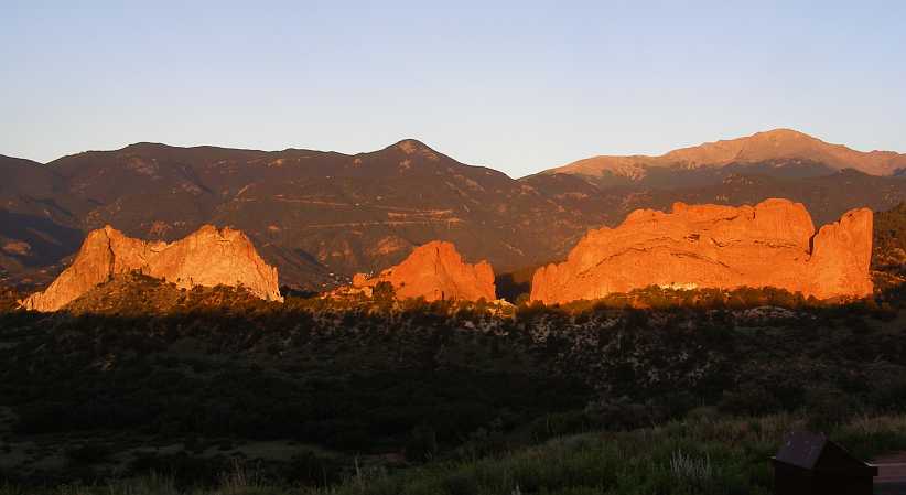
Pikes Peak and the Garden of the Gods. Both major attractions of the Colorado Springs area are visible here, though the emphasis is on the shapes and colours of the rocks of the garden.
Rules have to be applied, of course, and the local authorities have decided that people flying drones in the area might be a problem. And so this sign lets visitors know while the information board tells about the wildlife which inhabits the area�
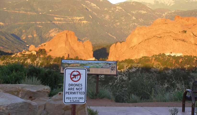
Banned! I�ve never seen a �drones banned� sign anywhere else, but there�s one here. I guess there will be more in coming years.
Shapes and colour. Many look at these rocks and find shapes, I�ve seen mentions of camels in one. I just think they�re shapes and worth admiring for what they are.`
There are walking trails, though I didn�t take to them, but this one leads in behind some of the rocks:
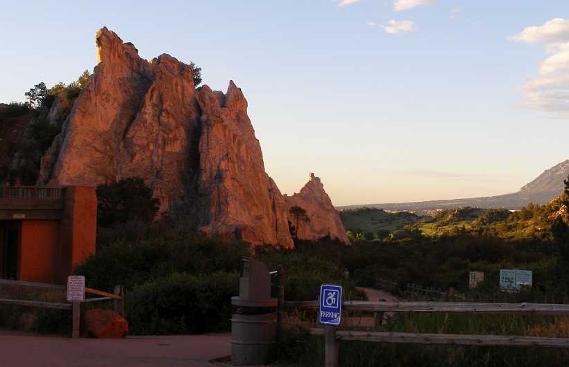
Walking trails. A walking trail here allows visitors to get up close to it all, with the views off to the South adding to the pleasure of being there.
Many shapes are encountered, the layers shown here giving a totally different impression to the picture they portray when looking from the East�
Split personalities. Standing out like this, these rocks have spent thousands of years weathering to these shapes.
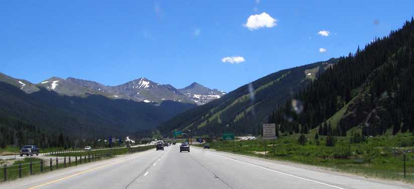
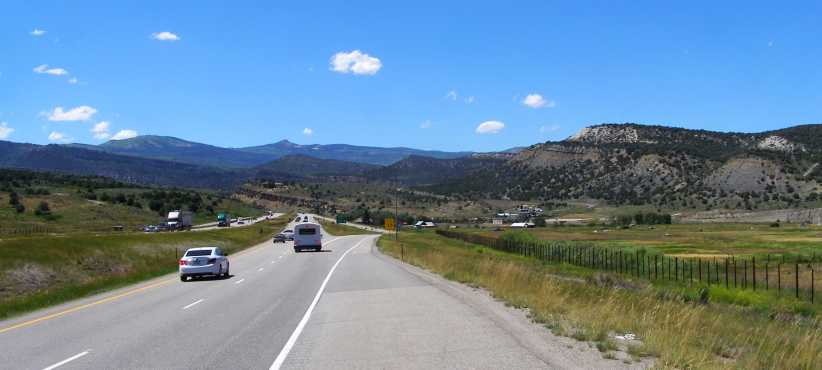
The sun was getting higher, it was time for breakfast and to set out for Denver. The I25 was moderately busy enough, but it flowed smoothly through the grasslands, mountains always being in the background on most sides.
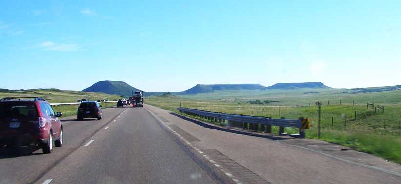
Road to Denver. It didn�t take long to cover this distance, once again about 70 miles for the trip.
Always I keep an eye out for the sights, of course, in particular things which are different to what we have at home. We certainly don�t have, for instance, pickups running around with the tyres sticking outside of the body line like this�
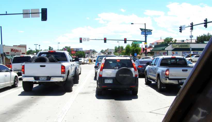
Denver lights. Stopping at the traffic lights gives one a good chance to look at other vehicles and the surroundings. Another thing here we don�t have at home is Walgreens Pharmacy, seen on the left. There are over 9,000 branches in America.
While in Denver I sought out a truck stop so I could get a shower, and I had some lunch after that before starting on my trip along the I70 to cross those Rockies.
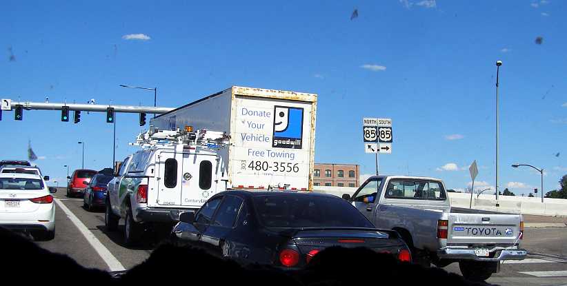
Donate your car. Another traffic light shot. This one prompted by the Goodwill Stores truck promoting the donation of cars to this Thrift (or �Op�) Shop group.
Before I left town, however, I did get caught up in a bit of a mid-town tangle where there was construction work going on. This had upset the Garmin and I was working around getting to where I wanted to go when I spotted this place:
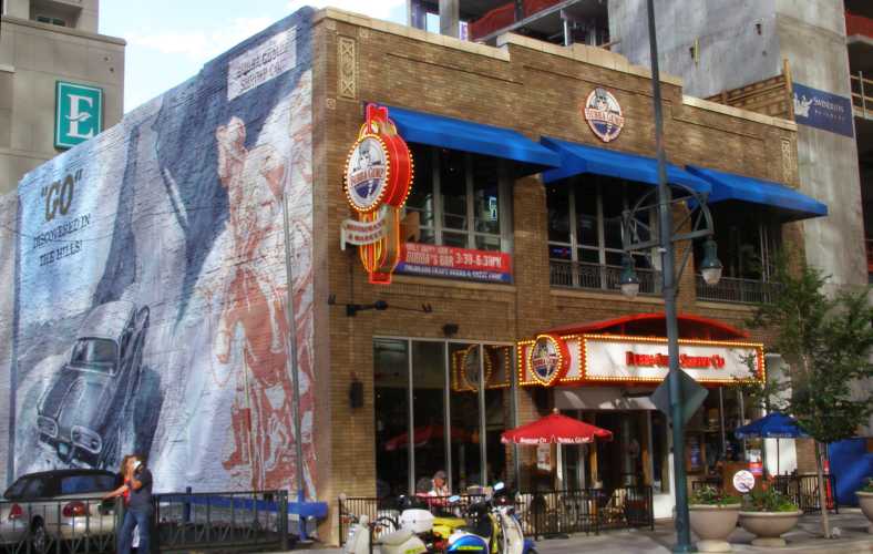
Bubba Gump Shrimp Co. Anyone who�s seen �Forrest Gump� would understand me stopping to look at this place.
I was later to learn that they have a chain of these, well spread out too. Some are in Qatar, others in London, Hong Kong and several states of the US. It�s interesting that the mural on the side wall features Pikes Peak, too. Anyway, inside I took this pic:
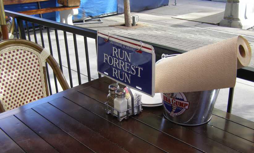
Greenbow Alabama. Obviously the place draws heavily on the well-remembered features of the movie.
So after that I headed West. It was on the first climb out of town on the I70 that I first struck trouble with fuel vaporisation. The combination of the heat of the day and the altitude led to such a loss of power that I knew that a steep hill would stop me. I spotted an exit at the top of a hill with a parking area and pulled in there.
Someone enquired about my problems when they saw me crawling over the van and told me that it was a common problem because the exhaust manifolds run close to the frame rails and that transfers the heat to the fuel line, which is clipped onto the rails. He suggested that packing the line away from the rails with wooden clothes pegs.
I was also fiddling with that electric pump I�d fitted earlier in the trip. I certainly knew I�d be in trouble trying to get up Mount Evans with this problem. In my case it was exacerbated by the busted manifold exhausting some of the hot gases on that side too.
Oh, yes, Mount Evans. Eric, the forum friend who came from Colorado, told me not to bother going up Pikes Peak again, but to go up Mount Evans instead. �It�s just a little bit higher, the road is sealed all the way and has been for forty years.�
As the day was getting away I knew I wouldn�t be going up there until the morning, when the cool would be on my side with the fuel problem. All of this was going through my mind as I was doing what I could to alleviate the problem here just off the I70:
Parking area. It was here I struggled to fix things and avoid being stuck on the hills with fuel vaporisation.
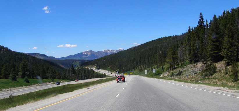
I got going again and just a few miles further on was rewarded with this great setting:
Into the hills. Actually the Rocky Mountains. One of the nicer photos of the trip, I reckon.
I kept going hoping to prove the problem was solved and looking for somewhere to stop. It got dark before long�
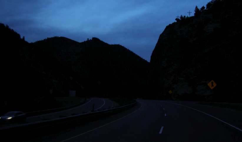
Darkness. The mountains range out each side of the I70 and the last vestiges of light in the sky comes over the top as I look for somewhere to stop.
The problem was that I�d gone past the turnoff to Mount Evans, so I turned around. Eventually I got back to a place called North Central Evergreen, where there was a shopping centre. But more importantly, there was a Walmart, with its free camping area, and a McDonalds, for breakfast, side by side.
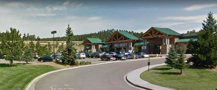
Walmart North Central Evergreen. Strangely, this was not a 24-hour store. But it was still possible � and legal � to camp in the staff carpark.
My newfound problem was worrying me as I got myself dinner and, ultimately, went off to sleep. But the anticipation of getting up yet another 14,000+ feet high peak gave me something to look forward to in the morning�
Although I had been to Pikes Peak on the previous trip, I still had to see more of this picturesque state, in particular the drive down the back of the Rockies that was recommended to me during my first trip (by that lovely couple from El Paso who helped me out when I had the wheel bearing failure out in the desert) down to Durango.
I was now moving in that general direction and had allowed time for this adventure, the course for this day was as shown�
The day did get started early and I reached the Garden of the Gods after a drive of 72 miles. It was beginning to get spectacular as I found my way around the vantage points.
Colours in the morning sun. That orange glow added a little colour to the formations as the sun�s strength started to come through.
Just how these formations came into being I don�t know. The Rockies are described as �fold� mountains and thus I guess these rocks have been thrust into a more or less vertical plane and erosion has then exposed them more.
To the North. This view is of the formations to the North of the array, with quite a difference in the impression they make.
Without the sun the rocks look quite different, and I�m sure an early afternoon view, when the sun would shine on these faces, would be spectacular in a different way. Later, of course, the sun would be gone as Pikes Peak began to throw its shadow over the garden.
Shade and sharp shapes. Getting this view helps appreciate more about the shapes and the random placement of the formations.
And speaking of Pikes Peak, it�s in the background of this shot. The peak stands about 7,000ft higher than the area in which the garden lies. The Rockies certainly are magnificent, something I would learn more about the next day:
Pikes Peak and the Garden of the Gods. Both major attractions of the Colorado Springs area are visible here, though the emphasis is on the shapes and colours of the rocks of the garden.
Rules have to be applied, of course, and the local authorities have decided that people flying drones in the area might be a problem. And so this sign lets visitors know while the information board tells about the wildlife which inhabits the area�
Banned! I�ve never seen a �drones banned� sign anywhere else, but there�s one here. I guess there will be more in coming years.
Shapes and colour. Many look at these rocks and find shapes, I�ve seen mentions of camels in one. I just think they�re shapes and worth admiring for what they are.`
There are walking trails, though I didn�t take to them, but this one leads in behind some of the rocks:
Walking trails. A walking trail here allows visitors to get up close to it all, with the views off to the South adding to the pleasure of being there.
Many shapes are encountered, the layers shown here giving a totally different impression to the picture they portray when looking from the East�
Split personalities. Standing out like this, these rocks have spent thousands of years weathering to these shapes.
The sun was getting higher, it was time for breakfast and to set out for Denver. The I25 was moderately busy enough, but it flowed smoothly through the grasslands, mountains always being in the background on most sides.
Road to Denver. It didn�t take long to cover this distance, once again about 70 miles for the trip.
Always I keep an eye out for the sights, of course, in particular things which are different to what we have at home. We certainly don�t have, for instance, pickups running around with the tyres sticking outside of the body line like this�
Denver lights. Stopping at the traffic lights gives one a good chance to look at other vehicles and the surroundings. Another thing here we don�t have at home is Walgreens Pharmacy, seen on the left. There are over 9,000 branches in America.
While in Denver I sought out a truck stop so I could get a shower, and I had some lunch after that before starting on my trip along the I70 to cross those Rockies.
Donate your car. Another traffic light shot. This one prompted by the Goodwill Stores truck promoting the donation of cars to this Thrift (or �Op�) Shop group.
Before I left town, however, I did get caught up in a bit of a mid-town tangle where there was construction work going on. This had upset the Garmin and I was working around getting to where I wanted to go when I spotted this place:
Bubba Gump Shrimp Co. Anyone who�s seen �Forrest Gump� would understand me stopping to look at this place.
I was later to learn that they have a chain of these, well spread out too. Some are in Qatar, others in London, Hong Kong and several states of the US. It�s interesting that the mural on the side wall features Pikes Peak, too. Anyway, inside I took this pic:
Greenbow Alabama. Obviously the place draws heavily on the well-remembered features of the movie.
So after that I headed West. It was on the first climb out of town on the I70 that I first struck trouble with fuel vaporisation. The combination of the heat of the day and the altitude led to such a loss of power that I knew that a steep hill would stop me. I spotted an exit at the top of a hill with a parking area and pulled in there.
Someone enquired about my problems when they saw me crawling over the van and told me that it was a common problem because the exhaust manifolds run close to the frame rails and that transfers the heat to the fuel line, which is clipped onto the rails. He suggested that packing the line away from the rails with wooden clothes pegs.
I was also fiddling with that electric pump I�d fitted earlier in the trip. I certainly knew I�d be in trouble trying to get up Mount Evans with this problem. In my case it was exacerbated by the busted manifold exhausting some of the hot gases on that side too.
Oh, yes, Mount Evans. Eric, the forum friend who came from Colorado, told me not to bother going up Pikes Peak again, but to go up Mount Evans instead. �It�s just a little bit higher, the road is sealed all the way and has been for forty years.�
As the day was getting away I knew I wouldn�t be going up there until the morning, when the cool would be on my side with the fuel problem. All of this was going through my mind as I was doing what I could to alleviate the problem here just off the I70:
Parking area. It was here I struggled to fix things and avoid being stuck on the hills with fuel vaporisation.
I got going again and just a few miles further on was rewarded with this great setting:
Into the hills. Actually the Rocky Mountains. One of the nicer photos of the trip, I reckon.
I kept going hoping to prove the problem was solved and looking for somewhere to stop. It got dark before long�
Darkness. The mountains range out each side of the I70 and the last vestiges of light in the sky comes over the top as I look for somewhere to stop.
The problem was that I�d gone past the turnoff to Mount Evans, so I turned around. Eventually I got back to a place called North Central Evergreen, where there was a shopping centre. But more importantly, there was a Walmart, with its free camping area, and a McDonalds, for breakfast, side by side.
Walmart North Central Evergreen. Strangely, this was not a 24-hour store. But it was still possible � and legal � to camp in the staff carpark.
My newfound problem was worrying me as I got myself dinner and, ultimately, went off to sleep. But the anticipation of getting up yet another 14,000+ feet high peak gave me something to look forward to in the morning�
Thread Starter
|
Captain
Joined: Oct 2005
Posts: 570
Likes: 8
From: The Summit, Queensland, Australia
After quickly taking in breakfast at the McDonalds the other end of the Walmart carpark, I set off on my drive to ascent Mount Evans. I was counting on the morning cool to keep the fuel vaporisation at bay, of course, and Mount Evans was the first stage of a day which had to take me over the Rockies towards that highly-anticipated drive down to Durango. So here�s the path I would see on this Summer Sunday:
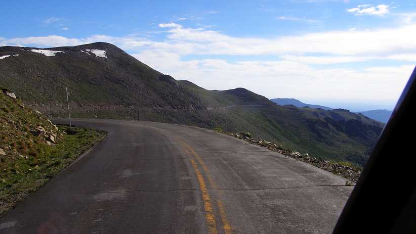
After about eleven miles up the Interstate, I turned off onto the road leading to the summit, which ascends for some 28 miles. There was no problem with the van on the climb, but I certainly had a problem as I got to the part where the serious climbing began, and that problem was with me.
I had, when driving up Pikes Peak on the previous trip, noted the lack of safety railing, the closeness of the edge of the road and the distance one would fall if they went over the edge. I had told many people that I thought it was daunting to drive up there.
Mount Evans� road was sealed, which was something Pikes Peak didn�t have until the last seven or eight years. But the Mount Evans road had been sealed over forty years ago. It was narrower, it had edges which were crumbling away and no more safety railing than Pikes Peak. This road wasn�t daunting, it was intimidating!
Blind bends presented a challenge as I knew that my van and an oncoming vehicle of the proportions of, say, a modern pickup (of which plenty were around) would have trouble passing in some circumstances. It all conspired to make me think negatively, so four times during that serious part of the drive I said to myself, �The next time I get a chance to turn around, I�m going back!�
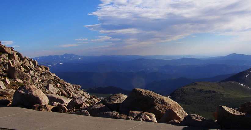
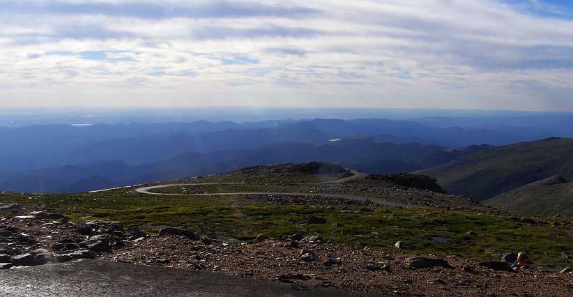
But something drove me on, I passed several places where there were little parking areas and I drove right on past them, ultimately getting to the carpark at the top. Well, not right to the top, for the carpark was a hundred feet or more below the actual summit. But the carpark level was perfect for getting pics of some great views�
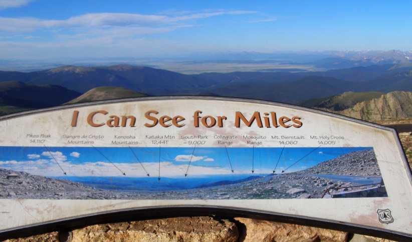
I can see for miles. Looking to the South from this point I could see much further than I�d travelled the previous day.
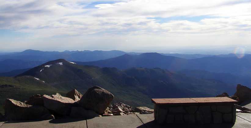
I took a series of photos from this point, turning to the right as I took them:
All mountains. The thing about these higher peaks is that you are able to look down on so much of the Rockies.
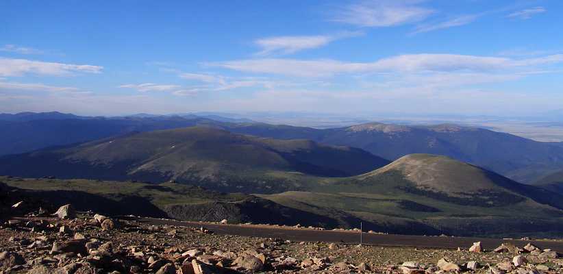
Over the tops. Looking beyond the high points here we see some plainlands in the distance.
More mountains. Further to the West we see even more of the mountain ranges stretching to the South.
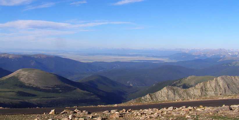
Residual snow. Then the view takes in more of the Rockies, some of them still covered with snow waiting to melt.
Mount Evans is just a little higher than Pikes Peak, which is 4,302 metres while Mount Evans is 4,348 metres. That�s 14,115 feet for Pikes Peak and14,265 feet for Mount Evans, which is just totally foreign to Australians. Our tallest mountain is Mount Kosciuszko at 2,228 metres (7,310 feet). Just a bit of a hill here, the basic ground level around Denver is about 6,000ft!
Top of Mount Evans. There�s a walking trail to the top, I didn�t take it as I remembered my altitude sickness when I went to Pikes Peak.
And I kept turning the camera to the right�
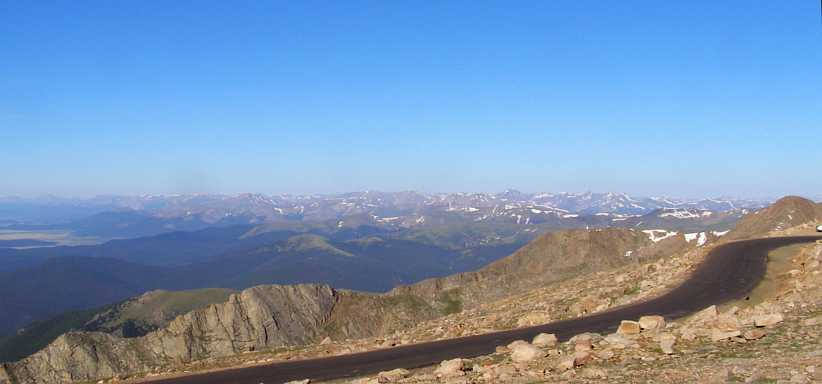
And to the North. The lines of mountain range dominate the scene to help Colorado live up to its reputation for mountain scenery.
Rugged country. As I got the camera around so the lens was facing more towards the East the morning light started to interfere. But still we can see the deep valleys and tall mountains, even if they were all below us.
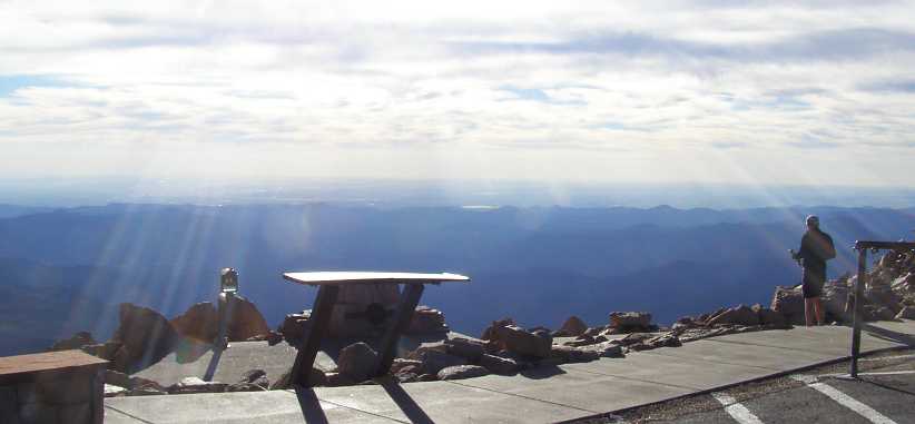
Spoiled by the light. Out beyond these ranges lies hundreds of miles of plainlands. Not visible because of the sun, but also frequently kept from clear view by the haze.
Having had a good look around it was then time to head the van down the mountain. Still the road was narrow, unprotected and suffering from crumbling edges, but I had confidence in my brakes and I had, after all, made it all the way up here without problems. But just as I rounded the first turn there was a surprise:
Big horn sheep. These sheep inhabit the tall mountain areas, I saw a sign about them at Pikes Peak, but this was the closest I got to one.
Apparently they are fairly used to people being around, as this lady explained on a web page:
https://activerain.com/blogsview/181...vans--colorado
The road down lay ahead of me, but I still had opportunities to get further pictures�
Winding across the scenery. The road ahead is steeper than it looks here, while it�s just possible to see some of the more distant areas in this picture.
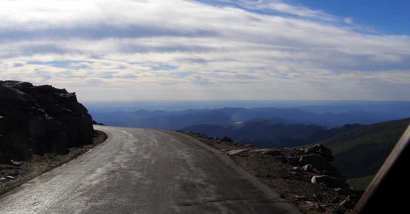
The road and the view. Narrow though it is, and so close to the edge, it�s still possible to appreciate the views.
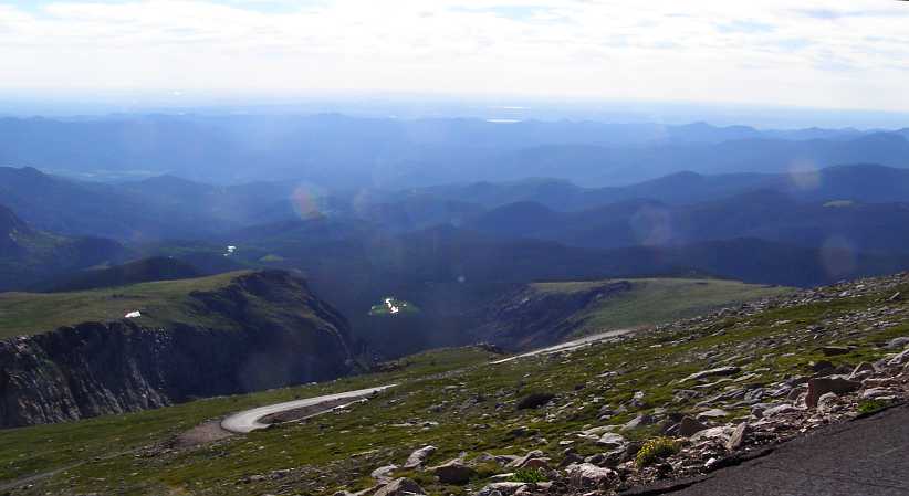
Winding into the distance. Looking down into the lower levels, this road had to take me all the way down there. It winds around plenty in its 20+ miles.
Eric, in encouraging me to put Mount Evans into my itinerary, told me he was married here. He had 85 guests at his wedding in this pretty spot called Summit Lake. The lake is perched in an area almost secluded in this picture between the steeply-rising mountain structures. The curved face which rises just beyond the lake (out of sight here) is called the �Boilerplates.�
Summit Lake. The main part of the lake is off to the left out of sight, the carpark to the right is where Eric�s wedding ceremony took place. I can well understand him having it there.
There was plenty more descent to come�
Further descent. Or �pity the roadbuilders.� Carving out this road must have been a massive job so many decades ago.
Another lake further down the mountain is called Echo Lake, it comes into sight some time before it�s reached and is surrounded by trees whereas Summit Lake is above the tree-line.
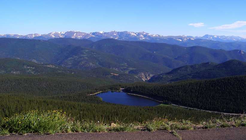
Echo Lake spotted. There�s still some distance to cover before reaching Echo Lake, but this spot is really picturesque with the lake, the trees and the unmelted snow on the mountains behind it all.
Yes, that�s the road down which runs alongside Echo Lake, and it goes on to pass through that gap in the mountains with the bare rock faces further down, but that only comes after we pass this idyllic lake:
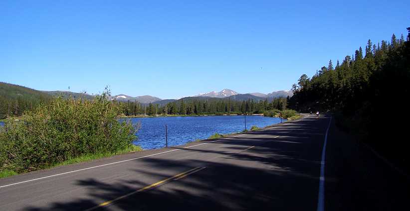
By the water. The road is wider here, with the suggestion that perhaps more people get this far when they�re out for a drive from Denver.
Now we�re amongst the trees the scenery is just so different to what was seen up in the higher parts. Eric mentioned that some of the pine trees are �Bristlecone Pines� but I think he said they�re up a little higher, closer to the tree-line.
Forested mountains. The trees add a lot to this setting of a valley which gives an opening to see yet another distant mountain.
My Mount Evans discovery tour was now over, then as I got closer to the I70 I spotted a place with a lot of cars around. A couple of them were of sufficient interest to make me stop and get the camera out again:
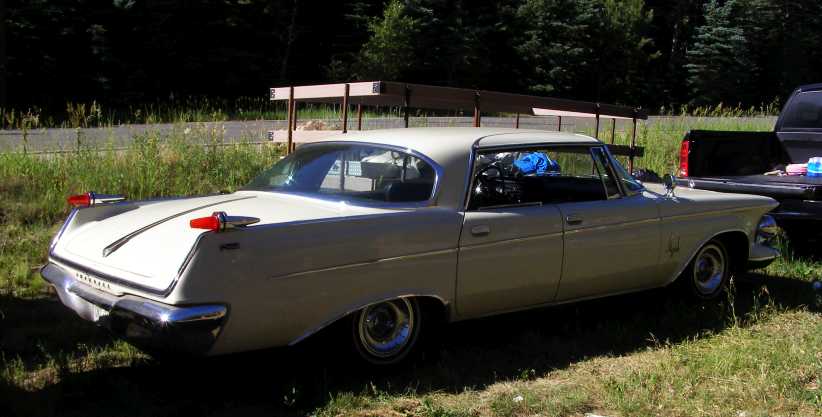
1962 Imperial. Carrying some of the features of the late fifties, this Imperial is certainly a large and impressive car.
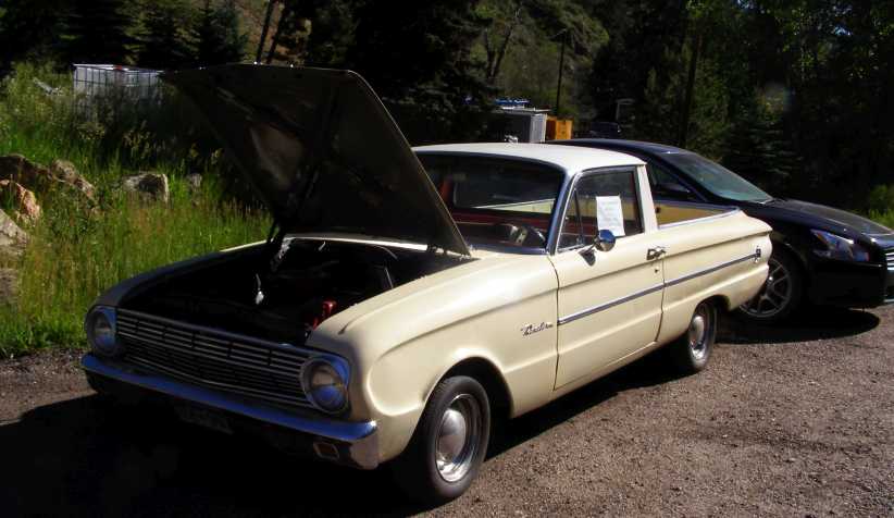
Falcon utility. Or at least we�d call it that at home. The model we�d identify as an XL, which came out in 1962 at home.
Once on the I70 I again focussed my mind on the vaporisation problem. It hadn�t struck me yet this day, but there were high mountain passes to come and the day would get hotter. My mind was working on the prospect of keeping that exhaust leak from creating more heat in the area where the fuel line came through alongside the engine.
I drove about ten miles until I reached Georgetown, thinking it might provide me with a good spot to pull up and jack up the front so I could get underneath and work on the problem. I�d also be looking for something to use as a kind of deflector for those hot gases.
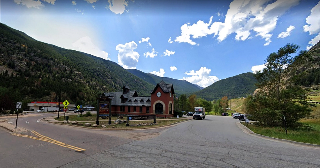
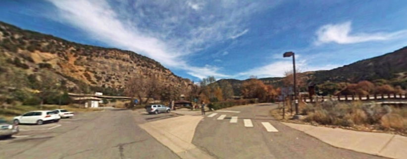
Georgetown Visitors� Center. An attractive building housing the visitors� centre was right there just off the exit from the Interstate.
Such a place would be helpful if I was there for a while, I thought. There�d be facilities for cleaning myself up after doing the job as well as a toilet which I might need. I looked around in their carpark�
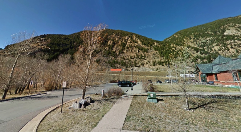
Worksite. The lowest car parking spot in this Street View picture, off to the left and under those trees, would give me a safe and convenient working area.
Parking the van in the shade (Google Earth�s view is obviously in Winter when the leaves were all gone) I set up and started looking for materials. There was a building site nearby, but there was nothing there suitable. Then I looked at that rear vision mirror I�d bought back in Pennsylvania, the one off a Chevy pickup.
Sure enough, it had a steel mounting bracket I wouldn�t ever need and it was big enough to provide some deflection. I tied it in place with some wire I�d bought along the way and looked around for suitable bits of wood to pack the fuel line away from the chassis rails.
I cleaned myself up in the Visitors� Center � where I�d been made to feel quite welcome � and fired the 360 up again. I drove out onto the I70 with renewed confidence and headed West�
After about eleven miles up the Interstate, I turned off onto the road leading to the summit, which ascends for some 28 miles. There was no problem with the van on the climb, but I certainly had a problem as I got to the part where the serious climbing began, and that problem was with me.
I had, when driving up Pikes Peak on the previous trip, noted the lack of safety railing, the closeness of the edge of the road and the distance one would fall if they went over the edge. I had told many people that I thought it was daunting to drive up there.
Mount Evans� road was sealed, which was something Pikes Peak didn�t have until the last seven or eight years. But the Mount Evans road had been sealed over forty years ago. It was narrower, it had edges which were crumbling away and no more safety railing than Pikes Peak. This road wasn�t daunting, it was intimidating!
Blind bends presented a challenge as I knew that my van and an oncoming vehicle of the proportions of, say, a modern pickup (of which plenty were around) would have trouble passing in some circumstances. It all conspired to make me think negatively, so four times during that serious part of the drive I said to myself, �The next time I get a chance to turn around, I�m going back!�
But something drove me on, I passed several places where there were little parking areas and I drove right on past them, ultimately getting to the carpark at the top. Well, not right to the top, for the carpark was a hundred feet or more below the actual summit. But the carpark level was perfect for getting pics of some great views�
I can see for miles. Looking to the South from this point I could see much further than I�d travelled the previous day.
I took a series of photos from this point, turning to the right as I took them:
All mountains. The thing about these higher peaks is that you are able to look down on so much of the Rockies.
Over the tops. Looking beyond the high points here we see some plainlands in the distance.
More mountains. Further to the West we see even more of the mountain ranges stretching to the South.
Residual snow. Then the view takes in more of the Rockies, some of them still covered with snow waiting to melt.
Mount Evans is just a little higher than Pikes Peak, which is 4,302 metres while Mount Evans is 4,348 metres. That�s 14,115 feet for Pikes Peak and14,265 feet for Mount Evans, which is just totally foreign to Australians. Our tallest mountain is Mount Kosciuszko at 2,228 metres (7,310 feet). Just a bit of a hill here, the basic ground level around Denver is about 6,000ft!
Top of Mount Evans. There�s a walking trail to the top, I didn�t take it as I remembered my altitude sickness when I went to Pikes Peak.
And I kept turning the camera to the right�
And to the North. The lines of mountain range dominate the scene to help Colorado live up to its reputation for mountain scenery.
Rugged country. As I got the camera around so the lens was facing more towards the East the morning light started to interfere. But still we can see the deep valleys and tall mountains, even if they were all below us.
Spoiled by the light. Out beyond these ranges lies hundreds of miles of plainlands. Not visible because of the sun, but also frequently kept from clear view by the haze.
Having had a good look around it was then time to head the van down the mountain. Still the road was narrow, unprotected and suffering from crumbling edges, but I had confidence in my brakes and I had, after all, made it all the way up here without problems. But just as I rounded the first turn there was a surprise:
Big horn sheep. These sheep inhabit the tall mountain areas, I saw a sign about them at Pikes Peak, but this was the closest I got to one.
Apparently they are fairly used to people being around, as this lady explained on a web page:
https://activerain.com/blogsview/181...vans--colorado
The road down lay ahead of me, but I still had opportunities to get further pictures�
Winding across the scenery. The road ahead is steeper than it looks here, while it�s just possible to see some of the more distant areas in this picture.
The road and the view. Narrow though it is, and so close to the edge, it�s still possible to appreciate the views.
Winding into the distance. Looking down into the lower levels, this road had to take me all the way down there. It winds around plenty in its 20+ miles.
Eric, in encouraging me to put Mount Evans into my itinerary, told me he was married here. He had 85 guests at his wedding in this pretty spot called Summit Lake. The lake is perched in an area almost secluded in this picture between the steeply-rising mountain structures. The curved face which rises just beyond the lake (out of sight here) is called the �Boilerplates.�
Summit Lake. The main part of the lake is off to the left out of sight, the carpark to the right is where Eric�s wedding ceremony took place. I can well understand him having it there.
There was plenty more descent to come�
Further descent. Or �pity the roadbuilders.� Carving out this road must have been a massive job so many decades ago.
Another lake further down the mountain is called Echo Lake, it comes into sight some time before it�s reached and is surrounded by trees whereas Summit Lake is above the tree-line.
Echo Lake spotted. There�s still some distance to cover before reaching Echo Lake, but this spot is really picturesque with the lake, the trees and the unmelted snow on the mountains behind it all.
Yes, that�s the road down which runs alongside Echo Lake, and it goes on to pass through that gap in the mountains with the bare rock faces further down, but that only comes after we pass this idyllic lake:
By the water. The road is wider here, with the suggestion that perhaps more people get this far when they�re out for a drive from Denver.
Now we�re amongst the trees the scenery is just so different to what was seen up in the higher parts. Eric mentioned that some of the pine trees are �Bristlecone Pines� but I think he said they�re up a little higher, closer to the tree-line.
Forested mountains. The trees add a lot to this setting of a valley which gives an opening to see yet another distant mountain.
My Mount Evans discovery tour was now over, then as I got closer to the I70 I spotted a place with a lot of cars around. A couple of them were of sufficient interest to make me stop and get the camera out again:
1962 Imperial. Carrying some of the features of the late fifties, this Imperial is certainly a large and impressive car.
Falcon utility. Or at least we�d call it that at home. The model we�d identify as an XL, which came out in 1962 at home.
Once on the I70 I again focussed my mind on the vaporisation problem. It hadn�t struck me yet this day, but there were high mountain passes to come and the day would get hotter. My mind was working on the prospect of keeping that exhaust leak from creating more heat in the area where the fuel line came through alongside the engine.
I drove about ten miles until I reached Georgetown, thinking it might provide me with a good spot to pull up and jack up the front so I could get underneath and work on the problem. I�d also be looking for something to use as a kind of deflector for those hot gases.
Georgetown Visitors� Center. An attractive building housing the visitors� centre was right there just off the exit from the Interstate.
Such a place would be helpful if I was there for a while, I thought. There�d be facilities for cleaning myself up after doing the job as well as a toilet which I might need. I looked around in their carpark�
Worksite. The lowest car parking spot in this Street View picture, off to the left and under those trees, would give me a safe and convenient working area.
Parking the van in the shade (Google Earth�s view is obviously in Winter when the leaves were all gone) I set up and started looking for materials. There was a building site nearby, but there was nothing there suitable. Then I looked at that rear vision mirror I�d bought back in Pennsylvania, the one off a Chevy pickup.
Sure enough, it had a steel mounting bracket I wouldn�t ever need and it was big enough to provide some deflection. I tied it in place with some wire I�d bought along the way and looked around for suitable bits of wood to pack the fuel line away from the chassis rails.
I cleaned myself up in the Visitors� Center � where I�d been made to feel quite welcome � and fired the 360 up again. I drove out onto the I70 with renewed confidence and headed West�
Thread Starter
|
Captain
Joined: Oct 2005
Posts: 570
Likes: 8
From: The Summit, Queensland, Australia
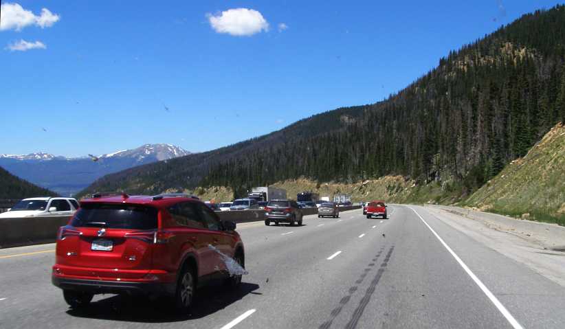
The sun was high in the air when I left Georgetown, there was a little traffic about but the road was clear and many miles of the Rockies lay ahead. I would be crossing two high points of the range as I drove this day and high points always means views to be seen.
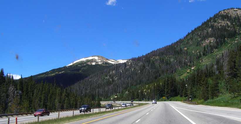
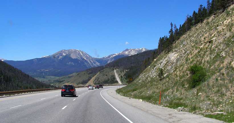
Back onto the I70. There seemed to be more traffic heading in the direction of Denver while for me the traffic was light. Snow on the higher peaks became a common sight.
Then, after the first high point there was some kind of traffic holdup for that Denver-bound traffic. Quite a traffic jam and I felt for the truck drivers caught up in it in particular as it was a steep climb they were on.
Traffic jam. A nasty holdup for the Eastbound lanes, while we�re starting to descend at a rapid rate of fall heading West from that first high point.
It was here that I noticed something quite dramatic about American trucks. Every so often as we sped down this mountain slope � which was steep for some miles � there was a black blotch on the right lane and then followed a trickle of black to the side.
My admiration for the powerful rigs used in transcontinental transport in America is great, those prime movers hauling huge tonnages at constant speeds often over 75mph deserve recognition. Whether they be Peterbilts or Freightliners or Kenworths, they all bore along the Interstates day and night keeping up high average speeds.
But this stretch seems to be one to test their mettle. I rather suspect it�s more on the descents, as I was on here, rather than on the climbs, holding the weight back against the engine compression and testing the machinery to its limits. And each blotch, I guess, represents when they went beyond those limits. Engines or gearboxes? Both, probably.
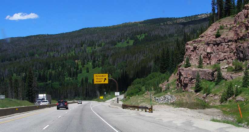
Pleasant driving. What a magnificent bit of road this is for travelling through these mountains. Here, a bit further down that great descent, we have a view of the mountain peaks, while nearer to us there�s one of the safety ramps to give runaway trucks a chance to pull up before they gain too much speed.
That pleasant running continued between this descent and the long and steep ascent to the Eisenhower Tunnel at the other crest in the Rockies. President Eisenhower has his name on the whole network of Interstates too, because he was the President who signed the Federal Aid Highway Act of 1956 which set in train the construction of this mighty road network. The planning outline for the network had been under consideration since 1939 and gained further authorisation for a network totalling up to 40,000 miles under a Federal Act of 1944.
The tunnel is adjacent to the Loveland ski area, it�s 13 miles from Georgetown and marked 92 miles I�d been on the road so far for the day. But that included the 57-mile diversion in to Mount Evans. There was still 102 miles to cover before I got to Glenwood Springs.
Of note was the fact that the fuel vaporisation hadn�t given me any problems despite climbing to these heights in the middle of the day.
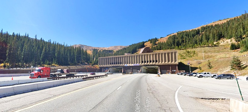
Eisenhower Tunnel. This cut out a bit of the climb, but it�s still 11,013 feet above sea level � 3,613 metres � and then there�s another long descent.
Tunnels are not common in Australia except in the cities. We could certainly use one at Cunningham�s Gap in Queensland, where rock falls have blocked the highway from time to time and I�m sure it would give a great saving in fuel comsumption to the many trucks rumbling through there en-route from Brisbane to Outback Queensland or to Sydney. We did, of course, drive through hundreds of tunnels in Europe.
And after this tunnel there was obviously a long descent, dropping to 2754 metres at Silverthorne, with more evidence of catastrophic truck problems as we descended:
Down to Silverthorne. You can see how sharp this descent is in this frame, and it lasts for a few miles before it levels out at Silverthorne and Frisco.
Again there was provision for runaway trucks, this time it was merely a sign telling them to stay on the Interstate. One can easily imagine what might happen if they didn�t, of course�
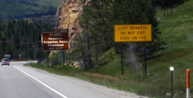
Lost brakes? I�m sure it would be a nightmare for truck drivers to face here, and I�d certainly hope that they stuck by this sign rather than chance running down an exit.
I pulled into Silverthorne and started looking around the shops and found an abundance of �name� clothing stores. Names which attract the wealthier people, I guess you could say, names like Christian Dior and so on. Prices were set to match the names and I quickly gathered it wasn�t somewhere I would find anything I was looking for and I went on to Frisco.
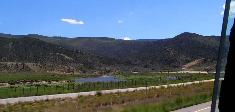
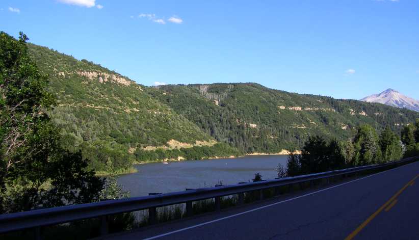
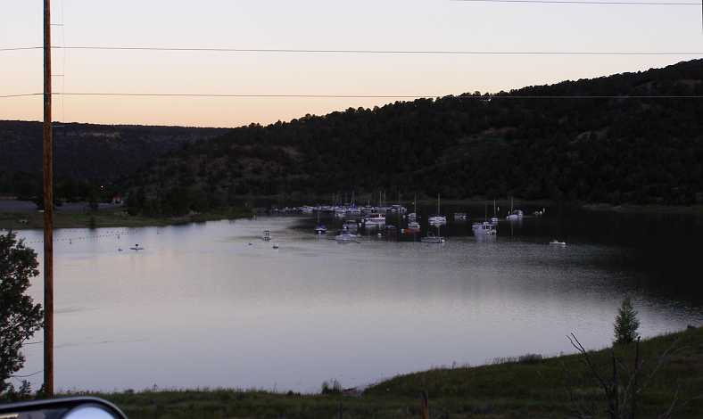
Just before Silverthorne�s twin-town of Frisco there was a scenic pull-off to look over the waters and islands of the Dillon Reservoir. I took the opportunity to pull in there and take this pic:
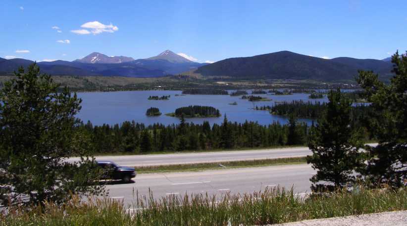
Dillon Reservoir. From the scenic pull-off I captured this scene with the islands in the reservoir and the distant mountians.
At Frisco I found a Walmart, from which I bought some supplies to keep me going. I was looking to cook myself a hot lunch when I found a suitable spot. And as I continued the wonderful state of Colorado kept throwing up scenes worth photographing to take them home.
Near Copper Mountain. Copper Mountain is yet another ski resort area and this exit provides the opportunity to head off to the South to Independence Pass while the I70 takes a sharp turn to the North-West.
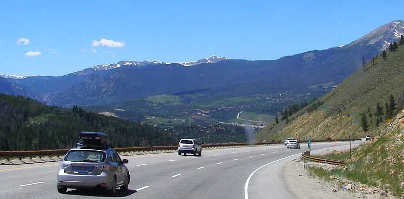
Now clear of the higher ridges, the I70 finds some more open ground to cover. Still there are distant peaks with their snow showing despite it being July.
Open road. Some straighter running was afforded along some of these valleys in the mountains.
That�s not to say there still wasn�t some ascents and descents to come, nor bends, for the I70 is still in the midst of the mountains right through to the Glenwood Canyon. And trucks were still given some opportunity for salvation when all went wrong�
Safety ramp. Or that�s the name by which we know them at home. This one seems to have a fairly tight entry, however, but it might be better than careering downhill for another mile without brakes.
Maybe it went wrong for one here? The fence has been mauled and police and recovery vehicles have got the main lanes blocked so they can work at clearing it up.
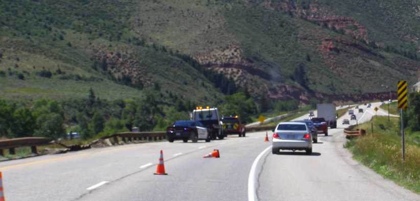
Accident scene. This was the third accident scene I�d come across in my trip from East to West. There�s a gap between the East- and Westbound lanes here so room for mishaps to be contained.
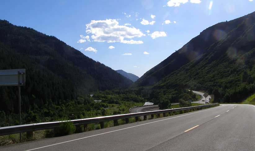
For a long time the I70 followed the Eagle River. We were alongside it here as we approached the Wolcott exit, about 58 miles after the Eisenhower tunnel:
Wolcott exit. A very open scene as we follow the Eagle River, the Wolcott exit is just ahead of us.
The next �landmark� was at Dotsero, where the Colorado River joins with the Eagle River and their combined waters prepare for their trip to the sea. Shortly after they joined together I took this photo of the Colorado River as it flowed alongside the Interstate:
Colorado River. Carrying the melted snows, this river has certainly made its mark on the landscape further down, but here it seems almost innocent of such power.
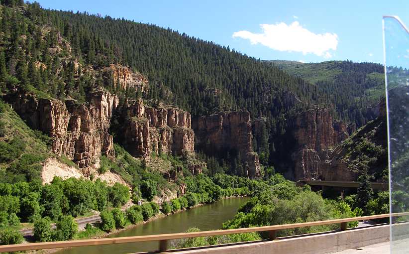
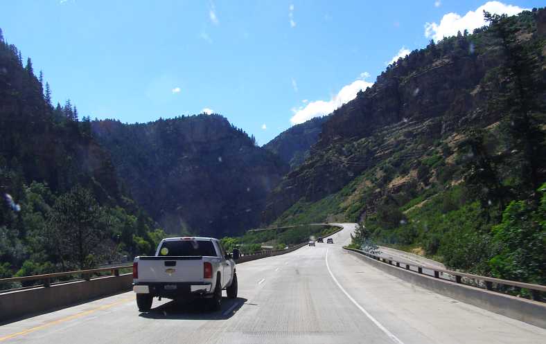
The canyon-carving river alongside of us carved its first canyon from around the next bend. We entered the Glenwood Canyon with the railway clearly visible on the opposite shore and the Interstate jammed between the river and the cliffs to our right on many occasions. It was a place where the roadmakers had to come up with answers to the need to preserve the canyon while continuing to serve the transport needs of the country.
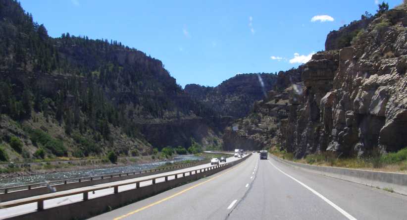
Glenwood Canyon. The first of the Colorado River�s achievements in creating canyons is this 13-mile long carving of rock and soil.
Soon after entering the canyon I found my opportunity to stop and cook up that meal. Known as the �Bair Ranch Rest Area�, this little oasis where the canyon�s width is greater provided me with a parking lot and facilities so necessary when cooking and cleaning up on the run. I�ve resorted to a Google Earth view of that spot, but it was (again) taken when the trees were lifeless, whereas I was able to pull up under some good shade.
Bair Ranch. A nice spot, with the river on one side and the Interstate humming away on the other. I was able to cook a nice lunch in a parking spot under the trees to the left.
Having enjoyed some conversation with fellow picnickers, I cleaned up and took a stroll up to the exit road, from which I got this picture which shows more leaf and shade.
Top side. As can be seen from this shot from the top road, there was plenty of foliage to throw shade on me as I cooked my lunch.
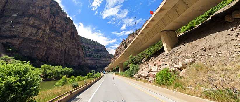
Driving through the canyon was nice. There were some tight spots where the engineers had to devise ways to reduce the overall road width and they did this by overlapping the lanes slightly, the Eastbound lanes being built lower than the Westbound.
Bridges in the canyon. Much of the road is elevated to enable it to fit into the narrow confines of the canyon. Note the railway on the opposite side of the Colorado River.
And resorting again to Google Earth�s Street View to show how it was done:
Overlap. Here�s an example of the overlapping of the converging lanes. It might not be a lot, but it makes a difference when there isn�t much room.
The canyon, as mentioned, wasn�t all that long. Soon it was to end and we�d be out of it again. But first there were some tunnels where we crossed the river at a bend and it was really tight:
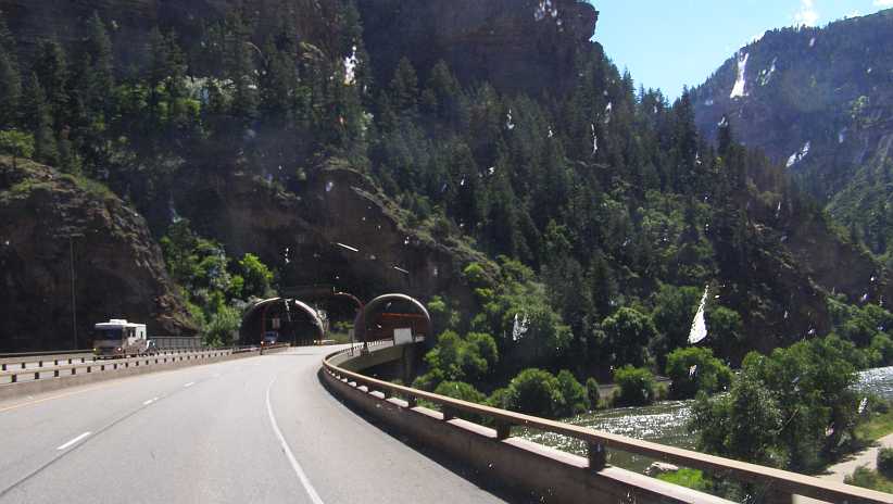
Tunnels. Sometimes it is necessary to resort to this method to keep up the smooth flow of the road within the geographic constraints.
It all opened up again just before Glenwood Springs�
Opening up. No longer the tight confines of the canyon proper, there�s more room here for the Interstate and the railway to peacefully co-exist with the river.
�before we got to No Name. Yes, that�s right, No Name. There�s a No Name Rest Area, a No Name Lane and a No Name Creek, which must be hard for residents there to explain when they�re trying to tell someone where they live!
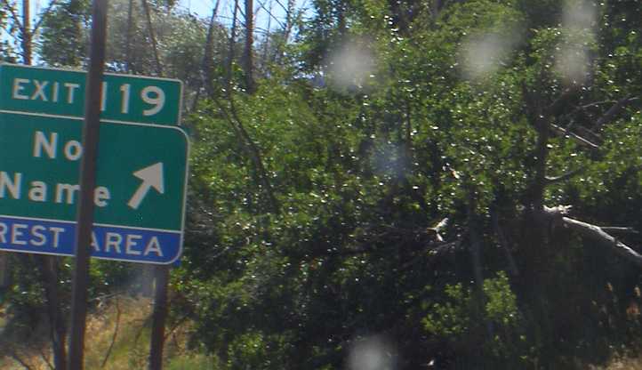
No Name! I just caught this one as I got close to Glenwood Springs, I guess it�s an easy name to give a place when every other name is taken.
Then there is another pair of tunnels, known as the �No Name� tunnels before the entry into the built up area of Glenwood Springs. Another thing visible in this photo is the sign relating to the adoption of this section of road, in this case by a business, which means they go out and tidy along the edges from time to time. Often these adoptions are by community groups in the nearby towns.
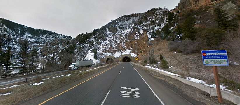
No Name tunnels. Google Earth got this shot in some colder weather, the tunnels and the sign about the section�s adoption by �The Green Joint.�
I still had a way to go on my day�s drive, but there�s so much to the day that I�ll break here again before describing the magic of the Crystal River and the sudden change heading into Delta�
Back onto the I70. There seemed to be more traffic heading in the direction of Denver while for me the traffic was light. Snow on the higher peaks became a common sight.
Then, after the first high point there was some kind of traffic holdup for that Denver-bound traffic. Quite a traffic jam and I felt for the truck drivers caught up in it in particular as it was a steep climb they were on.
Traffic jam. A nasty holdup for the Eastbound lanes, while we�re starting to descend at a rapid rate of fall heading West from that first high point.
It was here that I noticed something quite dramatic about American trucks. Every so often as we sped down this mountain slope � which was steep for some miles � there was a black blotch on the right lane and then followed a trickle of black to the side.
My admiration for the powerful rigs used in transcontinental transport in America is great, those prime movers hauling huge tonnages at constant speeds often over 75mph deserve recognition. Whether they be Peterbilts or Freightliners or Kenworths, they all bore along the Interstates day and night keeping up high average speeds.
But this stretch seems to be one to test their mettle. I rather suspect it�s more on the descents, as I was on here, rather than on the climbs, holding the weight back against the engine compression and testing the machinery to its limits. And each blotch, I guess, represents when they went beyond those limits. Engines or gearboxes? Both, probably.
Pleasant driving. What a magnificent bit of road this is for travelling through these mountains. Here, a bit further down that great descent, we have a view of the mountain peaks, while nearer to us there�s one of the safety ramps to give runaway trucks a chance to pull up before they gain too much speed.
That pleasant running continued between this descent and the long and steep ascent to the Eisenhower Tunnel at the other crest in the Rockies. President Eisenhower has his name on the whole network of Interstates too, because he was the President who signed the Federal Aid Highway Act of 1956 which set in train the construction of this mighty road network. The planning outline for the network had been under consideration since 1939 and gained further authorisation for a network totalling up to 40,000 miles under a Federal Act of 1944.
The tunnel is adjacent to the Loveland ski area, it�s 13 miles from Georgetown and marked 92 miles I�d been on the road so far for the day. But that included the 57-mile diversion in to Mount Evans. There was still 102 miles to cover before I got to Glenwood Springs.
Of note was the fact that the fuel vaporisation hadn�t given me any problems despite climbing to these heights in the middle of the day.
Eisenhower Tunnel. This cut out a bit of the climb, but it�s still 11,013 feet above sea level � 3,613 metres � and then there�s another long descent.
Tunnels are not common in Australia except in the cities. We could certainly use one at Cunningham�s Gap in Queensland, where rock falls have blocked the highway from time to time and I�m sure it would give a great saving in fuel comsumption to the many trucks rumbling through there en-route from Brisbane to Outback Queensland or to Sydney. We did, of course, drive through hundreds of tunnels in Europe.
And after this tunnel there was obviously a long descent, dropping to 2754 metres at Silverthorne, with more evidence of catastrophic truck problems as we descended:
Down to Silverthorne. You can see how sharp this descent is in this frame, and it lasts for a few miles before it levels out at Silverthorne and Frisco.
Again there was provision for runaway trucks, this time it was merely a sign telling them to stay on the Interstate. One can easily imagine what might happen if they didn�t, of course�
Lost brakes? I�m sure it would be a nightmare for truck drivers to face here, and I�d certainly hope that they stuck by this sign rather than chance running down an exit.
I pulled into Silverthorne and started looking around the shops and found an abundance of �name� clothing stores. Names which attract the wealthier people, I guess you could say, names like Christian Dior and so on. Prices were set to match the names and I quickly gathered it wasn�t somewhere I would find anything I was looking for and I went on to Frisco.
Just before Silverthorne�s twin-town of Frisco there was a scenic pull-off to look over the waters and islands of the Dillon Reservoir. I took the opportunity to pull in there and take this pic:
Dillon Reservoir. From the scenic pull-off I captured this scene with the islands in the reservoir and the distant mountians.
At Frisco I found a Walmart, from which I bought some supplies to keep me going. I was looking to cook myself a hot lunch when I found a suitable spot. And as I continued the wonderful state of Colorado kept throwing up scenes worth photographing to take them home.
Near Copper Mountain. Copper Mountain is yet another ski resort area and this exit provides the opportunity to head off to the South to Independence Pass while the I70 takes a sharp turn to the North-West.
Now clear of the higher ridges, the I70 finds some more open ground to cover. Still there are distant peaks with their snow showing despite it being July.
Open road. Some straighter running was afforded along some of these valleys in the mountains.
That�s not to say there still wasn�t some ascents and descents to come, nor bends, for the I70 is still in the midst of the mountains right through to the Glenwood Canyon. And trucks were still given some opportunity for salvation when all went wrong�
Safety ramp. Or that�s the name by which we know them at home. This one seems to have a fairly tight entry, however, but it might be better than careering downhill for another mile without brakes.
Maybe it went wrong for one here? The fence has been mauled and police and recovery vehicles have got the main lanes blocked so they can work at clearing it up.
Accident scene. This was the third accident scene I�d come across in my trip from East to West. There�s a gap between the East- and Westbound lanes here so room for mishaps to be contained.
For a long time the I70 followed the Eagle River. We were alongside it here as we approached the Wolcott exit, about 58 miles after the Eisenhower tunnel:
Wolcott exit. A very open scene as we follow the Eagle River, the Wolcott exit is just ahead of us.
The next �landmark� was at Dotsero, where the Colorado River joins with the Eagle River and their combined waters prepare for their trip to the sea. Shortly after they joined together I took this photo of the Colorado River as it flowed alongside the Interstate:
Colorado River. Carrying the melted snows, this river has certainly made its mark on the landscape further down, but here it seems almost innocent of such power.
The canyon-carving river alongside of us carved its first canyon from around the next bend. We entered the Glenwood Canyon with the railway clearly visible on the opposite shore and the Interstate jammed between the river and the cliffs to our right on many occasions. It was a place where the roadmakers had to come up with answers to the need to preserve the canyon while continuing to serve the transport needs of the country.
Glenwood Canyon. The first of the Colorado River�s achievements in creating canyons is this 13-mile long carving of rock and soil.
Soon after entering the canyon I found my opportunity to stop and cook up that meal. Known as the �Bair Ranch Rest Area�, this little oasis where the canyon�s width is greater provided me with a parking lot and facilities so necessary when cooking and cleaning up on the run. I�ve resorted to a Google Earth view of that spot, but it was (again) taken when the trees were lifeless, whereas I was able to pull up under some good shade.
Bair Ranch. A nice spot, with the river on one side and the Interstate humming away on the other. I was able to cook a nice lunch in a parking spot under the trees to the left.
Having enjoyed some conversation with fellow picnickers, I cleaned up and took a stroll up to the exit road, from which I got this picture which shows more leaf and shade.
Top side. As can be seen from this shot from the top road, there was plenty of foliage to throw shade on me as I cooked my lunch.
Driving through the canyon was nice. There were some tight spots where the engineers had to devise ways to reduce the overall road width and they did this by overlapping the lanes slightly, the Eastbound lanes being built lower than the Westbound.
Bridges in the canyon. Much of the road is elevated to enable it to fit into the narrow confines of the canyon. Note the railway on the opposite side of the Colorado River.
And resorting again to Google Earth�s Street View to show how it was done:
Overlap. Here�s an example of the overlapping of the converging lanes. It might not be a lot, but it makes a difference when there isn�t much room.
The canyon, as mentioned, wasn�t all that long. Soon it was to end and we�d be out of it again. But first there were some tunnels where we crossed the river at a bend and it was really tight:
Tunnels. Sometimes it is necessary to resort to this method to keep up the smooth flow of the road within the geographic constraints.
It all opened up again just before Glenwood Springs�
Opening up. No longer the tight confines of the canyon proper, there�s more room here for the Interstate and the railway to peacefully co-exist with the river.
�before we got to No Name. Yes, that�s right, No Name. There�s a No Name Rest Area, a No Name Lane and a No Name Creek, which must be hard for residents there to explain when they�re trying to tell someone where they live!
No Name! I just caught this one as I got close to Glenwood Springs, I guess it�s an easy name to give a place when every other name is taken.
Then there is another pair of tunnels, known as the �No Name� tunnels before the entry into the built up area of Glenwood Springs. Another thing visible in this photo is the sign relating to the adoption of this section of road, in this case by a business, which means they go out and tidy along the edges from time to time. Often these adoptions are by community groups in the nearby towns.
No Name tunnels. Google Earth got this shot in some colder weather, the tunnels and the sign about the section�s adoption by �The Green Joint.�
I still had a way to go on my day�s drive, but there�s so much to the day that I�ll break here again before describing the magic of the Crystal River and the sudden change heading into Delta�
Thread Starter
|
Captain
Joined: Oct 2005
Posts: 570
Likes: 8
From: The Summit, Queensland, Australia
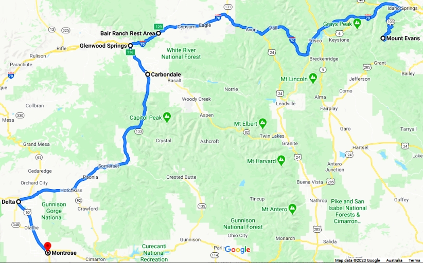
I didn�t allow Glenwood Springs to slow my progress, rather concentrated on heading off towards the road down to Durango. I had two choices, of course, or more if I got adventurous, but principally to go either the shorter major route via Carbondale and the Crystal River Valley, which was 120 miles to Montrose�
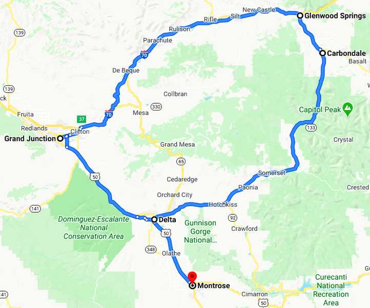
Alternatives. These were my choices from Glenwood Springs to Montrose, with little to choose in distance it came down to thinking about a change of scenery.
�or to stay on the I70 and go out to Grand Junction, only a little longer at 148 miles and probably likely to take about the same time. But even though I didn�t know what either route held in store, I felt I�d been on the I70 for a while now, it was time to take advantage of less-well trod paths. Thus I chose the Crystal River Valley path and I was to become so pleased that I did.
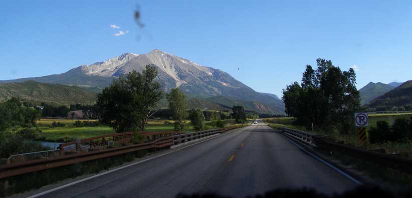
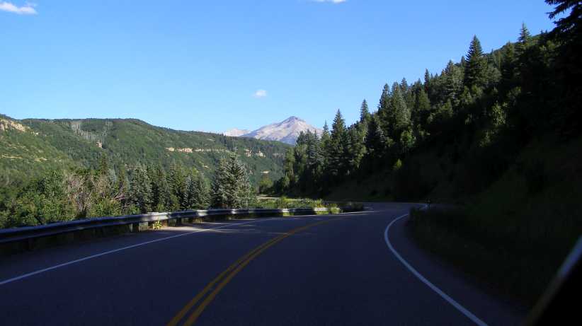
It began with turning South from Glenwood Springs on the main road to Aspen. Under fifteen miles passed before turning to the right, but much of the way from Glenwood Springs I�d been impressed by the sight of Mount Sopris out there between some of the closer peaks:
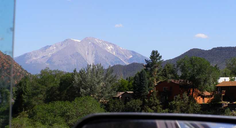
Mount Sopris. Dominating the outlook as I headed towards Carbondale was this peak, which reaches about 13,000ft.
Then I was to get closer to it as I struck out on the 86-mile stretch to Delta. My progress came to a brief halt when I noticed this truck�
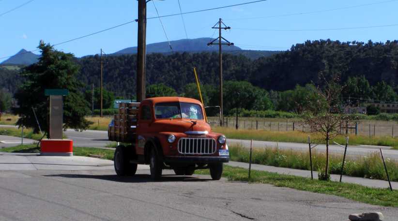
Strange Dodge. This truck was parked her to promote a farm�s produce, but to me it was the unusual grille which caught my attention.
�which was parked at the front of the Roaring Fork Valley Co-op group of stores. Just what that grille comes from I can�t identify.
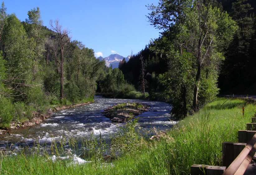
Leaving the Carbondale area saw Mount Sopris still very much a focal point. A 2-lane road, very light traffic, this was already a good start to my off-Interstate drive for the day. Little did I know at this stage what impact that innocent little river flowing under this bridge would have on me just a little while later:
Leaving Carbondale. The footbridge is most appropriate beside the road here, taking the short walk out of town to admire the view � and in particular the river � would make for a nice interlude.
Naturally, as a road which followed a river through a mountainous region, it was to carry on through gorges as well as more open country�
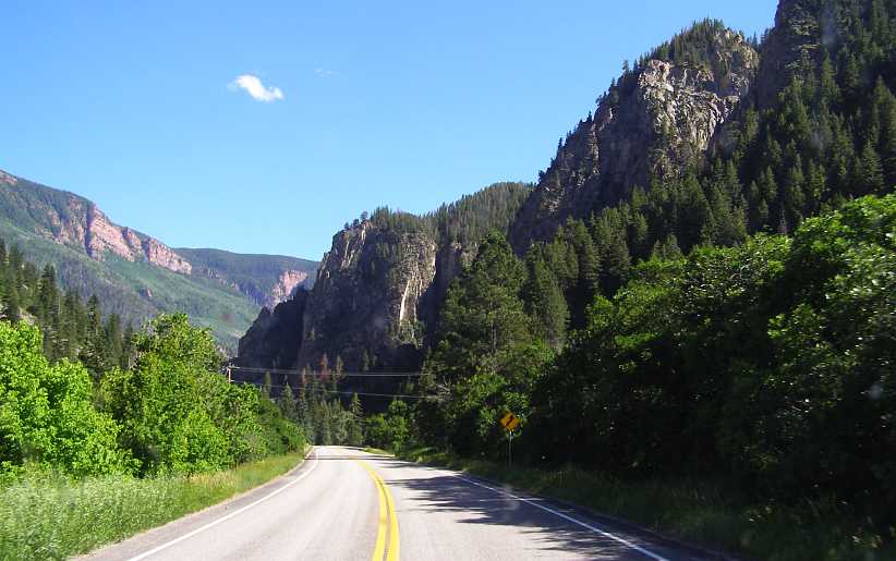
Into a gorge. There�s common ground here between the Crystal River and the Colorado River as it has carved its way through these mountains over the millenia. I could see there was more beauty to come.
The road swept round a few curves as it climbed and I became more and more aware of the Crystal River at my left. It ripped its way over rocks as it fell downhill, at times little bridges crossed it going onto properties of people who live among this beauty, but they were rare. Eventually I had to pull up and get some decent photos of a river which really lives up to its name:
Crystal ripples. Surely the most aptly-named river in the world. The rippling of the waters over the rocks was entrancing.
Rippling around an island. No doubt little islands wash up from time to time as the melting snows send huge quantities of waters down the valley and carry sands and stones with them.
Just how �crystal� clear this river is can be seen here, the rocks being washed below the waters show through clearly:
Transparency. The clarity of the waters of the Crystal River made a big impression on me, even the late afternoon shadows did little to prevent seeing the rocks on the riverbed.
With these thoughts I kept on looking until the river left me. Or the road left the river. It had to climb over a range and as it did I was afforded the vistas that only mountain areas give us. I did try to catch one such scene, down a valley off to the right, as I drove:
Ascending the range. A valley view which came up as I drove up the steep climb. Unfortunately not a very clear picture.
Ultimately I reached the top of that climb and then the view of the other side was there to confront me. More mountains, some cleared areas and just a few soft little clouds high in the sky. It was truly a nice day to be going for such a drive.
Top of the range. Yes, more mountains in view, but amid that haze and with the sun now low in the West to create this effect on the view.
What goes up must come down, they say, so I now enjoyed the descent on a nice smooth bit of 2-lane with virtually no other traffic about�
Descent. Alone on the road, I was able to enjoy driving through these curves as well as the views which opened up before me.
As things levelled out a bit I came into a stretch where there were some towns. After Somerset there was a nice stretch of water alongside the road, obviously a water-supply dam for the towns nearby. This was the Paonia Reservoir which was formed by damming the North Arm Gunnison River, which was the valley the road was following at this stage.
Paonia Reservoir. With a high peak in the background, the waters of the Paonia Reservoir stood out in the afternoon sun below cliffs trying to stand out from the trees clinging to the steep slopes.
This road still proved to be interesting and enjoyable to drive, just below the dam came the turnoff to Gunnison and the sweeps of the road and the glimpses of the river made a worthwhile scene.
Gunnison turnoff. The steep slopes frame this scene, the sheen of the sun off the river forms the focus of the vee they form, while the road sweeps left and right to give the setting more character.
This had marked the half-way point in the Carbondale to Delta stretch. Soon I was in the town of Hotchkiss, where the alternating lights outside the First State Bank told me it was 6:29pm and that it was still quite a hot day in the lower reaches:
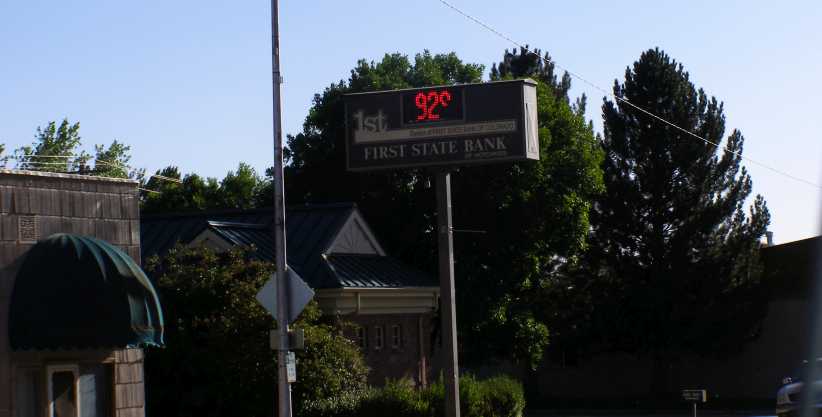
First State Temperature. 92� in the late afternoon was the message I got here as I drove through with the thought that Delta would be a good spot to refuel and get something to eat.
The scenery suddenly changed during this short drive. I was out of gorges and mountains, I was on the flatter country like that I�d seen in so many parts of this country. I was 236 miles from North Central Evergreen as I drove into Delta, almost all of that distance having been consumed driving more or less directly over the magnificent Rockies.
I was also thinking at the time that I�d seen so much beauty during this day�s drive that my next day going down to Durango must be very special. But driving into Delta showed nothing of that. I looked around to see where I might get fuel and food, but was interrupted in that course by the sight of all these old cars:
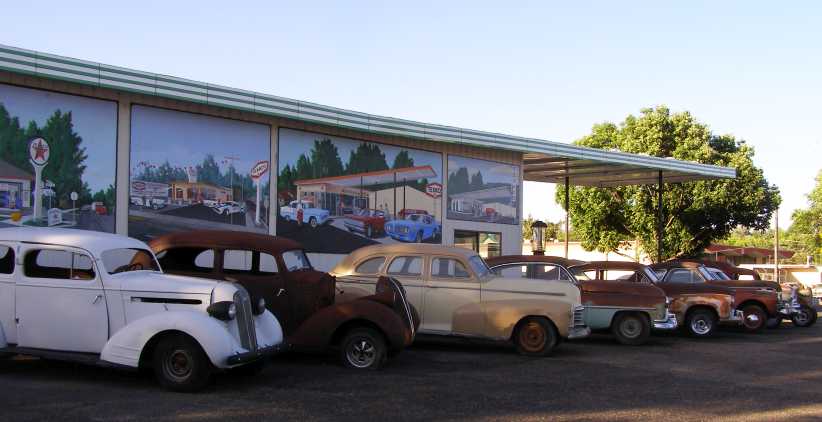
Orval�s Classic Cars. These relics spread in the forecourt of this car yard, many different makes and models generally from the mid-thirties to the late-fifties. But more of the older ones.
The interesting thing about this picture is that those very cars still line the front of the building, which seems to indicate that dragging old cars off farms and out of creek beds might not be a quick way to riches. A whole yard across the road was home to many more�
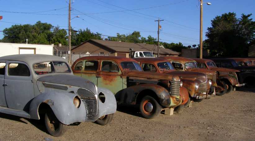
More old relics. Ford, Oldsmobile, Plymouth, Chevrolet, there�s at least one of most makes in Orval�s collection.
And one I�m not likely to have seen at home:
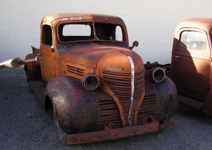
Plymouth pickup. The Plymouth name wasn�t used on commercial vehicles in Australia. This would have been sold at home as a Fargo.
I went back to the Northern end of town where the City Market gas station featured the colours of the discount card I obtained in 2014 from the �Loaf & Jug� outlet I�d visited in Spearfish, South Dakota, and so I got a bit of a discount as I filled my tank. As it was too dark for pics I relied on the Google Earth Street View to get this:
City Market gas. I filled the van�s large fuel tank here and then went to the McDonalds in the background to get a quick burger.
I recall striking up a conversation with another patron in McDonalds that evening, yet another traveller, then drove in the dark to Montrose. This was only 20 miles South and that concluded a day in which I�d covered 313 miles and been able to enjoy some wonderful scenery. I found a Walmart there, right on the main road, and headed up into the staff parking area where I found a number of others camped in motorhomes and with caravans.
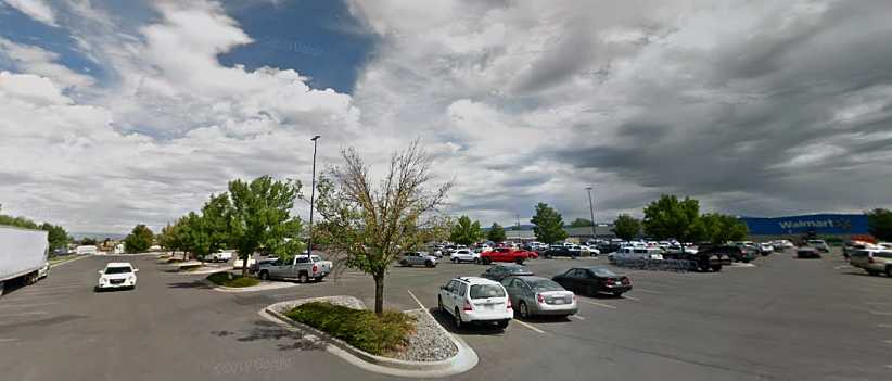
Walmart at Montrose. My camping spot was up the top end of this picture, to the right of the row of trees.
I struck up another conversation with a fellow traveller here, but it wasn�t long before I headed off to bed and some sound sleep to prepare me for the long-awaited drive to Durango�
Alternatives. These were my choices from Glenwood Springs to Montrose, with little to choose in distance it came down to thinking about a change of scenery.
�or to stay on the I70 and go out to Grand Junction, only a little longer at 148 miles and probably likely to take about the same time. But even though I didn�t know what either route held in store, I felt I�d been on the I70 for a while now, it was time to take advantage of less-well trod paths. Thus I chose the Crystal River Valley path and I was to become so pleased that I did.
It began with turning South from Glenwood Springs on the main road to Aspen. Under fifteen miles passed before turning to the right, but much of the way from Glenwood Springs I�d been impressed by the sight of Mount Sopris out there between some of the closer peaks:
Mount Sopris. Dominating the outlook as I headed towards Carbondale was this peak, which reaches about 13,000ft.
Then I was to get closer to it as I struck out on the 86-mile stretch to Delta. My progress came to a brief halt when I noticed this truck�
Strange Dodge. This truck was parked her to promote a farm�s produce, but to me it was the unusual grille which caught my attention.
�which was parked at the front of the Roaring Fork Valley Co-op group of stores. Just what that grille comes from I can�t identify.
Leaving the Carbondale area saw Mount Sopris still very much a focal point. A 2-lane road, very light traffic, this was already a good start to my off-Interstate drive for the day. Little did I know at this stage what impact that innocent little river flowing under this bridge would have on me just a little while later:
Leaving Carbondale. The footbridge is most appropriate beside the road here, taking the short walk out of town to admire the view � and in particular the river � would make for a nice interlude.
Naturally, as a road which followed a river through a mountainous region, it was to carry on through gorges as well as more open country�
Into a gorge. There�s common ground here between the Crystal River and the Colorado River as it has carved its way through these mountains over the millenia. I could see there was more beauty to come.
The road swept round a few curves as it climbed and I became more and more aware of the Crystal River at my left. It ripped its way over rocks as it fell downhill, at times little bridges crossed it going onto properties of people who live among this beauty, but they were rare. Eventually I had to pull up and get some decent photos of a river which really lives up to its name:
Crystal ripples. Surely the most aptly-named river in the world. The rippling of the waters over the rocks was entrancing.
Rippling around an island. No doubt little islands wash up from time to time as the melting snows send huge quantities of waters down the valley and carry sands and stones with them.
Just how �crystal� clear this river is can be seen here, the rocks being washed below the waters show through clearly:
Transparency. The clarity of the waters of the Crystal River made a big impression on me, even the late afternoon shadows did little to prevent seeing the rocks on the riverbed.
With these thoughts I kept on looking until the river left me. Or the road left the river. It had to climb over a range and as it did I was afforded the vistas that only mountain areas give us. I did try to catch one such scene, down a valley off to the right, as I drove:
Ascending the range. A valley view which came up as I drove up the steep climb. Unfortunately not a very clear picture.
Ultimately I reached the top of that climb and then the view of the other side was there to confront me. More mountains, some cleared areas and just a few soft little clouds high in the sky. It was truly a nice day to be going for such a drive.
Top of the range. Yes, more mountains in view, but amid that haze and with the sun now low in the West to create this effect on the view.
What goes up must come down, they say, so I now enjoyed the descent on a nice smooth bit of 2-lane with virtually no other traffic about�
Descent. Alone on the road, I was able to enjoy driving through these curves as well as the views which opened up before me.
As things levelled out a bit I came into a stretch where there were some towns. After Somerset there was a nice stretch of water alongside the road, obviously a water-supply dam for the towns nearby. This was the Paonia Reservoir which was formed by damming the North Arm Gunnison River, which was the valley the road was following at this stage.
Paonia Reservoir. With a high peak in the background, the waters of the Paonia Reservoir stood out in the afternoon sun below cliffs trying to stand out from the trees clinging to the steep slopes.
This road still proved to be interesting and enjoyable to drive, just below the dam came the turnoff to Gunnison and the sweeps of the road and the glimpses of the river made a worthwhile scene.
Gunnison turnoff. The steep slopes frame this scene, the sheen of the sun off the river forms the focus of the vee they form, while the road sweeps left and right to give the setting more character.
This had marked the half-way point in the Carbondale to Delta stretch. Soon I was in the town of Hotchkiss, where the alternating lights outside the First State Bank told me it was 6:29pm and that it was still quite a hot day in the lower reaches:
First State Temperature. 92� in the late afternoon was the message I got here as I drove through with the thought that Delta would be a good spot to refuel and get something to eat.
The scenery suddenly changed during this short drive. I was out of gorges and mountains, I was on the flatter country like that I�d seen in so many parts of this country. I was 236 miles from North Central Evergreen as I drove into Delta, almost all of that distance having been consumed driving more or less directly over the magnificent Rockies.
I was also thinking at the time that I�d seen so much beauty during this day�s drive that my next day going down to Durango must be very special. But driving into Delta showed nothing of that. I looked around to see where I might get fuel and food, but was interrupted in that course by the sight of all these old cars:
Orval�s Classic Cars. These relics spread in the forecourt of this car yard, many different makes and models generally from the mid-thirties to the late-fifties. But more of the older ones.
The interesting thing about this picture is that those very cars still line the front of the building, which seems to indicate that dragging old cars off farms and out of creek beds might not be a quick way to riches. A whole yard across the road was home to many more�
More old relics. Ford, Oldsmobile, Plymouth, Chevrolet, there�s at least one of most makes in Orval�s collection.
And one I�m not likely to have seen at home:
Plymouth pickup. The Plymouth name wasn�t used on commercial vehicles in Australia. This would have been sold at home as a Fargo.
I went back to the Northern end of town where the City Market gas station featured the colours of the discount card I obtained in 2014 from the �Loaf & Jug� outlet I�d visited in Spearfish, South Dakota, and so I got a bit of a discount as I filled my tank. As it was too dark for pics I relied on the Google Earth Street View to get this:
City Market gas. I filled the van�s large fuel tank here and then went to the McDonalds in the background to get a quick burger.
I recall striking up a conversation with another patron in McDonalds that evening, yet another traveller, then drove in the dark to Montrose. This was only 20 miles South and that concluded a day in which I�d covered 313 miles and been able to enjoy some wonderful scenery. I found a Walmart there, right on the main road, and headed up into the staff parking area where I found a number of others camped in motorhomes and with caravans.
Walmart at Montrose. My camping spot was up the top end of this picture, to the right of the row of trees.
I struck up another conversation with a fellow traveller here, but it wasn�t long before I headed off to bed and some sound sleep to prepare me for the long-awaited drive to Durango�
Thread Starter
|
Captain
Joined: Oct 2005
Posts: 570
Likes: 8
From: The Summit, Queensland, Australia
I was on the road early, and that shows in the first several photos. Just to underline my anticipation for this day�s journey, I was told back in New Mexico on my 2012 trip that it was the �nicest drive in all of America.� I couldn�t fit it into that first trip, nor my second trip in 2014, but no way was I missing out again on this trip. A quick breakfast and into the driver�s seat, this was the path I would follow:
A straightforward run of about 108 miles to Durango, but with a promise of many beautiful scenes to admire, but not immediately going out of Montrose�
Leaving Montrose.[i] Getting away early means poor lighting, as can be seen here. Little more than a glimmer of light on the horizon.
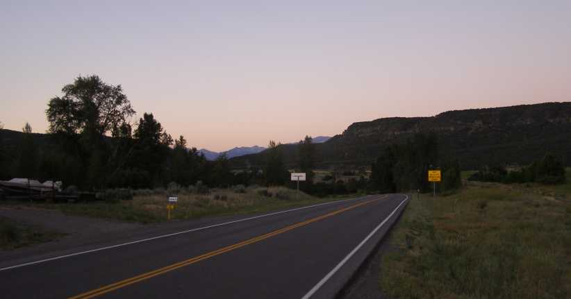
�though there�s a hint of pink sky in the next picture. Montrose to Ridgway was just 26 miles, so not a lot of changes would take place as I drove there.
Still dawn. A little pink in the sky shows how early it is too, the road to Ridgway being surrounded by high� umm� ridges.
And I wasn�t alone on the road. Mostly early workers headed into Montrose or, probably, Delta coming the other way. I felt this ragged horizon was worth stopping to capture:
Ragged horizon. A ragged ridgeline such as this is to be expected in mountainous country, and there was plenty of that along this road.
Such things change as you drive, with various peaks at different distances and subject to apparent �movement� from your point of view. And the higher parts would get the warming sun earlier too, so I was to enjoy seeing that line of sunshine cut across the vista as I drove into Ridgway.
Ridgway sunrise. The summer sun lights up the distant peaks, a sure sign that the day is arriving in the little town of Ridgway.
The sun would be a nice addition to the lake just before town, a lake where locals moor their boats and enjoy time on the water:
Ridgway boating. There was a number of boats in the lake on the hill overlooking Ridgway, no doubt a feature of living and holidaying in the town.
It wasn�t the only lake to be seen, either. A bit further along I got this picture, which also shows the sun advancing further down the slopes of the distant mountains. It was good to watch the sun�s progress as I drove�
Another lake, more sunshine. Watching the sun and seeing the lakes was a good start to the day�
�continually exposing more of the view�
More sun rising. �and gave warm feelings even in the cool morning. Rocks and snow coming into view as I went past farms, homes and forests.
�for a while. Then I entered into shadow for some time, the Rockies on my left encroaching on the prospect of me seeing more sun nearby, only lighting up some peaks in the distance. I was getting closer to Ouray, which is 36 miles from Montrose.
 [/url]
Tops alight. But only the tops. At this point I was driving into deeper shadow from the mountains to my left.
Cliffs came closer to the road, shutting out more of the morning with their deep shadows.
 [/url]
Shadowed cliffs. Crammed against the cliff, the road here would not see sunshine until late morning. Too late for my passage.
And then I was in Ouray. It�s a town with obvious tourist leanings, accommodation and souvenirs are probably the main business there. It�s nestled into a tight valley surrounded by steep mountains, as can be seen:
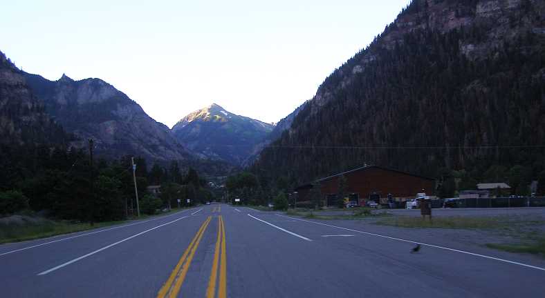
Entering Ouray. I�m supposing that this was the start of the really spectacular drive I�d been told I should take, with Ouray just a town from which to begin.
Behind the displayed vehicles, the stage coach and the old covered wagon, can be seen the hotels which provide for the tourists coming here. The stage coach looked like it was out of the Wild West, which it probably was�
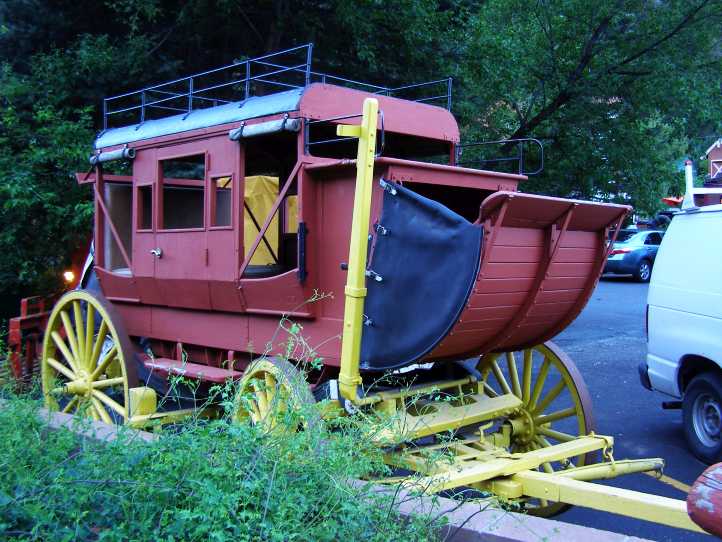
Stage Coach. Looking like you could hitch up a team of four or six horses and go for a run, I�m pretty sure that doesn�t happen.
�and so did the covered wagon:
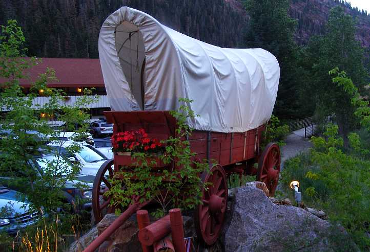
Wagon on rock. I don�t know why it�s perched over a rock, maybe that left more room for the car park? This kind of wagon probably did roll through these hills, but it would have been a perilous thing, I�m sure.
The town was just starting to come to life as I breezed through. Some lights still on and not much of a buzz of activity yet. And straight ahead was that mountain tip with the sun lighting it up:
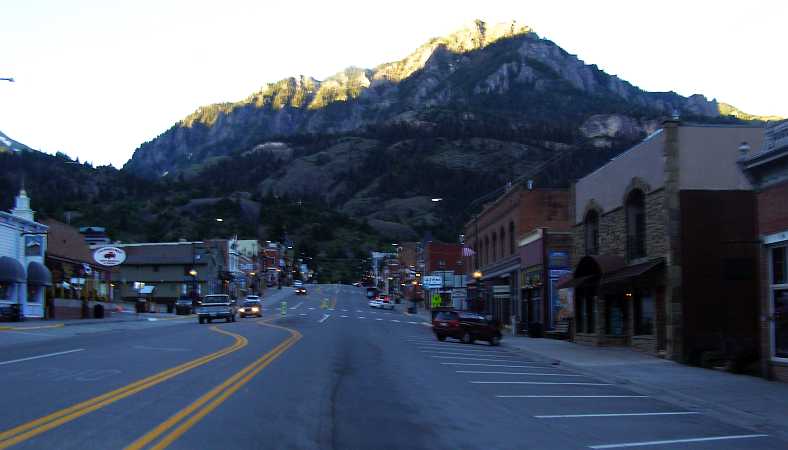
Main street and mountain. A great view adorns this main street. While the town is deep in a valley, the mountain gives it appeal.
Climbing the hill to head further South, I was able to look back on the town in its still-shadowed valley. The climb out of Ouray is long and steep, certainly not easy work for one of those wagons, but not too hard for the 360 in my steed.
Leaving Ouray. This view gives a good indication of how the town is hemmed in by those mountains, closing in on three sides and not leaving much of a gap on the fourth.
Climbing this hill I was able to recall the story a woman told me some time earlier. �I�m not going back on that road again! No way!� she said. �You look straight down the cliffs into the valley � and there�s no fences!� Was I facing another of those roads I�d call �intimidating�?
The first thing that had to happen, however, was to get through this tunnel, where the signs read �Tunnel may be ice,� �Bear Creek Trail Head,� and explain that the tunnel�s height is 13�9�:
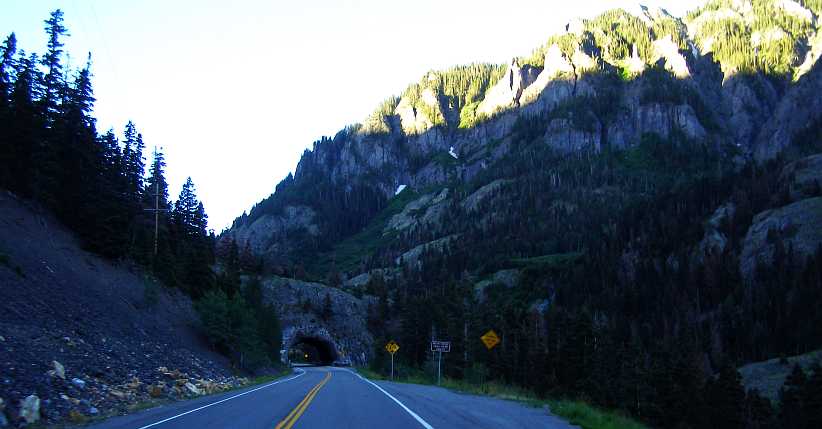
Tunnel closer to the sun. Getting ever closer to the top of that mountain seen from the main street, the tunnel enables traffic to climb higher.
Leaving that milestone behind, I got to the point where a waterfall comes out from under the road�
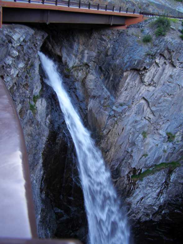
Waterfall from under road. Gushing strongly from under this bridge, the melting snow makes a worthy picture as it commences its fall to the gorge below.
�and cascades into a deep ravine, creating a spray and constantly washing the rocks:
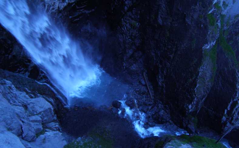
Waterfall in gorge. This chasm, one has to assume, is watered like this all year round. Unless, of course, it�s too cold and turns to ice.
Looking forward from that point the road keeps on climbing. The sunlit peak ahead is the same one we saw before we entered Ouray and now we�re climbing slowly towards it. This is one of those roads which just keeps climbing�
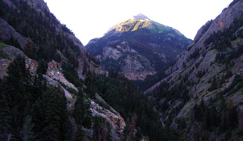
Valley and road ahead. Is there safety railing on that road up the valley? We�re about to find out, and to learn whether the lady�s fears were well-founded. Certainly there are long drops if you go over�
I stopped at a point where there is a fence to get a shot of another waterfall:
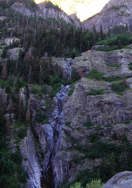
Waterfall across the valley. Only a small one, but it�s falling a long way, while the pine trees cling to their precious perches at an altitude which must be just below the tree line.
This was one of those roads which keeps on giving you more. More climb, that is. Every time you think that it must be the crest ahead, you take a turn and find that it goes up to another level in these mountains.
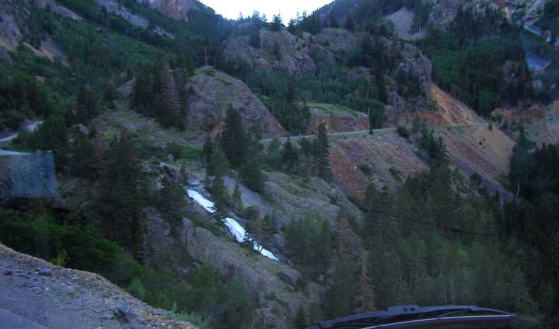
Near the top? Still climbing and still not fence � and how close is the passenger�s side of the van to disaster?
The van was holding up well, too, no vaporisation (it wouldn�t dare in the morning cool, would it?) and the gearbox noise not getting any worse. The 360 had plenty of power to haul it up this steep climb which eventually must end.
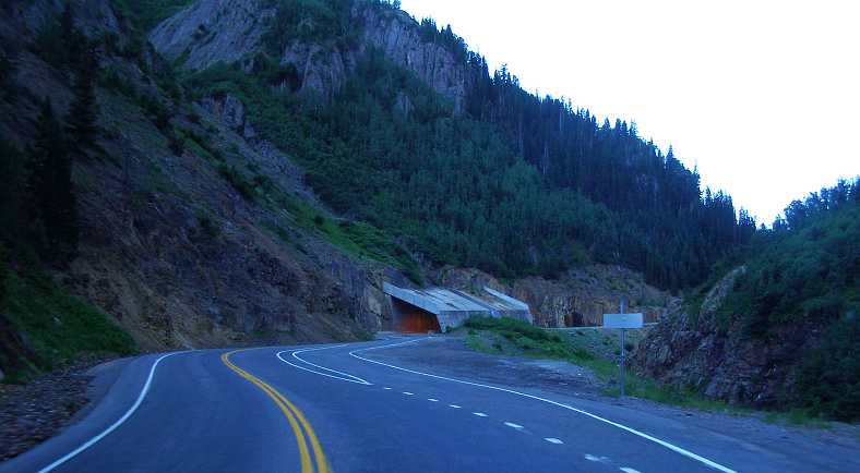
Snow cover. Around another bend and there�s more climbing, this time we go through a concrete tunnel created to allow passage as the snowdrifts come down from the mountain.
The top of the climb finally came, of course. And I was to learn that I hadn�t been the only early bird out travelling this road. I�m sure this cyclist must have left Ouray in the dark to have come this far already:
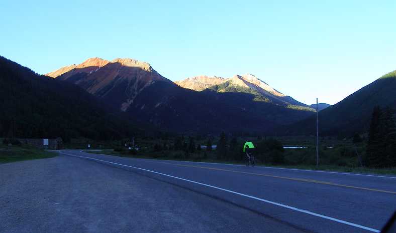
Cyclist at the top. What relief this bloke�s legs must have felt as the road levelled out after that long, steep climb. And there are still-higher peaks well in view.
Then followed a bit of a �transit stage� (as a rallyist would put it) as I drove towards the next town, Silverton. This was about 24 miles from Ouray and reached by another descent. In the meantime I enjoyed the picturesque easy running and the views that were unfolding.
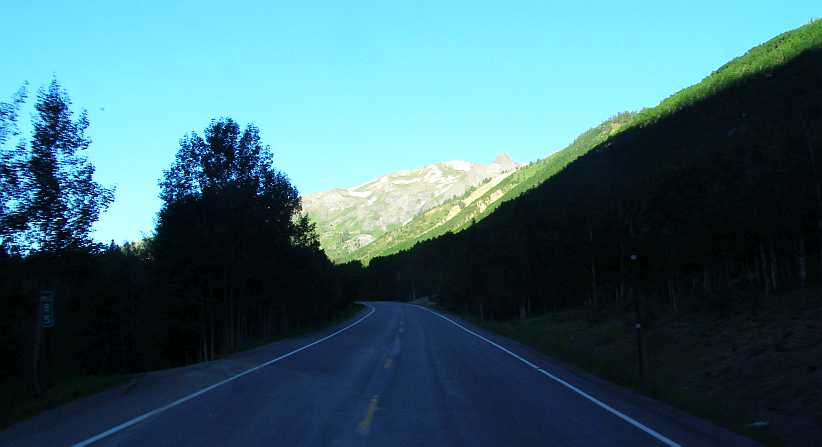
Forests and mountains. The pine trees proliferate here, but not so strongly on those higher peaks just ahead.
And at times I came into full-sun as the road carried me along. It was truly living up to the words of those people who recommended the path, and I feel sorry for that lady who doesn�t want to come this way again as the beauty of this stretch of the Rockies is very real.
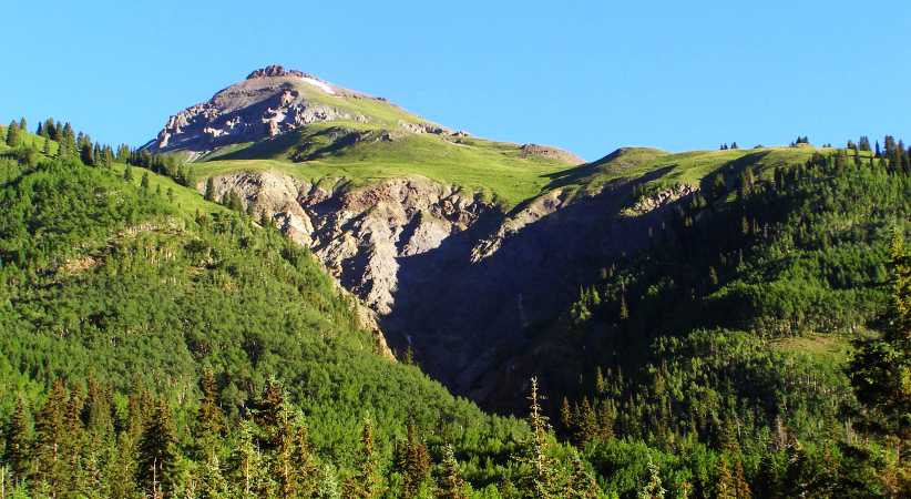
Rough-cast nature. As nature forms the mountains and the valleys it does so in a fashion that is determined by what there is to erode. The shapes left behind can be quite striking but never clinical, rarely symmetrical. And so it is here, unplanned and not complying to any known order.
There would be much more of this to come as I drove, but another thing to be noted is that man�s intrusion is visible as well.
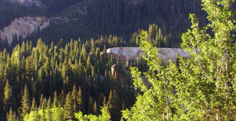
Signs of mining. An overburden pile (or is it tailings?) heralded the presence of some kind of mining in these mountains.
Of course, minerals of all kinds are to be found in all sorts of places, mountains particularly being capable of throwing them up and making the winning of them worthwhile. Silverton, just a little further on, is a town which grew and thrived on mining.
The sun would be a little higher in the sky by the time I got there�
A straightforward run of about 108 miles to Durango, but with a promise of many beautiful scenes to admire, but not immediately going out of Montrose�
Leaving Montrose.[i] Getting away early means poor lighting, as can be seen here. Little more than a glimmer of light on the horizon.
�though there�s a hint of pink sky in the next picture. Montrose to Ridgway was just 26 miles, so not a lot of changes would take place as I drove there.
Still dawn. A little pink in the sky shows how early it is too, the road to Ridgway being surrounded by high� umm� ridges.
And I wasn�t alone on the road. Mostly early workers headed into Montrose or, probably, Delta coming the other way. I felt this ragged horizon was worth stopping to capture:
Ragged horizon. A ragged ridgeline such as this is to be expected in mountainous country, and there was plenty of that along this road.
Such things change as you drive, with various peaks at different distances and subject to apparent �movement� from your point of view. And the higher parts would get the warming sun earlier too, so I was to enjoy seeing that line of sunshine cut across the vista as I drove into Ridgway.
Ridgway sunrise. The summer sun lights up the distant peaks, a sure sign that the day is arriving in the little town of Ridgway.
The sun would be a nice addition to the lake just before town, a lake where locals moor their boats and enjoy time on the water:
Ridgway boating. There was a number of boats in the lake on the hill overlooking Ridgway, no doubt a feature of living and holidaying in the town.
It wasn�t the only lake to be seen, either. A bit further along I got this picture, which also shows the sun advancing further down the slopes of the distant mountains. It was good to watch the sun�s progress as I drove�
Another lake, more sunshine. Watching the sun and seeing the lakes was a good start to the day�
�continually exposing more of the view�
More sun rising. �and gave warm feelings even in the cool morning. Rocks and snow coming into view as I went past farms, homes and forests.
�for a while. Then I entered into shadow for some time, the Rockies on my left encroaching on the prospect of me seeing more sun nearby, only lighting up some peaks in the distance. I was getting closer to Ouray, which is 36 miles from Montrose.
[/url]Tops alight. But only the tops. At this point I was driving into deeper shadow from the mountains to my left.
Cliffs came closer to the road, shutting out more of the morning with their deep shadows.
[/url]Shadowed cliffs. Crammed against the cliff, the road here would not see sunshine until late morning. Too late for my passage.
And then I was in Ouray. It�s a town with obvious tourist leanings, accommodation and souvenirs are probably the main business there. It�s nestled into a tight valley surrounded by steep mountains, as can be seen:
Entering Ouray. I�m supposing that this was the start of the really spectacular drive I�d been told I should take, with Ouray just a town from which to begin.
Behind the displayed vehicles, the stage coach and the old covered wagon, can be seen the hotels which provide for the tourists coming here. The stage coach looked like it was out of the Wild West, which it probably was�
Stage Coach. Looking like you could hitch up a team of four or six horses and go for a run, I�m pretty sure that doesn�t happen.
�and so did the covered wagon:
Wagon on rock. I don�t know why it�s perched over a rock, maybe that left more room for the car park? This kind of wagon probably did roll through these hills, but it would have been a perilous thing, I�m sure.
The town was just starting to come to life as I breezed through. Some lights still on and not much of a buzz of activity yet. And straight ahead was that mountain tip with the sun lighting it up:
Main street and mountain. A great view adorns this main street. While the town is deep in a valley, the mountain gives it appeal.
Climbing the hill to head further South, I was able to look back on the town in its still-shadowed valley. The climb out of Ouray is long and steep, certainly not easy work for one of those wagons, but not too hard for the 360 in my steed.
Leaving Ouray. This view gives a good indication of how the town is hemmed in by those mountains, closing in on three sides and not leaving much of a gap on the fourth.
Climbing this hill I was able to recall the story a woman told me some time earlier. �I�m not going back on that road again! No way!� she said. �You look straight down the cliffs into the valley � and there�s no fences!� Was I facing another of those roads I�d call �intimidating�?
The first thing that had to happen, however, was to get through this tunnel, where the signs read �Tunnel may be ice,� �Bear Creek Trail Head,� and explain that the tunnel�s height is 13�9�:
Tunnel closer to the sun. Getting ever closer to the top of that mountain seen from the main street, the tunnel enables traffic to climb higher.
Leaving that milestone behind, I got to the point where a waterfall comes out from under the road�
Waterfall from under road. Gushing strongly from under this bridge, the melting snow makes a worthy picture as it commences its fall to the gorge below.
�and cascades into a deep ravine, creating a spray and constantly washing the rocks:
Waterfall in gorge. This chasm, one has to assume, is watered like this all year round. Unless, of course, it�s too cold and turns to ice.
Looking forward from that point the road keeps on climbing. The sunlit peak ahead is the same one we saw before we entered Ouray and now we�re climbing slowly towards it. This is one of those roads which just keeps climbing�
Valley and road ahead. Is there safety railing on that road up the valley? We�re about to find out, and to learn whether the lady�s fears were well-founded. Certainly there are long drops if you go over�
I stopped at a point where there is a fence to get a shot of another waterfall:
Waterfall across the valley. Only a small one, but it�s falling a long way, while the pine trees cling to their precious perches at an altitude which must be just below the tree line.
This was one of those roads which keeps on giving you more. More climb, that is. Every time you think that it must be the crest ahead, you take a turn and find that it goes up to another level in these mountains.
Near the top? Still climbing and still not fence � and how close is the passenger�s side of the van to disaster?
The van was holding up well, too, no vaporisation (it wouldn�t dare in the morning cool, would it?) and the gearbox noise not getting any worse. The 360 had plenty of power to haul it up this steep climb which eventually must end.
Snow cover. Around another bend and there�s more climbing, this time we go through a concrete tunnel created to allow passage as the snowdrifts come down from the mountain.
The top of the climb finally came, of course. And I was to learn that I hadn�t been the only early bird out travelling this road. I�m sure this cyclist must have left Ouray in the dark to have come this far already:
Cyclist at the top. What relief this bloke�s legs must have felt as the road levelled out after that long, steep climb. And there are still-higher peaks well in view.
Then followed a bit of a �transit stage� (as a rallyist would put it) as I drove towards the next town, Silverton. This was about 24 miles from Ouray and reached by another descent. In the meantime I enjoyed the picturesque easy running and the views that were unfolding.
Forests and mountains. The pine trees proliferate here, but not so strongly on those higher peaks just ahead.
And at times I came into full-sun as the road carried me along. It was truly living up to the words of those people who recommended the path, and I feel sorry for that lady who doesn�t want to come this way again as the beauty of this stretch of the Rockies is very real.
Rough-cast nature. As nature forms the mountains and the valleys it does so in a fashion that is determined by what there is to erode. The shapes left behind can be quite striking but never clinical, rarely symmetrical. And so it is here, unplanned and not complying to any known order.
There would be much more of this to come as I drove, but another thing to be noted is that man�s intrusion is visible as well.
Signs of mining. An overburden pile (or is it tailings?) heralded the presence of some kind of mining in these mountains.
Of course, minerals of all kinds are to be found in all sorts of places, mountains particularly being capable of throwing them up and making the winning of them worthwhile. Silverton, just a little further on, is a town which grew and thrived on mining.
The sun would be a little higher in the sky by the time I got there�
Thread Starter
|
Captain
Joined: Oct 2005
Posts: 570
Likes: 8
From: The Summit, Queensland, Australia
It was not much further on that the serious part of this little mining operation was evident. The structure was not far from the road and seemed to still be in use�
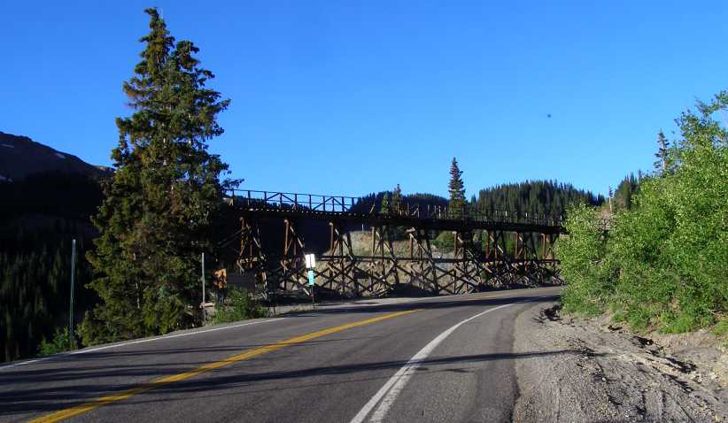
Min workings. A lot of work has evidently gone into building this structure and working the mine.
The descent to Silverton was long and not as dramatic as the climb out of Ouray. The Rockies kept thrusting forth peaks which captured the early morning sun as I drove along, it was indeed as the couple from El Paso had told me, a lovely drive.
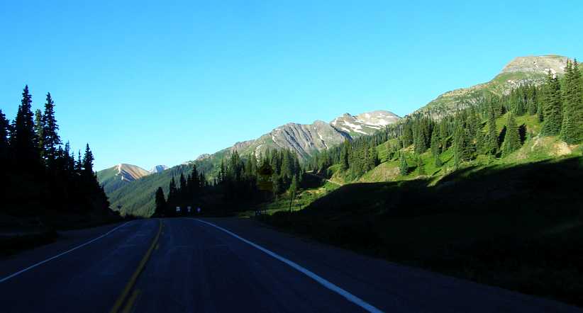
Mountains capture the sun. The tall peaks were bathing in the richness of the new day�s light, while in the shadows just ahead there�s a yellow sign which depicts a steep descent.
Variations of thousands of feet in altitude were at play here, hence the huge differences in available morning light. The trees especially were affected by the sun, those in the light appearing to be a totally different colour to those in the shade. And occasionally there�d be a home tucked in among some trees, as was this one:
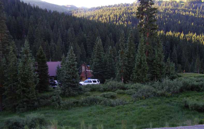
Home in the trees. Looking fairly modern and definitely well-established, this home was located near the top of the long descent into Silverton.
As I drove on the valley to my left was still almost in darkness. But the sun was creeping higher and the shadow on the Western side of the valley was becoming smaller all the time�
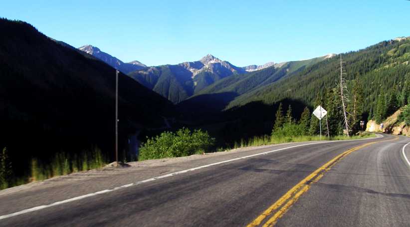
Descent to Silverton. Mountain peaks of enormous size in the background, pine-covered ridges in the foreground, it was certainly picturesque.
When I got to Silverton and started looking around, another factor helped in giving it more light from the sun. It lies in a valley with a gap in the mountains to the East. Of course, it was first things first when I got there and saw this predecessor of my van:
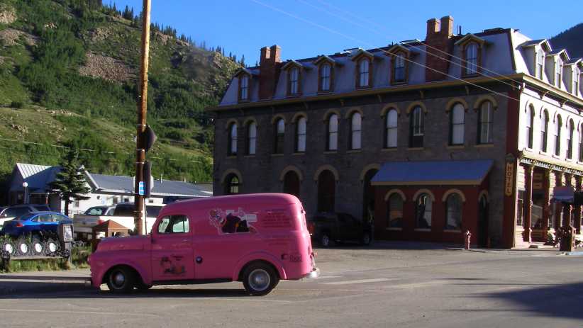
Just visiting. This van carries signage for a catering company in Arizona. Being about a 1954 model, it was therefore about 33 years older than mine.
It would likely have had (when original, of course) a side-valve six engine and probably a 3-speed gearbox, but the wheels tend to indicate it�s power train might be more modern than that today.
The first thing I did was drive up the other end of the main street and find a high point to take some photos with the sun behind me. There was a convenient spot there which enabled me to get this shot:
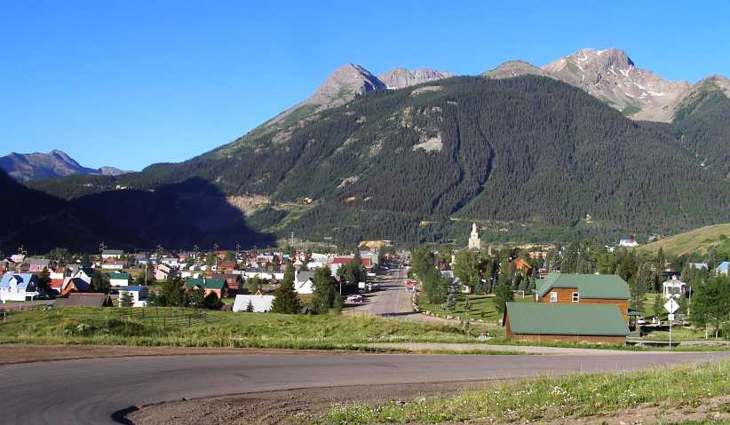
Silverton. Looking over this town there�s a lot to see here. The road I�d be taking out climbing steadily up the mountain is seen on the huge mountain rising to the town�s west.
The town is certainly small compared to the mountains which surround it, but it�s well-established and attracts a lot of visitors every year. One reason for that is its background in winning minerals from the mountains which surround it, or alluvial gold from the creeks and rivers, but today it�s a centre for camping and outdoor adventure, while the steam train from Durango is another attraction.
The main street is loaded down with grand old buildings which are quite colourful today�
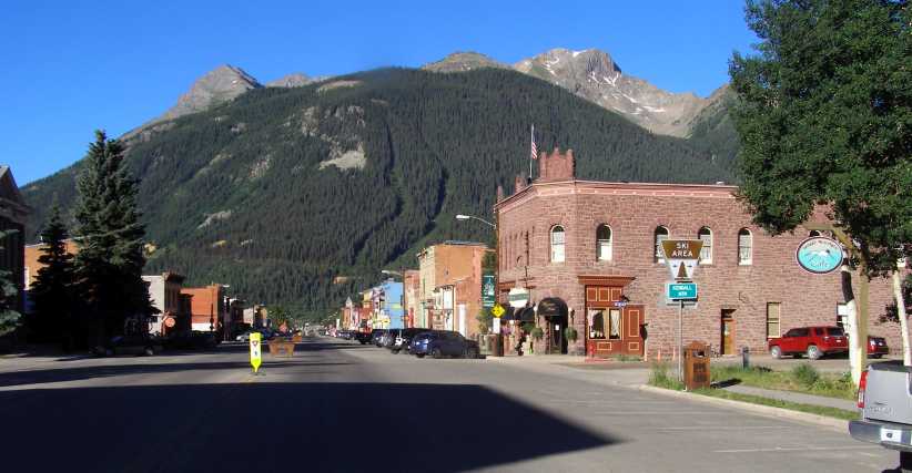
Main street. Dwarfed by that mountain, the main street features older-style architecture in its solid-looking buildings.
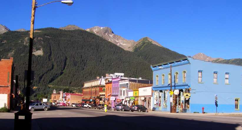
Colourful. Many of the buildings have been painted in bright colours, which makes the street stand out as somewhat different to the norm.
And there�s definitely a leaning towards preserving the history here. Just thinking of what it must have been like for the prospectors who wandered off into these mountains in search of their fortune is an adventure. But many lived that life and they�ve been remembered all around town�
Memories in a bin. Whether or not it�s a fitting way to recall the lonely men who made this country I won�t enter into, but the garbage bins in the street certainly look the part.
I drove out of town to start on the final stretch to Durango. Looking back as I ascended that mountain I caught this glimpse of much of the town:
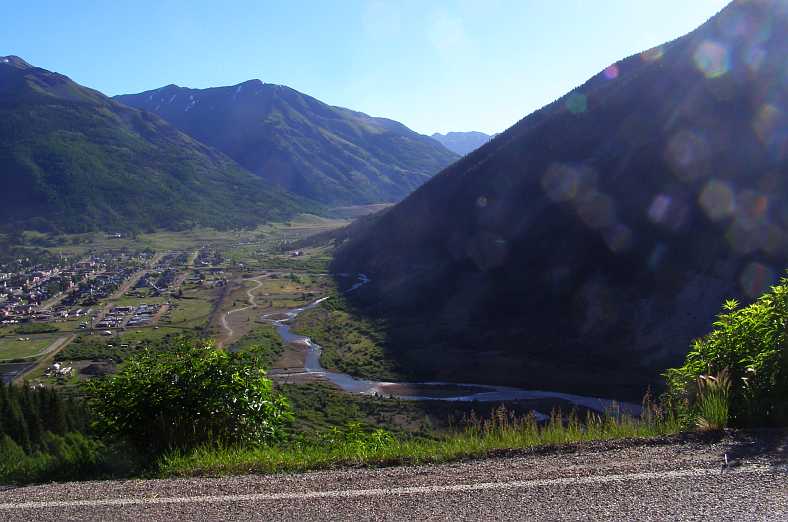
Looking back. The sun glistening off the water and playing havoc with the unclean lens, this pic still shows how Silverton is settled into the surrounding mountains.
Sometimes little things are worth a look, too�
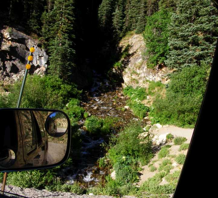
Stream on the hill. So much water must run down off this mountain, I imagine that at times this little stream is a veritable river.
And so I continued, finding more and more vistas to capture and wonder at. Some mountain peaks were distant and some were close, but all of them added up to a scene well worth the time spent taking a look at them.
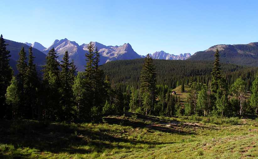
Distant mountain peaks. The Colorado Rockies throw these up in a plentiful fashion, standing out in the distance and clearly above the tree line.
And the rocks here stand out rather less, but still look spectacular:
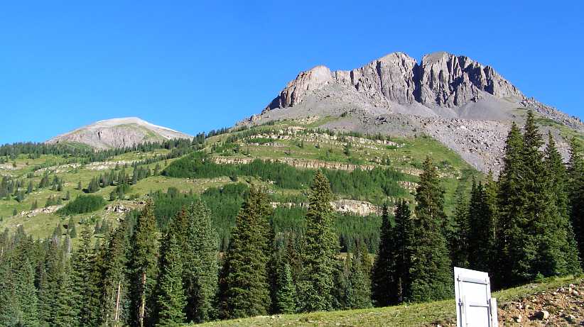
Rocky exposure. Quite apart from the native rock here, I�m convinced that there�s further evidence of mining or quarrying going on here.
This kind of formation is something I�ve not seen elsewhere, but almost common in this part of the world:
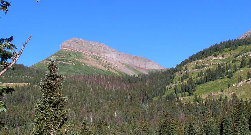
Mountain cap. Something different, the rocky ridge along the top here was something new to me.
Entranced by this, and looking for a good angle to shoot the pic, I�d taken a small track off the side of the road to a spot where I could pull up. And there I found a caravan which had been camped for the night, and so I had a nice conversation with this couple�
Camping couple. Camped out with their dogs, this couple were very familiar with this part of the country.
They explained to me that they lived in Ridgway, but every year they rented their house out for the summer and went touring with their caravan. Which sounded like a fine way to live, and I�m sure the dogs enjoyed it too.
It was not far from this point to Molas Pass, which was a good place to pull up and have a bit of a look at the scenery. First there was, however, the Molas Pass campground:
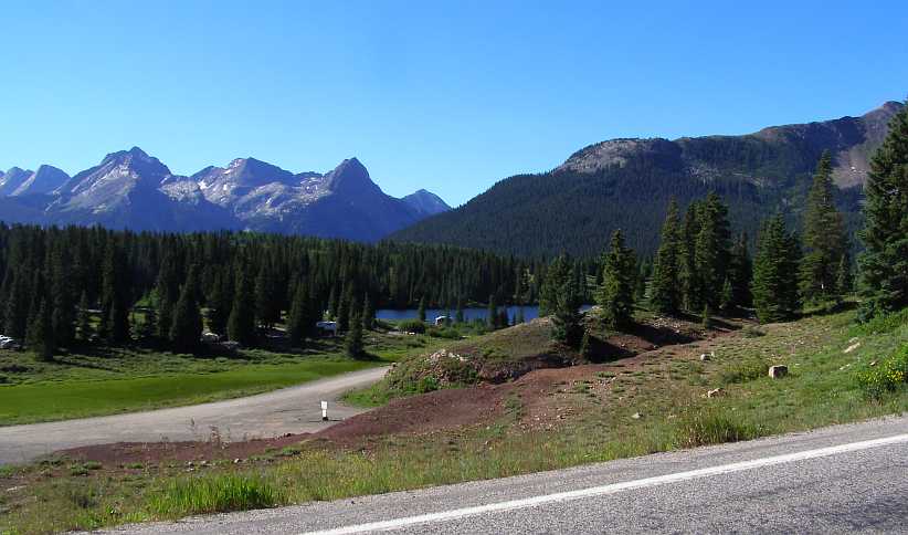
Campground. With the lake and all those pine trees, this would make a nice spot to spend a few days.
And right on the top of the pass was a parking bay and lookout, complete with signage to inform passers-by about this spot. The important sign was this one:
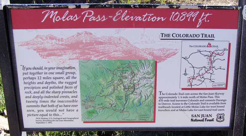
Molas Pass. The quote on the left from W H Holmes is worth reading, even if it dates back almost 150 years.
One thing the sign does indicate is that this particular area is in the San Juan Mountains and another is that it�s not far from the Colorado Trail.
This trail is for use by hikers, cyclists, horse-riders and backpackers and extends from Durango to Denver. A mere 567 miles.
The opportunity to get a couple more pictures was not wasted:
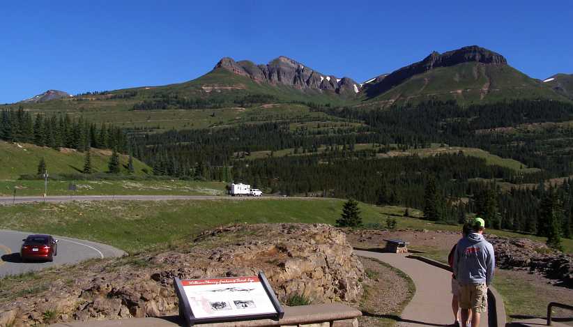
Looking North. This is the view in the direction from which I�d just come. There was no end to the beauty to be seen here.
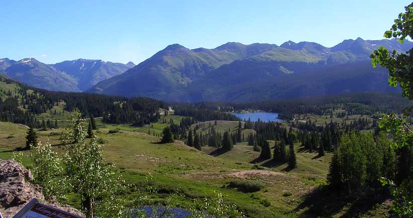
And North-East. Looking over the lake and campground, the sheer size of these mountains hits home.
Time to move along. Just down the road I snapped the next example of those unusual formations:
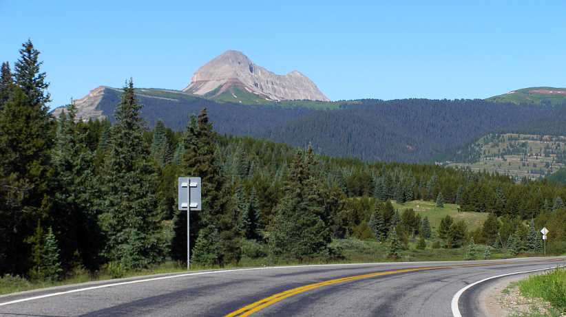
Next peak. Still looking different to anything I�d seen before, I would think this one is larger than the previous example.
The road continued to take me through this magnificent country. It was in very good shape and there was very little traffic.
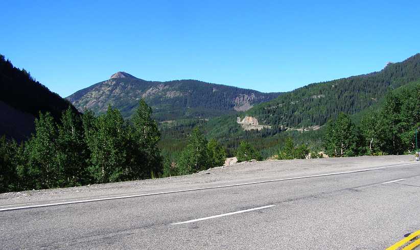
The road ahead. Have I taken this picture of the mountain peak or the road ahead of me? No matter which way I pointed the camera there was something worth seeing.
A little further on the road climbs in such a way that it necessitates some twists and turns, giving an opportunity to look back on where I�d been rather than where I was going:
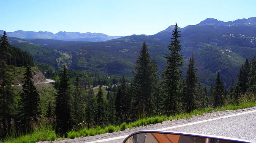
Looking back. Over this deep valley there�s more peaks to be seen, while the steeply-climbing road winds around the mountian.
It was truly turning into a beautiful day, just a couple of tiny wisps of clouds in the deep blue of the sky and the sun shining strongly on the mountains to point out their sharp features and character. And at times there were fences, too.
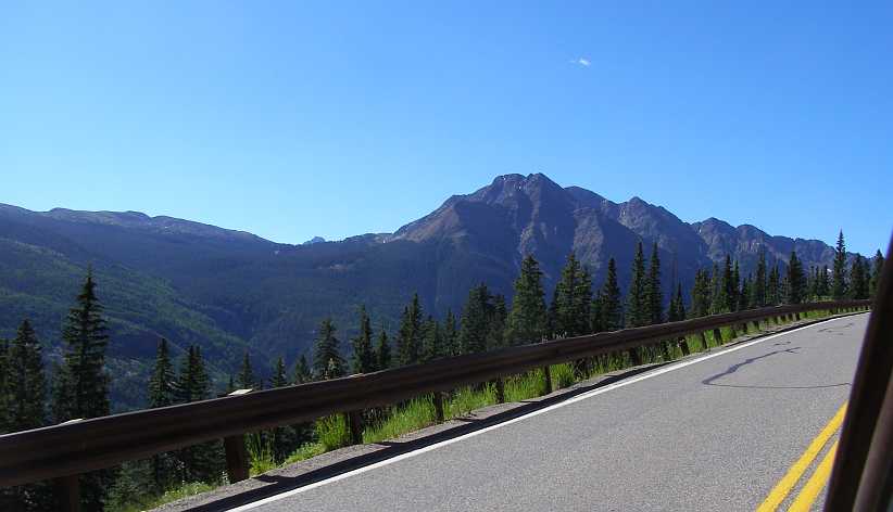
Brilliant day. The contrast between sunlit rock and rock in shadow is clear, the blue of the sky, a great experience.
The road continued to have a need to wind around the mountains, good driving territory, and then there were the escarpments where rugged faces don�t give the pines a chance to grow�
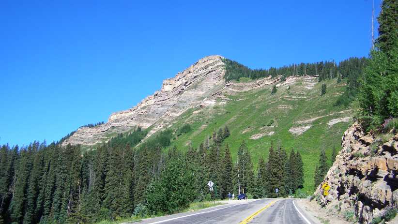
Ess and escarpment. Some tighter bends coming up here as I grab a shot of this rocky formation.
And at times one stops to check out the wildflowers, right? Well, at least I took a pic of them to take home to Sandra�
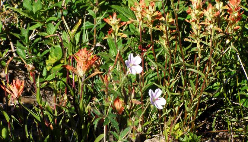
Wildflowers. They were there when I stopped to take another pic, but a chance to get a shot for Sandra.
In descending towards Durango there were some points where it was hard to get a decent shot. I climbed an embankment to get this one and it�s not as good as I�d have liked:
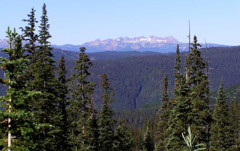
Distant snowy peaks. Just visible from road level, I got a slightly better shot by climbing the bank.
Once on a lower level the road straightened out and the views were of a totally different kind. This is at Hotter Brothers Lake, there were horses grazing across the other side but they�re out of this frame:
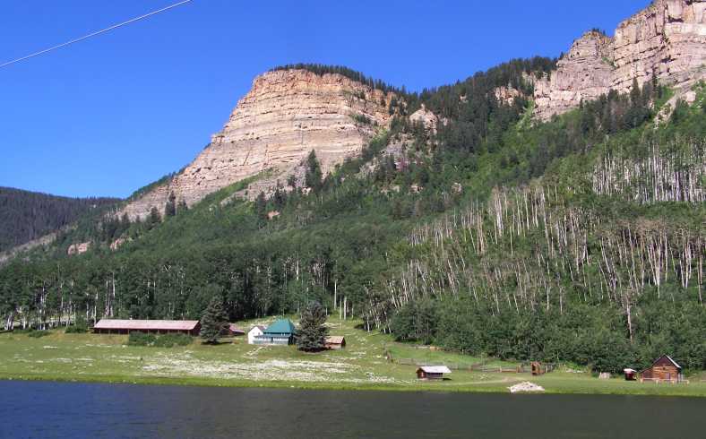
Hotters Brothers Lake. The lake is placid and the mountain would make for early afternoons, but I�d still think this was a pleasant place to make a home.
From this point we were definitely out of the taller mountains and running along on a fairly level stretch of road into Durango. For a while I followed this motorhome with its companion vehicle in tow:
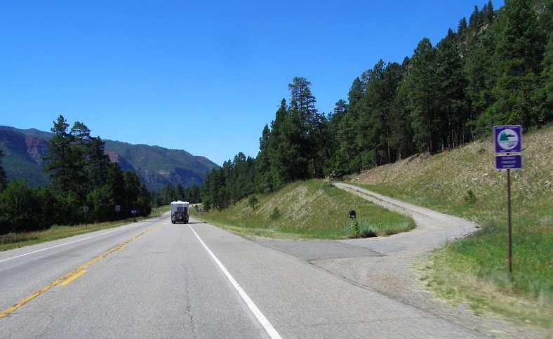
Mountains behind us. Still the scenery was nice and the drive pleasant. I would definitely like to do this again.
The steam trains that run between Durango and Silverton for tourists do a lot of business at this time of year and I saw two of them as I neared Durango. The first near this nice home:
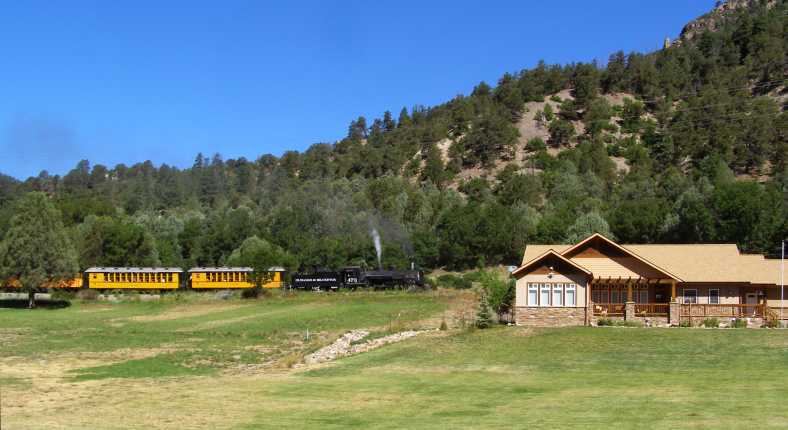
Steam train. A popular ride for tourists, this steam train would give a totally different view of the landscape along the path, which follows the Animas River.
As surprised and happy as I was to see that train, I was even more surprised to see another one only minutes later at a point where the railway is right next to the road�
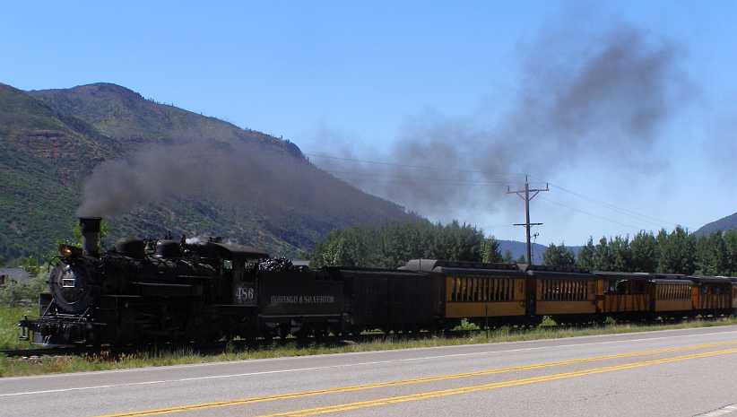
Another steam train. Demand must have been high for the train ride as another train followed just minutes after the first.
I reached Durango, 108 miles from my starting point for the day at Montrose, having seen some fantastic scenery and really enjoyed the drive. But it was still fairly early in the day, so there was lots more to see.
And all of it totally different to the country through which I�d just come...
Min workings. A lot of work has evidently gone into building this structure and working the mine.
The descent to Silverton was long and not as dramatic as the climb out of Ouray. The Rockies kept thrusting forth peaks which captured the early morning sun as I drove along, it was indeed as the couple from El Paso had told me, a lovely drive.
Mountains capture the sun. The tall peaks were bathing in the richness of the new day�s light, while in the shadows just ahead there�s a yellow sign which depicts a steep descent.
Variations of thousands of feet in altitude were at play here, hence the huge differences in available morning light. The trees especially were affected by the sun, those in the light appearing to be a totally different colour to those in the shade. And occasionally there�d be a home tucked in among some trees, as was this one:
Home in the trees. Looking fairly modern and definitely well-established, this home was located near the top of the long descent into Silverton.
As I drove on the valley to my left was still almost in darkness. But the sun was creeping higher and the shadow on the Western side of the valley was becoming smaller all the time�
Descent to Silverton. Mountain peaks of enormous size in the background, pine-covered ridges in the foreground, it was certainly picturesque.
When I got to Silverton and started looking around, another factor helped in giving it more light from the sun. It lies in a valley with a gap in the mountains to the East. Of course, it was first things first when I got there and saw this predecessor of my van:
Just visiting. This van carries signage for a catering company in Arizona. Being about a 1954 model, it was therefore about 33 years older than mine.
It would likely have had (when original, of course) a side-valve six engine and probably a 3-speed gearbox, but the wheels tend to indicate it�s power train might be more modern than that today.
The first thing I did was drive up the other end of the main street and find a high point to take some photos with the sun behind me. There was a convenient spot there which enabled me to get this shot:
Silverton. Looking over this town there�s a lot to see here. The road I�d be taking out climbing steadily up the mountain is seen on the huge mountain rising to the town�s west.
The town is certainly small compared to the mountains which surround it, but it�s well-established and attracts a lot of visitors every year. One reason for that is its background in winning minerals from the mountains which surround it, or alluvial gold from the creeks and rivers, but today it�s a centre for camping and outdoor adventure, while the steam train from Durango is another attraction.
The main street is loaded down with grand old buildings which are quite colourful today�
Main street. Dwarfed by that mountain, the main street features older-style architecture in its solid-looking buildings.
Colourful. Many of the buildings have been painted in bright colours, which makes the street stand out as somewhat different to the norm.
And there�s definitely a leaning towards preserving the history here. Just thinking of what it must have been like for the prospectors who wandered off into these mountains in search of their fortune is an adventure. But many lived that life and they�ve been remembered all around town�
Memories in a bin. Whether or not it�s a fitting way to recall the lonely men who made this country I won�t enter into, but the garbage bins in the street certainly look the part.
I drove out of town to start on the final stretch to Durango. Looking back as I ascended that mountain I caught this glimpse of much of the town:
Looking back. The sun glistening off the water and playing havoc with the unclean lens, this pic still shows how Silverton is settled into the surrounding mountains.
Sometimes little things are worth a look, too�
Stream on the hill. So much water must run down off this mountain, I imagine that at times this little stream is a veritable river.
And so I continued, finding more and more vistas to capture and wonder at. Some mountain peaks were distant and some were close, but all of them added up to a scene well worth the time spent taking a look at them.
Distant mountain peaks. The Colorado Rockies throw these up in a plentiful fashion, standing out in the distance and clearly above the tree line.
And the rocks here stand out rather less, but still look spectacular:
Rocky exposure. Quite apart from the native rock here, I�m convinced that there�s further evidence of mining or quarrying going on here.
This kind of formation is something I�ve not seen elsewhere, but almost common in this part of the world:
Mountain cap. Something different, the rocky ridge along the top here was something new to me.
Entranced by this, and looking for a good angle to shoot the pic, I�d taken a small track off the side of the road to a spot where I could pull up. And there I found a caravan which had been camped for the night, and so I had a nice conversation with this couple�
Camping couple. Camped out with their dogs, this couple were very familiar with this part of the country.
They explained to me that they lived in Ridgway, but every year they rented their house out for the summer and went touring with their caravan. Which sounded like a fine way to live, and I�m sure the dogs enjoyed it too.
It was not far from this point to Molas Pass, which was a good place to pull up and have a bit of a look at the scenery. First there was, however, the Molas Pass campground:
Campground. With the lake and all those pine trees, this would make a nice spot to spend a few days.
And right on the top of the pass was a parking bay and lookout, complete with signage to inform passers-by about this spot. The important sign was this one:
Molas Pass. The quote on the left from W H Holmes is worth reading, even if it dates back almost 150 years.
One thing the sign does indicate is that this particular area is in the San Juan Mountains and another is that it�s not far from the Colorado Trail.
This trail is for use by hikers, cyclists, horse-riders and backpackers and extends from Durango to Denver. A mere 567 miles.
The opportunity to get a couple more pictures was not wasted:
Looking North. This is the view in the direction from which I�d just come. There was no end to the beauty to be seen here.
And North-East. Looking over the lake and campground, the sheer size of these mountains hits home.
Time to move along. Just down the road I snapped the next example of those unusual formations:
Next peak. Still looking different to anything I�d seen before, I would think this one is larger than the previous example.
The road continued to take me through this magnificent country. It was in very good shape and there was very little traffic.
The road ahead. Have I taken this picture of the mountain peak or the road ahead of me? No matter which way I pointed the camera there was something worth seeing.
A little further on the road climbs in such a way that it necessitates some twists and turns, giving an opportunity to look back on where I�d been rather than where I was going:
Looking back. Over this deep valley there�s more peaks to be seen, while the steeply-climbing road winds around the mountian.
It was truly turning into a beautiful day, just a couple of tiny wisps of clouds in the deep blue of the sky and the sun shining strongly on the mountains to point out their sharp features and character. And at times there were fences, too.
Brilliant day. The contrast between sunlit rock and rock in shadow is clear, the blue of the sky, a great experience.
The road continued to have a need to wind around the mountains, good driving territory, and then there were the escarpments where rugged faces don�t give the pines a chance to grow�
Ess and escarpment. Some tighter bends coming up here as I grab a shot of this rocky formation.
And at times one stops to check out the wildflowers, right? Well, at least I took a pic of them to take home to Sandra�
Wildflowers. They were there when I stopped to take another pic, but a chance to get a shot for Sandra.
In descending towards Durango there were some points where it was hard to get a decent shot. I climbed an embankment to get this one and it�s not as good as I�d have liked:
Distant snowy peaks. Just visible from road level, I got a slightly better shot by climbing the bank.
Once on a lower level the road straightened out and the views were of a totally different kind. This is at Hotter Brothers Lake, there were horses grazing across the other side but they�re out of this frame:
Hotters Brothers Lake. The lake is placid and the mountain would make for early afternoons, but I�d still think this was a pleasant place to make a home.
From this point we were definitely out of the taller mountains and running along on a fairly level stretch of road into Durango. For a while I followed this motorhome with its companion vehicle in tow:
Mountains behind us. Still the scenery was nice and the drive pleasant. I would definitely like to do this again.
The steam trains that run between Durango and Silverton for tourists do a lot of business at this time of year and I saw two of them as I neared Durango. The first near this nice home:
Steam train. A popular ride for tourists, this steam train would give a totally different view of the landscape along the path, which follows the Animas River.
As surprised and happy as I was to see that train, I was even more surprised to see another one only minutes later at a point where the railway is right next to the road�
Another steam train. Demand must have been high for the train ride as another train followed just minutes after the first.
I reached Durango, 108 miles from my starting point for the day at Montrose, having seen some fantastic scenery and really enjoyed the drive. But it was still fairly early in the day, so there was lots more to see.
And all of it totally different to the country through which I�d just come...
Thread Starter
|
Captain
Joined: Oct 2005
Posts: 570
Likes: 8
From: The Summit, Queensland, Australia
As mentioned, things changed pretty abruptly on turning West from Durango. That road took me through Hesperus to Mancos, then to Cortez. I was heading for the famous �Four Corners� where the states of Colorado, New Mexico, Arizona and Utah share a common survey peg.
After two full days of driving through mountains, looking over valleys full of pine trees and seeing clear waters in rivers and streams, I was heading into much flatter country, and this became very obvious as I drove out of Mancos � just 29 miles from Durango. Already I had covered 108 miles to get from Montrose to Durango, but by the end of this day I would be doing a further 310 miles out into Utah�s desert country to finish up a Page:
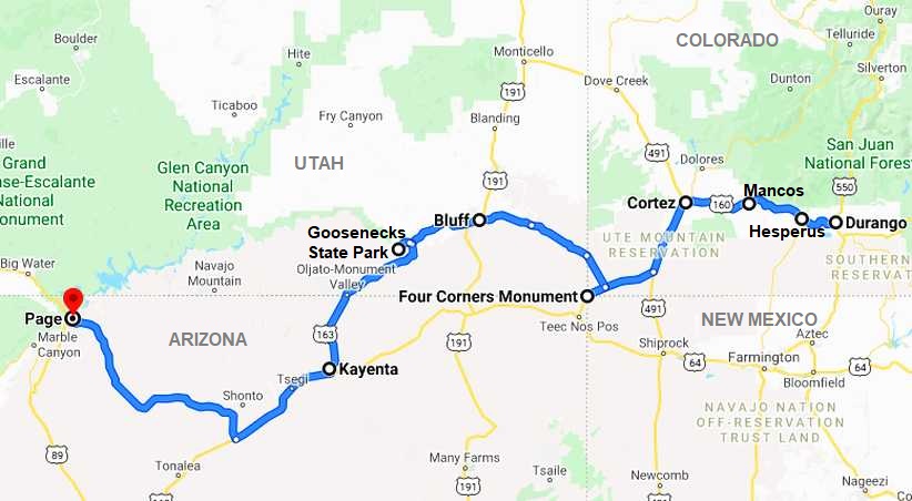
It�s easy to see here that there�s a very big difference in the terrain:
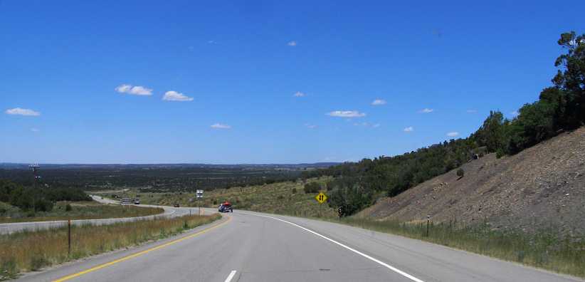
Leaving Mancos and the mountains. Such a difference here! Suddenly I was seeing a road stretching out before me on flat country, and so it would remain for the rest of the day.
From the heights at Molas Pass at almost 12,000 feet altitude, Durango sits at a much lower 6,500 feet, or 1,988 metres. Still almost as high as the highest peaks in Australia, but way lower than those majestic mountains. Mancos was actually a few hundred feet higher, but then the land slipped away again so that Cortez was just a little lower than Durango.
Apart from the Four Corners, two other features of the general area I wanted to see were Monument Valley and the Goosenecks in the San Juan River. And the changes in landform started to become visible quite early on�
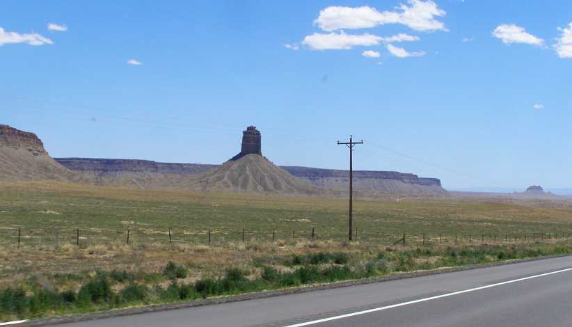
A spire. If I understand it correctly, a mesa wears away and becomes a butte, then if that keeps on eroding to a tiny core it�s a spire. This desert country hides all of those secrets.
The path had some variation, but it was all desert. Some was not so interesting, some was varied, but it was still desert.
Mesas and washaways. As I neared New Mexico the road had to find a way through this rougher country.
And then, after about 85 miles driving from Durango, I was at the famous Four Corners:
Four Corners. The junction of the borders is behind this gate, with a charge for visitors.
Then I leaned that there was a fee payable for those who wanted to look at the survey peg. Actually, there�s a monument there, but it didn�t interest me enough to pay for it. As far as I was concerned, I�d been to the Four Corners, I�d thought, and so I turned around to head off towards my next destination. I�ve since learned that the monument is over half a kilometre East of where it should be.
I had crossed the border into New Mexico getting there, however, noting the presence of a burned out caravan right at the border. When I went back by several minutes later I got a photo of this caravan, being towed by a white pickup as they were photographing the �Welcome to Colorful Colorado� sign:
Burned out. A strange sight, a caravan looking pretty much destroyed, but being towed by the pickup.
The sign here was the same as the one I�d seen going from Kansas into Colorado on my previous trip, though the posts differed. This time, however, my stay in Colorado was to be brief, twelve or fifteen miles, before I came to yet another welcoming sign:
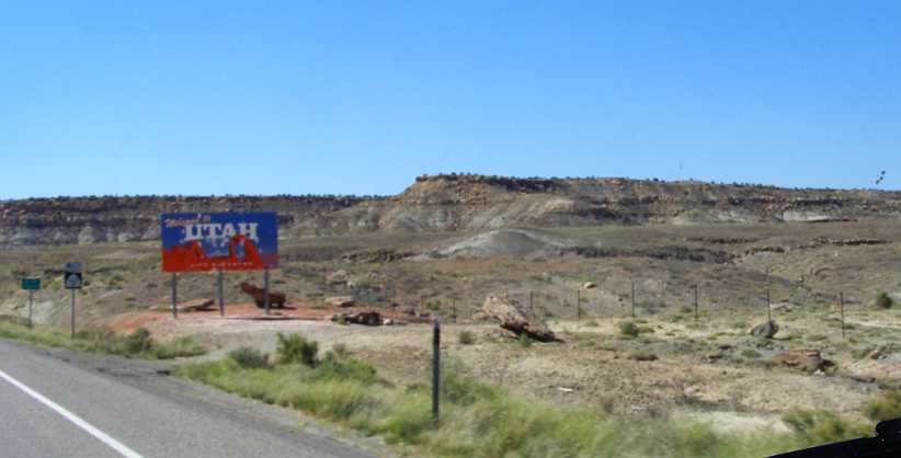
Welcome to Utah. �Life Elevated� is the lower line. But the scenery is hardly as welcoming as the sign here.
The elevation at the monument was 1487 metres or 4841 feet. Now I was heading downhill again and it�s evident in this distant shot of more of this unforgiving landscape:
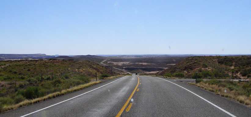 [/url]
The miles roll out. It was almost fifty miles to my next landmark, one I hadn�t expected to draw my attention at all. This a bleak-looking part of that distance.
And then I came upon Bluff, a little town out there in the desert, surrounded by rockforms and home to a few hundred people. It wasn�t even visible until I got right to the town�
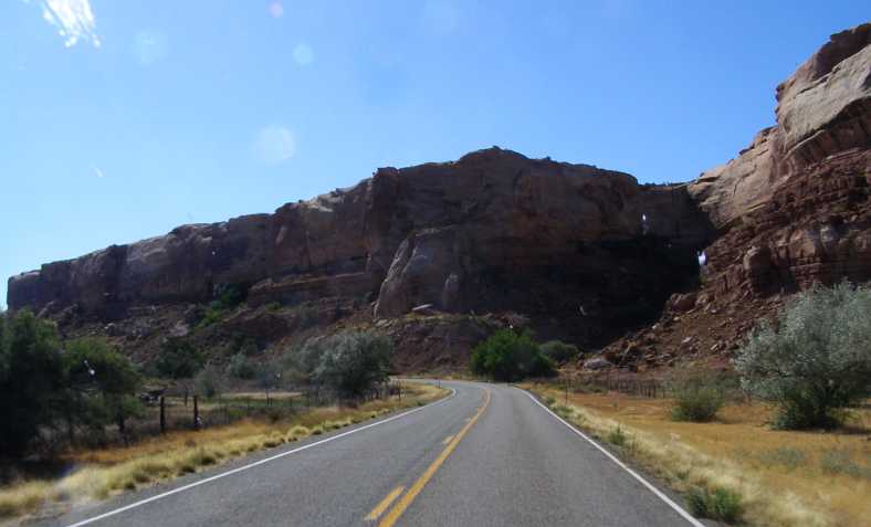
Entering Bluff. The cliffs here are indicative of the scenery around Bluff, and it seemed that I should have a bit of a look around here.
�and it occurred to me that, with a couple of caravan parks there, I might find a laundromat here to take care of the ever-growing pile of washing I had to look after. Some driving a little off-course was necessary to find out where to go, which is why I took this pic coming down what�s more or less the main commercial street in the town:
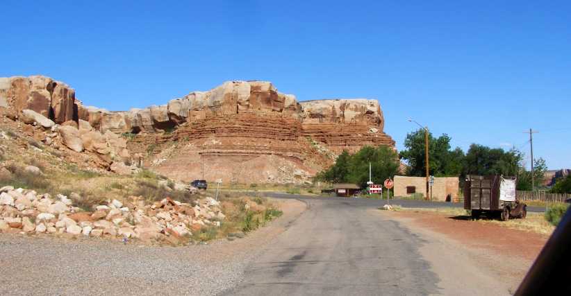
Town under cliffs. Those cliffs ahead of us here are similar to those to the left but out of frame, the whole town being build under the cliffs.
When I did find the laundromat I had a delay as the lady in charge wasn�t on hand. I waited a little while and then I was able to get started on replenishing my supply of clean shirts, shorts, socks and undies. It was opposite one of the caravan parks.
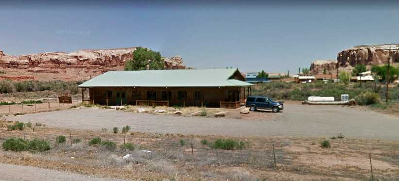
Laundry at Bluff. This is the laundromat where I whiled away a little time, some waiting, some washing and drying so I�d have clean clothes for the next few days.
Leaving Bluff, which is at 1,318 metres or 4324 feet, I pressed on towards the Goosenecks State Park, this being where the San Juan River twists and turns and, having done so for thousands of years, it has carved its twists and turns deep into the desert floor. This would be another brief stop as I could see some of those shapes in the distance as I drove there�
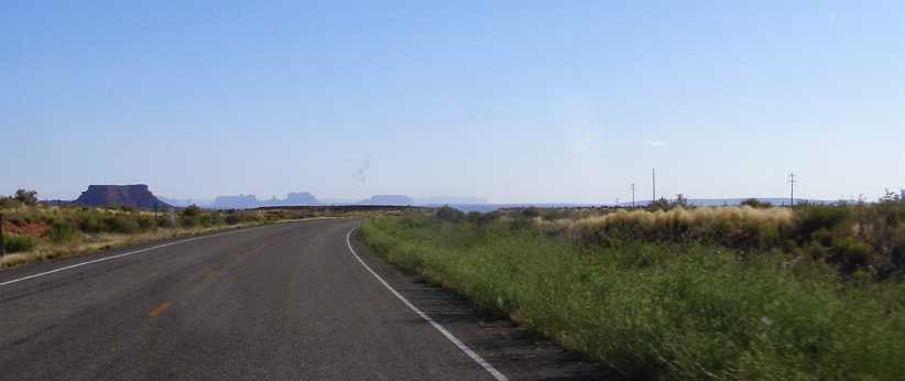
Shapes in the distance. I was getting closer to the Monument Valley, but first I had to go to the Goosenecks State Park.
I was now climbing gently again over the 25 miles to the Goosenecks. A couple of spires were tantalising as I wondered what I�d see when I got to the valley:
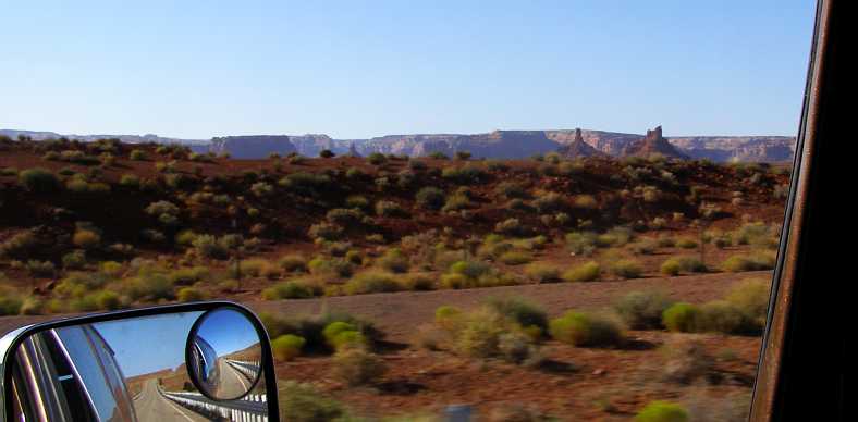
More shapes. There�s no doubting that there are plenty of shapes out here to keep up the traveller�s interest.
As was this balancing rock up there on a cliff:
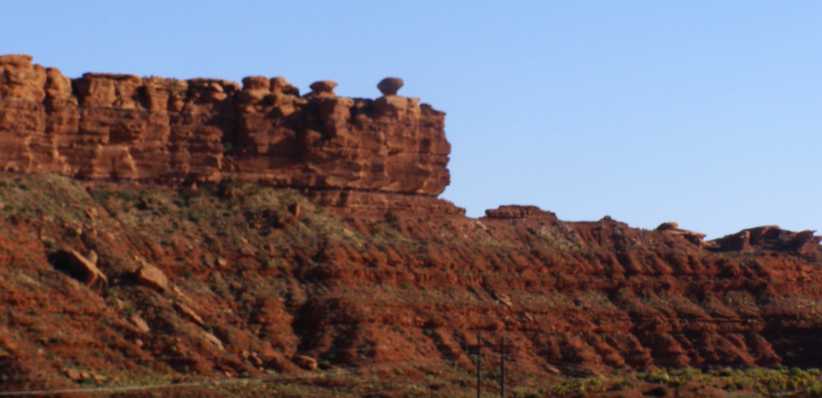
Balancing rock. One begins to wonder how many years it took for the wind and water to erode away the soil or rocks that once surrounded this survivor.
Finally, after turning off the main road and driving a short distance into the State Park I was able to look down on the river which had done this earthmoving over the centuries:
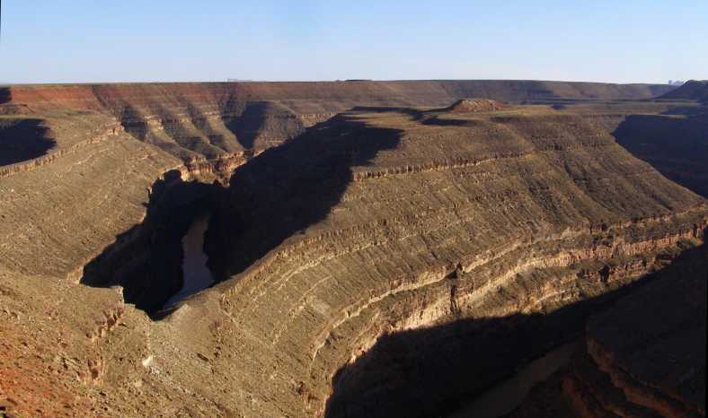
Goosenecks. Layer after layer of rock and soil has been cut through in a snaking fashion by this river here.
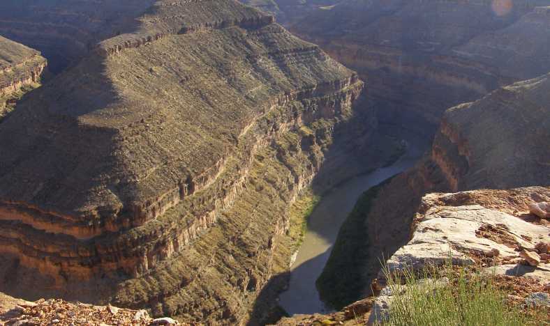
The river. The San Juan River rises in the San Juan Mountains I�d driven through earlier in the day and goes on to join the Colorado River.
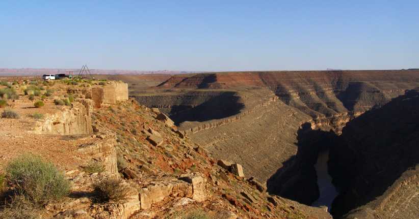
Viewing spot. Many people come to look at this sight and a couple of spots are specifically provided for safe viewing.
Rejoining the highway it was only a few miles before I saw the �Mexican Hat�:
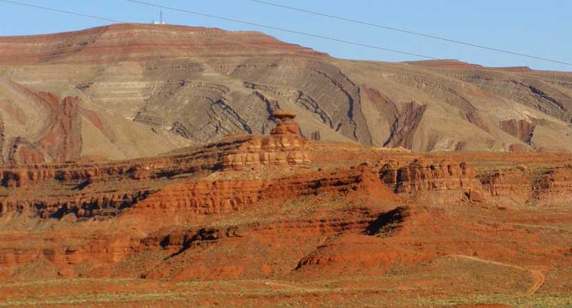
Mexican Hat. Another example of weatherbeaten rock, this one forming the shape of an inverted hat.
And there was a town by the same name, sitting alongside the San Juan River. Just past the town the road turned hard left over this bridge�
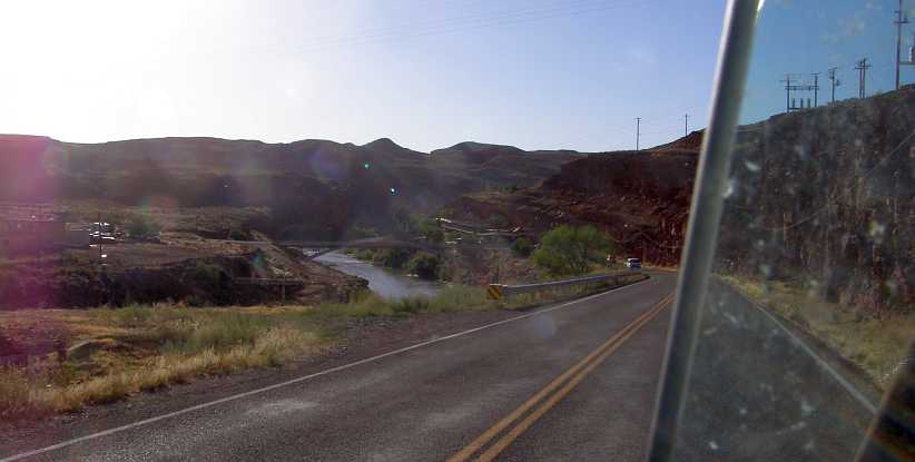
Bridge across the San Juan River. The bridge is reached fairly suddenly and looks rather more dramatic than my poor photo.
Now I was closing in on Monument Valley. More mesas, buttes and spires appeared as I drove�
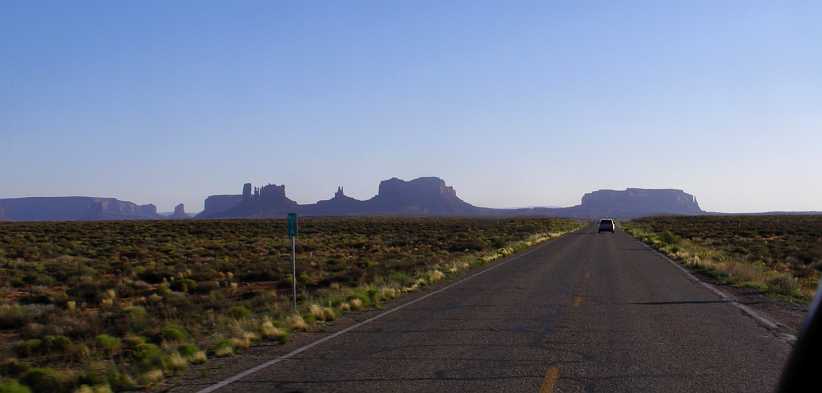
Silhouettes. This spot is named as Forrest Gump Hill, with the point where Forrest Gump stopped running being just over that next crest. The background is, therefore, quite famous.
Shapes. And more of them, getting closer as I drove on in the late afternoon.
�getting closer all the time to the sought-after valley. I crossed the border into Arizona here:
State Line. Arizona began with this simple sign, the scenery continued as it had done for some miles.
Still I awaited the drama I expected of entering the famous valley. What I didn�t realise was that I had to turn off this road to see it, so I was to miss out on the best of it.
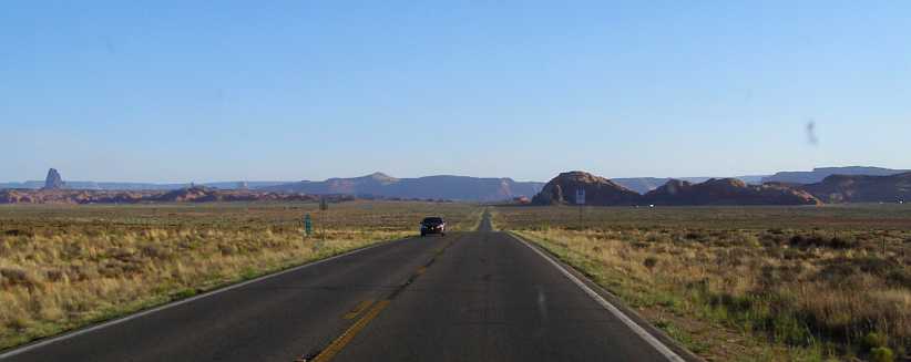
Straight roads. The kind of country here provided well for easy and straight roads, while occasional spires were dotted about.
One rather different spire stood high over some cliffs at a point where the road was forced to deviate around the topography:
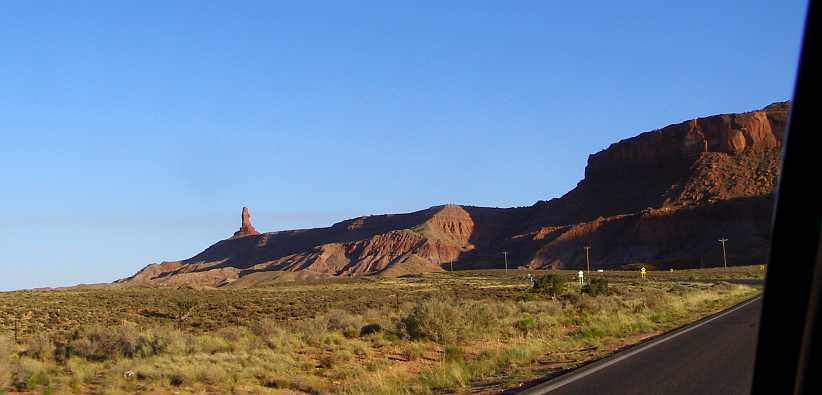
Cliffs and tall spire. This one stood out, standing so high over the cliffs of the supporting mesa.
Gradually I was getting closer to the next town, Kayenta. But before I got there there was this great lump of rock to capture my attention:
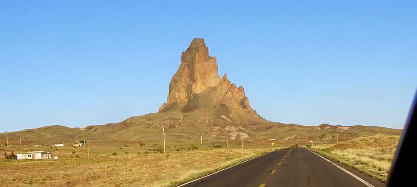
Big rock. This edifice seems to be all one rock, standing out of the surrounding country.
Kayenta was getting back to a similar altitude to Durango, but such a different-looking place! Homes and temporary housing was scattered about as I drove into the town�
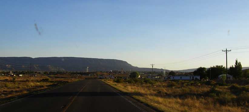
Entering Kayenta. There�s little notable about the town as it�s approached, though out of sight there are areas of housing provided for the Navajo Indians.
�which is home to about 5,000 people. It�s essentially built on a very flat bit of country and looks to be, largely, a town providing for the needs of passing tourists. Gas stations, fast food places and motels are seen in numbers.
Kayenta. A Google Earth view of Kayenta with gas stations most evident. A set of traffic lights was a bit of a surprise.
I had to fill my tank here and I also bought something to eat. I was now about 210 miles from Durango having covered 318 miles altogether since leaving Montrose. I�d driven through the most beautiful of mountain scenery and travelled across a mixture of different desert areas. Now it was getting on towards evening and I wanted to get more miles under my belt.
I decided I�d press on to Page, which meant covering almost a hundred miles in the dark, before pulling up for the night. At this point I was more concerned with getting to the North rim of the Grand Canyon than anything else, having been assured it was a better view than the South rim where I�d gone in 2012.
I was to learn there were other things to be seen on the way�
After two full days of driving through mountains, looking over valleys full of pine trees and seeing clear waters in rivers and streams, I was heading into much flatter country, and this became very obvious as I drove out of Mancos � just 29 miles from Durango. Already I had covered 108 miles to get from Montrose to Durango, but by the end of this day I would be doing a further 310 miles out into Utah�s desert country to finish up a Page:
It�s easy to see here that there�s a very big difference in the terrain:
Leaving Mancos and the mountains. Such a difference here! Suddenly I was seeing a road stretching out before me on flat country, and so it would remain for the rest of the day.
From the heights at Molas Pass at almost 12,000 feet altitude, Durango sits at a much lower 6,500 feet, or 1,988 metres. Still almost as high as the highest peaks in Australia, but way lower than those majestic mountains. Mancos was actually a few hundred feet higher, but then the land slipped away again so that Cortez was just a little lower than Durango.
Apart from the Four Corners, two other features of the general area I wanted to see were Monument Valley and the Goosenecks in the San Juan River. And the changes in landform started to become visible quite early on�
A spire. If I understand it correctly, a mesa wears away and becomes a butte, then if that keeps on eroding to a tiny core it�s a spire. This desert country hides all of those secrets.
The path had some variation, but it was all desert. Some was not so interesting, some was varied, but it was still desert.
Mesas and washaways. As I neared New Mexico the road had to find a way through this rougher country.
And then, after about 85 miles driving from Durango, I was at the famous Four Corners:
Four Corners. The junction of the borders is behind this gate, with a charge for visitors.
Then I leaned that there was a fee payable for those who wanted to look at the survey peg. Actually, there�s a monument there, but it didn�t interest me enough to pay for it. As far as I was concerned, I�d been to the Four Corners, I�d thought, and so I turned around to head off towards my next destination. I�ve since learned that the monument is over half a kilometre East of where it should be.
I had crossed the border into New Mexico getting there, however, noting the presence of a burned out caravan right at the border. When I went back by several minutes later I got a photo of this caravan, being towed by a white pickup as they were photographing the �Welcome to Colorful Colorado� sign:
Burned out. A strange sight, a caravan looking pretty much destroyed, but being towed by the pickup.
The sign here was the same as the one I�d seen going from Kansas into Colorado on my previous trip, though the posts differed. This time, however, my stay in Colorado was to be brief, twelve or fifteen miles, before I came to yet another welcoming sign:
Welcome to Utah. �Life Elevated� is the lower line. But the scenery is hardly as welcoming as the sign here.
The elevation at the monument was 1487 metres or 4841 feet. Now I was heading downhill again and it�s evident in this distant shot of more of this unforgiving landscape:
[/url]The miles roll out. It was almost fifty miles to my next landmark, one I hadn�t expected to draw my attention at all. This a bleak-looking part of that distance.
And then I came upon Bluff, a little town out there in the desert, surrounded by rockforms and home to a few hundred people. It wasn�t even visible until I got right to the town�
Entering Bluff. The cliffs here are indicative of the scenery around Bluff, and it seemed that I should have a bit of a look around here.
�and it occurred to me that, with a couple of caravan parks there, I might find a laundromat here to take care of the ever-growing pile of washing I had to look after. Some driving a little off-course was necessary to find out where to go, which is why I took this pic coming down what�s more or less the main commercial street in the town:
Town under cliffs. Those cliffs ahead of us here are similar to those to the left but out of frame, the whole town being build under the cliffs.
When I did find the laundromat I had a delay as the lady in charge wasn�t on hand. I waited a little while and then I was able to get started on replenishing my supply of clean shirts, shorts, socks and undies. It was opposite one of the caravan parks.
Laundry at Bluff. This is the laundromat where I whiled away a little time, some waiting, some washing and drying so I�d have clean clothes for the next few days.
Leaving Bluff, which is at 1,318 metres or 4324 feet, I pressed on towards the Goosenecks State Park, this being where the San Juan River twists and turns and, having done so for thousands of years, it has carved its twists and turns deep into the desert floor. This would be another brief stop as I could see some of those shapes in the distance as I drove there�
Shapes in the distance. I was getting closer to the Monument Valley, but first I had to go to the Goosenecks State Park.
I was now climbing gently again over the 25 miles to the Goosenecks. A couple of spires were tantalising as I wondered what I�d see when I got to the valley:
More shapes. There�s no doubting that there are plenty of shapes out here to keep up the traveller�s interest.
As was this balancing rock up there on a cliff:
Balancing rock. One begins to wonder how many years it took for the wind and water to erode away the soil or rocks that once surrounded this survivor.
Finally, after turning off the main road and driving a short distance into the State Park I was able to look down on the river which had done this earthmoving over the centuries:
Goosenecks. Layer after layer of rock and soil has been cut through in a snaking fashion by this river here.
The river. The San Juan River rises in the San Juan Mountains I�d driven through earlier in the day and goes on to join the Colorado River.
Viewing spot. Many people come to look at this sight and a couple of spots are specifically provided for safe viewing.
Rejoining the highway it was only a few miles before I saw the �Mexican Hat�:
Mexican Hat. Another example of weatherbeaten rock, this one forming the shape of an inverted hat.
And there was a town by the same name, sitting alongside the San Juan River. Just past the town the road turned hard left over this bridge�
Bridge across the San Juan River. The bridge is reached fairly suddenly and looks rather more dramatic than my poor photo.
Now I was closing in on Monument Valley. More mesas, buttes and spires appeared as I drove�
Silhouettes. This spot is named as Forrest Gump Hill, with the point where Forrest Gump stopped running being just over that next crest. The background is, therefore, quite famous.
Shapes. And more of them, getting closer as I drove on in the late afternoon.
�getting closer all the time to the sought-after valley. I crossed the border into Arizona here:
State Line. Arizona began with this simple sign, the scenery continued as it had done for some miles.
Still I awaited the drama I expected of entering the famous valley. What I didn�t realise was that I had to turn off this road to see it, so I was to miss out on the best of it.
Straight roads. The kind of country here provided well for easy and straight roads, while occasional spires were dotted about.
One rather different spire stood high over some cliffs at a point where the road was forced to deviate around the topography:
Cliffs and tall spire. This one stood out, standing so high over the cliffs of the supporting mesa.
Gradually I was getting closer to the next town, Kayenta. But before I got there there was this great lump of rock to capture my attention:
Big rock. This edifice seems to be all one rock, standing out of the surrounding country.
Kayenta was getting back to a similar altitude to Durango, but such a different-looking place! Homes and temporary housing was scattered about as I drove into the town�
Entering Kayenta. There�s little notable about the town as it�s approached, though out of sight there are areas of housing provided for the Navajo Indians.
�which is home to about 5,000 people. It�s essentially built on a very flat bit of country and looks to be, largely, a town providing for the needs of passing tourists. Gas stations, fast food places and motels are seen in numbers.
Kayenta. A Google Earth view of Kayenta with gas stations most evident. A set of traffic lights was a bit of a surprise.
I had to fill my tank here and I also bought something to eat. I was now about 210 miles from Durango having covered 318 miles altogether since leaving Montrose. I�d driven through the most beautiful of mountain scenery and travelled across a mixture of different desert areas. Now it was getting on towards evening and I wanted to get more miles under my belt.
I decided I�d press on to Page, which meant covering almost a hundred miles in the dark, before pulling up for the night. At this point I was more concerned with getting to the North rim of the Grand Canyon than anything else, having been assured it was a better view than the South rim where I�d gone in 2012.
I was to learn there were other things to be seen on the way�
Thread Starter
|
Captain
Joined: Oct 2005
Posts: 570
Likes: 8
From: The Summit, Queensland, Australia
Once again I was on the road at first light, keen to put miles behind me while seeing the sights and meeting and talking to people doing the same thing. Or people doing it differently.
From Page I had to head South, then turn North at Bitter Springs before again reversing my direction at the Marble Canyon. So the path I took to the North Rim was as shown here:
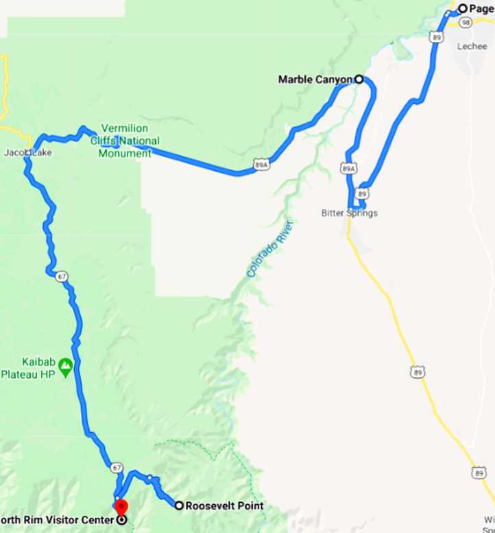
The road initially took me South parallel to the Colorado River, so with the sun on my left I cruised easily along the initial straight stretches�
Straight roads into the desert. Running South towards Bitter Springs in the early morning, the shadow of the van is evident to the right as the straight road stretches out before me.
We had to drop to a lower level to get to Bitter Springs, where there was � effectively � a U-turn to head North again. The descent was quite a serious one, but it gave a good view of the desert out to the South-West:
Descent. Once again I was dealing with different elevation levels between places, which always gives rise to expansive views.
The Marble Canyon I hadn�t heard of until I reached it. A narrow gorge about 130 metres deep with the everpresent Colorado River running at its base. Narrow? Well, nothing like the canyon further downstream, nor even the Glenwood Canyon:
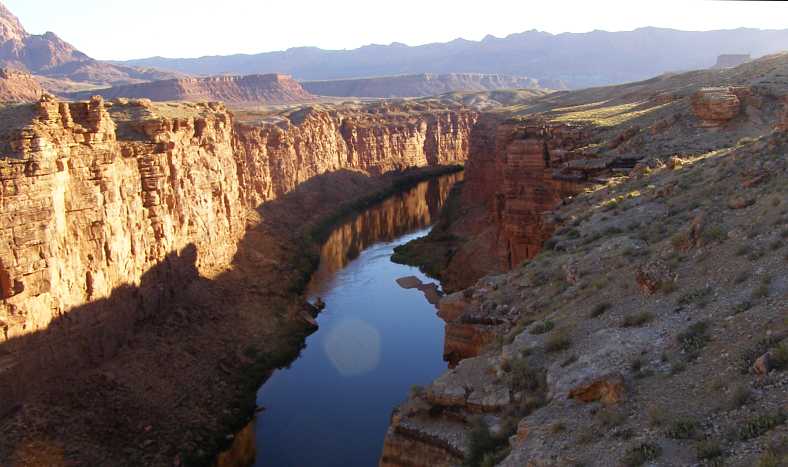
Marble Canyon. Looking North from the bridges, the canyon shows off its colours in the morning sun. The river doesn�t run as strongly since the building of the Glen Canyon dam near Page.
As mentioned repeatedly, nothing stops the road-builders in America and we needed to cross this gorge. The first bridge was built in 1927-28 but was deemed to be inadequate (both in width and load-carrying capacity) so a replacement was built right alongside it in the mid-nineties. The original bridge remains as a pedestrian bridge.
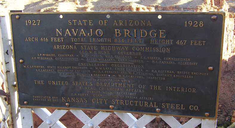
Navajo Bridge details. The original name for the bridge was the �Grand Canyon Bridge�, but the Arizona government changed that after just five years.
The two bridges look very similar, but the load-carrying ability of the new one is much higher than the 40 tons limit on the original. It�s also wide enough for trucks to pass safely. Of interest is the fact that a safety net was hung under it during construction so rocks being cut out would not fall on people rafting down the river.
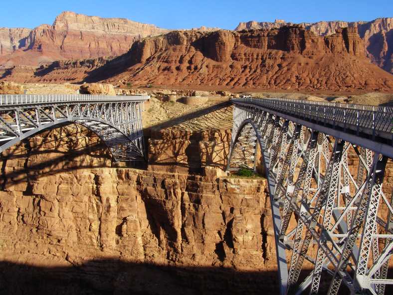
Twin bridges. The old bridge is to the right, the new bridge is about 20 metres longer than the older one, which now serves the needs of pedestrians.
The provision of this bridge came about because settlers in Utah moved Southwards into Arizona and needed to cross the river. A ferry was set up nearer to Page, where access to the river was easier, but over many years it became inadequate for the traffic, particularly with the advent of cars and trucks.
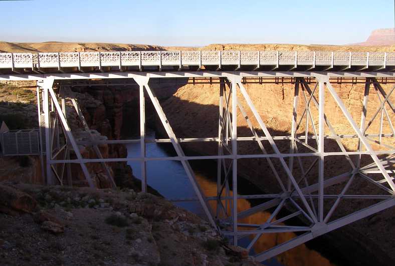
Well-anchored. The supports for both bridges are cut well into the cliffs, this is the new bridge and the canyon looking to the South.
Immediately across the river there was a sign of another feature of this country:
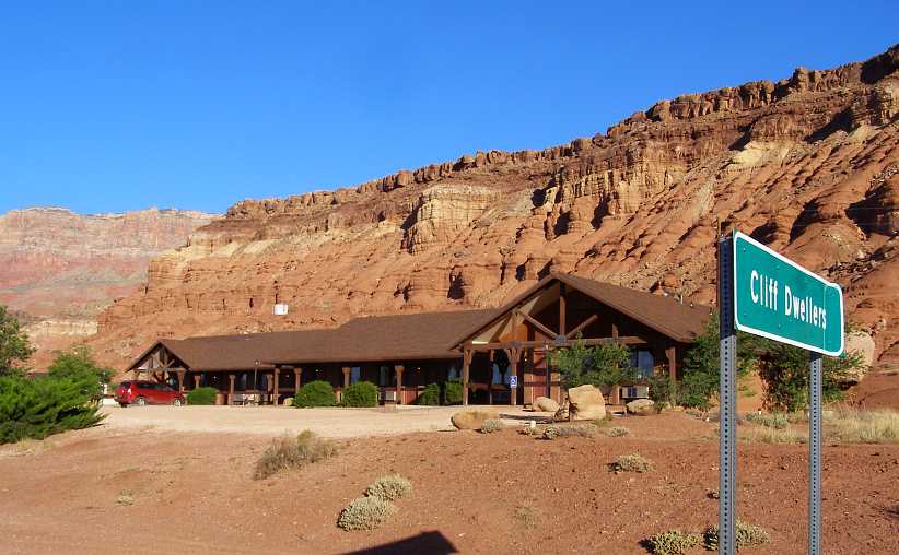
Cliff dwellers. The sign left me thinking that Indians once lived in the cliffs behind the building, but that wasn�t quite so.
The title comes from the settling here of Blanche Russell, a well-known dancer of the Ziegfeld Follies, with her husband after their car broke down. Bill had been diagnosed as having Pulmonary Tuberculosis and they were travelling and on the lookout for somewhere for him to spend his final days.
While they awaited repairs to their car � and this was in 1920 � Blanche took a liking to the desert and its environment and they built a simple rock wall under a fallen boulder to create a home for themselves. They bought the land and then started a business selling refreshments to passing travellers. It was very well-established when they sold it all a decade later and it became the hub for river tours using an airboat as well.
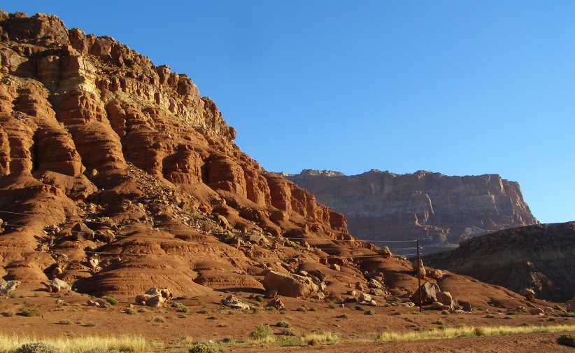
The cliffs. No dwellings up there, the Indians who were truly cliff-dwellers were in the vicinity of the Four Corners 800 years ago. These cliffs are merely a part of the fascinating desert country of Arizona.
From there the road headed generally West and, after another 20 miles or so of desert, climbed to a plateau and I drove among pine trees. It�s a well-used path, but not up to Interstate status and is the route used by those pioneers from Utah as they expanded into Arizona. Today it�s a highway that carries all the traffic going to the entry road to the North Rim of the Grand Canyon.
That road goes off to the South about 41 miles from the Marble Canyon, and it�s through similar country to this highway:
Highway to the canyon. Pine trees line the highway which climbs to the plateau above the Northern side of the Grand Canyon.
After taking the turn to the South I was several miles along the road when I came upon this sight:
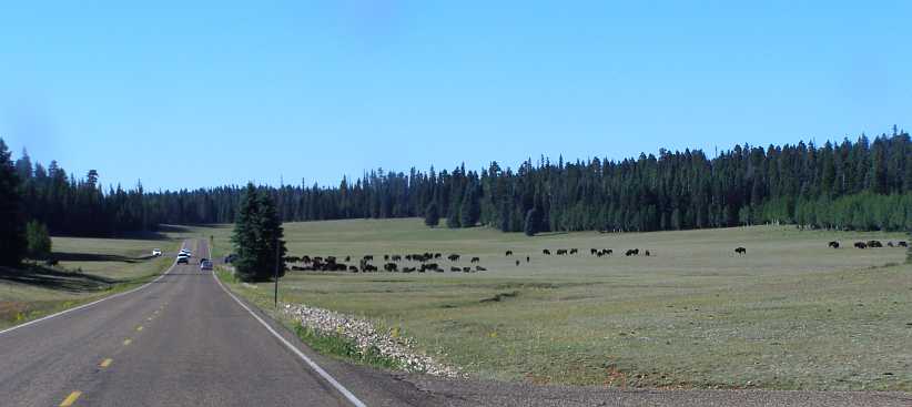
Buffalo in sight. A herd of buffalo grazing in a paddock alongside the road, many cars stopped to have a look, others simply slowed down.
I knew this was a sight Sandra would have liked to have seen, particularly as there was a large number of young calves with their mothers. This is quite evident in this photo:
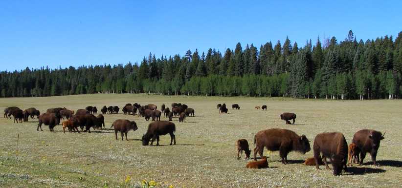
Quietly grazing. It was a placid herd, quite unaffected by the audience they were drawing, and there was a large number of calves with them.
I made sure I got some good pics of the calves to take home to Sandra�
�before pressing on towards the canyon. I took the turnoff to Roosevelt Point and started looking at different points along the way. This road wound around a fair bit and I probably covered five or six miles before turning back to the main road.
Even though I�d been there before � albeit to the South side � it was still an awe-inspiring sight, a true wonder, seeing how this enormous plateau has been carved away to such an extent by the river.
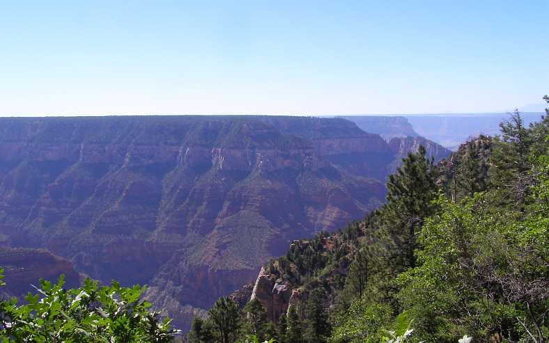
First sight. The first point where I pulled up to have a look � with poor lighting � and the layers showing still where the land mass has been carved up.
The next point had a board which explained why there was so much haze spoiling the view�
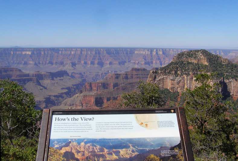
San Francisco Peaks. Not to be seen as clearly as they might because of pollution coming in from cities in the South and the West.
�depending on the angle of the sun, of course. This valley had the sun in the right place:
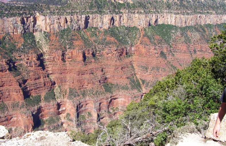
Classic canyon formations. The hard upper layer over the top of softer sedimentary layers leads to formations as we have here.
Some signboards were very informative, this one explaining that there�s a fault line along the river here which has led to the raising of one part of the plateau. One gets the impression that many geologists have studied the canyon and come to conclusions about things like this.
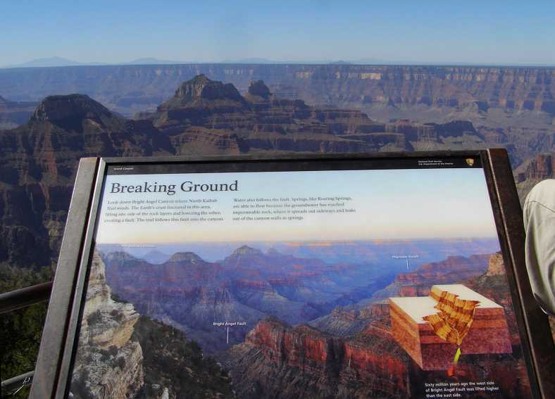
Breaking ground. A seismic fault line follows the river � or the river follows a fault line? � along from Bright Angel Falls.
It follows, then, that the next point I visited was in the area where the ground was lifted up. This point is over a mile higher than the Colorado River:
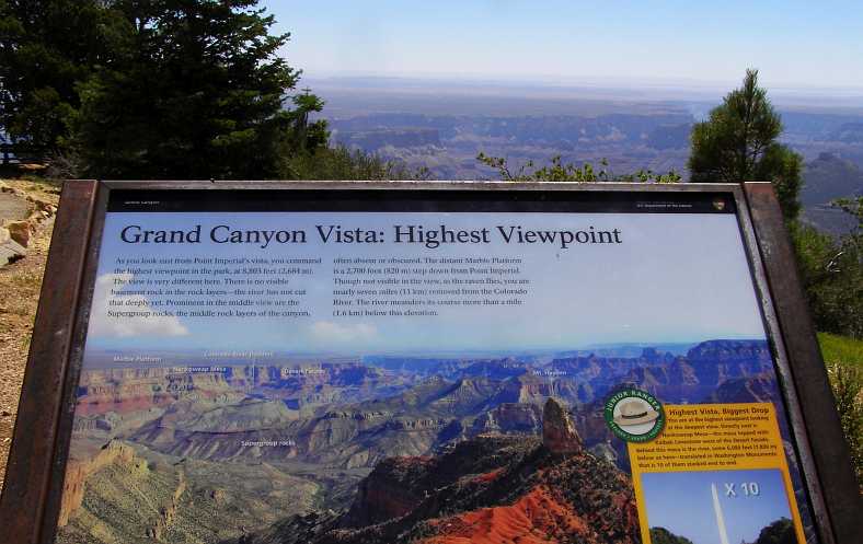
Point Imperial. This is the highest point on the rim of the canyon, 8803 feet or 2764 metres above sea level.
Note that this means that the river still has some falling to do between here and the Gulf of Mexico, over 3,500 feet or 1,100 metres.
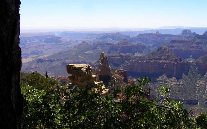
Near and far. The formations are endless, as this photo shows. Channels and ridges, peaks and plateaus, fallen rock and resolute residue, they are all a part of the picture.
As one studies the layers of different colours, this area shows that not all layers are lying horizontal, but there are angles at which they lie to give evidence of seismic activity over the centuries.
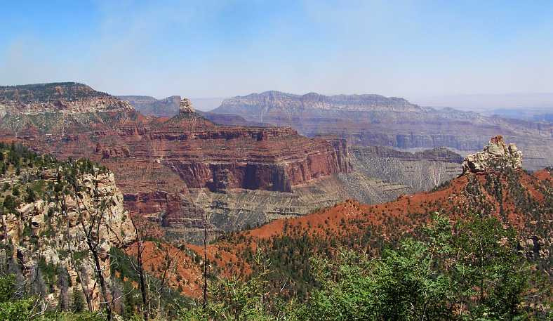
Angles. No doubt this is something the geologists have studied at length over the years.
I reached Roosevelt Point, a place which is quite attractive. It seems appropriate that such a staunch defender of National Parks should have his name on such a place in this huge canyon area.
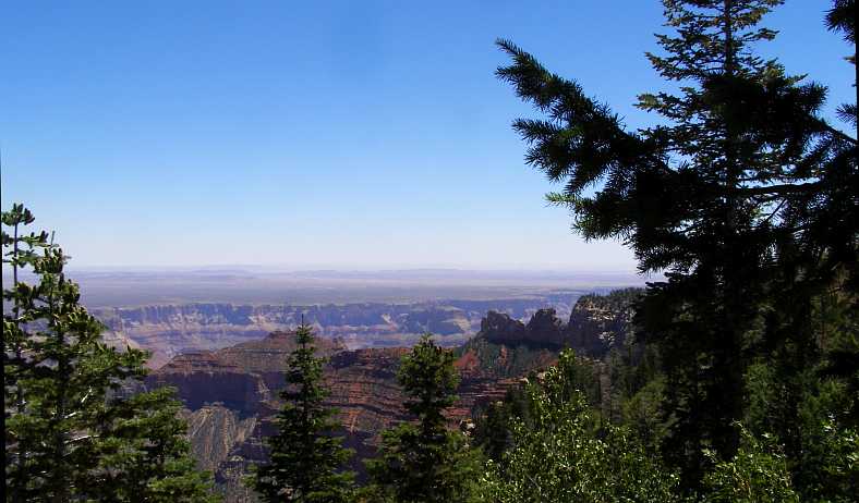
Roosevelt Point. Looking out along this ridge which extends from the firm plateau on which we stand, this is the Northern side of Roosevelt Point.
Theodore Roosevelt visited the canyon over a hundred years ago. He was awed by its natural beauty and keen to ensure that it would never change. This plaque records his feelings:
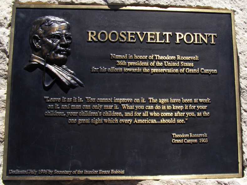
Roosevelt plaque. The quote attributed to Roosevelt here seems to be a composite from a few of his recorded statements in relation to National Parks.
I went hunting on the internet to find out when and where Roosevelt made this statement and found it�s probably not an accurate record, though it would seem to be a true reflection of his feelings. From the National Parks website I found these:
It seems he would fit in well with a lot of people today, and it�s definitely the case that his feelings about keeping nature and natural features of the land intact is morally right.
The Southern view of Roosevelt Point supports his point of view:
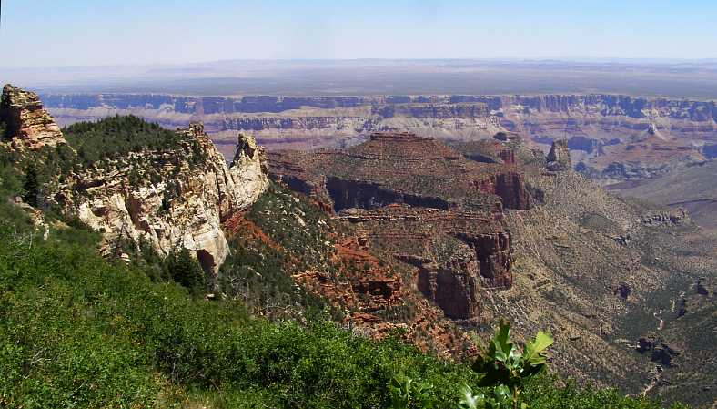
The Southern aspect. Roosevelt Point has all the character of the Grand Canyon�s many points of interests as it projects out into the great cavity in the earth.
There was more for me to see this day, I�ll come back with that in the next post. Perhaps I�ll wrap up this one with another Roosevelt quote:
From Page I had to head South, then turn North at Bitter Springs before again reversing my direction at the Marble Canyon. So the path I took to the North Rim was as shown here:
The road initially took me South parallel to the Colorado River, so with the sun on my left I cruised easily along the initial straight stretches�
Straight roads into the desert. Running South towards Bitter Springs in the early morning, the shadow of the van is evident to the right as the straight road stretches out before me.
We had to drop to a lower level to get to Bitter Springs, where there was � effectively � a U-turn to head North again. The descent was quite a serious one, but it gave a good view of the desert out to the South-West:
Descent. Once again I was dealing with different elevation levels between places, which always gives rise to expansive views.
The Marble Canyon I hadn�t heard of until I reached it. A narrow gorge about 130 metres deep with the everpresent Colorado River running at its base. Narrow? Well, nothing like the canyon further downstream, nor even the Glenwood Canyon:
Marble Canyon. Looking North from the bridges, the canyon shows off its colours in the morning sun. The river doesn�t run as strongly since the building of the Glen Canyon dam near Page.
As mentioned repeatedly, nothing stops the road-builders in America and we needed to cross this gorge. The first bridge was built in 1927-28 but was deemed to be inadequate (both in width and load-carrying capacity) so a replacement was built right alongside it in the mid-nineties. The original bridge remains as a pedestrian bridge.
Navajo Bridge details. The original name for the bridge was the �Grand Canyon Bridge�, but the Arizona government changed that after just five years.
The two bridges look very similar, but the load-carrying ability of the new one is much higher than the 40 tons limit on the original. It�s also wide enough for trucks to pass safely. Of interest is the fact that a safety net was hung under it during construction so rocks being cut out would not fall on people rafting down the river.
Twin bridges. The old bridge is to the right, the new bridge is about 20 metres longer than the older one, which now serves the needs of pedestrians.
The provision of this bridge came about because settlers in Utah moved Southwards into Arizona and needed to cross the river. A ferry was set up nearer to Page, where access to the river was easier, but over many years it became inadequate for the traffic, particularly with the advent of cars and trucks.
Well-anchored. The supports for both bridges are cut well into the cliffs, this is the new bridge and the canyon looking to the South.
Immediately across the river there was a sign of another feature of this country:
Cliff dwellers. The sign left me thinking that Indians once lived in the cliffs behind the building, but that wasn�t quite so.
The title comes from the settling here of Blanche Russell, a well-known dancer of the Ziegfeld Follies, with her husband after their car broke down. Bill had been diagnosed as having Pulmonary Tuberculosis and they were travelling and on the lookout for somewhere for him to spend his final days.
While they awaited repairs to their car � and this was in 1920 � Blanche took a liking to the desert and its environment and they built a simple rock wall under a fallen boulder to create a home for themselves. They bought the land and then started a business selling refreshments to passing travellers. It was very well-established when they sold it all a decade later and it became the hub for river tours using an airboat as well.
The cliffs. No dwellings up there, the Indians who were truly cliff-dwellers were in the vicinity of the Four Corners 800 years ago. These cliffs are merely a part of the fascinating desert country of Arizona.
From there the road headed generally West and, after another 20 miles or so of desert, climbed to a plateau and I drove among pine trees. It�s a well-used path, but not up to Interstate status and is the route used by those pioneers from Utah as they expanded into Arizona. Today it�s a highway that carries all the traffic going to the entry road to the North Rim of the Grand Canyon.
That road goes off to the South about 41 miles from the Marble Canyon, and it�s through similar country to this highway:
Highway to the canyon. Pine trees line the highway which climbs to the plateau above the Northern side of the Grand Canyon.
After taking the turn to the South I was several miles along the road when I came upon this sight:
Buffalo in sight. A herd of buffalo grazing in a paddock alongside the road, many cars stopped to have a look, others simply slowed down.
I knew this was a sight Sandra would have liked to have seen, particularly as there was a large number of young calves with their mothers. This is quite evident in this photo:
Quietly grazing. It was a placid herd, quite unaffected by the audience they were drawing, and there was a large number of calves with them.
I made sure I got some good pics of the calves to take home to Sandra�
�before pressing on towards the canyon. I took the turnoff to Roosevelt Point and started looking at different points along the way. This road wound around a fair bit and I probably covered five or six miles before turning back to the main road.
Even though I�d been there before � albeit to the South side � it was still an awe-inspiring sight, a true wonder, seeing how this enormous plateau has been carved away to such an extent by the river.
First sight. The first point where I pulled up to have a look � with poor lighting � and the layers showing still where the land mass has been carved up.
The next point had a board which explained why there was so much haze spoiling the view�
San Francisco Peaks. Not to be seen as clearly as they might because of pollution coming in from cities in the South and the West.
�depending on the angle of the sun, of course. This valley had the sun in the right place:
Classic canyon formations. The hard upper layer over the top of softer sedimentary layers leads to formations as we have here.
Some signboards were very informative, this one explaining that there�s a fault line along the river here which has led to the raising of one part of the plateau. One gets the impression that many geologists have studied the canyon and come to conclusions about things like this.
Breaking ground. A seismic fault line follows the river � or the river follows a fault line? � along from Bright Angel Falls.
It follows, then, that the next point I visited was in the area where the ground was lifted up. This point is over a mile higher than the Colorado River:
Point Imperial. This is the highest point on the rim of the canyon, 8803 feet or 2764 metres above sea level.
Note that this means that the river still has some falling to do between here and the Gulf of Mexico, over 3,500 feet or 1,100 metres.
Near and far. The formations are endless, as this photo shows. Channels and ridges, peaks and plateaus, fallen rock and resolute residue, they are all a part of the picture.
As one studies the layers of different colours, this area shows that not all layers are lying horizontal, but there are angles at which they lie to give evidence of seismic activity over the centuries.
Angles. No doubt this is something the geologists have studied at length over the years.
I reached Roosevelt Point, a place which is quite attractive. It seems appropriate that such a staunch defender of National Parks should have his name on such a place in this huge canyon area.
Roosevelt Point. Looking out along this ridge which extends from the firm plateau on which we stand, this is the Northern side of Roosevelt Point.
Theodore Roosevelt visited the canyon over a hundred years ago. He was awed by its natural beauty and keen to ensure that it would never change. This plaque records his feelings:
Roosevelt plaque. The quote attributed to Roosevelt here seems to be a composite from a few of his recorded statements in relation to National Parks.
I went hunting on the internet to find out when and where Roosevelt made this statement and found it�s probably not an accurate record, though it would seem to be a true reflection of his feelings. From the National Parks website I found these:
In the Grand Canyon, Arizona has a natural wonder which is in kind absolutely unparalleled throughout the rest of the world. I want to ask you to keep this great wonder of nature as it now is. I hope you will not have a building of any kind, not a summer cottage, a hotel or anything else, to mar the wonderful grandeur, the sublimity, the great loneliness and beauty of the canyon. Leave it as it is. You cannot improve on it. The ages have been at work on it, and man can only mar it.
There can be nothing in the world more beautiful than the Yosemite, the groves of the giant sequoias and redwoods, the Canyon of the Colorado, the Canyon of the Yellowstone, the Three Tetons; and our people should see to it that they are preserved for their children and their children's children forever, with their majestic beauty all unmarred.
We have become great because of the lavish use of our resources. But the time has come to inquire seriously what will happen when our forests are gone, when the coal, the iron, the oil, and the gas are exhausted, when the soils have still further impoverished and washed into the streams, polluting the rivers, denuding the fields and obstructing navigation.
It is also vandalism wantonly to destroy or to permit the destruction of what is beautiful in nature, whether it be a cliff, a forest, or a species of mammal or bird. Here in the United States we turn our rivers and streams into sewers and dumping-grounds, we pollute the air, we destroy forests, and exterminate fishes, birds and mammals - not to speak of vulgarizing charming landscapes with hideous advertisements. But at last it looks as if our people were awakening.
The Southern view of Roosevelt Point supports his point of view:
The Southern aspect. Roosevelt Point has all the character of the Grand Canyon�s many points of interests as it projects out into the great cavity in the earth.
There was more for me to see this day, I�ll come back with that in the next post. Perhaps I�ll wrap up this one with another Roosevelt quote:
It is not what we have that will make us a great nation; it is the way in which we use it.
Thread Starter
|
Captain
Joined: Oct 2005
Posts: 570
Likes: 8
From: The Summit, Queensland, Australia
Spending time at this stunning example of random erosion on a grand scale really does make you appreciate the scale of things on this earth. I would not be there for the rest of the day, but long enough to have a good look around, take some photos and talk to some fellow tourists.
I was allowing plenty of time, however, with the long summer days taken into account, for me to see what I wanted to here and then to press on towards Zion National Park. That would entail putting only about 220 miles into the day in all including the diversion to the sights along the Cape Royal Road to Roosevelt Point.
The map for the rest of the day would be something like this:
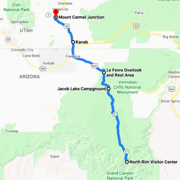
I remained on the Cape Royal Road section for a little longer, getting a few more pics and learning a little more about this great spectacle…
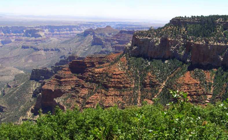
Another view. No two views are the same here. This picture is from much the same place as the previous one, but pointing more to the South.
You have to keep reminding yourself of the scale as you look upon the various landforms in the chasm before you. There are sections there which are higher than and larger than mountains at home, yet here they are contained within the canyon. Mount Bartle Frere, the tallest mountain in Queensland, and the whole Bellenden Ker Range, of which it’s a part, would readily fit into the Grand Canyon at its deepest point.
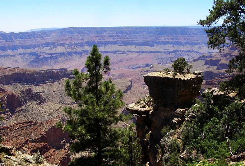
Tree growing. That little tree out there growing on the top of a rock is so insignificant when seen as a part of this scene. It clings to life just as the rock on which it sits clings to the rim of the canyon.
The canyon is perhaps five miles across here, and there are people on the other side looking back at where we are and we cannot see them. Such is the scale of this place, it is truly amazing.
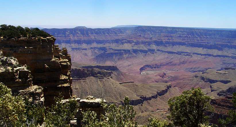
Living Delta. There’s a bend in the river where it forms the Unkar Delta. Puebloan Indians lived through their Winters growing crops there about 1,000 years ago.
Also amazing is the fact that the Puebloans farmed in the base of the canyon in Winter and lived just near this vantage point in Summer, regularly climbing into and out of the canyon.
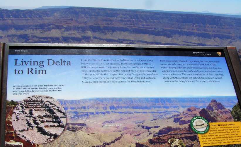
Subsistence living. Growing a few crops and hunting their food, as well as picking wild berries etc, it would have been a hard life for the Puebloans.
Not that the vegetation has an easy life up on the rim. This tree was just begging to be photographed as it clung to life on the edge:
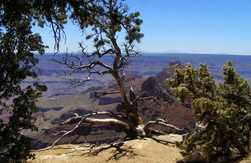
A hardy tree. The seeds of trees don’t get much choice of where they sprout, they just have to endure whatever comes their way. But as ones such as this do, they make the setting more picturesque.
I went round to the North Rim Visitors’ Center, where there were various helpful things. One thing I did want to do was top up my water bottles – actually 1-litre Gatorade bottles Sandra and I had bought back in Spokane complete with lime-flavoured drink – and I looked over the various maps and so on, talking to others as I got the chance. The carpark was well-shaded…
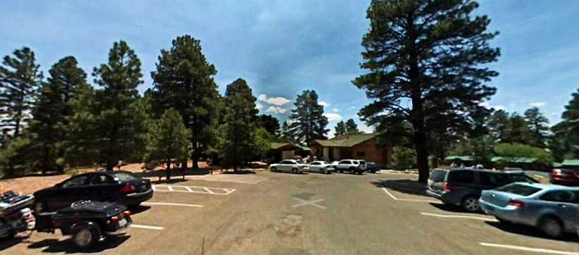
Visitors’ Center. Shaded parking was nice, there is also accommodation in cabins off to the right. Walks radiate in many directions from here.
The variety of formations come into sight before you here, and on these walks you can get more adventurous as pathways with railings have been built further out from the edges. Oddities come into view like this one…
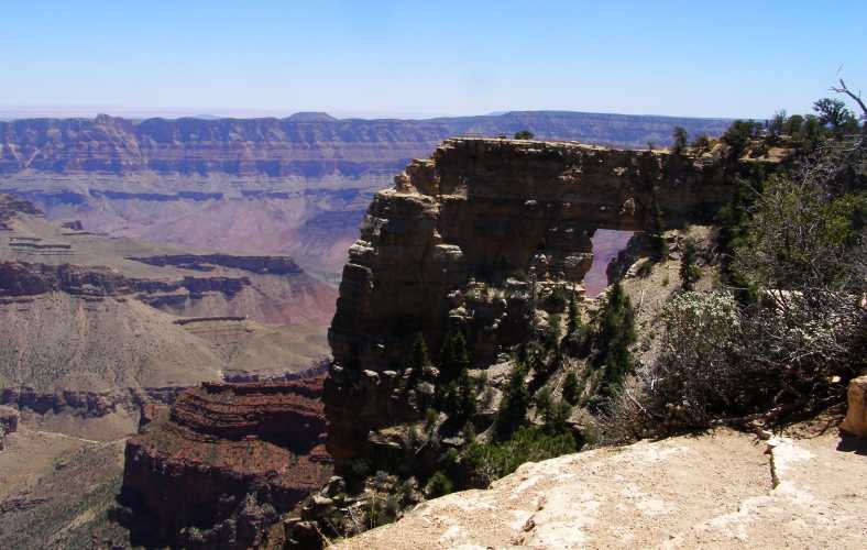
A window. As rocks have been eroded and fallen, this outcrop was left with a gap beneath the top cap to form a window.
I headed around to the South of the Center, where yet more views were to be seen:
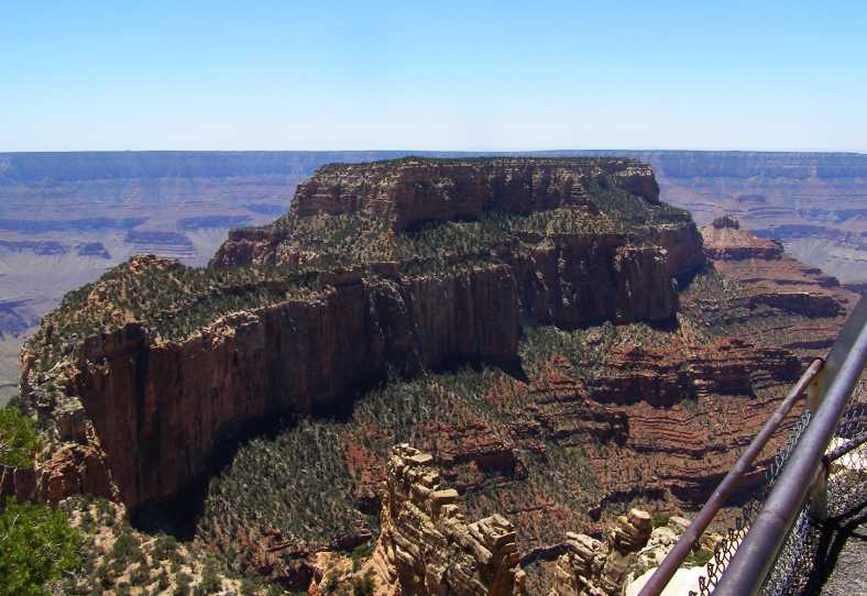
Mountains and valleys. Once again the sheer size of the place stands out here, veritable mountains left between the heavily-eroded valleys.
Size is what the Grand Canyon is all about, after all. It was time to take a long-distance view:
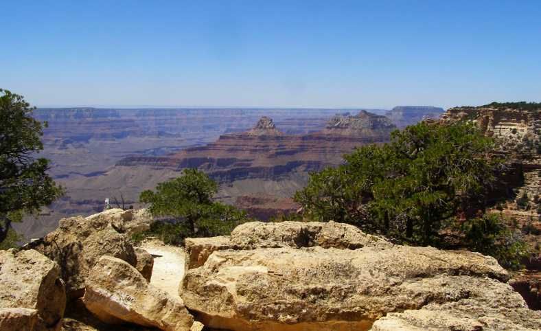
Into the distance. I’m not going to guess how far away the most distant point is in this picture, but I know it’s a very long way. And the canyon stretches on much further than that.
As I circled around the Center I came to the end of one of the valleys. They are everywhere, of course, but it was here that I chose to end my pursuit of canyon exploration for the day. For this trip…
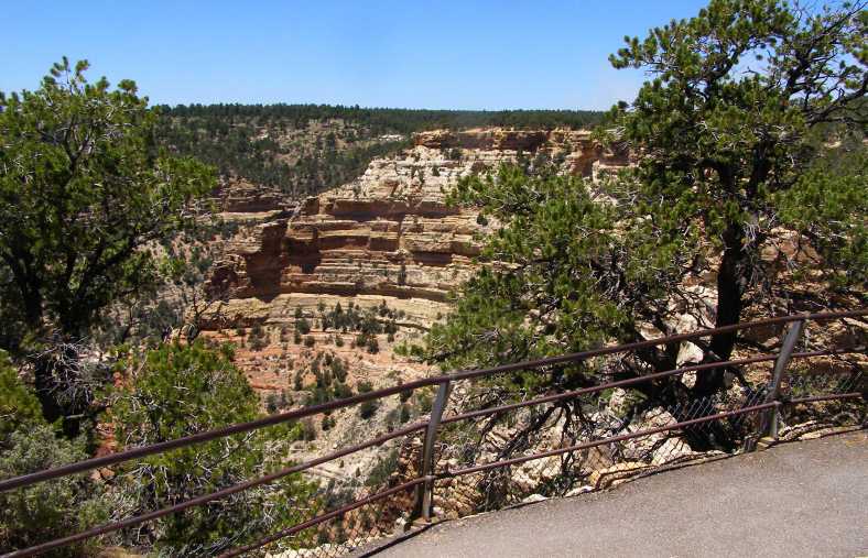
End of the line. Here is where I decided that going further was going to be too much for me, the rounded canyon section becoming my last look for the trip.
But I was still looking around as I prepared to leave. From that canyon point the view was still pretty incredible:
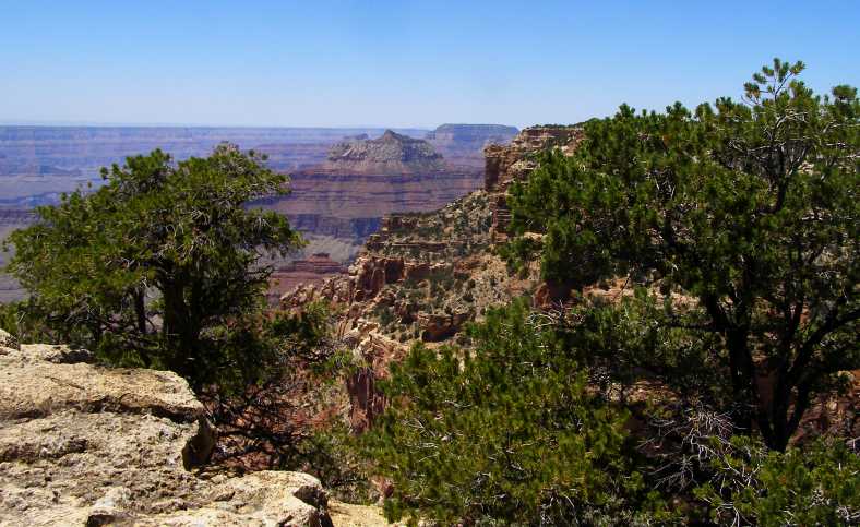
Plenty of canyon left. And many were exploring beyond this point, but I felt it was time to climb back into the van and leave the park.
One more look down into this valley brought another interesting shot. The way time and its allies, water and wind, have cut through there, and the way they’ve left that standing rock in the middle is a source of wonder:
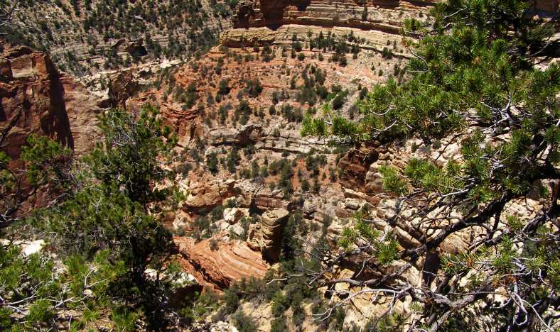
Down below. Looking down I saw this result of the centuries of erosion, it was a good ‘grand finale’ to this visit to the canyon.
Now I had about a hundred miles ahead of me to Mount Carmel. I knew that was a pretty good spot to pull up for the night to give me an easy run into Zion National Park in the morning. Janet and I had stayed there after visiting Zion (all too briefly!) on the first trip. So I swung up into the driver’s seat and headed out of the carpark and up the road:
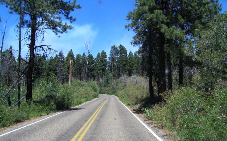
The road out. Through the pine stands of the plateau, the road wends its way towards Jacob’s Lake, about 43 miles away.
Covering miles that I’d only driven down a few hours earlier meant that I knew what to expect as I drove. Two things that stood out were a section where a fire had been through and destroyed a lot of the trees, and the buffalo. The buffalo had moved on, I learned, but not so the blackened trees…
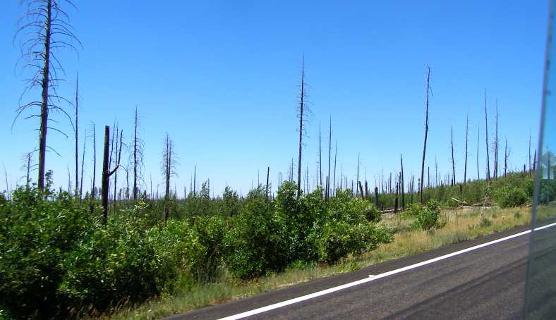
Signs of fire. The emerging new growth tends to camouflage the blackness of the dead sticks that were once emergent pines.
By this time, of course, I was getting a bit hungry. I had some things to cook for myself and all I needed was somewhere shaded to pull up and cook. Preferably with some amenities about.
Just as it was so sorely needed, the campground at Jacob Lake came into sight. I drove in there and set myself up in a shaded corner and put the camp stove to work, making myself a nice meal and also a nice coffee to go with it. I never took any photos of the place, but once again Google Earth has done it for me:
Jacob Lake Campground. A perfect place for me to pull in, cook and eat my meal, then to clean up.
Just eleven miles further on I came upon the Le Fevre Overlook, where the Rest Area has a lookout that provides views over the country ahead. This is a high point before the road started to descend to a lower level, so the views were good.
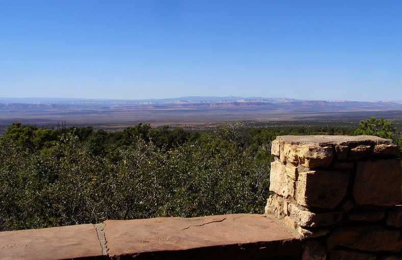
Le Fevre views. Ahead of me lay this flat country, all at a lower level than the plateau I’d been on since climbing from the Marble Canyon.
Another 26 miles saw me, after crossing the border into Utah, entering the town of Kanab. I decided that this would be a good opportunity for me to go online as there was a McDonalds there and I was able to get a dessert to chase down my lunch. After catching up on various forums and my e.mails, I took the time to phone Sandra. She was happy to hear from me and we had a good chat before I packed the laptop and got back into the van.
Kanab, Utah. It was at this McDonalds I spent some time online and from here I phoned Sandra.
As always, our phone call ended with her telling me to be safe. Well, I wasn’t rushing about, anyway. It was already early evening even though it was still daylight. I hadn’t tried to save time anywhere because I knew I wasn’t going far before calling it a day. In fact it was only 17 miles to my planned destination of Mount Carmel Junction. But with some daylight left I decided to go a little further:
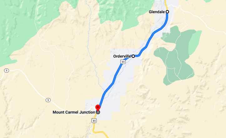
Not very far, about eight and a half miles to Glendale, where Janet and I had stopped in 2012 and she'd gone to a garage sale while I looked around a yard full of old cars. I thought I might check out the old cars again, see if there was anything exciting. There wasn't. But, as the day started to fizzle out I spotted something interesting parked in front of some untidy houses in Glendale:
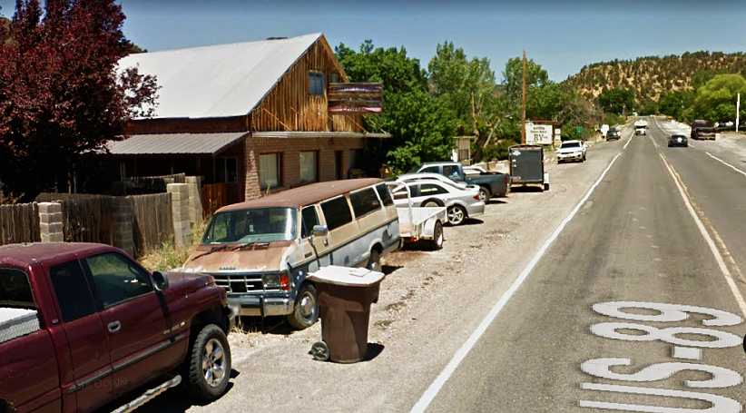
Disused van. This van caught my eye and I stopped to see a bit more, hoping that perhaps I could acquire some parts from it.
A van in a dilapidated and disused state! This pic is from Street View almost two years later, it was still there. I knocked on doors and couldn't find anyone to ask about it, but if I had I would have been looking to buy tail lights, the mirrors and front indicator lights in their outer grille sections as spares to take home with me.
But I found nobody and drove on back to Mount Carmel Junction and this parking area:
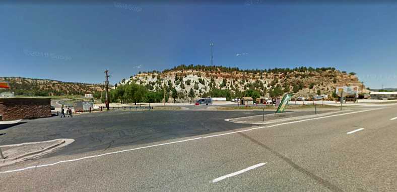
Camping spot. This Google Earth view is of the area where I pulled up to spend the night. I was not alone, a Ram with a large trailer was already camped there in the dark.
Yes, it was dark by the time I ambled back into Mt Carmel Junction. I had noticed a few trucks pulled up in this location the last time we were here so I figured it would do me too. Well-satisfied with my day’s travels and well-fed, I locked myself into the back of the van, lay down in the bed and dozed off…
I was allowing plenty of time, however, with the long summer days taken into account, for me to see what I wanted to here and then to press on towards Zion National Park. That would entail putting only about 220 miles into the day in all including the diversion to the sights along the Cape Royal Road to Roosevelt Point.
The map for the rest of the day would be something like this:
I remained on the Cape Royal Road section for a little longer, getting a few more pics and learning a little more about this great spectacle…
Another view. No two views are the same here. This picture is from much the same place as the previous one, but pointing more to the South.
You have to keep reminding yourself of the scale as you look upon the various landforms in the chasm before you. There are sections there which are higher than and larger than mountains at home, yet here they are contained within the canyon. Mount Bartle Frere, the tallest mountain in Queensland, and the whole Bellenden Ker Range, of which it’s a part, would readily fit into the Grand Canyon at its deepest point.
Tree growing. That little tree out there growing on the top of a rock is so insignificant when seen as a part of this scene. It clings to life just as the rock on which it sits clings to the rim of the canyon.
The canyon is perhaps five miles across here, and there are people on the other side looking back at where we are and we cannot see them. Such is the scale of this place, it is truly amazing.
Living Delta. There’s a bend in the river where it forms the Unkar Delta. Puebloan Indians lived through their Winters growing crops there about 1,000 years ago.
Also amazing is the fact that the Puebloans farmed in the base of the canyon in Winter and lived just near this vantage point in Summer, regularly climbing into and out of the canyon.
Subsistence living. Growing a few crops and hunting their food, as well as picking wild berries etc, it would have been a hard life for the Puebloans.
Not that the vegetation has an easy life up on the rim. This tree was just begging to be photographed as it clung to life on the edge:
A hardy tree. The seeds of trees don’t get much choice of where they sprout, they just have to endure whatever comes their way. But as ones such as this do, they make the setting more picturesque.
I went round to the North Rim Visitors’ Center, where there were various helpful things. One thing I did want to do was top up my water bottles – actually 1-litre Gatorade bottles Sandra and I had bought back in Spokane complete with lime-flavoured drink – and I looked over the various maps and so on, talking to others as I got the chance. The carpark was well-shaded…
Visitors’ Center. Shaded parking was nice, there is also accommodation in cabins off to the right. Walks radiate in many directions from here.
The variety of formations come into sight before you here, and on these walks you can get more adventurous as pathways with railings have been built further out from the edges. Oddities come into view like this one…
A window. As rocks have been eroded and fallen, this outcrop was left with a gap beneath the top cap to form a window.
I headed around to the South of the Center, where yet more views were to be seen:
Mountains and valleys. Once again the sheer size of the place stands out here, veritable mountains left between the heavily-eroded valleys.
Size is what the Grand Canyon is all about, after all. It was time to take a long-distance view:
Into the distance. I’m not going to guess how far away the most distant point is in this picture, but I know it’s a very long way. And the canyon stretches on much further than that.
As I circled around the Center I came to the end of one of the valleys. They are everywhere, of course, but it was here that I chose to end my pursuit of canyon exploration for the day. For this trip…
End of the line. Here is where I decided that going further was going to be too much for me, the rounded canyon section becoming my last look for the trip.
But I was still looking around as I prepared to leave. From that canyon point the view was still pretty incredible:
Plenty of canyon left. And many were exploring beyond this point, but I felt it was time to climb back into the van and leave the park.
One more look down into this valley brought another interesting shot. The way time and its allies, water and wind, have cut through there, and the way they’ve left that standing rock in the middle is a source of wonder:
Down below. Looking down I saw this result of the centuries of erosion, it was a good ‘grand finale’ to this visit to the canyon.
Now I had about a hundred miles ahead of me to Mount Carmel. I knew that was a pretty good spot to pull up for the night to give me an easy run into Zion National Park in the morning. Janet and I had stayed there after visiting Zion (all too briefly!) on the first trip. So I swung up into the driver’s seat and headed out of the carpark and up the road:
The road out. Through the pine stands of the plateau, the road wends its way towards Jacob’s Lake, about 43 miles away.
Covering miles that I’d only driven down a few hours earlier meant that I knew what to expect as I drove. Two things that stood out were a section where a fire had been through and destroyed a lot of the trees, and the buffalo. The buffalo had moved on, I learned, but not so the blackened trees…
Signs of fire. The emerging new growth tends to camouflage the blackness of the dead sticks that were once emergent pines.
By this time, of course, I was getting a bit hungry. I had some things to cook for myself and all I needed was somewhere shaded to pull up and cook. Preferably with some amenities about.
Just as it was so sorely needed, the campground at Jacob Lake came into sight. I drove in there and set myself up in a shaded corner and put the camp stove to work, making myself a nice meal and also a nice coffee to go with it. I never took any photos of the place, but once again Google Earth has done it for me:
Jacob Lake Campground. A perfect place for me to pull in, cook and eat my meal, then to clean up.
Just eleven miles further on I came upon the Le Fevre Overlook, where the Rest Area has a lookout that provides views over the country ahead. This is a high point before the road started to descend to a lower level, so the views were good.
Le Fevre views. Ahead of me lay this flat country, all at a lower level than the plateau I’d been on since climbing from the Marble Canyon.
Another 26 miles saw me, after crossing the border into Utah, entering the town of Kanab. I decided that this would be a good opportunity for me to go online as there was a McDonalds there and I was able to get a dessert to chase down my lunch. After catching up on various forums and my e.mails, I took the time to phone Sandra. She was happy to hear from me and we had a good chat before I packed the laptop and got back into the van.
Kanab, Utah. It was at this McDonalds I spent some time online and from here I phoned Sandra.
As always, our phone call ended with her telling me to be safe. Well, I wasn’t rushing about, anyway. It was already early evening even though it was still daylight. I hadn’t tried to save time anywhere because I knew I wasn’t going far before calling it a day. In fact it was only 17 miles to my planned destination of Mount Carmel Junction. But with some daylight left I decided to go a little further:
Not very far, about eight and a half miles to Glendale, where Janet and I had stopped in 2012 and she'd gone to a garage sale while I looked around a yard full of old cars. I thought I might check out the old cars again, see if there was anything exciting. There wasn't. But, as the day started to fizzle out I spotted something interesting parked in front of some untidy houses in Glendale:
Disused van. This van caught my eye and I stopped to see a bit more, hoping that perhaps I could acquire some parts from it.
A van in a dilapidated and disused state! This pic is from Street View almost two years later, it was still there. I knocked on doors and couldn't find anyone to ask about it, but if I had I would have been looking to buy tail lights, the mirrors and front indicator lights in their outer grille sections as spares to take home with me.
But I found nobody and drove on back to Mount Carmel Junction and this parking area:
Camping spot. This Google Earth view is of the area where I pulled up to spend the night. I was not alone, a Ram with a large trailer was already camped there in the dark.
Yes, it was dark by the time I ambled back into Mt Carmel Junction. I had noticed a few trucks pulled up in this location the last time we were here so I figured it would do me too. Well-satisfied with my day’s travels and well-fed, I locked myself into the back of the van, lay down in the bed and dozed off…
Last edited by Ray Bell; Nov 18, 2020 at 11:03 PM.
Thread Starter
|
Captain
Joined: Oct 2005
Posts: 570
Likes: 8
From: The Summit, Queensland, Australia
It was a bit of a restless night at Mt Carmel Junction, but I got through it and woke up fairly early. I took a couple of photos there and breakfasted before I moved off towards Zion National Park, the drive this day would eventually take me as far as Boulder City, the other side of Las Vegas, so this is the path I took:
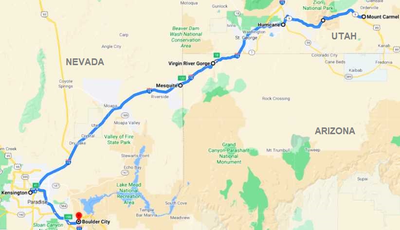
The first photo I took was of the Toronado in the nice little motel where Janet and I stayed during the first trip. This was almost four years on and the owner was already very unhappy with his son for having it there when we came through…
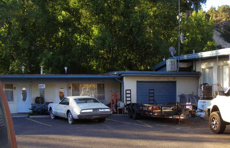
Toronado and trailer. Still there after almost four years, this was a source of angst between the motel owner and his son.
…so, seeing as I had Google Earth Street View on to get the pic of the campsite across the road, I checked to see if it was still there, Street View’s date being in 2018. It was gone, but is this car perhaps a replacement?
Replacement or guest’s car? I don’t know, of course, but it’s an interesting prospect.
And the second photo I took was of the RAM with its large trailer and load, clearly I was on the move earlier than its driver:
Black RAM. I guess these smaller, but still large, trailers give transport operators flexibility in their business.
After a quick breakfast I drove on, it was a road Janet and I drove in semi-darkness (we weren’t going to travel at night, remember?) and so I was seeing more clearly the views I could barely make out the last time…
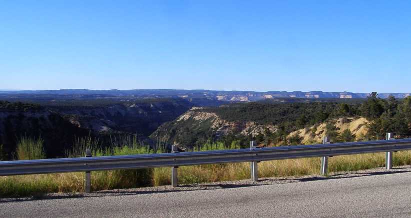
Familiar sight. But much more clearly visible this time as the sun started to rise in the clear blue sky.
Yes, a clear blue sky which promised a nice day exploring the Zion National Park. Oh, yes, we’d also seen buffalo along this path last time and they were still there:
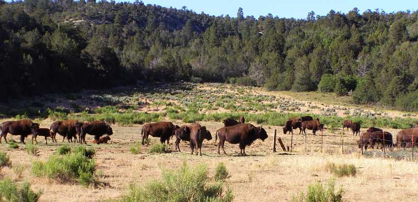
Buffalo. This small herd was several miles along, it is on private property so I guess they are breeding them for sale. Would that be right?
Naturally enough I stopped to get a closer look again, and I also took a pic of one of the babies to take home to Sandra.
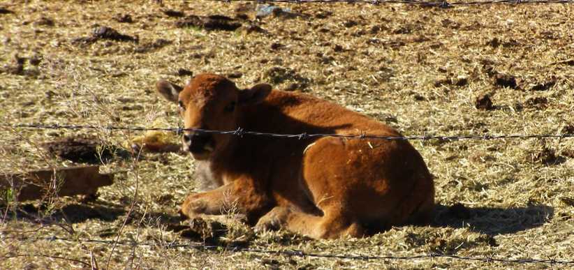
Buffalo calf. Just sitting there quietly wondering what I was doing, it got up onto its feet as soon as I took this picture.
Resuming my drive I soon got closer to the National Park entry, where I would again have to present my pass purchased way back at Yellowstone in April, when we’d seen the buffalo with the snow on their backs. The first indication that it’s getting close is this place:
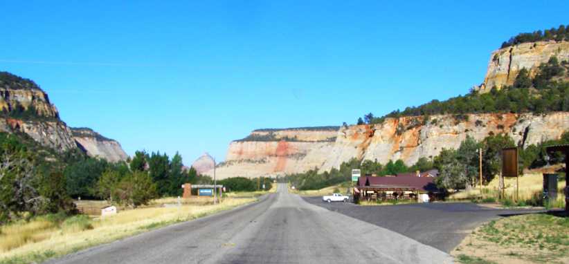
Zion Mountain Trading Post. This ‘Trading Post’ is set up to look like it’s from the distant past, but I didn’t stop.
More familiar was the Checkerboard Mesa, which soon came into view:
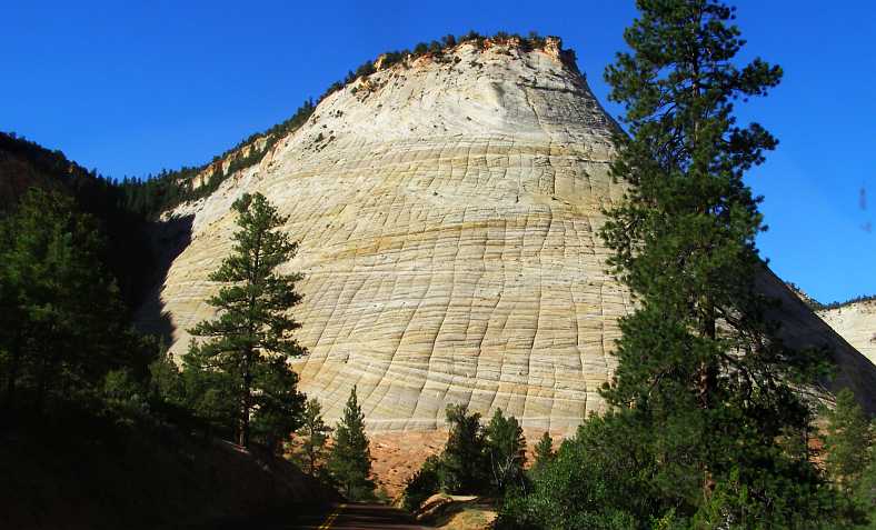
Checkerboard Mesa. One of Zion’s features, the mesa with the patterned rock face looking like the traditional board game.
Continuing downhill, for we’re now dropping into yet another of America’s canyons, the road twists and turns a bit. I must apologies for some of these photos as I’d accidentally changed the camera’s settings, I’ve done the best I can to fix them, but they’re generally too light. Traffic was light…
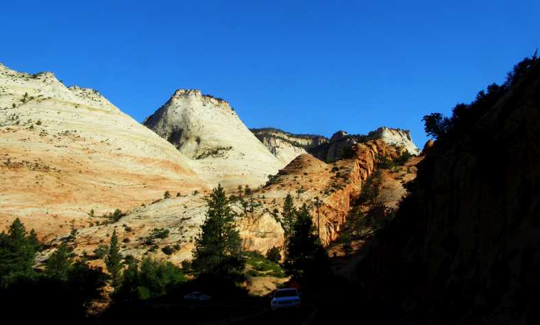
Light traffic. One of the advantages of travelling early, the traffic is light and there’s not much to hold you up.
…and Utah’s mesas and time-worn plateaux started to become towers overhead. We had still to descend much further and there are many landforms to observe on the way. On display in this natural place of wonderment are a number of sandstone ‘blind arches’ - as well as one which has gone right through and formed a bridge. But I only saw the blind ones…
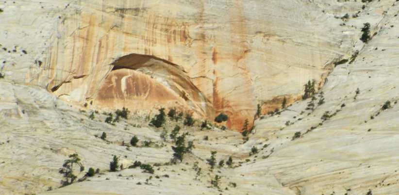
Sandstone arches. This is just one of the many such arches around the Zion National Park, some stretch out to as long as 600 feet (185 metres).
And then came the first tunnel, the short one:
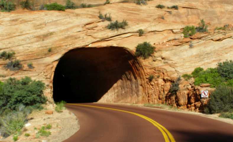
Short tunnel. To make it possible to access the canyon from the Northern side (or North-Eastern…) there are two tunnels, this is the first.
Carved in the sandstone, it leads to the short piece of road between the tunnels.
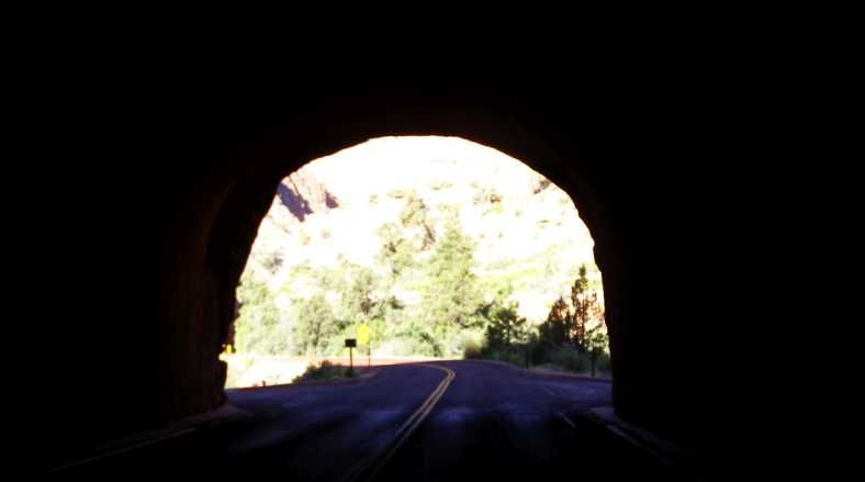
Out of the first tunnel. It isn’t far from the first tunnel to the second, but enough room for…
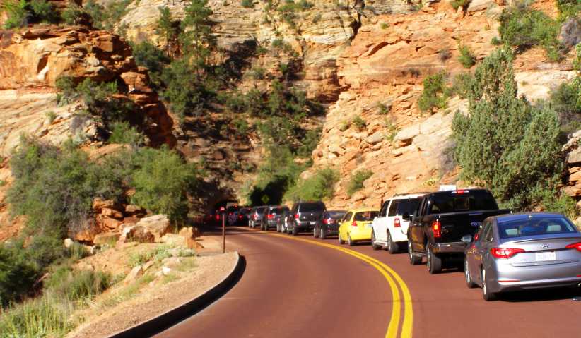
Entry queue. …the park entry gate and a queue of cars showing their cards or paying to get in.
And then came the longer tunnel, I think I recall that it’s a mile long, descending to a convenient point for the road climbing out of the canyon to meat it.
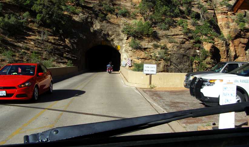
Tunnel in. After paying you enter this mile-long tunnel which provides an easier path to the canyon than a road around the mountain would have. It’s buried in behind sheer cliffs.
The main entry is from the opposite direction, which is where the tour buses run. That’s right, tour buses – little buses, usually coupled up to trailer units the same size and shape. They run constantly up and down the road into the canyon all day and really make it easy to see the features of the park.
There’s a number of bus stops and you’re free to get on or off at any, to travel either way according to your desires, once in the park the buses are totally at your disposal. Miss one and another will soon be along. And they all start from the main area at the Southern entry to the park proper. It can become a busy little bus station.
Main park station. A bus complete with trailer pulls in to drop off some and pick up others for a trip into the canyon.
I decided to go to each stop in turn. On the way to the first I got these two photos of the high cliffs which surrounded the entry to the main part of the canyon.
Sandstone arch high up. Another of the sandstone arches, which simply defeat my understanding of how they are formed. It’s hundreds of feet above the ground level, too.
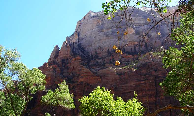
Pines cling to cliffs. Apart from the cliffs themselves, the pine trees growing up there got my attention.
This is a bus stop along the path of the tour:
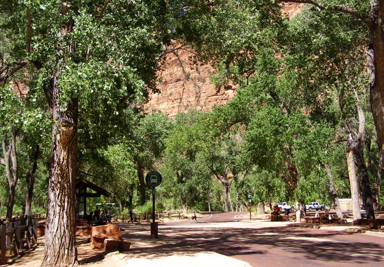
Bus stop. Shade trees surround the bus stop, while there’s plenty of benches and seats for people to sit on both while they wait or to simply rest during their stay.
Each stop took people to different features of the canyon, some showing off natural features, some giving a perspective on the cliffs that surround everything and the interpretation that has been given to them.
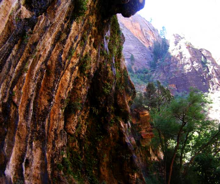
Growth on rocks. Seepage waters the rock and plants grow from the pores while above it all there’s small trees clinging to the fissures in the cliffs.
Looking up at the canyon walls is certainly different to the Grand Canyon experience. There also seems to be more integrity in the rock here, it’s not layered to the same extent as the Grand Canyon surrounds, more like the sandstone cliffs we see at home in places like the Blue Mountains.
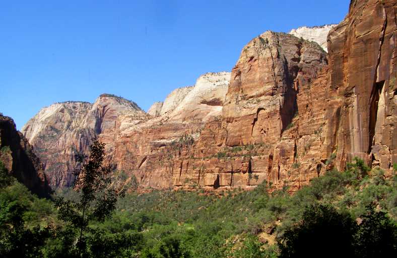
Rock walls. Without referring to the literature, I don’t know what these rock forms are named for. Being Utah and being distinctly religious in overtone, there is probably a biblical reference in there somewhere.
The name of the park is ‘Zion,’ itself a biblical name. Many features are named for biblical things, like the ‘Court of the Patricarchs’ and ‘Angel’s Landing’. I was trying to stick to enjoying the scenery, the natural features which are so abundant in the canyon.
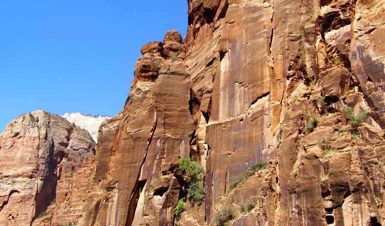
Trees growing. More trees trying to grow in an impossible place. Seeds have blown into a crevice, dust and water do the rest, but growth will be limited.
I was far from alone this day. Many tourists were present as it was the height of Summer, and International tourists were certainly among the many wandering about. Of course, everyone knows how keen Japanese (and other Asian) people are about taking photos, and in these latter days also ‘selfies’, some go to extremes to get something a bit different…
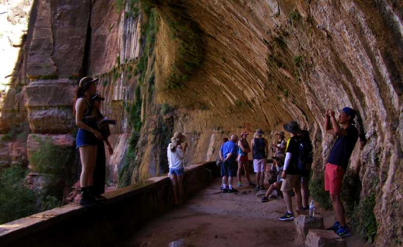
Darwin award candidates. Wet shoes, a skinny wall to stand on, a long drop behind them, they did survive but it could have been different if one had slipped. This formation is like a wave coming over, complete with more small plants.
We were well along the path now, the tall cliffs got closer together and the stream running down through the canyon was more evident. Looking further ahead I saw how rugged it was…
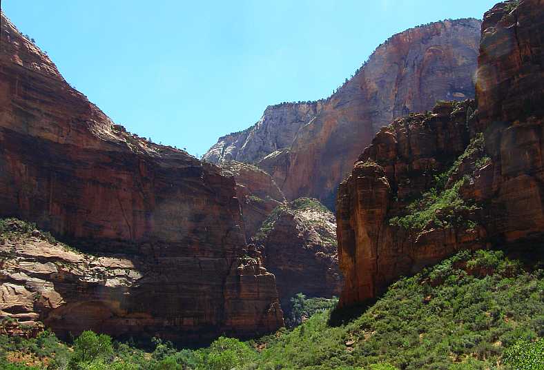
Rugged country. As the canyon narrowed the ruggedness of the country became more evident.
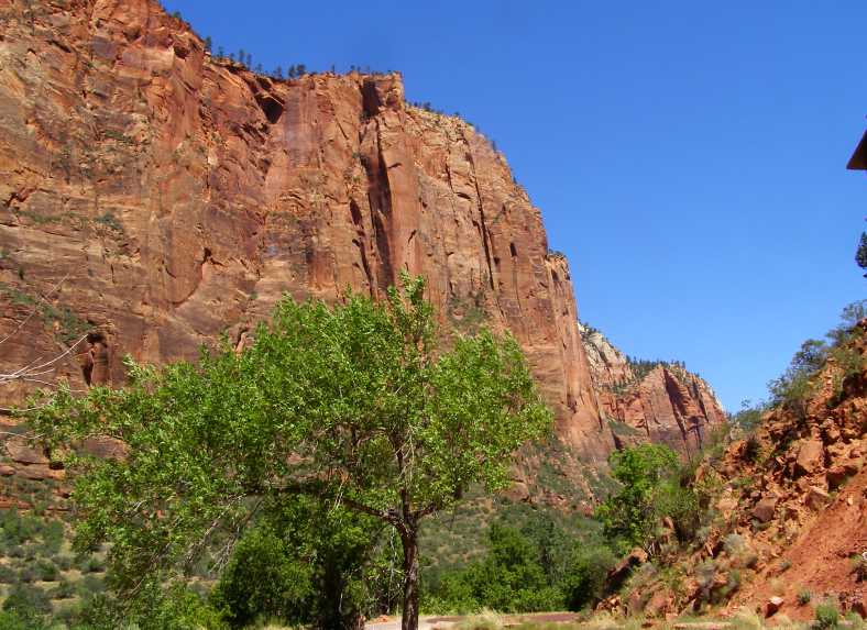
Tall wall. Another example of a sandstone cliff, straight and tall and dwarfing the people walking along the path winding ahead.
Now I was past the last bus stop. It was cooler, due to the running water, there were some squirrels about too, and the path was fenced in parts due to the narrowness of the canyon at this point and the need to allow the natural plants their room to grow.
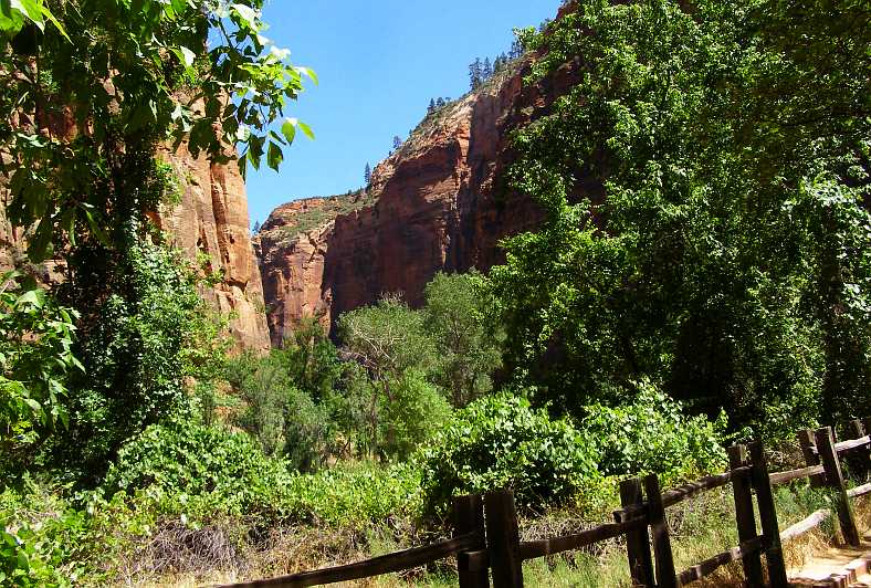
Narrowing canyon. With sandstone cliffs both sides, we were reaching the point where the canyon was at its narrowest.
I started to see signs related to swimming, something I hadn’t expected, but the water was certainly flowing:
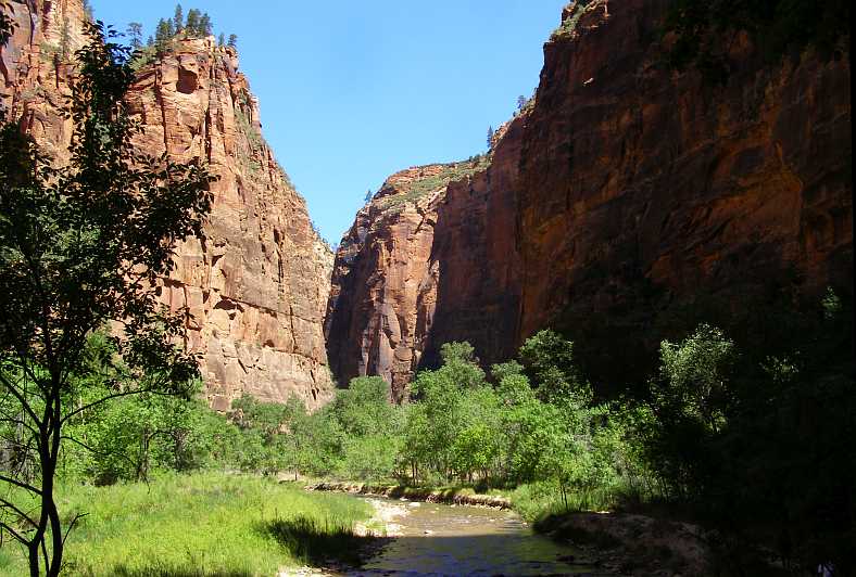
Flowing stream. It doesn’t look like much flow, but other seepage and little tributaries feed this stream further down.
I walked on, even though my knee was sometimes telling me it was time to turn around. But all the while I knew it wasn’t really that far back to the last bus stop, from which point the knee would get an easier time. A squirrel or two ran about me and I wanted to get a photo…
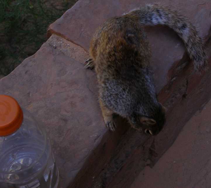
Squirrel. Remember, we don’t have these in Australia. This little fellow is about to turn and run after I put my Gatorade bottle full of water down near him.
I was really enjoying Zion National Park, it was a nice place and well worth the visit. I reflected on how much of a shame it was that Janet and I had missed out on doing this in 2012 due to that second wheel bearing failure. All we’d had time to do was look at a few display boards.
More about this park and the drive to Boulder City in the next post…
The first photo I took was of the Toronado in the nice little motel where Janet and I stayed during the first trip. This was almost four years on and the owner was already very unhappy with his son for having it there when we came through…
Toronado and trailer. Still there after almost four years, this was a source of angst between the motel owner and his son.
…so, seeing as I had Google Earth Street View on to get the pic of the campsite across the road, I checked to see if it was still there, Street View’s date being in 2018. It was gone, but is this car perhaps a replacement?
Replacement or guest’s car? I don’t know, of course, but it’s an interesting prospect.
And the second photo I took was of the RAM with its large trailer and load, clearly I was on the move earlier than its driver:
Black RAM. I guess these smaller, but still large, trailers give transport operators flexibility in their business.
After a quick breakfast I drove on, it was a road Janet and I drove in semi-darkness (we weren’t going to travel at night, remember?) and so I was seeing more clearly the views I could barely make out the last time…
Familiar sight. But much more clearly visible this time as the sun started to rise in the clear blue sky.
Yes, a clear blue sky which promised a nice day exploring the Zion National Park. Oh, yes, we’d also seen buffalo along this path last time and they were still there:
Buffalo. This small herd was several miles along, it is on private property so I guess they are breeding them for sale. Would that be right?
Naturally enough I stopped to get a closer look again, and I also took a pic of one of the babies to take home to Sandra.
Buffalo calf. Just sitting there quietly wondering what I was doing, it got up onto its feet as soon as I took this picture.
Resuming my drive I soon got closer to the National Park entry, where I would again have to present my pass purchased way back at Yellowstone in April, when we’d seen the buffalo with the snow on their backs. The first indication that it’s getting close is this place:
Zion Mountain Trading Post. This ‘Trading Post’ is set up to look like it’s from the distant past, but I didn’t stop.
More familiar was the Checkerboard Mesa, which soon came into view:
Checkerboard Mesa. One of Zion’s features, the mesa with the patterned rock face looking like the traditional board game.
Continuing downhill, for we’re now dropping into yet another of America’s canyons, the road twists and turns a bit. I must apologies for some of these photos as I’d accidentally changed the camera’s settings, I’ve done the best I can to fix them, but they’re generally too light. Traffic was light…
Light traffic. One of the advantages of travelling early, the traffic is light and there’s not much to hold you up.
…and Utah’s mesas and time-worn plateaux started to become towers overhead. We had still to descend much further and there are many landforms to observe on the way. On display in this natural place of wonderment are a number of sandstone ‘blind arches’ - as well as one which has gone right through and formed a bridge. But I only saw the blind ones…
Sandstone arches. This is just one of the many such arches around the Zion National Park, some stretch out to as long as 600 feet (185 metres).
And then came the first tunnel, the short one:
Short tunnel. To make it possible to access the canyon from the Northern side (or North-Eastern…) there are two tunnels, this is the first.
Carved in the sandstone, it leads to the short piece of road between the tunnels.
Out of the first tunnel. It isn’t far from the first tunnel to the second, but enough room for…
Entry queue. …the park entry gate and a queue of cars showing their cards or paying to get in.
And then came the longer tunnel, I think I recall that it’s a mile long, descending to a convenient point for the road climbing out of the canyon to meat it.
Tunnel in. After paying you enter this mile-long tunnel which provides an easier path to the canyon than a road around the mountain would have. It’s buried in behind sheer cliffs.
The main entry is from the opposite direction, which is where the tour buses run. That’s right, tour buses – little buses, usually coupled up to trailer units the same size and shape. They run constantly up and down the road into the canyon all day and really make it easy to see the features of the park.
There’s a number of bus stops and you’re free to get on or off at any, to travel either way according to your desires, once in the park the buses are totally at your disposal. Miss one and another will soon be along. And they all start from the main area at the Southern entry to the park proper. It can become a busy little bus station.
Main park station. A bus complete with trailer pulls in to drop off some and pick up others for a trip into the canyon.
I decided to go to each stop in turn. On the way to the first I got these two photos of the high cliffs which surrounded the entry to the main part of the canyon.
Sandstone arch high up. Another of the sandstone arches, which simply defeat my understanding of how they are formed. It’s hundreds of feet above the ground level, too.
Pines cling to cliffs. Apart from the cliffs themselves, the pine trees growing up there got my attention.
This is a bus stop along the path of the tour:
Bus stop. Shade trees surround the bus stop, while there’s plenty of benches and seats for people to sit on both while they wait or to simply rest during their stay.
Each stop took people to different features of the canyon, some showing off natural features, some giving a perspective on the cliffs that surround everything and the interpretation that has been given to them.
Growth on rocks. Seepage waters the rock and plants grow from the pores while above it all there’s small trees clinging to the fissures in the cliffs.
Looking up at the canyon walls is certainly different to the Grand Canyon experience. There also seems to be more integrity in the rock here, it’s not layered to the same extent as the Grand Canyon surrounds, more like the sandstone cliffs we see at home in places like the Blue Mountains.
Rock walls. Without referring to the literature, I don’t know what these rock forms are named for. Being Utah and being distinctly religious in overtone, there is probably a biblical reference in there somewhere.
The name of the park is ‘Zion,’ itself a biblical name. Many features are named for biblical things, like the ‘Court of the Patricarchs’ and ‘Angel’s Landing’. I was trying to stick to enjoying the scenery, the natural features which are so abundant in the canyon.
Trees growing. More trees trying to grow in an impossible place. Seeds have blown into a crevice, dust and water do the rest, but growth will be limited.
I was far from alone this day. Many tourists were present as it was the height of Summer, and International tourists were certainly among the many wandering about. Of course, everyone knows how keen Japanese (and other Asian) people are about taking photos, and in these latter days also ‘selfies’, some go to extremes to get something a bit different…
Darwin award candidates. Wet shoes, a skinny wall to stand on, a long drop behind them, they did survive but it could have been different if one had slipped. This formation is like a wave coming over, complete with more small plants.
We were well along the path now, the tall cliffs got closer together and the stream running down through the canyon was more evident. Looking further ahead I saw how rugged it was…
Rugged country. As the canyon narrowed the ruggedness of the country became more evident.
Tall wall. Another example of a sandstone cliff, straight and tall and dwarfing the people walking along the path winding ahead.
Now I was past the last bus stop. It was cooler, due to the running water, there were some squirrels about too, and the path was fenced in parts due to the narrowness of the canyon at this point and the need to allow the natural plants their room to grow.
Narrowing canyon. With sandstone cliffs both sides, we were reaching the point where the canyon was at its narrowest.
I started to see signs related to swimming, something I hadn’t expected, but the water was certainly flowing:
Flowing stream. It doesn’t look like much flow, but other seepage and little tributaries feed this stream further down.
I walked on, even though my knee was sometimes telling me it was time to turn around. But all the while I knew it wasn’t really that far back to the last bus stop, from which point the knee would get an easier time. A squirrel or two ran about me and I wanted to get a photo…
Squirrel. Remember, we don’t have these in Australia. This little fellow is about to turn and run after I put my Gatorade bottle full of water down near him.
I was really enjoying Zion National Park, it was a nice place and well worth the visit. I reflected on how much of a shame it was that Janet and I had missed out on doing this in 2012 due to that second wheel bearing failure. All we’d had time to do was look at a few display boards.
More about this park and the drive to Boulder City in the next post…
Last edited by Ray Bell; Aug 29, 2020 at 08:54 AM.