

Ride along with me...


Thread Starter
|
Captain

Joined: Oct 2005
Posts: 570
Likes: 8
From: The Summit, Queensland, Australia
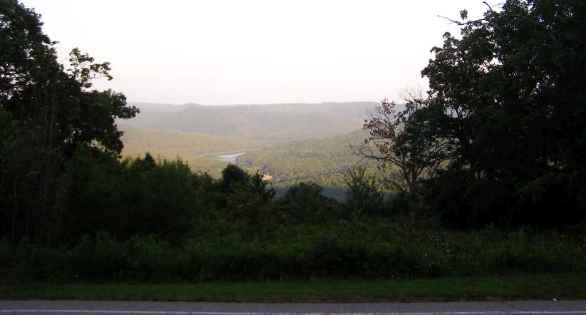
The falls were still roaring when I awoke on Sunday morning. I prepared myself for the tourist bit and got an early look around the US side. As far as I was concerned it was just a matter of quickly getting some snaps for Sandra and the session produced these pictures:
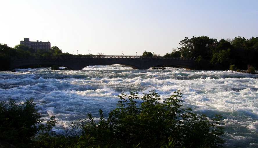
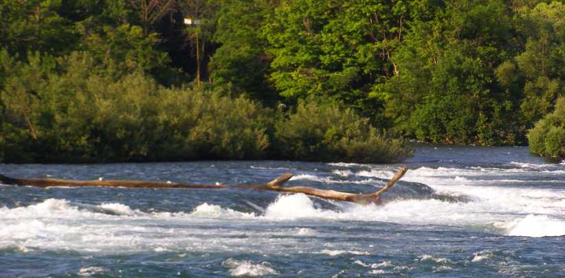
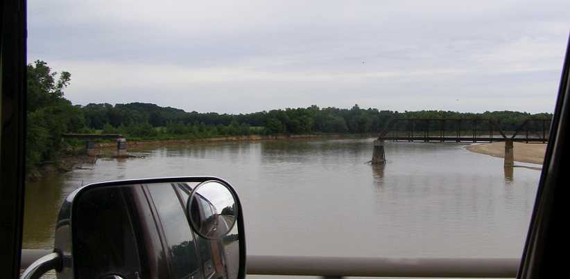
Turbulent waters. Those waters come under the Goat Island Bridge and from there nothing can stop them falling over the American Falls.
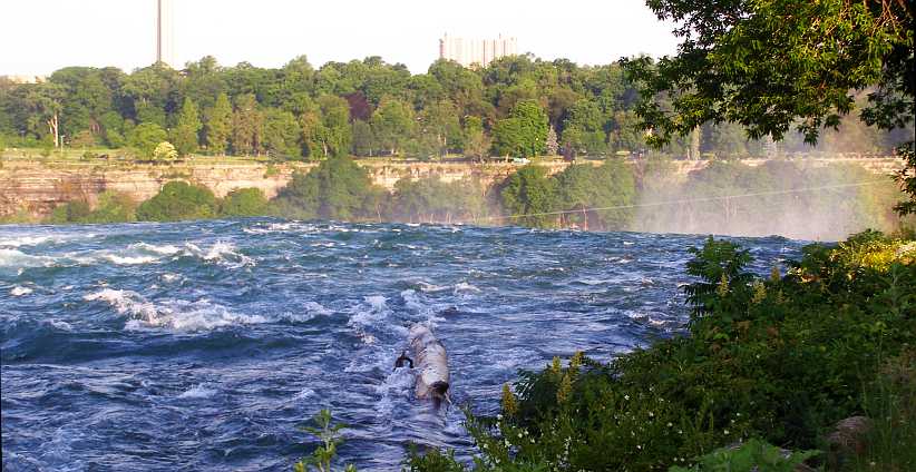
Tree trunk. Rocks might stop the odd tree trunk from going over, however, but for how long?
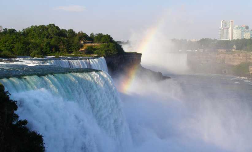
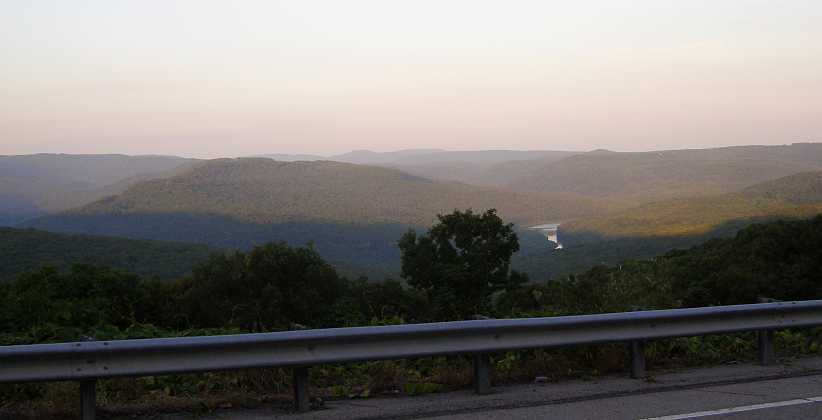
Rainbow in the spray. Still on the American side, looking over the American Falls and towards the Horseshoe Falls.
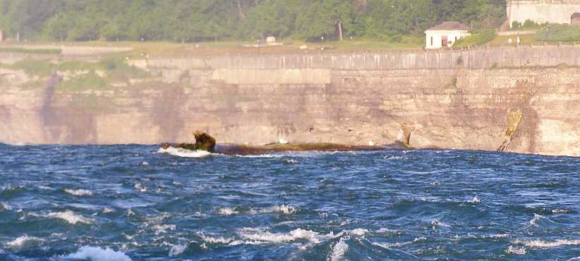
Tree to go over. It looks like this tree trunk’s time is up and it’s about to fall to the rocks below.
Stuck on the rocks. The rocks are holding back this one for now. No doubt its turn soon came too.
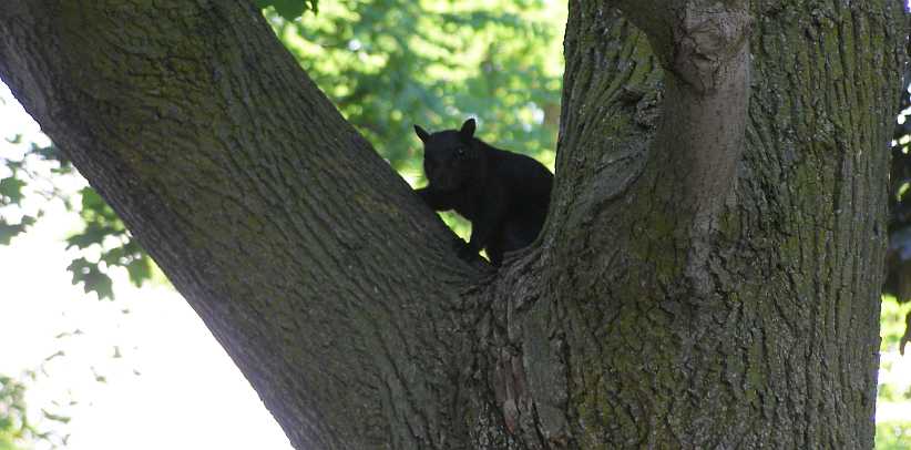
Squirrel in treee. As I walked back to the van this squirrel and I exchanged glances.
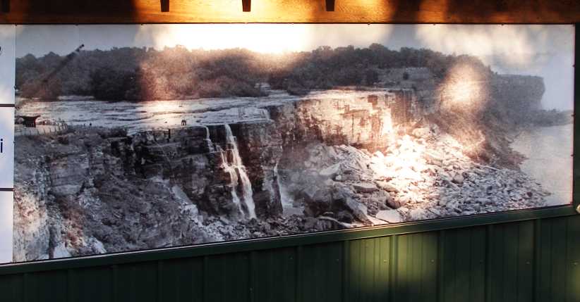
The falls dry. I don’t know how this picture came about, I know it was a long time ago. The photo was up on a wall and it may be from when some big works were being carried out and the river was (somehow!) diverted.
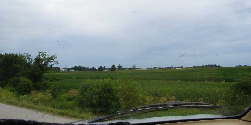
After that I took a drive towards the North for a little way, seeing some more of the Niagara River and its gorge as I drove. It wasn’t long before the roads took me deeper into upstate New York.
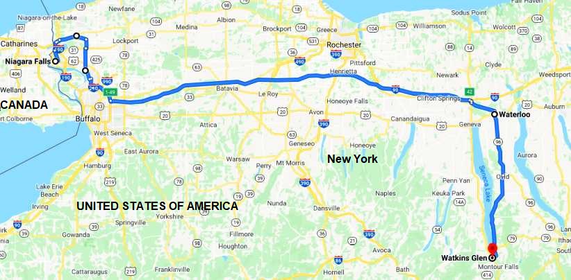
Here’s my path of the intended trip that day:
So the last I saw of Niagara was this bridge:
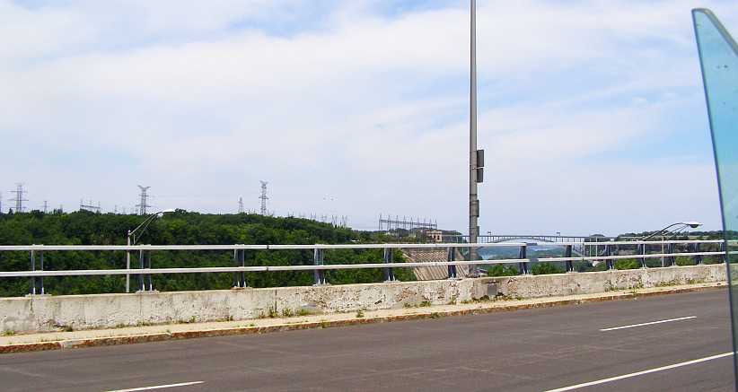
Lewiston-Queenston bridge Another bridge connecting the USA to Canada just a few miles downstream from the falls and before the river spills into Lake Ontario.
Next stop, of course, was the Premium Outlet Center near Waterloo, a place Janet and I had found on our first trip and where I bought Reeboks both previous trips…
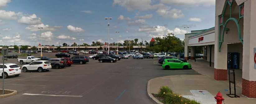
Waterloo Premium Outlets. My regular stop to ensure I go home with some new shoes, Reebocks costing me about $75 for two pairs.
I drove in there in the mid-afternoon and took a little time selecting some shoes, then went out knowing that I wouldn’t be able to go to the International Motor Racing Research Center at Watkins Glen until Monday morning.
As always, I was looking for somewhere to spend some time on the internet and as I cruised South-West from the Outlet Center I found a convenient Walmart on the North Road...
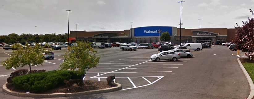
Back to camping at Walmart. Using their wi-fi and camping in their carpark made it easy to choose the Waterloo Walmart as my stopover point this Sunday night.
Naturally I bought some provisions while I was there as I was back to providing for myself with meals and I decided to camp out that night.
Walmart’s staff carpark provided me with that opportunity, of course. I made a few phone calls as well, getting in touch with various people I was looking to visit over the next week or two. A quiet day followed by a quiet night’s sleep.
Turbulent waters. Those waters come under the Goat Island Bridge and from there nothing can stop them falling over the American Falls.
Tree trunk. Rocks might stop the odd tree trunk from going over, however, but for how long?
Rainbow in the spray. Still on the American side, looking over the American Falls and towards the Horseshoe Falls.
Tree to go over. It looks like this tree trunk’s time is up and it’s about to fall to the rocks below.
Stuck on the rocks. The rocks are holding back this one for now. No doubt its turn soon came too.
Squirrel in treee. As I walked back to the van this squirrel and I exchanged glances.
The falls dry. I don’t know how this picture came about, I know it was a long time ago. The photo was up on a wall and it may be from when some big works were being carried out and the river was (somehow!) diverted.
After that I took a drive towards the North for a little way, seeing some more of the Niagara River and its gorge as I drove. It wasn’t long before the roads took me deeper into upstate New York.
Here’s my path of the intended trip that day:
So the last I saw of Niagara was this bridge:
Lewiston-Queenston bridge Another bridge connecting the USA to Canada just a few miles downstream from the falls and before the river spills into Lake Ontario.
Next stop, of course, was the Premium Outlet Center near Waterloo, a place Janet and I had found on our first trip and where I bought Reeboks both previous trips…
Waterloo Premium Outlets. My regular stop to ensure I go home with some new shoes, Reebocks costing me about $75 for two pairs.
I drove in there in the mid-afternoon and took a little time selecting some shoes, then went out knowing that I wouldn’t be able to go to the International Motor Racing Research Center at Watkins Glen until Monday morning.
As always, I was looking for somewhere to spend some time on the internet and as I cruised South-West from the Outlet Center I found a convenient Walmart on the North Road...
Back to camping at Walmart. Using their wi-fi and camping in their carpark made it easy to choose the Waterloo Walmart as my stopover point this Sunday night.
Naturally I bought some provisions while I was there as I was back to providing for myself with meals and I decided to camp out that night.
Walmart’s staff carpark provided me with that opportunity, of course. I made a few phone calls as well, getting in touch with various people I was looking to visit over the next week or two. A quiet day followed by a quiet night’s sleep.
Last edited by Ray Bell; Jul 17, 2020 at 09:12 AM.
Thread Starter
|
Captain
Joined: Oct 2005
Posts: 570
Likes: 8
From: The Summit, Queensland, Australia
Morning came, I was in no real rush to get mobile as it wasn�t far to Watkins Glen and people wouldn�t be on deck until a more reasonable hour. I had decided to drop in and visit Jean Argetsinger at the family vineyard on the shores of Lake Seneca at Burdett. Jean, well into her nineties, had welcomed me when I went there with Michael on the previous trip and in particular I wanted to offer my condolences for the loss of both Michael and his brother, Sam.
Though I didn�t really expect to get all the way this day, the route to be covered to my next firm engagement was as shown here:
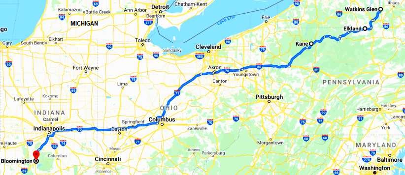
I would be dropping out of New York and crossing a large piece of Pennsylvania, going right across Ohio and halfway across Indiana. But the first step was to Burdett and along the way I was able to indulge in my hobby of collecting photos of delapidated barns:
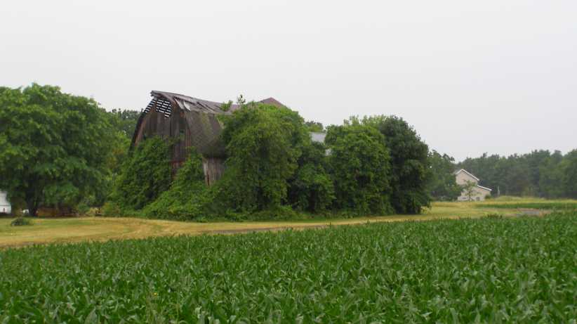
Overgrown. Lush growth around this abandoned barn might be what�s holding it up now. Or maybe not?
In the immediate area near the Argetsinger farm I got this sign, which in this case didn�t seem to indicate a local Amish population. Perhaps it was a buggy rent-a-ride area?
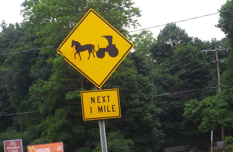
Buggy sign. The graphics indicate classy buggies and horses, I didn�t see any.
I got a big lost and had to ask directions, but ultimately I found the Argetsinger farm and knocked on the door. One of the sons, Duke, answered and when I introduced myself and asked if I could see Jean he said he felt she wasn�t up to it, but he would ask her. Reappearing shortly after from upstairs, he motioned me to go on up and so I was able to deliver my message of sympathy to this matriarch of a fine family � and public-spirited old lady.
I didn�t keep her long and really appreciated the time she gave me that morning, I could see she was not well at all. I bid farewell and headed off to the complex which is named after her:
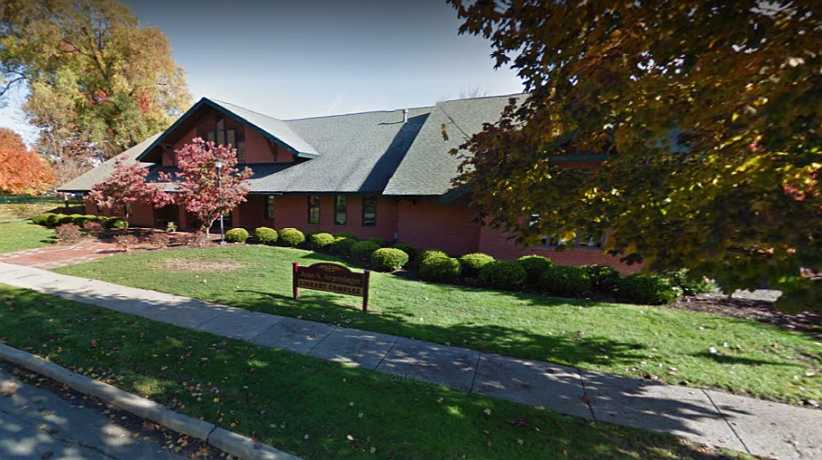
Jean S Argetsinger library complex. Years of hard work by Jean and other supporters has helped Watkins Glen to have this nice library, which also houses the IMRRC. The picture is from Street View.
Prior to leaving home I had negotiated a little deal to sell some books to the Center for resale. The F5000 book they already had but the Tasman Cup book was new. Bill Green welcomed me and though there was some rushing around going on I was able to spend a little time in conversation with him.
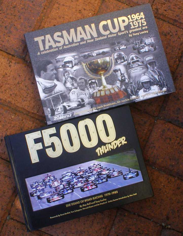
Books for the IMRRC. The books I had to deliver, both of which I had some part in the writing and production.
Then it was time to hit the road on my journey to see my son. I struck out with the Garmin set to �shortest distance�, which might, in the light of subsequent events, have been the wrong thing to do, especially in the light of events of the day indicating that the condition of the carburettor was deteriorating further. I really didn�t know what was wrong, but I plugged on with the roads I was taking proving to be very slow when it came to covering long distances.
Before this became evident, however, after travelling through Elkland I managed to stop at a tatty wrecking yard at Westfield and obtain another mirror for the van. It was off a Chevy and its bracketry was all heavier than that on the Dodge, but the mirror was the same.
I trust my readers will forgive me not taking many photos this day, but I was about to get into serious trouble as the day grew longer and longer. The fuel feed seemed to be letting me down and I stopped in the shade of big tree in front of a park and got under the van. Lying on the cool grass was refreshing, but finding the problem was difficult.
I got going again and not too many miles later it faltered and I decided I needed to put an electric fuel pump into the line to keep up the fuel supply. But where would I get one?
I locked the van and hitch-hiked to Kane and bought the pump and some hose, then I managed to get a lift back to where I had parked the van with a young man who lived in a house nearby. He offered to help me, but it all turned out to be a case of the blind leading the blind. As darkness came I settled in to sleep in the van and got up at first light to finish my lash-up job. It got me going, at least.
I drove on to Kane and kept following the road the Garmin showed me. I had to look for breakfast but drove a long way before I got anything, at least I had the van running now and though my confidence was not great I wasn�t suffering the way I had done the previous afternoon. I even got a photo of a sign which made me smile:
Buckle up. In Australia the mandating of belt wearing led to an immediate drop of over 30% in road deaths, so I was in favour of this sign.
And I saw this trio of neglected Mopars in front of an equally-neglected house:
Dart in the grass. This model Dart we never saw in Australia, though it�s like one I tried to buy for my 2014 trip.
Rusting van. Had someone been around I would have offered to buy the tail lights from this van. As it was I noted that it had a single rear door, unlike my �barn door� arrangement.
Yet another van. Not so badly delapidated, this one had rear doors like mine. Both were shorter vans, however.
Finally I reached the I80 and travelling became easier and faster. Before long I was able to note that I was going out of Pennsylvania�
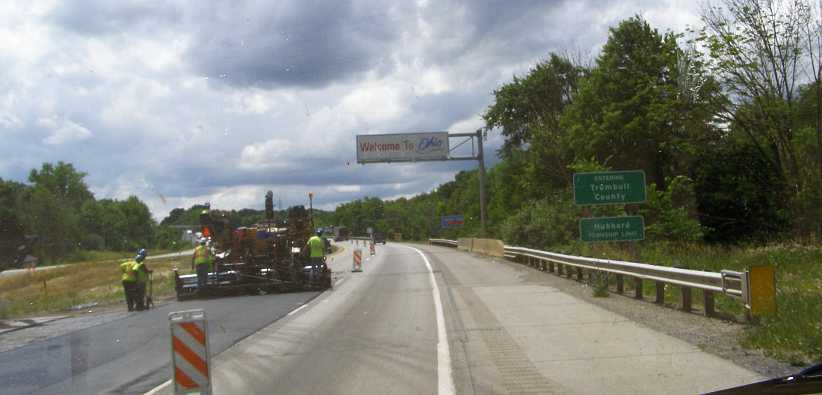
Ohio. The entry to Ohio is near Hubbard and was a welcome sight.
I still wasn�t getting a great deal of speed, so by the time I got to the outskirts of Dayton I was among the afternoon rush-hour traffic on the ring roads. I had stopped at a McDonalds to get something to eat through the day and snapped the only other pic I took there:
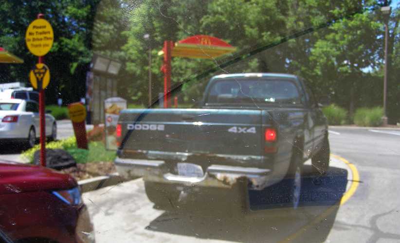
Bumper rust. I�m still amazed at the levels of rust seen on American roads, and bumpers should be fairly hefty steel.
Phoning Justin he directed me to the place he�d booked for me in Bloomington. That�s right, I still didn�t get to go to his home to stay, but the Candlewood Suites were comfortable and convenient. And he paid:
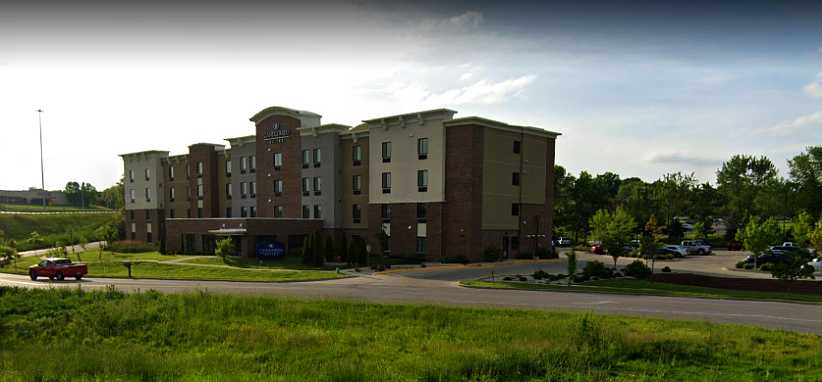
Candlewood Suites. This is the Street View picture of the place where Justin arranged for me to stay for the three nights I was to be in Bloomington.
It was right on the exit to one of the main roads and the carpark was well laid-out so I had no trouble finding a park near the entry, which is in the rear, while I was there. Justin met me there and delivered two items I�d had sent to his place after buying them on eBay:
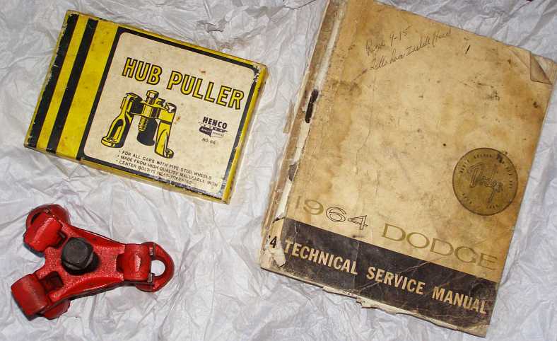
Puller and manual. The puller is for taking hubs off the old-style tapered axles while the workshop manual was for my nephew, Ben, who has that model Dodge at home.
After the frustration and difficulty of the preceding two days on the road, I was really happy to be able to be in one place for a few days so I could get the carburettor looked at by someone who knows what they are doing. Justin had made some enquiries and found someone who could help so that would be the first thing to do the next day.
My next commitment in the trip to be at Fayetteville in Arkansas on Saturday evening. So I had a little time up my sleeve even if I wasn�t going to have the van mobile for part of that time.
I cooked a meal on a real stove, had a nice hot shower and then a good night�s sleep prepared me for the next morning�
Though I didn�t really expect to get all the way this day, the route to be covered to my next firm engagement was as shown here:
I would be dropping out of New York and crossing a large piece of Pennsylvania, going right across Ohio and halfway across Indiana. But the first step was to Burdett and along the way I was able to indulge in my hobby of collecting photos of delapidated barns:
Overgrown. Lush growth around this abandoned barn might be what�s holding it up now. Or maybe not?
In the immediate area near the Argetsinger farm I got this sign, which in this case didn�t seem to indicate a local Amish population. Perhaps it was a buggy rent-a-ride area?
Buggy sign. The graphics indicate classy buggies and horses, I didn�t see any.
I got a big lost and had to ask directions, but ultimately I found the Argetsinger farm and knocked on the door. One of the sons, Duke, answered and when I introduced myself and asked if I could see Jean he said he felt she wasn�t up to it, but he would ask her. Reappearing shortly after from upstairs, he motioned me to go on up and so I was able to deliver my message of sympathy to this matriarch of a fine family � and public-spirited old lady.
I didn�t keep her long and really appreciated the time she gave me that morning, I could see she was not well at all. I bid farewell and headed off to the complex which is named after her:
Jean S Argetsinger library complex. Years of hard work by Jean and other supporters has helped Watkins Glen to have this nice library, which also houses the IMRRC. The picture is from Street View.
Prior to leaving home I had negotiated a little deal to sell some books to the Center for resale. The F5000 book they already had but the Tasman Cup book was new. Bill Green welcomed me and though there was some rushing around going on I was able to spend a little time in conversation with him.
Books for the IMRRC. The books I had to deliver, both of which I had some part in the writing and production.
Then it was time to hit the road on my journey to see my son. I struck out with the Garmin set to �shortest distance�, which might, in the light of subsequent events, have been the wrong thing to do, especially in the light of events of the day indicating that the condition of the carburettor was deteriorating further. I really didn�t know what was wrong, but I plugged on with the roads I was taking proving to be very slow when it came to covering long distances.
Before this became evident, however, after travelling through Elkland I managed to stop at a tatty wrecking yard at Westfield and obtain another mirror for the van. It was off a Chevy and its bracketry was all heavier than that on the Dodge, but the mirror was the same.
I trust my readers will forgive me not taking many photos this day, but I was about to get into serious trouble as the day grew longer and longer. The fuel feed seemed to be letting me down and I stopped in the shade of big tree in front of a park and got under the van. Lying on the cool grass was refreshing, but finding the problem was difficult.
I got going again and not too many miles later it faltered and I decided I needed to put an electric fuel pump into the line to keep up the fuel supply. But where would I get one?
I locked the van and hitch-hiked to Kane and bought the pump and some hose, then I managed to get a lift back to where I had parked the van with a young man who lived in a house nearby. He offered to help me, but it all turned out to be a case of the blind leading the blind. As darkness came I settled in to sleep in the van and got up at first light to finish my lash-up job. It got me going, at least.
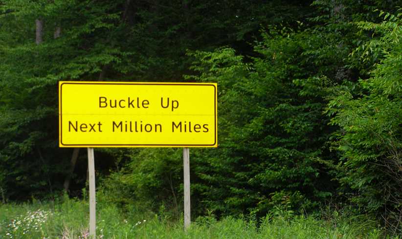
I drove on to Kane and kept following the road the Garmin showed me. I had to look for breakfast but drove a long way before I got anything, at least I had the van running now and though my confidence was not great I wasn�t suffering the way I had done the previous afternoon. I even got a photo of a sign which made me smile:
Buckle up. In Australia the mandating of belt wearing led to an immediate drop of over 30% in road deaths, so I was in favour of this sign.
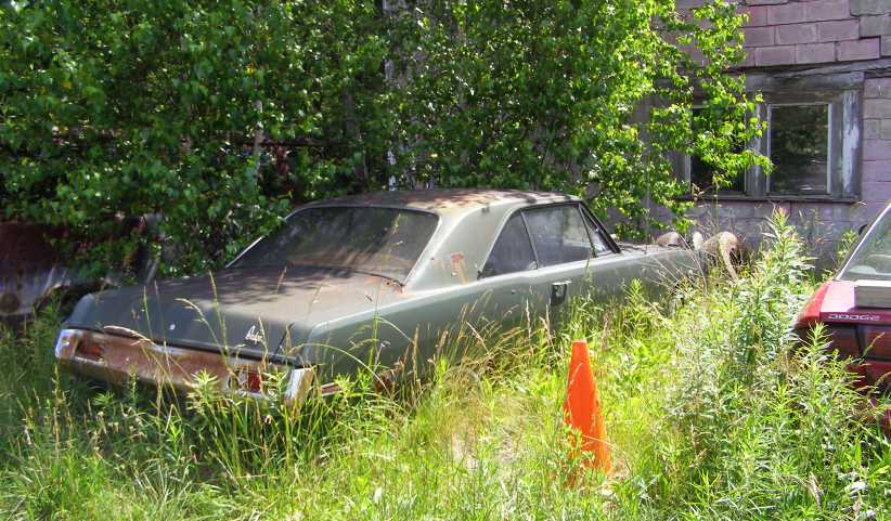
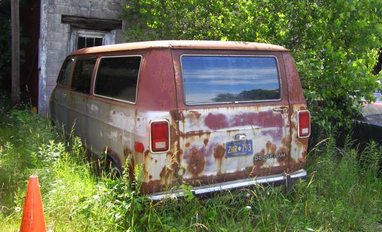
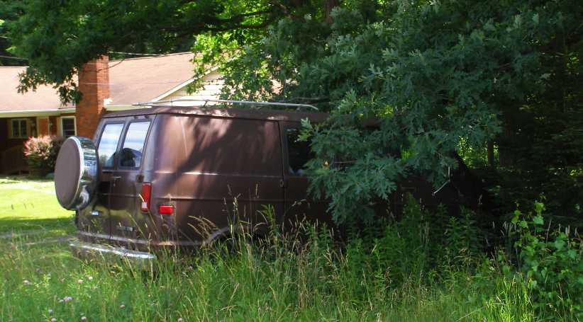
And I saw this trio of neglected Mopars in front of an equally-neglected house:
Dart in the grass. This model Dart we never saw in Australia, though it�s like one I tried to buy for my 2014 trip.
Rusting van. Had someone been around I would have offered to buy the tail lights from this van. As it was I noted that it had a single rear door, unlike my �barn door� arrangement.
Yet another van. Not so badly delapidated, this one had rear doors like mine. Both were shorter vans, however.
Finally I reached the I80 and travelling became easier and faster. Before long I was able to note that I was going out of Pennsylvania�
Ohio. The entry to Ohio is near Hubbard and was a welcome sight.
I still wasn�t getting a great deal of speed, so by the time I got to the outskirts of Dayton I was among the afternoon rush-hour traffic on the ring roads. I had stopped at a McDonalds to get something to eat through the day and snapped the only other pic I took there:
Bumper rust. I�m still amazed at the levels of rust seen on American roads, and bumpers should be fairly hefty steel.
Phoning Justin he directed me to the place he�d booked for me in Bloomington. That�s right, I still didn�t get to go to his home to stay, but the Candlewood Suites were comfortable and convenient. And he paid:
Candlewood Suites. This is the Street View picture of the place where Justin arranged for me to stay for the three nights I was to be in Bloomington.
It was right on the exit to one of the main roads and the carpark was well laid-out so I had no trouble finding a park near the entry, which is in the rear, while I was there. Justin met me there and delivered two items I�d had sent to his place after buying them on eBay:
Puller and manual. The puller is for taking hubs off the old-style tapered axles while the workshop manual was for my nephew, Ben, who has that model Dodge at home.
After the frustration and difficulty of the preceding two days on the road, I was really happy to be able to be in one place for a few days so I could get the carburettor looked at by someone who knows what they are doing. Justin had made some enquiries and found someone who could help so that would be the first thing to do the next day.
My next commitment in the trip to be at Fayetteville in Arkansas on Saturday evening. So I had a little time up my sleeve even if I wasn�t going to have the van mobile for part of that time.
I cooked a meal on a real stove, had a nice hot shower and then a good night�s sleep prepared me for the next morning�
Thread Starter
|
Captain
Joined: Oct 2005
Posts: 570
Likes: 8
From: The Summit, Queensland, Australia
This was the day, Wednesday June 29, 2016, when I would finally learn if we were able to put an end to all those problems with the van. The name of the place recommended to me sounded like it was just the right one, Jerry�s Diagnostics, and it wasn�t too far away, though somewhat difficult to find due to some road works.
I went around there and talked to Jerry, he quickly asserted that a complete carburettor rebuild would be necessary, a new kit of parts going into it, we discussed me removing the carby and leaving it with him and that was all right by him. He quoted me a figure around $320 and I already knew that if he fixed the problem I�d save more than that on fuel between here and California.
Quite apart from the frustration, the prospect of being stuck on the road and � worse � missing my appointment to get the van into a shipping yard in Long Beach and me on a �plane home.
I went back to the Candlewood Suites and made arrangements with Justin, he�d be available to run me back there with the carby and take care of my needs while the van was out of action.
The carby�
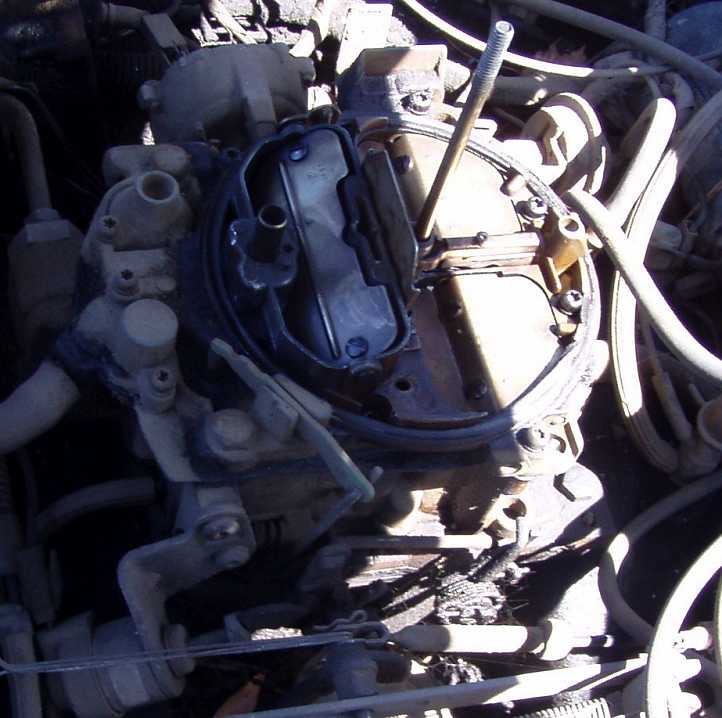
The Rochester Quadrajet. Though the Rochester Quadrajet is more often seen on GM engines, several models of Dodge had them. Here is the carby we fitted to my van early in the 2014 trip after taking it from a pickup with the same 360 engine.
�was easily removed. I�d taken it off a couple of times trying to find the problem myself before the European leg of the trip, so there were no surprises here. We dropped it around to Jerry, he told me he�d ordered the kit and it should be ready to go the next day.
I then spent some time with Justin shopping and looking around, that evening a handyman who sometimes does work for Justin, and whom I�d met the previous trip, came around with a bottle of wine.
I phoned Jerry the Thursday morning and he confirmed that he�d found that the backfiring had burned the plastic floats in the carburettor and that it would be ready before the day got too much older.
The floats burned. That explained the fuel usage getting worse and worse, they�d have stopped floating and shutting off the fuel at the needle and seat. But why? What had caused that misfiring? Why had it stopped?
We went around to Jerry�s�
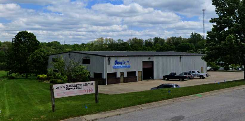
Jerry�s Diagnostics. This was where the carburettor problem was finally sorted out. And the other problems which had caused the carburettor problem.
�and he handed over the carby, telling me to bring the van back around as soon as I fitted it so he could make sure it was right. Which I did. Justin and I sat in the shade of a tree on that grassy bank waiting for Jerry to have time to come out. Then we learned the truth of it all.
He came out to look at the exposed engine, carburettor and all, went straight to the plug leads and checked the firing order. I had crossed two plug leads when I changed the spark plugs back in Helena, Montana!
This had directly caused the backfiring. The two plugs at the rear of the right bank I had pulled off together, all the others I�d done one at a time, but I knew I couldn�t get this wrong. But I did. And why did the backfiring stop? Presumably because the plug which was giving the most grief got so carboned up it stopped firing altogether.
He located a couple of other air leaks in the system and then sent me on my way, a happy boy with a sweetly-running van again!
I didn�t know it at the time, but there were two more latent problems � the fuel vaporisation which had destroyed me on the drive across from Watkins Glen, and which had been there on the hotter days of the previous trip, and that mysterious non-starting feature which had led to the plug change at Helena � which wouldn�t be fixed for a long time. But for now, I was able to motor on.
I went around there and talked to Jerry, he quickly asserted that a complete carburettor rebuild would be necessary, a new kit of parts going into it, we discussed me removing the carby and leaving it with him and that was all right by him. He quoted me a figure around $320 and I already knew that if he fixed the problem I�d save more than that on fuel between here and California.
Quite apart from the frustration, the prospect of being stuck on the road and � worse � missing my appointment to get the van into a shipping yard in Long Beach and me on a �plane home.
I went back to the Candlewood Suites and made arrangements with Justin, he�d be available to run me back there with the carby and take care of my needs while the van was out of action.
The carby�
The Rochester Quadrajet. Though the Rochester Quadrajet is more often seen on GM engines, several models of Dodge had them. Here is the carby we fitted to my van early in the 2014 trip after taking it from a pickup with the same 360 engine.
�was easily removed. I�d taken it off a couple of times trying to find the problem myself before the European leg of the trip, so there were no surprises here. We dropped it around to Jerry, he told me he�d ordered the kit and it should be ready to go the next day.
I then spent some time with Justin shopping and looking around, that evening a handyman who sometimes does work for Justin, and whom I�d met the previous trip, came around with a bottle of wine.
I phoned Jerry the Thursday morning and he confirmed that he�d found that the backfiring had burned the plastic floats in the carburettor and that it would be ready before the day got too much older.
The floats burned. That explained the fuel usage getting worse and worse, they�d have stopped floating and shutting off the fuel at the needle and seat. But why? What had caused that misfiring? Why had it stopped?
We went around to Jerry�s�
Jerry�s Diagnostics. This was where the carburettor problem was finally sorted out. And the other problems which had caused the carburettor problem.
�and he handed over the carby, telling me to bring the van back around as soon as I fitted it so he could make sure it was right. Which I did. Justin and I sat in the shade of a tree on that grassy bank waiting for Jerry to have time to come out. Then we learned the truth of it all.
He came out to look at the exposed engine, carburettor and all, went straight to the plug leads and checked the firing order. I had crossed two plug leads when I changed the spark plugs back in Helena, Montana!
This had directly caused the backfiring. The two plugs at the rear of the right bank I had pulled off together, all the others I�d done one at a time, but I knew I couldn�t get this wrong. But I did. And why did the backfiring stop? Presumably because the plug which was giving the most grief got so carboned up it stopped firing altogether.
He located a couple of other air leaks in the system and then sent me on my way, a happy boy with a sweetly-running van again!
Reality check here. I don�t think I�m blowing my trumpet here to say I should have been able to fix all of this myself. But I do consider myself to be lacking when it comes to detail knowledge of fuel and ignition systems.
Even so, I had completely dismantled and reassembled the carburettor twice in unfavourable conditions and hadn�t made any mess of it. My shortfall was not knowing what to look for.
And then there was my belief that I couldn�t make a mistake with the plug leads. Like I said, I did each plug individually until I got to the last two, they were the most accessible and I felt it was easy to keep the plug leads apart and not make any mistake in putting them back on the right plugs. And I had conveyed this to the other people to whom I�d gone for help, so they couldn�t help because they were badly informed.
I had a workshop manual there with me, I could have checked it all out for myself, but I was simply too confident that I hadn�t made a mistake.
Thread Starter
|
Captain
Joined: Oct 2005
Posts: 570
Likes: 8
From: The Summit, Queensland, Australia
With Justin going to work the next day, Friday, I set about changing the fuel pump in the hope that would deal with the vaporisation issue. I actually had a new pump, but in the van it’s fitment is in the middle of a huge and complicated bracket which is there to mount the alternator. That bracket, and the size of the alternator – not to mention the lack of space – made it a very difficult job, but it got done.
Then I went into Indianapolis and found the ‘U-Pull and Pay’ wrecking yard in there…
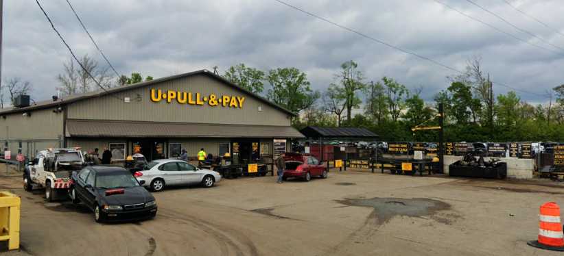
U-Pull & Pay. A chance to get into a wrecking yard like this was not to be missed.
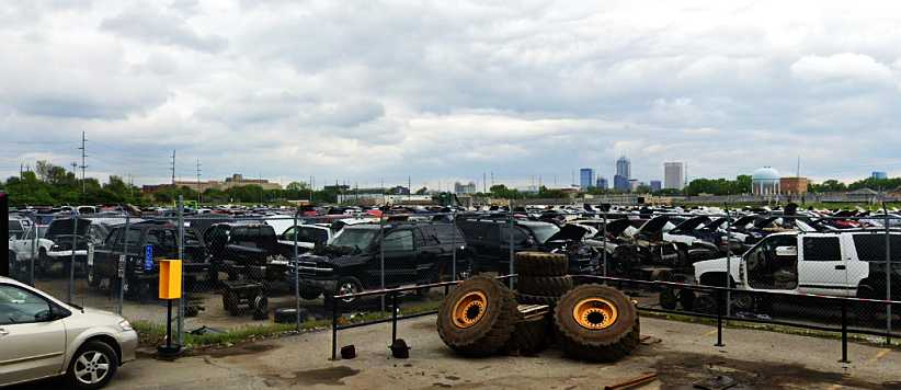
Good stocks. Plenty of pickups in there, not quite as good a range as I found in Spokane but useful.
…which I thought was the one Bill Parker had told me about a couple of years earlier. And though it wasn’t, it gave me a couple of hours fun and I found myself walking out with a few small things including a 4-way towbar fitting which allowed the use of 1⅞”, 2” and 2�” trailer couplings and the fourth side has a hook:
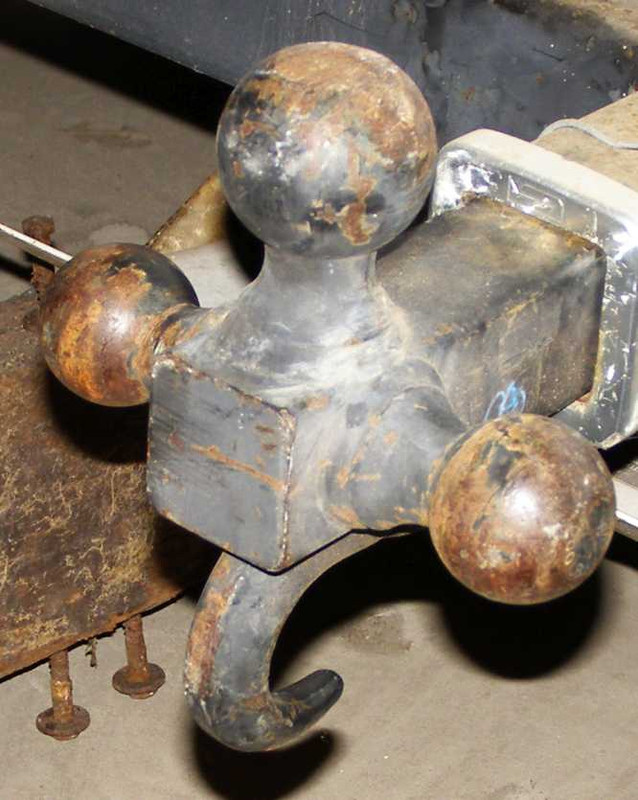
Towball medley. A conversation piece if nothing else. To be honest, I don't know if it's legal to use in Australia because it's welded together.
It had been fitted to the truck it was on with a lockable pin, but I fixed that.
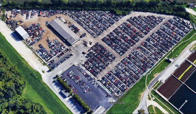
U-Pull from Google Earth. Well laid-out on the Western edge of the city, it wasn’t the place recommended by Bill Parker.
I wasn’t too far from the place Bill recommended:
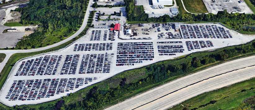
Pull-a-Part. This is the place Bill told me about, he explained that the whole yard had been emptied and concreted, and that’s obvious in this Google Earth view.
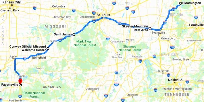
Justin joined me again that evening back at the Candlewood Suites and we arranged to go to the markets together the next morning before I left town. I had a commitment to be in Arkansas by Saturday night and so this was the route I was to take:
I was very emotional as I left my son that morning. I had no idea if or when I’d be able to get back to see him again and it was pretty clear that he’s unlikely to be rushing out to Australia at any time. Lore can’t travel those distances for medical reasons and so it didn’t look likely. In fact, the morning was pretty well gone by the time I got away and onto the I69.
I had driven up the new I69 the previous trip, coming up from Evansville KY using that road when it was available and diving off on minor roads in the few patches where it hadn’t yet been completed. Now it was complete and offered easy running to the I64 just North of the Kentucky border, where I would swing to the West. This was a new road to me as both previous trips I’d left Indiana by way of Terre Haute
Not that it made much difference to the scenery…
Back to enjoying the scenery. After the terrors of the previous days of driving, now I was able to maintain a good speed and didn’t have to worry about the way the van would perform.
The first hundred miles or so were whisked away easily, shortly after turning onto the I64 I started taking photos again. The first was this one of the Garmin, taped into the cubby-hole in the dash, sharing space with some nibblies and my passport:
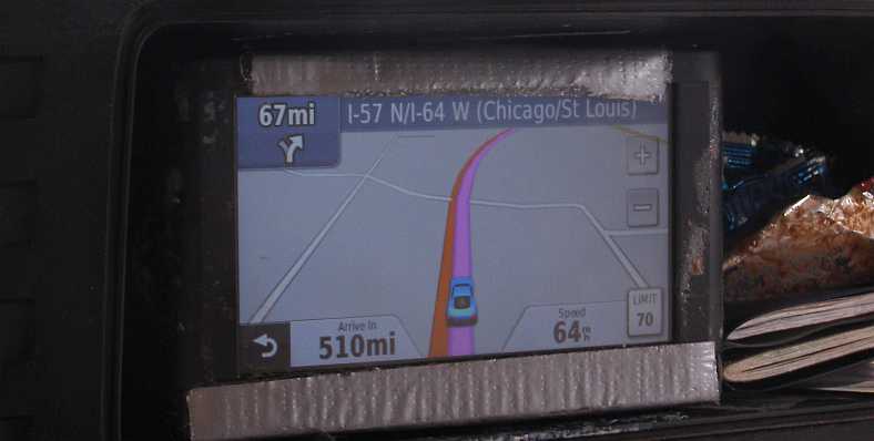
The Garmin. Set for Fayetteville, it shows that I’ve already covered over 110 miles of this day’s journey.
Saturday afternoons are usually pretty quiet on these Interstates and so this one proved. This is near the exit to Poseyville…
Poseyville exit. My time in Indiana was just about over, Poseyville not being far from the Illinois border.
…and that was soon followed by the Wabash River bridge…
Wabash River bridge. Marking the border of Indiana and Illinois is the Wabash River and this sizeable double bridge spans it for the I64 traffic.
…which took me into Illinois again. Looking to the right I saw that the railway has been abandoned and the rail bridge is no longer complete…
Bridge out. Perhaps it was the coming of the Interstates which caused the railway to go out of business? The missing span certainly shows no trains will be going by here soon.
And here’s the evidence of the new state:
Illinois welcome. Now I was almost 130 miles out of Bloomington, time for a quick break…
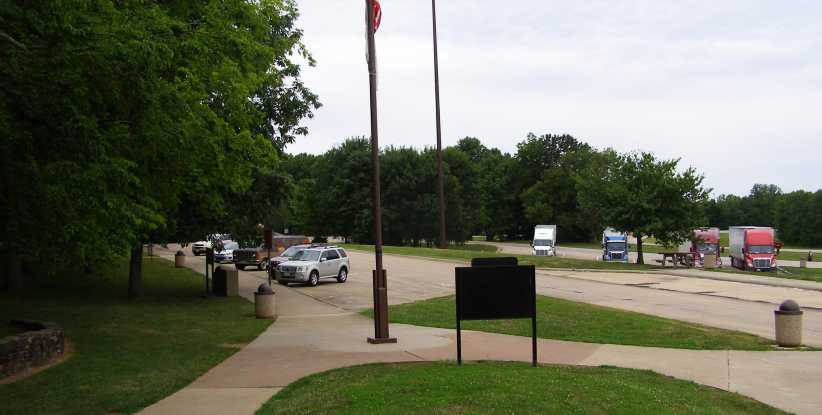
Skeeter Mountain Rest Area. Time for my first stop, this rest area was really well laid-out and appointed, very welcoming.
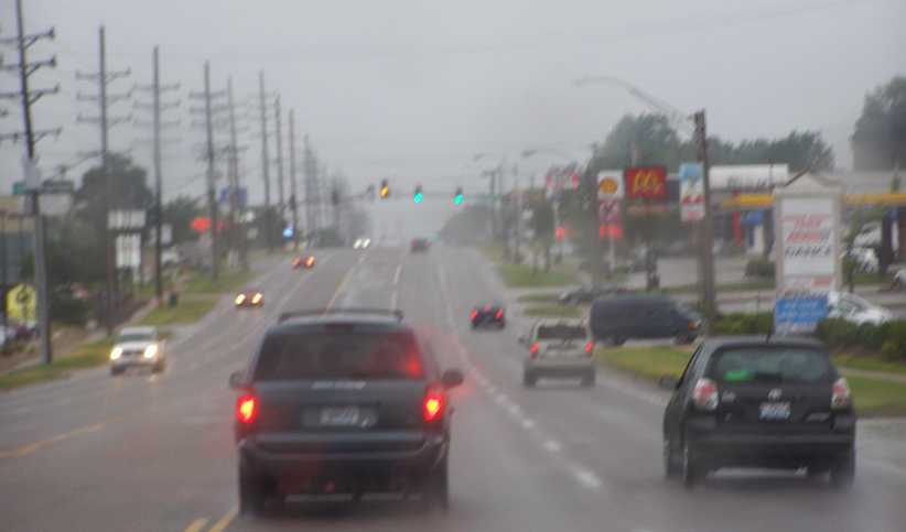
That cloud in the distance in the Poseyville shot, gathering strength in the subsequent pictures, proved to bear fruit between this point and St Louis, which was just as far from Skeeter Mountain as Skeeter Mountain was from Bloomington. I drove into the rain…
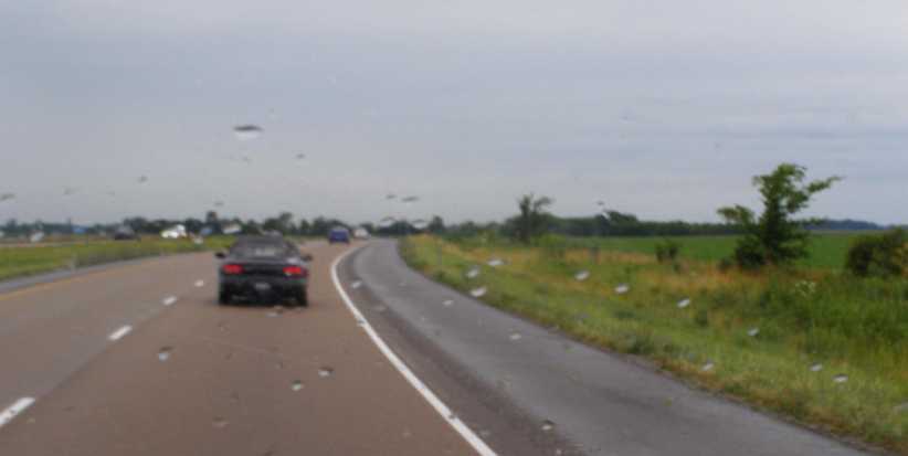
Rain spots. With a stiff wind from the West, rain spots soon showed up during my drive across Illinois.
…and easily kept up my pace until the skyline looked like a city and the structures looked like massive bridges. I was approaching St Louis and the Mississippi was about to be crossed.
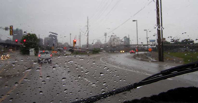
St Louis in view. As I timed my shot to be between wiper swipes, the bridge over the Mississippi stands out while the famous arch is just out of frame to the left.
Once across the bridge I was in St Louis and also in Missouri and I got a nice surprise seeing carriages drawn by horses in a couple of spots:
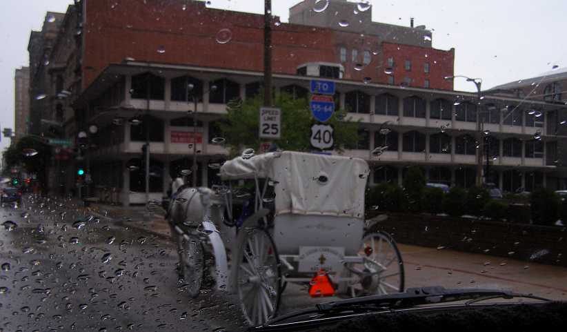
Wet ride. Possibly hard work for this horse climbing this hill, it’s all in a day’s work for the St Louis Carriage Company horses.
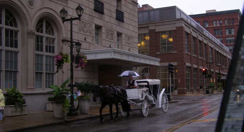
Under an umbrella. This driver has his umbrella out, his buggy looks identical to the previous one.
A local attraction which Sandra would like to have seen, if the pictures she took in Cordoba are anything to go by. But for me, after taking those to show her later, there was the more important task of getting most of the way across Missouri as quickly as possible. The Garmin took me down Watson Road…
Watson Road. A serious thoroughfare, but a busy road which is apparently shorter than the main road.
…which is in the suburb of Crestwood. I soon worked my way through all of this and got past Eureka and then pulled up for my second stop of the day at the Route 66 State Park. I didn’t buy any souvenirs this time, but I did note that the deck was gone off this bridge I’d seen back in 2012:
Bridge deck gone. When I’d last been here it would have been possible to walk across this bridge, but no longer.
And so I rejoined the Interstate refreshed once again after a brief pause. I was mixing it with the trucks along here as the traffic got heavier and it was raining on and off as I drove. Then I saw something I’ve never seen before – a flare on the road to warn of an accident.
Of course it was the perfect scenario for an accident, slippery wet surface on long bends with traffic about, Saturday afternoon with part-time drivers on the road. Almost inevitable, you might say.
Trucks and flares. In these conditions police use flares to give early warning of an incident ahead.
The trucks around me slowed down, but I found it interesting to look closely at this last photo and see the additional mirror that’s mounted well-forward on the truck’s mudguard. It must be a convex mirror as it shows things as further away, but I also see that my van is visible in the mirror.
We soon came to the scene of the crash, it was hard to see all that was going on but the wreckage was all down on the median and rescue crews were at work. There were more flares, which were very effective in the conditions:
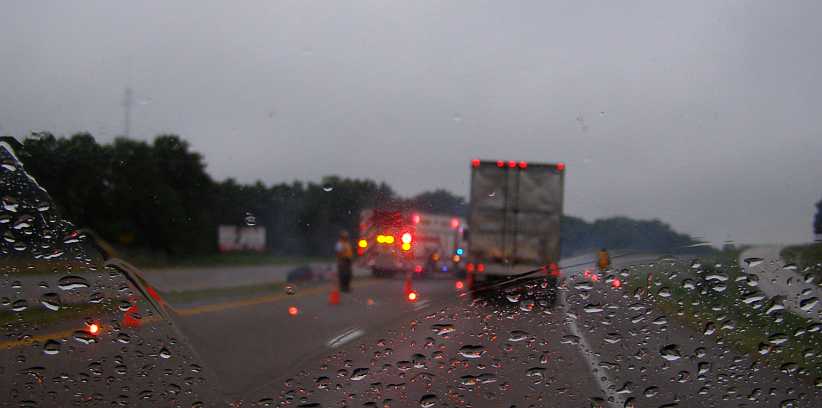
Flares at crash. More flares, witches hats reduce the road to one lane and the people charged with taking care of these things are getting on with the job.
The weather kept changing, but mostly getting less moist after a while. I was almost a hundred miles past St Louis, and now over halfway through my drive for the day, when I left the Interstate at Saint James and headed for McDonalds for my (late) lunch.
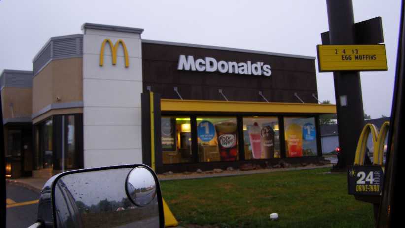
Saint James McDonalds. I had a right to be hungry after I’d covered 360 miles, so a quick top-up here kept me going.
It must be mentioned that this was the July 4 weekend. So I was seeing plenty of fireworks outlets as I drove and, in the above photo, the typical tents used to market fireworks are just visible in the mirror of the van. On into the evening I would periodically see fireworks being set off.
Just 85 miles further on I stopped at the Conway Illinois Welcome Center, which had a neat neon sign. Obviously there’s a need to stop 85 miles after obtaining a coffee with some food from McDonalds and this was the place.
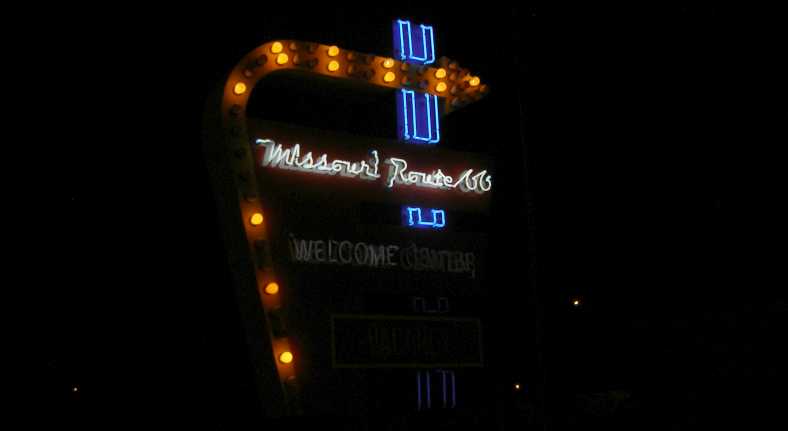
Conway Welcome Center. Well lit up and a welcome relief, a quick stop was achieved here with a simple entry and exit road.
I was now seeing the distance to Fayetteville on the Garmin as being under 200 miles, but it was also now dark. In the dark I saw this sign and thought it odd that such a statistic could be true:
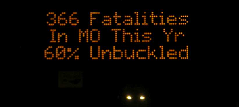
Unbuckled. This would be virtually impossible in Australia, where belt wearing has been almost universal since being mandated in 1970. That one move took over 30% off the annual death tallies across the country.
I was still going well, however, making a few phone calls as I drove and another hundred miles along I neared Joplin. It was here that the Garmin directed me to turn South, and as it was now well after sunset I started to think I should get a meal while there were plenty of places still open.
This led to me making a discovery which people at home found hard to believe. I went to a Kentucky Fried Chicken store and started looking at what packs they had and learned that, where we at home get the breast and the rib as separate pieces, in America they have a large piece which is the rib plus half of the breast.
I feasted as I drove, heading South, and a bit over an hour later I pulled into a Walmart carpark. I went into the store briefly to use their wi-fi and buy some fruit, then I retired to the van and dozed off after covering about 600 miles.
Sunday would put me in contact with a young lady who was very keen to meet me, even though Sandra wouldn’t be there to enjoy the surprise we’d cooked up for her five months earlier. I looked forward to waking up early…[/i]
Then I went into Indianapolis and found the ‘U-Pull and Pay’ wrecking yard in there…
U-Pull & Pay. A chance to get into a wrecking yard like this was not to be missed.
Good stocks. Plenty of pickups in there, not quite as good a range as I found in Spokane but useful.
…which I thought was the one Bill Parker had told me about a couple of years earlier. And though it wasn’t, it gave me a couple of hours fun and I found myself walking out with a few small things including a 4-way towbar fitting which allowed the use of 1⅞”, 2” and 2�” trailer couplings and the fourth side has a hook:
Towball medley. A conversation piece if nothing else. To be honest, I don't know if it's legal to use in Australia because it's welded together.
It had been fitted to the truck it was on with a lockable pin, but I fixed that.
U-Pull from Google Earth. Well laid-out on the Western edge of the city, it wasn’t the place recommended by Bill Parker.
I wasn’t too far from the place Bill recommended:
Pull-a-Part. This is the place Bill told me about, he explained that the whole yard had been emptied and concreted, and that’s obvious in this Google Earth view.
Justin joined me again that evening back at the Candlewood Suites and we arranged to go to the markets together the next morning before I left town. I had a commitment to be in Arkansas by Saturday night and so this was the route I was to take:
I was very emotional as I left my son that morning. I had no idea if or when I’d be able to get back to see him again and it was pretty clear that he’s unlikely to be rushing out to Australia at any time. Lore can’t travel those distances for medical reasons and so it didn’t look likely. In fact, the morning was pretty well gone by the time I got away and onto the I69.
I had driven up the new I69 the previous trip, coming up from Evansville KY using that road when it was available and diving off on minor roads in the few patches where it hadn’t yet been completed. Now it was complete and offered easy running to the I64 just North of the Kentucky border, where I would swing to the West. This was a new road to me as both previous trips I’d left Indiana by way of Terre Haute
Not that it made much difference to the scenery…
Back to enjoying the scenery. After the terrors of the previous days of driving, now I was able to maintain a good speed and didn’t have to worry about the way the van would perform.
The first hundred miles or so were whisked away easily, shortly after turning onto the I64 I started taking photos again. The first was this one of the Garmin, taped into the cubby-hole in the dash, sharing space with some nibblies and my passport:
The Garmin. Set for Fayetteville, it shows that I’ve already covered over 110 miles of this day’s journey.
Saturday afternoons are usually pretty quiet on these Interstates and so this one proved. This is near the exit to Poseyville…
Poseyville exit. My time in Indiana was just about over, Poseyville not being far from the Illinois border.
…and that was soon followed by the Wabash River bridge…
Wabash River bridge. Marking the border of Indiana and Illinois is the Wabash River and this sizeable double bridge spans it for the I64 traffic.
…which took me into Illinois again. Looking to the right I saw that the railway has been abandoned and the rail bridge is no longer complete…
Bridge out. Perhaps it was the coming of the Interstates which caused the railway to go out of business? The missing span certainly shows no trains will be going by here soon.
And here’s the evidence of the new state:
Illinois welcome. Now I was almost 130 miles out of Bloomington, time for a quick break…
Skeeter Mountain Rest Area. Time for my first stop, this rest area was really well laid-out and appointed, very welcoming.
That cloud in the distance in the Poseyville shot, gathering strength in the subsequent pictures, proved to bear fruit between this point and St Louis, which was just as far from Skeeter Mountain as Skeeter Mountain was from Bloomington. I drove into the rain…
Rain spots. With a stiff wind from the West, rain spots soon showed up during my drive across Illinois.
…and easily kept up my pace until the skyline looked like a city and the structures looked like massive bridges. I was approaching St Louis and the Mississippi was about to be crossed.
St Louis in view. As I timed my shot to be between wiper swipes, the bridge over the Mississippi stands out while the famous arch is just out of frame to the left.
Once across the bridge I was in St Louis and also in Missouri and I got a nice surprise seeing carriages drawn by horses in a couple of spots:
Wet ride. Possibly hard work for this horse climbing this hill, it’s all in a day’s work for the St Louis Carriage Company horses.
Under an umbrella. This driver has his umbrella out, his buggy looks identical to the previous one.
A local attraction which Sandra would like to have seen, if the pictures she took in Cordoba are anything to go by. But for me, after taking those to show her later, there was the more important task of getting most of the way across Missouri as quickly as possible. The Garmin took me down Watson Road…
Watson Road. A serious thoroughfare, but a busy road which is apparently shorter than the main road.
…which is in the suburb of Crestwood. I soon worked my way through all of this and got past Eureka and then pulled up for my second stop of the day at the Route 66 State Park. I didn’t buy any souvenirs this time, but I did note that the deck was gone off this bridge I’d seen back in 2012:
Bridge deck gone. When I’d last been here it would have been possible to walk across this bridge, but no longer.
And so I rejoined the Interstate refreshed once again after a brief pause. I was mixing it with the trucks along here as the traffic got heavier and it was raining on and off as I drove. Then I saw something I’ve never seen before – a flare on the road to warn of an accident.
Of course it was the perfect scenario for an accident, slippery wet surface on long bends with traffic about, Saturday afternoon with part-time drivers on the road. Almost inevitable, you might say.
Trucks and flares. In these conditions police use flares to give early warning of an incident ahead.
The trucks around me slowed down, but I found it interesting to look closely at this last photo and see the additional mirror that’s mounted well-forward on the truck’s mudguard. It must be a convex mirror as it shows things as further away, but I also see that my van is visible in the mirror.
We soon came to the scene of the crash, it was hard to see all that was going on but the wreckage was all down on the median and rescue crews were at work. There were more flares, which were very effective in the conditions:
Flares at crash. More flares, witches hats reduce the road to one lane and the people charged with taking care of these things are getting on with the job.
The weather kept changing, but mostly getting less moist after a while. I was almost a hundred miles past St Louis, and now over halfway through my drive for the day, when I left the Interstate at Saint James and headed for McDonalds for my (late) lunch.
Saint James McDonalds. I had a right to be hungry after I’d covered 360 miles, so a quick top-up here kept me going.
It must be mentioned that this was the July 4 weekend. So I was seeing plenty of fireworks outlets as I drove and, in the above photo, the typical tents used to market fireworks are just visible in the mirror of the van. On into the evening I would periodically see fireworks being set off.
Just 85 miles further on I stopped at the Conway Illinois Welcome Center, which had a neat neon sign. Obviously there’s a need to stop 85 miles after obtaining a coffee with some food from McDonalds and this was the place.
Conway Welcome Center. Well lit up and a welcome relief, a quick stop was achieved here with a simple entry and exit road.
I was now seeing the distance to Fayetteville on the Garmin as being under 200 miles, but it was also now dark. In the dark I saw this sign and thought it odd that such a statistic could be true:
Unbuckled. This would be virtually impossible in Australia, where belt wearing has been almost universal since being mandated in 1970. That one move took over 30% off the annual death tallies across the country.
I was still going well, however, making a few phone calls as I drove and another hundred miles along I neared Joplin. It was here that the Garmin directed me to turn South, and as it was now well after sunset I started to think I should get a meal while there were plenty of places still open.
This led to me making a discovery which people at home found hard to believe. I went to a Kentucky Fried Chicken store and started looking at what packs they had and learned that, where we at home get the breast and the rib as separate pieces, in America they have a large piece which is the rib plus half of the breast.
I feasted as I drove, heading South, and a bit over an hour later I pulled into a Walmart carpark. I went into the store briefly to use their wi-fi and buy some fruit, then I retired to the van and dozed off after covering about 600 miles.
Sunday would put me in contact with a young lady who was very keen to meet me, even though Sandra wouldn’t be there to enjoy the surprise we’d cooked up for her five months earlier. I looked forward to waking up early…[/i]
Last edited by Ray Bell; Aug 9, 2020 at 06:36 AM.
Thread Starter
|
Captain
Joined: Oct 2005
Posts: 570
Likes: 8
From: The Summit, Queensland, Australia
In the morning I drove around to Angie’s place. She’s located in a public housing unit in a street full of such dwellings. Aged just a year younger than my daughter (about 40 at the time of my visit), Angie has been waylaid by a series of medical problems which have mean she can’t work and so has to live on Social Security and in this public housing. I had met her on another forum about a year earlier.
The arrangements for this day were for me to go to Angie’s place…
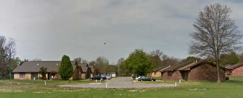
Basic accommodation. Angie’s home is in a street like this, there are 4-unit places on the left and duplexes on the right.
…and then I went on to her sister’s home a few miles South at West Fork, where there was a nice breakfast for us. A family day out would take us all to Fort Smith and meant I got to ride in a ‘mini van’, a Dodge Caravan with Tim and Shelley with Tim’s niece Kayla. Kayla lives with them as her mother’s got problems. Angie took her car so a friend could go with her.
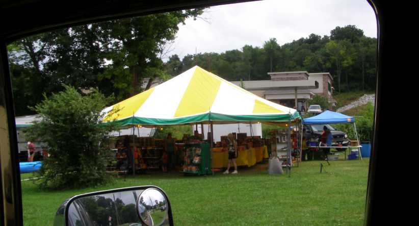
Of course there were things to see on the way. First, before leaving Fayetteville, the very popular fireworks tent sales centres were seen in all sorts of places:
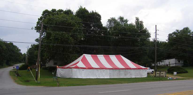
Fireworks tent. With the fourth of July the following day, tents such as this were doing a good trade.
And then there was something all-new to me. This is a local industry which does good business, it seems:
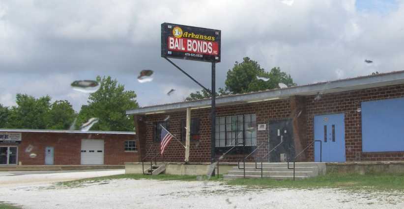
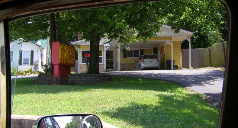
Bail bonding. There’s a jail nearby so the desire for people to seek freedom has led to many of these businesses springing up.
And then there was breakfast. I met Shelly and Tim for the first time, and also Kayla. Their home is in a low-lying area which apparently sees some occasional flooding, but not this day.
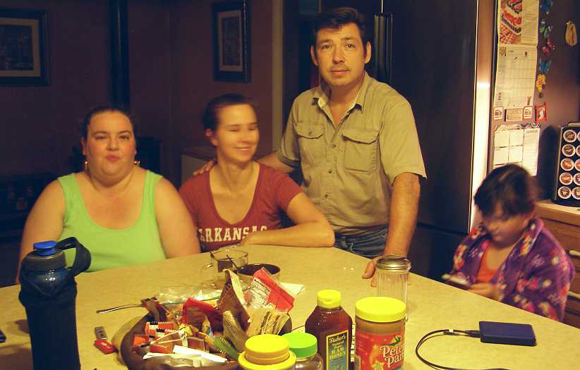
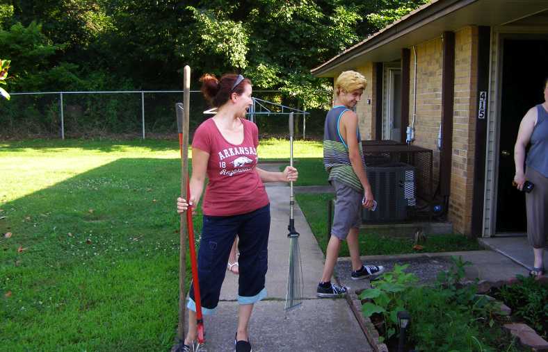
Breakfast pose. I was to enjoy three days with these people, left to right being Angie, Shelly, Tim and Kayla.
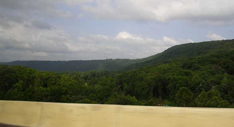
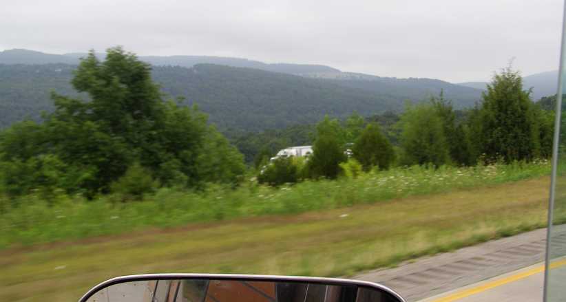
The drive was a simple one down the I49, which took us easily through the hills of Arkansas and exposed us to some views like this one:
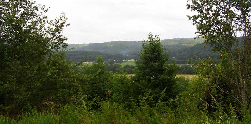
I49 view. From the Interstate we occasionally saw some hills and some valleys, with the odd small town sometimes evident.
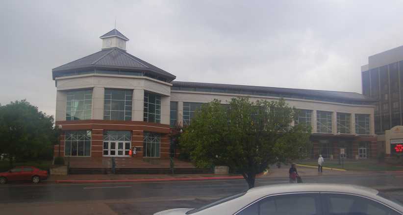
I didn’t take many photos in Fort Smith, where we enjoyed a nice lunch together and met up with some others they knew. The day was overcast and, at times, a wet one. I was being introduced to a number of people and had a good time in conversation with them. I noted this unappealing sign at the local convention centre:
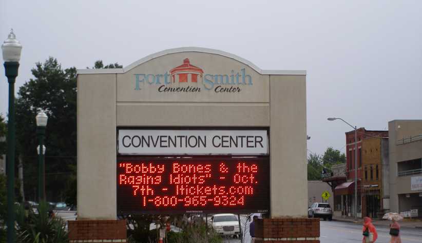
Not my taste. Having rather more conventional tastes, I wouldn’t be calling that 1-800 number. The main thing in this pic is the evidence of wet weather.
While the desire to dress up an otherwise plain wall has led to this creation:
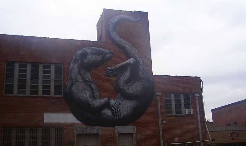
Otter on the wall. This wall art was just across the road, where the otter’s shape has been well-fitted onto the available plain wall.
Despite the miserable weather, I had a pleasant day in which I got to know these people a lot better. You’d think Fort Smith could have turned on a nicer day for me, wouldn’t you?
Foggy centre. The mist, or fog, or low cloud, hangs about the convention centre late in the morning.
And the weather started to break up as we headed back towards ‘home’. I was still riding with Tim and Shelly in the ‘mini van’ and the hills started to light up a bit as the blue sky began to make an appearance…
Weather breaking. Some blue sky coming through the clouds was a very welcome sight.
We did have a break in the journey, however, when we stopped to help someone with a flat tyre. The young driver of the Honda looked like she needed a hand, and it turned out that they knew her too.
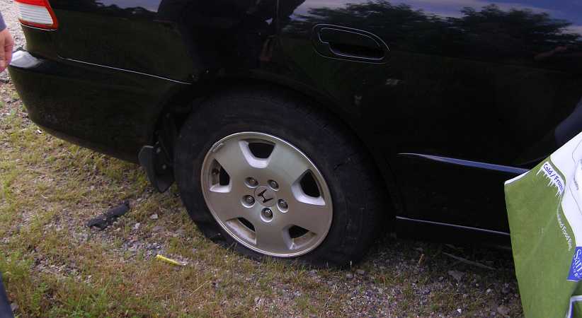
Flat tyre. A chance to do a good deed for someone, we put the Honda’s spare wheel on instead of this deflated example.
And so we continued on our way. A bit of a feature of the I49 here is the Bobby Hopper tunnel, named after a local resident who was a director of the Highway Commission and who presided over the construction of this section of Interstate.
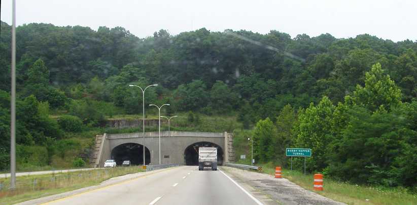
Bobby Hopper Tunnel. Saving the highway from going over a large hill, this tunnel is about a third of a mile long.
From there it wasn’t many miles to the exit to West Fork, which was on Route 170. I would see this road a couple more times before I left town.
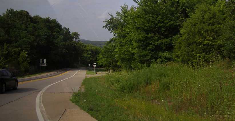
West Fork exit. It wasn’t far off the Interstate to the built-up area of West Fork and the day’s journey was done.
That night Angie went to stay with her friend, I had her unit all to myself and slept on the lounge. I had made arrangements with a man from Texas to deliver those Dodge Monaco trim items, the grille, headlight surrounds, tail lights etc, that I’d picked up from John in Iowa. He had come across to Arkansas this weekend to visit family and I had to meet him on a back road near Fort Smith.
Heading South again. This trip was in my van, it was still running just fine and covering miles easily.
Again through the Bobby Hopper tunnel…
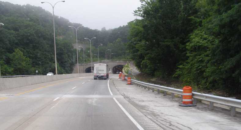
Southbound tunnel entry. The road is climbing as it approaches and as it travels through the tunnel in this direction.
It didn’t take long to make this little journey, complete the transaction, and then head back to Fayetteville. On the way back I did get some more pics:
Fireworks open. Descending into West Fork I passed this fireworks tent doing a roaring trade. It was in front of the Harps food store, which looked sizeable.
Just down the road from there is a spot named Riverside Park, where plenty of people were enjoying the warmth and the water upstream from this weir:
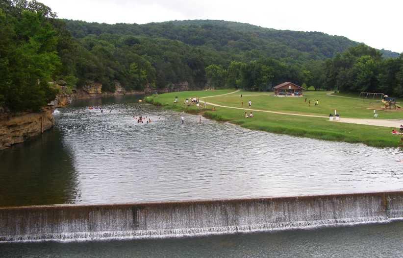
Fun in the weir. It looked to me that these people were having a lot of mid-summer fun.
And there was more fun in store for some as the fireworks sales went on just a little further up the road…
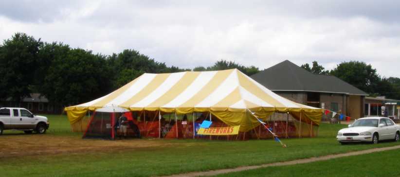
More fireworks. Sales continued here too, though as it was now July 4 their time was running out.
I was to have a little fun, too. Well, was it fun?
The problems I’d had with the engine had given the driveline a beating and the weak link was the A833 overdrive gearbox. Most of my miles were done in overdrive, of course, and that gear puts a heavy loading on the bearing where the mainshaft runs in the back of the input shaft. I was aware of a bit of grumbling going on there and thought it would be good to pick up another similar gearbox for fitment if I actually ran into trouble along the road.
So when I saw this place…
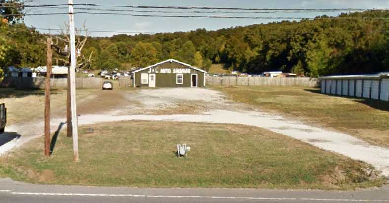
J & L Auto Salvage. This wrecking yard came into view at just the right time, located between West Fork and Fayetteville.
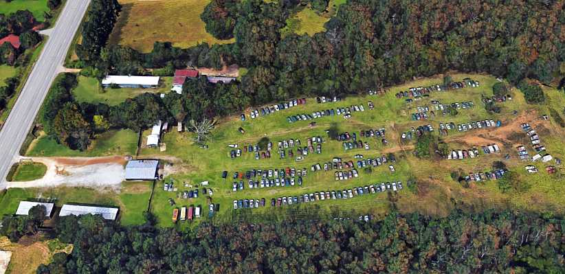
Aerial view. Both of these pics are from Google Earth, this one shows that it’s not nearly as big as some of the others I’d been visiting.
I went in and asked if they had one. And they did, it was in a pickup with a slant 6 engine and we walked right up the back of the yard to have a look. I explained to the proprietor that it was a ‘just in case I need it’ deal and that it would be going back to Australia with me whether I fitted it or not.
He then explained to me that the pickup it was in was already spreading itself out over the countryside, “The long bed I sent up to Iowa,” he told me, “and the back axle went to Indiana. Now you tell me the transmission will go to Australia?”
It was the right gearbox and wasn’t going to be hard to remove. He told me to drop back the next morning and he’d have it out ready for me. Which suited me as time was getting away and I had an important appointment. A little way up the road...
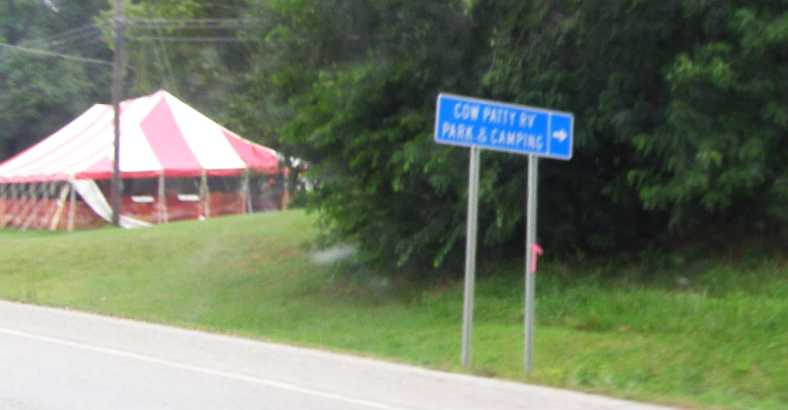
Fireworks closing. It looks like trade has dropped off and it’s about to close up. The name of the RV park doesn't make it sound attractive!
Just a couple more things to note as I headed back to Angie’s place. The local industry was very much in evidence…
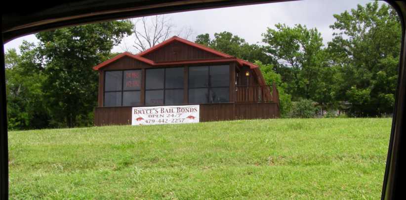
Bryce Bail Bonds. Another of the many bail bonding places which are a feature of Fayetteville.
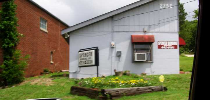
Spencer Bonding. This place doesn’t look so prosperous, perhaps dealing only in smaller bail bonds?
Angie and Shelly were waiting for me. It was a really big deal for Angie this afternoon. Normally a bit shy, she had gone to great lengths to provide a welcome for me, but there was more to it than that. She had even booked a special room which is available to the public at a local aged care facility so that we could be comfortably accommodated for a ‘bring a plate’ lunch.
And there was more to it than that. You might recall that I mentioned Sandra told me she liked surprises? This event was meant to be a special surprise for her and it was to be a special afternoon, even without her…
The arrangements for this day were for me to go to Angie’s place…
Basic accommodation. Angie’s home is in a street like this, there are 4-unit places on the left and duplexes on the right.
…and then I went on to her sister’s home a few miles South at West Fork, where there was a nice breakfast for us. A family day out would take us all to Fort Smith and meant I got to ride in a ‘mini van’, a Dodge Caravan with Tim and Shelley with Tim’s niece Kayla. Kayla lives with them as her mother’s got problems. Angie took her car so a friend could go with her.
Of course there were things to see on the way. First, before leaving Fayetteville, the very popular fireworks tent sales centres were seen in all sorts of places:
Fireworks tent. With the fourth of July the following day, tents such as this were doing a good trade.
And then there was something all-new to me. This is a local industry which does good business, it seems:
Bail bonding. There’s a jail nearby so the desire for people to seek freedom has led to many of these businesses springing up.
And then there was breakfast. I met Shelly and Tim for the first time, and also Kayla. Their home is in a low-lying area which apparently sees some occasional flooding, but not this day.
Breakfast pose. I was to enjoy three days with these people, left to right being Angie, Shelly, Tim and Kayla.
The drive was a simple one down the I49, which took us easily through the hills of Arkansas and exposed us to some views like this one:
I49 view. From the Interstate we occasionally saw some hills and some valleys, with the odd small town sometimes evident.
I didn’t take many photos in Fort Smith, where we enjoyed a nice lunch together and met up with some others they knew. The day was overcast and, at times, a wet one. I was being introduced to a number of people and had a good time in conversation with them. I noted this unappealing sign at the local convention centre:
Not my taste. Having rather more conventional tastes, I wouldn’t be calling that 1-800 number. The main thing in this pic is the evidence of wet weather.
While the desire to dress up an otherwise plain wall has led to this creation:
Otter on the wall. This wall art was just across the road, where the otter’s shape has been well-fitted onto the available plain wall.
Despite the miserable weather, I had a pleasant day in which I got to know these people a lot better. You’d think Fort Smith could have turned on a nicer day for me, wouldn’t you?
Foggy centre. The mist, or fog, or low cloud, hangs about the convention centre late in the morning.
And the weather started to break up as we headed back towards ‘home’. I was still riding with Tim and Shelly in the ‘mini van’ and the hills started to light up a bit as the blue sky began to make an appearance…
Weather breaking. Some blue sky coming through the clouds was a very welcome sight.
We did have a break in the journey, however, when we stopped to help someone with a flat tyre. The young driver of the Honda looked like she needed a hand, and it turned out that they knew her too.
Flat tyre. A chance to do a good deed for someone, we put the Honda’s spare wheel on instead of this deflated example.
And so we continued on our way. A bit of a feature of the I49 here is the Bobby Hopper tunnel, named after a local resident who was a director of the Highway Commission and who presided over the construction of this section of Interstate.
Bobby Hopper Tunnel. Saving the highway from going over a large hill, this tunnel is about a third of a mile long.
From there it wasn’t many miles to the exit to West Fork, which was on Route 170. I would see this road a couple more times before I left town.
West Fork exit. It wasn’t far off the Interstate to the built-up area of West Fork and the day’s journey was done.
That night Angie went to stay with her friend, I had her unit all to myself and slept on the lounge. I had made arrangements with a man from Texas to deliver those Dodge Monaco trim items, the grille, headlight surrounds, tail lights etc, that I’d picked up from John in Iowa. He had come across to Arkansas this weekend to visit family and I had to meet him on a back road near Fort Smith.
Heading South again. This trip was in my van, it was still running just fine and covering miles easily.
Again through the Bobby Hopper tunnel…
Southbound tunnel entry. The road is climbing as it approaches and as it travels through the tunnel in this direction.
It didn’t take long to make this little journey, complete the transaction, and then head back to Fayetteville. On the way back I did get some more pics:
Fireworks open. Descending into West Fork I passed this fireworks tent doing a roaring trade. It was in front of the Harps food store, which looked sizeable.
Just down the road from there is a spot named Riverside Park, where plenty of people were enjoying the warmth and the water upstream from this weir:
Fun in the weir. It looked to me that these people were having a lot of mid-summer fun.
And there was more fun in store for some as the fireworks sales went on just a little further up the road…
More fireworks. Sales continued here too, though as it was now July 4 their time was running out.
I was to have a little fun, too. Well, was it fun?
The problems I’d had with the engine had given the driveline a beating and the weak link was the A833 overdrive gearbox. Most of my miles were done in overdrive, of course, and that gear puts a heavy loading on the bearing where the mainshaft runs in the back of the input shaft. I was aware of a bit of grumbling going on there and thought it would be good to pick up another similar gearbox for fitment if I actually ran into trouble along the road.
So when I saw this place…
J & L Auto Salvage. This wrecking yard came into view at just the right time, located between West Fork and Fayetteville.
Aerial view. Both of these pics are from Google Earth, this one shows that it’s not nearly as big as some of the others I’d been visiting.
I went in and asked if they had one. And they did, it was in a pickup with a slant 6 engine and we walked right up the back of the yard to have a look. I explained to the proprietor that it was a ‘just in case I need it’ deal and that it would be going back to Australia with me whether I fitted it or not.
He then explained to me that the pickup it was in was already spreading itself out over the countryside, “The long bed I sent up to Iowa,” he told me, “and the back axle went to Indiana. Now you tell me the transmission will go to Australia?”
It was the right gearbox and wasn’t going to be hard to remove. He told me to drop back the next morning and he’d have it out ready for me. Which suited me as time was getting away and I had an important appointment. A little way up the road...
Fireworks closing. It looks like trade has dropped off and it’s about to close up. The name of the RV park doesn't make it sound attractive!
Just a couple more things to note as I headed back to Angie’s place. The local industry was very much in evidence…
Bryce Bail Bonds. Another of the many bail bonding places which are a feature of Fayetteville.
Spencer Bonding. This place doesn’t look so prosperous, perhaps dealing only in smaller bail bonds?
Angie and Shelly were waiting for me. It was a really big deal for Angie this afternoon. Normally a bit shy, she had gone to great lengths to provide a welcome for me, but there was more to it than that. She had even booked a special room which is available to the public at a local aged care facility so that we could be comfortably accommodated for a ‘bring a plate’ lunch.
And there was more to it than that. You might recall that I mentioned Sandra told me she liked surprises? This event was meant to be a special surprise for her and it was to be a special afternoon, even without her…
Last edited by Ray Bell; Jul 27, 2020 at 05:25 AM.
Thread Starter
|
Captain
Joined: Oct 2005
Posts: 570
Likes: 8
From: The Summit, Queensland, Australia
My discussions with Angie back in January included her making a statement to me. “Today is 20 years since my mom died.”
Her father had died when she was just four, so she’d been orphaned just as she became an adult. We had discussed this a few times, but this time she asked, “Will you adopt me?”
Of course she wasn’t serious, but then, why not? We concocted a plan in which Sandra and I would go through a ceremony to adopt her, to become her adopted parents even though we lived half a world away. Then, of course Sandra went home, so we arranged to carry it through with just me ‘adopting’ her.
As time went on the plans developed. We wrote up agreements to do with it all and then we decided to include Shelly in it too. Lesley, a forum friend from Oklahoma drove across to visit Angie in April or May when they went on a weekend away by some lakes. Lesley we had watched on the forum as she described the passing of her father the previous year and so she was also an orphan.
She also became a member of the family.
That afternoon Angie had arranged to use the sunroom/community room of a local aged care facility, which is made available to the public under certain circumstances, and then started inviting friends from all around Fayetteville and West Fork for the afternoon, ostensibly for them to meet the ‘world traveller’ in their midst.
For her it was a big deal, she went well beyond the boundaries of her normal semi-shy personality to pull this together and was rewarded by there being about 35 people present.
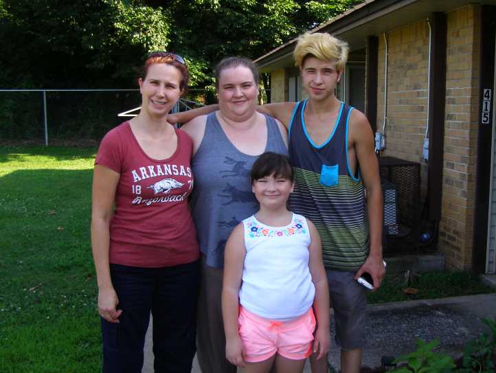
So I showed them photographs, I told them about places I’d been and talked to most of them individually. Everyone brought a plate so we had plenty of finger-food to nibble on, and generally it was a fun afternoon gathering. Then we had this special announcement.
Angie delivered a little speech, then I spoke about it, the terms of the ‘adoptions’ were explained and the certificates she’d printed up were signed by all parties involved. Guests were invited to be witnesses to the event…
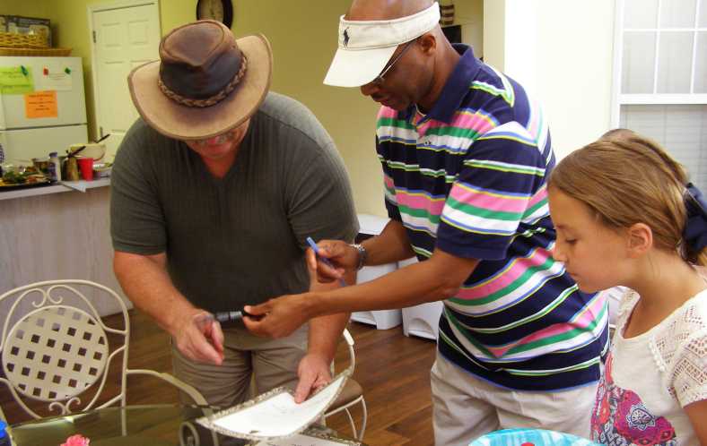
Witnesses to the ‘adoptions’. Guests sign the papers where we had declared our parts and responsibilities in the ‘adoption.’
And so everyone was surprised at how it was done. Then Angie uncovered a whole bundle of gifts for me. She knew I ate oatmeal cookies as I travelled, so they featured in a big way. Way too big a way! And other delights. There were also gifts for Sandra and myself as belated wedding gifts, including two sets of bamboo bed sheets.
The ‘adoptees’ were photographed:
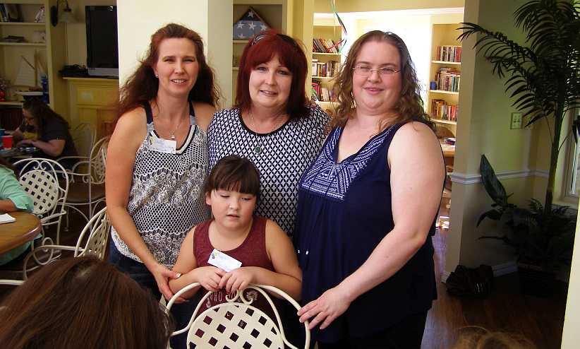
The ‘adoptees’. Shelly, Lesley and Angie, with Kayla in the foreground. Yes, we did and ‘adoption’ certificate for Kayla too.
It was very nice of Lesley to drive across from Oklahoma, but it also meant she had to leave a little early. But in time the whole party had to break up and everyone seemed pleased with the way they’d spent their fourth of July.
Her father had died when she was just four, so she’d been orphaned just as she became an adult. We had discussed this a few times, but this time she asked, “Will you adopt me?”
Of course she wasn’t serious, but then, why not? We concocted a plan in which Sandra and I would go through a ceremony to adopt her, to become her adopted parents even though we lived half a world away. Then, of course Sandra went home, so we arranged to carry it through with just me ‘adopting’ her.
As time went on the plans developed. We wrote up agreements to do with it all and then we decided to include Shelly in it too. Lesley, a forum friend from Oklahoma drove across to visit Angie in April or May when they went on a weekend away by some lakes. Lesley we had watched on the forum as she described the passing of her father the previous year and so she was also an orphan.
She also became a member of the family.
That afternoon Angie had arranged to use the sunroom/community room of a local aged care facility, which is made available to the public under certain circumstances, and then started inviting friends from all around Fayetteville and West Fork for the afternoon, ostensibly for them to meet the ‘world traveller’ in their midst.
For her it was a big deal, she went well beyond the boundaries of her normal semi-shy personality to pull this together and was rewarded by there being about 35 people present.
So I showed them photographs, I told them about places I’d been and talked to most of them individually. Everyone brought a plate so we had plenty of finger-food to nibble on, and generally it was a fun afternoon gathering. Then we had this special announcement.
Angie delivered a little speech, then I spoke about it, the terms of the ‘adoptions’ were explained and the certificates she’d printed up were signed by all parties involved. Guests were invited to be witnesses to the event…
Witnesses to the ‘adoptions’. Guests sign the papers where we had declared our parts and responsibilities in the ‘adoption.’
And so everyone was surprised at how it was done. Then Angie uncovered a whole bundle of gifts for me. She knew I ate oatmeal cookies as I travelled, so they featured in a big way. Way too big a way! And other delights. There were also gifts for Sandra and myself as belated wedding gifts, including two sets of bamboo bed sheets.
The ‘adoptees’ were photographed:
The ‘adoptees’. Shelly, Lesley and Angie, with Kayla in the foreground. Yes, we did and ‘adoption’ certificate for Kayla too.
It was very nice of Lesley to drive across from Oklahoma, but it also meant she had to leave a little early. But in time the whole party had to break up and everyone seemed pleased with the way they’d spent their fourth of July.
Thread Starter
|
Captain
Joined: Oct 2005
Posts: 570
Likes: 8
From: The Summit, Queensland, Australia
The party wound down and we tidied up and returned briefly to Angie�s to put things away and so on. Angie went with Shelly to her place and I soon headed there as I wanted to check out some of the things Tim had stashed behind his shed.
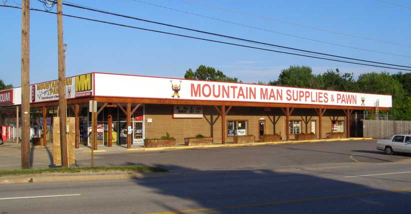
Mountain Man. This made me think of someone at home I call �Mountain Man�, it was located on the main road to Tim and Shelly�s place.
Passing by a couple of the bail bonding places I couldn�t help but get pics of them�
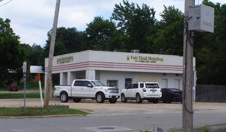
Fair Deal Bonding. This looks like it�s an old gas station, but it also looks like business is brisk.
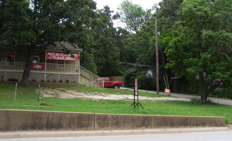
Ace Bail Bonds. Working from home? With a temporary sign on the front of a house, it looks like it.
�because we don�t have such things in Australia. Or at least that I�ve ever heard of. Perhaps it�s uniquely American?
Tim�s shed and rubble produced nothing I would be looking for. But while I was there he also showed me the �toys� he and Shelly owned. Modern sporty US-built cars that barely see the light of day in their ownership. After a coffee Angie went off to her friend�s place to spend the night and I went around to see another of her friends, Summer.
Summer lives with her mother and suffers some disablement. She�s younger and Angie has put a lot of time into helping her, though at the cost of having Summer tend to rely too much on her. Summer was also included in the �adoption� process on the day as she had no father and I gave her the certificate printed up for her. She and her mother were delighted and I spent a couple of hours with them before going back to my �digs�.
In the morning I went off to pick up the gearbox from J & L, on the way being able to observe that the party was over for everyone as the fireworks vendors were packing up too:
Fireworks packed away. The tent partially dismantled and the fireworks all gone, the fourth of July was certainly over for another year.
I found that the transmission had been successfully removed from the pickup by the wrecker and it sat there complete with the shifter ready for me to take away, an easy job for him, he explained, showing me his three-feet long ⅜-inch drive socket extension. He also gave me the bolts which attach it to the bellhousing and I got the throwout bearing, but the bellhousing for the Slant 6 was of no use to me as I already had some.
I took some time to talk to the man there about my adventures and so on. Shelly spotted my van on the way past and came in too as she knows him fairly well and the conversation rolled on. I then ran the gauntlet of bail bondsmen�
Mountain Man Bail Bonds. I wonder if this business is connected to the store pictured earlier?
Shelly had come by as she was on her way to Angie�s with her son to pick up some gardening gear Angie had borrowed for her little garden, in which she pins some hope of turning out some nice flowers. Angie had also returned by now�
Shelly and Caleb. With gardening equipment in hand, Shelly is trying to encourage Caleb to be in the photo.
Eventually he agreed and I got a shot of them plus Kayla:
Shelly, Angie, Caleb and Kayla. We hadn�t seen much of Caleb all weekend but he did join in for this family shot.
Angie had decided to take me to lunch at a restaurant on the other side of town. It was nice there and I enjoyed the meal with her as we discussed what might be around the corner with her medical condition. After that it was time for me to leave, I was all packed up since early in the day and I headed out of town to the South.
I had a long way to go as I wanted to be in New Mexico to see David by Thursday. It was now Tuesday and the road beckoned. I bid farewell to the bail bondsmen�
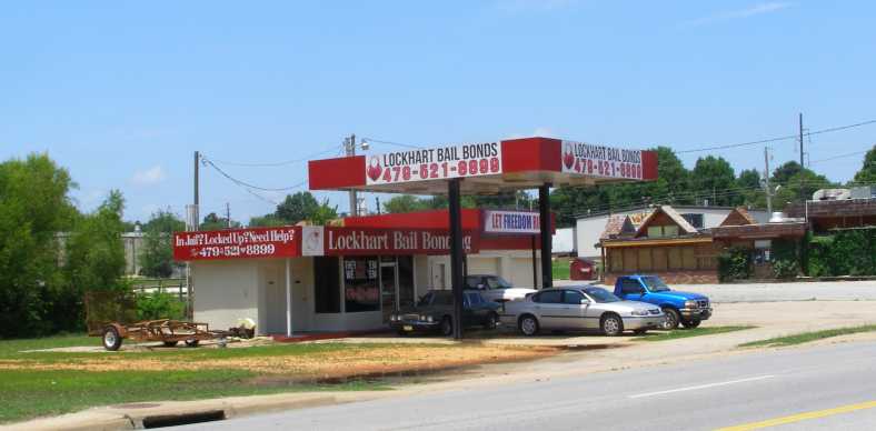
Lockhart Bail Bonds. Yet another utilising an old gas station for a new purpose. The motifs around the periphery are interesting.
�with this one advertising with signs, �In jail? Locked up? Need help? Phone�� and �Let freedom ring.� I guess there are people who need their services and I was glad not to be one of them as I headed down Arkansas� Route 71 towards Fort Smith.
Well, I had gone via the I49 a couple of times now, so this was an alternative. And I gathered that it was more scenic anyway. And so it proved to be as the road wound its way through that same mountain country through which we�d travelled on the I49, but just a bit to the East.
Revelling once again in having a healthy van under me and knowing I wanted to get a lot of miles behind me before nightfall, I was travelling at a healthy gait. At least until a bit past Winslow, when I stopped to take a photo of these Fords�
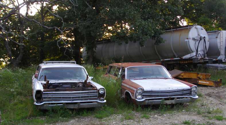
Ford wagons. I thought someone at home might be interested to see these, we only got sedans through the dealers in Australia.
�and this Dodge B350 van:
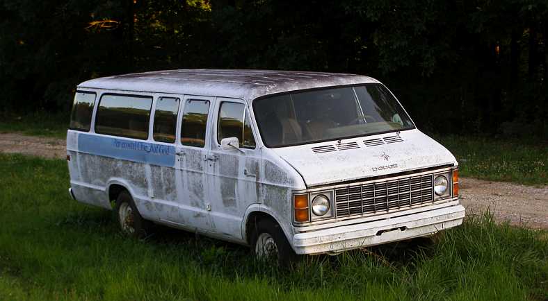
Something like mine. This one is the same length as mine, but a lower level (as per the round headlights) and built as a sixteen or eighteen-passenger bus.
The next excuse I had to take a pic was at a spot in the road called �Artist Point� and it looked out over the Frog Bayou:
Artist Point. Frog Bayou is the focal point, but the �artist point� name indicates that it�s popular with artists. Are photographers artists?
A number of miles further on the Frog Bayou has been dammed to form Lake Fort Smith, my first sight of that was this little piece which includes the Lake Fort Smith Arena:
Lake Fort Smith in view. I was getting closer to Fort Smith by now and spotted this arm of the lake, though the marina isn�t obvious.
The size of the waters is more obvious here, just a little way back up from the wall:
Much more water. Nearer the dam wall the water covers a greater area, this becomes a playground for boating and fishing.
And just below the wall, the spillway and training wall, is the filtration plant which ensures clean water for the Fort Smith and area�s populace�
Filtration plant. A necessary part of water supply, the filtration plant sits in a nice bushland location.
And now I was in place to enter the I40, going the opposite direction to what I�d travelled here two years earlier. I had a long way to go, and with the van running well I also had on my side that I was going West and could gain a little by travelling with the sun. and there was also daylight saving.
But I would have to keep the hammer down�
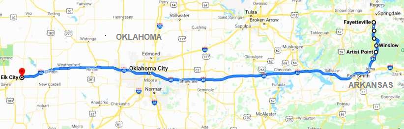
�and get through this section before too much of the day was gone.
Mountain Man. This made me think of someone at home I call �Mountain Man�, it was located on the main road to Tim and Shelly�s place.
Passing by a couple of the bail bonding places I couldn�t help but get pics of them�
Fair Deal Bonding. This looks like it�s an old gas station, but it also looks like business is brisk.
Ace Bail Bonds. Working from home? With a temporary sign on the front of a house, it looks like it.
�because we don�t have such things in Australia. Or at least that I�ve ever heard of. Perhaps it�s uniquely American?
Tim�s shed and rubble produced nothing I would be looking for. But while I was there he also showed me the �toys� he and Shelly owned. Modern sporty US-built cars that barely see the light of day in their ownership. After a coffee Angie went off to her friend�s place to spend the night and I went around to see another of her friends, Summer.
Summer lives with her mother and suffers some disablement. She�s younger and Angie has put a lot of time into helping her, though at the cost of having Summer tend to rely too much on her. Summer was also included in the �adoption� process on the day as she had no father and I gave her the certificate printed up for her. She and her mother were delighted and I spent a couple of hours with them before going back to my �digs�.
In the morning I went off to pick up the gearbox from J & L, on the way being able to observe that the party was over for everyone as the fireworks vendors were packing up too:
Fireworks packed away. The tent partially dismantled and the fireworks all gone, the fourth of July was certainly over for another year.
I found that the transmission had been successfully removed from the pickup by the wrecker and it sat there complete with the shifter ready for me to take away, an easy job for him, he explained, showing me his three-feet long ⅜-inch drive socket extension. He also gave me the bolts which attach it to the bellhousing and I got the throwout bearing, but the bellhousing for the Slant 6 was of no use to me as I already had some.
I took some time to talk to the man there about my adventures and so on. Shelly spotted my van on the way past and came in too as she knows him fairly well and the conversation rolled on. I then ran the gauntlet of bail bondsmen�
Mountain Man Bail Bonds. I wonder if this business is connected to the store pictured earlier?
Shelly had come by as she was on her way to Angie�s with her son to pick up some gardening gear Angie had borrowed for her little garden, in which she pins some hope of turning out some nice flowers. Angie had also returned by now�
Shelly and Caleb. With gardening equipment in hand, Shelly is trying to encourage Caleb to be in the photo.
Eventually he agreed and I got a shot of them plus Kayla:
Shelly, Angie, Caleb and Kayla. We hadn�t seen much of Caleb all weekend but he did join in for this family shot.
Angie had decided to take me to lunch at a restaurant on the other side of town. It was nice there and I enjoyed the meal with her as we discussed what might be around the corner with her medical condition. After that it was time for me to leave, I was all packed up since early in the day and I headed out of town to the South.
I had a long way to go as I wanted to be in New Mexico to see David by Thursday. It was now Tuesday and the road beckoned. I bid farewell to the bail bondsmen�
Lockhart Bail Bonds. Yet another utilising an old gas station for a new purpose. The motifs around the periphery are interesting.
�with this one advertising with signs, �In jail? Locked up? Need help? Phone�� and �Let freedom ring.� I guess there are people who need their services and I was glad not to be one of them as I headed down Arkansas� Route 71 towards Fort Smith.
Well, I had gone via the I49 a couple of times now, so this was an alternative. And I gathered that it was more scenic anyway. And so it proved to be as the road wound its way through that same mountain country through which we�d travelled on the I49, but just a bit to the East.
Revelling once again in having a healthy van under me and knowing I wanted to get a lot of miles behind me before nightfall, I was travelling at a healthy gait. At least until a bit past Winslow, when I stopped to take a photo of these Fords�
Ford wagons. I thought someone at home might be interested to see these, we only got sedans through the dealers in Australia.
�and this Dodge B350 van:
Something like mine. This one is the same length as mine, but a lower level (as per the round headlights) and built as a sixteen or eighteen-passenger bus.
The next excuse I had to take a pic was at a spot in the road called �Artist Point� and it looked out over the Frog Bayou:
Artist Point. Frog Bayou is the focal point, but the �artist point� name indicates that it�s popular with artists. Are photographers artists?
A number of miles further on the Frog Bayou has been dammed to form Lake Fort Smith, my first sight of that was this little piece which includes the Lake Fort Smith Arena:
Lake Fort Smith in view. I was getting closer to Fort Smith by now and spotted this arm of the lake, though the marina isn�t obvious.
The size of the waters is more obvious here, just a little way back up from the wall:
Much more water. Nearer the dam wall the water covers a greater area, this becomes a playground for boating and fishing.
And just below the wall, the spillway and training wall, is the filtration plant which ensures clean water for the Fort Smith and area�s populace�
Filtration plant. A necessary part of water supply, the filtration plant sits in a nice bushland location.
And now I was in place to enter the I40, going the opposite direction to what I�d travelled here two years earlier. I had a long way to go, and with the van running well I also had on my side that I was going West and could gain a little by travelling with the sun. and there was also daylight saving.
But I would have to keep the hammer down�
�and get through this section before too much of the day was gone.
Thread Starter
|
Captain
Joined: Oct 2005
Posts: 570
Likes: 8
From: The Summit, Queensland, Australia
The I40 stretched out before me, hundreds of miles of it. Not an unfamiliar sight for many and much of it I was to cover for the second time in this direction, while a short distance I once covered in the opposite direction.
Going into fourth gear, which is overdrive, the 360 was barely past idle speed at 70mph and the miles were covered easily. I was already 180 miles into the drive as Shawnee came to attention�
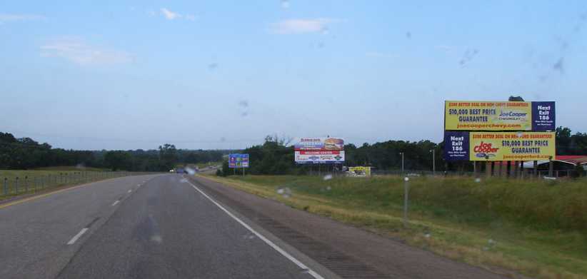
Shawnee signs. I was well into Oklahoma when these signs signalled that Shawnee was coming up.
The I40 is the passageway between the Virginia and Washington DC area and Los Angeles. From Oklahoma City it gets traffic from Chicago, Detroit and New York blending in as it rushes to LA. It is, therefore, the most convenient road between the major centres of the East and West coasts. From Oklahoma City it also follows generally the path of the famous Route 66.
Trucks of all sizes and shapes are to be seen in large numbers on this Interstate, a road built to keep them rolling at high speeds. But at times other things came into view, and I have always been fascinated with the way pickups are turned into semi-trailers like this one�
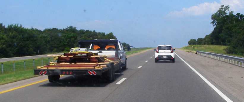
Pickup extended. The humble pickup often serves this kind of purpose in the US, with the dual-wheeled versions towing even larger trailers and loads than this one.
After 250 miles I had stopped at the Oklahoma City Visitor�s Center and had a free coffee, then went past this notable edifice again:
Peterbilt in the sky. Rush Trucks still had the Peterbilt up there on steel columns. I wonder if anywhere in the US there�s a bigger display up on such columns?
Sixty miles further on I diverted from the main lanes to briefly use some of the old Route 66 pathway�
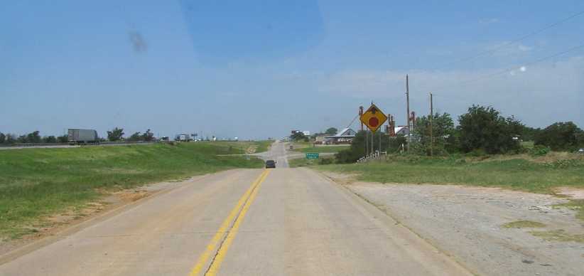
Hydro turnoff. I wouldn�t find anything here and so got straight back onto the Interstate.
�before continuing on. During this day�s drive I would see most kinds of things. Many are visible here � the long straights, the frequent exits to refuelling and food outlets, the old Route 66 road right alongside and the never-ending string of trucks:
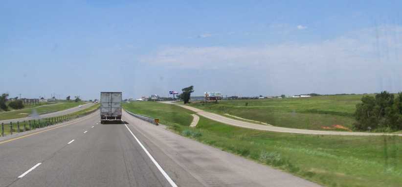
Typical scene. The old road looks puny alongside the Interstate, while everything else in the picture would have been rather less common to someone on Route 66 in the forties or fifties.
As I neared Clinton, just ten or fifteen miles further along, roadworks narrowed our path to a single lane�
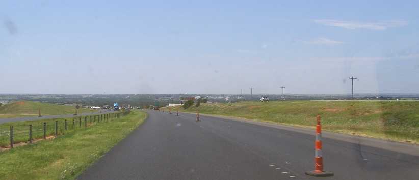
Roadworks. Maintenance on such a heavily-used road is always ongoing. This slowed the pace for a while.
�and so care had to be taken not to be speeding through this area. And the appearance of the Clinton exit�
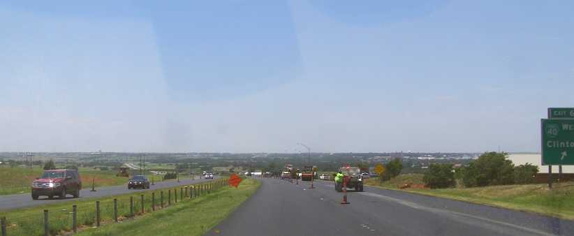
Clinton, OK. The miles of Oklahoma were slipping away under my wheels, only 65 miles from here to Texas.
�showed I was making good ground. By Elk City I was 360 miles into the drive and pulled into the town to find somewhere to make myself another coffee. I found a delightful park with trees and little lakes, so I was able to pull up under a tree and get out my stove and kettle to make it a nice little break.
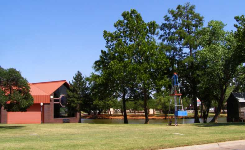
Ackley Park. A nicely groomed park with trees and lakes is found right in the middle of Elk City.
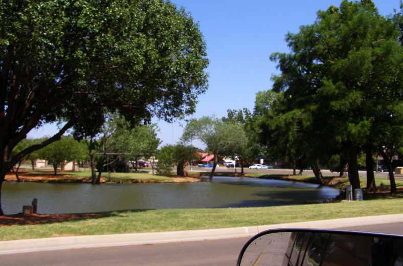
Relieving. On a hot summer�s day like this, the small lakes also contribute to some refreshment.
I was now nearing half-way to my New Mexico destination. The plan was to get close enough before I stopped for the night to be able to run on in easily in the morning. I was on the phone to David making arrangements and established that he had a doctor�s appointment in Albuquerque mid- to late-morning.
Getting across the Texas �Panhandle� would therefore be a good goal for the day and I was getting ever-nearer to the Texas border. This stage of the journey therefore followed this path:
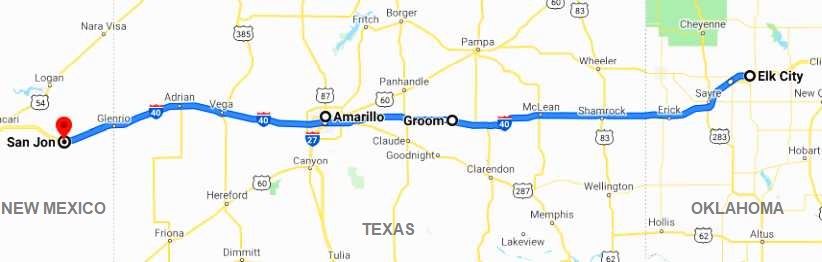
I was noting the scenery as I drove, the way it turned from heavily-treed or mountainous in Arkansas to much flatter and carrying less vegetation the further I got across Oklahoma. And I snapped an example of this just as I hit the Texas border:
Wheeler County Line. Not only a County boundary, this is the border of Texas, with scenery remaining for some time similar to that in most of Oklahoma.
Like I said, Texas didn�t change much�
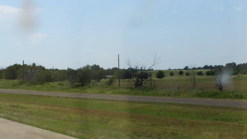
Texas � more of the same. More of a grassland than forests or cropping country, this part of Texas resembles many parts of Australia.
�which meant it was much like lots of places at home.
Crossing into Texas had disappointed us during out 2012 trip because we were looking for a State Welcome Center, mostly to get a hotel coupons magazine, but found none. But we did find this Visitor�s Center for the Gray County. It�s an impressive building standing out of the plains and presenting the Lone Star of Texas very well.
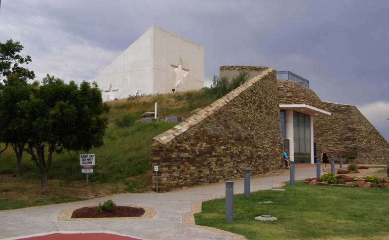
Gray County Visitor�s Center. Imposing and informative, this building serves a dual purpose.
Still more stars surround the place in the fences, looking over which gives panoramic views of the local topography:
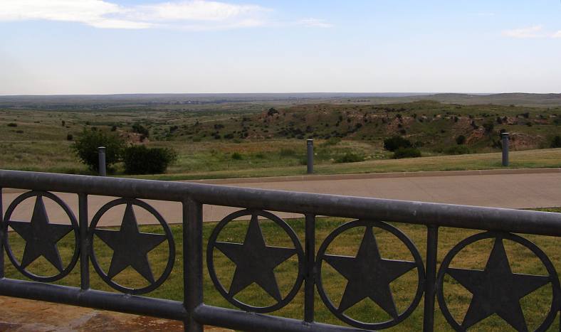
Gray County Stars. The stars are hardly alone here, hundreds of them surround the centre.
A lot of information is to be gleaned from the display boards inside, particularly noteworthy are those relating to the disappearance of the buffalo from the area and the hard times struck by early settlers in the district. Of particular note was the information about the devastating dust storms of the depression years:
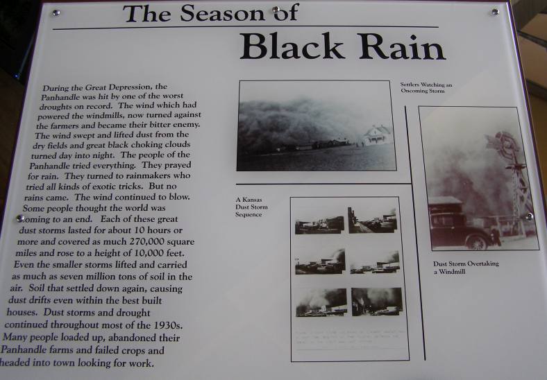
Black Rain. Another way of describing the dust storms which stole away topsoil and demoralised everyone trying to eke out a living.
And, of course, there were details of local features which might be of interest�
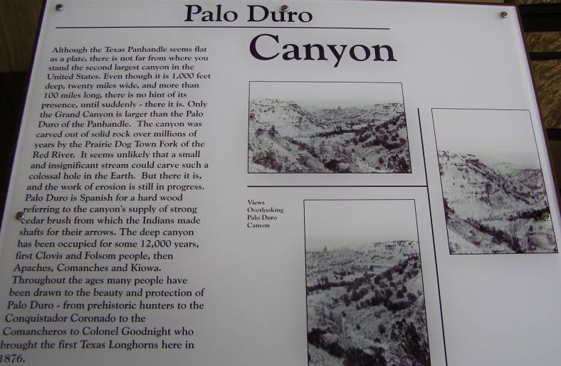
Palo Duro Canyon. Everyone knows the biggest canyon, a bit further to the West, but the second-biggest is tucked away on the Panhandle.
And I mentioned the centre served a dual purpose role. Signs inside explained this:
Tornado shelter. I�m sure if one were driving along the I40 and a tornado was heading towards them, this shelter would be very welcome.
Leaving there, one soon passes the Donley County Rest Area, which is located on the Eastbound lanes and is yet another imposing building for a roadside stop, though totally different to Gray County�s structure.
And speaking of the weather, as I drove towards Groom it seemed that I�d be seeing some rain:
Weather threatening. Dark clouds and signs of rain falling ahead, but it cleared before I reached it.
Another landmark from our 2012 trip, a water tower to be found on Google Earth under the title of �The Leaning Tower of Texas� is still leaning just as it was four years earlier�
Still not spilling. I don�t know if they still pump water up into this tower, but it�s got a name for itself and is a landmark to passers-by.
I cruised through Amarillo without stopping, then the smooth-running of the Interstate was to be interrupted about five miles to the West. This was the junction where we�d left the Interstate in the black of the morning because we wondered what the blinking red lights were (wind farm lights) in 2012, but now the traffic slowed suddenly and we were directed to the off-ramp to get around this incident:
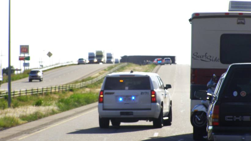
Rollover. Right on the overpass a semi-trailer straddled the median and created a need to divert traffic.
The truck was suspended across between the Eastbound and Westbound lanes, something you�d never expect to see and making it very difficult to understand how it got there, though there is a wrecked car in frame too, so it was obviously a part of it. A slightly closer look:
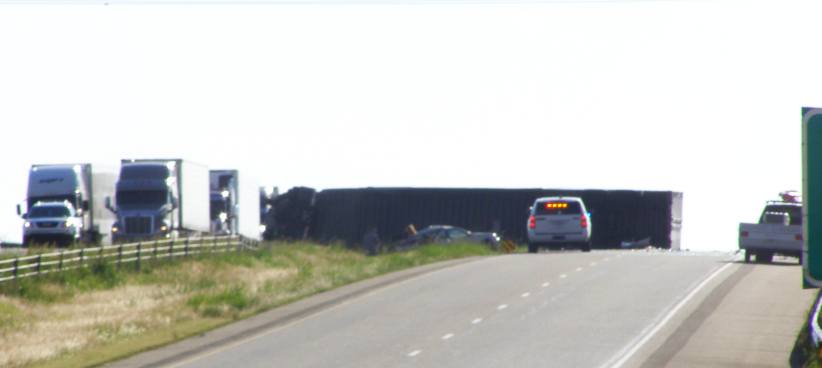
Traffic diverted. That�s the underside of the trailer we can see here as everyone heading West goes onto the off-ramp at Bushland.
I was now 520 miles into the day�s drive and didn�t mind slipping under the overpass and seeing what I could see from the other side. I would imagine it would have been a while before all of this was cleaned up:
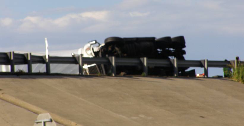
The other side. From the South-Western side, the picture does nothing to solve the mystery of how it all came about.
And then it was back to looking at the scenery and watching the miles go by. A number of feedlots dot the side of the Interstate in this area�
Feedlot. Just one of a number of feedlots visible from the road just to the West of Amarillo.
�and the windfarm which bewildered us is there, up behind the rows of hay-rolls on the Northern side of the road:
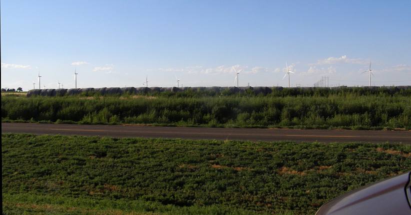
Hay and the windfarm. Still with the old Route 66 beside us, the view to the North included some hay-rolls and the expansive windfarm.
Adrian was a further 35 miles on and I once again diverted from the main road there to look for some refreshment. As the sun was going down in the West the shadow from this silo was long and solid:
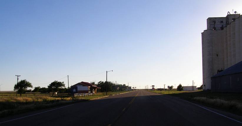
Adrian�s silo. Throwing a long shadow, this silo indicates that some successful grain-growing takes place on these plains.
And there was more windfarm activity here, obviously taking advantage of the strong winds which blow across the uninterrupted flat country. This building�
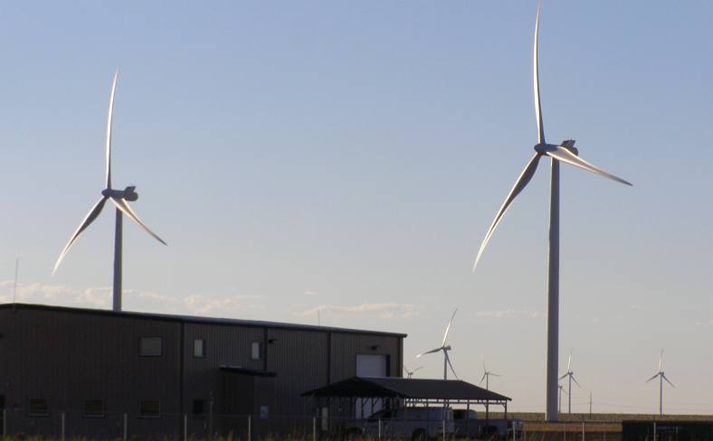
More wind farm. Strong winds out on the open plains will turn these blades strongly.
�is related to all those towers, no doubt housing controls and meters as well as maintenance equipment for the men taking care of the day-to-day running of the turbines.
My drive through Texas was coming to an end, a very long day at the wheel was getting me nearer to my goal and the long shadows said darkness wasn�t far away. I was 570 miles into the drive as I took this photo:
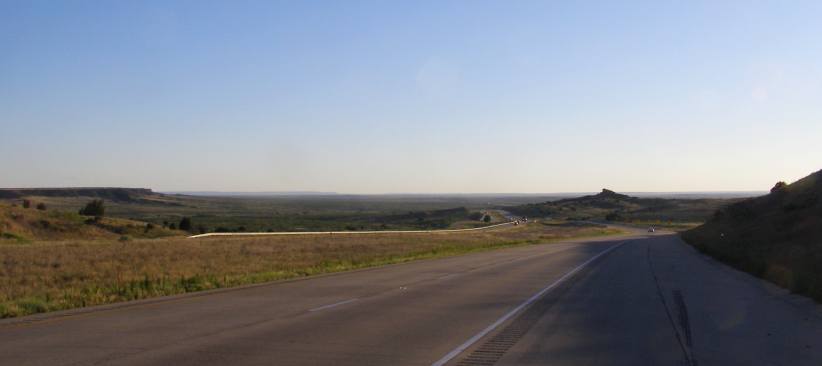
Sixteen miles to New Mexico. This downhill run provided a bit of an expansive view with an interesting rock outcrop straight ahead.
The sun was well and truly in my face as I crossed the border:
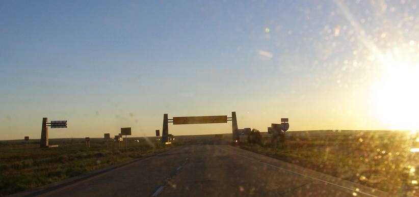
Nevada entry. The low sun silhouettes the New Mexico welcome sign and my day was coming to an end.
I drove right past the Welcome Center, which was likely as closed now as it was the morning we came this way before. I went on to take my day�s mileage to 620 by the time I pulled up at San Jon. A meal and a quiet place to bunk up in the back of the van and I knew it should be easy to get to meet up with David in the morning.
I did, however, want to hit the road early�
Going into fourth gear, which is overdrive, the 360 was barely past idle speed at 70mph and the miles were covered easily. I was already 180 miles into the drive as Shawnee came to attention�
Shawnee signs. I was well into Oklahoma when these signs signalled that Shawnee was coming up.
The I40 is the passageway between the Virginia and Washington DC area and Los Angeles. From Oklahoma City it gets traffic from Chicago, Detroit and New York blending in as it rushes to LA. It is, therefore, the most convenient road between the major centres of the East and West coasts. From Oklahoma City it also follows generally the path of the famous Route 66.
Trucks of all sizes and shapes are to be seen in large numbers on this Interstate, a road built to keep them rolling at high speeds. But at times other things came into view, and I have always been fascinated with the way pickups are turned into semi-trailers like this one�
Pickup extended. The humble pickup often serves this kind of purpose in the US, with the dual-wheeled versions towing even larger trailers and loads than this one.
After 250 miles I had stopped at the Oklahoma City Visitor�s Center and had a free coffee, then went past this notable edifice again:
Peterbilt in the sky. Rush Trucks still had the Peterbilt up there on steel columns. I wonder if anywhere in the US there�s a bigger display up on such columns?
Sixty miles further on I diverted from the main lanes to briefly use some of the old Route 66 pathway�
Hydro turnoff. I wouldn�t find anything here and so got straight back onto the Interstate.
�before continuing on. During this day�s drive I would see most kinds of things. Many are visible here � the long straights, the frequent exits to refuelling and food outlets, the old Route 66 road right alongside and the never-ending string of trucks:
Typical scene. The old road looks puny alongside the Interstate, while everything else in the picture would have been rather less common to someone on Route 66 in the forties or fifties.
As I neared Clinton, just ten or fifteen miles further along, roadworks narrowed our path to a single lane�
Roadworks. Maintenance on such a heavily-used road is always ongoing. This slowed the pace for a while.
�and so care had to be taken not to be speeding through this area. And the appearance of the Clinton exit�
Clinton, OK. The miles of Oklahoma were slipping away under my wheels, only 65 miles from here to Texas.
�showed I was making good ground. By Elk City I was 360 miles into the drive and pulled into the town to find somewhere to make myself another coffee. I found a delightful park with trees and little lakes, so I was able to pull up under a tree and get out my stove and kettle to make it a nice little break.
Ackley Park. A nicely groomed park with trees and lakes is found right in the middle of Elk City.
Relieving. On a hot summer�s day like this, the small lakes also contribute to some refreshment.
I was now nearing half-way to my New Mexico destination. The plan was to get close enough before I stopped for the night to be able to run on in easily in the morning. I was on the phone to David making arrangements and established that he had a doctor�s appointment in Albuquerque mid- to late-morning.
Getting across the Texas �Panhandle� would therefore be a good goal for the day and I was getting ever-nearer to the Texas border. This stage of the journey therefore followed this path:
I was noting the scenery as I drove, the way it turned from heavily-treed or mountainous in Arkansas to much flatter and carrying less vegetation the further I got across Oklahoma. And I snapped an example of this just as I hit the Texas border:
Wheeler County Line. Not only a County boundary, this is the border of Texas, with scenery remaining for some time similar to that in most of Oklahoma.
Like I said, Texas didn�t change much�
Texas � more of the same. More of a grassland than forests or cropping country, this part of Texas resembles many parts of Australia.
�which meant it was much like lots of places at home.
Crossing into Texas had disappointed us during out 2012 trip because we were looking for a State Welcome Center, mostly to get a hotel coupons magazine, but found none. But we did find this Visitor�s Center for the Gray County. It�s an impressive building standing out of the plains and presenting the Lone Star of Texas very well.
Gray County Visitor�s Center. Imposing and informative, this building serves a dual purpose.
Still more stars surround the place in the fences, looking over which gives panoramic views of the local topography:
Gray County Stars. The stars are hardly alone here, hundreds of them surround the centre.
A lot of information is to be gleaned from the display boards inside, particularly noteworthy are those relating to the disappearance of the buffalo from the area and the hard times struck by early settlers in the district. Of particular note was the information about the devastating dust storms of the depression years:
Black Rain. Another way of describing the dust storms which stole away topsoil and demoralised everyone trying to eke out a living.
And, of course, there were details of local features which might be of interest�
Palo Duro Canyon. Everyone knows the biggest canyon, a bit further to the West, but the second-biggest is tucked away on the Panhandle.
And I mentioned the centre served a dual purpose role. Signs inside explained this:
Tornado shelter. I�m sure if one were driving along the I40 and a tornado was heading towards them, this shelter would be very welcome.
Leaving there, one soon passes the Donley County Rest Area, which is located on the Eastbound lanes and is yet another imposing building for a roadside stop, though totally different to Gray County�s structure.
And speaking of the weather, as I drove towards Groom it seemed that I�d be seeing some rain:
Weather threatening. Dark clouds and signs of rain falling ahead, but it cleared before I reached it.
Another landmark from our 2012 trip, a water tower to be found on Google Earth under the title of �The Leaning Tower of Texas� is still leaning just as it was four years earlier�
Still not spilling. I don�t know if they still pump water up into this tower, but it�s got a name for itself and is a landmark to passers-by.
I cruised through Amarillo without stopping, then the smooth-running of the Interstate was to be interrupted about five miles to the West. This was the junction where we�d left the Interstate in the black of the morning because we wondered what the blinking red lights were (wind farm lights) in 2012, but now the traffic slowed suddenly and we were directed to the off-ramp to get around this incident:
Rollover. Right on the overpass a semi-trailer straddled the median and created a need to divert traffic.
The truck was suspended across between the Eastbound and Westbound lanes, something you�d never expect to see and making it very difficult to understand how it got there, though there is a wrecked car in frame too, so it was obviously a part of it. A slightly closer look:
Traffic diverted. That�s the underside of the trailer we can see here as everyone heading West goes onto the off-ramp at Bushland.
I was now 520 miles into the day�s drive and didn�t mind slipping under the overpass and seeing what I could see from the other side. I would imagine it would have been a while before all of this was cleaned up:
The other side. From the South-Western side, the picture does nothing to solve the mystery of how it all came about.
And then it was back to looking at the scenery and watching the miles go by. A number of feedlots dot the side of the Interstate in this area�
Feedlot. Just one of a number of feedlots visible from the road just to the West of Amarillo.
�and the windfarm which bewildered us is there, up behind the rows of hay-rolls on the Northern side of the road:
Hay and the windfarm. Still with the old Route 66 beside us, the view to the North included some hay-rolls and the expansive windfarm.
Adrian was a further 35 miles on and I once again diverted from the main road there to look for some refreshment. As the sun was going down in the West the shadow from this silo was long and solid:
Adrian�s silo. Throwing a long shadow, this silo indicates that some successful grain-growing takes place on these plains.
And there was more windfarm activity here, obviously taking advantage of the strong winds which blow across the uninterrupted flat country. This building�
More wind farm. Strong winds out on the open plains will turn these blades strongly.
�is related to all those towers, no doubt housing controls and meters as well as maintenance equipment for the men taking care of the day-to-day running of the turbines.
My drive through Texas was coming to an end, a very long day at the wheel was getting me nearer to my goal and the long shadows said darkness wasn�t far away. I was 570 miles into the drive as I took this photo:
Sixteen miles to New Mexico. This downhill run provided a bit of an expansive view with an interesting rock outcrop straight ahead.
The sun was well and truly in my face as I crossed the border:
Nevada entry. The low sun silhouettes the New Mexico welcome sign and my day was coming to an end.
I drove right past the Welcome Center, which was likely as closed now as it was the morning we came this way before. I went on to take my day�s mileage to 620 by the time I pulled up at San Jon. A meal and a quiet place to bunk up in the back of the van and I knew it should be easy to get to meet up with David in the morning.
I did, however, want to hit the road early�
Thread Starter
|
Captain
Joined: Oct 2005
Posts: 570
Likes: 8
From: The Summit, Queensland, Australia
There�s no mucking around when I�m on the move and sleep in the van. I wake up, walk forward to the driver�s seat, fire it up and get rolling. I had some pressure on me to get this stretch covered, but it was easy and fast running along the I40 and so, with the early start, I still had some time to play with.
I would be meeting up with David in Albuquerque, which was just on 200 miles away, then head down to Belen to spend the balance of the day and then the night at his place. Here�s the map:
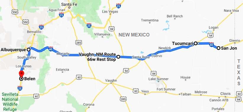
And I definitely got going early, this pic was taken just four or five miles out of San Jon and the shadows are still long as the morning sun starts to colour the scenery:
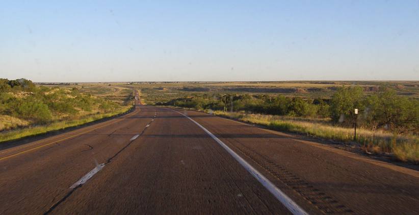
Long shadows. As the road is heading North-West at this point, the sun�s early position in the East throws its long shadows right across the road.
The really interesting part of driving across this road is the frequency of the towns. They have sprung up all along the way despite the barren nature of a lot of the country. The first town I went past was Tucumcari, which Janet noted four years earlier:
Google Earth confirms this view of the town, big hotels and lots of eating houses:
Tucumcari businesses. Thirty hotels, the signs said, 24 restaurants too, and there were several gas stations and truck stops.
I succumbed to the temptation to seek out breakfast. Resorting to my old pattern of going into McDonalds, buying their oatmeal and fruit and a coffee, then looking to see in which corner the old blokes were sitting having their daily chat. They were sitting in the front corner nearest the camera in that shot and I talked to them briefly, but they weren�t as receptive as I�d struck at most places in America.
Resuming my drive, about thirty miles further on I shot this pic�
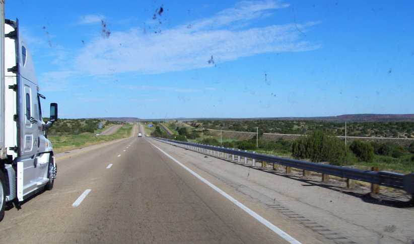
Sunlight brightens. Three-quarters of an hour made a difference to the amount of light about as I shared this piece of road with another fast-running truck.
�with the railway and the old Route 66 (or service road) all side by side. By coincidence, this was the same spot Janet mentioned here:
As the day continued to brighten up, the skies showed mostly blue and the Interstate rolled out in many stretches of long straight lines. From one hill I got this picture which shows just what I�m talking about:
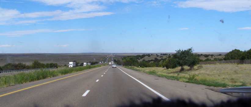
Long and straight. Out there in the distance there�s an overpass, where the road to New Mexico�s town called Las Vegas heads off to the North. Long straights were a feature of this whole stretch.
And the bridge that�s in frame there is shown here in full, the New Mexico people being among those who tend to decorate bridges with motifs and colours. The abutments were also more than just bland concrete construction:
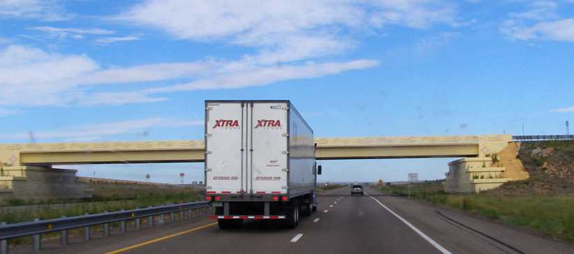
Decorated bridge. This corner of America sees a lot of bridges decorated with patterns and colours like this.
Just a couple of miles further on I pulled up at the Vaughn rest area for a quick stop. Then, as I left there I was surprised to see this sight:
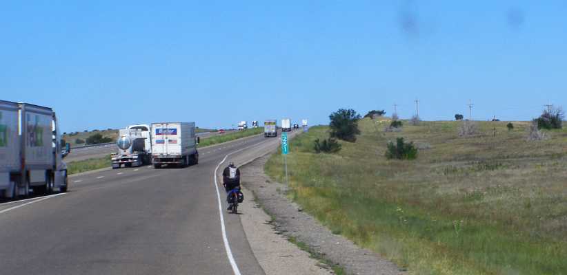
A bicycle! With all those trucks around, this bloke was taking his life in his hands riding his well-laden bicycle across the countryside.
Roadworks were to slow progress a little about twelve miles further on�
Roadworks. Not only the road but also the bridge were getting some treatment here, more serious railings being put on the bridge.
�but in good time I descended �The Canyon� into Albuquerque. David had advised me that he was delayed so I went down the main street looking to see if I could use the time productively. I�d come to the conclusion that I needed a new windscreen in the van, David advised me which place to go to for that; and I wanted to pick up all the tie rod ends for the steering so I�d be able to fit those once I got the van home.
The screen I had to arrange to have fitted the next day, which was fine, while the shopping list at the auto spares shop kept growing. A top radiator hose was obtained, but a lower hose I couldn�t match to the one in the van. I left there with many little boxes of bits and fairly satisfied that I�d save myself a lot of money and later aggravation.
Ultimately David was free and we met for lunch. Then we went to a wrecking yard for some more �shopping�, which David took to with a relish�
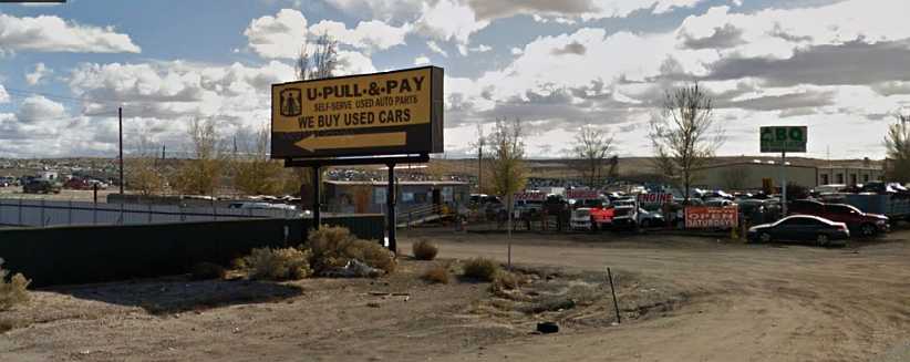
Wrecking yards. On the South side of town there were several, we only got to one. And had some small success.
�Principally I was after replacement parts for those bits which might easily get damaged in carpark incidents and the like. Things like tail light lenses (none to be found) and the outer ends of the grille, which incorporate the headlight surrounds and indicator lenses. I did find a pair of those, though one lens had been roughly repaired with fibreglass.
But the business hours of the day had now just about evaporated and there was only time to go to the one yard. I had seen this oddity, too, while driving there:
Strange combination. You see all sorts of things on the roads of America. Lowered, understandable. Skinny wheels, why?
Lowered to the hilt and with skinny wheels, that�s not what I�d expect to see anywhere.
We headed for David�s place, I parked in his driveway while his pickup was behind my van and his Skylark, Vega and Rambler were scattered about:
Crowded. With David�s relics, a Skylark and a Vega, on the lawn and his Dodge-powered Javelin out front, and the pickup at the side, parking space for my van was a bit limited.
David�s ex-wife had moved back in with him to help out as his condition deteriorated, she was yet to return when I got there. After getting something to eat I went out for a little while to see some other people I�d been wanting to visit, then when I returned David�s and we engaged in coversation as we awaited his wife�s return.
In due course we set up a temporary bed on his lounge for me, I was pretty happy I wasn�t allergic to all the dog fur stuck on every surface there, and it was time to sleep.
I would be meeting up with David in Albuquerque, which was just on 200 miles away, then head down to Belen to spend the balance of the day and then the night at his place. Here�s the map:
And I definitely got going early, this pic was taken just four or five miles out of San Jon and the shadows are still long as the morning sun starts to colour the scenery:
Long shadows. As the road is heading North-West at this point, the sun�s early position in the East throws its long shadows right across the road.
The really interesting part of driving across this road is the frequency of the towns. They have sprung up all along the way despite the barren nature of a lot of the country. The first town I went past was Tucumcari, which Janet noted four years earlier:
Tucumcari � a town in the middle of nowhere with all mod-cons, heaps of motels and eateries, a trainline running beside the road, not a common sight, seems quite rocky country and scrubby.
Tucumcari businesses. Thirty hotels, the signs said, 24 restaurants too, and there were several gas stations and truck stops.
I succumbed to the temptation to seek out breakfast. Resorting to my old pattern of going into McDonalds, buying their oatmeal and fruit and a coffee, then looking to see in which corner the old blokes were sitting having their daily chat. They were sitting in the front corner nearest the camera in that shot and I talked to them briefly, but they weren�t as receptive as I�d struck at most places in America.
Resuming my drive, about thirty miles further on I shot this pic�
Sunlight brightens. Three-quarters of an hour made a difference to the amount of light about as I shared this piece of road with another fast-running truck.
�with the railway and the old Route 66 (or service road) all side by side. By coincidence, this was the same spot Janet mentioned here:
More hills now, but not much habitation. For the last couple of days we have been running beside the original Route 66, still going in varying grades of disrepair. Just took a photo of a train only carrying goods.
Long and straight. Out there in the distance there�s an overpass, where the road to New Mexico�s town called Las Vegas heads off to the North. Long straights were a feature of this whole stretch.
And the bridge that�s in frame there is shown here in full, the New Mexico people being among those who tend to decorate bridges with motifs and colours. The abutments were also more than just bland concrete construction:
Decorated bridge. This corner of America sees a lot of bridges decorated with patterns and colours like this.
Just a couple of miles further on I pulled up at the Vaughn rest area for a quick stop. Then, as I left there I was surprised to see this sight:
A bicycle! With all those trucks around, this bloke was taking his life in his hands riding his well-laden bicycle across the countryside.
Roadworks were to slow progress a little about twelve miles further on�
Roadworks. Not only the road but also the bridge were getting some treatment here, more serious railings being put on the bridge.
�but in good time I descended �The Canyon� into Albuquerque. David had advised me that he was delayed so I went down the main street looking to see if I could use the time productively. I�d come to the conclusion that I needed a new windscreen in the van, David advised me which place to go to for that; and I wanted to pick up all the tie rod ends for the steering so I�d be able to fit those once I got the van home.
The screen I had to arrange to have fitted the next day, which was fine, while the shopping list at the auto spares shop kept growing. A top radiator hose was obtained, but a lower hose I couldn�t match to the one in the van. I left there with many little boxes of bits and fairly satisfied that I�d save myself a lot of money and later aggravation.
Ultimately David was free and we met for lunch. Then we went to a wrecking yard for some more �shopping�, which David took to with a relish�
Wrecking yards. On the South side of town there were several, we only got to one. And had some small success.
�Principally I was after replacement parts for those bits which might easily get damaged in carpark incidents and the like. Things like tail light lenses (none to be found) and the outer ends of the grille, which incorporate the headlight surrounds and indicator lenses. I did find a pair of those, though one lens had been roughly repaired with fibreglass.
But the business hours of the day had now just about evaporated and there was only time to go to the one yard. I had seen this oddity, too, while driving there:
Strange combination. You see all sorts of things on the roads of America. Lowered, understandable. Skinny wheels, why?
Lowered to the hilt and with skinny wheels, that�s not what I�d expect to see anywhere.
We headed for David�s place, I parked in his driveway while his pickup was behind my van and his Skylark, Vega and Rambler were scattered about:
Crowded. With David�s relics, a Skylark and a Vega, on the lawn and his Dodge-powered Javelin out front, and the pickup at the side, parking space for my van was a bit limited.
David�s ex-wife had moved back in with him to help out as his condition deteriorated, she was yet to return when I got there. After getting something to eat I went out for a little while to see some other people I�d been wanting to visit, then when I returned David�s and we engaged in coversation as we awaited his wife�s return.
In due course we set up a temporary bed on his lounge for me, I was pretty happy I wasn�t allergic to all the dog fur stuck on every surface there, and it was time to sleep.
Thread Starter
|
Captain
Joined: Oct 2005
Posts: 570
Likes: 8
From: The Summit, Queensland, Australia
The next morning, Friday July 7, I got busy with a couple of things. There was an electrical issue to fix on the van which had been bugging me and I really wanted to get that sorted while I was somewhere I might get help if it was needed.
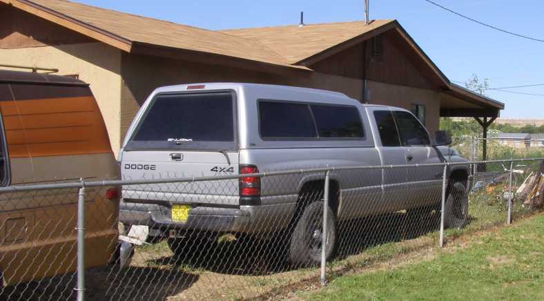
David’s RAM. Parking in this spot enabled me to get at the problem I had to fix on my van. David usually drove around in the silver RAM pickup.
And David was going to give me a complete rear axle assembly out of a Dodge pickup…
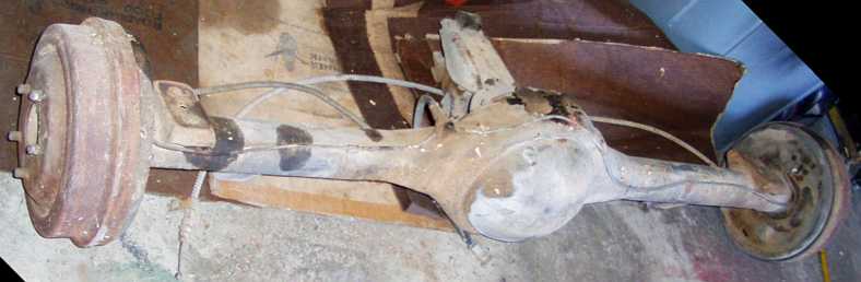
Pickup rear end. David had this for years, planning to fit it to his Javelin. But he was past such things and needed to get rid of it. I gave it a home.
…that had to be lifted into the van and put somewhere it wouldn’t be too badly in the way. And David couldn’t help with that, though his son could. After that I went back around to the thrift shop Janet and I had visited, but found nothing I really wanted, so it was time to bid farewell to David – and we both knew this would be the final time as his cancer was advancing – and head off to Albuquerque to get the new screen fitted.
After that I was heading in the general direction of Denver, Colorado, with a need to look around Santa Fe for Angie on the way. So this would be my path:
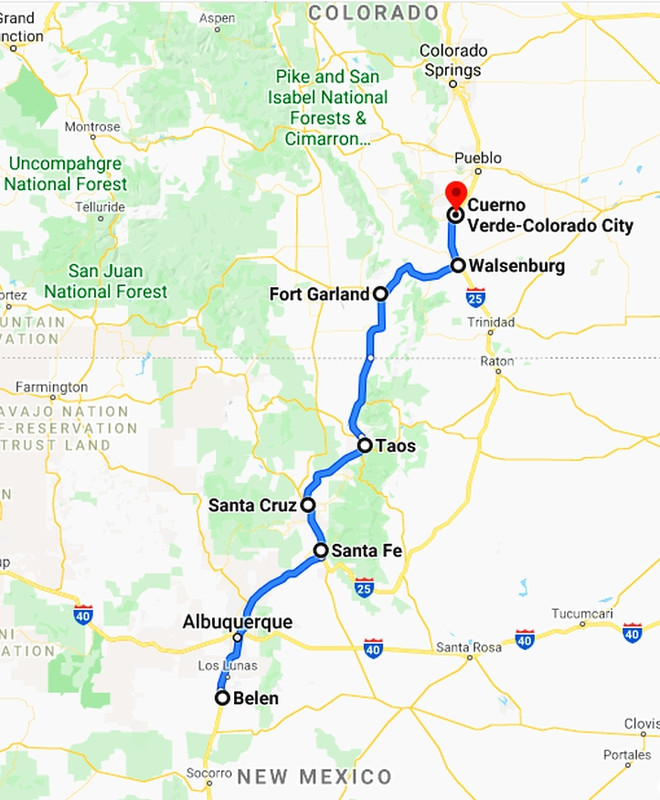
The first snag was when I got to the windscreen fitters’ to find that they’d had the wrong screen delivered. Some rushing about and they got the right one, then the way the ‘conversion’ to the van made fitting it difficult. The makers had built a compartment for radios etc into the front of the ceiling, and that impinged on access to the top of the windscreen rubber:
Encroaching on things. When it was built, this plywood-and-velour box structure housed a radio, possibly a CB and maybe a tape player. None of that survives.
The other end. It can be seen between the two pics how the structure gets in the way of the windscreen rubber across the top of the screen.
I sweated badly while the blokes doing the fitting worked on it, I was sure the straining and everything that was going on would result in a great crack across the new screen, but they got it in and it was, in the end, a job well done. I drove out of there knowing that I had a screen which would pass muster when the time came to register the van in Australia. As long as I didn’t get a stone through it in the rest of the trip!
My path from there was up the I25 to Santa Fe, getting me into some interesting landforms and giving me views ahead of the Rockies. And it was a nice clear view, too…
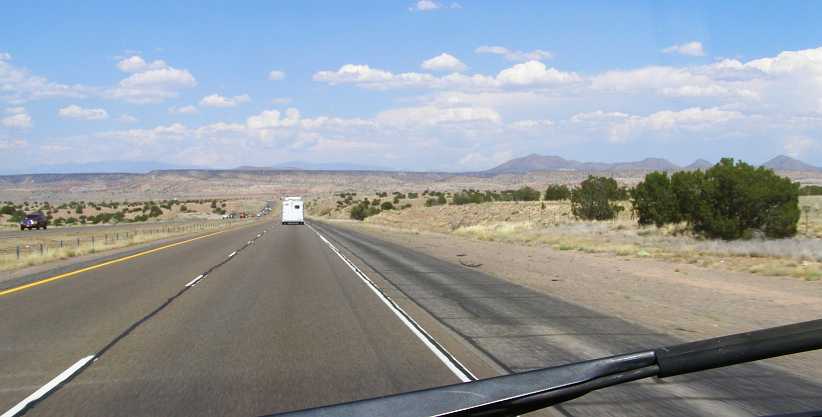
Clear view. Of course things would change over the coming days, but for now I had a crystal-clear view of the New Mexico scenery as I drove. Traffic was light and conditions were first class.
A number of small towns lay alongside the Interstate on the run up to Santa Fe. This Interstate is a part of the CanAm Highway, running from El Paso on the Mexican border to Weyburn, about 75 miles into Saskatchewan.
At one point there was a railway line came in under the Northbound lanes and stayed between the Northbound and Southbound lanes for about 14 miles. I never saw any trains, but Google Earth helps out there…
Railway Station. Commuter rail came to the desert in 2006 with the purchase of an existing line from Belen to Albuquerque by the state government. In 2008 they extended it to Santa Fe, this mid-highway station is at La Bajada, about ten miles from Santa Fe.
Both pics are from Street View, the one below is of a train stopped at that same station – or just taking off from it. Modern double-deck carriages were built for the line by 2006 and the train adopted the name ‘Railrunner’ from the state’s mascot bird, the roadrunner.
The ‘Railrunner’. Sleek and modern, it would afford a quick trip between Santa Fe and Belen, I’m sure. But so does the Interstate.
I went into Santa Fe and looked around a little, as I had promised Angie. I also took in a meal from McDonalds while I was there. But the worst of it was that I got lost looking around some semi-rural residential areas and wasted a bit of time finding my way out. From there I took the road most directly to the North, as the I25 swings to the South East for some distance and I was still looking to see different scenery.
Still there was a number of towns along the road, while the scenery changed as New Mexico Route 68 followed the Rio Grande river along the valleys heading North. As I drove under this bridge it was still a road of the same standard as an Interstate…
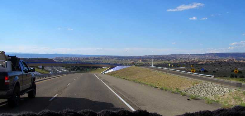
More bridge art. This bridge just South of Santa Cruz isn’t decorated in the same way as those others I’ve pointed out in the past, but…
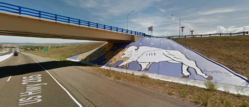
Buffalo. …the days of the huge buffalo herds are represented here in this painting on the concrete batter retainer. One way of preventing graffiti, I suppose.
…just the other side of Santa Cruz it came down to a regular 2-lane through the spectacular scenery. The Rio Grande Gorge was not far away as the wider section of the road petered out and more elevated country was coming into view.
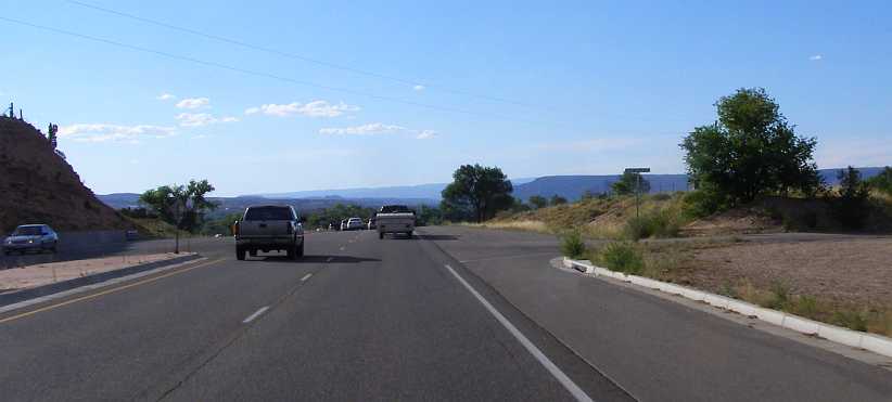
Mountains in view. Looking ahead I could see those mountains, peaks in Colorado reaching over 14,000ft.
The road was still good and traffic was light as I progressed into a section which is considered to be the Southern extremity of the Rockies. And still I was with the waters of the Rio Grande as the road followed this great river into the higher country.
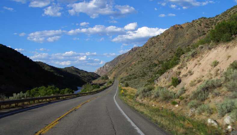
Along the Rio Grande. Heading into the Southernmost part of the Rocky Mountains, this road was a great sight as the afternoon progressed.
As can be seen in this next photo, the day was definitely getting away as I reached a point where I could look over the Rio Grande Gorge, something I’ll have to go back and get a better look at one day:
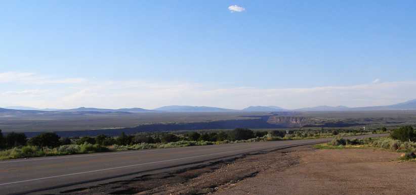
Rio Grande Gorge I’d never heard of it before, but this gorge seems to me to merit a bit more attention. And those taller mountains are getting a little closer.
As I drove through the little town of Taos I became aware that the style of building is reminiscent of the real Mexico. A bit old fashioned, a style seen in those old Westerns, these buildings were attractive and nostalgic. A couple of photos was all I got, however…
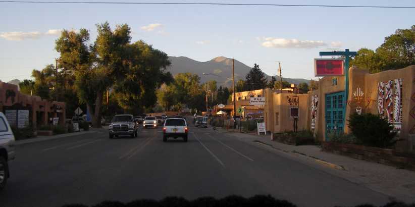
Pawn shop in the afternoon sun. The shadows were coming from low in the West as I reached Taos, about 170 miles from my starting point for the day.
I’d been climbing, too. Taos is located at about 6,500 feet and would be the last town I’d see in daylight this day. And well worth seeing…
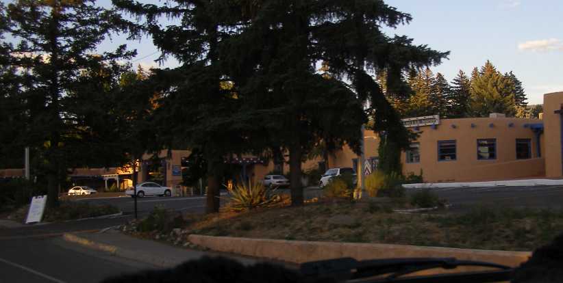
Taos shops. No horse railings, just car parking spots, still the old-style architecture is not spoiled at all.
Just four more towns were there to be seen in the next seventy miles to Fort Garland, but the light was failing as I continued and was gone by the time I got to this little place in Colorado. I had a quick look around, thinking I’d get something to eat, but nothing seemed to be open. It was going to be a late run this night.
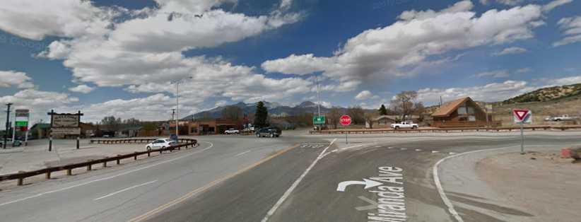
Fort Garland. Spread out and sleepy, as in this Street View picture, Fort Garland disappointed me with nowhere to get anything I’d like to eat.
At this point I was only 250 miles into the day’s journey, but the time lost with that windscreen problem, as well as the time I spent getting lost in Santa Fe, meant it was getting very late. It was only a little over forty miles along Rt 160, which included climbing over the mountains, to Walsenburg and the I25. I would have liked to have stopped there, it was getting towards bed time, but I found nothing and turned left on to the I25 and kept going until I saw a rest area sign.
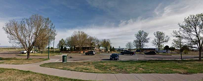
Cuerno Rest Area. Definitely a welcome sight, though I only saw it in the dark. Google Earth gives a good look at this well-treed and spacious rest area.
Just twenty miles further on than Walsenburg, It was somewhere I could prepare something to eat and get a good sleep before heading further North. I don’t think the sight of a rest area was ever more welcome…
David’s RAM. Parking in this spot enabled me to get at the problem I had to fix on my van. David usually drove around in the silver RAM pickup.
And David was going to give me a complete rear axle assembly out of a Dodge pickup…
Pickup rear end. David had this for years, planning to fit it to his Javelin. But he was past such things and needed to get rid of it. I gave it a home.
…that had to be lifted into the van and put somewhere it wouldn’t be too badly in the way. And David couldn’t help with that, though his son could. After that I went back around to the thrift shop Janet and I had visited, but found nothing I really wanted, so it was time to bid farewell to David – and we both knew this would be the final time as his cancer was advancing – and head off to Albuquerque to get the new screen fitted.
After that I was heading in the general direction of Denver, Colorado, with a need to look around Santa Fe for Angie on the way. So this would be my path:
The first snag was when I got to the windscreen fitters’ to find that they’d had the wrong screen delivered. Some rushing about and they got the right one, then the way the ‘conversion’ to the van made fitting it difficult. The makers had built a compartment for radios etc into the front of the ceiling, and that impinged on access to the top of the windscreen rubber:
Encroaching on things. When it was built, this plywood-and-velour box structure housed a radio, possibly a CB and maybe a tape player. None of that survives.
The other end. It can be seen between the two pics how the structure gets in the way of the windscreen rubber across the top of the screen.
I sweated badly while the blokes doing the fitting worked on it, I was sure the straining and everything that was going on would result in a great crack across the new screen, but they got it in and it was, in the end, a job well done. I drove out of there knowing that I had a screen which would pass muster when the time came to register the van in Australia. As long as I didn’t get a stone through it in the rest of the trip!
My path from there was up the I25 to Santa Fe, getting me into some interesting landforms and giving me views ahead of the Rockies. And it was a nice clear view, too…
Clear view. Of course things would change over the coming days, but for now I had a crystal-clear view of the New Mexico scenery as I drove. Traffic was light and conditions were first class.
A number of small towns lay alongside the Interstate on the run up to Santa Fe. This Interstate is a part of the CanAm Highway, running from El Paso on the Mexican border to Weyburn, about 75 miles into Saskatchewan.
At one point there was a railway line came in under the Northbound lanes and stayed between the Northbound and Southbound lanes for about 14 miles. I never saw any trains, but Google Earth helps out there…
Railway Station. Commuter rail came to the desert in 2006 with the purchase of an existing line from Belen to Albuquerque by the state government. In 2008 they extended it to Santa Fe, this mid-highway station is at La Bajada, about ten miles from Santa Fe.
Both pics are from Street View, the one below is of a train stopped at that same station – or just taking off from it. Modern double-deck carriages were built for the line by 2006 and the train adopted the name ‘Railrunner’ from the state’s mascot bird, the roadrunner.
The ‘Railrunner’. Sleek and modern, it would afford a quick trip between Santa Fe and Belen, I’m sure. But so does the Interstate.
I went into Santa Fe and looked around a little, as I had promised Angie. I also took in a meal from McDonalds while I was there. But the worst of it was that I got lost looking around some semi-rural residential areas and wasted a bit of time finding my way out. From there I took the road most directly to the North, as the I25 swings to the South East for some distance and I was still looking to see different scenery.
Still there was a number of towns along the road, while the scenery changed as New Mexico Route 68 followed the Rio Grande river along the valleys heading North. As I drove under this bridge it was still a road of the same standard as an Interstate…
More bridge art. This bridge just South of Santa Cruz isn’t decorated in the same way as those others I’ve pointed out in the past, but…
Buffalo. …the days of the huge buffalo herds are represented here in this painting on the concrete batter retainer. One way of preventing graffiti, I suppose.
…just the other side of Santa Cruz it came down to a regular 2-lane through the spectacular scenery. The Rio Grande Gorge was not far away as the wider section of the road petered out and more elevated country was coming into view.
Mountains in view. Looking ahead I could see those mountains, peaks in Colorado reaching over 14,000ft.
The road was still good and traffic was light as I progressed into a section which is considered to be the Southern extremity of the Rockies. And still I was with the waters of the Rio Grande as the road followed this great river into the higher country.
Along the Rio Grande. Heading into the Southernmost part of the Rocky Mountains, this road was a great sight as the afternoon progressed.
As can be seen in this next photo, the day was definitely getting away as I reached a point where I could look over the Rio Grande Gorge, something I’ll have to go back and get a better look at one day:
Rio Grande Gorge I’d never heard of it before, but this gorge seems to me to merit a bit more attention. And those taller mountains are getting a little closer.
As I drove through the little town of Taos I became aware that the style of building is reminiscent of the real Mexico. A bit old fashioned, a style seen in those old Westerns, these buildings were attractive and nostalgic. A couple of photos was all I got, however…
Pawn shop in the afternoon sun. The shadows were coming from low in the West as I reached Taos, about 170 miles from my starting point for the day.
I’d been climbing, too. Taos is located at about 6,500 feet and would be the last town I’d see in daylight this day. And well worth seeing…
Taos shops. No horse railings, just car parking spots, still the old-style architecture is not spoiled at all.
Just four more towns were there to be seen in the next seventy miles to Fort Garland, but the light was failing as I continued and was gone by the time I got to this little place in Colorado. I had a quick look around, thinking I’d get something to eat, but nothing seemed to be open. It was going to be a late run this night.
Fort Garland. Spread out and sleepy, as in this Street View picture, Fort Garland disappointed me with nowhere to get anything I’d like to eat.
At this point I was only 250 miles into the day’s journey, but the time lost with that windscreen problem, as well as the time I spent getting lost in Santa Fe, meant it was getting very late. It was only a little over forty miles along Rt 160, which included climbing over the mountains, to Walsenburg and the I25. I would have liked to have stopped there, it was getting towards bed time, but I found nothing and turned left on to the I25 and kept going until I saw a rest area sign.
Cuerno Rest Area. Definitely a welcome sight, though I only saw it in the dark. Google Earth gives a good look at this well-treed and spacious rest area.
Just twenty miles further on than Walsenburg, It was somewhere I could prepare something to eat and get a good sleep before heading further North. I don’t think the sight of a rest area was ever more welcome…
Last edited by Ray Bell; Aug 3, 2020 at 07:27 AM.