

Ride along with me...


Thread Starter
|
Captain

Joined: Oct 2005
Posts: 570
Likes: 8
From: The Summit, Queensland, Australia
Two weeks had now elapsed since we flew into Paris to commence the European leg of our trip. We�d been into three countries plus the Principality of Monaco and I�d been across some water to go to Sicily. Among the things I was looking forward to was a visit, on the recommendation of my friend, Bob Abberfield, to the town of Alberobello.
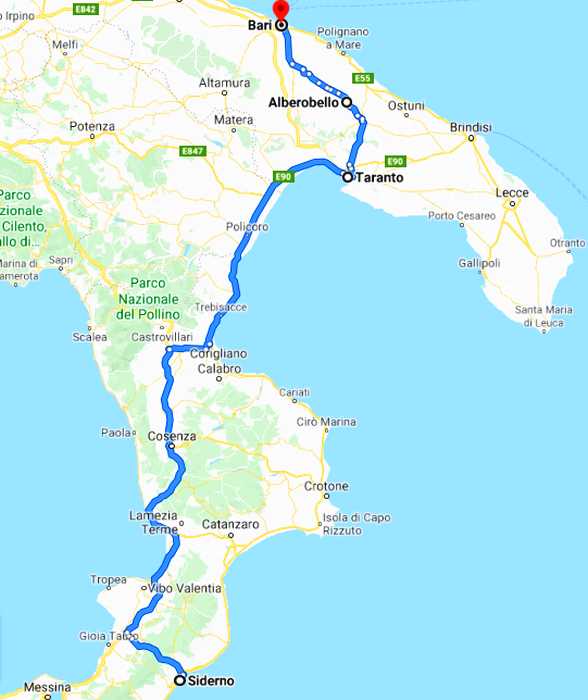
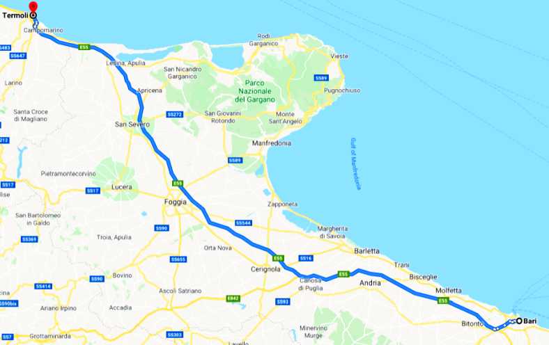
Now we were to head there, and then on to nearby Bari, another one of the many towns in Europe where motor racing was once conducted on public roads. So our path for the day:
This meant, of course, a parting with Vince and Mary. They had been wonderful hosts and helped us greatly at a difficult time, all the while ensuring that our needs were met fully. But such partings are repeated many times on trips like this.
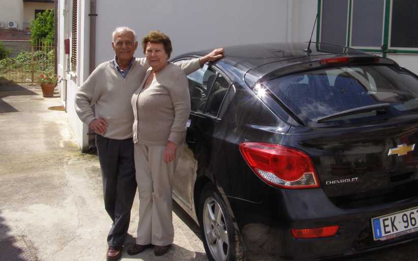
Goodbye to Vince and Mary. This farewell picture of them beside their everyday car belies the fact that in the garage was a much more sporting Alfa Romeo. Nor surprise when you look at Vince�s background.
We were packed and ready to drive, and as we were leaving the area we snapped a couple of pics:
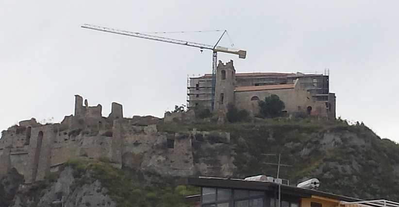
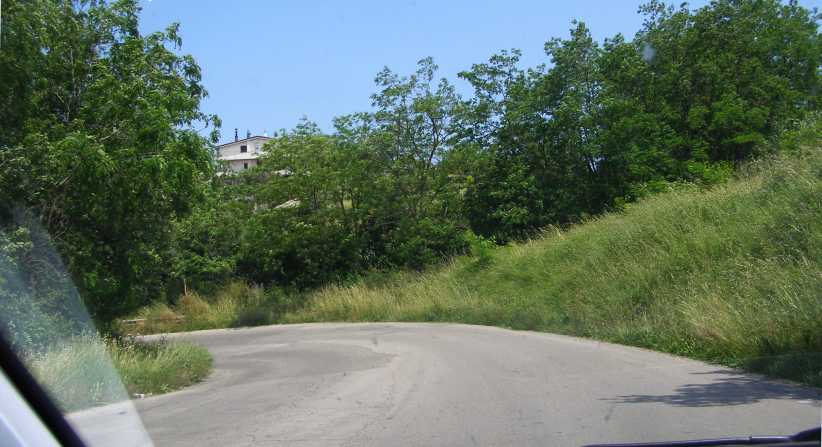
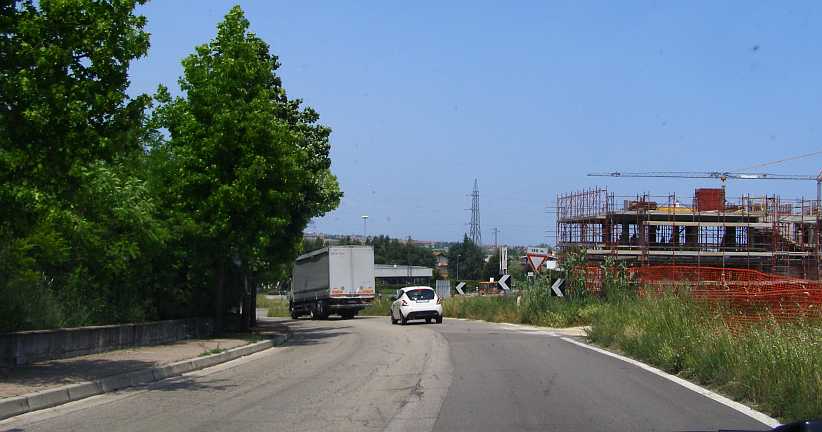
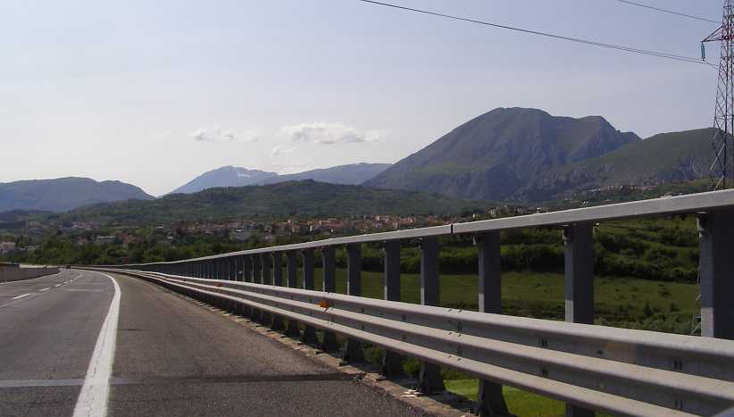
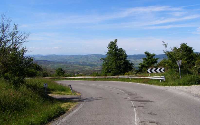
Bulding on the hill. There are ruins up there, but alongside of them a huge building is being constructed. No space is wasted.
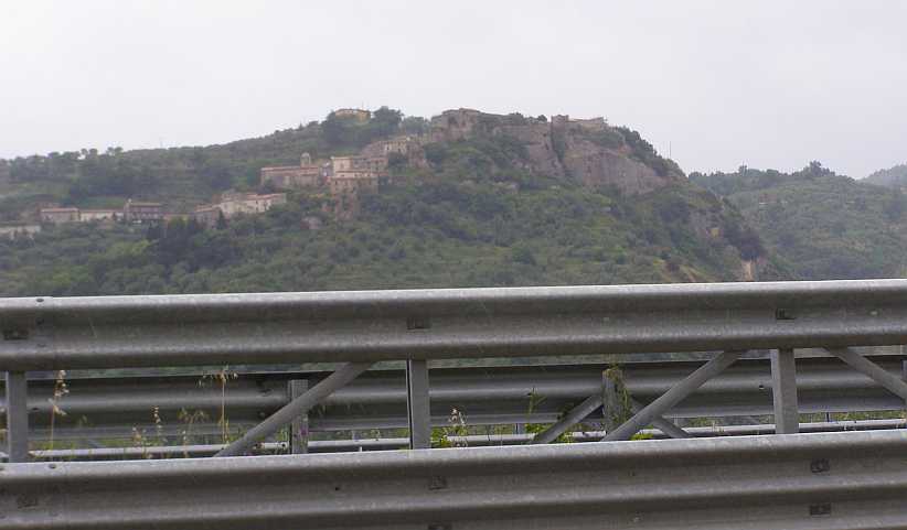
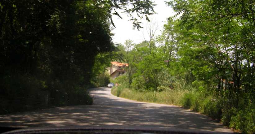
Last look at Gerace. Going to Gerace was a bit of an eye-opener. Now we saw our last of it as we headed along the Autostrada (or is that �Strada Statale�?) to start the drive to our next destination.
Now we were on our way, the Strada took us quickly to the top side of the �boot� and we then swung North, with our next turning being towards the North-East as we joined the next Strada Statale which headed to Trebisacce. This is a town on the coast in what might be called the arch of the �boot�.
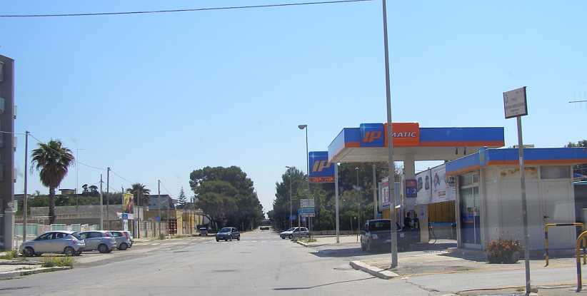
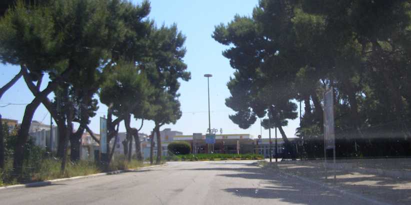
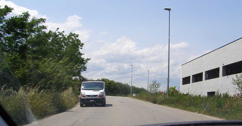
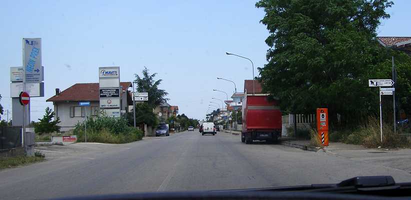
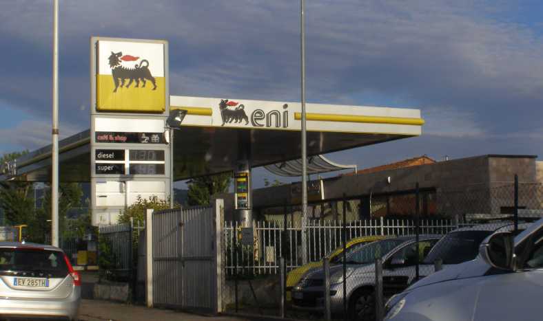
Along the way we had to refuel�
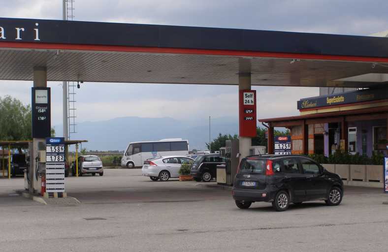
Another service station. An inescapable stop along the way despite the economy of the little turbocharged diesel engine in the Peugeot.
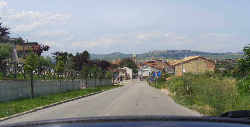
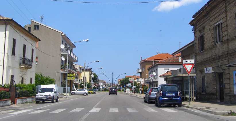
�but soon we reached the coast and began to see more and more coastal towns which seem to thrive on tourists in season.
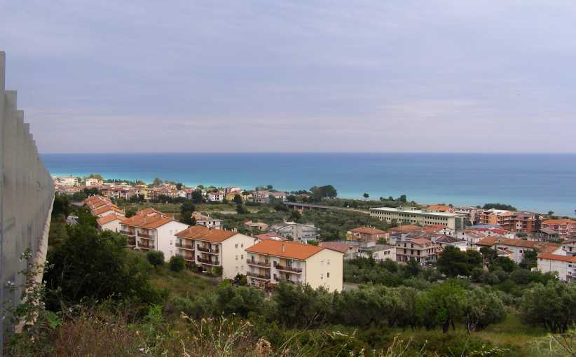
Trebisacce. Apartment buildings and a new school are evident in this picture as the popularity of living in or visiting this part of the coast has grown over the decades.
Along the way we were to go past a very well-preserved castle, this is the Castello Fredericiano which is a restaurant today:
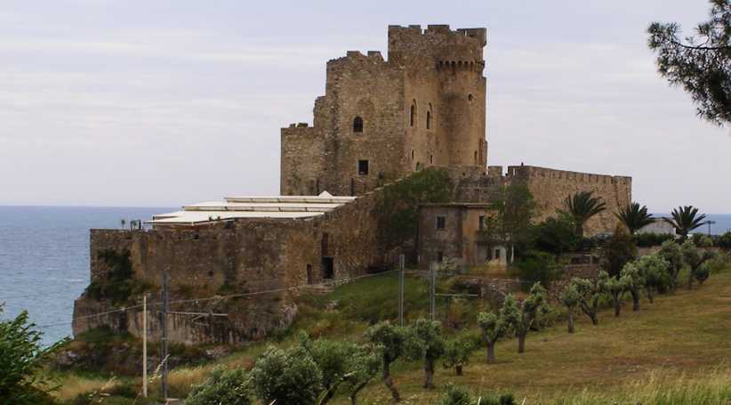
Castello Fredericiano. Now a restaurant, and with some newer structures behind those ancient walls, this castle holds a prominent place not far along from Trebisacce.
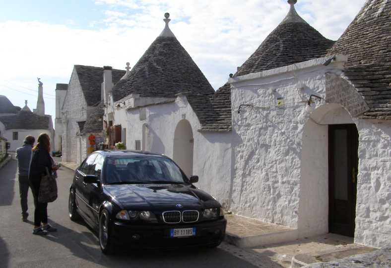
We weren�t wasting any time here, however, we were just enjoying a smooth run along the Stradas towards Taranto, where we turned to go to the ancient Alberobello. The story we were told was that the homes in the town were built without mortar so they could be dismantled and reassembled�
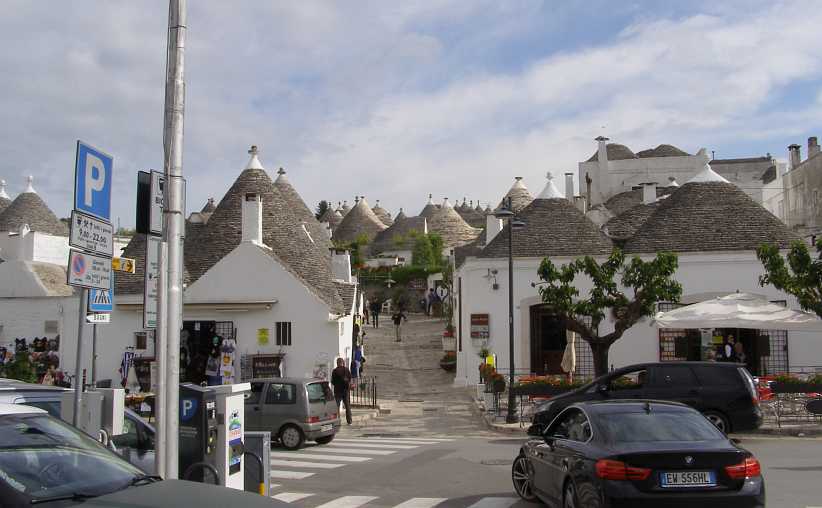
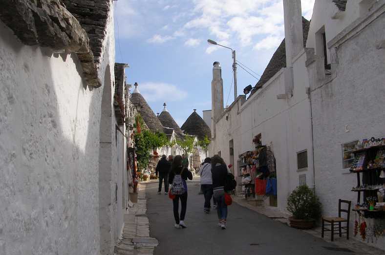
Alberobello. Obviously popular with tourists, this is the entry to the town where mortar wasn�t used to bind the rocks together as they built.
The reason for this was, we were told, because tax collectors would come annually to collect a tax payable for every permanent dwelling. This story, however, is not necessarily supported by website descriptions that I have found and it seems this kind of construction is not unusual across a wide area.
Here are more pictures:
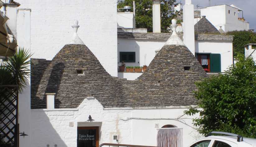
Roofbuilders. [i]The buildings are known by the name �Trulli�. And while anyone could stack rocks to make a wall, it�s the method used to build the roof that stands out.
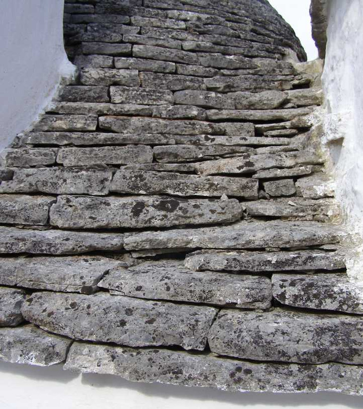
Close up. The dual needs of the roof structure are to keep out the rain and to support its own weight. No doubt careful planning was involved.
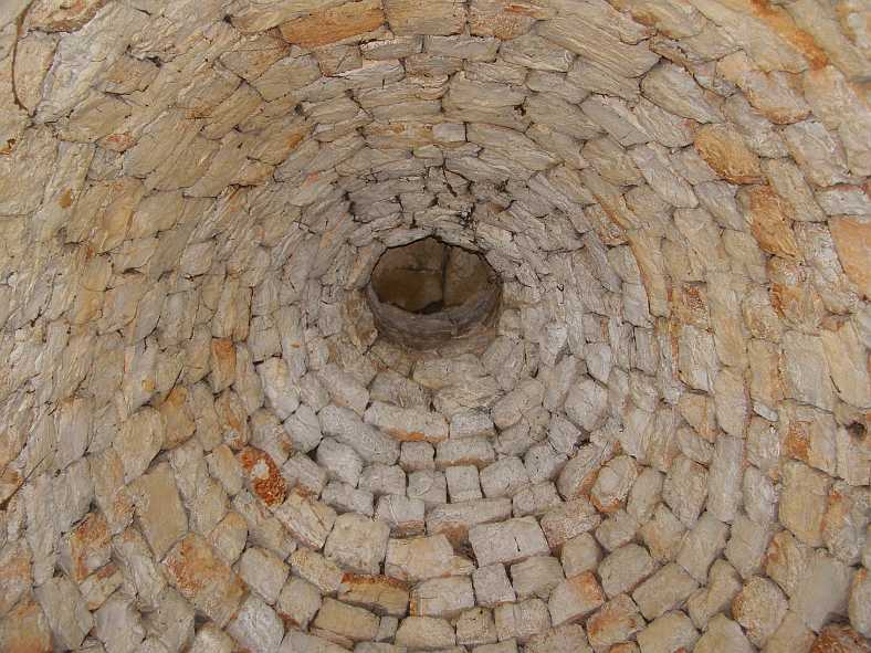
Inside structure. Looking up into the conical roof of this one shows that there must be a double layer of stones in the roof structure.
We walked around looking in wonderment of what we were seeing. There were various homes open and you could walk inside, usually for a commercial purpose. Like this one:
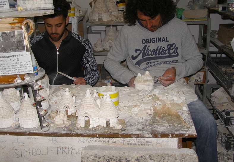
Model marketing. These souvenirs didn�t appeal to us, but no doubt some buy them. The young people here didn�t seem too enthusiastic either.
And for those of us who were keen to find out just how they built these places:
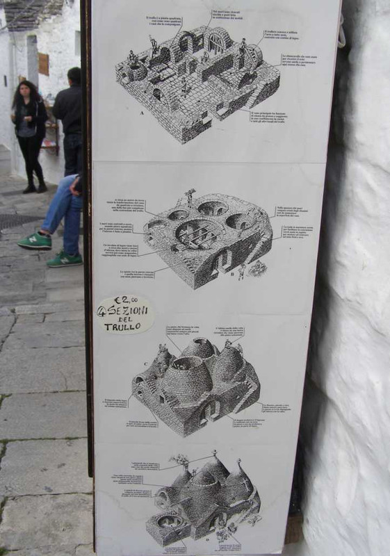
Building diagram. They have taken the trouble to display diagrams and explanations of how it was done.
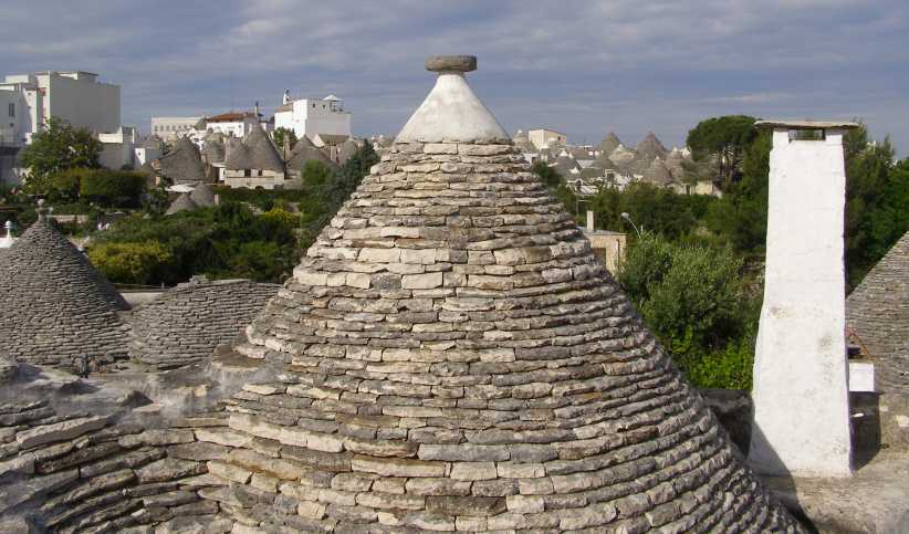
Capped off. The pointed top of the cones usually had some kind of cap on them, and here cement was used to bind it in place. This photo also shows how far the buildings spread in the background.
Vendors everywhere. I have no idea what all the vendors were selling as we weren�t in the market. Postcards and souvenirs are logical guesses, but it looks like more than that.
Business-as-usual could be seen, too. As tourists flock into places like this there is always a string of businesses which are set up to ease the Euros out of their wallets. This one had one of the most complex roof structures of all:
Trattoria. Visitors might need some lunch, a pizza or a drink, somebody has to take care of these needs.
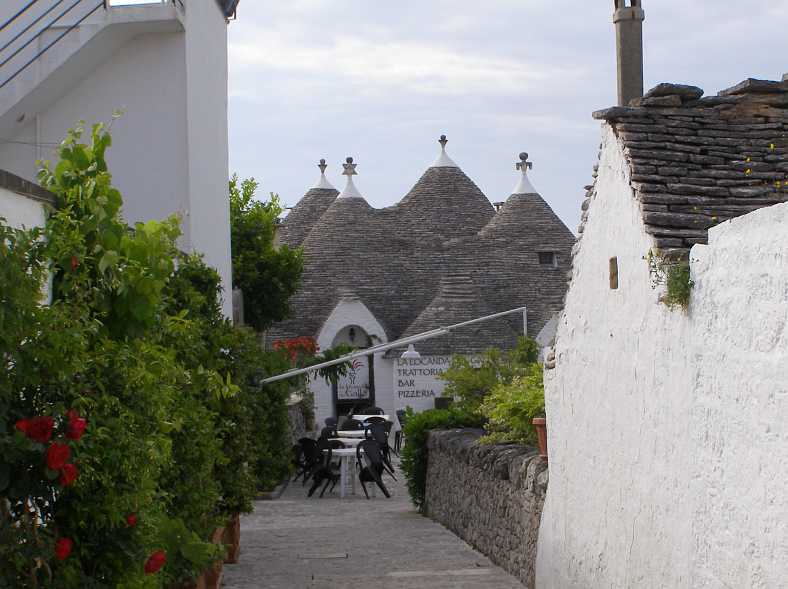
Another thing we noticed was the liking many had for religious symbols on their roof. Yes, people do live here in some of the homes, some of them are available for short stays, and it appears that some of the people who live here like to appeal to various gods:
Residence and symbolism. The car parked in the street would represent either a resident or a paying visitor. The symbol on the roof to the left is for a sun god, the one above the car is supposedly christian.
There were plenty of these, working out what they all are might be difficult, however�
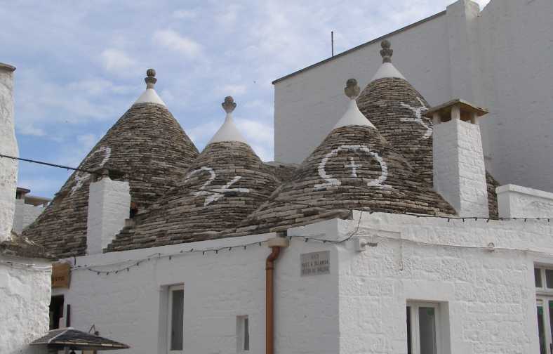
More symbols. Given the wide spread of people involved, over the years including marauding raiders of many backgrounds, it�s no wonder these symbols are diverse.
And so we wrapped up our time in Alberobello, I think Sandra enjoyed this little interlude as it was very different to anything we�d seen elsewhere and much neater than the ruins we�d inspected at Gerace. Now we fired up the 208 for the run to Bari.
Along the way we saw some very old olive trees. These poor gnarled old trees were being either ripped out or cut off to make way for something else, but they were still of interest to us. Olive trees grow for as many as 2,000 years and the older ones present a gnarled appearance as do these.
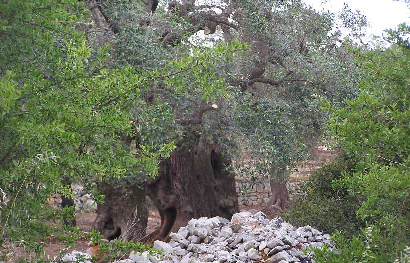
Olive tree. No doubt this one has produced its fair share of olives, its huge and very twisted trunk indicating that it�s many hundreds of years old.
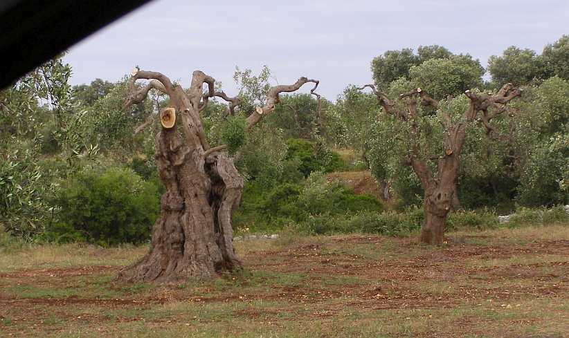
Olive trees cut down. It seemed somewhat sad to see these trees cut off like this. They have probably served their masters well over many years.
And on to Bari we drove. It was still daylight when we got there and we located a good hotel where we could get some rest, and particularly Sandra could give her body a break, before Sunday brought more new sights. And, hopefully, as interesting and pleasant a day as this one had been.
For me it was now time to go online and find the maps of the circuit used by the Grand Prix racers who ran here in the forties and fifties...
Now we were to head there, and then on to nearby Bari, another one of the many towns in Europe where motor racing was once conducted on public roads. So our path for the day:
This meant, of course, a parting with Vince and Mary. They had been wonderful hosts and helped us greatly at a difficult time, all the while ensuring that our needs were met fully. But such partings are repeated many times on trips like this.
Goodbye to Vince and Mary. This farewell picture of them beside their everyday car belies the fact that in the garage was a much more sporting Alfa Romeo. Nor surprise when you look at Vince�s background.
We were packed and ready to drive, and as we were leaving the area we snapped a couple of pics:
Bulding on the hill. There are ruins up there, but alongside of them a huge building is being constructed. No space is wasted.
Last look at Gerace. Going to Gerace was a bit of an eye-opener. Now we saw our last of it as we headed along the Autostrada (or is that �Strada Statale�?) to start the drive to our next destination.
Now we were on our way, the Strada took us quickly to the top side of the �boot� and we then swung North, with our next turning being towards the North-East as we joined the next Strada Statale which headed to Trebisacce. This is a town on the coast in what might be called the arch of the �boot�.
Along the way we had to refuel�
Another service station. An inescapable stop along the way despite the economy of the little turbocharged diesel engine in the Peugeot.
�but soon we reached the coast and began to see more and more coastal towns which seem to thrive on tourists in season.
Trebisacce. Apartment buildings and a new school are evident in this picture as the popularity of living in or visiting this part of the coast has grown over the decades.
Along the way we were to go past a very well-preserved castle, this is the Castello Fredericiano which is a restaurant today:
Castello Fredericiano. Now a restaurant, and with some newer structures behind those ancient walls, this castle holds a prominent place not far along from Trebisacce.
We weren�t wasting any time here, however, we were just enjoying a smooth run along the Stradas towards Taranto, where we turned to go to the ancient Alberobello. The story we were told was that the homes in the town were built without mortar so they could be dismantled and reassembled�
Alberobello. Obviously popular with tourists, this is the entry to the town where mortar wasn�t used to bind the rocks together as they built.
The reason for this was, we were told, because tax collectors would come annually to collect a tax payable for every permanent dwelling. This story, however, is not necessarily supported by website descriptions that I have found and it seems this kind of construction is not unusual across a wide area.
Here are more pictures:
Roofbuilders. [i]The buildings are known by the name �Trulli�. And while anyone could stack rocks to make a wall, it�s the method used to build the roof that stands out.
Close up. The dual needs of the roof structure are to keep out the rain and to support its own weight. No doubt careful planning was involved.
Inside structure. Looking up into the conical roof of this one shows that there must be a double layer of stones in the roof structure.
We walked around looking in wonderment of what we were seeing. There were various homes open and you could walk inside, usually for a commercial purpose. Like this one:
Model marketing. These souvenirs didn�t appeal to us, but no doubt some buy them. The young people here didn�t seem too enthusiastic either.
And for those of us who were keen to find out just how they built these places:
Building diagram. They have taken the trouble to display diagrams and explanations of how it was done.
Capped off. The pointed top of the cones usually had some kind of cap on them, and here cement was used to bind it in place. This photo also shows how far the buildings spread in the background.
Vendors everywhere. I have no idea what all the vendors were selling as we weren�t in the market. Postcards and souvenirs are logical guesses, but it looks like more than that.
Business-as-usual could be seen, too. As tourists flock into places like this there is always a string of businesses which are set up to ease the Euros out of their wallets. This one had one of the most complex roof structures of all:
Trattoria. Visitors might need some lunch, a pizza or a drink, somebody has to take care of these needs.
Another thing we noticed was the liking many had for religious symbols on their roof. Yes, people do live here in some of the homes, some of them are available for short stays, and it appears that some of the people who live here like to appeal to various gods:
Residence and symbolism. The car parked in the street would represent either a resident or a paying visitor. The symbol on the roof to the left is for a sun god, the one above the car is supposedly christian.
There were plenty of these, working out what they all are might be difficult, however�
More symbols. Given the wide spread of people involved, over the years including marauding raiders of many backgrounds, it�s no wonder these symbols are diverse.
And so we wrapped up our time in Alberobello, I think Sandra enjoyed this little interlude as it was very different to anything we�d seen elsewhere and much neater than the ruins we�d inspected at Gerace. Now we fired up the 208 for the run to Bari.
Along the way we saw some very old olive trees. These poor gnarled old trees were being either ripped out or cut off to make way for something else, but they were still of interest to us. Olive trees grow for as many as 2,000 years and the older ones present a gnarled appearance as do these.
Olive tree. No doubt this one has produced its fair share of olives, its huge and very twisted trunk indicating that it�s many hundreds of years old.
Olive trees cut down. It seemed somewhat sad to see these trees cut off like this. They have probably served their masters well over many years.
And on to Bari we drove. It was still daylight when we got there and we located a good hotel where we could get some rest, and particularly Sandra could give her body a break, before Sunday brought more new sights. And, hopefully, as interesting and pleasant a day as this one had been.
For me it was now time to go online and find the maps of the circuit used by the Grand Prix racers who ran here in the forties and fifties...
Last edited by Ray Bell; Feb 20, 2020 at 08:11 AM.
Thread Starter
|
Captain
Joined: Oct 2005
Posts: 570
Likes: 8
From: The Summit, Queensland, Australia
And our bunk for the night was in the Hotel Rondo...
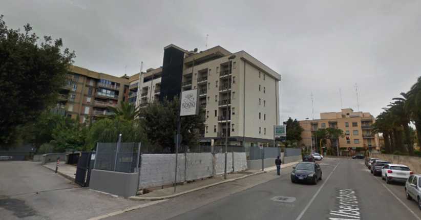
Hotel Rondo. Google Earth Street View produces this picture of the Hotel Rondo, but a couple of years after we were there. The construction work going on wasn't happening at that time. It was a nice place to stop for the night.
As I looked toward the coming days, the continuation of the trip I'd be making without Sandra, I knew I'd be 'roughing it' and not seeing much of hotels like this at all. But that was me, Sandra is another case and needed her comfort.
By the way, one of the things I learned in Italy was that you can't count on being able to use McDonalds Wi-Fi. If you don't have an Italian phone number for them to confirm your log-in you can forget about it.
Thread Starter
|
Captain
Joined: Oct 2005
Posts: 570
Likes: 8
From: The Summit, Queensland, Australia
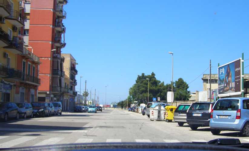
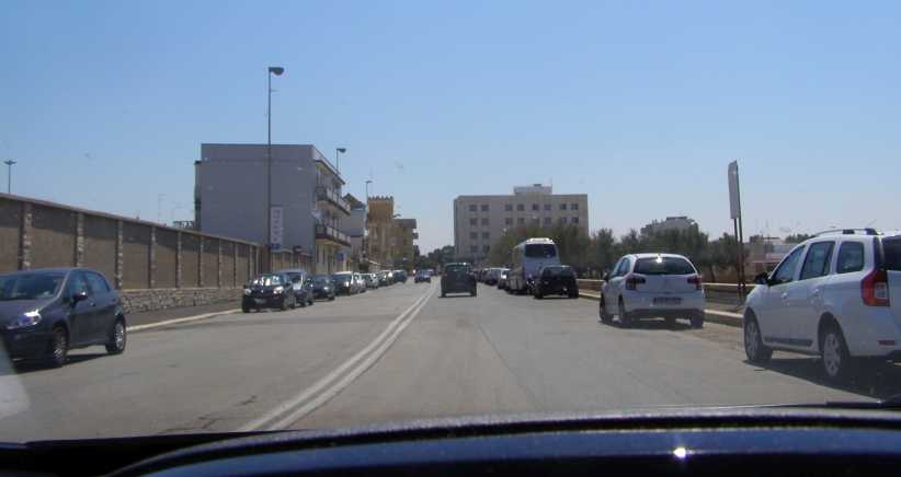
We had a quiet morning in Bari. Well, how quiet can it be in Italy?
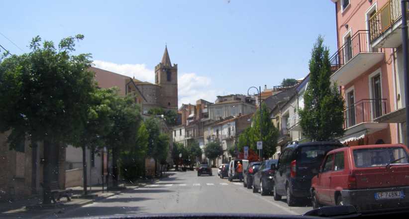
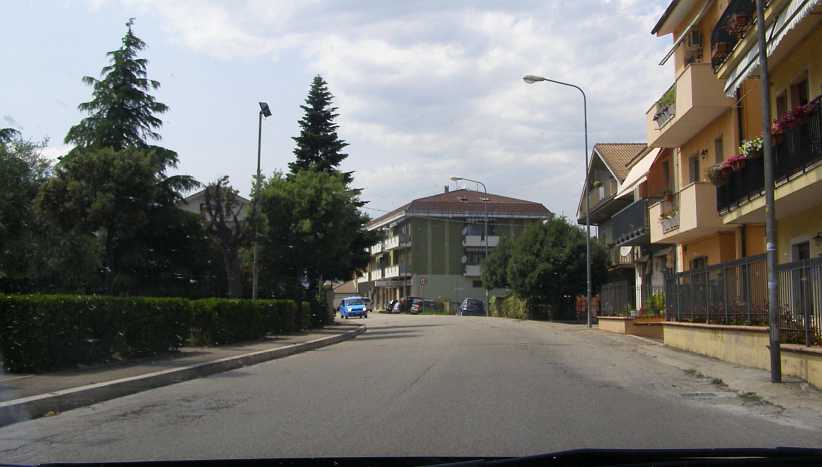
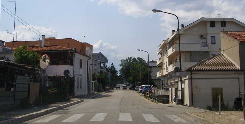
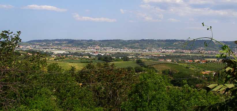
Taking a walk through town we did meet some people who spoke English and had some time talking with them. Like any other Italian city, it’s a busy place:
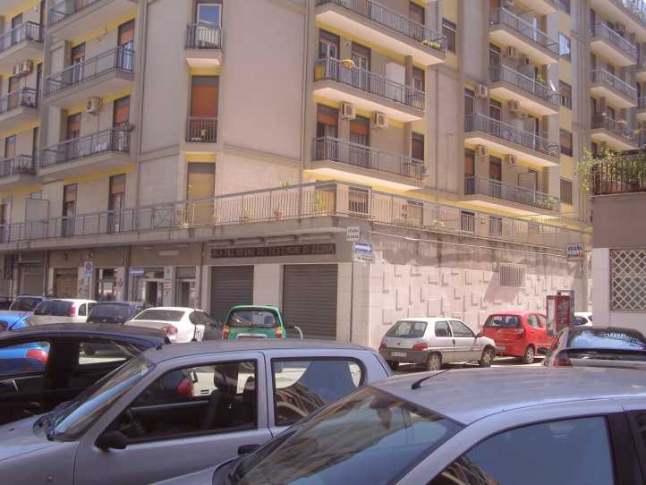
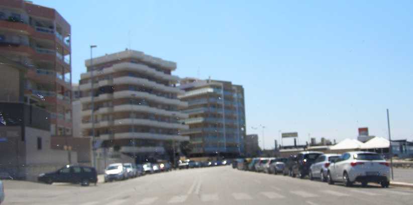
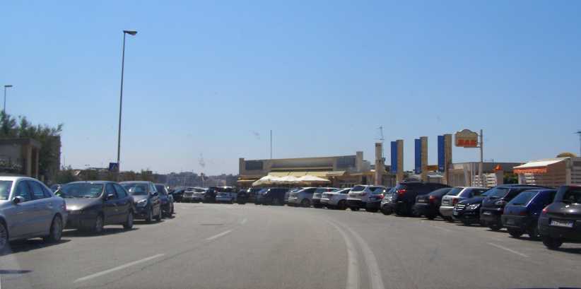
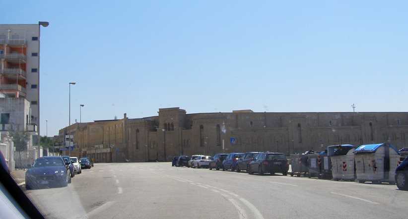
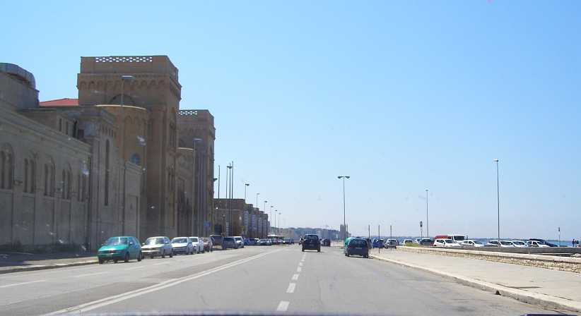
Busy Bari. Cars parked everywhere, high-rise apartments, typical of the busy nature of modern Italy.
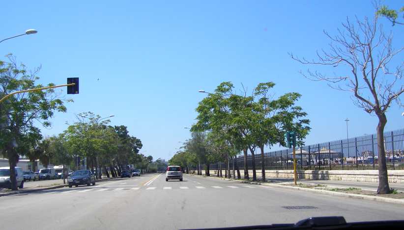
After that we went for a drive around the old circuit. It was known as the Circuito del Lungomare, which effectively means ‘Circuit of the Seafront’, it was over three miles (5kms) long and certainly covered a part of the ‘seafront’ just outside the harbour/shipping port that is clearly an important part of the city. This circuit was used from 1947 to 1956.
We began our drive at the part which departs from the water, a long straight which would have seen a fair speed from the Alfa Romeo 158/159s, the 4.5-litre Ferrari Grand Prix cars of 1951, and even from the sports cars for which the Grand Prix was run a couple of the years.
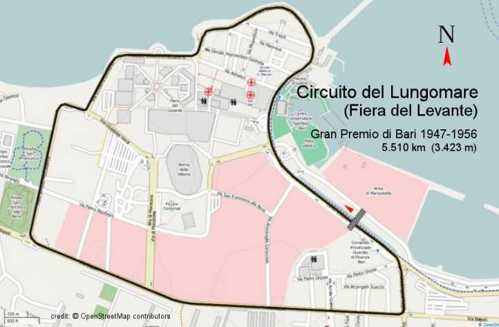
Circuit map. Adjacent to the port and near the city centre, the circuit takes in much of the tourist area of Bari.
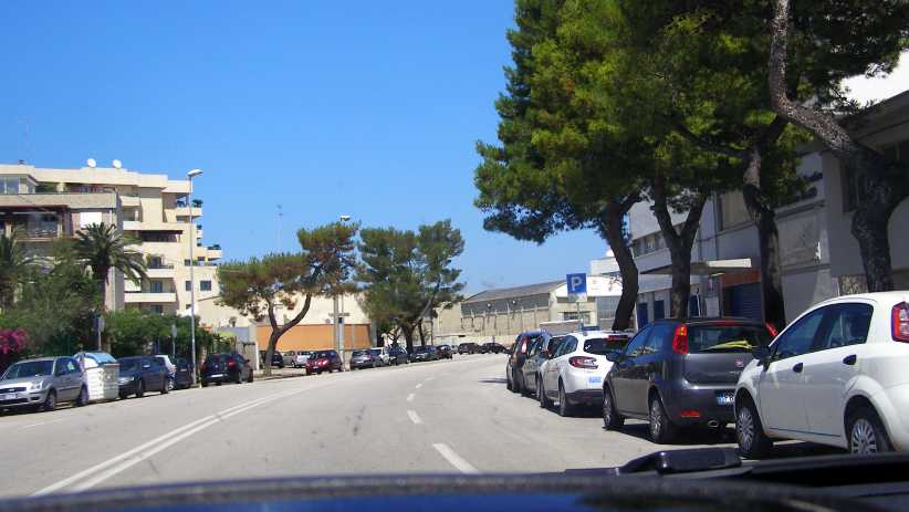
So we’re beginning on the medium-length straight to the left of the map:
That leads to the intersection with Via Napoli, with a triangular traffic island:
The Via Napoli leg is really fast, well over a mile with a flat-out kink in the middle...
A tight bend sends the cars towards the water at the port end...
Then a quick run towards the long right hand curve, this is the original start and finish area:
And here’s that sweeping curve to the right...
…which leads to a left hand sweeper…
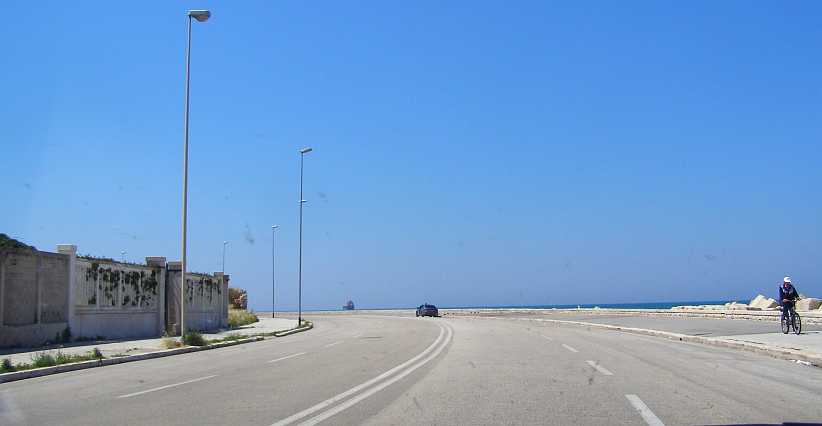
…which keeps on turning to the left past the seafront and holiday units…
…and the beach area:
Then a tighter turn to the right, to run past the Fiera Del Lavant trade fair centre…
…which is a fairly imposing place:
Turning left from there we head towards…
…the imposing Hotel Mari 7.
A short straight then leads to a left turn back onto the Via Saverio Mercadante where we began:
Somewhere along the way I spotted the van which carried this signage:
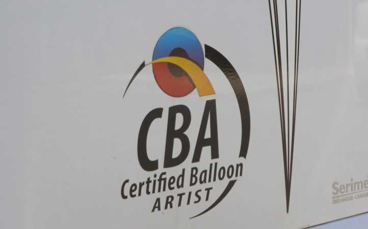
Balloon artist. I don’t think those letters would stand for those words back home.
I thought it was strange, anyway. But on this fine and pleasant Sunday afternoon we then started heading North with a view to be somewhere close to Pescara by the end of the day. Pleasant touring with some typical Italian scenery. Here's the day's map:
As I drove, I noticed something strange. Along this road, and on both sides of the road, there were occasional lay-bys so people could pull up if, perhaps, they were having problems with their car. In each case, the Armco was led back away from the edge of the road, there was enough space for a few cars to pull up, then the Armco would feed back to the edge. This is one (thanks to Google Earth):
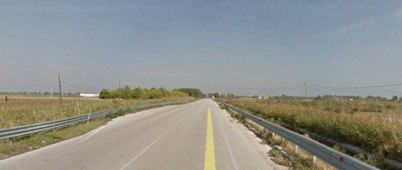
Laybys. Frequently seen along the stretch of Strada North of Bari, room to pull up if in trouble.
Some of these were occupied. Not by cars, but by young ladies sitting on a chair. In some cases the chair was there and no lady was present. Inevitably the young ladies were dressed in tight slacks and evocative tops, it had me intrigued until I sorted it out in my mind.
Of course, it’s possible that Sandra had already worked it out and didn’t mention it to me. By the time we got around to discussing it we’d been past the last of them.
But you never see the last of these:
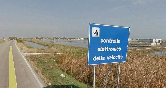
Big Brother. Another from Google Earth, a reminder that you are being watched wherever you are in the world!
On we drove, and around the sun went on its never-ending arc of travel. As it was heading further West and getting a bit low we drove into a little place called Termoli and looked for somewhere. This place looked like it was all closed up, but we checked it out:
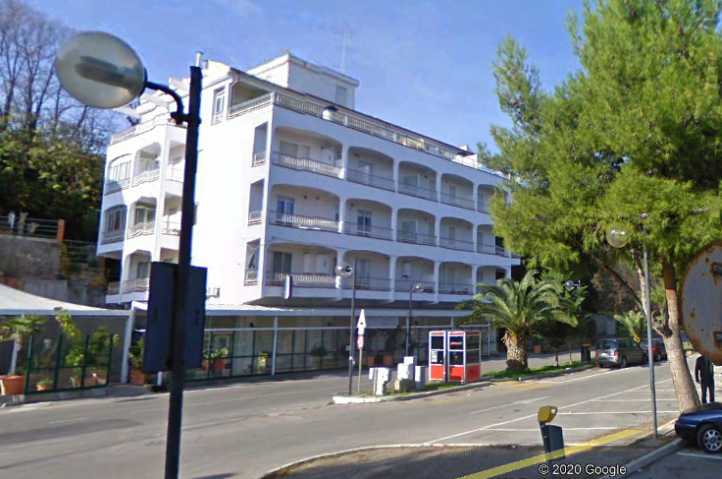
Hotel Georgione. The facade gives the impression that the place is closed off, but they were indeed open for business. This was our home for the night.
And then we took a walk over on the sands of the beach across the way. This is the view from our room on the third floor:
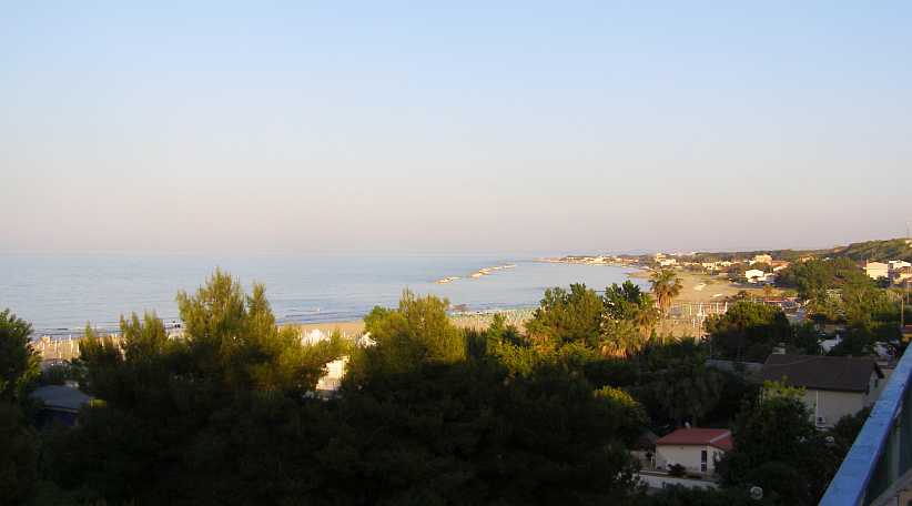
View of beach. Our room afforded us good views of the Termoli waterfront, including the beach and the port area.
It didn’t take long to graduate from looking at the sea to walking down to it.
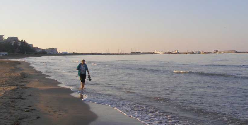
Sandra and the ships. Sandra just couldn’t wait to get her feet wet, she is something of a water-baby and had not been near water since the day she spent on her own at Ventimiglia a week earlier. In the background is the port with a ship in dock.
It was good, I thought, that she had this chance to relax and feel the water around her feet. She certainly looked like she was enjoying it as I looked around the beach at other things...
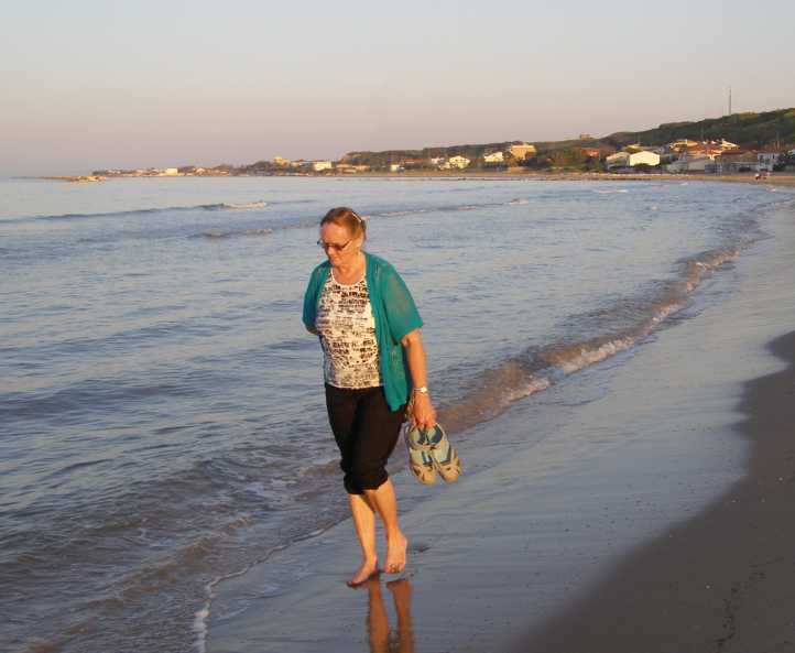
Sandra in the Adriatic. Having dipped her feet into the Bay of Biscay and then the sea at Ventimiglia, this meant that the trip had given her three seas she could say she’d been wet in.
In particular I was looking at the beach being developed to provide for an onslaught of visitors as the weather warmed up and people started heading to the coast for vacations.
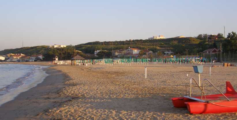
Beach umbrellas. Thousands of them! Another thing very much unlike home, where you take your own umbrella to the beach and set up anywhere you choose. The area nearer to us in this pic was having another large number of umbrellas prepared for the onset of the tourist season.
We had time to relax over a meal and get a good sleep. This part of the whole trip was probably the most leisurely and on the next day I would be getting to go around yet another circuit, this one a very special one, the longest circuit ever used for a World Championship Grand Prix.
Very different to the Bari circuit, a throwback to earlier times, combining some of Monaco, some of the Targa Florio and a lot of Italian enthusiasm, as might be seen in this recent post from the Nostalgia Forum:
This was to be my next circuit exploration and I was really looking forward to it. That night I checked maps online so I would know where I had to go...
Taking a walk through town we did meet some people who spoke English and had some time talking with them. Like any other Italian city, it’s a busy place:
Busy Bari. Cars parked everywhere, high-rise apartments, typical of the busy nature of modern Italy.
After that we went for a drive around the old circuit. It was known as the Circuito del Lungomare, which effectively means ‘Circuit of the Seafront’, it was over three miles (5kms) long and certainly covered a part of the ‘seafront’ just outside the harbour/shipping port that is clearly an important part of the city. This circuit was used from 1947 to 1956.
We began our drive at the part which departs from the water, a long straight which would have seen a fair speed from the Alfa Romeo 158/159s, the 4.5-litre Ferrari Grand Prix cars of 1951, and even from the sports cars for which the Grand Prix was run a couple of the years.
Circuit map. Adjacent to the port and near the city centre, the circuit takes in much of the tourist area of Bari.
So we’re beginning on the medium-length straight to the left of the map:
That leads to the intersection with Via Napoli, with a triangular traffic island:
The Via Napoli leg is really fast, well over a mile with a flat-out kink in the middle...
A tight bend sends the cars towards the water at the port end...
Then a quick run towards the long right hand curve, this is the original start and finish area:
And here’s that sweeping curve to the right...
…which leads to a left hand sweeper…
…which keeps on turning to the left past the seafront and holiday units…
…and the beach area:
Then a tighter turn to the right, to run past the Fiera Del Lavant trade fair centre…
…which is a fairly imposing place:
Turning left from there we head towards…
…the imposing Hotel Mari 7.
A short straight then leads to a left turn back onto the Via Saverio Mercadante where we began:
Somewhere along the way I spotted the van which carried this signage:
Balloon artist. I don’t think those letters would stand for those words back home.
I thought it was strange, anyway. But on this fine and pleasant Sunday afternoon we then started heading North with a view to be somewhere close to Pescara by the end of the day. Pleasant touring with some typical Italian scenery. Here's the day's map:
As I drove, I noticed something strange. Along this road, and on both sides of the road, there were occasional lay-bys so people could pull up if, perhaps, they were having problems with their car. In each case, the Armco was led back away from the edge of the road, there was enough space for a few cars to pull up, then the Armco would feed back to the edge. This is one (thanks to Google Earth):
Laybys. Frequently seen along the stretch of Strada North of Bari, room to pull up if in trouble.
Some of these were occupied. Not by cars, but by young ladies sitting on a chair. In some cases the chair was there and no lady was present. Inevitably the young ladies were dressed in tight slacks and evocative tops, it had me intrigued until I sorted it out in my mind.
Of course, it’s possible that Sandra had already worked it out and didn’t mention it to me. By the time we got around to discussing it we’d been past the last of them.
But you never see the last of these:
Big Brother. Another from Google Earth, a reminder that you are being watched wherever you are in the world!
On we drove, and around the sun went on its never-ending arc of travel. As it was heading further West and getting a bit low we drove into a little place called Termoli and looked for somewhere. This place looked like it was all closed up, but we checked it out:
Hotel Georgione. The facade gives the impression that the place is closed off, but they were indeed open for business. This was our home for the night.
And then we took a walk over on the sands of the beach across the way. This is the view from our room on the third floor:
View of beach. Our room afforded us good views of the Termoli waterfront, including the beach and the port area.
It didn’t take long to graduate from looking at the sea to walking down to it.
Sandra and the ships. Sandra just couldn’t wait to get her feet wet, she is something of a water-baby and had not been near water since the day she spent on her own at Ventimiglia a week earlier. In the background is the port with a ship in dock.
It was good, I thought, that she had this chance to relax and feel the water around her feet. She certainly looked like she was enjoying it as I looked around the beach at other things...
Sandra in the Adriatic. Having dipped her feet into the Bay of Biscay and then the sea at Ventimiglia, this meant that the trip had given her three seas she could say she’d been wet in.
In particular I was looking at the beach being developed to provide for an onslaught of visitors as the weather warmed up and people started heading to the coast for vacations.
Beach umbrellas. Thousands of them! Another thing very much unlike home, where you take your own umbrella to the beach and set up anywhere you choose. The area nearer to us in this pic was having another large number of umbrellas prepared for the onset of the tourist season.
We had time to relax over a meal and get a good sleep. This part of the whole trip was probably the most leisurely and on the next day I would be getting to go around yet another circuit, this one a very special one, the longest circuit ever used for a World Championship Grand Prix.
Very different to the Bari circuit, a throwback to earlier times, combining some of Monaco, some of the Targa Florio and a lot of Italian enthusiasm, as might be seen in this recent post from the Nostalgia Forum:
Originally posted by Doug Nye
1937 Coppa Acerbo, Pescara:
 [/b]
[/b]
1937 Coppa Acerbo, Pescara:
[/b]
Last edited by Ray Bell; Jul 4, 2020 at 08:03 AM.
Thread Starter
|
Captain
Joined: Oct 2005
Posts: 570
Likes: 8
From: The Summit, Queensland, Australia
May 23, 2016, and our days together in Italy were rapidly drawing to a close. It was Monday and Sandra was to fly out on Wednesday, we decided that we would go to somewhere not too far from Rome and spend a couple of quiet days together. Ultimately we found Avezzano, in the mountains in the centre of the country:
But we had to get there first and I had a long-held desire to drive around the Coppa Acerbo circuit at Pescara. Over fifteen miles of public roads with a history dating back to 1924, the Coppa Acerbo race was named after Tito Acerbo by his brother, Giacomo. Tito was a WW1 war hero and Giacomo was a teacher who grew in political influence under Mussolini before being part of a group which opposed him and wanted to get Italy out of Hitler’s war.
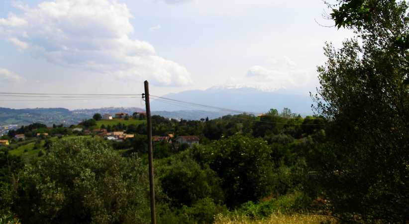
We were a little over 100kms South of Pescara, so there were sights to be seen on the way there…
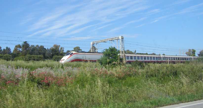
Fast train. Driving along the coast we saw this high-speed train in time to get a pic of it.
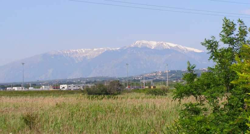
Snow on mountains. Probably the Focalone Mountains, this snow-capping was a great sight to see in late May.
Taking note of the different ways of doing things, we noticed a few of these as we followed a road which ran alongside the railway and clung to the coastline:
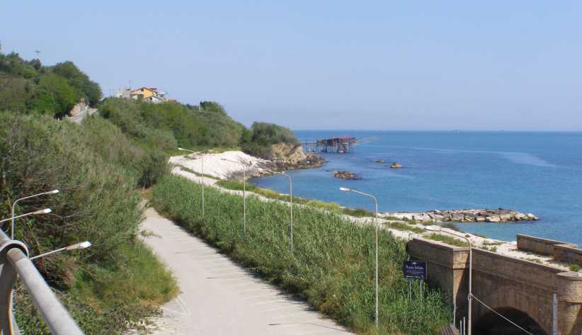
Fishing and old railway. Several of these fishing jetties came into our sight, this one being built out from a small cape where the old railway has been cut through the hill.
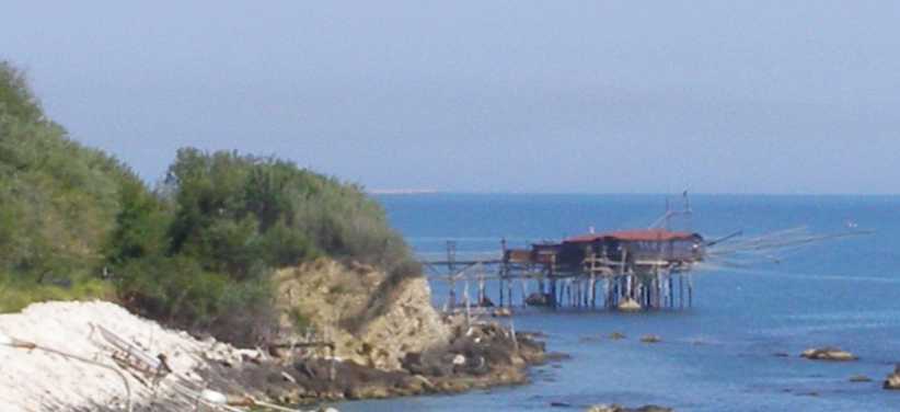
A closer look. There is probably thousands of years of history behind this kind of fishing, the catch no doubt feeding people for miles around.
It wasn’t all that long before we reached Pescara. I had done my internet research to help me find the circuit overnight, but I needed a decent map of the city to find my way as it was clear that there were many alternative roads and streets which could have been involved. The railway station was huge and we pulled in there to see if we could get one:
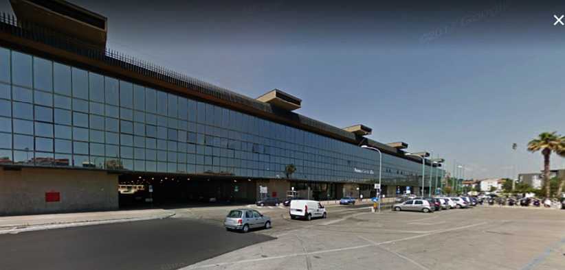
Pescara Railway Station. A huge place, this pic from Google Earth street view shows how imposing the station is.
But I wasn’t real happy with what we could find and expected I’d have trouble following it all in the city and maybe in some of the villages through which the races passed. Here’s a map similar to what I found on the internet the night before:
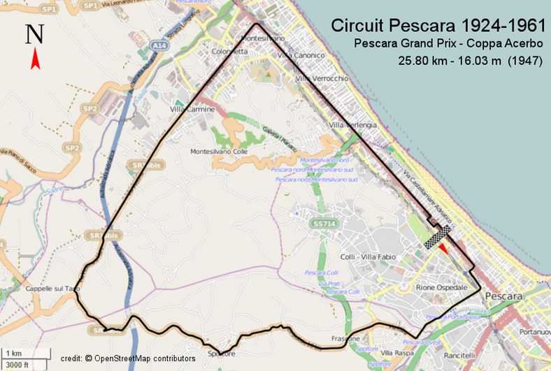
Pescara circuit map. The longest circuit ever used for a World Championship Grand Prix event, this circuit remained almost unchanged from 1924 until 1961 – with the exception of road improvements, of course – and was lapped at over 98mph average by Stirling Moss in 1957.
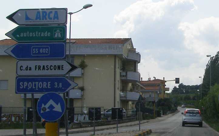
We drove around the station to the road I expected would be the one which started the run out of the city. I kept driving and trying to navigate by the maps I had until I got to Spoltore, and then I knew I was on the right road and could start taking photographs. Of course, a 15+ mile circuit I’m not going to put up the photos of the whole course, but enough to give a good idea of what it was like.
In Spoltore. We’re near the highest point on the circuit here, over 180m elevation, and tall buildings line the road.
Curve. Being built on a hill, Spoltore’s road system has plenty of curves.
More Spoltore. The echoes of exhausts of racing cars must have thrilled thousands lining the streets here in the centre of Spoltore.
Over the crest. And this twist over a crest would have thrilled the drivers!
Climb and twist. It would have been hard work to maintain speed in this section, where the road climbs, drops, twists and turns out of Spoltore.
Another village. Villages are dotted along the course. In the day the enthusiasm of the Italian crowds would have had everyone on the edge of the road to watch.
More heights. Descending and then climbing again, this is another crest being reached.
Down the other side. Steeply down, in fact, tight corners here come one after another.
Hairpin and monument. This steep pinch is followed by a hairpin, but to the right is a monument celebrating the Coppa Acerbo.
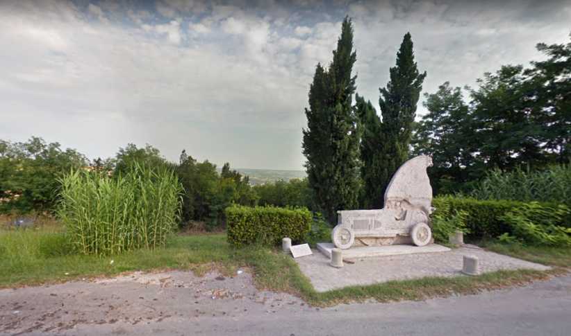
Monument. A better view of the monument from Google Earth. I’m not sure what the animal is, maybe a seal? If anyone knows, please let us also share. Note the view from this high point.
Tight left. The tightness of this section is shown by this corner after the hairpin.
More bends. Like the Targa Florio, the bends on this section just keep coming.
Local flavour. A produce stall opposite a big home (built to take advantage of the view) give this pic a fresh flavour.
Capelle sul Tuvo. Another village comes into view and we know we’ve reached the point most distant from Pescara.
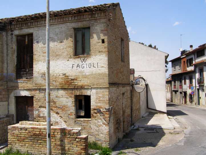
Writing on the wall. I don’t know if this graffiti had anything to do with racing driver Luigi F agioli, but I imagine it did.
Luigi Fa gioli was known as the “Abruzzi Robber” and came originally from Osimo, about 100kms North of Pescara. The ‘Abruzzi’ name might tie him to the mountainous regions South West of Pescara. He was born in 1898, so that gave him a few distinctive features in his life’s motor racing history.
He started racing in 1926 and by 1930 he was in the Maserati team. He won a number of races for that team, and then went to the Ferrari-managed Alfa Romeo team, winning the Coppa Acerbo for them among other races. In 1934 when Mercedes-Benz went Grand Prix racing again they hired him and he had another Coppa Acerbo win with them.
At times he was able to beat the two stand-out Italian drivers of the period, Archille Varzi and Tazio Nuvolari, but in 1936 he was weakened by a severe attack of rheumatism which affected him until the early post-war years. Then he became a member of the ‘Three Fs’ team of Alfa Romeo drivers in the near-invincible 158 and 159 Alfas which swept (almost) all before them in 1950 and 1951.
At the age of 53 he won the 1951 French Grand Prix, sharing his Alfa with Juan Manuel Fangio, and so he became the oldest winner of a World Championship race. And the only winner of such a race born outside the 20th century. But he died in a minor crash at Monaco in 1952 aged 54.
Hairpin sign. As the racers left Cappelle sul Tavo they had two sharp bends to negotiate, approached via this steep downhill run.
Here we see another feature of the circuit. The growth of the area after World War 2 and particularly since the 1950s means that a lot of homes and buildings along the course were not there when racing took place. This is most evident later in the main drag through the city.
Hairpin entry. It’s a very tight descending left-hander here, many would have had fading brakes already as they came to this point. And another follows it to the right.
More downhill. No more hairpins but the downhill curves kept coming…
Near the bottom. Relief is in sight as the descent nears its end. Drivers knew they’d be able to relax shortly.
Along the long straight. It’s four miles along here, under one Autostrada and between a growing number of buildings. One kink breaks the monotony.
There was a ‘flying kilometre’ along this stretch which took speed readings of cars as they came through. Some were going as fast as 190mph with Fangio doing 192mph in his Alfa 158/9 in 1950.
End in sight. Coming to the end of the straight at Montesilvano.
At this point I was in trouble finding the right way. It was more or less up the main road with a diversion for a chicane to slow the cars before the pit area, but my maps were inadequate and I didn’t get to follow it accurately. This, however, is typical of what it looks like in that area:
Pescara built up. Typical of the city area, these buildings have mostly been constructed well after racing came to a halt here. The city of Pescara’s growth has been exponential since the fifties.
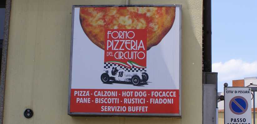
Pizza recollection. This pizza shop pays homage to the old racing days, it’s just around from the railway station and on the corner where the circuit turns to go away from the main city area.
Back on track, I now just had to retrace the steps I’d taken earlier to get to Spoltore. We were both, however, starting to feel the pangs of lunchtime hunger…
More apartments. Heading to the hinterland we started by driving past lots of new apartment buildings.
Roundabouts. There were two roundabouts in this stretch which certainly weren’t there when the racing was held.
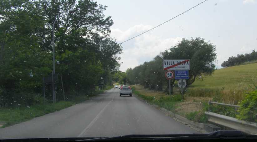
Villa Raspa. Up this hill at Villa Raspa we’re heading to the point where we must turn right to reach Spoltore.
Climbing towards Spoltore. Still surrounded by tall buildings, we proceed through Villa Raspa on our climb.
Just imagine… When I think of seeing those pre-war Mercedes or Auto Unions, or the Alfa 158s or even the Vanwalls accelerating up this hill it make me think it was a great place to spectate.
Over the Autostrada. Another sign of the modern world, we traverse a bridge over the Autostrada to Rome.
3.8kms to Spoltore. At this point we still had two and a half miles to go to Spoltore, still climbing as it’s the high point on the circuit.
Sweeping on. New apartments to the left and an old stone wall to the right, all the character is still there.
Leaving Raspa. Open countryside again as we leave the village, but there are more curves and hills to traverse.
Entering Spoltore. We come to the point where we began our photo session. Spoltore with its buildings along the ridges.
So we were able to stop and buy something for lunch. To Sandra’s relief and a return to earth for me as I struggled to find something which didn’t feature onion or garlic. We soon ate, however, and then looked towards leaving this area and taking some back roads which would put us onto that Autostrada towards Rome.
Last view of the Adriatic. The Eastern side of Italy would be put behind us as we drove away, I snapped this pic of the vista where we looked over olive trees, farms, villages and the city to say goodbye to the Adriatic Sea.
We still had some sightseeing to do this afternoon, but this post is already extraordinarily long and I’ll cover all of that in the next one.
But we had to get there first and I had a long-held desire to drive around the Coppa Acerbo circuit at Pescara. Over fifteen miles of public roads with a history dating back to 1924, the Coppa Acerbo race was named after Tito Acerbo by his brother, Giacomo. Tito was a WW1 war hero and Giacomo was a teacher who grew in political influence under Mussolini before being part of a group which opposed him and wanted to get Italy out of Hitler’s war.
We were a little over 100kms South of Pescara, so there were sights to be seen on the way there…
Fast train. Driving along the coast we saw this high-speed train in time to get a pic of it.
Snow on mountains. Probably the Focalone Mountains, this snow-capping was a great sight to see in late May.
Taking note of the different ways of doing things, we noticed a few of these as we followed a road which ran alongside the railway and clung to the coastline:
Fishing and old railway. Several of these fishing jetties came into our sight, this one being built out from a small cape where the old railway has been cut through the hill.
A closer look. There is probably thousands of years of history behind this kind of fishing, the catch no doubt feeding people for miles around.
It wasn’t all that long before we reached Pescara. I had done my internet research to help me find the circuit overnight, but I needed a decent map of the city to find my way as it was clear that there were many alternative roads and streets which could have been involved. The railway station was huge and we pulled in there to see if we could get one:
Pescara Railway Station. A huge place, this pic from Google Earth street view shows how imposing the station is.
But I wasn’t real happy with what we could find and expected I’d have trouble following it all in the city and maybe in some of the villages through which the races passed. Here’s a map similar to what I found on the internet the night before:
Pescara circuit map. The longest circuit ever used for a World Championship Grand Prix event, this circuit remained almost unchanged from 1924 until 1961 – with the exception of road improvements, of course – and was lapped at over 98mph average by Stirling Moss in 1957.
We drove around the station to the road I expected would be the one which started the run out of the city. I kept driving and trying to navigate by the maps I had until I got to Spoltore, and then I knew I was on the right road and could start taking photographs. Of course, a 15+ mile circuit I’m not going to put up the photos of the whole course, but enough to give a good idea of what it was like.
In Spoltore. We’re near the highest point on the circuit here, over 180m elevation, and tall buildings line the road.
Curve. Being built on a hill, Spoltore’s road system has plenty of curves.
More Spoltore. The echoes of exhausts of racing cars must have thrilled thousands lining the streets here in the centre of Spoltore.
Over the crest. And this twist over a crest would have thrilled the drivers!
Climb and twist. It would have been hard work to maintain speed in this section, where the road climbs, drops, twists and turns out of Spoltore.
Another village. Villages are dotted along the course. In the day the enthusiasm of the Italian crowds would have had everyone on the edge of the road to watch.
More heights. Descending and then climbing again, this is another crest being reached.
Down the other side. Steeply down, in fact, tight corners here come one after another.
Hairpin and monument. This steep pinch is followed by a hairpin, but to the right is a monument celebrating the Coppa Acerbo.
Monument. A better view of the monument from Google Earth. I’m not sure what the animal is, maybe a seal? If anyone knows, please let us also share. Note the view from this high point.
Tight left. The tightness of this section is shown by this corner after the hairpin.
More bends. Like the Targa Florio, the bends on this section just keep coming.
Local flavour. A produce stall opposite a big home (built to take advantage of the view) give this pic a fresh flavour.
Capelle sul Tuvo. Another village comes into view and we know we’ve reached the point most distant from Pescara.
Writing on the wall. I don’t know if this graffiti had anything to do with racing driver Luigi F agioli, but I imagine it did.
Luigi Fa gioli was known as the “Abruzzi Robber” and came originally from Osimo, about 100kms North of Pescara. The ‘Abruzzi’ name might tie him to the mountainous regions South West of Pescara. He was born in 1898, so that gave him a few distinctive features in his life’s motor racing history.
He started racing in 1926 and by 1930 he was in the Maserati team. He won a number of races for that team, and then went to the Ferrari-managed Alfa Romeo team, winning the Coppa Acerbo for them among other races. In 1934 when Mercedes-Benz went Grand Prix racing again they hired him and he had another Coppa Acerbo win with them.
At times he was able to beat the two stand-out Italian drivers of the period, Archille Varzi and Tazio Nuvolari, but in 1936 he was weakened by a severe attack of rheumatism which affected him until the early post-war years. Then he became a member of the ‘Three Fs’ team of Alfa Romeo drivers in the near-invincible 158 and 159 Alfas which swept (almost) all before them in 1950 and 1951.
At the age of 53 he won the 1951 French Grand Prix, sharing his Alfa with Juan Manuel Fangio, and so he became the oldest winner of a World Championship race. And the only winner of such a race born outside the 20th century. But he died in a minor crash at Monaco in 1952 aged 54.
Hairpin sign. As the racers left Cappelle sul Tavo they had two sharp bends to negotiate, approached via this steep downhill run.
Here we see another feature of the circuit. The growth of the area after World War 2 and particularly since the 1950s means that a lot of homes and buildings along the course were not there when racing took place. This is most evident later in the main drag through the city.
Hairpin entry. It’s a very tight descending left-hander here, many would have had fading brakes already as they came to this point. And another follows it to the right.
More downhill. No more hairpins but the downhill curves kept coming…
Near the bottom. Relief is in sight as the descent nears its end. Drivers knew they’d be able to relax shortly.
Along the long straight. It’s four miles along here, under one Autostrada and between a growing number of buildings. One kink breaks the monotony.
There was a ‘flying kilometre’ along this stretch which took speed readings of cars as they came through. Some were going as fast as 190mph with Fangio doing 192mph in his Alfa 158/9 in 1950.
End in sight. Coming to the end of the straight at Montesilvano.
At this point I was in trouble finding the right way. It was more or less up the main road with a diversion for a chicane to slow the cars before the pit area, but my maps were inadequate and I didn’t get to follow it accurately. This, however, is typical of what it looks like in that area:
Pescara built up. Typical of the city area, these buildings have mostly been constructed well after racing came to a halt here. The city of Pescara’s growth has been exponential since the fifties.
Pizza recollection. This pizza shop pays homage to the old racing days, it’s just around from the railway station and on the corner where the circuit turns to go away from the main city area.
Back on track, I now just had to retrace the steps I’d taken earlier to get to Spoltore. We were both, however, starting to feel the pangs of lunchtime hunger…
More apartments. Heading to the hinterland we started by driving past lots of new apartment buildings.
Roundabouts. There were two roundabouts in this stretch which certainly weren’t there when the racing was held.
Villa Raspa. Up this hill at Villa Raspa we’re heading to the point where we must turn right to reach Spoltore.
Climbing towards Spoltore. Still surrounded by tall buildings, we proceed through Villa Raspa on our climb.
Just imagine… When I think of seeing those pre-war Mercedes or Auto Unions, or the Alfa 158s or even the Vanwalls accelerating up this hill it make me think it was a great place to spectate.
Over the Autostrada. Another sign of the modern world, we traverse a bridge over the Autostrada to Rome.
3.8kms to Spoltore. At this point we still had two and a half miles to go to Spoltore, still climbing as it’s the high point on the circuit.
Sweeping on. New apartments to the left and an old stone wall to the right, all the character is still there.
Leaving Raspa. Open countryside again as we leave the village, but there are more curves and hills to traverse.
Entering Spoltore. We come to the point where we began our photo session. Spoltore with its buildings along the ridges.
So we were able to stop and buy something for lunch. To Sandra’s relief and a return to earth for me as I struggled to find something which didn’t feature onion or garlic. We soon ate, however, and then looked towards leaving this area and taking some back roads which would put us onto that Autostrada towards Rome.
Last view of the Adriatic. The Eastern side of Italy would be put behind us as we drove away, I snapped this pic of the vista where we looked over olive trees, farms, villages and the city to say goodbye to the Adriatic Sea.
We still had some sightseeing to do this afternoon, but this post is already extraordinarily long and I’ll cover all of that in the next one.
Last edited by Ray Bell; Feb 24, 2020 at 09:56 PM.
Thread Starter
|
Captain
Joined: Oct 2005
Posts: 570
Likes: 8
From: The Summit, Queensland, Australia
The trip wasn’t very long that afternoon and was pleasant. For a while we were on minor roads as we made our way directly out of Spoltore and followed the GPS to get us onto the Autostrada. In hilly country, there were periodic glimpses back towards the coast…
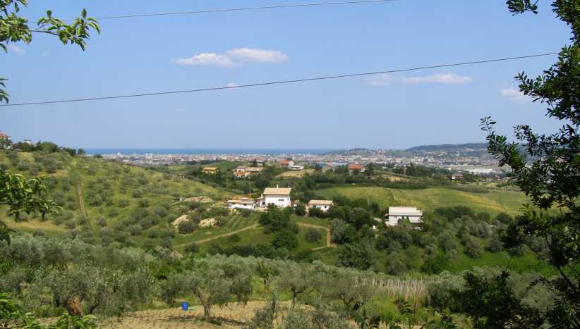
Last view of the busy Pescara area.Glimpses like this enabled us to look back over where we had been. We were now leaving the Adriatic coast behind and heading into the mountains. The river seen here is the Fiume Pescara and the Abruzzo airport is in the picture as well.
The river seen here is the Fiume Pescara and the Abruzzo airport is in the picture as well.
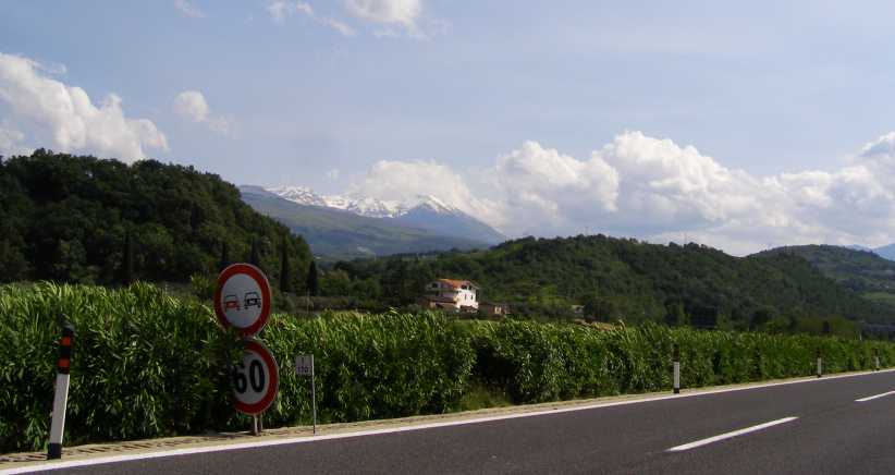
…and we overlooked some nice farmlands. Homes were dotted about everywhere. Then our progress took us into more mountainous country and snowy caps came into view to the South:
More snow. Again we saw snow, possibly on the same mountains where it had been visible to us coming along the coast.
The roads were improving as we drove and so was the visibility of the snow on top of the mountains. I guess were were taking particular note of this because it’s something we simply don’t see at home…
Closer view. A clearer view of the snow as we got onto better roads and drove further into the mountains.It wasn’t without cost, however…
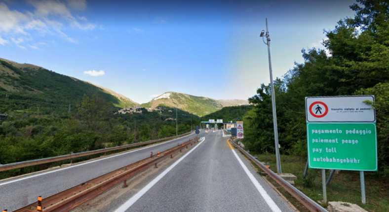
Toll roads. It wasn’t far along the Autostrada before we found a toll gate. I didn’t photograph them but Google Earth did.
Oddly enough, discussing this trip with Bob and Elaine Abberfield prior to making it, I had declared that I wouldn’t be paying tolls everywhere I went. But many of the stretches on which we drove we did pay tolls.
Small villages kept coming into view, too, with the major roads bypassing them to make travel faster. We had grown used to seeing villages like this in our week and a half in Italy:
Village in the mountains. The village of Gerchio is overshadowed by the mountain to its North, but not as much as the smaller village of Aielli beyond it.
We were now well into the mountains right in the middle of the country. Mountains, of course, mean wind at many times and this seemingly was true here, as further up the mountainside from the villages there was a large wind farm:
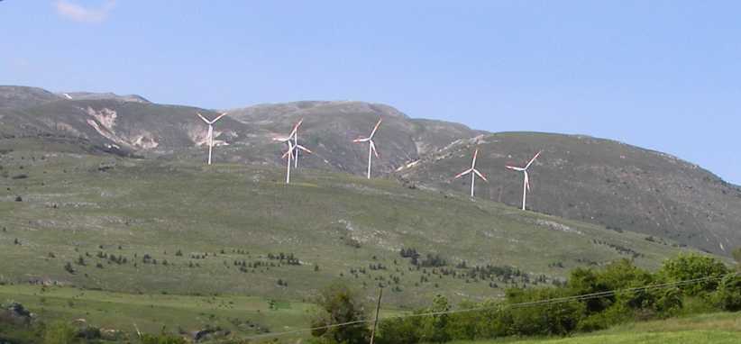
Wind farm. In this mountainous country they are making use of the prevailing winds to add electricity to their grid. 45% of Italy’s power comes from natural gas, another 16% from hydro-electric plants, coal just over 9%, solar 8.3% and ‘other fossil fuels’ and wind give 6.2% each.
By this time we knew we’d have to find somewhere to stay fairly soon. All we wanted to do was find somewhere we could spend our last day and a half of our honeymoon quietly and not have to worry too much about how far it was to put Sandra on the plane in Rome. But we didn’t want to be too close to Rome either. Villages kept filling our views…
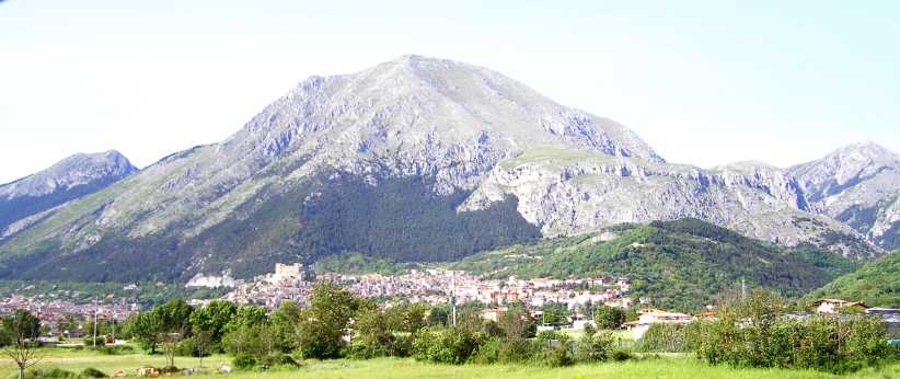
Castello at Celano. Not much further along the road was Celano, which was outstanding for the impressive Castle dominating the town.
…and then we decided to call into the rather larger town of Avezzano. On the way into town we stopped to look over some old ruins which had been exposed and then protected for display by a huge covering roof. This was right next to a huge shopping centre:
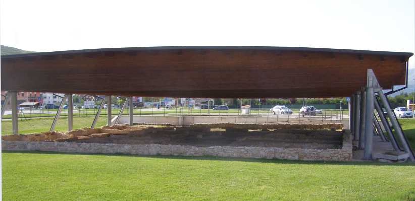
Remains on display. This cover protects what archaeologists have dug up alongside the road into Avezzano.
To get into Avezzano you actually drive past the town and then turn in from the Autostrada exit. It’s right alongside this exit that this archaeological ‘dig’ has taken place. A closer look:
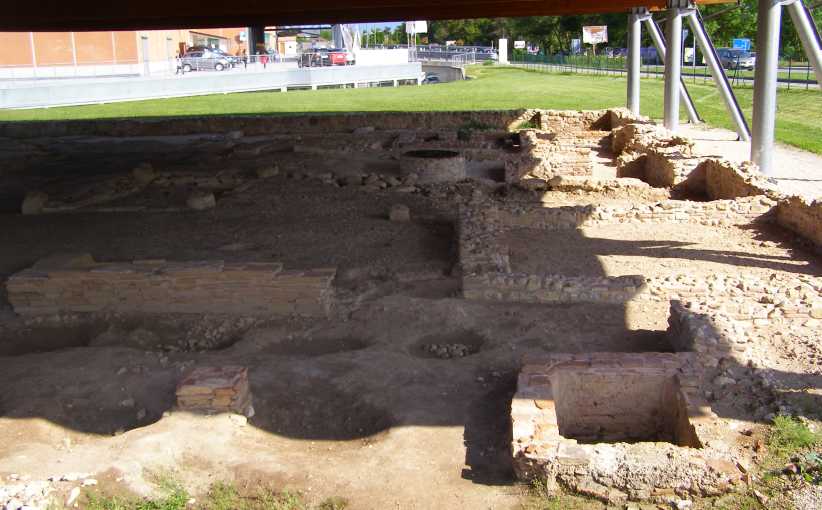
Avezzano ruins. It must have been a very long time ago when people laid out these rocks to provide themselves with shelter.
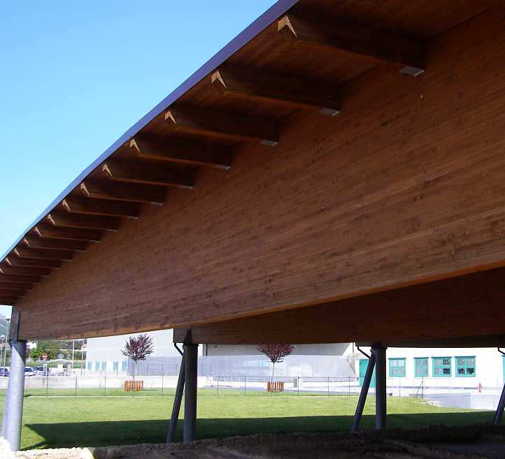
Laminated beams. I was probably just as interested in the laminated timber beams supporting the huge roof over the display.
Our next move was to go to the Tourist Information Office and have a look around. A couple of things piqued my interest and thus became earmarked for something to do the next day. Then we went off to find somewhere to stay. The Hotel Velino looked okay and we settled on that…
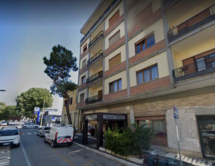
Hotel Velino. This was where we’d spend the last two nights of our honeymoon together, and you're right, I didn't take a photo of the place, this is from Google Earth Street View. Right in the middle of the town, no off-street parking, but we had no real problems with that.
…and took our bags inside. Soon I was setting up my laptop to use their wi-fi and found that it didn’t work in our room. I had to take the laptop out to the lobby and sit there to use it.
Tomorrow would be a quiet day, but we’d still find things to do and see...
Last view of the busy Pescara area.Glimpses like this enabled us to look back over where we had been. We were now leaving the Adriatic coast behind and heading into the mountains. The river seen here is the Fiume Pescara and the Abruzzo airport is in the picture as well.
The river seen here is the Fiume Pescara and the Abruzzo airport is in the picture as well.
…and we overlooked some nice farmlands. Homes were dotted about everywhere. Then our progress took us into more mountainous country and snowy caps came into view to the South:
More snow. Again we saw snow, possibly on the same mountains where it had been visible to us coming along the coast.
The roads were improving as we drove and so was the visibility of the snow on top of the mountains. I guess were were taking particular note of this because it’s something we simply don’t see at home…
Closer view. A clearer view of the snow as we got onto better roads and drove further into the mountains.It wasn’t without cost, however…
Toll roads. It wasn’t far along the Autostrada before we found a toll gate. I didn’t photograph them but Google Earth did.
Oddly enough, discussing this trip with Bob and Elaine Abberfield prior to making it, I had declared that I wouldn’t be paying tolls everywhere I went. But many of the stretches on which we drove we did pay tolls.
Small villages kept coming into view, too, with the major roads bypassing them to make travel faster. We had grown used to seeing villages like this in our week and a half in Italy:
Village in the mountains. The village of Gerchio is overshadowed by the mountain to its North, but not as much as the smaller village of Aielli beyond it.
We were now well into the mountains right in the middle of the country. Mountains, of course, mean wind at many times and this seemingly was true here, as further up the mountainside from the villages there was a large wind farm:
Wind farm. In this mountainous country they are making use of the prevailing winds to add electricity to their grid. 45% of Italy’s power comes from natural gas, another 16% from hydro-electric plants, coal just over 9%, solar 8.3% and ‘other fossil fuels’ and wind give 6.2% each.
By this time we knew we’d have to find somewhere to stay fairly soon. All we wanted to do was find somewhere we could spend our last day and a half of our honeymoon quietly and not have to worry too much about how far it was to put Sandra on the plane in Rome. But we didn’t want to be too close to Rome either. Villages kept filling our views…
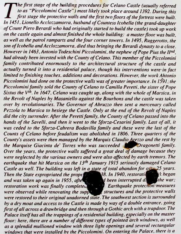
Castello at Celano. Not much further along the road was Celano, which was outstanding for the impressive Castle dominating the town.
…and then we decided to call into the rather larger town of Avezzano. On the way into town we stopped to look over some old ruins which had been exposed and then protected for display by a huge covering roof. This was right next to a huge shopping centre:
Remains on display. This cover protects what archaeologists have dug up alongside the road into Avezzano.
To get into Avezzano you actually drive past the town and then turn in from the Autostrada exit. It’s right alongside this exit that this archaeological ‘dig’ has taken place. A closer look:
Avezzano ruins. It must have been a very long time ago when people laid out these rocks to provide themselves with shelter.
Laminated beams. I was probably just as interested in the laminated timber beams supporting the huge roof over the display.
Our next move was to go to the Tourist Information Office and have a look around. A couple of things piqued my interest and thus became earmarked for something to do the next day. Then we went off to find somewhere to stay. The Hotel Velino looked okay and we settled on that…
Hotel Velino. This was where we’d spend the last two nights of our honeymoon together, and you're right, I didn't take a photo of the place, this is from Google Earth Street View. Right in the middle of the town, no off-street parking, but we had no real problems with that.
…and took our bags inside. Soon I was setting up my laptop to use their wi-fi and found that it didn’t work in our room. I had to take the laptop out to the lobby and sit there to use it.
Tomorrow would be a quiet day, but we’d still find things to do and see...
Last edited by Ray Bell; Jul 6, 2020 at 09:33 AM.
Thread Starter
|
Captain
Joined: Oct 2005
Posts: 570
Likes: 8
From: The Summit, Queensland, Australia
May 24, 2016, this would be our last full day together before I returned to Australia in mid-July. It had to be a quiet day to help Sandra with her back, as we knew that her long flight the next day would do it no good at all.
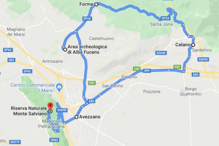
A bit of a loop around the sights of Avezzano was called for, just looking around and seeing what would fall our way. In the end, this was the territory we covered:
It was the picture we�d seen in the tourist office�
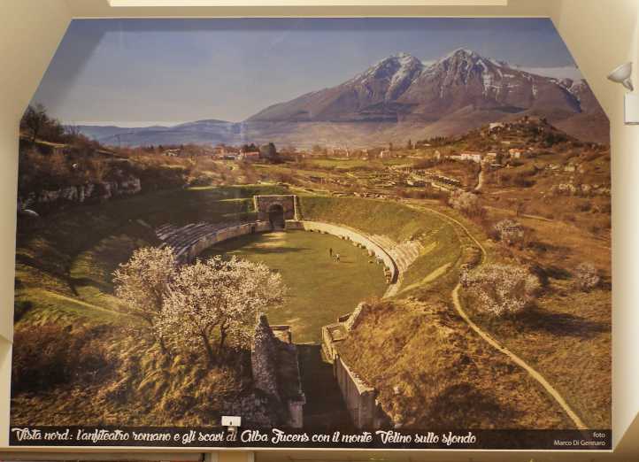
Motivation. This picture in the tourist office had grabbed my attention the previous day, so that was our first destination.
�which gave us direction to start our day. Alba Fucens wasn�t far away and looked like it would bear a good look. We fired up the little 208 and headed in that direction. It was only a 10km drive but the day looked threatening. In the end we didn�t have any rain, but heavy overcast was everpresent.
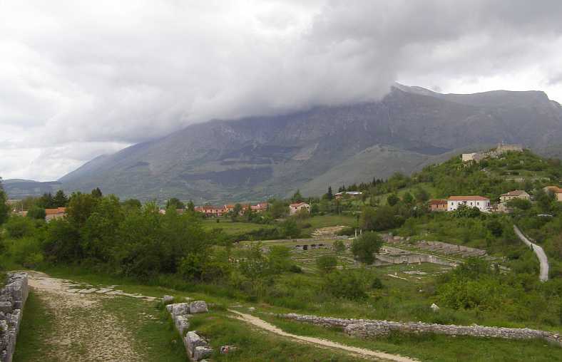
We soon found when we got there that there is still a small town with people living there�
Alba Fucens. A small town still exists here and we parked near these homes to walk down to where archaelogists have scraped away the mists of centuries from a more distant time.
�while just down the hill...
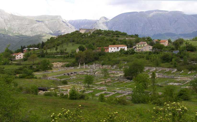
Archaelogical remains. This was quite a bit larger than the one we�d seen the previous day in Avezzano.
�and then we moved to car to a carpark closer to the arena we�d come to see:
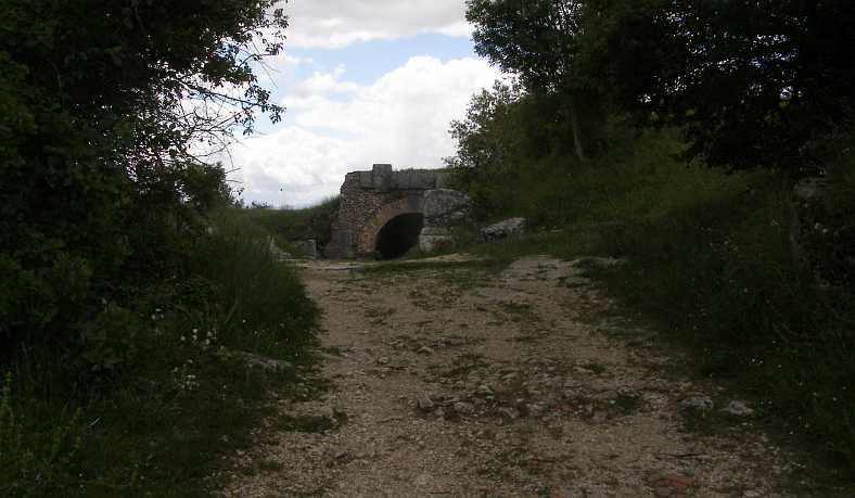
Tunnel entrance. We soon walked up to this tunnel entry to the arena.
As we reached this point we were able to look back from this elevated area for a better overall view�
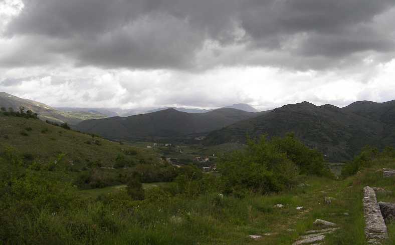
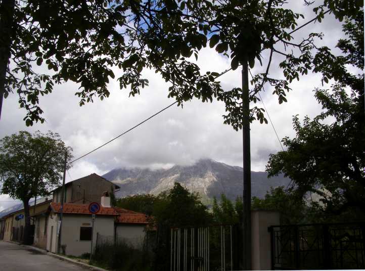
Looking back at the weather. Those clouds were still threatening, the mountains looking impressive.
�and the remains of the old town�
Excavated. With a huge mountain overlooking it and some more modern homes around, the excavated area sit forlorn in its little valley.
So on to the arena, a different kind of arena to those we�d seen at Arles and in Rome. We climbed around the outside of the tunnel to see it from where spectators had taken their place�
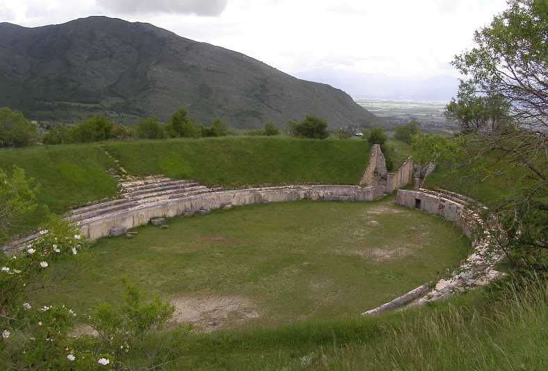
Over the top. Rather than walk through the tunnel we climbed up the slope to see what the spectators could see.
�then we walked around to the other end:
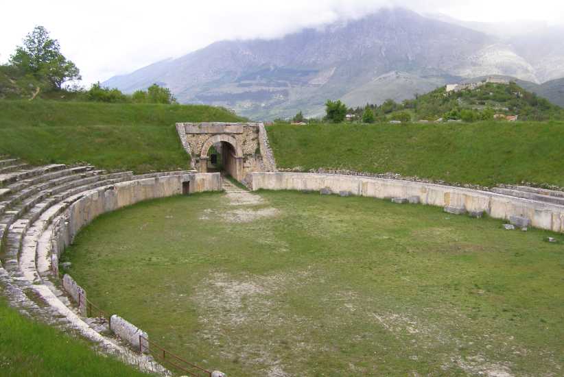
From the other end. Looking back toward the tunnel this picture shows how the arena was built.
Rather than being a stone structure rising from flat ground, this arena was dug into the ground and the sides were built up with soil as well as rocks.
And, having seen that, we headed off to see that huge castle we�d spied from the Autostrada the day before. To get to Celano we went a back road through Forme and after about 18kms we were there looking upon the huge structure that formed the castle.
We were able to read about its history on an enamel signboard which was clearly not too new:
Chequered history. Telling the story of the castle, its building, its changes of ownership, its renovations, this sign gave a lot of information.
It was very much a story of the history of this region, mentioning conquests by invaders, territorial disputes, papal empire building and more over its 600 years since construction began. The imposing impact of seeing the castle surrounded by homes within the town�
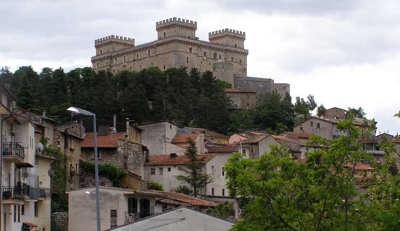
Surrounded by the town. The castle is dominant in the town which surrounds it.
�and has an impressive facade when approached from the front:
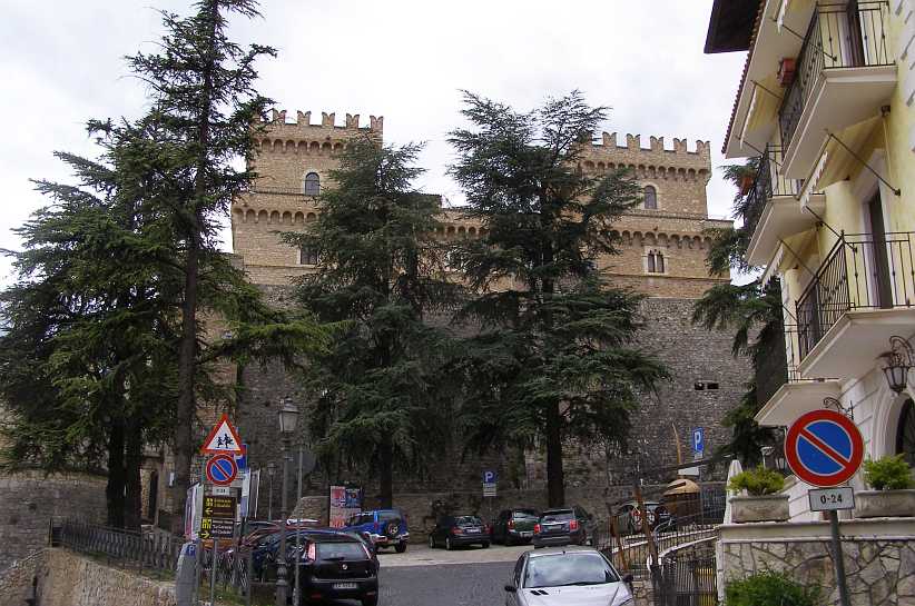
Front of the castle. The incongruity of these modern cars in the area strikes me when I look at this picture of the front of the castle.
And speaking of vehicles, a couple of outstanding ones caught my eye as we looked around Celano:
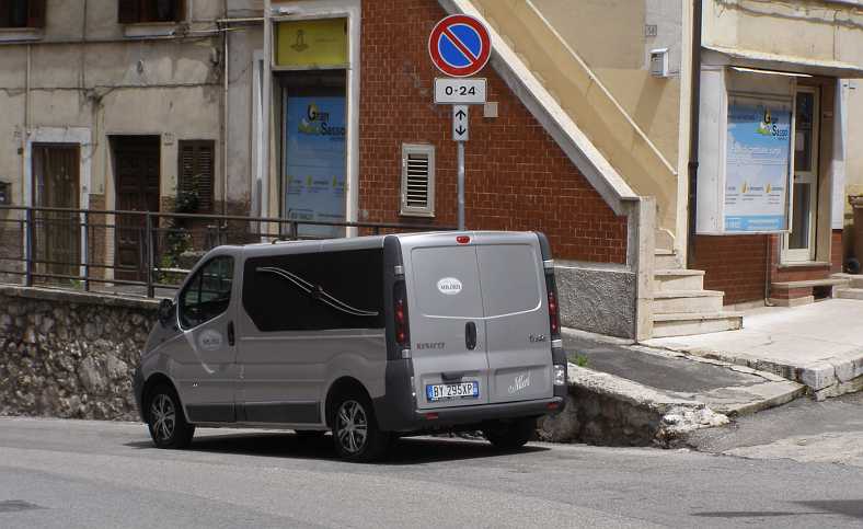
Funeral vehicle. This Renault van would appear very commercial and normal if the decorations hadn�t been added to the side.
I imagine this van is used for transporting the coffins and the bodies, not for the funerals themselves. For that, I found via google, they have a most imposing Mercedes-Benz. The other interesting thing is the use of a very English expression as their name, though spelled �Milord� rather than �M�Lord�.
And when I took this photo�
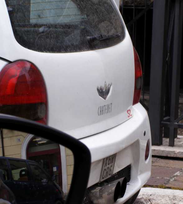
Chatenet. Never heard of them, right? Neither had I, but later in the trip I saw another.
�I had no idea what the car was. It was only months later that something came up on a forum and I posted a picture of another one I saw that I learned about these freakish little cars. With engines around half a litre in capacity, they fall into a class aimed at defeating the taxing systems in France, where they are built.
Heading back to Avezzano, where we would get something to eat, I took a photo of yet another incomplete-and-abandoned building:
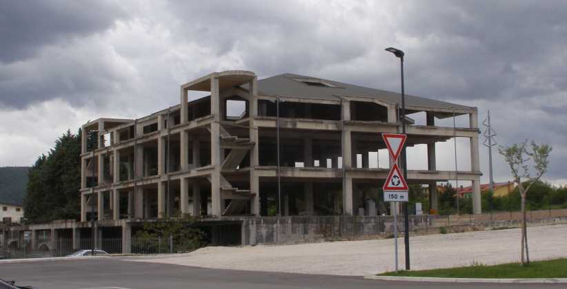
Modern ruins. Another of those big buildings left incomplete and ready to decay, I imagine somebody�s life savings went into this before it fell on hard times.
After lunch we went for a pleasant drive up Monte Silviano, to the West of town. From here we could see right over Avezzano�
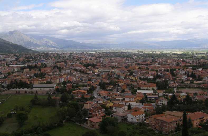
Overlooking Avezzano. Monte Silviano is within its own National Park and was very pleasant to drive up. From here all of Avezzano is visible, and lots more.
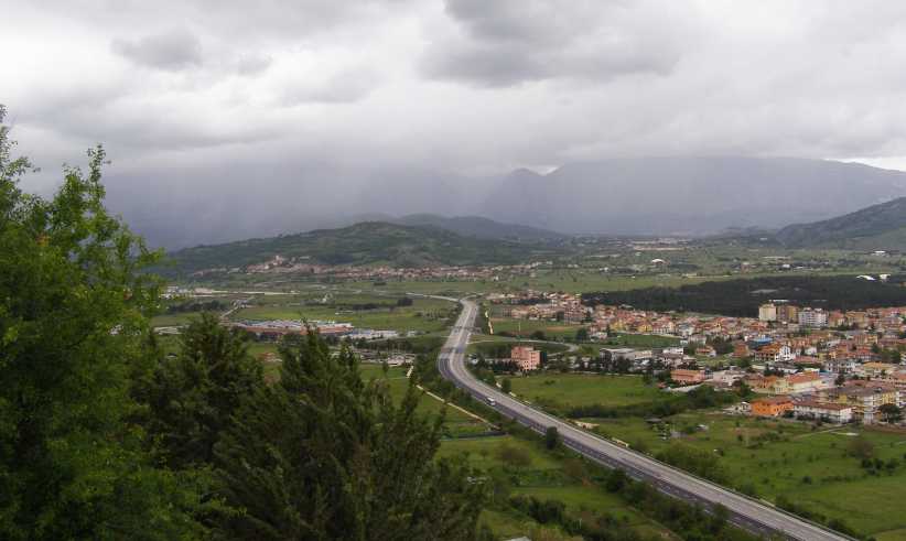
Tomorrow. And from Monte Silviano we could see the road which would lead us towards Rome the following day.
A mention is made in that plaque about the castle about an earthquake causing damage in 1915. This whole mountainous area is subject to earthquakes and tremors and several months after our visit a major one just 60kms North of Avezzano was to see the deaths of hundreds of people and the reduction of a lot of homes to rubble. This was in the areas of Armatrice, Accumoli and Arquata del Tronto and I imagine it was well and truly felt in this immediate area as well.
With our day starting to turn into evening we found ourselves somewhere to dine and then retired to our last European night together in the Hotel Velino.
There was still a lot of this trip ahead of me, but travelling alone. I had by now reconciled to it and realised that I could travel further, faster and at lower cost, taking the time to see more of the things I wanted to see, by myself. But that didn�t alter the fact that it wasn�t what I�d planned at all...
A bit of a loop around the sights of Avezzano was called for, just looking around and seeing what would fall our way. In the end, this was the territory we covered:
It was the picture we�d seen in the tourist office�
Motivation. This picture in the tourist office had grabbed my attention the previous day, so that was our first destination.
�which gave us direction to start our day. Alba Fucens wasn�t far away and looked like it would bear a good look. We fired up the little 208 and headed in that direction. It was only a 10km drive but the day looked threatening. In the end we didn�t have any rain, but heavy overcast was everpresent.
We soon found when we got there that there is still a small town with people living there�
Alba Fucens. A small town still exists here and we parked near these homes to walk down to where archaelogists have scraped away the mists of centuries from a more distant time.
�while just down the hill...
Archaelogical remains. This was quite a bit larger than the one we�d seen the previous day in Avezzano.
�and then we moved to car to a carpark closer to the arena we�d come to see:
Tunnel entrance. We soon walked up to this tunnel entry to the arena.
As we reached this point we were able to look back from this elevated area for a better overall view�
Looking back at the weather. Those clouds were still threatening, the mountains looking impressive.
�and the remains of the old town�
Excavated. With a huge mountain overlooking it and some more modern homes around, the excavated area sit forlorn in its little valley.
So on to the arena, a different kind of arena to those we�d seen at Arles and in Rome. We climbed around the outside of the tunnel to see it from where spectators had taken their place�
Over the top. Rather than walk through the tunnel we climbed up the slope to see what the spectators could see.
�then we walked around to the other end:
From the other end. Looking back toward the tunnel this picture shows how the arena was built.
Rather than being a stone structure rising from flat ground, this arena was dug into the ground and the sides were built up with soil as well as rocks.
And, having seen that, we headed off to see that huge castle we�d spied from the Autostrada the day before. To get to Celano we went a back road through Forme and after about 18kms we were there looking upon the huge structure that formed the castle.
We were able to read about its history on an enamel signboard which was clearly not too new:
Chequered history. Telling the story of the castle, its building, its changes of ownership, its renovations, this sign gave a lot of information.
It was very much a story of the history of this region, mentioning conquests by invaders, territorial disputes, papal empire building and more over its 600 years since construction began. The imposing impact of seeing the castle surrounded by homes within the town�
Surrounded by the town. The castle is dominant in the town which surrounds it.
�and has an impressive facade when approached from the front:
Front of the castle. The incongruity of these modern cars in the area strikes me when I look at this picture of the front of the castle.
And speaking of vehicles, a couple of outstanding ones caught my eye as we looked around Celano:
Funeral vehicle. This Renault van would appear very commercial and normal if the decorations hadn�t been added to the side.
I imagine this van is used for transporting the coffins and the bodies, not for the funerals themselves. For that, I found via google, they have a most imposing Mercedes-Benz. The other interesting thing is the use of a very English expression as their name, though spelled �Milord� rather than �M�Lord�.
And when I took this photo�
Chatenet. Never heard of them, right? Neither had I, but later in the trip I saw another.
�I had no idea what the car was. It was only months later that something came up on a forum and I posted a picture of another one I saw that I learned about these freakish little cars. With engines around half a litre in capacity, they fall into a class aimed at defeating the taxing systems in France, where they are built.
Heading back to Avezzano, where we would get something to eat, I took a photo of yet another incomplete-and-abandoned building:
Modern ruins. Another of those big buildings left incomplete and ready to decay, I imagine somebody�s life savings went into this before it fell on hard times.
After lunch we went for a pleasant drive up Monte Silviano, to the West of town. From here we could see right over Avezzano�
Overlooking Avezzano. Monte Silviano is within its own National Park and was very pleasant to drive up. From here all of Avezzano is visible, and lots more.
Tomorrow. And from Monte Silviano we could see the road which would lead us towards Rome the following day.
A mention is made in that plaque about the castle about an earthquake causing damage in 1915. This whole mountainous area is subject to earthquakes and tremors and several months after our visit a major one just 60kms North of Avezzano was to see the deaths of hundreds of people and the reduction of a lot of homes to rubble. This was in the areas of Armatrice, Accumoli and Arquata del Tronto and I imagine it was well and truly felt in this immediate area as well.
With our day starting to turn into evening we found ourselves somewhere to dine and then retired to our last European night together in the Hotel Velino.
There was still a lot of this trip ahead of me, but travelling alone. I had by now reconciled to it and realised that I could travel further, faster and at lower cost, taking the time to see more of the things I wanted to see, by myself. But that didn�t alter the fact that it wasn�t what I�d planned at all...
Thread Starter
|
Captain
Joined: Oct 2005
Posts: 570
Likes: 8
From: The Summit, Queensland, Australia
It had been a nice little stay in Avezzano, but full of concerns for both of us. For Sandra, she had no idea how she would cope with the flights. Rome to Dubai, Dubai to Perth, Perth to Brisbane. The first stretch is five hours and forty minutes, the Perth leg is over ten hours, then Perth to Brisbane is over four hours.
The day really began with packing the bags. We had to make sure that she had everything she wanted to take home with her, while at the same time I had to make sure that my bags weren’t too heavy for my flight back to Canada. I could abandon stuff in the USA if needed, as shipping the van home would enable me to leave things that weren’t urgently required in a bag inside it.
We drove the 130kms down the mountains and to Rome Fiucimo airport and had some sad moments there. Again she told me to have a good time. I said I’d call her every day, she said to make it once a week. We didn’t yet know what she had in store for her.
I tried not to overstay my parking time at the airport’s busy drop-off area…
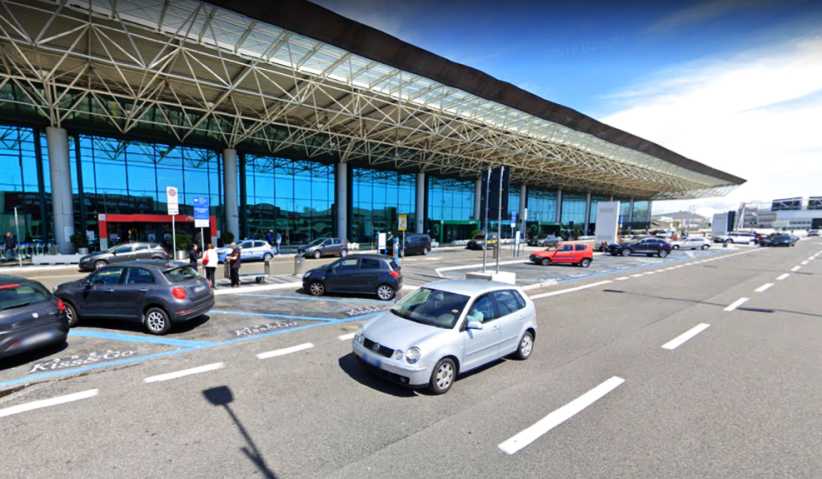
Airport parking. I’m sure I overstayed my time at the airport as I saw Sandra off. I left before she checked in.
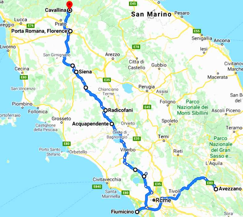
…and seemingly I avoided trouble there. And then I was on my own. Setting the GPS for the Futa Pass, I drove off on my personal European adventure with the 208 to be my home for the next four weeks. We’d completed the drive from Avezzano to Rome, this is an approximation of the whole day’s drive:
I headed North following the GPS, it was either on the same roads or very close to the roads we’d traversed on the way down from Pisa to Rome. Definitely the same road as I passed Lago di Bolsena, this time I knew it was there and got a photo…
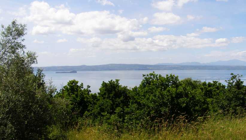
Lago di Bolsena. This is a sizable lake about 90kms North of Rome. And there’s an island out there in the water too.
Soon after passing the lake I came upon this little Fiat and followed it into Acquapendente:
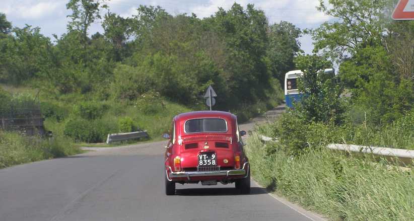
Hot Fiat. And older-style Fiat 500, but note that the engine cover is propped permanently partly open. I knew that this mean it was probably a long way from standard.
It was a nicely looked-after car, possibly a ’70s vintage (yes, they still made them into the seventies!) and I’m sure a look at the engine would reveal some nice modifications. Knowing how the Italians are, it’s most likely also fitted with a 5-speed gearbox too. These cars, by the way, always had dog-engagement (non-synchromesh) transmissions, which made them more fun to drive.
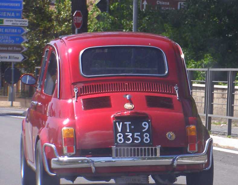
Closer look. Possibly a Giannini 590GT, you can see here the Giannini cast alloy sump and the engine cover propped open. As well as that there are bumper extenders which Giannini produced.
Soon it was time to stop for some fuel, and little did I know what trouble this was going to cause me. I pulled up at this service station at Centeno…
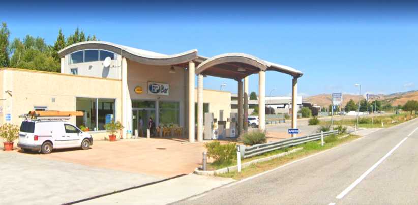
BP at Centeno. This is where I got fuel as I headed North. I also used the dining room off to the left.
…and topped up the car’s tank. After paying for that I decided I might as well eat there, discussed what was available with the girl at the counter and once again tendered my card and paid for a meal. Outside there were trucks which drew my attention for how different they are from what we see at home. This one in particular:
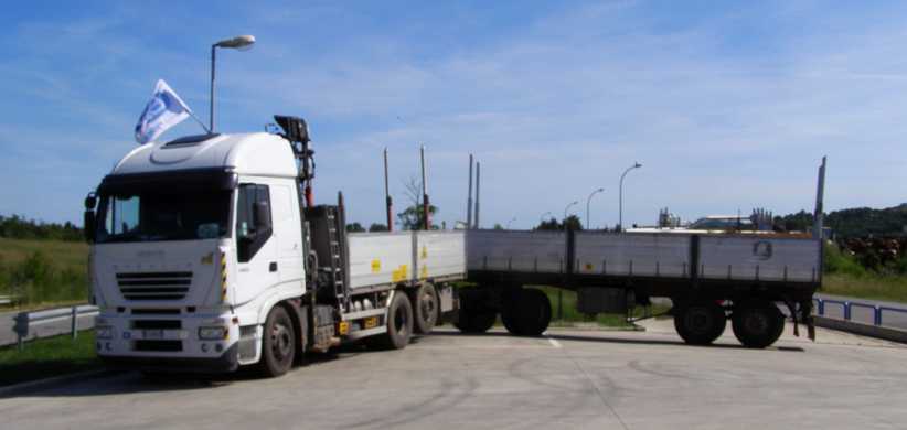
Truck and trailer. The shortness of the truck and its trailer indicate it’s for use on twisty roads.
And then I drove off, with the old fort at Radifocani surprising me by coming into my sights again. I got a few better pics of it from different angles…
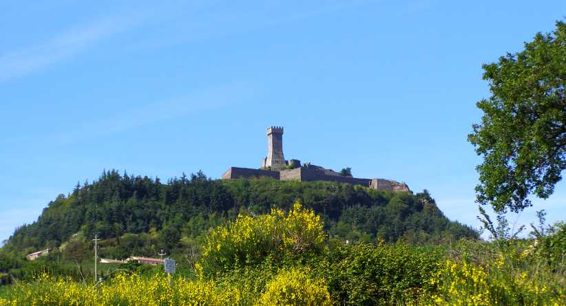
Fort at Radifocani again. It’s an outstanding landmark in the area and I had to get a better picture than we got before.
…and then started on the way to Florence. This type of road I was on was enjoyable, especially now I could get into the swing of things a bit without upsetting Sandra’s back. And some of the scenery was good too:
There were villages, large and small, along the way…
Villages. It was certainly varied driving country and I was enjoying myself.
I knew that Sandra should have been in the air by now, bound for Dubai, and I hoped she was coping all right with that. And then I got to Florence and saw this old Roman city gate and the statue in front of it…
Porta Romana, Florence. The statue of Michelangelo Pistoletto and the Roman gate to the city of Florence.
But my thoughts were elsewhere. Between Florence and Bologna lie the roads that Denis Jenkinson made famous in writing his entrancing report on riding with Stirling Moss in the Mille Miglia in 1955. These were the roads over the Futa and Raticossa Passes.An opportunity arose for me to get a good shot of the Agip 6-legged dog on its home turf so I got this on the Northern side of Florence…
Six-legged dog. Agip’s famous trademark, though one wonders why a dog has fire coming from its mouth.
Then it was time to follow the GPS as it was set to find the Futa Pass. But this day was now pretty much gone.
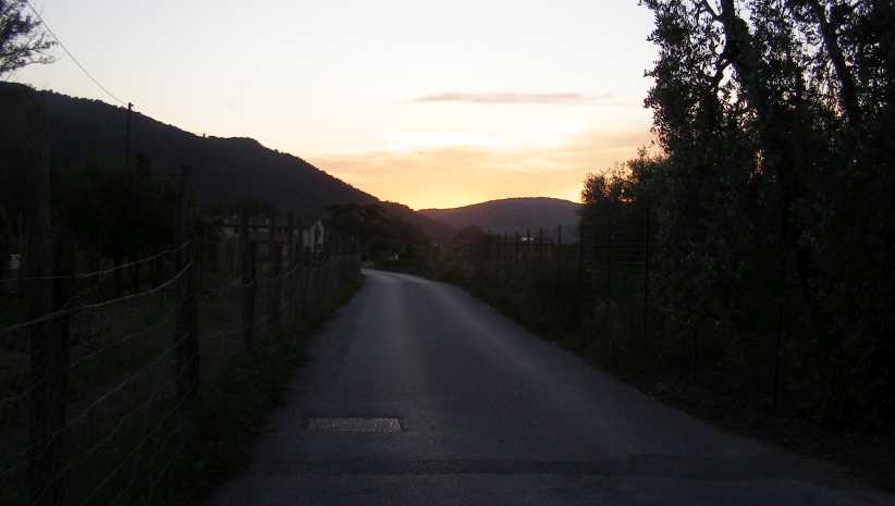
Sun sinking. I got onto narrower roads at times. The GPS was set for the Futa Pass and I followed it as best I could. My last pic of the day as the sun went down.
I had, in fact, been on the old Mille Miglia course for much of the time since leaving Sandra at the airport. And to explain to those unaware, the Mille Miglia was an open-road race from Brescia to Pescara, across the mountains to Rome and then back through the mountains to Bologna and then on to Brescia again. Anyone who is in a mood to read a seriously interesting report on that 1955 race can look at Denis Jenkinson’s masterpiece on this web page:
https://www.motorsportmagazine.com/a...s-mille-miglia
When darkness set in I started looking for somewhere to eat. Ultimately I found a little village somewhere near Cavallina where a small restaurant was open and I went in there and found they could get something for me I could eat. I didn’t rush the meal as I wasn’t going any further, and when I finished I merely drove to the edge of the village, pulled up, lay the seat back just a little and went off to sleep.
The day really began with packing the bags. We had to make sure that she had everything she wanted to take home with her, while at the same time I had to make sure that my bags weren’t too heavy for my flight back to Canada. I could abandon stuff in the USA if needed, as shipping the van home would enable me to leave things that weren’t urgently required in a bag inside it.
We drove the 130kms down the mountains and to Rome Fiucimo airport and had some sad moments there. Again she told me to have a good time. I said I’d call her every day, she said to make it once a week. We didn’t yet know what she had in store for her.
I tried not to overstay my parking time at the airport’s busy drop-off area…
Airport parking. I’m sure I overstayed my time at the airport as I saw Sandra off. I left before she checked in.
…and seemingly I avoided trouble there. And then I was on my own. Setting the GPS for the Futa Pass, I drove off on my personal European adventure with the 208 to be my home for the next four weeks. We’d completed the drive from Avezzano to Rome, this is an approximation of the whole day’s drive:
I headed North following the GPS, it was either on the same roads or very close to the roads we’d traversed on the way down from Pisa to Rome. Definitely the same road as I passed Lago di Bolsena, this time I knew it was there and got a photo…
Lago di Bolsena. This is a sizable lake about 90kms North of Rome. And there’s an island out there in the water too.
Soon after passing the lake I came upon this little Fiat and followed it into Acquapendente:
Hot Fiat. And older-style Fiat 500, but note that the engine cover is propped permanently partly open. I knew that this mean it was probably a long way from standard.
It was a nicely looked-after car, possibly a ’70s vintage (yes, they still made them into the seventies!) and I’m sure a look at the engine would reveal some nice modifications. Knowing how the Italians are, it’s most likely also fitted with a 5-speed gearbox too. These cars, by the way, always had dog-engagement (non-synchromesh) transmissions, which made them more fun to drive.
Closer look. Possibly a Giannini 590GT, you can see here the Giannini cast alloy sump and the engine cover propped open. As well as that there are bumper extenders which Giannini produced.
Soon it was time to stop for some fuel, and little did I know what trouble this was going to cause me. I pulled up at this service station at Centeno…
BP at Centeno. This is where I got fuel as I headed North. I also used the dining room off to the left.
…and topped up the car’s tank. After paying for that I decided I might as well eat there, discussed what was available with the girl at the counter and once again tendered my card and paid for a meal. Outside there were trucks which drew my attention for how different they are from what we see at home. This one in particular:
Truck and trailer. The shortness of the truck and its trailer indicate it’s for use on twisty roads.
And then I drove off, with the old fort at Radifocani surprising me by coming into my sights again. I got a few better pics of it from different angles…
Fort at Radifocani again. It’s an outstanding landmark in the area and I had to get a better picture than we got before.
…and then started on the way to Florence. This type of road I was on was enjoyable, especially now I could get into the swing of things a bit without upsetting Sandra’s back. And some of the scenery was good too:
There were villages, large and small, along the way…
Villages. It was certainly varied driving country and I was enjoying myself.
I knew that Sandra should have been in the air by now, bound for Dubai, and I hoped she was coping all right with that. And then I got to Florence and saw this old Roman city gate and the statue in front of it…
Porta Romana, Florence. The statue of Michelangelo Pistoletto and the Roman gate to the city of Florence.
But my thoughts were elsewhere. Between Florence and Bologna lie the roads that Denis Jenkinson made famous in writing his entrancing report on riding with Stirling Moss in the Mille Miglia in 1955. These were the roads over the Futa and Raticossa Passes.An opportunity arose for me to get a good shot of the Agip 6-legged dog on its home turf so I got this on the Northern side of Florence…
Six-legged dog. Agip’s famous trademark, though one wonders why a dog has fire coming from its mouth.
Then it was time to follow the GPS as it was set to find the Futa Pass. But this day was now pretty much gone.
Sun sinking. I got onto narrower roads at times. The GPS was set for the Futa Pass and I followed it as best I could. My last pic of the day as the sun went down.
I had, in fact, been on the old Mille Miglia course for much of the time since leaving Sandra at the airport. And to explain to those unaware, the Mille Miglia was an open-road race from Brescia to Pescara, across the mountains to Rome and then back through the mountains to Bologna and then on to Brescia again. Anyone who is in a mood to read a seriously interesting report on that 1955 race can look at Denis Jenkinson’s masterpiece on this web page:
https://www.motorsportmagazine.com/a...s-mille-miglia
When darkness set in I started looking for somewhere to eat. Ultimately I found a little village somewhere near Cavallina where a small restaurant was open and I went in there and found they could get something for me I could eat. I didn’t rush the meal as I wasn’t going any further, and when I finished I merely drove to the edge of the village, pulled up, lay the seat back just a little and went off to sleep.
Last edited by Ray Bell; Mar 7, 2020 at 03:05 AM.
Thread Starter
|
Captain
Joined: Oct 2005
Posts: 570
Likes: 8
From: The Summit, Queensland, Australia
For all those many years since I first read the story of the Mille Miglia in Denis Jenkinson’s book I have wanted to see some of it. Of course, I read about it in other accounts too. A thousand miles on public roads, closed for the day, hundreds of competitors leaving Brescia at 2-minute intervals with the potentially faster cars leaving last.
Now I was to see the part which ‘Jenks’ had highlighted in that report. Some 61 years after the event. That wasn’t to be my whole day, as I would spend part of the afternoon at Venice and then see how much further I would go towards Slovenia. In the end I made it to Pordenone…
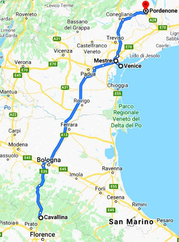
I’ll break the day into two as there’s a lot of pictures, and we start with this one, taken as it turns out, from the wrong road. My early start and following the GPS up the wrong road got me this view:
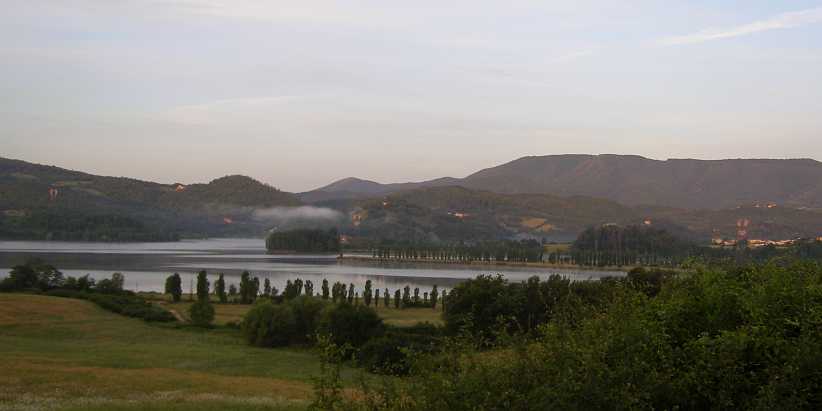
Lago di Bilancino. From the Strada Provincial 8 near Le Marschere.
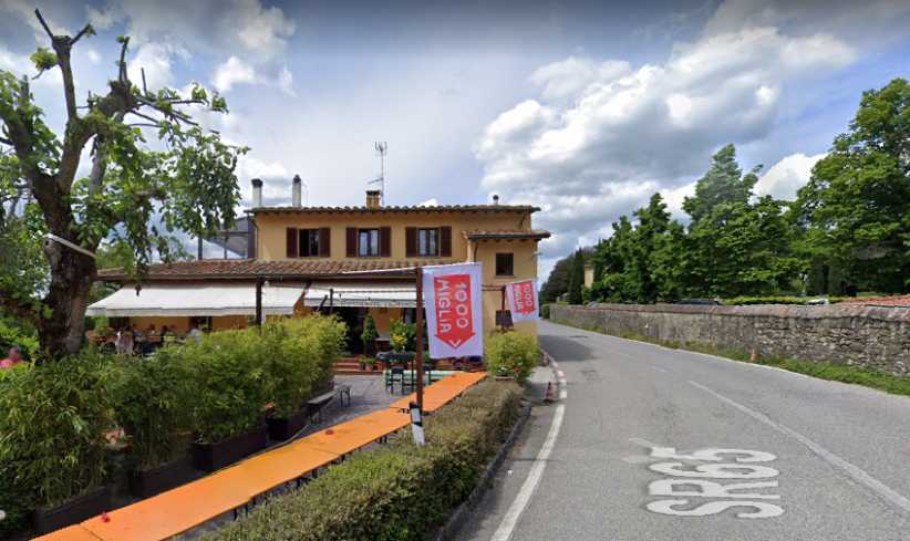
Mille Miglia Cafe. On the right road I missed out on seeing this cafe with its signs. Google Earth didn’t miss it, though, and I learned this checking over the route later.
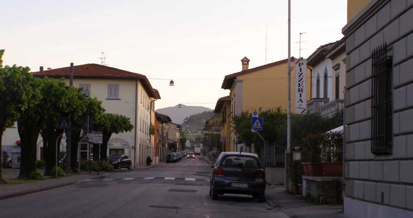
Barberino di Mugella. One of a few villages I went through on the wrong road, it was still typical of what I would have seen on the right road.
And the type of road was just the same, the topography very much the same, so it didn’t make much difference that I covered 15 or 20 twisty kilometres on the SP08 instead of the SR (Strada Regionale) 65.
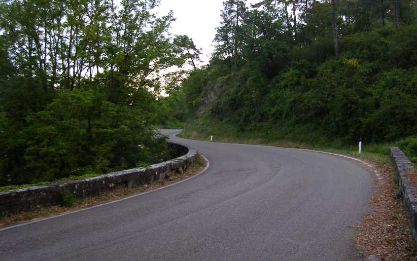
SP8 curves. Just what I expected to see on this testy mountain section, even if on the wrong road.
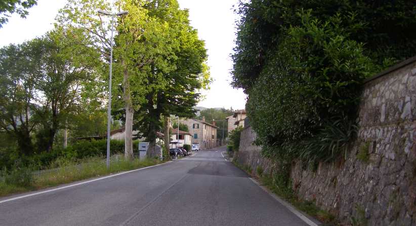
Montecarelli. Now on the right road, it took me through Montecarelli…
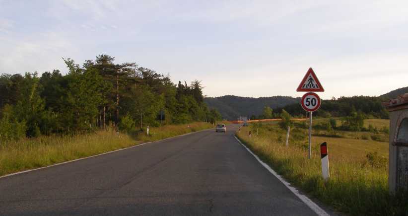
New road works. …and then through this section of roadworks where a new entry was being built for the Autostrada in the adjacent valley.
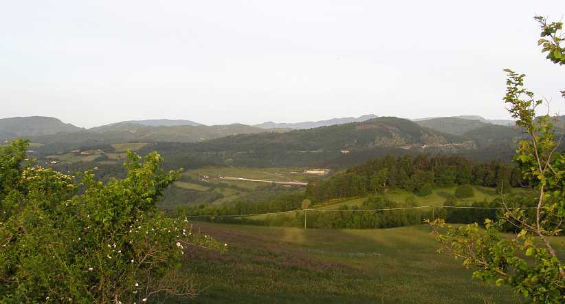
Autostrada. From a high point I could see the autostrada which no cuts the time taken to drive from Florence to Bologna.
The miles rolled on, twisty sections, villages, twisty roads through villages, climbing, dropping. Mostly the roads were fairly narrow, though not down to single lane widths. At 40kms from Florence was Santa Lucia and I was working towards that point.
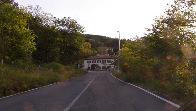
Climb to Santa Lucia. A tight ‘S’ bend is a feature of the road at Santa Lucia, at this point we’re climbing towards it.
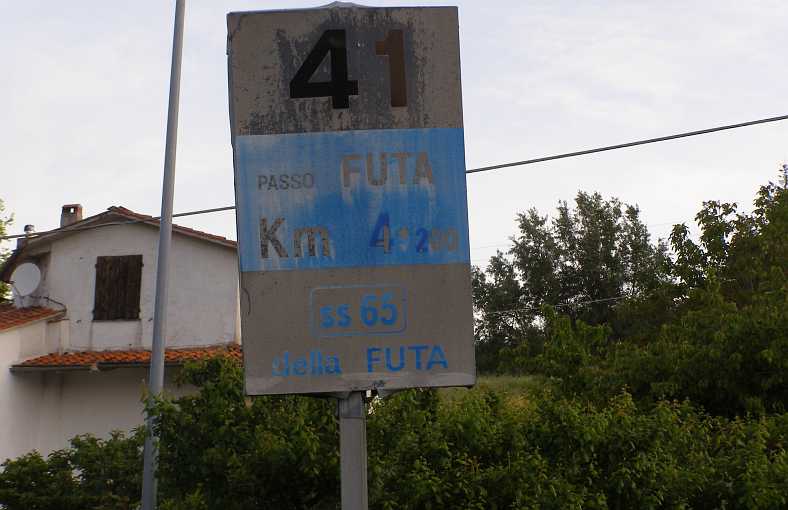
41 sign. No doubt about being on the right road here, the sign might well have been here in 1955 too.
And then I could picture the faster cars, the Maseratis, the Ferraris and the Mercedes storming through the village trying to save seconds on the way to Brescia. This bend took them through the last of Santa Lucia:
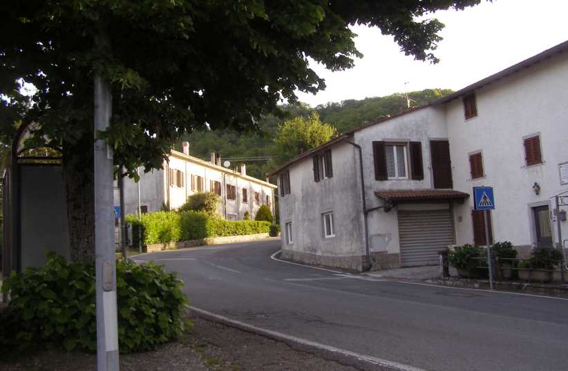
[[b]Santa Lucia. The exhausts of the racers would have echoed off these buildings as they applied full power through here.
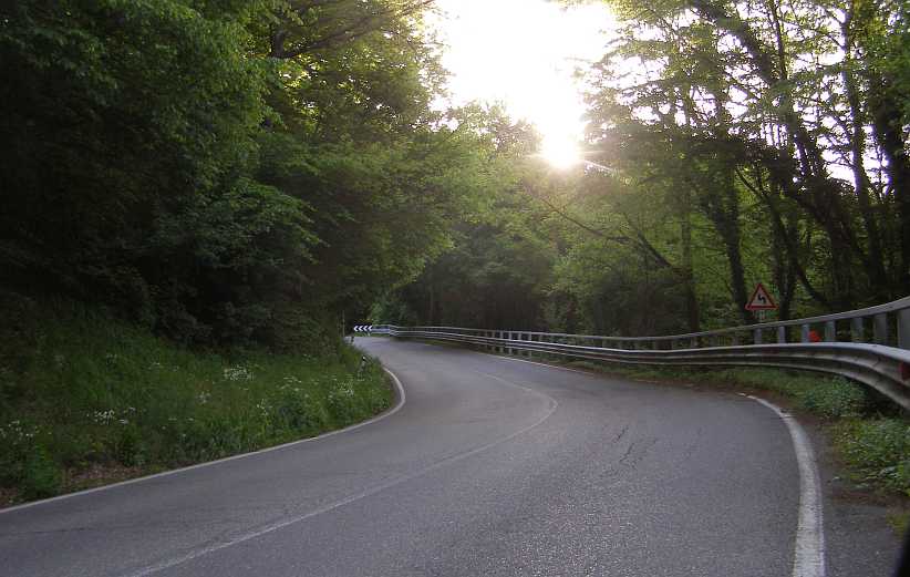
Downhill run. After Monte di Fo the descent is long, this run leads to a hairpin bend.
Covigliaio. Another village which would have been alive with people lining the roads in the years of the race.
Rugged scenery. This photo was taken near Pietramala looking West from the SR65. Agriculture blends with the rocky background scenery.
For those who don’t know about the Mille Miglia in detail, it was first run in 1927 and it was such a tough event that it was held that only an Italian could win. But in 1931 Rudolf Caracciola (Mercedes) proved that to be wrong and Huschke von Hanstein (BMW 328) repeated this in 1940.
Legends grew around the race and one was that the driver who led at Rome could never win. Stirling Moss became the first to achieve a win after leading at the capital.
The final race was held in 1957 and was marred by a couple of accidents which led to the race not being run again. The worst was that which befell Spanish driver, Fon de Portago. This was how the incident was described in graphic detail in the British magazine, Motor Racing:
On the straight, at about 180mph, a tyre burst for reasons which are still not clear. The car veered off the road, uprooted a massive granite marker stone, then flew through the air, snapping off a telegraph pole, and cutting to pieces spectators at the roadside who were pressing forward, regardless of danger, to see the cars pass. Annihilating its crew as it went, it bounced into one ditch, then hurtled across the road into the ditch on the opposite side. The Marquis de Portago, his passenger, Eddie Nelson, and nine spectators, of whom five were children, died, and several injured.
Futa Pass plaque. A road junction at the top of the pass has three of these bronze facades – one for the Mille Miglia, one for a cyclist and I don’t know what the other represented.
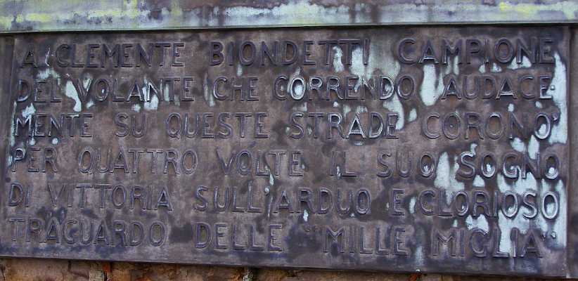
Clemente Biondetti. Four times a winner of the Mille Miglia, Biondetti certainly deserves the recognition he receives here. He did of cancer aged just 57 three months before Moss’ tremendous win in 1955.
Keeping on moving along, we now had to head over the Raticosa Pass to Bologna…
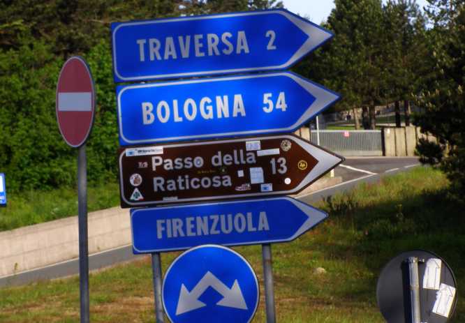
54 to Bologna. The signs tell the story, still plenty of twists and turns to go to Bologna.
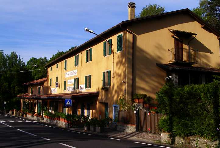
Albergo Bar. Just along from the signs is this hotel, which clearly caters for the motor racing enthusiasts who come through here.
And you just have to love the dedication of the Italians to their racing over the years. Like the Targa Florio, the Circuit of Mugello was a race on public roads run from 1914 to 1970. Some of those miles were on the SR65. The hotel recognised the efforts of one of the latter day competitors:
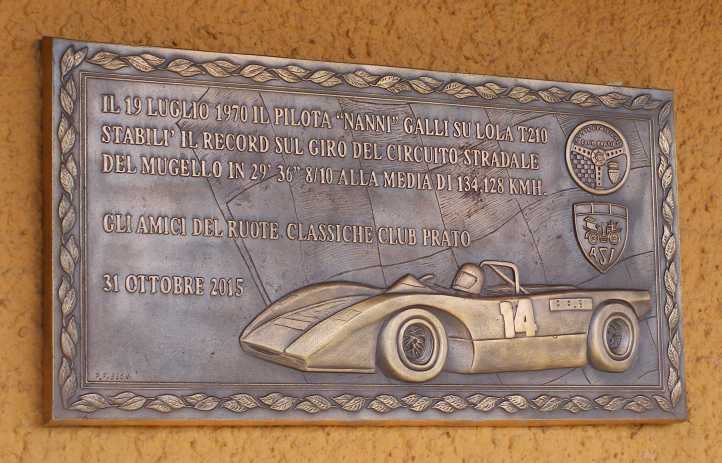
Nanni Galli. This plaque on the hotel wall tells of Galli’s lap record at Mugello 134.128kmh in a Lola sports car.
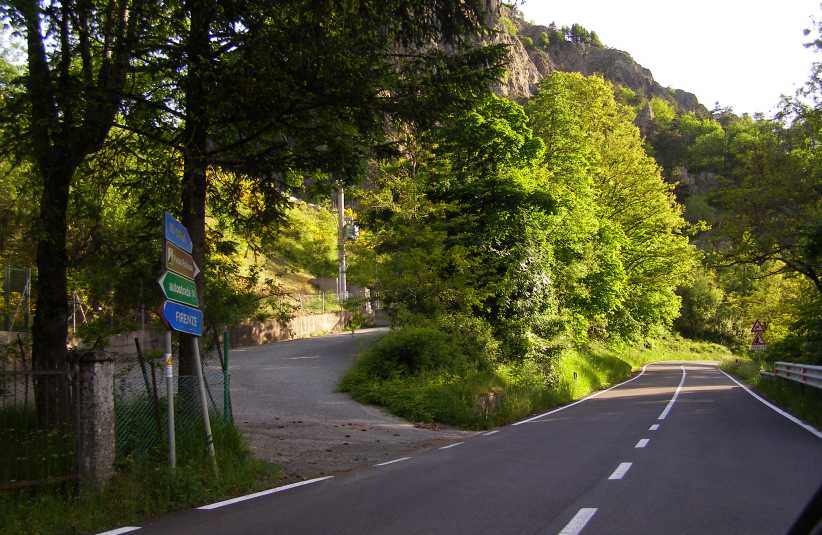
Road to Bologna. Yes, we have to go on, and the road is inviting. This was when I really was glad Sandra had gone home.
And you can’t drive roads through mountains like these without seeing some sights. Mountains and valleys…
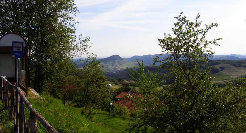
Mountains and valleys. To the East, despite a bit of haze, the scenery looked good.
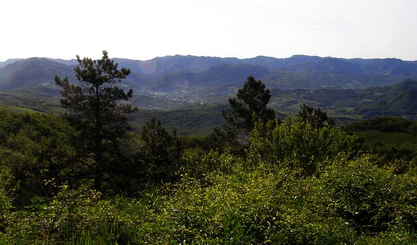
All mountains. Everywhere you looked there was more mountains.
Still the villages fitted in with the passage of the road, Montelbano and Filagre came up in short order, both with ‘S’ bends through the towns:
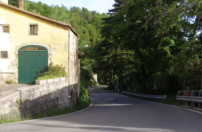
Montelbano. The descent through this village created these tight corners.
I took some trouble to get good shots at Filigare because of an incident going through there.
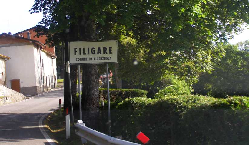
Filigare. Just another Italian mountain village, right?
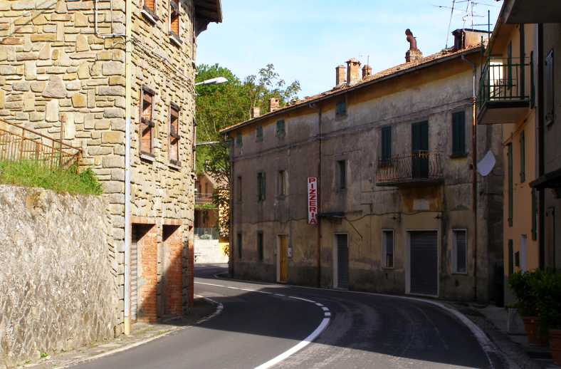
Another ‘S’ bend. Nothing unusual here? But there was as I first drove through.
I may have been hurrying a little as I came through, but an elderly gentleman saw me coming and had to dart back off the road. He had a tool in his hand and he’d been out on the road so he could shut off the water supply to his house. Dashing out of the way when vehicles come through is, I guess, a way of life in these villages.
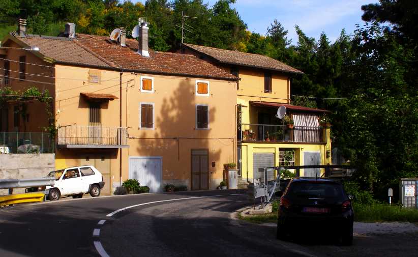
Shutting off the water. Right in this bend there’s a cover over a mains supply faucet for the house on the other side.
And the drive continued, the country levelling out just a little when we got to C� del Costa…
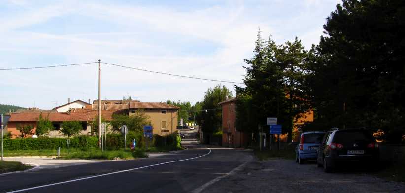
C� del Costa.A bigger town than many I’d been through this day.
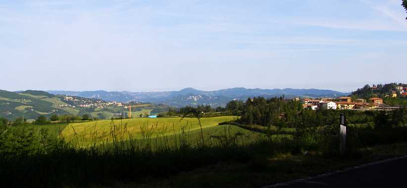
View over Piamaggio.And Piamaggio, off to the West, seemed to be bigger still.
And so I drove on into Bologna. My only other stop along the way was to get a picture of this Fiat Multipla:
Fiat Multipla.I’d been seeing these around and was astounded by their, shall we say, awkward appearance. I had a chance to get some good shots here.
Oddly enough, Jeremy Clarkson did an interesting show about ideal family vehicles and you might be interested in seeing how this one stacked up:
And for me, the next step was a quick look at a couple of things Bologna had to offer and to head off to Mestre, the ‘jumping off’ place to get to Venice.
Now I was to see the part which ‘Jenks’ had highlighted in that report. Some 61 years after the event. That wasn’t to be my whole day, as I would spend part of the afternoon at Venice and then see how much further I would go towards Slovenia. In the end I made it to Pordenone…
I’ll break the day into two as there’s a lot of pictures, and we start with this one, taken as it turns out, from the wrong road. My early start and following the GPS up the wrong road got me this view:
Lago di Bilancino. From the Strada Provincial 8 near Le Marschere.
Mille Miglia Cafe. On the right road I missed out on seeing this cafe with its signs. Google Earth didn’t miss it, though, and I learned this checking over the route later.
Barberino di Mugella. One of a few villages I went through on the wrong road, it was still typical of what I would have seen on the right road.
And the type of road was just the same, the topography very much the same, so it didn’t make much difference that I covered 15 or 20 twisty kilometres on the SP08 instead of the SR (Strada Regionale) 65.
SP8 curves. Just what I expected to see on this testy mountain section, even if on the wrong road.
Montecarelli. Now on the right road, it took me through Montecarelli…
New road works. …and then through this section of roadworks where a new entry was being built for the Autostrada in the adjacent valley.
Autostrada. From a high point I could see the autostrada which no cuts the time taken to drive from Florence to Bologna.
The miles rolled on, twisty sections, villages, twisty roads through villages, climbing, dropping. Mostly the roads were fairly narrow, though not down to single lane widths. At 40kms from Florence was Santa Lucia and I was working towards that point.
Climb to Santa Lucia. A tight ‘S’ bend is a feature of the road at Santa Lucia, at this point we’re climbing towards it.
41 sign. No doubt about being on the right road here, the sign might well have been here in 1955 too.
And then I could picture the faster cars, the Maseratis, the Ferraris and the Mercedes storming through the village trying to save seconds on the way to Brescia. This bend took them through the last of Santa Lucia:
[[b]Santa Lucia. The exhausts of the racers would have echoed off these buildings as they applied full power through here.
Downhill run. After Monte di Fo the descent is long, this run leads to a hairpin bend.
Covigliaio. Another village which would have been alive with people lining the roads in the years of the race.
Rugged scenery. This photo was taken near Pietramala looking West from the SR65. Agriculture blends with the rocky background scenery.
For those who don’t know about the Mille Miglia in detail, it was first run in 1927 and it was such a tough event that it was held that only an Italian could win. But in 1931 Rudolf Caracciola (Mercedes) proved that to be wrong and Huschke von Hanstein (BMW 328) repeated this in 1940.
Legends grew around the race and one was that the driver who led at Rome could never win. Stirling Moss became the first to achieve a win after leading at the capital.
The final race was held in 1957 and was marred by a couple of accidents which led to the race not being run again. The worst was that which befell Spanish driver, Fon de Portago. This was how the incident was described in graphic detail in the British magazine, Motor Racing:
On the straight, at about 180mph, a tyre burst for reasons which are still not clear. The car veered off the road, uprooted a massive granite marker stone, then flew through the air, snapping off a telegraph pole, and cutting to pieces spectators at the roadside who were pressing forward, regardless of danger, to see the cars pass. Annihilating its crew as it went, it bounced into one ditch, then hurtled across the road into the ditch on the opposite side. The Marquis de Portago, his passenger, Eddie Nelson, and nine spectators, of whom five were children, died, and several injured.
Futa Pass plaque. A road junction at the top of the pass has three of these bronze facades – one for the Mille Miglia, one for a cyclist and I don’t know what the other represented.
Clemente Biondetti. Four times a winner of the Mille Miglia, Biondetti certainly deserves the recognition he receives here. He did of cancer aged just 57 three months before Moss’ tremendous win in 1955.
Keeping on moving along, we now had to head over the Raticosa Pass to Bologna…
54 to Bologna. The signs tell the story, still plenty of twists and turns to go to Bologna.
Albergo Bar. Just along from the signs is this hotel, which clearly caters for the motor racing enthusiasts who come through here.
And you just have to love the dedication of the Italians to their racing over the years. Like the Targa Florio, the Circuit of Mugello was a race on public roads run from 1914 to 1970. Some of those miles were on the SR65. The hotel recognised the efforts of one of the latter day competitors:
Nanni Galli. This plaque on the hotel wall tells of Galli’s lap record at Mugello 134.128kmh in a Lola sports car.
Road to Bologna. Yes, we have to go on, and the road is inviting. This was when I really was glad Sandra had gone home.
And you can’t drive roads through mountains like these without seeing some sights. Mountains and valleys…
Mountains and valleys. To the East, despite a bit of haze, the scenery looked good.
All mountains. Everywhere you looked there was more mountains.
Still the villages fitted in with the passage of the road, Montelbano and Filagre came up in short order, both with ‘S’ bends through the towns:
Montelbano. The descent through this village created these tight corners.
I took some trouble to get good shots at Filigare because of an incident going through there.
Filigare. Just another Italian mountain village, right?
Another ‘S’ bend. Nothing unusual here? But there was as I first drove through.
I may have been hurrying a little as I came through, but an elderly gentleman saw me coming and had to dart back off the road. He had a tool in his hand and he’d been out on the road so he could shut off the water supply to his house. Dashing out of the way when vehicles come through is, I guess, a way of life in these villages.
Shutting off the water. Right in this bend there’s a cover over a mains supply faucet for the house on the other side.
And the drive continued, the country levelling out just a little when we got to C� del Costa…
C� del Costa.A bigger town than many I’d been through this day.
View over Piamaggio.And Piamaggio, off to the West, seemed to be bigger still.
And so I drove on into Bologna. My only other stop along the way was to get a picture of this Fiat Multipla:
Fiat Multipla.I’d been seeing these around and was astounded by their, shall we say, awkward appearance. I had a chance to get some good shots here.
Oddly enough, Jeremy Clarkson did an interesting show about ideal family vehicles and you might be interested in seeing how this one stacked up:
And for me, the next step was a quick look at a couple of things Bologna had to offer and to head off to Mestre, the ‘jumping off’ place to get to Venice.
Last edited by Ray Bell; Mar 11, 2020 at 10:48 AM.
Thread Starter
|
Captain
Joined: Oct 2005
Posts: 570
Likes: 8
From: The Summit, Queensland, Australia
Having seen a little of Bologna, I noted that there were trolley buses there, and one thing in the back of my mind was that I’d tried to point these out to Sandra earlier in the trip and she missed out on seeing them. We haven’t had any in Australia for over fifty years, so I decided to get a pic of one. All I managed in the time I allowed myself, however, was a bit of a pic of their power source:
Power for the buses. Up there in the trees are the lines which give power to the trolley buses. They are both positive and negative, unlike trains, which often have the negative in the railway lines.
While I was waiting I noted that there were other unusual sources of power for some of their local buses…
Natural gas bus. Proudly proclaiming its effort to be different, this bus was all I could capture.
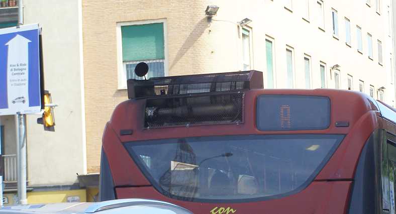
Strange rear end. Does anyone know why this arrangement is on the back of these buses?
I then set my sights on getting to Mestre in sufficient time to see Venice. Friends had advised me to use public transport to get to Venice as it’s not a place suited to access by cars. I set off on the A13 Autostrada, but it was only ten or twelve kilometres before I pulled up at the Castelbentivoglio Autogrill to get something to eat. And to see in the carpark a fairly rare car being transported:
Porsche convertible. This Porsche 356 convertible was something different.
Not finding anything to my liking, I pressed on along the A13…
Autostrada. In flatter country than I’d been in during the morning, this Autostrada connects Bologna and Padua.
…to an Autogrill about sixty kilometres further along the A13, so about halfway between Bologna and Mestre. There I was interested to see the structure of the footbridge across the Autostrada:
Pedestrian bridge. Each Autogrill seems to have a bridge to connect the businesses each side of the Autostrada. Though they usually like this one, locked.
Spotting this well-laden sporty car I wondered what it was…
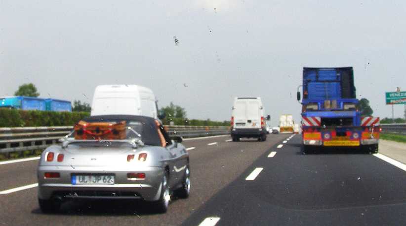
Unknown sports car. This car didn’t seem to have any identifying badges and it mystified me.
…until I posted a photo on a forum and it was identified as a Fiat.
All these things to look at as I flew through the miles to Mestre. Once I got there I had to find a parking spot where I didn’t have to walk too far to get a bus to Venice and where I wouldn’t outstay a meter or some other parking restriction. To this day I’m not sure how well I got on there.
Crossing to Venice. The bus took me along the causeway, built to enable road traffic to read the island(s) in the 1930s. Alongside was the railway, built in the previous century.
Entry to Venice. Restrictions on vehicle access to Venice has led to a large bus terminus where tourists and residents embark and disembark.
Canals and boats. Tradition usually imparts that transport on the canals is all by gondola, but all manner of boats are seen there as daily life in the city demands.
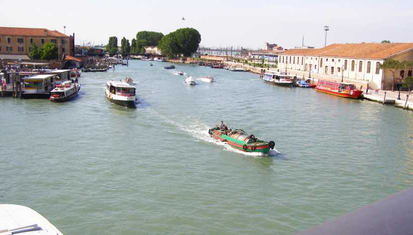
From the bridge. Looking towards the North the canal is wide and very busy.
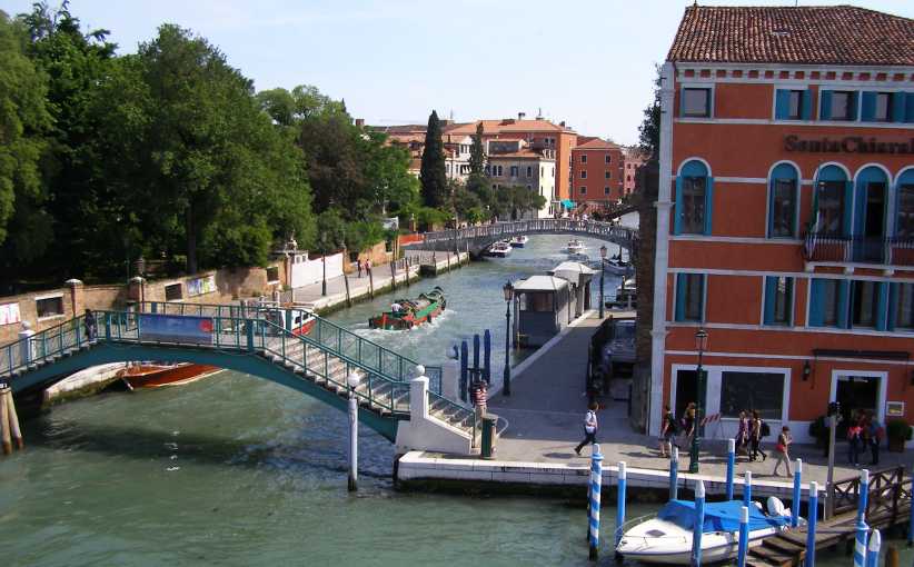
Looking the other way. It’s no less busy, but there’s less room to move in the water.
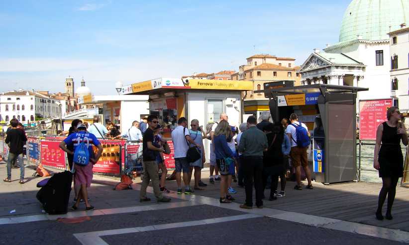
Tourists. Everywhere there are tourists. Like me. But most of them probably spent more money than I did on souvenirs and gondola rides and other local things.
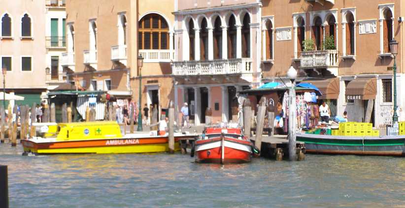
Ambulance. If your city is surrounded by water, and your houses too, naturally you’d need to have a waterborne ambulance.
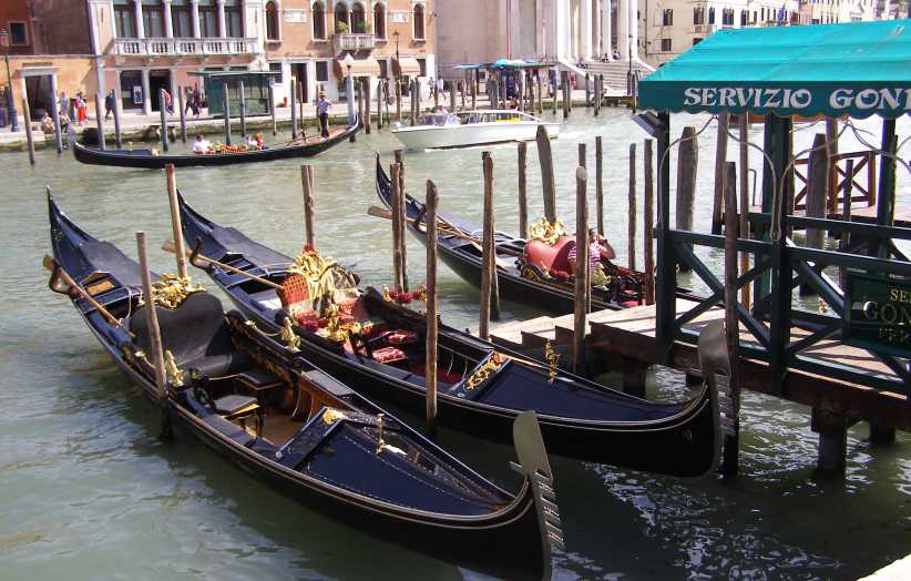
Gondolas at rest. Finally I saw some gondolas, but they were immobile, presumably waiting for some customers to come along.
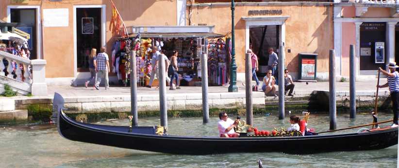
Gondola at work. Is this man serenading his lady as the gondola operator navigates for them?
Crowds in the lane. Narrow lanes proliferate, as in many older Italian cities. But few have crowds as big as this using them.
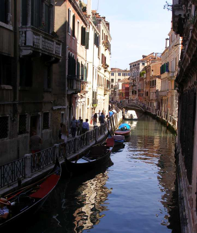
Back canal. More tourists keep to the narrow walkway alongside this canal in the ‘backblocks’ of the city. Gondolas and other boats lie dormant and the crowded nature of the city is evident everywhere you look.
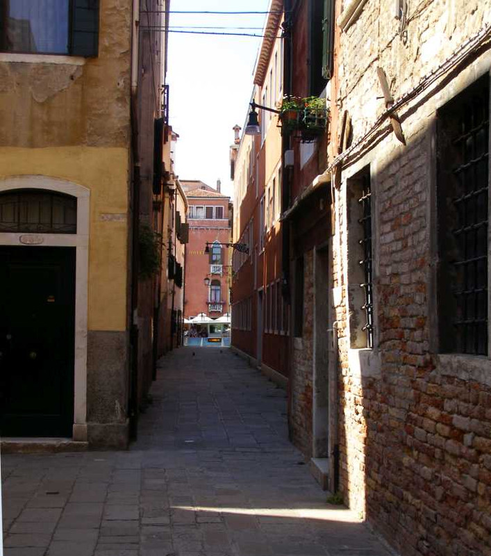
Another laneway. This one, however, can be seen to lead to an outdoor eatery.
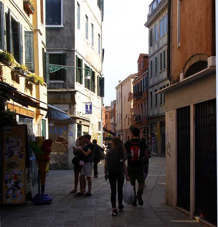
On a lean. Signs of potential collapse? These tourists are apparently blissfully unaware of the lean of the building they’re next to.
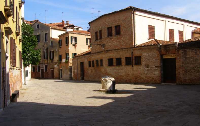
Quiet backstreet. Nobody here to spoil the quiet…
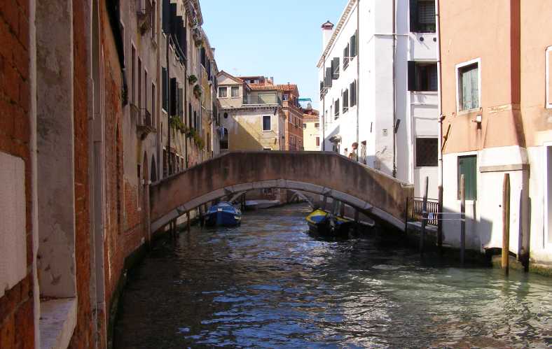
Quiet backwater. …nor here.
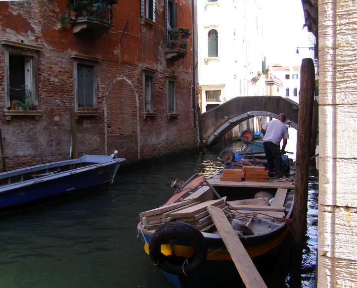
Maintenance. Or possibly renovation? Work goes on, even if access is only by boat.
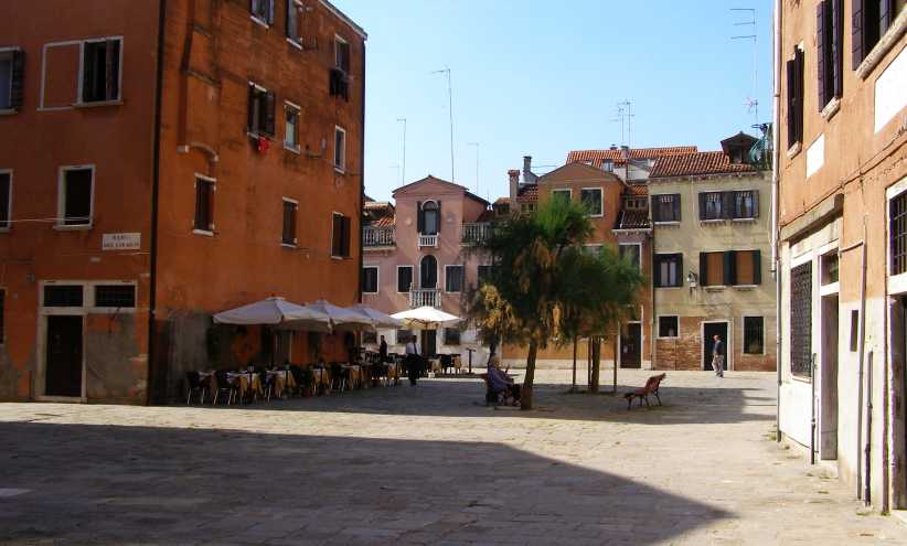
Dining in the square. Ready for customers is this outdoor restaurant.
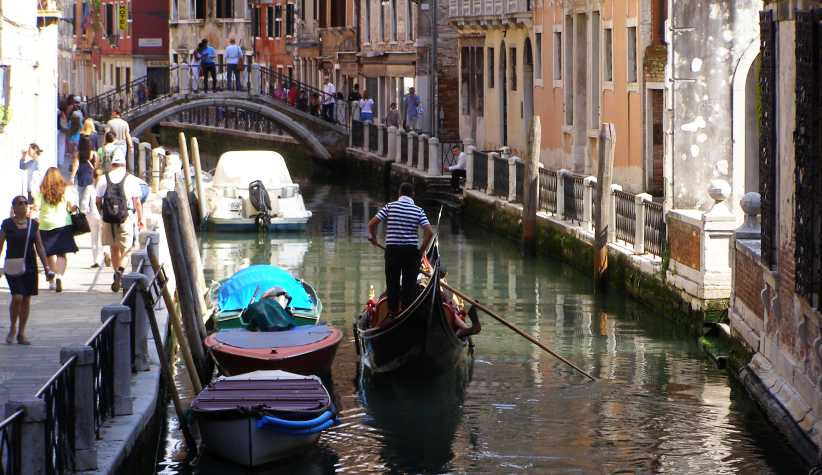
Still romancing? That same gondola travels up a less romantic part of the city.
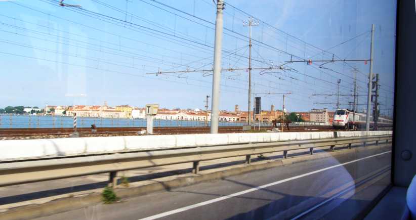
Last look… Looking back from the bus on the causeway, our last look at Venice and the sight of one of the regular trains to the city. The line is, of course, electrified.With this trip back to Mestre I found my way back to the car. I then went to buy some things and found, to my surprise, another SPAR store…
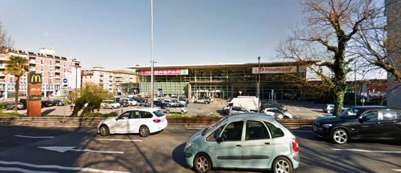
Another SPAR. This time ‘Interspar’, it was conveniently located for me to do some shopping before leaving Mestre. Another Google Street View picture.
…I did a little shopping there and then I set off to head towards Slovenia as I had an invitation to visit some people in Serbia.
Another German car. A poor picture, but it is an even rarer car than the Porsche I’d seen earlier. This is an NSU RO80, the first production rotary-engined model built.
That evening I got as far as Pordenone, where I’m sure I found a Kentucky Fried Chicken store to get something to eat. But according to Google there’s no such thing in the town.
I met up with some English-speaking people and we had a good time together. I was invited back to spend the night at a home atop a shop in the town and in the morning luxuriated in a comfortable family setting with young children asking me questions of all kinds. After a shower I left and headed on my way.
At that stage things were going very well, but it was to change dramatically later in the day…
Power for the buses. Up there in the trees are the lines which give power to the trolley buses. They are both positive and negative, unlike trains, which often have the negative in the railway lines.
While I was waiting I noted that there were other unusual sources of power for some of their local buses…
Natural gas bus. Proudly proclaiming its effort to be different, this bus was all I could capture.
Strange rear end. Does anyone know why this arrangement is on the back of these buses?
I then set my sights on getting to Mestre in sufficient time to see Venice. Friends had advised me to use public transport to get to Venice as it’s not a place suited to access by cars. I set off on the A13 Autostrada, but it was only ten or twelve kilometres before I pulled up at the Castelbentivoglio Autogrill to get something to eat. And to see in the carpark a fairly rare car being transported:
Porsche convertible. This Porsche 356 convertible was something different.
Not finding anything to my liking, I pressed on along the A13…
Autostrada. In flatter country than I’d been in during the morning, this Autostrada connects Bologna and Padua.
…to an Autogrill about sixty kilometres further along the A13, so about halfway between Bologna and Mestre. There I was interested to see the structure of the footbridge across the Autostrada:
Pedestrian bridge. Each Autogrill seems to have a bridge to connect the businesses each side of the Autostrada. Though they usually like this one, locked.
Spotting this well-laden sporty car I wondered what it was…
Unknown sports car. This car didn’t seem to have any identifying badges and it mystified me.
…until I posted a photo on a forum and it was identified as a Fiat.
All these things to look at as I flew through the miles to Mestre. Once I got there I had to find a parking spot where I didn’t have to walk too far to get a bus to Venice and where I wouldn’t outstay a meter or some other parking restriction. To this day I’m not sure how well I got on there.
Crossing to Venice. The bus took me along the causeway, built to enable road traffic to read the island(s) in the 1930s. Alongside was the railway, built in the previous century.
Entry to Venice. Restrictions on vehicle access to Venice has led to a large bus terminus where tourists and residents embark and disembark.
Canals and boats. Tradition usually imparts that transport on the canals is all by gondola, but all manner of boats are seen there as daily life in the city demands.
From the bridge. Looking towards the North the canal is wide and very busy.
Looking the other way. It’s no less busy, but there’s less room to move in the water.
Tourists. Everywhere there are tourists. Like me. But most of them probably spent more money than I did on souvenirs and gondola rides and other local things.
Ambulance. If your city is surrounded by water, and your houses too, naturally you’d need to have a waterborne ambulance.
Gondolas at rest. Finally I saw some gondolas, but they were immobile, presumably waiting for some customers to come along.
Gondola at work. Is this man serenading his lady as the gondola operator navigates for them?
Crowds in the lane. Narrow lanes proliferate, as in many older Italian cities. But few have crowds as big as this using them.
Back canal. More tourists keep to the narrow walkway alongside this canal in the ‘backblocks’ of the city. Gondolas and other boats lie dormant and the crowded nature of the city is evident everywhere you look.
Another laneway. This one, however, can be seen to lead to an outdoor eatery.
On a lean. Signs of potential collapse? These tourists are apparently blissfully unaware of the lean of the building they’re next to.
Quiet backstreet. Nobody here to spoil the quiet…
Quiet backwater. …nor here.
Maintenance. Or possibly renovation? Work goes on, even if access is only by boat.
Dining in the square. Ready for customers is this outdoor restaurant.
Still romancing? That same gondola travels up a less romantic part of the city.
Last look… Looking back from the bus on the causeway, our last look at Venice and the sight of one of the regular trains to the city. The line is, of course, electrified.With this trip back to Mestre I found my way back to the car. I then went to buy some things and found, to my surprise, another SPAR store…
Another SPAR. This time ‘Interspar’, it was conveniently located for me to do some shopping before leaving Mestre. Another Google Street View picture.
…I did a little shopping there and then I set off to head towards Slovenia as I had an invitation to visit some people in Serbia.
Another German car. A poor picture, but it is an even rarer car than the Porsche I’d seen earlier. This is an NSU RO80, the first production rotary-engined model built.
That evening I got as far as Pordenone, where I’m sure I found a Kentucky Fried Chicken store to get something to eat. But according to Google there’s no such thing in the town.
I met up with some English-speaking people and we had a good time together. I was invited back to spend the night at a home atop a shop in the town and in the morning luxuriated in a comfortable family setting with young children asking me questions of all kinds. After a shower I left and headed on my way.
At that stage things were going very well, but it was to change dramatically later in the day…
Last edited by Ray Bell; Jul 13, 2020 at 09:33 AM.
Thread Starter
|
Captain
Joined: Oct 2005
Posts: 570
Likes: 8
From: The Summit, Queensland, Australia
After the refreshing stop in Pordenone I set the Garmin to take me to Senta, in the Northern part of Serbia. The route this day would take me through parts of Slovenia and a little of Croatia before crossing the border into Serbia. I was not going all the way to Senta, just to be close enough to drive in there on the Saturday morning and call in on the people to whom I had a letter of introduction.
Leaving that good stuff for now, it�s time to look at the journey across parts of four countries. I�m not sure this is the accurate route, but it�s close:
Somewhere a little short of the border I would need to pull up for fuel, but there were plenty of places to do that, easily accessed from the Autostrada�
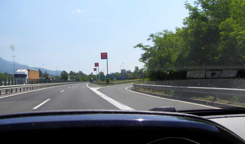
Fuel exit. The Autostrada was well-served with fuel and food stops on the way to Trieste.
�and there were signs that showed that Slovenia was getting to be in easy reach:
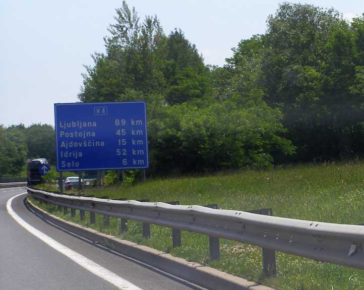
Signs of Slovenia. Getting closer to the next country on my trip.
When I did stop I snapped a photo of this Fiat Barchetta, a front view of the same model I�d not been able to identify the rear of the day before�
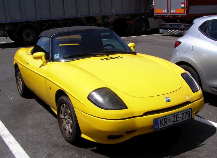
Fiat front. The Barchetta�s front. Though I don�t fancy front wheel drive sports cars at all.
�and I saw a number of signs I couldn�t read or in any way understand relating to Slovenia. This was to prove my downfall this day.
Back in the car I came to the border before too long. Toll gates were there�
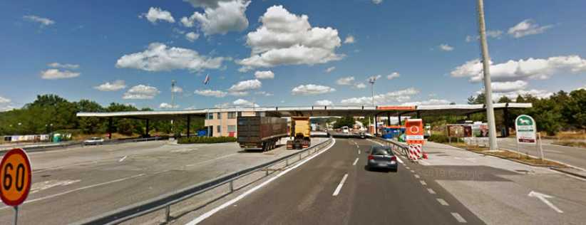
Entering Slovenia. Border crossings are nothing in Europe these days, but these toll gates used to be there to collect tolls for the motorway in Slovenia. But nobody was home.
�but when I pulled up to pay the toll there was no way to pay it. I looked around, nobody was there, I simply didn�t understand it and so there was nothing to do but drive on.
Almost as soon as I crossed the border I felt I was in a different, more satisfyingly pretty land. Slovenia, even from the motorway, looked much more inviting than Italy. All of that, of course, was to be spoiled when I got to the next toll gates:
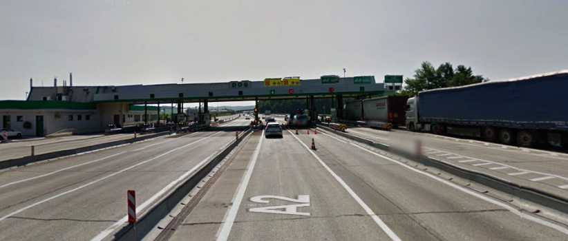
The reckoning. This is the toll gate where I was to meet the nastiest person I encountered on the whole trip.
Again, there was nobody there. I looked around, I could see no way to pay any toll. Then a lady in a police van about 50 metres away signalled to me to go to her. So I duly went� like a lamb to the slaughter.
With no sign of understanding or compassion, with no semblance of niceness, with a totally vicious and dictatorial manner she spat out to me that I had to have a �vigneta�. A what? What on earth is a �vigneta�? No matter what I knew and didn�t know, the message was clear, �Show me your Vigneta, you have to have a Vigneta!�
That was what those signs at the service station were about back in Italy. Slovenian Vignetas were available there to allow you to drive down their toll roads unmolested, they are a label you stick up in your windscreen and, presumably, some kind of camera takes note of them. But I didn�t know that and I was certainly being molested.
She was spitting out in the most unpleasant way that I should have known, that I had to pay. And because I didn�t I had to buy the Vigneta from her for �16, but not before I paid a fine for not having bought it in advance. �300!
Naturally my first thought was to try to get out of this, but this dropout from the local school for public relations wasn�t going to allow me to get away with anything. And if I kept trying she was gong to confiscate my licence and passport and I wouldn�t be able to get them back for 30 days. Her manner throughout all of this was mean, officious and overbearing.
So I agreed to pay what was necessary. Half the fine had to be paid on the spot and the rest later (I never heard another word about it, by the way) and so I shelled out �166 using my �Load & Go� Visa travel card. Yes, she was equipped with all that was needed to peel money out of the tourists right then and there. To say I was unhappy as I drove away would be an understatement.
To her credit, however, she did tell me which countries had �vignetas� so I would know as I got to their borders.
I figured it was better to put the bad thoughts aside and enjoy the drive, and Slovenia repaid with some nice scenery, seen only from the toll road. Subsequently a lot of people have told me how beautiful Slovenia is, but then they talk about beaches and seashore and I wasn�t near any of that.
Nevertheless, there were nice sights�
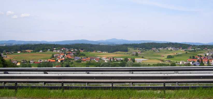
Slovenian scenery. It all seemed greener and cleaner than Italy, I was quite impressed with the scenery as I drove on.
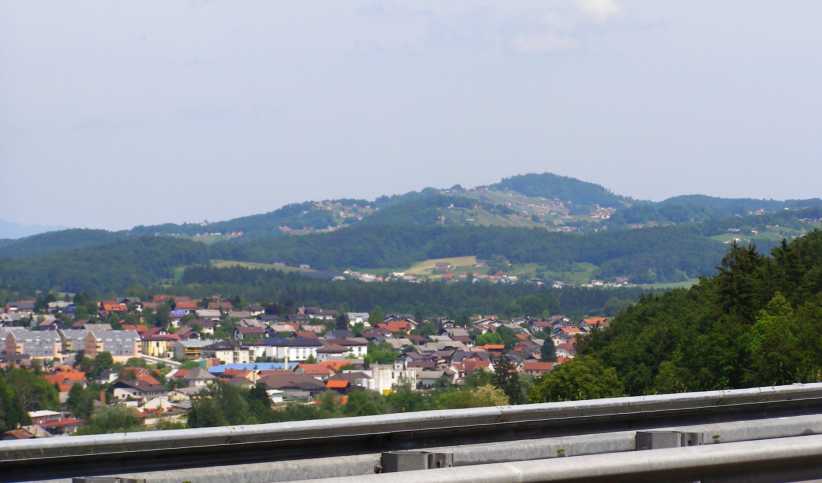
Slovenian city. This may well be Ljubljana, spreading itself alongside the motorway.
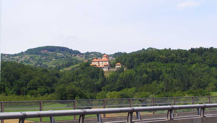
Impressive. This building stood out in the scenery, very imposing.
And there was more to see as I drove along. The sign here says it�s 56kms to Zagreb, so I was making progress without stopping anywhere other than for the police�
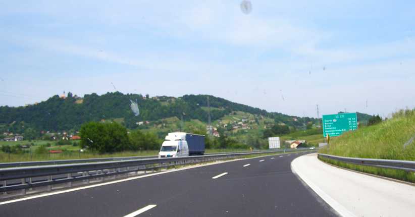
Covering the distance. 56kms to Zagreb, which is in Croatia, I was making progress in my drive to get to Serbia. Still the scenery was interesting.
�and this one identifies the first village in Croatia, with more toll gates coming up:
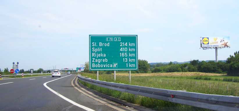
Another border. Crossing from country to country, here I was about to enter the third country I�d been in on this day, with another to come. Here I didn't need another vigneta. And I note the LiDL (Aldi's main competitor in Europe) sign welcoming me too.
�and then I crossed the border into Croatia. The evidence that I�d crossed a border soon came up on a roadside sign�
Granny Smiths. The famous breed of apples which the old lady in Sydney grew were here the symbol of a chain of supermarkets. I didn�t go there or to any other shop in either Slovenia or Croatia, nibbling on leftovers and other food I had on board.
Was I more interested in that because it featured an Australian breed of apple?
At a derelict border post (not that it was out of use, just less used than it obviously once was) I stopped and looked for somewhere for personal relief�
Derelict. Buildings alongside yet another toll station were looking pretty rough. I�m not sure whether or not these might have been businesses or were part of a border crossing.
�It all told a story of times past, when there was great animosity between these peoples who were put into the one country under the title �Yugoslavia� after the first World War, but who rebelled against all of that back in the nineties in another bloody war and became separate countries again, and now they unite as part of the European Economic Community but remain separate sovereign states.
The roadside differed a little through Croatia, it didn�t seem as prosperous, or maybe the conditions under which the freeway was pushed through were different. At times streets of villages came to an abrupt halt at the edge�
Villages at the edge. Village roads cut off by the motorway left houses right up against the new road.
�but at times we were driving through forest�
Through the forests. And there were sections where only the forest could be seen, so there was variety.
�and other times it was very reminiscent of what I�d seen earlier in the day:
Well settled. More like what I�d seen in Slovenia, this scene reminds me that the density of population in Europe is well above what I know in Australia. A modern bridge adds to the more traditional outlook.
But I hadn�t seen one of these for a while � and I wouldn�t be going anywhere near that far in that direction � but it was still familiar�
Very familiar. I hadn�t seen a sign of the all too familiar American brand for a while, and I wouldn�t be going far enough to see this place.
�while this kind of information for travellers was useful�
Roadside services. Features like LPG, showers, phones and currency exchange, valuable information for people in need of such things.
And, as you can see from the toning in that picture, the day was starting to go away from me. Soon I pulled up and looked behind to get this sunset shot as my last photo of the day:
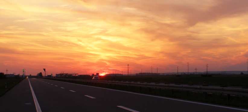
Croatian sunset. As the sunset formed in my mirrors I decided to stop and get a photo of it.
I drove on, and when I turned North towards Senta I went from freeway to regular roads. Soon I would pull up and get some fuel and some food, but I found that the Load & Go Visa travel card wouldn�t work there. I�d struck cards not working in odd places before, I was able to pay with another card, but this was to become a bigger problem over the next few days.
Having filled the car and myself, I then started to look for somewhere safe to park so I could sleep for the night before calling on the people I was looking forward to meeting.
During the day I got a text message from Sandra, she told me she was back in Brisbane but very tired.
Leaving that good stuff for now, it�s time to look at the journey across parts of four countries. I�m not sure this is the accurate route, but it�s close:
Somewhere a little short of the border I would need to pull up for fuel, but there were plenty of places to do that, easily accessed from the Autostrada�
Fuel exit. The Autostrada was well-served with fuel and food stops on the way to Trieste.
�and there were signs that showed that Slovenia was getting to be in easy reach:
Signs of Slovenia. Getting closer to the next country on my trip.
When I did stop I snapped a photo of this Fiat Barchetta, a front view of the same model I�d not been able to identify the rear of the day before�
Fiat front. The Barchetta�s front. Though I don�t fancy front wheel drive sports cars at all.
�and I saw a number of signs I couldn�t read or in any way understand relating to Slovenia. This was to prove my downfall this day.
Back in the car I came to the border before too long. Toll gates were there�
Entering Slovenia. Border crossings are nothing in Europe these days, but these toll gates used to be there to collect tolls for the motorway in Slovenia. But nobody was home.
�but when I pulled up to pay the toll there was no way to pay it. I looked around, nobody was there, I simply didn�t understand it and so there was nothing to do but drive on.
Almost as soon as I crossed the border I felt I was in a different, more satisfyingly pretty land. Slovenia, even from the motorway, looked much more inviting than Italy. All of that, of course, was to be spoiled when I got to the next toll gates:
The reckoning. This is the toll gate where I was to meet the nastiest person I encountered on the whole trip.
Again, there was nobody there. I looked around, I could see no way to pay any toll. Then a lady in a police van about 50 metres away signalled to me to go to her. So I duly went� like a lamb to the slaughter.
With no sign of understanding or compassion, with no semblance of niceness, with a totally vicious and dictatorial manner she spat out to me that I had to have a �vigneta�. A what? What on earth is a �vigneta�? No matter what I knew and didn�t know, the message was clear, �Show me your Vigneta, you have to have a Vigneta!�
That was what those signs at the service station were about back in Italy. Slovenian Vignetas were available there to allow you to drive down their toll roads unmolested, they are a label you stick up in your windscreen and, presumably, some kind of camera takes note of them. But I didn�t know that and I was certainly being molested.
She was spitting out in the most unpleasant way that I should have known, that I had to pay. And because I didn�t I had to buy the Vigneta from her for �16, but not before I paid a fine for not having bought it in advance. �300!
Naturally my first thought was to try to get out of this, but this dropout from the local school for public relations wasn�t going to allow me to get away with anything. And if I kept trying she was gong to confiscate my licence and passport and I wouldn�t be able to get them back for 30 days. Her manner throughout all of this was mean, officious and overbearing.
So I agreed to pay what was necessary. Half the fine had to be paid on the spot and the rest later (I never heard another word about it, by the way) and so I shelled out �166 using my �Load & Go� Visa travel card. Yes, she was equipped with all that was needed to peel money out of the tourists right then and there. To say I was unhappy as I drove away would be an understatement.
To her credit, however, she did tell me which countries had �vignetas� so I would know as I got to their borders.
I figured it was better to put the bad thoughts aside and enjoy the drive, and Slovenia repaid with some nice scenery, seen only from the toll road. Subsequently a lot of people have told me how beautiful Slovenia is, but then they talk about beaches and seashore and I wasn�t near any of that.
Nevertheless, there were nice sights�
Slovenian scenery. It all seemed greener and cleaner than Italy, I was quite impressed with the scenery as I drove on.
Slovenian city. This may well be Ljubljana, spreading itself alongside the motorway.
Impressive. This building stood out in the scenery, very imposing.
And there was more to see as I drove along. The sign here says it�s 56kms to Zagreb, so I was making progress without stopping anywhere other than for the police�
Covering the distance. 56kms to Zagreb, which is in Croatia, I was making progress in my drive to get to Serbia. Still the scenery was interesting.
�and this one identifies the first village in Croatia, with more toll gates coming up:
Another border. Crossing from country to country, here I was about to enter the third country I�d been in on this day, with another to come. Here I didn't need another vigneta. And I note the LiDL (Aldi's main competitor in Europe) sign welcoming me too.
�and then I crossed the border into Croatia. The evidence that I�d crossed a border soon came up on a roadside sign�
Granny Smiths. The famous breed of apples which the old lady in Sydney grew were here the symbol of a chain of supermarkets. I didn�t go there or to any other shop in either Slovenia or Croatia, nibbling on leftovers and other food I had on board.
Was I more interested in that because it featured an Australian breed of apple?
At a derelict border post (not that it was out of use, just less used than it obviously once was) I stopped and looked for somewhere for personal relief�
Derelict. Buildings alongside yet another toll station were looking pretty rough. I�m not sure whether or not these might have been businesses or were part of a border crossing.
�It all told a story of times past, when there was great animosity between these peoples who were put into the one country under the title �Yugoslavia� after the first World War, but who rebelled against all of that back in the nineties in another bloody war and became separate countries again, and now they unite as part of the European Economic Community but remain separate sovereign states.
The roadside differed a little through Croatia, it didn�t seem as prosperous, or maybe the conditions under which the freeway was pushed through were different. At times streets of villages came to an abrupt halt at the edge�
Villages at the edge. Village roads cut off by the motorway left houses right up against the new road.
�but at times we were driving through forest�
Through the forests. And there were sections where only the forest could be seen, so there was variety.
�and other times it was very reminiscent of what I�d seen earlier in the day:
Well settled. More like what I�d seen in Slovenia, this scene reminds me that the density of population in Europe is well above what I know in Australia. A modern bridge adds to the more traditional outlook.
But I hadn�t seen one of these for a while � and I wouldn�t be going anywhere near that far in that direction � but it was still familiar�
Very familiar. I hadn�t seen a sign of the all too familiar American brand for a while, and I wouldn�t be going far enough to see this place.
�while this kind of information for travellers was useful�
Roadside services. Features like LPG, showers, phones and currency exchange, valuable information for people in need of such things.
And, as you can see from the toning in that picture, the day was starting to go away from me. Soon I pulled up and looked behind to get this sunset shot as my last photo of the day:
Croatian sunset. As the sunset formed in my mirrors I decided to stop and get a photo of it.
I drove on, and when I turned North towards Senta I went from freeway to regular roads. Soon I would pull up and get some fuel and some food, but I found that the Load & Go Visa travel card wouldn�t work there. I�d struck cards not working in odd places before, I was able to pay with another card, but this was to become a bigger problem over the next few days.
Having filled the car and myself, I then started to look for somewhere safe to park so I could sleep for the night before calling on the people I was looking forward to meeting.
During the day I got a text message from Sandra, she told me she was back in Brisbane but very tired.
Last edited by Ray Bell; Apr 4, 2020 at 02:04 AM.