

Ride along with me...


Thread Starter
|
Captain

Joined: Oct 2005
Posts: 568
Likes: 8
From: The Summit, Queensland, Australia
I generally don’t have any trouble waking up early when I sleep along the road, and so it proved this morning. The van sprang into life with very little light in the Eastern sky and I began my drive towards the rock…
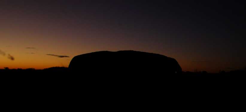
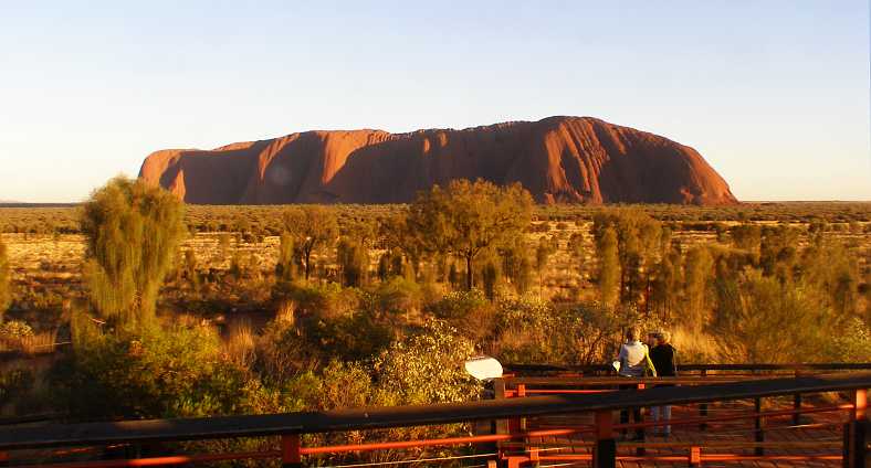
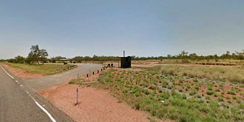
Up early. Driving down the now-familiar road towards the monolith with the first vestiges of the breaking day in the background, dirty windscreen in the foreground.
It was quite some distance to the well-arranged viewing area for the sunrise spectacle and the parking area was a few hundred yards from where viewing platforms had been constructed. It wasn’t far from the carpark that we started walking on elevated walkways to protect the local flora.
No sun yet. While there’s plenty of light about at this point, the sun is not yet striking Ayers Rock while the Olgas in the distance also await their turn.
Walking along these paths were many visitors, of course. The rock was experiencing some of the biggest crowds ever because of the imminence of the ban on climbing on it.
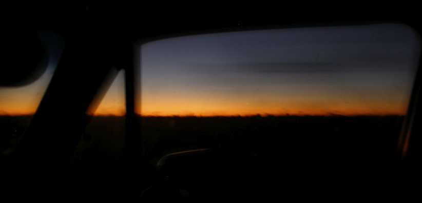
Still early on the path. The glow on the horizon silhouettes the scrub as I walk out the path towards the viewing platforms.
Remembering the fire we saw the previous evening, this sign gave us some information relating to the regular burning that’s carried out:
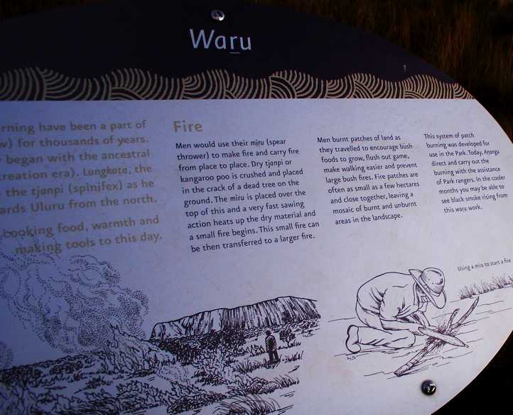
Fire sign. This explains about the burning off practices and traditions where burning-off is carried out in patches. It concludes, “Today, Anangu direct and carry out the burning with the assistance of Park rangers. In the cooler months you may be able to see black smoke rising from this waru work.”
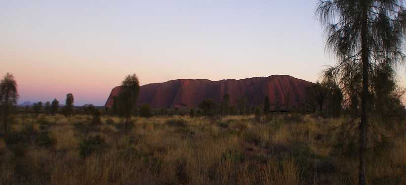
Soon the sun started its inexorable advance into the sky, throwing its bright rays onto the rock:
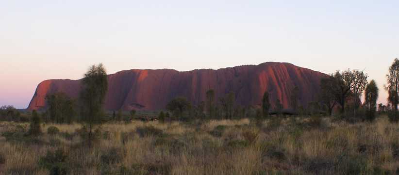
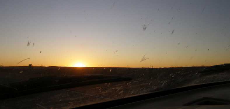
First of the bright sun. The rock is ready for another day basking in the sun, which selectively lights up areas as they are presented by the rock’s shape.
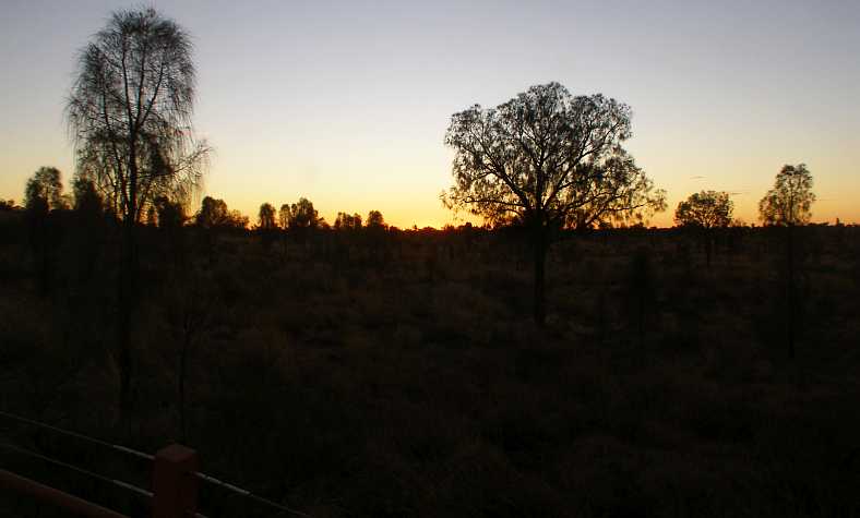
It still took a while, but we all waited patiently. Most eyes, naturally enough, were on the rock, but at times looking back the other way showed the progress of the sun’s rising.
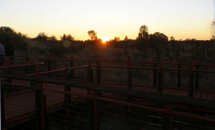
Sun rising and the elevated path. This place is really out in the desert, yet so much effort has gone into preparing it for tourists from all over the world. The elevated pathways are yet to meet the full force of the morning sun here.
As the sun rose the whole scene became lighter and lighter…

More of that sun. Contrasts became harsher as the sun rose, but the lack of light on the scrub and grass shows that it’s not yet very high.
…and in the distance we began to acknowledge that the spectacle of the sun beaming down on the Olgas was perhaps even greater.
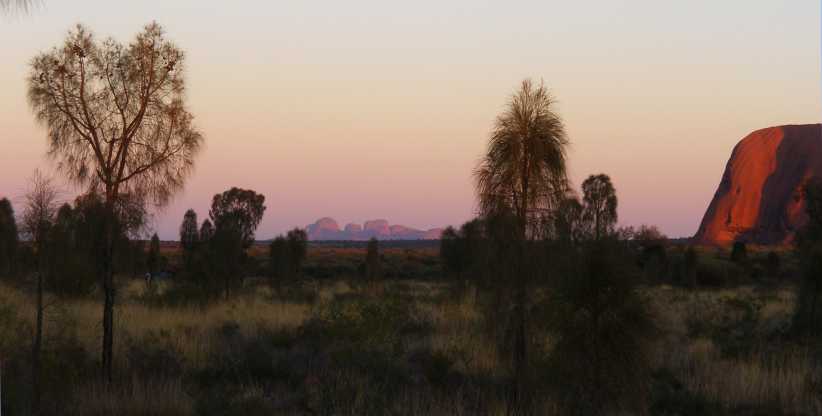
The Olgas, too. The early sun on the Olgas was, I feel, more impressive than it was on Ayers Rock.
So the sun climbed up in the sky and the whole landscape was being properly lit up:
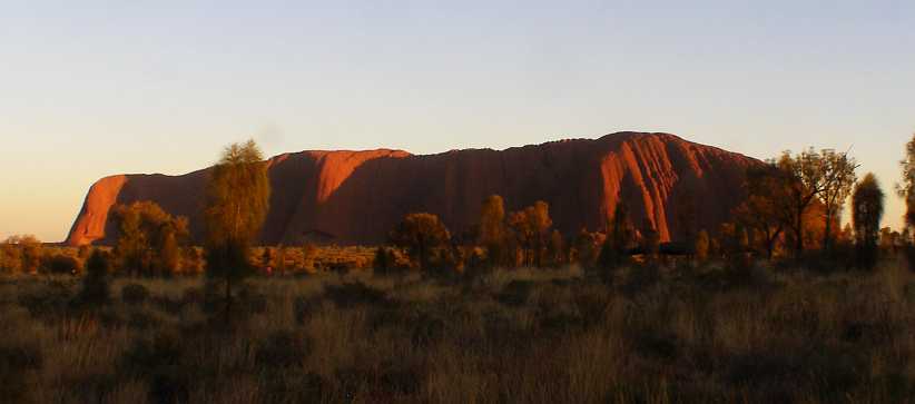
Sun up now. It was only a matter of time and the sun crept right across the desert.
There were many cars and some buses in the carpark, a further indication of the high level of tourist activity at the rock at this time. The crowd could now be satisfied that they’d seen this sight…

Crowd on lookout. With some small hills to work with, the park has provided lookouts with elevated platforms for viewing. They were busy places this morning.
…and this one, too:

Olgas in the sun. Though they were over twenty miles away, the Olgas were a great sight from this viewing area.
And as the sun got higher the brightness played out on everything in sight. People staying at Yulara went back there for breakfast, a few diligent souls hung around and kept on looking.
Harsh morning sun. Though it was winter it was still the desert and it reflected the strong light the sun threw down.
Another perspective on the Olgas:

With the Olgas. With most viewers gone, a couple remain to get a last look at the scene, in which the shadows on Ayers Rock make it look quite different to the sunlight reflecting all over the Olgas.
I went back to the carpark. On the way I struck up a conversation with a family from one of the smaller European countries, either Denmark or Finland, and it transpired they were parked near my van. They invited me to join them for breakfast and that was something I couldn’t turn down. They were certainly enjoying their trip through our Red Centre, the children being young teenagers.
But I still had work to do in Alice Springs and I had to make do with this time I’d spent here. As I drove out I captured this picture:

Climbing slope. The shiny slope seen here is the one up which people climbed the rock. Posts with chains helped people in this endeavour.
Seeing the steepness of the climb, and understanding the length of it, confirmed that I would not be thinking of doing it. My knee would never forgive me.
On the way back to Alice Springs I was almost at Erldunda when I ran out of fuel and had to put in the first of the drums I’d brought all the way from Toowoomba. At Erldunda I stopped and bought another 'Barra Burger' for my lunch.
Back at the Alice. The Woolworths carpark, which serves an arcade as well, is a busy place. I managed to scratch a door of the van on a tight turn past a Landcruiser ‘roo bar in here.
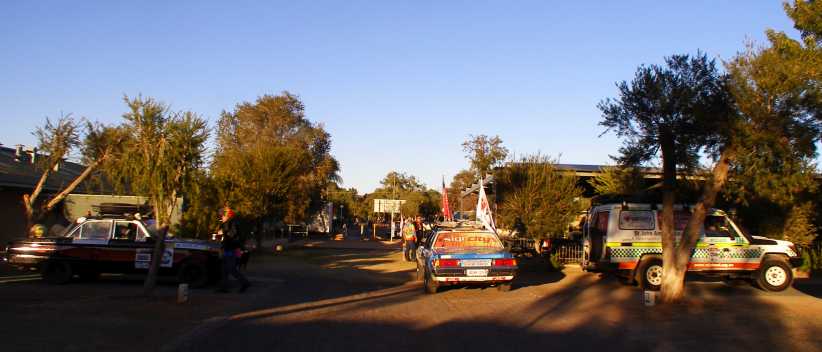
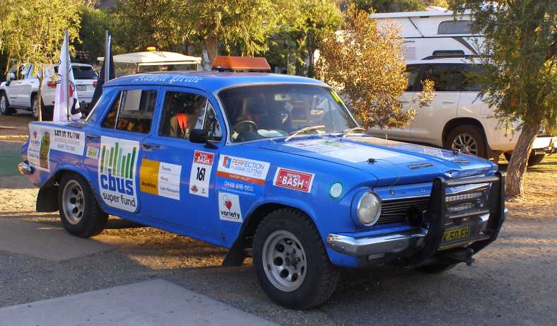
I was back to the camping area at Ross for the couple of nights I still had left in town. I got a bit of a surprise when I went to the camp kitchen on one of these mornings and found that the Northern Territory Variety Club Bash was happening and the crews were camped in the park.

VW encampment. ‘Dak-dak’ is a common nickname for Volkswagens in Australia, taking off their horizontally opposed exhaust sound. This competitor in the bash seems to have plenty of rollover protection.
They were throughout the park – surely an indication that they were booked in a long time ago – and the club wasn’t the only thing which had ‘variety’ about it. Though these competitors…
Falcons. About twenty years separate these Falcons, but that made no difference to their eligibility or enthusiasm to compete.
…both had Falcons. To the right can be seen the St Johns Ambulance vehicle which accompanied the event.
With so many of them there, feeding the ‘troops’ was a big job. They were ready for it with this barbecue plate:

Barbecue trailer. Beyond the camp kitchen’s regular barbecues can be seen the massive barbecue plate mounted on a trailer.
The competitors basically took over the camp kitchen, both the cooking area and the seats and tables. They were dressed up, likely following a theme for the day.
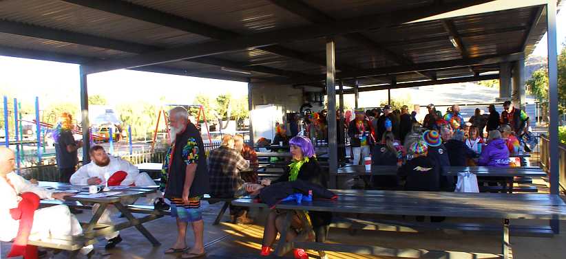
Plenty for breakfast. The camp kitchen was the centre of activity for the crews at breakfast time, with a lot of colour in their adornment and dress.
As mentioned, these events are all about raising money for charities. The Variety Club assists children with illnesses and disabilities and has its worldwide roots in America having been established in Pittsburgh PA in 1927. This particular event, however, was assisting the Royal Flying Doctor Service.
The camping area fell in line with the event, donating a substantial figure:

Handsome cheque. The Flying Doctor Service serves most remote areas of Australia and helps ensure that adults as well as children can get the best medical service possible.
More of the cars came before the lens of my camera:
EJ Holden. Dating from 1962/63, this Holden originally had a 138ci six, but it’s likely this car had a 179 from the next model installed.
The Holden was from the Central Coast of New South Wales, so it was a long way from home, while this Mercedes…
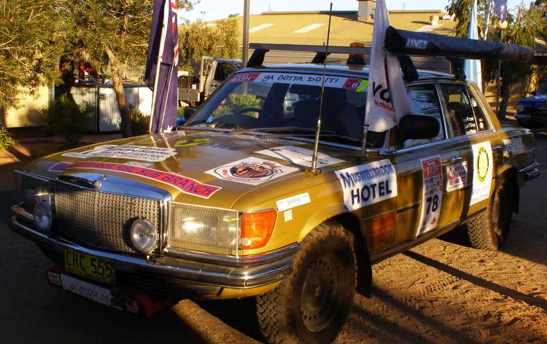
Mercedes from the Hunter. Doing it in style, the crew of this car should have had a comfortable ride in the event.
…was just a tad closer, having come from the Hunter Valley, which adjoins the Central Coast. They had still crossed at least two state borders to get to Alice Springs.
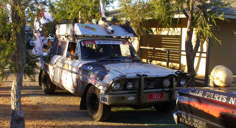
Compact Fairlane. The Fairlane is a local car. The model seems to be fairly popular in these events, having decent power and not being too large. Note the skull on the bootlid of the Falcon in front of them.
And so the fun and games of the Variety Club Bash was placed before me on this day. And then I had to get to work again, which led to me getting this photo as I headed in from Braitling:
Self-contained earthmover. With two earthmoving machines on the truck and first trailer, there’s also a fuel tank to keep them going tagging along behind.
I had the chance this day to follow up on the regular weekend job I’d done in The Gap a week or two earlier. That was an interesting day, I was in the middle of interviewing a young bloke and his girlfriend arrived on her bicycle, which she put down on the lawn in full view of their seating position in the lounge.
All of a sudden, the girl exclaimed: “That kid’s taking my bike!” Instantly the young man gave chase, returning soon afterwards with the bike and a story about how he’d chased the errant child up the street. “He told me he was going to break it,” he said. He hadn’t stolen it to use, but to give himself something to destroy. “that’s what they do,” he concluded.
I had also interviewed a very nice family man in that street and he had triplets. One of the things we do is offer people with children aged from six to thirteen a small survey booklet for their children, who get a gift once it’s completed. He accepted on behalf of his girls:
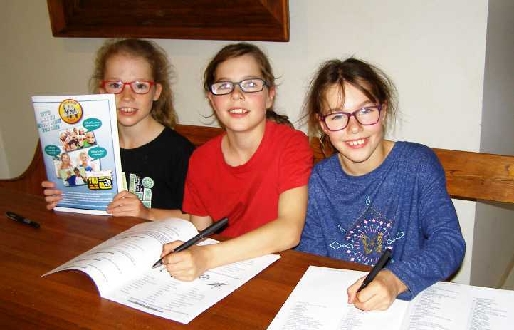
Triplets. Enthusiastically filling out their survey booklets, these girls were aged ten. I’d arranged to go back and photograph them for us to use to promote the ‘Young Australia Survey’ they were doing.
I wasn’t yet finished in Alice Springs. Due to this, the company had arranged for someone else to do the area I’d been intended to cover at Lajamanu – the Aboriginal area for which I’d obtained the ‘working with children’ permission – but they had other work for me to do as others were falling behind in getting the areas covered elsewhere.
And I had to take the opportunity to have a look around another little tourist attraction the area offers…
Up early. Driving down the now-familiar road towards the monolith with the first vestiges of the breaking day in the background, dirty windscreen in the foreground.
It was quite some distance to the well-arranged viewing area for the sunrise spectacle and the parking area was a few hundred yards from where viewing platforms had been constructed. It wasn’t far from the carpark that we started walking on elevated walkways to protect the local flora.
No sun yet. While there’s plenty of light about at this point, the sun is not yet striking Ayers Rock while the Olgas in the distance also await their turn.
Walking along these paths were many visitors, of course. The rock was experiencing some of the biggest crowds ever because of the imminence of the ban on climbing on it.
Still early on the path. The glow on the horizon silhouettes the scrub as I walk out the path towards the viewing platforms.
Remembering the fire we saw the previous evening, this sign gave us some information relating to the regular burning that’s carried out:
Fire sign. This explains about the burning off practices and traditions where burning-off is carried out in patches. It concludes, “Today, Anangu direct and carry out the burning with the assistance of Park rangers. In the cooler months you may be able to see black smoke rising from this waru work.”
Soon the sun started its inexorable advance into the sky, throwing its bright rays onto the rock:
First of the bright sun. The rock is ready for another day basking in the sun, which selectively lights up areas as they are presented by the rock’s shape.
It still took a while, but we all waited patiently. Most eyes, naturally enough, were on the rock, but at times looking back the other way showed the progress of the sun’s rising.
Sun rising and the elevated path. This place is really out in the desert, yet so much effort has gone into preparing it for tourists from all over the world. The elevated pathways are yet to meet the full force of the morning sun here.
As the sun rose the whole scene became lighter and lighter…
More of that sun. Contrasts became harsher as the sun rose, but the lack of light on the scrub and grass shows that it’s not yet very high.
…and in the distance we began to acknowledge that the spectacle of the sun beaming down on the Olgas was perhaps even greater.
The Olgas, too. The early sun on the Olgas was, I feel, more impressive than it was on Ayers Rock.
So the sun climbed up in the sky and the whole landscape was being properly lit up:
Sun up now. It was only a matter of time and the sun crept right across the desert.
There were many cars and some buses in the carpark, a further indication of the high level of tourist activity at the rock at this time. The crowd could now be satisfied that they’d seen this sight…
Crowd on lookout. With some small hills to work with, the park has provided lookouts with elevated platforms for viewing. They were busy places this morning.
…and this one, too:
Olgas in the sun. Though they were over twenty miles away, the Olgas were a great sight from this viewing area.
And as the sun got higher the brightness played out on everything in sight. People staying at Yulara went back there for breakfast, a few diligent souls hung around and kept on looking.
Harsh morning sun. Though it was winter it was still the desert and it reflected the strong light the sun threw down.
Another perspective on the Olgas:
With the Olgas. With most viewers gone, a couple remain to get a last look at the scene, in which the shadows on Ayers Rock make it look quite different to the sunlight reflecting all over the Olgas.
I went back to the carpark. On the way I struck up a conversation with a family from one of the smaller European countries, either Denmark or Finland, and it transpired they were parked near my van. They invited me to join them for breakfast and that was something I couldn’t turn down. They were certainly enjoying their trip through our Red Centre, the children being young teenagers.
But I still had work to do in Alice Springs and I had to make do with this time I’d spent here. As I drove out I captured this picture:
Climbing slope. The shiny slope seen here is the one up which people climbed the rock. Posts with chains helped people in this endeavour.
Seeing the steepness of the climb, and understanding the length of it, confirmed that I would not be thinking of doing it. My knee would never forgive me.
On the way back to Alice Springs I was almost at Erldunda when I ran out of fuel and had to put in the first of the drums I’d brought all the way from Toowoomba. At Erldunda I stopped and bought another 'Barra Burger' for my lunch.
Back at the Alice. The Woolworths carpark, which serves an arcade as well, is a busy place. I managed to scratch a door of the van on a tight turn past a Landcruiser ‘roo bar in here.
I was back to the camping area at Ross for the couple of nights I still had left in town. I got a bit of a surprise when I went to the camp kitchen on one of these mornings and found that the Northern Territory Variety Club Bash was happening and the crews were camped in the park.
VW encampment. ‘Dak-dak’ is a common nickname for Volkswagens in Australia, taking off their horizontally opposed exhaust sound. This competitor in the bash seems to have plenty of rollover protection.
They were throughout the park – surely an indication that they were booked in a long time ago – and the club wasn’t the only thing which had ‘variety’ about it. Though these competitors…
Falcons. About twenty years separate these Falcons, but that made no difference to their eligibility or enthusiasm to compete.
…both had Falcons. To the right can be seen the St Johns Ambulance vehicle which accompanied the event.
With so many of them there, feeding the ‘troops’ was a big job. They were ready for it with this barbecue plate:
Barbecue trailer. Beyond the camp kitchen’s regular barbecues can be seen the massive barbecue plate mounted on a trailer.
The competitors basically took over the camp kitchen, both the cooking area and the seats and tables. They were dressed up, likely following a theme for the day.
Plenty for breakfast. The camp kitchen was the centre of activity for the crews at breakfast time, with a lot of colour in their adornment and dress.
As mentioned, these events are all about raising money for charities. The Variety Club assists children with illnesses and disabilities and has its worldwide roots in America having been established in Pittsburgh PA in 1927. This particular event, however, was assisting the Royal Flying Doctor Service.
The camping area fell in line with the event, donating a substantial figure:
Handsome cheque. The Flying Doctor Service serves most remote areas of Australia and helps ensure that adults as well as children can get the best medical service possible.
More of the cars came before the lens of my camera:
EJ Holden. Dating from 1962/63, this Holden originally had a 138ci six, but it’s likely this car had a 179 from the next model installed.
The Holden was from the Central Coast of New South Wales, so it was a long way from home, while this Mercedes…
Mercedes from the Hunter. Doing it in style, the crew of this car should have had a comfortable ride in the event.
…was just a tad closer, having come from the Hunter Valley, which adjoins the Central Coast. They had still crossed at least two state borders to get to Alice Springs.
Compact Fairlane. The Fairlane is a local car. The model seems to be fairly popular in these events, having decent power and not being too large. Note the skull on the bootlid of the Falcon in front of them.
And so the fun and games of the Variety Club Bash was placed before me on this day. And then I had to get to work again, which led to me getting this photo as I headed in from Braitling:
Self-contained earthmover. With two earthmoving machines on the truck and first trailer, there’s also a fuel tank to keep them going tagging along behind.
I had the chance this day to follow up on the regular weekend job I’d done in The Gap a week or two earlier. That was an interesting day, I was in the middle of interviewing a young bloke and his girlfriend arrived on her bicycle, which she put down on the lawn in full view of their seating position in the lounge.
All of a sudden, the girl exclaimed: “That kid’s taking my bike!” Instantly the young man gave chase, returning soon afterwards with the bike and a story about how he’d chased the errant child up the street. “He told me he was going to break it,” he said. He hadn’t stolen it to use, but to give himself something to destroy. “that’s what they do,” he concluded.
I had also interviewed a very nice family man in that street and he had triplets. One of the things we do is offer people with children aged from six to thirteen a small survey booklet for their children, who get a gift once it’s completed. He accepted on behalf of his girls:
Triplets. Enthusiastically filling out their survey booklets, these girls were aged ten. I’d arranged to go back and photograph them for us to use to promote the ‘Young Australia Survey’ they were doing.
I wasn’t yet finished in Alice Springs. Due to this, the company had arranged for someone else to do the area I’d been intended to cover at Lajamanu – the Aboriginal area for which I’d obtained the ‘working with children’ permission – but they had other work for me to do as others were falling behind in getting the areas covered elsewhere.
And I had to take the opportunity to have a look around another little tourist attraction the area offers…
Last edited by Ray Bell; Mar 15, 2021 at 11:20 PM.
Thread Starter
|
Captain
Joined: Oct 2005
Posts: 568
Likes: 8
From: The Summit, Queensland, Australia
While at ‘The Alice’ I had heard reports about the Australian Road Transport Museum just South of town at Arumbera. I’d also driven past it while looking for people with whom I could leave questionnaires, but until I went inside the buildings and walked around their yards full of display items I had no idea what they had…
Starting with a couple of really old ones:
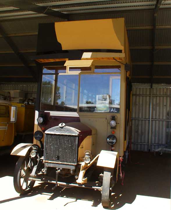
Maudslay with overhead camshaft. This British maker built trucks and some cars up until the forties, but this one seems to be from the pre-1920 period.
…with solid rubber tyres and other interesting features. This particular Maudslay, in fact, has features just like some I found in pictures from the first World War. But the overhead camshaft was something that really caught my eye and I learned that they were probably the first makers to put overhead cams into production – which they did on small engines in 1903 and sixes like this in 1904.
From my own neighborhood:
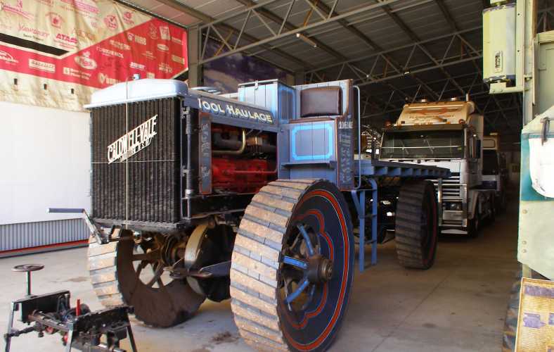
Caldwell-Vale. Four wheel drive, some models had 4-wheel steering as well, the Caldwell Vale trucks were built about four miles from where I was born. But a lot earlier, they ceased production about 1913.
I am intrigued by the ‘safety’ of the passenger in that one, while it looks like this ‘wool haulage’ truck is very low-geared and ready for any terrain.
Much more modern equipment was to be found, however, in the large sheds making up the main part of the museum. In this line-up we have…

Space saving. Cars loaded onto the back of the trucks saved display room in this hall. The nearest row of trucks are all Fords while beside them are International Harvesters. Well, certainly the front one is.
…cars loaded onto the back of trucks. The cars are, from left to right, Ford Anglia, Morris 850 (Mini), something too modern to bother with and a Holden HQ ‘one-tonner’ table top. Cabinets full of models can be seen lower in the pic and I’ve obviously taken this from another level where there are more displays.
Studebaker were represented…
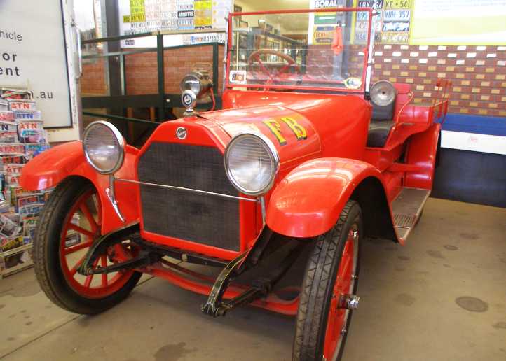
Studebaker fire truck. Formerly in service fighting fires in and around Charters Towers, Queensland, this has been nicely restored.
…and there was a number of twenties Buicks:
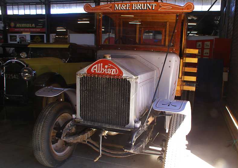
Albion and Buick. Some fine restoration work has gone into this old Albion, which features lots of woodwork at the rear. The Buick is a wire-wheeled beauty which has also had lots of loving attention.
And the Chrysler marques were far from forgotten…

Chrysler roadster. Another nice restoration, probably from the late twenties and very likely a Chrysler 70.
…though the Dodge Fast Four was a model inherited by Chrysler when they merged with Dodge:

Dodge Fast Four. Not a lot of this model were produced as Chrysler soon phased them out to end the 4-cylinder Dodge’s history.
You couldn’t have these things and not have a Packard, could you?
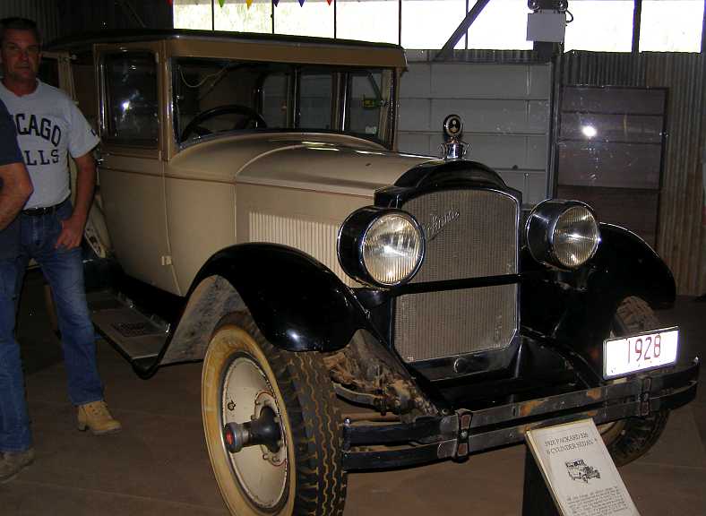
1928 Packard. Well-known for their quality in their day, this Packard is also of a very stately appearance.
But principally the museum is a trucker’s paradise. They have some major sponsorship from suppliers to the trucking industry, which is essential to the life and breath of Central Australia. Cummins put these on display:
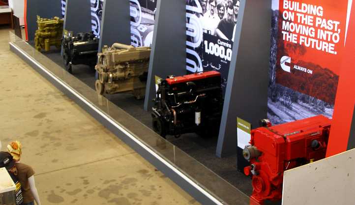
Cummins power. A line showing progress of Cummins diesels is backed up by pictures from the days when Cummins ran diesel cars at Indianapolis.
Outside these walls were many other exhibits – or simply trucks which have been donated and are more or less just lying around. Some are in sheds or under cover, some sit in the desert.
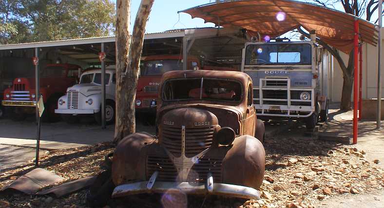
Dodges. The 1940s pickup is largely gutted, but the white British (Kew) Dodge truck is under cover. The forward-control trucks between them are a re-badged Commer and another I don’t recognise, while there’s an International down the end to give more variety.
Variety? There’s plenty of variety here! There are two of these Wisconsin-built trucks from the 4 Wheel Drive Auto Co:
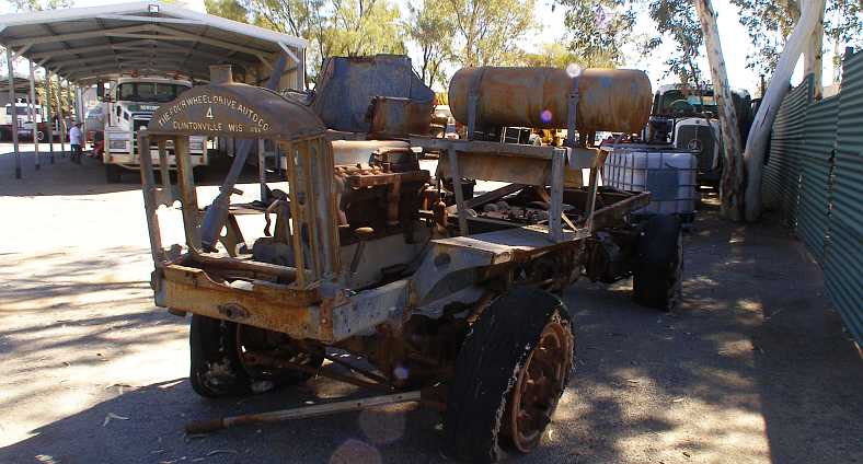
4 Wheel Drive. In a sad state, this one has obviously had a hard life. Behind it along the fence is a long-nose Mercedes-Benz truck.
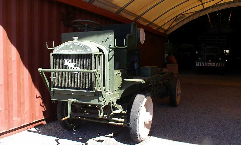
Solid tyres. Apparently an older model, judging by the tyres, but this one is more complete and gives a better idea of what they should look like.
I can’t imagine what it was like sitting up there above the hot engine, out in the dust and hot sun struggling over the terrain these trucks undoubtedly saw.
Kew Dodges. Two of the British Dodges from the fifties sit in the desert between the remains of a timber jinker on the left and a Bedford on the right.
Citroen 2CVs attract followers all over the world, and even though there aren’t many of them in Australia, owners of them get together to stage ‘Raids’ - competitive events on rough roads - from time to time and this one was a competitor in 2008.

’Raid’ Citroen 2CV. The air-cooled flat-twin engine in the front of these must work very hard, but they do date back to the thirties and were in production until, I think, the seventies. It would have been more comfortable than the Land Rover beside it, I’m sure, but was it a better choice for the job?
So there’s a good mix of vehicles from all over the world. I’m sure that a lot of them were collected from nearby as the country around Alice Springs would have worn out a lot of machinery as it was being developed. Or as they were simply passing through.
Dodge four. From the early to mid-twenties, this Dodge has the older 4-cylinder engine and appears to have been dragged in from a nearby property. The headlights have been converted at some time.
Would you like to have swayed around on a rough old road on the top deck of this one?
Maudslay bus. Still from the solid rubber tyre period, this Maudslay is more likely from the late twenties. Just where it was used as a double-decked bus I wouldn’t care to guess.
And would you expect to see a London Cab way out here?
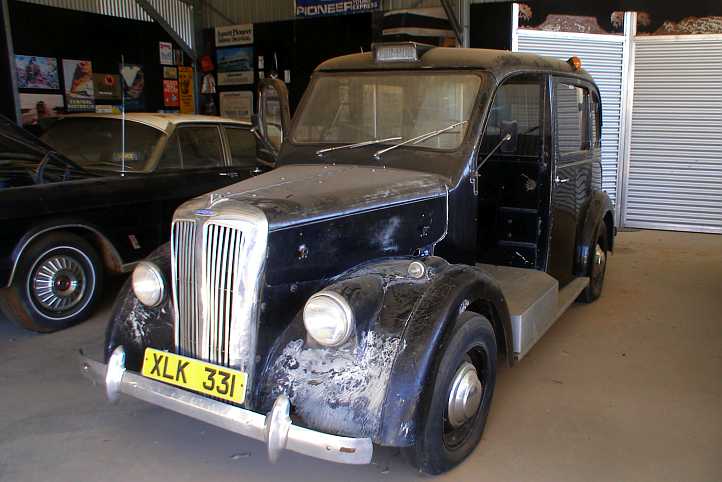
Beardmore. Austin didn’t make all the cabs in London, one competitor for that market was Beardmore. Beside it is an Australian (Falcon-based) Fairlane.
Beardmore’s cabs had some different features. They were powered by Ford Consul engines, a 4-cylinder ohv unit of about 1500cc to 1800cc and you can see by the crazing of the outer mudguard (fender) sections that they had some fibreglass panels.
The museum also pays homage to some of the leading lights in the road transport industry in Australia with displays like this: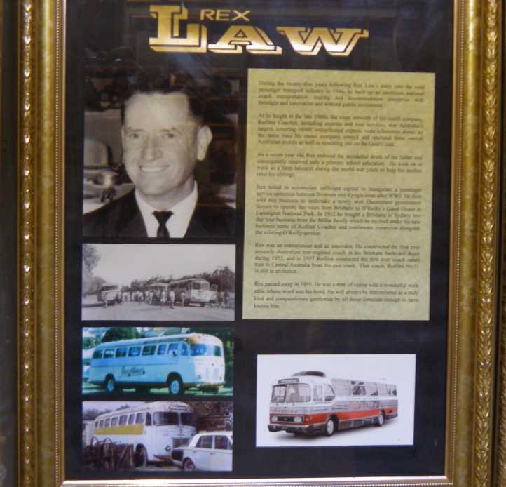
Rex Law. The man who ran the first rear-engined coach in Australia and built one of our biggest coach lines before being deceived by a potential buyer and seeing the business go into liquidation.
‘Redline Coaches’ was Rex Law’s business in the fifties and sixties, the fitment of a Cadillac (side-valve) V8 into the rear of a bus formerly powered by an International inline engine led to a revolution as passengers gained comfort with the noise being behind them. The Caddy engine also saw service in his race car built on a Regal Underslung chassis.
Redline was the first coach company to schedule regular services to the distant capital cities, Perth and Darwin and was based in Brisbane. He certainly deserved to be ranked up there among the men who helped build the road transport industry in the post-war years.
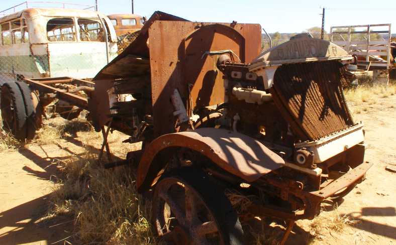
Some things were just lying around…

Air-cooled. This engine was lying there, I’m not sure whether it was an exhibit, a bit of background, or even if they were waiting for someone to come along and identify it.
Needless to say, if I’d had more time I’d have been back there looking at more. But my time in The Alice was running out. One task I took on between picking up the last of the questionnaires was to train a lady who’d filled one out to do the interviewing work.
This actually necessitated me staying there an extra day, but we figured it would be worthwhile because the company is often faced with having to fly someone in to get the jobs done so that their survey results would be truly representative of people living all over Australia.
Sadly, after taking all that time with her, she reckoned it wasn’t for her after they sent her one assignment.
And so, as a parting gesture as I was ready to head North, I ascended the hill to that end of town, known as Anzac Hill. This is the point from which most scenic views of Alice Springs are taken, and I didn’t neglect to take some of my own:

Looking South. With the gap in the MacDonnell Ranges prominent in the background, the city shows its modern features of growth. The school in the foreground is St Philips College.
Because I’d kept on working till the last moment, the sun was going down as I shot these pics, this one to the North:
Room to move. Contrasting with the view to the South, looking North shows a scattering of homes and buildings. A motorhome descends from the lookout in the lower left.
And so, with the sun setting to my left, I drove away from this hive of activity into the vast desert:

Another sunset. Typical desert outlook in the West as I headed North. Hills and scrub are silhouetted as the next part of my trip began.
My next work assignments were at Mount Isa, which was almost 1,200 kilometres away. A good day’s driving, or more if sightseeing. Getting away from Alice Springs I was intent on getting some fair distance behind me to reduce that a little, ultimately I would stop for dinner at Aileron, 130kms out, and then pull up for the night just over 300kms from Alice Springs:


Quiet darkening. There was still light after the sun went over the horizon and I snapped this shot which showed I was on the road. All alone on the road.
I had no idea where I’d get something to eat, but the signs for Aileron Roadhouse came up at the right time:

Aileron Roadhouse. It was the usual setup, a little caravan park, a few motel rooms, fuel and food available. I simply ate there.(GE)
They were quite nice people there, and the place was far from crowded so the service was good. The ‘Special of the Day’ appealed to me (Roast beef with chips and vegetables) and it wasn’t too expensive at $20. I soon drove out again ready for the night however far it might take me up the Stuart Highway. At first I pulled in to the little town of Ti Tree, but there wasn't anywhere obvious to park there and I went on.
Taylor Creek Rest Area. There’s a lot of cleared and levelled area here and many motorhomes and caravans were camped for the night when I arrived.(GE)
So I was a couple of hundred miles into my journey to Mount Isa when I pulled up to sleep. It was a quiet spot and the toilet was handy. What milestones would tomorrow bring?
Starting with a couple of really old ones:
Maudslay with overhead camshaft. This British maker built trucks and some cars up until the forties, but this one seems to be from the pre-1920 period.
…with solid rubber tyres and other interesting features. This particular Maudslay, in fact, has features just like some I found in pictures from the first World War. But the overhead camshaft was something that really caught my eye and I learned that they were probably the first makers to put overhead cams into production – which they did on small engines in 1903 and sixes like this in 1904.
From my own neighborhood:
Caldwell-Vale. Four wheel drive, some models had 4-wheel steering as well, the Caldwell Vale trucks were built about four miles from where I was born. But a lot earlier, they ceased production about 1913.
I am intrigued by the ‘safety’ of the passenger in that one, while it looks like this ‘wool haulage’ truck is very low-geared and ready for any terrain.
Much more modern equipment was to be found, however, in the large sheds making up the main part of the museum. In this line-up we have…
Space saving. Cars loaded onto the back of the trucks saved display room in this hall. The nearest row of trucks are all Fords while beside them are International Harvesters. Well, certainly the front one is.
…cars loaded onto the back of trucks. The cars are, from left to right, Ford Anglia, Morris 850 (Mini), something too modern to bother with and a Holden HQ ‘one-tonner’ table top. Cabinets full of models can be seen lower in the pic and I’ve obviously taken this from another level where there are more displays.
Studebaker were represented…
Studebaker fire truck. Formerly in service fighting fires in and around Charters Towers, Queensland, this has been nicely restored.
…and there was a number of twenties Buicks:
Albion and Buick. Some fine restoration work has gone into this old Albion, which features lots of woodwork at the rear. The Buick is a wire-wheeled beauty which has also had lots of loving attention.
And the Chrysler marques were far from forgotten…
Chrysler roadster. Another nice restoration, probably from the late twenties and very likely a Chrysler 70.
…though the Dodge Fast Four was a model inherited by Chrysler when they merged with Dodge:
Dodge Fast Four. Not a lot of this model were produced as Chrysler soon phased them out to end the 4-cylinder Dodge’s history.
You couldn’t have these things and not have a Packard, could you?
1928 Packard. Well-known for their quality in their day, this Packard is also of a very stately appearance.
But principally the museum is a trucker’s paradise. They have some major sponsorship from suppliers to the trucking industry, which is essential to the life and breath of Central Australia. Cummins put these on display:
Cummins power. A line showing progress of Cummins diesels is backed up by pictures from the days when Cummins ran diesel cars at Indianapolis.
Outside these walls were many other exhibits – or simply trucks which have been donated and are more or less just lying around. Some are in sheds or under cover, some sit in the desert.
Dodges. The 1940s pickup is largely gutted, but the white British (Kew) Dodge truck is under cover. The forward-control trucks between them are a re-badged Commer and another I don’t recognise, while there’s an International down the end to give more variety.
Variety? There’s plenty of variety here! There are two of these Wisconsin-built trucks from the 4 Wheel Drive Auto Co:
4 Wheel Drive. In a sad state, this one has obviously had a hard life. Behind it along the fence is a long-nose Mercedes-Benz truck.
Solid tyres. Apparently an older model, judging by the tyres, but this one is more complete and gives a better idea of what they should look like.
I can’t imagine what it was like sitting up there above the hot engine, out in the dust and hot sun struggling over the terrain these trucks undoubtedly saw.
Kew Dodges. Two of the British Dodges from the fifties sit in the desert between the remains of a timber jinker on the left and a Bedford on the right.
Citroen 2CVs attract followers all over the world, and even though there aren’t many of them in Australia, owners of them get together to stage ‘Raids’ - competitive events on rough roads - from time to time and this one was a competitor in 2008.
’Raid’ Citroen 2CV. The air-cooled flat-twin engine in the front of these must work very hard, but they do date back to the thirties and were in production until, I think, the seventies. It would have been more comfortable than the Land Rover beside it, I’m sure, but was it a better choice for the job?
So there’s a good mix of vehicles from all over the world. I’m sure that a lot of them were collected from nearby as the country around Alice Springs would have worn out a lot of machinery as it was being developed. Or as they were simply passing through.
Dodge four. From the early to mid-twenties, this Dodge has the older 4-cylinder engine and appears to have been dragged in from a nearby property. The headlights have been converted at some time.
Would you like to have swayed around on a rough old road on the top deck of this one?
Maudslay bus. Still from the solid rubber tyre period, this Maudslay is more likely from the late twenties. Just where it was used as a double-decked bus I wouldn’t care to guess.
And would you expect to see a London Cab way out here?
Beardmore. Austin didn’t make all the cabs in London, one competitor for that market was Beardmore. Beside it is an Australian (Falcon-based) Fairlane.
Beardmore’s cabs had some different features. They were powered by Ford Consul engines, a 4-cylinder ohv unit of about 1500cc to 1800cc and you can see by the crazing of the outer mudguard (fender) sections that they had some fibreglass panels.
The museum also pays homage to some of the leading lights in the road transport industry in Australia with displays like this:
Rex Law. The man who ran the first rear-engined coach in Australia and built one of our biggest coach lines before being deceived by a potential buyer and seeing the business go into liquidation.
‘Redline Coaches’ was Rex Law’s business in the fifties and sixties, the fitment of a Cadillac (side-valve) V8 into the rear of a bus formerly powered by an International inline engine led to a revolution as passengers gained comfort with the noise being behind them. The Caddy engine also saw service in his race car built on a Regal Underslung chassis.
Redline was the first coach company to schedule regular services to the distant capital cities, Perth and Darwin and was based in Brisbane. He certainly deserved to be ranked up there among the men who helped build the road transport industry in the post-war years.
Some things were just lying around…
Air-cooled. This engine was lying there, I’m not sure whether it was an exhibit, a bit of background, or even if they were waiting for someone to come along and identify it.
Needless to say, if I’d had more time I’d have been back there looking at more. But my time in The Alice was running out. One task I took on between picking up the last of the questionnaires was to train a lady who’d filled one out to do the interviewing work.
This actually necessitated me staying there an extra day, but we figured it would be worthwhile because the company is often faced with having to fly someone in to get the jobs done so that their survey results would be truly representative of people living all over Australia.
Sadly, after taking all that time with her, she reckoned it wasn’t for her after they sent her one assignment.
And so, as a parting gesture as I was ready to head North, I ascended the hill to that end of town, known as Anzac Hill. This is the point from which most scenic views of Alice Springs are taken, and I didn’t neglect to take some of my own:
Looking South. With the gap in the MacDonnell Ranges prominent in the background, the city shows its modern features of growth. The school in the foreground is St Philips College.
Because I’d kept on working till the last moment, the sun was going down as I shot these pics, this one to the North:
Room to move. Contrasting with the view to the South, looking North shows a scattering of homes and buildings. A motorhome descends from the lookout in the lower left.
And so, with the sun setting to my left, I drove away from this hive of activity into the vast desert:
Another sunset. Typical desert outlook in the West as I headed North. Hills and scrub are silhouetted as the next part of my trip began.
My next work assignments were at Mount Isa, which was almost 1,200 kilometres away. A good day’s driving, or more if sightseeing. Getting away from Alice Springs I was intent on getting some fair distance behind me to reduce that a little, ultimately I would stop for dinner at Aileron, 130kms out, and then pull up for the night just over 300kms from Alice Springs:
Quiet darkening. There was still light after the sun went over the horizon and I snapped this shot which showed I was on the road. All alone on the road.
I had no idea where I’d get something to eat, but the signs for Aileron Roadhouse came up at the right time:
Aileron Roadhouse. It was the usual setup, a little caravan park, a few motel rooms, fuel and food available. I simply ate there.(GE)
They were quite nice people there, and the place was far from crowded so the service was good. The ‘Special of the Day’ appealed to me (Roast beef with chips and vegetables) and it wasn’t too expensive at $20. I soon drove out again ready for the night however far it might take me up the Stuart Highway. At first I pulled in to the little town of Ti Tree, but there wasn't anywhere obvious to park there and I went on.
Taylor Creek Rest Area. There’s a lot of cleared and levelled area here and many motorhomes and caravans were camped for the night when I arrived.(GE)
So I was a couple of hundred miles into my journey to Mount Isa when I pulled up to sleep. It was a quiet spot and the toilet was handy. What milestones would tomorrow bring?
Last edited by Ray Bell; Mar 16, 2021 at 09:35 PM.
Thread Starter
|
Captain
Joined: Oct 2005
Posts: 568
Likes: 8
From: The Summit, Queensland, Australia
This was to be the day to break the back of the trip to Mt Isa. To go all the way if it wasn�t too hard. But there can be distractions�

Nobody can say I didn�t try to get on with the job. As I commenced driving the glow in the Eastern sky was still faint:
Early start. Maybe a truck woke me up? Anyway, I got moving early and was rewarded with a comprehensive view of the day beginning.
There can be no denying that this is a big country. Some distance up the road the light was starting to shine across it�

Vast expanse. No city lights out here, just plain old desert country with a road and a centreline along it. Still my headlights did more to light up that centreline than the rising sun.
�and after forty or fifty minutes the sun began to peek up over the horizon:
The sun appears. The bugs on my windscreen show up well as a bend in the road about 45 miles out puts the rising sun full in view.
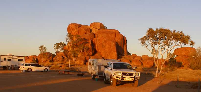
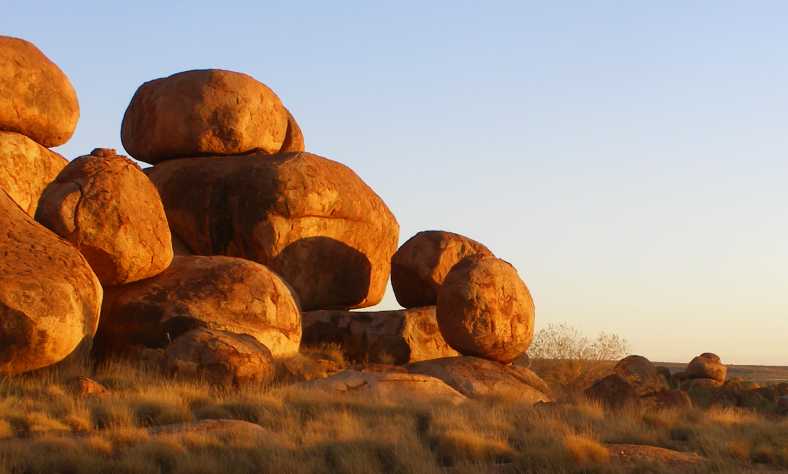
But the road is not devoid of interest. Soon after this came the turn into the Devil�s Marbles. Another place out in the desert where the rocks come to the fore and attract many visitors.

First of the marbles. Driving into the conservation park this silhouette view greeted me. As did many others.
Further up the drive I came to an area where several caravans were camped, as I turned back to see the way the morning sun was throwing colour on the rocks I got these pics:

The sunny side. Rocks are piled upon each other everywhere here, and then there are those which have chosen to balance on others. The sun lit them up nicely.
With the pop-tops. The pop-top on the right is from Western Australia, others were from Eastern states, the rocks simply spoke of being there from time immemorial, baking in the sun, cooling each night.
As I moved off to go to the lower area, I kept coming across more piles worth photographing�

Marbles everywhere. Some look like they�ve grown there together, others fell into place as they were exposed by weathering and erosion.

Heading to the lower area. The sun was coming up to strike upon more and more as I drove down the track. Visible is the picnic area in the midst of the distant rocks.
Individual clusters of rocks had their own little features:
Balanced. You would think that rock would slip from its position of balance, but the sunrise this day found it exactly where it�s been for centuries.
Finding a toilet block was a good thing for me at this time, it required a short walk between piles of rocks from the parking area where the picnic area is set out.
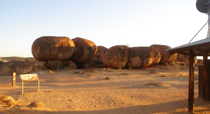
Amenities. There�s a picnic area here, with the covered area to the right, while down beyond the rocks on the left is a toilet block.
It was here that I struck a most unusual response from someone. A young lady came to me and almost demanded that I move my van. �I�ve come here all the way from Melbourne to photograph these rocks in the sunrise!� she explained.
Well, I was done here now and I moved pretty soon after, but I had to explain to her that nobody was there from just around the corner. Everyone had come a great distance to see these sights and there was a limit to the number of places to park anyway. Unfortunately, her attitude didn�t change.
There was a further viewing area about a mile further up, I stopped there to take more pics:

Balanced in the field. Another balancing rock, with a backdrop which shows even more of the expansive field that�s home to the �marbles�.
It all goes on for some considerable distance�
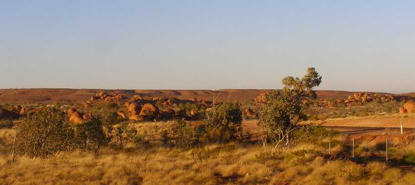
Marble field. Looking back towards the picnic area we see yet more of the bunches of rocks reflecting that morning sun.
It was soon time for me to move on and the park road rejoined the highway a little further on and then it was about 60 miles to Tennant Creek. Along the way I found at times I was driving past untold numbers of termite mounds:
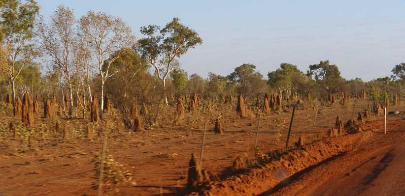
Termite mounds. There must be millions of them out there! And each one is a self-contained home and breeding place of great complexity.
As I kept driving I spotted a few of them had been fitted with T-shirts! Later I would learn that there�s some controversy over this, but it was certainly happening way out here!
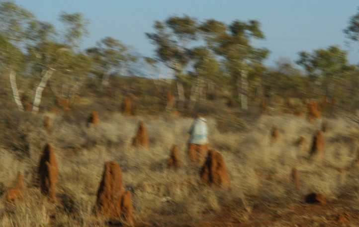
Dressed. People put T-shirts on the mound, some go to even more trouble than that. But why?
It wasn�t long before some familiar signs�
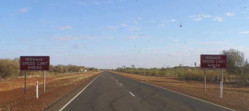
Drop the speed. From 130 down to 100 shortly before Tennant Creek, there�s plenty of clarity in this warning.
�heralded the presence of the town. Tennant Creek is another town which grew around mining, in this case gold mining. Today it�s home to about 3,000 people and is a centre for some of the huge properties in the area. Tourists come through in droves, of course, particularly in the cooler months.
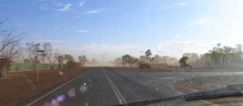
Dust storm. Just as I was getting into town there was a dust storm blew up, but it was only a minor one.
I was on the lookout for a likely place to get a decent breakfast. I passed on a couple of service stations and then came back through town, taking this photo on the way:
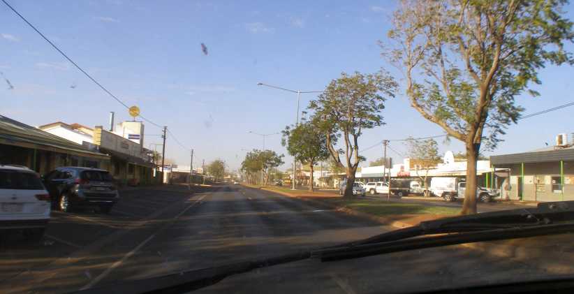
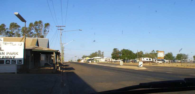
Tennant Creek. With a prominent hotel on the left, this was the fairly quiet scene as I cruised back to find my breakfast.
I found the Top of the Town cafe just opposite where I was when I took that shot and went inside to get some eggs on toast and a coffee. That would have to keep me going for a while.
I did buy a little more fuel at the Shell service station on the Northern edge of town and that led to me taking this shot of a Road Train refuelling:
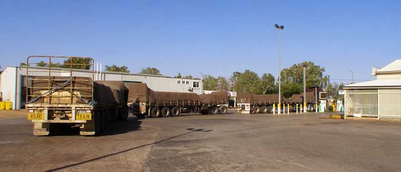
Road train refuel. With loads like this it�s no surprise that they take a while to pour in all the diesel needed to top up their tanks.
And as I went out there was another road train ready to come in for its turn:

Another road train. There�s a saying, �without trucks Australia stops,� and the Northern Territory certainly proves that to be true.
Just a little way North of Tennant Creek is The Threeways, where the Barkly Highway comes across to meet the Stuart. This is the main road to and from Queensland and there�s a small roadhouse just a little way past the junction. Of course, I had to turn to the right and focus on getting into Queensland.
There were phases to this drive, areas of termite mounds, areas of stunted desert scrub and areas like this:
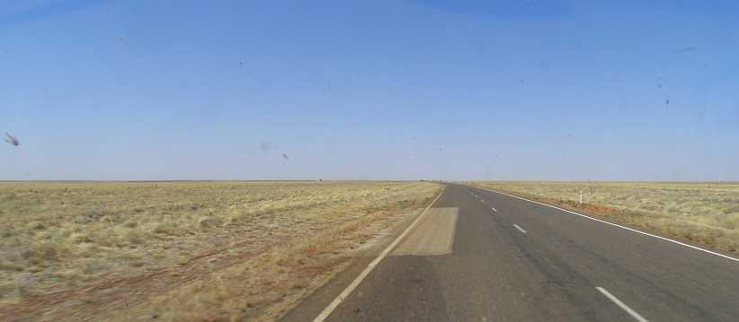
Endless nothing. If these areas support any stock, they were absent for my passing. Miles and miles of nothing was not unusual.
The one place along this road at which I stopped was the Barkly Homestead, where I thought they might offer something suitable for my lunch. It was a pleasant oasis in the midst of all that nothing�

Barkly Homestead. Like an oasis, this place was green and well-treed. It offered all the usual comforts for travellers, but I wasn�t going to partake.
�but it still offered me little. I decided to nibble on things I had in the van and, after having a chat with a passing motorcyclist, drove on.
More of the same kept coming at me, scrubland, empty desert, termite mounds and the opportunity to syphon one of my fuel drums into the van�s tank. I was watching the consumption like a hawk as I wanted to arrive at the next place where fuel was a reasonable price, Mount Isa, without buying any surplus at the inflated rate.
Eventually the Queensland border came into sight:
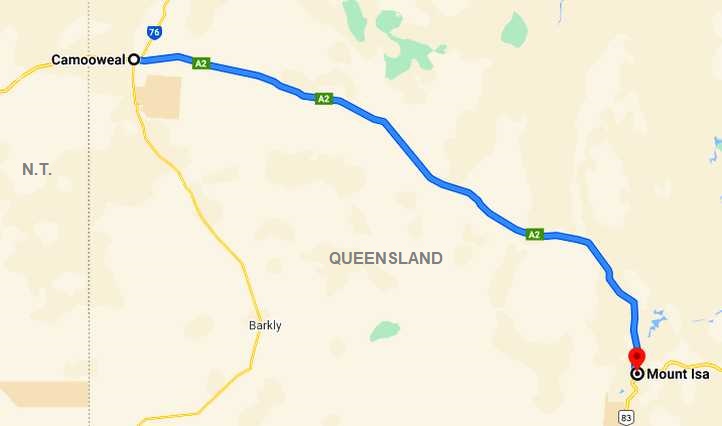
Queensland border. Signs dotted everywhere to announce the change of title to this desolate land. The brown and cream one on the left announces that Camooweal is the �Droving Capital�.
The signs were inviting, they heralded the end of the day on the road for me as I�d decided that the final 190kms into Mount Isa would be easily covered early the next morning. Distances I had to consider were confirmed here:

Camooweal 13. Only seven miles to Camooweal, I had no idea how big the place was but figured there�d be somewhere there I could eat and camp.
I had a quick look around town and then returned to the first place I�d seen on the way in. There they had a cafe and a small caravan park, so I parked outside and went to see them.
Main street. It�s a fairly quiet life in this town, I�d think. Old buildings, some with new paint, tourists looking for a camp was the main activity at this time of day.
Fish and chips did me for a meal that night while the basic offerings in the caravan park amenities were good enough too. There were a few other travellers I could talk to, some heading where I�d been were keen to know what to look for.
And, of course, the big Yankee van drew attention from many. But I was getting closer to home now after most of three months away. Each night Sandra would tell me what she�d been up to in working in the gardens and so on, so I was looking forward to getting the three areas I had to complete in Mount Isa done and heading there.
But the first step would be the morning drive to Mount Isa:
Not far to go now�
Nobody can say I didn�t try to get on with the job. As I commenced driving the glow in the Eastern sky was still faint:
Early start. Maybe a truck woke me up? Anyway, I got moving early and was rewarded with a comprehensive view of the day beginning.
There can be no denying that this is a big country. Some distance up the road the light was starting to shine across it�
Vast expanse. No city lights out here, just plain old desert country with a road and a centreline along it. Still my headlights did more to light up that centreline than the rising sun.
�and after forty or fifty minutes the sun began to peek up over the horizon:
The sun appears. The bugs on my windscreen show up well as a bend in the road about 45 miles out puts the rising sun full in view.
But the road is not devoid of interest. Soon after this came the turn into the Devil�s Marbles. Another place out in the desert where the rocks come to the fore and attract many visitors.
First of the marbles. Driving into the conservation park this silhouette view greeted me. As did many others.
Further up the drive I came to an area where several caravans were camped, as I turned back to see the way the morning sun was throwing colour on the rocks I got these pics:
The sunny side. Rocks are piled upon each other everywhere here, and then there are those which have chosen to balance on others. The sun lit them up nicely.
With the pop-tops. The pop-top on the right is from Western Australia, others were from Eastern states, the rocks simply spoke of being there from time immemorial, baking in the sun, cooling each night.
As I moved off to go to the lower area, I kept coming across more piles worth photographing�
Marbles everywhere. Some look like they�ve grown there together, others fell into place as they were exposed by weathering and erosion.
Heading to the lower area. The sun was coming up to strike upon more and more as I drove down the track. Visible is the picnic area in the midst of the distant rocks.
Individual clusters of rocks had their own little features:
Balanced. You would think that rock would slip from its position of balance, but the sunrise this day found it exactly where it�s been for centuries.
Finding a toilet block was a good thing for me at this time, it required a short walk between piles of rocks from the parking area where the picnic area is set out.
Amenities. There�s a picnic area here, with the covered area to the right, while down beyond the rocks on the left is a toilet block.
It was here that I struck a most unusual response from someone. A young lady came to me and almost demanded that I move my van. �I�ve come here all the way from Melbourne to photograph these rocks in the sunrise!� she explained.
Well, I was done here now and I moved pretty soon after, but I had to explain to her that nobody was there from just around the corner. Everyone had come a great distance to see these sights and there was a limit to the number of places to park anyway. Unfortunately, her attitude didn�t change.
There was a further viewing area about a mile further up, I stopped there to take more pics:
Balanced in the field. Another balancing rock, with a backdrop which shows even more of the expansive field that�s home to the �marbles�.
It all goes on for some considerable distance�
Marble field. Looking back towards the picnic area we see yet more of the bunches of rocks reflecting that morning sun.
It was soon time for me to move on and the park road rejoined the highway a little further on and then it was about 60 miles to Tennant Creek. Along the way I found at times I was driving past untold numbers of termite mounds:
Termite mounds. There must be millions of them out there! And each one is a self-contained home and breeding place of great complexity.
As I kept driving I spotted a few of them had been fitted with T-shirts! Later I would learn that there�s some controversy over this, but it was certainly happening way out here!
Dressed. People put T-shirts on the mound, some go to even more trouble than that. But why?
It wasn�t long before some familiar signs�
Drop the speed. From 130 down to 100 shortly before Tennant Creek, there�s plenty of clarity in this warning.
�heralded the presence of the town. Tennant Creek is another town which grew around mining, in this case gold mining. Today it�s home to about 3,000 people and is a centre for some of the huge properties in the area. Tourists come through in droves, of course, particularly in the cooler months.
Dust storm. Just as I was getting into town there was a dust storm blew up, but it was only a minor one.
I was on the lookout for a likely place to get a decent breakfast. I passed on a couple of service stations and then came back through town, taking this photo on the way:
Tennant Creek. With a prominent hotel on the left, this was the fairly quiet scene as I cruised back to find my breakfast.
I found the Top of the Town cafe just opposite where I was when I took that shot and went inside to get some eggs on toast and a coffee. That would have to keep me going for a while.
I did buy a little more fuel at the Shell service station on the Northern edge of town and that led to me taking this shot of a Road Train refuelling:
Road train refuel. With loads like this it�s no surprise that they take a while to pour in all the diesel needed to top up their tanks.
And as I went out there was another road train ready to come in for its turn:
Another road train. There�s a saying, �without trucks Australia stops,� and the Northern Territory certainly proves that to be true.
Just a little way North of Tennant Creek is The Threeways, where the Barkly Highway comes across to meet the Stuart. This is the main road to and from Queensland and there�s a small roadhouse just a little way past the junction. Of course, I had to turn to the right and focus on getting into Queensland.
There were phases to this drive, areas of termite mounds, areas of stunted desert scrub and areas like this:
Endless nothing. If these areas support any stock, they were absent for my passing. Miles and miles of nothing was not unusual.
The one place along this road at which I stopped was the Barkly Homestead, where I thought they might offer something suitable for my lunch. It was a pleasant oasis in the midst of all that nothing�
Barkly Homestead. Like an oasis, this place was green and well-treed. It offered all the usual comforts for travellers, but I wasn�t going to partake.
�but it still offered me little. I decided to nibble on things I had in the van and, after having a chat with a passing motorcyclist, drove on.
More of the same kept coming at me, scrubland, empty desert, termite mounds and the opportunity to syphon one of my fuel drums into the van�s tank. I was watching the consumption like a hawk as I wanted to arrive at the next place where fuel was a reasonable price, Mount Isa, without buying any surplus at the inflated rate.
Eventually the Queensland border came into sight:
Queensland border. Signs dotted everywhere to announce the change of title to this desolate land. The brown and cream one on the left announces that Camooweal is the �Droving Capital�.
The signs were inviting, they heralded the end of the day on the road for me as I�d decided that the final 190kms into Mount Isa would be easily covered early the next morning. Distances I had to consider were confirmed here:
Camooweal 13. Only seven miles to Camooweal, I had no idea how big the place was but figured there�d be somewhere there I could eat and camp.
I had a quick look around town and then returned to the first place I�d seen on the way in. There they had a cafe and a small caravan park, so I parked outside and went to see them.
Main street. It�s a fairly quiet life in this town, I�d think. Old buildings, some with new paint, tourists looking for a camp was the main activity at this time of day.
Fish and chips did me for a meal that night while the basic offerings in the caravan park amenities were good enough too. There were a few other travellers I could talk to, some heading where I�d been were keen to know what to look for.
And, of course, the big Yankee van drew attention from many. But I was getting closer to home now after most of three months away. Each night Sandra would tell me what she�d been up to in working in the gardens and so on, so I was looking forward to getting the three areas I had to complete in Mount Isa done and heading there.
But the first step would be the morning drive to Mount Isa:
Not far to go now�
Thread Starter
|
Captain
Joined: Oct 2005
Posts: 568
Likes: 8
From: The Summit, Queensland, Australia
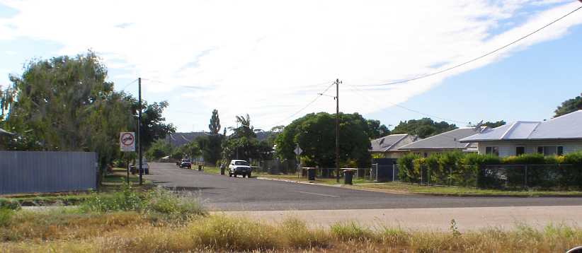
I�d had a bit of a drive around Camooweal after arriving there in the afternoon. Mostly quite aged homes on very large blocks of land, a typical country town as we see them here with the old-fashioned layout with lanes between the streets to give rear access. Undoubtedly that was helpful in the days of horses and carts.
Many blocks are now vacant as such towns dwindle. They don�t rebuild when a fire guts a home, it simply becomes a vacant allotment and usually a part of the neighbour�s domain. All the streets were sealed and the main street was very wide�

More of the main street. Probably the busiest part of town with the Post Office/General Store and service station side by side and the hotel to the right just out of frame.
�while the other streets have the design width, but not all have the same expanse of bitumen:

Quiet rural living. There�s plenty of room at Camooweal, typical of many Australian country towns.
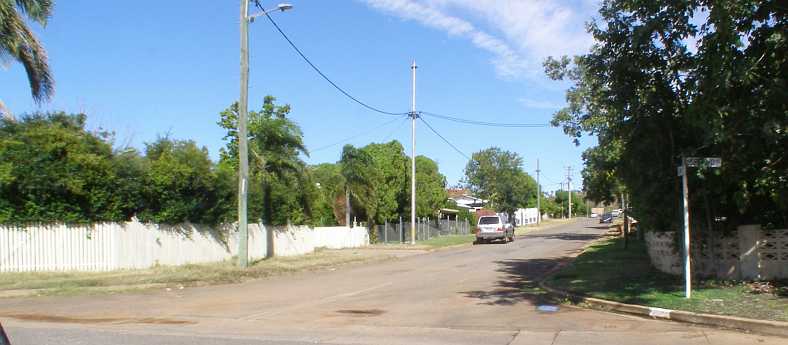
Nowranie Street, however, shares the Highway�s lavish bitumen and kerbing:

Wider bitumen. Perhaps it�s because the church is down Nowranie Street that it�s seen greater favour?
On this morning, however, I was completing the run to Mount Isa. The Barkly Highway, about which I would learn a great deal more in a couple of hours, lay itself out before me:

Easy running. Like most roads I�d been on over the past few weeks, this one presented few challenges and offered a smooth ride.

Scrubby country. Much of the running was through this kind of scrubby bushland, country best suited to goats.
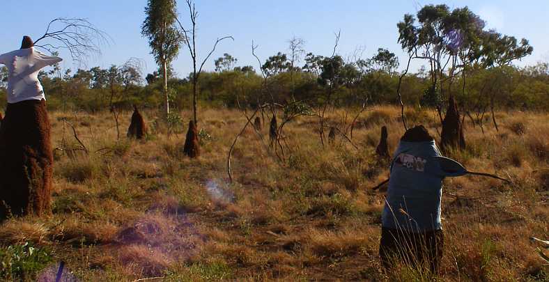
And then I came upon more termite nests, many thousands of them, once again being bewildered by the thought processes behind the �dressing� of these inanimate piles of solidified mud�

All dressed up. Do tourists carry surplus or old clothing with them to dress these as they go by, I wondered.
 \
\
More termites, more imagination. Some people went to the trouble of pushing sticks through the mounds to support the sleeves of their old shirts.
And so the morning drive went. I wasn�t going all that far, only a bit over a hundred miles, so there was no great rush. I was also watching my fuel gauge. I had by now put the last of my low-priced fuel I�d brought from home into the van as the price through this area was the highest I�d find in the trip. I reckoned I had enough to get to Mount Isa. Just.

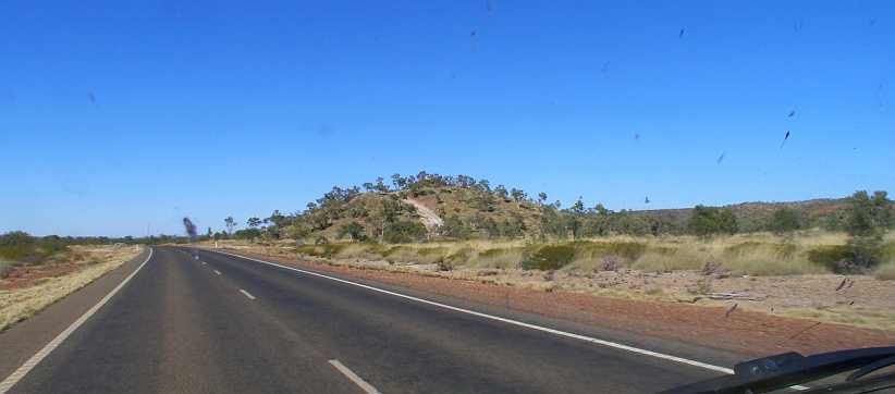
Hills and cattle sign. There are people farming out here and so a warning sign like this, which has solar power to light up at night, indicated potential roadblocks. The hills ahead promised that the road might change too.
The hills did change the direction of the road a few times but there wasn�t much in the way of hill climbing to be done�

Hills and turns. The road here sweeps to the left, a small climbing stretch, but by and large the running remained fairly level and straight.
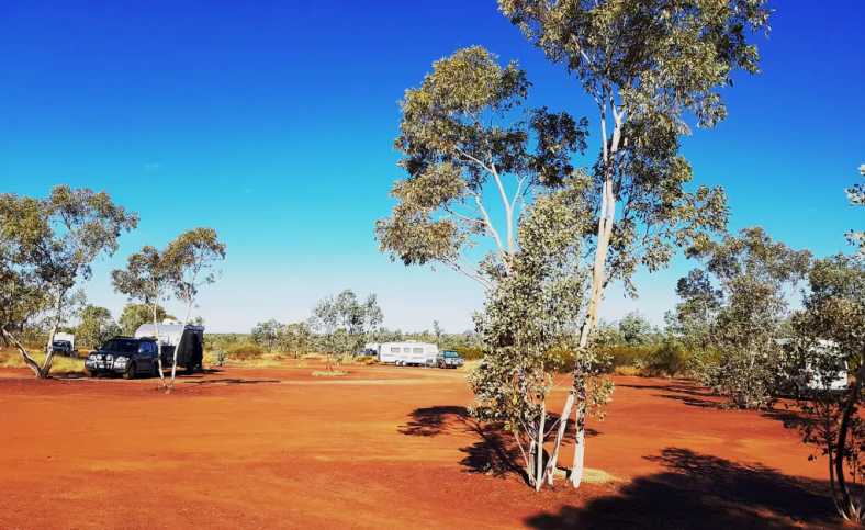
I reached a point about thirty-five miles short of Mount Isa where there was a large Rest Area, so I decided to stop and take a break. I had no idea the surprise I was in for, the education I�d receive, at this spot:

WWII Memorial Rest Area. A Rest Area larger than normal and very well-appointed. Tracks into the bush allow overnight campers to spread out and get well away from traffic noise.(GE)
Several covered picnic areas were there, flushing toilets in the elevated toilet block, while the remains of the original highway ran most of the length of the area parallel to the new road. I was drawn to explore a little
Campers spread out. Two photos from caravanners Dixie and Graeme�s travel blog help me to illustrate this site.
Ultimately I got to the Eastern end of the area, where the reason for the size and appointments were explained. The Rest Area is a Memorial to the soldiers who did the bulk of the work building the road, also those troops who travelled it so heavily as it provided a main source of supplies to Darwin during World War 2.
It�s explained on this board, the photo generously supplied by Dixie and Graeme, whose website is at https://www.aussiecaravanninglifestyle.com:

Memorial explained. Erected in 1995, this (sheltered) board tells of the travails of the roadbuilders and those who came by here in huge numbers immediately it was a passable route.
The board�s wording is reproduced in full here:
What a subject this is, there must have been many individual stories of endurance and struggles. Some further good reading:
http://www.ntlexhibit.nt.gov.au/exhi...w/track/barkly
http://www.ntlexhibit.nt.gov.au/exhi...track/building
The sign, which is seen under the shelter to the left, mentions looking to the left to see the original road�
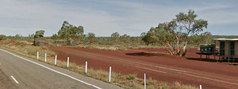
Original road sample. The board mentions that the road followed the contours, and it can be seen here that it does so while the replacement road comes through a cutting at this point.(GE)
Having refreshed myself a little and filled my mind with thoughts of those dark days just a couple of years before I was born, I pressed on. It was 54kms to Mount Isa, but the first sight of the kind of mining for which this town is famous was this one of the George Fisher silver mine:

Silver mine. Mount Isa�s mining is very similar to Broken Hill�s, with a variety of minerals being won from the holes in the ground. The George Fisher mine is about 20kms from the city.
Those few kilometres had me watching and waiting for the fuel to run out. I knew it was going to be touch and go�
Final miles. The scenery didn�t change much for the final miles, save for a few more hills.
�and finally the last of the fuel burned up and I was coasting. Fortunately I had some momentum going as this sign appeared as I was coasting down the hill:
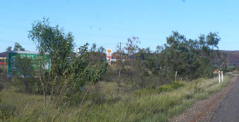
Relief in sight! One of the very first things one comes to as you arrive in Mount Isa is the Shell truck stop. Very handy for me.
I still had enough speed up to coast in around the corner and right up to the bowser. I definitely didn�t have to brake hard when I got there.
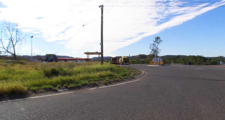
Shell Mount Isa. The service station wasn�t on the main road but just around the corner in a side street.
I threw in a few gallons and went on. I�d be looking for some lunch soon and to find the caravan park so I could settle in and know where I stood with things for the week or so I�d be in town. The first residential area I came upon was Soldiers Hill, which had streets running off a service road alongside the highway. This would become the first area in which I worked later in the day.

Soldiers Hill. The residential areas began on this side of town with Soldiers Hill, so named because the soldiers who built the road were housed here. In tents, no doubt. The streets are named for locations made famous by World War 2.
The huge Mount Isa Mine was coming into sight by now. Dominating the town, very much like the Broken Hill mine does that city, it lines the Western side of the Barkly Highway.

Mine in sight. One of the smoke stacks, structures common to mining towns and piles of overburden are prominent alongside the highway.
After finding McDonalds and getting a bite to eat I enquired of people about finding a caravan park. It wasn�t far away, at the top of the hill on the road that heads to the coast:
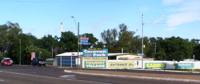
Mount Isa Caravan Park. It didn�t take long to establish myself in the caravan park, where I would spend most of my nights in the town.
I was given a very convenient spot under some trees and right near the amenities block�

My spot in the park. I would come and go a lot from this spot, but I had a powered site and I didn�t have to go far for showers or toilets.
�and just a short walk from the camp kitchen:
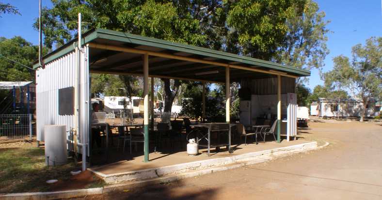
Camp kitchen. I would meet a lot of different people from places all around the world as I cooked my meals and sat using the internet (and watching some television) in this camp kitchen.
By the late afternoon I was ready to go out to work. As mentioned, I started with the address I had in Soldiers Hill�
Soldiers Hill street. This was another �high fence� area with dogs, which didn�t inspire me, but I found my way around and found some nice people.
Another area I had to cover was to start with a unit in the Parkside Apartments�

Parkside Apartments. When I saw this block I thought I would get it easy, just going from apartment to apartment. But they were being renovated and I wasn�t going to do anything here at all!
�but that led to me pounding the streets among the normal housing nearby. That led me into the streets of Parkside:
Parkside. I met all kinds of people in this suburb, the particularly receptive ones leaving me with kind memories of the area.
And a day or two later I�d attack the area starting with an address in Happy Valley:
Happy Valley. Modest homes in a tidy area made Happy Valley a pleasant place to knock on doors.
So I was earnestly back at work and trying to get through the areas I�d been given to cover. I was also to do a regular weekend assignment while I was here and I�d catch up with an old Mopar friend too�
Many blocks are now vacant as such towns dwindle. They don�t rebuild when a fire guts a home, it simply becomes a vacant allotment and usually a part of the neighbour�s domain. All the streets were sealed and the main street was very wide�
More of the main street. Probably the busiest part of town with the Post Office/General Store and service station side by side and the hotel to the right just out of frame.
�while the other streets have the design width, but not all have the same expanse of bitumen:
Quiet rural living. There�s plenty of room at Camooweal, typical of many Australian country towns.
Nowranie Street, however, shares the Highway�s lavish bitumen and kerbing:
Wider bitumen. Perhaps it�s because the church is down Nowranie Street that it�s seen greater favour?
On this morning, however, I was completing the run to Mount Isa. The Barkly Highway, about which I would learn a great deal more in a couple of hours, lay itself out before me:
Easy running. Like most roads I�d been on over the past few weeks, this one presented few challenges and offered a smooth ride.
Scrubby country. Much of the running was through this kind of scrubby bushland, country best suited to goats.
And then I came upon more termite nests, many thousands of them, once again being bewildered by the thought processes behind the �dressing� of these inanimate piles of solidified mud�
All dressed up. Do tourists carry surplus or old clothing with them to dress these as they go by, I wondered.
\More termites, more imagination. Some people went to the trouble of pushing sticks through the mounds to support the sleeves of their old shirts.
And so the morning drive went. I wasn�t going all that far, only a bit over a hundred miles, so there was no great rush. I was also watching my fuel gauge. I had by now put the last of my low-priced fuel I�d brought from home into the van as the price through this area was the highest I�d find in the trip. I reckoned I had enough to get to Mount Isa. Just.
Hills and cattle sign. There are people farming out here and so a warning sign like this, which has solar power to light up at night, indicated potential roadblocks. The hills ahead promised that the road might change too.
The hills did change the direction of the road a few times but there wasn�t much in the way of hill climbing to be done�
Hills and turns. The road here sweeps to the left, a small climbing stretch, but by and large the running remained fairly level and straight.
I reached a point about thirty-five miles short of Mount Isa where there was a large Rest Area, so I decided to stop and take a break. I had no idea the surprise I was in for, the education I�d receive, at this spot:
WWII Memorial Rest Area. A Rest Area larger than normal and very well-appointed. Tracks into the bush allow overnight campers to spread out and get well away from traffic noise.(GE)
Several covered picnic areas were there, flushing toilets in the elevated toilet block, while the remains of the original highway ran most of the length of the area parallel to the new road. I was drawn to explore a little
Campers spread out. Two photos from caravanners Dixie and Graeme�s travel blog help me to illustrate this site.
Ultimately I got to the Eastern end of the area, where the reason for the size and appointments were explained. The Rest Area is a Memorial to the soldiers who did the bulk of the work building the road, also those troops who travelled it so heavily as it provided a main source of supplies to Darwin during World War 2.
It�s explained on this board, the photo generously supplied by Dixie and Graeme, whose website is at https://www.aussiecaravanninglifestyle.com:
Memorial explained. Erected in 1995, this (sheltered) board tells of the travails of the roadbuilders and those who came by here in huge numbers immediately it was a passable route.
The board�s wording is reproduced in full here:
The Mount Isa to Camooweal Road was built during WWII as part of the inland defence road system. In 1940, as the war moved to the Pacific Region, the defence of Northern Australia became an urgent issue.
The Queensland Main Roads Commission, now the Queensland Department of Main Roads, was given the responsibility to build the road, west from Mount Isa to link up with the north-south road at Tennant Creek.
Prior to 1940 the road west was a track which ran close to the telegraph line erected in 1897 and meandered from waterhole to waterhole across ridges and black-soil plains.
In January, 1941, work commenced on the road, which was ten miles shorter than the track. However, there were difficulties in building the road, with funds exhausted and chronic shortages of machinery and manpower.
By the end of 1941, Australian and American military traffic on the East-West Road increased with volumes as high as 1000 vehicles per day.
The situation improved in May 1942 with the formation of the Allied Works Council. Funding was provided by the Commonwealth Government and machinery borrowed from across Queensland.
By virtually working around the clock, the road was gravelled and bridges over Spear Creek and the Buckley, Georgina and Franklin Rivers neared completion by October, 1942.
By late 1943, due to heavy use and obvious maintenance problems, the Mount Isa to Camooweal Road was bitumen-sealed to a width of sixteen feet.
The road, used unaltered for more than twenty years afterwards, represented a significant contribution to Australia�s wartime defence priorities, and to improving the lives of the people of north-west Queensland.
The story of its construction during the war years is a remarkable testimony to the fortitude, persistence and sheer hard work of everyone involved. In memory of this, Main Roads is preserving a section of the original road.
Looking to the left, a good example of the design standards of the time will be noted. The road hugs the natural surface, traversing both flood plains and crests. The adjacent road, constructed in 1994, provides a stark contrast in standards.
The nearby rest area is built on land generously provided by the Kalkadoon People, who were part of the workforce that helped construct the East West Road which traverses their traditional land.
Funding for this project has been provided by the Federal Government under the National Highway Program.
Main Roads manages and maintains this, and other major roads, in Queensland and is proud to be a part of the commitment to the Australia Remembers celebration.
http://www.ntlexhibit.nt.gov.au/exhi...w/track/barkly
http://www.ntlexhibit.nt.gov.au/exhi...track/building
The sign, which is seen under the shelter to the left, mentions looking to the left to see the original road�
Original road sample. The board mentions that the road followed the contours, and it can be seen here that it does so while the replacement road comes through a cutting at this point.(GE)
Having refreshed myself a little and filled my mind with thoughts of those dark days just a couple of years before I was born, I pressed on. It was 54kms to Mount Isa, but the first sight of the kind of mining for which this town is famous was this one of the George Fisher silver mine:
Silver mine. Mount Isa�s mining is very similar to Broken Hill�s, with a variety of minerals being won from the holes in the ground. The George Fisher mine is about 20kms from the city.
Those few kilometres had me watching and waiting for the fuel to run out. I knew it was going to be touch and go�
Final miles. The scenery didn�t change much for the final miles, save for a few more hills.
�and finally the last of the fuel burned up and I was coasting. Fortunately I had some momentum going as this sign appeared as I was coasting down the hill:
Relief in sight! One of the very first things one comes to as you arrive in Mount Isa is the Shell truck stop. Very handy for me.
I still had enough speed up to coast in around the corner and right up to the bowser. I definitely didn�t have to brake hard when I got there.
Shell Mount Isa. The service station wasn�t on the main road but just around the corner in a side street.
I threw in a few gallons and went on. I�d be looking for some lunch soon and to find the caravan park so I could settle in and know where I stood with things for the week or so I�d be in town. The first residential area I came upon was Soldiers Hill, which had streets running off a service road alongside the highway. This would become the first area in which I worked later in the day.
Soldiers Hill. The residential areas began on this side of town with Soldiers Hill, so named because the soldiers who built the road were housed here. In tents, no doubt. The streets are named for locations made famous by World War 2.
The huge Mount Isa Mine was coming into sight by now. Dominating the town, very much like the Broken Hill mine does that city, it lines the Western side of the Barkly Highway.
Mine in sight. One of the smoke stacks, structures common to mining towns and piles of overburden are prominent alongside the highway.
After finding McDonalds and getting a bite to eat I enquired of people about finding a caravan park. It wasn�t far away, at the top of the hill on the road that heads to the coast:
Mount Isa Caravan Park. It didn�t take long to establish myself in the caravan park, where I would spend most of my nights in the town.
I was given a very convenient spot under some trees and right near the amenities block�
My spot in the park. I would come and go a lot from this spot, but I had a powered site and I didn�t have to go far for showers or toilets.
�and just a short walk from the camp kitchen:
Camp kitchen. I would meet a lot of different people from places all around the world as I cooked my meals and sat using the internet (and watching some television) in this camp kitchen.
By the late afternoon I was ready to go out to work. As mentioned, I started with the address I had in Soldiers Hill�
Soldiers Hill street. This was another �high fence� area with dogs, which didn�t inspire me, but I found my way around and found some nice people.
Another area I had to cover was to start with a unit in the Parkside Apartments�
Parkside Apartments. When I saw this block I thought I would get it easy, just going from apartment to apartment. But they were being renovated and I wasn�t going to do anything here at all!
�but that led to me pounding the streets among the normal housing nearby. That led me into the streets of Parkside:
Parkside. I met all kinds of people in this suburb, the particularly receptive ones leaving me with kind memories of the area.
And a day or two later I�d attack the area starting with an address in Happy Valley:
Happy Valley. Modest homes in a tidy area made Happy Valley a pleasant place to knock on doors.
So I was earnestly back at work and trying to get through the areas I�d been given to cover. I was also to do a regular weekend assignment while I was here and I�d catch up with an old Mopar friend too�
Thread Starter
|
Captain
Joined: Oct 2005
Posts: 568
Likes: 8
From: The Summit, Queensland, Australia
My working routine saw me with time to spare in the middle of the day. This kind of work, and the instructions we’re given for its accomplishment, makes it a priority to be there when people are at home and that’s not the middle of the day. One day I chose to spend a little time sightseeing, and that led me to the lookout on the hill in the middle of the town:
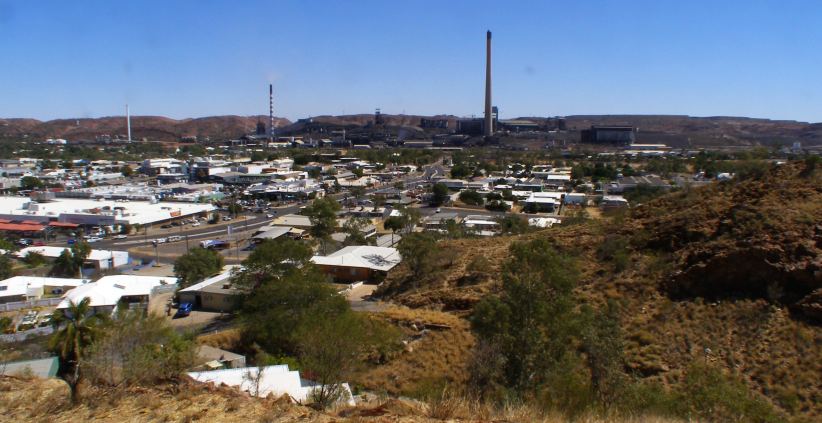
Town and mine. The mountain of waste and overburden from the Mount Isa mine is the backdrop, with the thriving and busy CBD in the foreground.
While I was there a support vehicle from a ‘Round Australia’ rally which was coming through at the time. For the past sixty years the ‘Round Australia’ events have been popular with competitors and the public and did a lot towards the opening up of travel on the roads of outback areas such as this.
They began in the fifties and ran each year until 1958, and these were very competitive events which drew huge crowds at every town through which they went. The roads were usually gravel, or dirt, or sometimes mud. Peugeot and Volkswagen did very well in these early runs before the events lapsed after some major problems with organisation and control.
In 1970 they were reborn, but just one event was run, then in 1979 there was another. By this time the roads were vastly improved and organisers were pushing the event onto little-used tracks a lot of the time to provide the kind of car-breaking settings required to sort the men from the boys. It would be many years before another was run, but the nostalgia of the early events led to ‘re-runs’ of the earliest ones, while this one was pretty much a re-run of the ‘79 event.
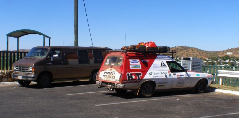
Repco ‘Around Australia.’ Repco, the parts manufacturer, sponsored the 1979 ‘Round Australia’ trial and this re-run too. This service van is a Holden looking identical to the ones George Shepheard used to support his team of Holden Commodores which swept the board in 1979.
Like I saw in Strasbourg, a post with multiple directions to distance places was placed high above the Mount Isa scenery. This one, however, seemed to display a lot more accuracy than the one in France…

Directions. All distances on this signpost are large as there isn’t much that’s in easy reach of Mount Isa.
I also paid a visit to the local Toyota dealership:
Bell & Moir. I first became aware that this dealership had such a significant name when I came across a numberplate surround in a wrecking yard in NSW about fifteen years earlier.
So what was the ‘significant’ part of the name? Well, my name is obviously ‘Bell,’ so my father’s was too. And ‘Moir’ was my mother’s maiden name. And the reason I was calling in was because my sister got in touch with them when she learned of their name and told them of this connection.
They were very generous and sent a package of promotional gear which my sister passed on to mum and dad in 2007:
Bell and Moir. My mum and dad showing off the many gifts sent for them by the Bell & Moir Toyota dealership.
Dad had been a Toyota driver for about thirty years at this time and while they wore the hats and carried the stubby-holders and pens, their new Corolla – purchased from another dealer, of course – got to wear a sticker (decal) and the numberplate surrounds front and rear.
Over 65 years. And it seems that the partners in Bell & Moir got together only a year or so before mum and dad. I don’t know how long they’d been sponsoring the Mount Isa Rotary Rodeo, but they have their name attached to the Rodeo Ball.
Back at the caravan park there was an ever-changing scene as various people came and went. Some of these caravans are set up as permanent fixtures for short-term accommodation while others are travelling caravans.
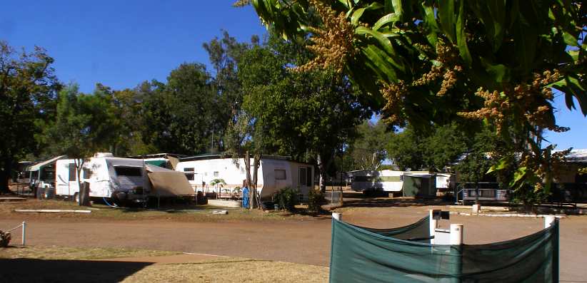
Caravans. The caravan in the centre of this pic is a fixture, with an ‘annexe’ built on the side as would be built onto a house or shed. It also has, as does the one behind it, a ‘tropical roof’ with roof sheeting fixed to a frame higher than its roof to provide some relief from the sun’s heat.
Some caravans get pretty plush, but I’ve never seen a patio on one before:
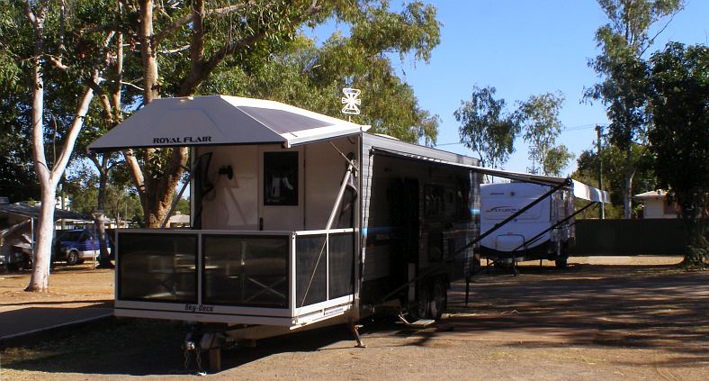
Royal Flair with flair. The semi-streamlined front of this caravan folds up and forms a roof over a fold-down sun deck. With fence, what’s more. Very exclusive!
During my stay I paid Nigel a couple of visits. From the caravan park it was a simple drive along Abel Smith Drive, which for some distance featured a huge drainage canal – obviously built to cope with sudden storms which might otherwise flood the area.
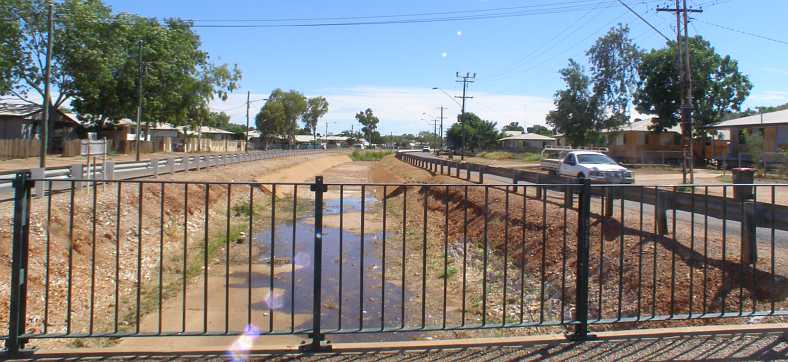
Abel Smith drain. Flash flooding might be a problem in storms were it not for this drain in the middle of the road. Most of it is fully concrete lined, however.
As mentioned, Nigel is a Mopar lover – I met him through the old Moparmarket forum – and collects what he can. Living on the edge of town was a bonus as the vacant land behind his back fence gave him somewhere to store old cars, but that has since been stamped on by the authorities.
When I was there he had an old caravan completely filled with parts out the back, and there was this VG utility…
VG ute. Not in great shape any more, but there were parts to be salvaged. Or would it do for a rebuild?
…and a Chrysler by Chrysler. This was a model that became top of Chrysler’s Australia’s line when they dropped the C-body Phoenixes in the early seventies. Very well-appointed and fitted with a 360 engine, not many are still around and Nigel has since sent this one to another home:

Chrysler by Chrysler. The 360 is long gone, as has the shine of the paint. In the background is the caravan used to stash Valiant parts.
Just around the corner (in Hinkler Crescent) I stopped to get a different shot of the mine, this time with playing fields which are on Abel Smith Drive and put some green into the setting…
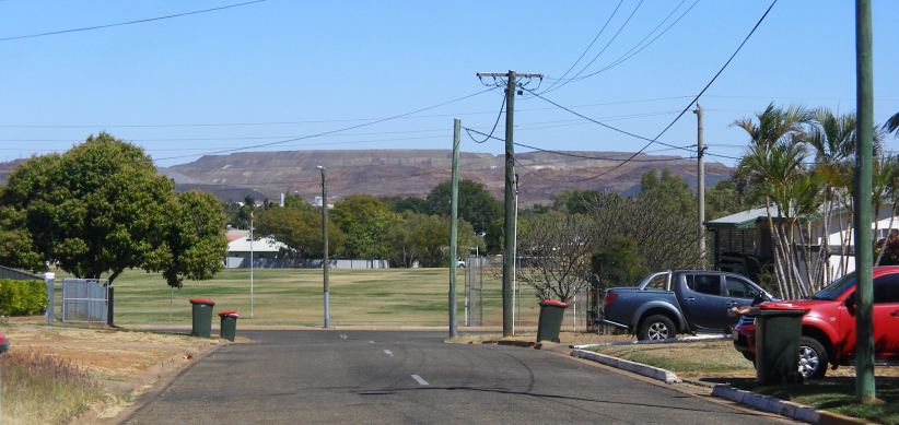
Another view of the mine. Looking across the playing fields, the mine’s pile of overburden would be a blight on the landscape in other settings.
I also managed to find somewhere to have a haircut, though I later wished I hadn’t gone to that particular hairdresser. Meanwhile, the trucks rumble through town night and day, many of them being road trains:
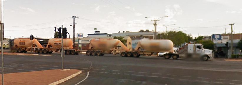
Road train through the CBD. I couldn’t resist putting up this picture of a road train carrying bulk cement dust through the busy intersection at one corner of the CBD. I found it on Google Earth Street View while looking for something else.(GE)
All the while, I wasn’t to forget that my purpose there was to get this survey work done. And seeing as I was there doing the Drug Survey for a full week (actually August 20 to 29) I had a regular weekend assignment to complete as well. This was in an area adjacent to where I’d done the other survey in Parkside and featured some nice steep hills in a couple of streets:
Sixth Street, Parkside. You can see here that the houses are all on steep blocks, while around that next bend there’s a short steep incline to the next corner. My knee was far from grateful for all of this.
Also on steep terrain was this house, which had seen me wondering exactly what it was the whole time I was there…

Big house on the hill. Visible from all around, this house was huge and must have commanded tremendous views.
…in particular as it was not far from the caravan park. But I didn’t spend every night in the caravan park, either, as the weekend assignment let me get into the luxury of a motel for a couple of nights:

Outback Motel. My room was on the left just past that angled hedge, it was a nice place and a bit of a change from sleeping in the van and having to walk to the amenities all the time.
Finally it was time to leave Mount Isa behind and head for home. As mentioned before, I was finished all the work assigned to me for this trip, but I knew that there were areas elsewhere that needed cleaning up before the final date for the Drug Survey arrived. Of course, there was a mad rush around on the morning of my departure just making sure I had the last of those questionnaires I’d be able to pick up.
The first day of my trip towards home took me to Barcaldine…
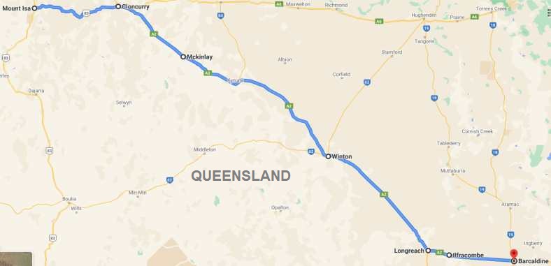
…which is another of those small outback towns which thrives a bit less today than it did when transport wasn’t so readily accessible. One wonders what life was really like in these places when you’d order things through a catalogue and wait while delivery was made by horse-drawn wagons on dusty (or muddy) tracks through a veritable wilderness.
Of course, railways opened things up considerably. Barcaldine, in fact, grew around the railway line when it reached there in 1886. But my immediate need was to know that the roads were open…
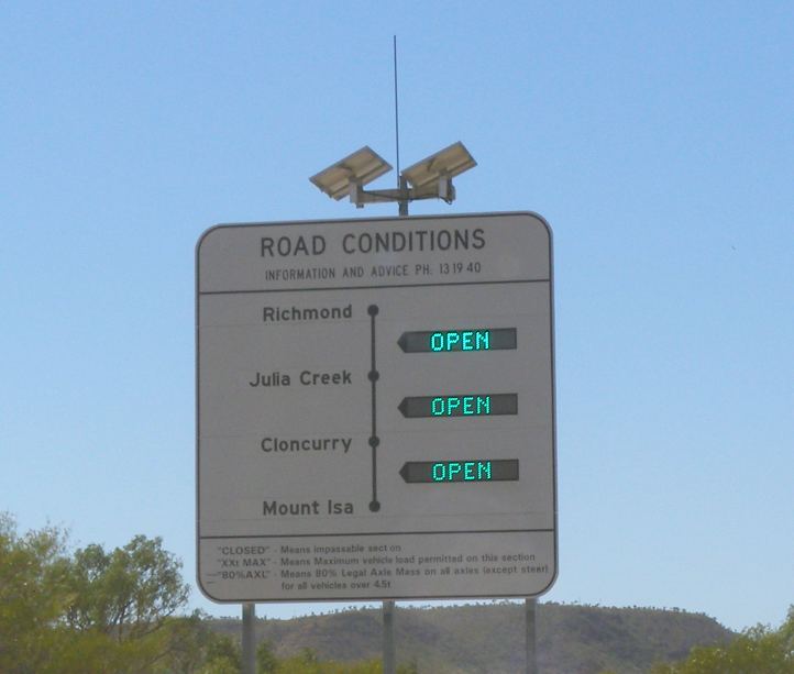
Open roads. These signs are common throughout Queensland (and other states) because of periodic flooding. But we were in the middle of a huge drought, so ‘OPEN’ was a very common sight.
The road ahead was through hilly country, at least as far as Cloncurry. They weren’t large hills, but they demanded that the road have the odd twist and turn to it as it travelled through what looked like fairly barren red-soil (or more ‘red stones’) country. Growth of trees was limited to the stunted variety and grass was generally brown.

Back on the road. Stretching the legs of the van, overdrive keeping the 360s revs down, this road was soon swallowed up.
Rocky outcrops on some of the hills stood out at times. And I was blissfully unaware at this stage that this stretch of road would one day present me with the most picturesque 75 miles of scenery I have ever seen. Matching or eclipsing, even, the magnificence of the sights of Colorado.
You certainly wouldn’t think so here, where it’s more like a corner of Utah:

Rocky hills. Outcrops like on these ridges were frequently seen, as was the Armco railing through the bends.
Ultimately I arrived at Cloncurry. Some of my newfound friends in Mount Isa recommended I go visit a friend of theirs, so I slowed down a bit and looked around…

Street lights. Entering Cloncurry came with a definite air of change. Street lights and speed limit signs heralded the arrival in this small town.
I took a brief drive up a couple of streets, which led me to the main junction in the middle of town:

The pub and the hardware store. With the Post Office on one corner, there’s a large hotel opposite, with another just out of frame to the right, while Mitre 10 is a chain of hardware stores which has dressed the old building with their trademark blue and white signage.
The man I was seeking to meet conducts training classes to help aboriginal teenagers learn skills and become decent citizens. It’s called Cloncurry Multi-Skill Training and it all takes place in this building:
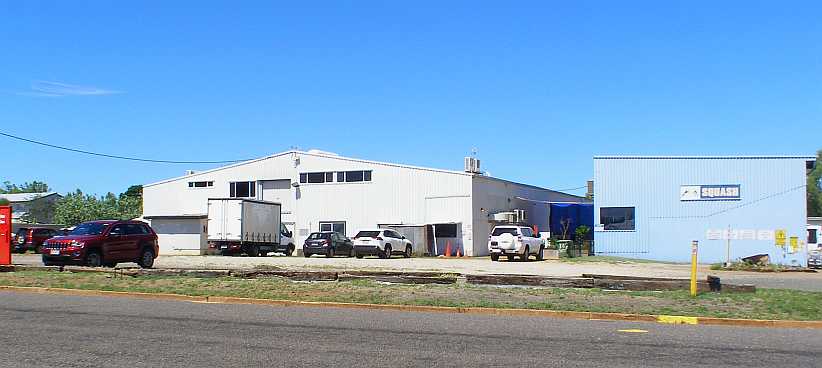
Multiple skills. The building where I learned that many teenagers have been to learn how to find themselves better-equipped to deal with the modern world.
After that stopover I started to head out of town. The road crosses the railway here…

Cloncurry houses. Elevated houses are built in many parts of Queensland to help people cope with the hot weather. The level crossing is by no means busy, by the way, being over a local branch line.
After the hilly drive from Mount Isa, the road out of Cloncurry was more what I’ve come to expect of roads in Western Queensland. Like the Northern Territory, mostly straight and mostly flat.
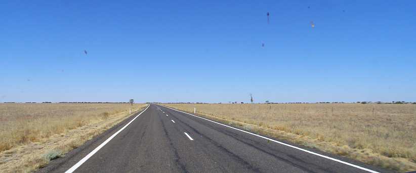
Flat and straight. Out onto the plains once more, there are always trees on the horizon because there is always a (usually dry) creek or river out there somewhere and that’s where the trees grow.
The road straight across to the coast at Townsville is the Flinders Highway, but not far out of town I turned onto the Landsborough Highway and before too long – about sixty miles – my boredom was broken by the sight of a little town…

Entering McKinlay. Over a creek and into the town, a United service station was evident, though closed and then came a pub.
The pub, in fact, was surprisingly one known widely around the world. Though not by its proper name…
Town and mine. The mountain of waste and overburden from the Mount Isa mine is the backdrop, with the thriving and busy CBD in the foreground.
While I was there a support vehicle from a ‘Round Australia’ rally which was coming through at the time. For the past sixty years the ‘Round Australia’ events have been popular with competitors and the public and did a lot towards the opening up of travel on the roads of outback areas such as this.
They began in the fifties and ran each year until 1958, and these were very competitive events which drew huge crowds at every town through which they went. The roads were usually gravel, or dirt, or sometimes mud. Peugeot and Volkswagen did very well in these early runs before the events lapsed after some major problems with organisation and control.
In 1970 they were reborn, but just one event was run, then in 1979 there was another. By this time the roads were vastly improved and organisers were pushing the event onto little-used tracks a lot of the time to provide the kind of car-breaking settings required to sort the men from the boys. It would be many years before another was run, but the nostalgia of the early events led to ‘re-runs’ of the earliest ones, while this one was pretty much a re-run of the ‘79 event.
Repco ‘Around Australia.’ Repco, the parts manufacturer, sponsored the 1979 ‘Round Australia’ trial and this re-run too. This service van is a Holden looking identical to the ones George Shepheard used to support his team of Holden Commodores which swept the board in 1979.
Like I saw in Strasbourg, a post with multiple directions to distance places was placed high above the Mount Isa scenery. This one, however, seemed to display a lot more accuracy than the one in France…
Directions. All distances on this signpost are large as there isn’t much that’s in easy reach of Mount Isa.
I also paid a visit to the local Toyota dealership:
Bell & Moir. I first became aware that this dealership had such a significant name when I came across a numberplate surround in a wrecking yard in NSW about fifteen years earlier.
So what was the ‘significant’ part of the name? Well, my name is obviously ‘Bell,’ so my father’s was too. And ‘Moir’ was my mother’s maiden name. And the reason I was calling in was because my sister got in touch with them when she learned of their name and told them of this connection.
They were very generous and sent a package of promotional gear which my sister passed on to mum and dad in 2007:
Bell and Moir. My mum and dad showing off the many gifts sent for them by the Bell & Moir Toyota dealership.
Dad had been a Toyota driver for about thirty years at this time and while they wore the hats and carried the stubby-holders and pens, their new Corolla – purchased from another dealer, of course – got to wear a sticker (decal) and the numberplate surrounds front and rear.
Over 65 years. And it seems that the partners in Bell & Moir got together only a year or so before mum and dad. I don’t know how long they’d been sponsoring the Mount Isa Rotary Rodeo, but they have their name attached to the Rodeo Ball.
Back at the caravan park there was an ever-changing scene as various people came and went. Some of these caravans are set up as permanent fixtures for short-term accommodation while others are travelling caravans.
Caravans. The caravan in the centre of this pic is a fixture, with an ‘annexe’ built on the side as would be built onto a house or shed. It also has, as does the one behind it, a ‘tropical roof’ with roof sheeting fixed to a frame higher than its roof to provide some relief from the sun’s heat.
Some caravans get pretty plush, but I’ve never seen a patio on one before:
Royal Flair with flair. The semi-streamlined front of this caravan folds up and forms a roof over a fold-down sun deck. With fence, what’s more. Very exclusive!
During my stay I paid Nigel a couple of visits. From the caravan park it was a simple drive along Abel Smith Drive, which for some distance featured a huge drainage canal – obviously built to cope with sudden storms which might otherwise flood the area.
Abel Smith drain. Flash flooding might be a problem in storms were it not for this drain in the middle of the road. Most of it is fully concrete lined, however.
As mentioned, Nigel is a Mopar lover – I met him through the old Moparmarket forum – and collects what he can. Living on the edge of town was a bonus as the vacant land behind his back fence gave him somewhere to store old cars, but that has since been stamped on by the authorities.
When I was there he had an old caravan completely filled with parts out the back, and there was this VG utility…
VG ute. Not in great shape any more, but there were parts to be salvaged. Or would it do for a rebuild?
…and a Chrysler by Chrysler. This was a model that became top of Chrysler’s Australia’s line when they dropped the C-body Phoenixes in the early seventies. Very well-appointed and fitted with a 360 engine, not many are still around and Nigel has since sent this one to another home:
Chrysler by Chrysler. The 360 is long gone, as has the shine of the paint. In the background is the caravan used to stash Valiant parts.
Just around the corner (in Hinkler Crescent) I stopped to get a different shot of the mine, this time with playing fields which are on Abel Smith Drive and put some green into the setting…
Another view of the mine. Looking across the playing fields, the mine’s pile of overburden would be a blight on the landscape in other settings.
I also managed to find somewhere to have a haircut, though I later wished I hadn’t gone to that particular hairdresser. Meanwhile, the trucks rumble through town night and day, many of them being road trains:
Road train through the CBD. I couldn’t resist putting up this picture of a road train carrying bulk cement dust through the busy intersection at one corner of the CBD. I found it on Google Earth Street View while looking for something else.(GE)
All the while, I wasn’t to forget that my purpose there was to get this survey work done. And seeing as I was there doing the Drug Survey for a full week (actually August 20 to 29) I had a regular weekend assignment to complete as well. This was in an area adjacent to where I’d done the other survey in Parkside and featured some nice steep hills in a couple of streets:
Sixth Street, Parkside. You can see here that the houses are all on steep blocks, while around that next bend there’s a short steep incline to the next corner. My knee was far from grateful for all of this.
Also on steep terrain was this house, which had seen me wondering exactly what it was the whole time I was there…
Big house on the hill. Visible from all around, this house was huge and must have commanded tremendous views.
…in particular as it was not far from the caravan park. But I didn’t spend every night in the caravan park, either, as the weekend assignment let me get into the luxury of a motel for a couple of nights:
Outback Motel. My room was on the left just past that angled hedge, it was a nice place and a bit of a change from sleeping in the van and having to walk to the amenities all the time.
Finally it was time to leave Mount Isa behind and head for home. As mentioned before, I was finished all the work assigned to me for this trip, but I knew that there were areas elsewhere that needed cleaning up before the final date for the Drug Survey arrived. Of course, there was a mad rush around on the morning of my departure just making sure I had the last of those questionnaires I’d be able to pick up.
The first day of my trip towards home took me to Barcaldine…
…which is another of those small outback towns which thrives a bit less today than it did when transport wasn’t so readily accessible. One wonders what life was really like in these places when you’d order things through a catalogue and wait while delivery was made by horse-drawn wagons on dusty (or muddy) tracks through a veritable wilderness.
Of course, railways opened things up considerably. Barcaldine, in fact, grew around the railway line when it reached there in 1886. But my immediate need was to know that the roads were open…
Open roads. These signs are common throughout Queensland (and other states) because of periodic flooding. But we were in the middle of a huge drought, so ‘OPEN’ was a very common sight.
The road ahead was through hilly country, at least as far as Cloncurry. They weren’t large hills, but they demanded that the road have the odd twist and turn to it as it travelled through what looked like fairly barren red-soil (or more ‘red stones’) country. Growth of trees was limited to the stunted variety and grass was generally brown.
Back on the road. Stretching the legs of the van, overdrive keeping the 360s revs down, this road was soon swallowed up.
Rocky outcrops on some of the hills stood out at times. And I was blissfully unaware at this stage that this stretch of road would one day present me with the most picturesque 75 miles of scenery I have ever seen. Matching or eclipsing, even, the magnificence of the sights of Colorado.
You certainly wouldn’t think so here, where it’s more like a corner of Utah:
Rocky hills. Outcrops like on these ridges were frequently seen, as was the Armco railing through the bends.
Ultimately I arrived at Cloncurry. Some of my newfound friends in Mount Isa recommended I go visit a friend of theirs, so I slowed down a bit and looked around…
Street lights. Entering Cloncurry came with a definite air of change. Street lights and speed limit signs heralded the arrival in this small town.
I took a brief drive up a couple of streets, which led me to the main junction in the middle of town:
The pub and the hardware store. With the Post Office on one corner, there’s a large hotel opposite, with another just out of frame to the right, while Mitre 10 is a chain of hardware stores which has dressed the old building with their trademark blue and white signage.
The man I was seeking to meet conducts training classes to help aboriginal teenagers learn skills and become decent citizens. It’s called Cloncurry Multi-Skill Training and it all takes place in this building:
Multiple skills. The building where I learned that many teenagers have been to learn how to find themselves better-equipped to deal with the modern world.
After that stopover I started to head out of town. The road crosses the railway here…
Cloncurry houses. Elevated houses are built in many parts of Queensland to help people cope with the hot weather. The level crossing is by no means busy, by the way, being over a local branch line.
After the hilly drive from Mount Isa, the road out of Cloncurry was more what I’ve come to expect of roads in Western Queensland. Like the Northern Territory, mostly straight and mostly flat.
Flat and straight. Out onto the plains once more, there are always trees on the horizon because there is always a (usually dry) creek or river out there somewhere and that’s where the trees grow.
The road straight across to the coast at Townsville is the Flinders Highway, but not far out of town I turned onto the Landsborough Highway and before too long – about sixty miles – my boredom was broken by the sight of a little town…
Entering McKinlay. Over a creek and into the town, a United service station was evident, though closed and then came a pub.
The pub, in fact, was surprisingly one known widely around the world. Though not by its proper name…
Thread Starter
|
Captain
Joined: Oct 2005
Posts: 568
Likes: 8
From: The Summit, Queensland, Australia
Yes, this pub is best known by a very different name, being the setting for the ‘home’ scenes of the movie, Crocodile Dundee. Just how it came to be chosen for that film is hard to understand, being thousands of kilometres from any crocodiles.

Walkabout Creek? The hotel at McKinlay has embraced its movie identity to become a bit of a tourist attraction.
Outside there’s a Valiant ute that’s seen better days. This is the AP6 model, the fourth model we had in Australia:
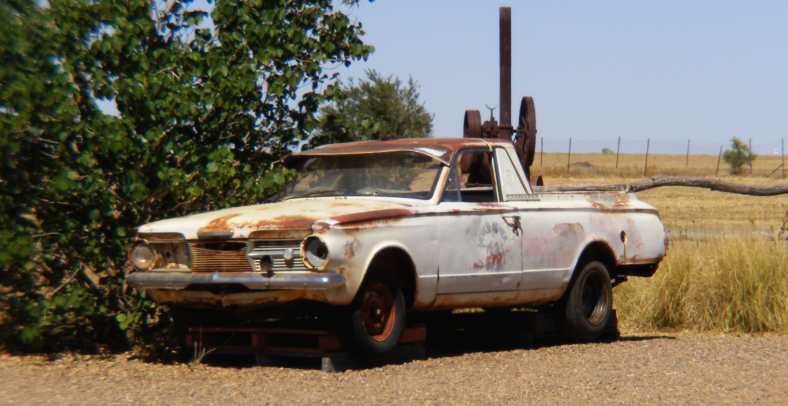
AP6 utility. I particularly like the way Aussie invention has put this up on pallets to keep it off the ground. The AP6 was the first model to have significant body differences to the US models, this being the grille.
In the background of that picture you’ll see an old traction engine, these steam-powered devices must have been very numerous in areas like this in the decades before tractors came into play. I’ve more recently learned that the hotel was named the ‘Federal Hotel’ and was built in the year of Australia’s Federation, 1901. It was also built in a back street of McKinlay and moved to the main road for the movie.
And the town itself was named for Scotsman Robert McKinlay, who journeyed through the area in 1861 as he explored between Adelaide and the Gulf of Carpentaria.
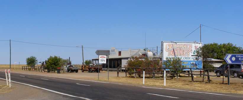
Faded sign. It is a long time since the movie, this picture taken 34 years after its release. The pub does attract a number of tourists.
The blue direction sign to the right of that picture points to Gidyea Bug Byway, named for a local bug which causes havoc among crops in particularly wet years.

Blue skies. On the road again, long straights and blue skies were predominant. For people farming this area, the brown grass was all they had after a couple of years of drought.
This drive was done as the Winter left us and brought Spring to our shores. Not much changed, but the van was happy to romp along at about 70mph in overdrive over the longest stretches of the run across Queensland. I had allowed two days to get home to Toowoomba from Mount Isa, and the stretch from McKinlay to Kynuna was 75kms, while Kynuna marked 300kms (about 200 miles) from Mount Isa, with another hundred miles to the next decent town, Winton.
Kynuna came up soon enough…

Kynuna. Barely a dot on the map, Kynuna have very few dwellings spread out on the grasslands.
…and presented itself with a couple of opportunities to slake one’s thirst, first at the roadhouse…
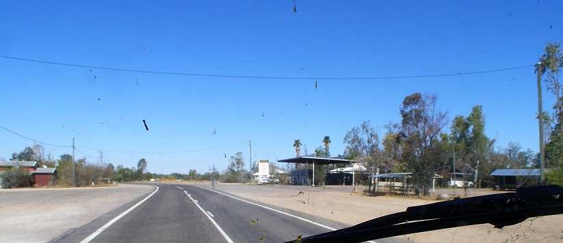
Kynuna Roadhouse. Fuel, food (reputed to be quite good) and alcohol are all available here.
…and around the corner at the Blue Heeler Hotel:

Hotel. Named for the unique Australian breed of working dog, the hotel is on the Eastern end of Kynuna.
Keeping up the pressure to get to Longreach and Barcaldine, I pressed on without stopping. Out here stock on properties have a lot of acres to roam, so it was almost a rare sight that I saw beside the road here:
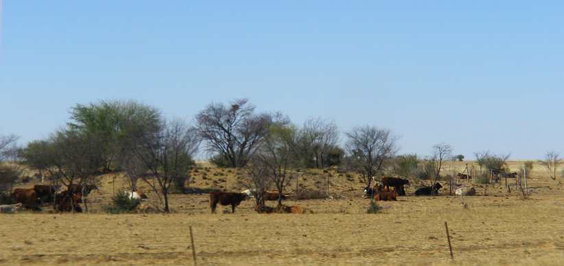
Cattle seek shade. The scrubby trees here throw little shade, but the cattle take advantage of what little there is.
Some would find these roads boring, but you have to keep your mind active and your eyes open to safely cover the miles. The many miles.

Mostly straight and flat. A fresh patch in the bitumen is the outstanding sight in this scene as the road follows a straight line to the South-East.
Conversations I’d recently had with a friend, Graeme Baird, came to mind along here. He’d recently taken a trip to Darwin and noted that trucks were usually not allowed into the Rest Areas on the Northern Territory highways.
The problem there is that the truck’s own ‘stopping bays’ had no facilities, whereas there were some – in particular toilets – in the areas provided for car traffic. Truck drivers were expected to drive inordinate distances with no prospect of relief. Not only that, but police pounced on any truck driver they spotted in a stopping bay hiding behind the truck to wet the ground between his vehicle’s wheels.
Queensland, therefore, must be regarded as heaven for truckies driving between Darwin and Brisbane:

Rest Area. Note that the sign offers parking to trucks at this Rest Area about twenty miles out of Kynuna.
Further along there was a change in the scenery. There are hilly places called ‘Jump-Ups’ locally, places where the topography has formed differently over time. It’s described here:
Here I approach the Ayrshire Hills:
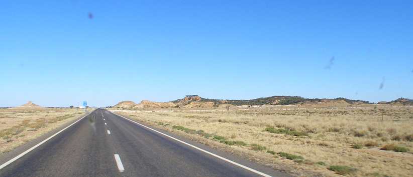
Ayrshire Hills. One of the ‘Jump-Ups’ of the Winton district, covering several square miles.
This is the Rest Area where it seems caravanners tend to stop for a night or two as they explore the hills. In particular in this you can see landforms more like those of Utah and Arizona, created by those top-covering rocks being hard and having the softer ground under them erode away.

Ayrshire Rest Area. The similarities between these landforms and many in America can be seen here. This is rare in Australia.
And then Winton, the end of the longest stretch of the drive as far as decent towns is concerned, it being about 230 miles between Cloncurry and this point. The sun was behind me and I was feeling fresh enough as the town came into view…

Entering Winton. A town of 1,600 people, Winton lays claim to the origin of the song Waltzing Matilda.
…and thus I took a few pictures around town. The main street…

Main street. With the old-style hotel most obvious, the various shops and businesses stretch for a couple of blocks of this broad street.
…is where the Waltzing Matilda Centre is located:
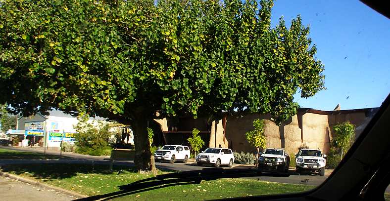
Waltzing Matilda Centre. Behind the wall is a display covering more than Banjo Paterson’s song, it’s a museum and can be explored on the internet. The opal shop on the left serves the local opal hunters.
‘Banjo’ Paterson, a solicitor and well-known (and well-published) poet of the late 1800s, wrote Waltzing Matilda in the wake of the huge shearer’s strike of the early 1890s. Towards the end of the strike, one of the ringleaders, ‘Frenchy’ Hoffmeyer, inspired the burning down of the shearing shed on Dagworth Station and killed himself to escape police capture. Whether he’s the central character of the song or not, I guess we’ll never be sure.
Winton is also the centre of a lot of archeologcal work relating to dinosaurs and this accounts for a lot of the tourist interest, especially after they publicise some new find of a previously-undiscovered species.
Wide streets criss-cross the town, again showing a well spread-out array of homes, small businesses, schools and churches:

Back streets. The width of the streets, sealed from kerb to kerb, is shown here. Trees, giving precious trade, are encouraged to grow in all these towns.
After getting some food and fuel I hit the road again. Soon the time of day was starting to make itself felt…
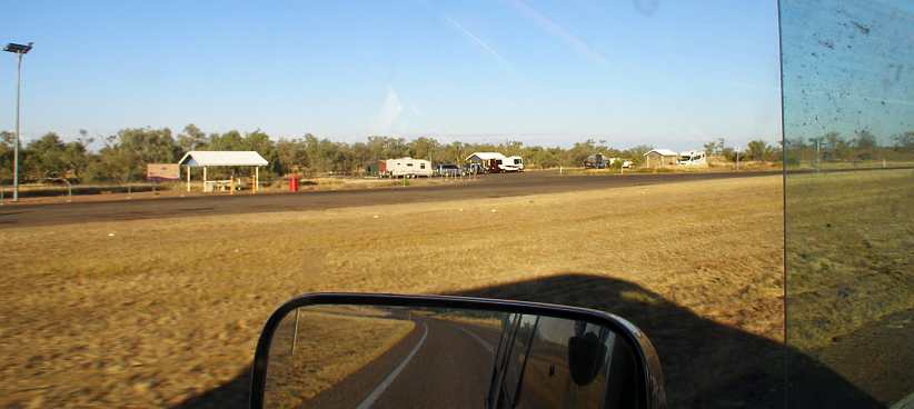
Rest area and shadow. Four overnight campers are settling in at this Rest Area between Winton and Longreach. And the shadow of my van is stretching out in their direction as the sun lowers itself in the sky.
…and I was becoming somewhat fixated on watching the length of the van’s shadow grow before me:
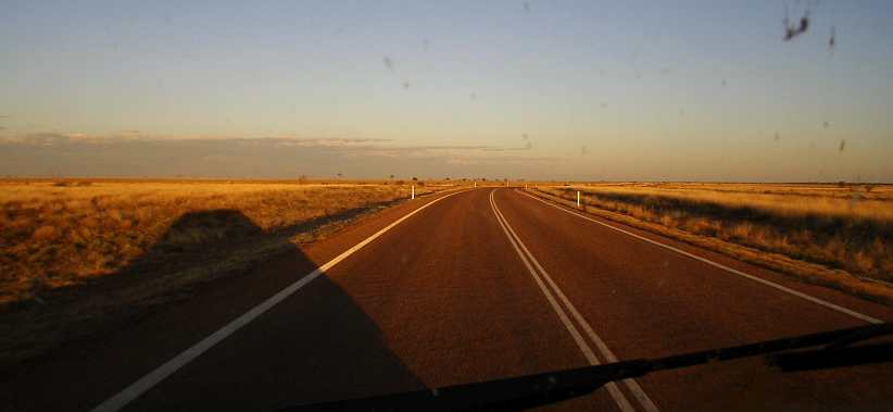
Longer shadows. There are promising clouds in the distance, but attached to the van is this lengthening shadow on the way to Longreach.
Longreach was a little more than a hundred miles from Winton and it was now clear I wouldn’t be there in daylight. Colours in the clouds reflected the sunset:
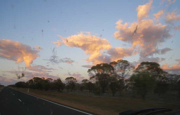
Sunset’s reflection. The pink tinge in the clouds, remaining after the sun’s gone from the road and the trees. Darkness wasn’t far away now.
The lights of Longreach were not far away either at this stage. A major milestone in the drive and signalling that I was now almost 650kms (400 miles) into my day’s drive. There was still a sixty-four mile drive to go to get to Barcaldine.

Lights of Longreach. A larger town, something over 3,000 people live here. Its lights were a very welcome sight to me.
Full darkness was not far away as I arrived and photography was impossible with the camera. These pics are from my phone, but lack significantly because of the light situation.

Welcome. Right on the roundabout as I drove into town was this welcoming sign. The town is even more famous than Winton in my eyes.
I had been to Longreach before, in 1996 when I was the Media Liaison Officer for the Camp Quality Caper. That was just after the huge Stockman’s Hall of Fame and Outback Heritage Centre had opened, this being full of the history pertaining to the area from the explorers to the initial farming activity and through the creation of Qantas, Australia’s National Airline.

Through the town. Another elevated house predominates here, the bulk of the town is off to the right of the highway.
I had no cause to stop and so I didn’t. I drove right past the Qantas Founders’ Museum, which is separate from the Hall of Fame. This was all-new since my earlier trip, the 707 arriving there in 2007, a 747 in 2012, a Catalina flying boat in 2015 and a Lockheed Constellation in 2017.
The latter was interesting. It was a US Navy aircraft which had been sold to group who used it to transport fish before it was impounded in Manila for 25 years. The museum bought it at auction and then set about transporting it (in parts), reassembling and finishing the aircraft to a similar standard to that displayed by Constellations operated by the company in the fifties and early sixties. Many volunteers were involved in this, including a friend of mine, Barry Carr.
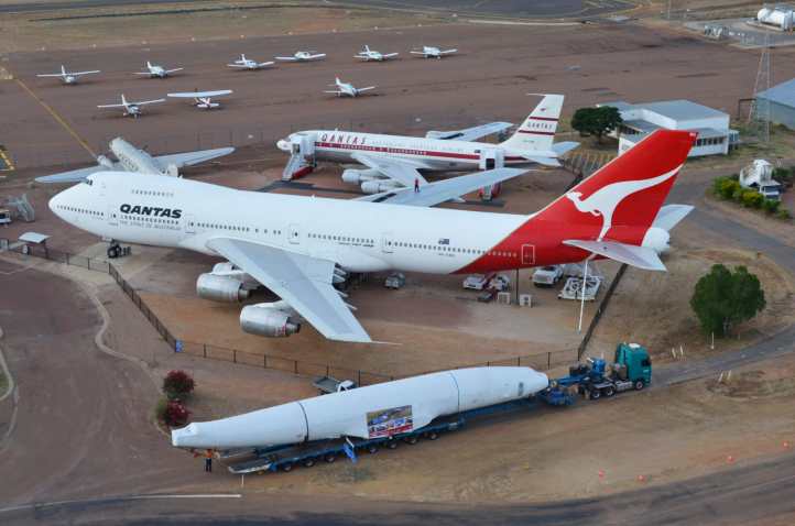
Constellation arriving. Ready for a lot of work, the Constellation was trucked in to join its stablemates. The 707, 747 and Catalina (out of frame) flew in when they arrived. Photo from the museum website.
The main instigator of Qantas was Hudson Fysh. He must have been a dynamic individual to attempt to build an airline from a couple of WW1 bombers when he created the Queensland And Northern Territory Aerial Services. Later he went on to head the Snowy Mountains Hydro-Electric Authority, the biggest-ever infrastructure development in Australian history.

Today’s night-time display. A year after my trip this roof was completed over the aircraft display, with this being the view by night from the highway.
The other reason Longreach is a little memorable to me is that one of Fysh’s cohorts, Herb Avery, put together a car there in the early thirties. This went on to become, in Rex Law’s hands, a famous racing Special using the original Regal Underslung chassis (c1911) and a wartime Cadillac V8.
Herb Avery. An inveterate town-to-town record setter in the late twenties and through the thirties, Herb Avery built up this car using Regal Underslung underpinnings and Austin 25 mechanicals. He is said to have made a lot of money out of bets on what time he’d do from place to place in both this and his previous mounts, Studebakers.
Barcaldine was my destination for the day because Sandra had arranged for me to meet her cousin for breakfast in Blackall the next morning. Camping at Barcaldine would put that in easy reach with an early start. I was a bit disappointed that this meant I couldn’t stop at Ilfracombe, just a short distance out of Longreach.
This little place has a display along the highway which shows off the machinery used on farms and for transport over the decades, I’d seen it very briefly in 1996 but I really wanted to get a better look.
Instead I went straight through, though I recall having a problem with a car parked facing me a little way out of town. With headlights on high beam, and driving lights, just the thing to blind anyone trying to find their way past that point. I stopped and had stern words with the driver.
When I got to Barcaldine I found the Rest Area just a little past the town, set up my stove and cooked a nice dinner. And afterwards I slipped off to sleep. And looked forward to bacon and eggs in the morning…
Walkabout Creek? The hotel at McKinlay has embraced its movie identity to become a bit of a tourist attraction.
Outside there’s a Valiant ute that’s seen better days. This is the AP6 model, the fourth model we had in Australia:
AP6 utility. I particularly like the way Aussie invention has put this up on pallets to keep it off the ground. The AP6 was the first model to have significant body differences to the US models, this being the grille.
In the background of that picture you’ll see an old traction engine, these steam-powered devices must have been very numerous in areas like this in the decades before tractors came into play. I’ve more recently learned that the hotel was named the ‘Federal Hotel’ and was built in the year of Australia’s Federation, 1901. It was also built in a back street of McKinlay and moved to the main road for the movie.
And the town itself was named for Scotsman Robert McKinlay, who journeyed through the area in 1861 as he explored between Adelaide and the Gulf of Carpentaria.
Faded sign. It is a long time since the movie, this picture taken 34 years after its release. The pub does attract a number of tourists.
The blue direction sign to the right of that picture points to Gidyea Bug Byway, named for a local bug which causes havoc among crops in particularly wet years.
Blue skies. On the road again, long straights and blue skies were predominant. For people farming this area, the brown grass was all they had after a couple of years of drought.
This drive was done as the Winter left us and brought Spring to our shores. Not much changed, but the van was happy to romp along at about 70mph in overdrive over the longest stretches of the run across Queensland. I had allowed two days to get home to Toowoomba from Mount Isa, and the stretch from McKinlay to Kynuna was 75kms, while Kynuna marked 300kms (about 200 miles) from Mount Isa, with another hundred miles to the next decent town, Winton.
Kynuna came up soon enough…
Kynuna. Barely a dot on the map, Kynuna have very few dwellings spread out on the grasslands.
…and presented itself with a couple of opportunities to slake one’s thirst, first at the roadhouse…
Kynuna Roadhouse. Fuel, food (reputed to be quite good) and alcohol are all available here.
…and around the corner at the Blue Heeler Hotel:
Hotel. Named for the unique Australian breed of working dog, the hotel is on the Eastern end of Kynuna.
Keeping up the pressure to get to Longreach and Barcaldine, I pressed on without stopping. Out here stock on properties have a lot of acres to roam, so it was almost a rare sight that I saw beside the road here:
Cattle seek shade. The scrubby trees here throw little shade, but the cattle take advantage of what little there is.
Some would find these roads boring, but you have to keep your mind active and your eyes open to safely cover the miles. The many miles.
Mostly straight and flat. A fresh patch in the bitumen is the outstanding sight in this scene as the road follows a straight line to the South-East.
Conversations I’d recently had with a friend, Graeme Baird, came to mind along here. He’d recently taken a trip to Darwin and noted that trucks were usually not allowed into the Rest Areas on the Northern Territory highways.
The problem there is that the truck’s own ‘stopping bays’ had no facilities, whereas there were some – in particular toilets – in the areas provided for car traffic. Truck drivers were expected to drive inordinate distances with no prospect of relief. Not only that, but police pounced on any truck driver they spotted in a stopping bay hiding behind the truck to wet the ground between his vehicle’s wheels.
Queensland, therefore, must be regarded as heaven for truckies driving between Darwin and Brisbane:
Rest Area. Note that the sign offers parking to trucks at this Rest Area about twenty miles out of Kynuna.
Further along there was a change in the scenery. There are hilly places called ‘Jump-Ups’ locally, places where the topography has formed differently over time. It’s described here:
Landscapes of the Winton Shire.
Geological History of the Area:
The extensive plains and uplands of Western Queensland span some two billion years of geological time. Winton is part of the Great Artesian Basin, stretching from South Australia and New South Wales to the Gulf of Carpentaria and Cape York.
The Basin was created some 220 million years ago when enormous tectonic forces down warped the region which then began to fill with the sediments of rivers and lakes. These sediments eventually became the sandstones and rocks at the base of the Basin.
A series of inland seas then flooded the continent. The most extensive flooding was around 110 million years ago and the last marine flooding was about 100 million years ago. The rocks laid down during these times contain many marine fossils.
The final phase of the development of the Artesian Basin occurred over the next 20 million years. As the seas retreated north, thick layers of sand and mud stones were laid down by lakes and rivers. These rocks are called the Winton Formation.
The Winton Formation then underwent heavy weathering and erosion, creating the present day landscapes around Winton – the distinctive flat-topped escarpments of the jump up country and Mitchell grass downs. These processes also formed the world famous opals from areas Jundah, Yowah and Opalton.
Jump Up Country:
The ranges that can be seen on the horizon are wonderful examples of this weathering and erosion process. It is possible to see these remnants because they have not been worn down as they are capped by unusually hard rock. This formed when naturally occurring chemicals cemented the rock, creating a Lateritic formation, allowing the rock to resist erosion and protect softer rocks beneath. In certain areas of jump ups there will be sharp overhangs where the softer rock underneath has been eroded away.
Much of the debris has been carried away by water and scattered but the character of the landscape surrounding the jump ups is distinctive, with a covering of stony loose rocks and boulders over the steep slopes below the jump up surfaces. There has been some 90 million years of slow, but relentless erosion and millions of years worth of sediment have been carried through waterways. This works to equalize the landscape, reducing the higher ground and building up the lower regions, forming the rolling Mitchell grass downs.
There are many more examples of jump ups throughout the Winton district, each with their own unique character and charm, set among the differing landscapes, but all formed with similar earth forces. Each of these formations is of different size caused by differences in the states of erosion from different rock compounds, the age of the rocks and how long it has been uncovered on the surface.
Ayrshire Hills. One of the ‘Jump-Ups’ of the Winton district, covering several square miles.
This is the Rest Area where it seems caravanners tend to stop for a night or two as they explore the hills. In particular in this you can see landforms more like those of Utah and Arizona, created by those top-covering rocks being hard and having the softer ground under them erode away.
Ayrshire Rest Area. The similarities between these landforms and many in America can be seen here. This is rare in Australia.
And then Winton, the end of the longest stretch of the drive as far as decent towns is concerned, it being about 230 miles between Cloncurry and this point. The sun was behind me and I was feeling fresh enough as the town came into view…
Entering Winton. A town of 1,600 people, Winton lays claim to the origin of the song Waltzing Matilda.
…and thus I took a few pictures around town. The main street…
Main street. With the old-style hotel most obvious, the various shops and businesses stretch for a couple of blocks of this broad street.
…is where the Waltzing Matilda Centre is located:
Waltzing Matilda Centre. Behind the wall is a display covering more than Banjo Paterson’s song, it’s a museum and can be explored on the internet. The opal shop on the left serves the local opal hunters.
‘Banjo’ Paterson, a solicitor and well-known (and well-published) poet of the late 1800s, wrote Waltzing Matilda in the wake of the huge shearer’s strike of the early 1890s. Towards the end of the strike, one of the ringleaders, ‘Frenchy’ Hoffmeyer, inspired the burning down of the shearing shed on Dagworth Station and killed himself to escape police capture. Whether he’s the central character of the song or not, I guess we’ll never be sure.
Winton is also the centre of a lot of archeologcal work relating to dinosaurs and this accounts for a lot of the tourist interest, especially after they publicise some new find of a previously-undiscovered species.
Wide streets criss-cross the town, again showing a well spread-out array of homes, small businesses, schools and churches:
Back streets. The width of the streets, sealed from kerb to kerb, is shown here. Trees, giving precious trade, are encouraged to grow in all these towns.
After getting some food and fuel I hit the road again. Soon the time of day was starting to make itself felt…
Rest area and shadow. Four overnight campers are settling in at this Rest Area between Winton and Longreach. And the shadow of my van is stretching out in their direction as the sun lowers itself in the sky.
…and I was becoming somewhat fixated on watching the length of the van’s shadow grow before me:
Longer shadows. There are promising clouds in the distance, but attached to the van is this lengthening shadow on the way to Longreach.
Longreach was a little more than a hundred miles from Winton and it was now clear I wouldn’t be there in daylight. Colours in the clouds reflected the sunset:
Sunset’s reflection. The pink tinge in the clouds, remaining after the sun’s gone from the road and the trees. Darkness wasn’t far away now.
The lights of Longreach were not far away either at this stage. A major milestone in the drive and signalling that I was now almost 650kms (400 miles) into my day’s drive. There was still a sixty-four mile drive to go to get to Barcaldine.
Lights of Longreach. A larger town, something over 3,000 people live here. Its lights were a very welcome sight to me.
Full darkness was not far away as I arrived and photography was impossible with the camera. These pics are from my phone, but lack significantly because of the light situation.
Welcome. Right on the roundabout as I drove into town was this welcoming sign. The town is even more famous than Winton in my eyes.
I had been to Longreach before, in 1996 when I was the Media Liaison Officer for the Camp Quality Caper. That was just after the huge Stockman’s Hall of Fame and Outback Heritage Centre had opened, this being full of the history pertaining to the area from the explorers to the initial farming activity and through the creation of Qantas, Australia’s National Airline.
Through the town. Another elevated house predominates here, the bulk of the town is off to the right of the highway.
I had no cause to stop and so I didn’t. I drove right past the Qantas Founders’ Museum, which is separate from the Hall of Fame. This was all-new since my earlier trip, the 707 arriving there in 2007, a 747 in 2012, a Catalina flying boat in 2015 and a Lockheed Constellation in 2017.
The latter was interesting. It was a US Navy aircraft which had been sold to group who used it to transport fish before it was impounded in Manila for 25 years. The museum bought it at auction and then set about transporting it (in parts), reassembling and finishing the aircraft to a similar standard to that displayed by Constellations operated by the company in the fifties and early sixties. Many volunteers were involved in this, including a friend of mine, Barry Carr.
Constellation arriving. Ready for a lot of work, the Constellation was trucked in to join its stablemates. The 707, 747 and Catalina (out of frame) flew in when they arrived. Photo from the museum website.
The main instigator of Qantas was Hudson Fysh. He must have been a dynamic individual to attempt to build an airline from a couple of WW1 bombers when he created the Queensland And Northern Territory Aerial Services. Later he went on to head the Snowy Mountains Hydro-Electric Authority, the biggest-ever infrastructure development in Australian history.
Today’s night-time display. A year after my trip this roof was completed over the aircraft display, with this being the view by night from the highway.
The other reason Longreach is a little memorable to me is that one of Fysh’s cohorts, Herb Avery, put together a car there in the early thirties. This went on to become, in Rex Law’s hands, a famous racing Special using the original Regal Underslung chassis (c1911) and a wartime Cadillac V8.
Herb Avery. An inveterate town-to-town record setter in the late twenties and through the thirties, Herb Avery built up this car using Regal Underslung underpinnings and Austin 25 mechanicals. He is said to have made a lot of money out of bets on what time he’d do from place to place in both this and his previous mounts, Studebakers.
Barcaldine was my destination for the day because Sandra had arranged for me to meet her cousin for breakfast in Blackall the next morning. Camping at Barcaldine would put that in easy reach with an early start. I was a bit disappointed that this meant I couldn’t stop at Ilfracombe, just a short distance out of Longreach.
This little place has a display along the highway which shows off the machinery used on farms and for transport over the decades, I’d seen it very briefly in 1996 but I really wanted to get a better look.
Instead I went straight through, though I recall having a problem with a car parked facing me a little way out of town. With headlights on high beam, and driving lights, just the thing to blind anyone trying to find their way past that point. I stopped and had stern words with the driver.
When I got to Barcaldine I found the Rest Area just a little past the town, set up my stove and cooked a nice dinner. And afterwards I slipped off to sleep. And looked forward to bacon and eggs in the morning…
Last edited by Ray Bell; May 2, 2021 at 06:36 AM.
Thread Starter
|
Captain
Joined: Oct 2005
Posts: 568
Likes: 8
From: The Summit, Queensland, Australia
Naturally I set off early from Barcaldine. I punched along the mostly-straight road through the flat country heading to Blackall. Not a long drive, as one would plan for a drive before breakfast, a bit under seventy miles.
At this stage my trip home was getting a bit �cruisy� as I wasn�t hurrying at all, so although I made it to Chinchilla that night, the number of things seen in my pics for the day mean that once again the day will be broken into two parts. Part one is to Morven:

But first I found myself going the wrong way at Barcaldine for some reason or other. Just for a mile or so, then I turned back and headed in the right direction. I did hit the road as soon as I was awake and it was still very early�
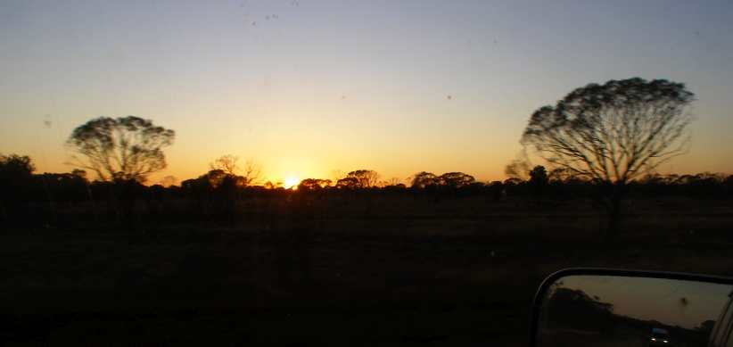
Another sunrise on the road. Just out of Barcaldine and heading South, the sun sat on the horizon to my left, but only briefly. In my mirror a local courier driver is seen out early on his inter-town rounds.
�but quickly turning light to expose the path to Blackall. I was keenly looking out for kangaroos, this being one of their prime times of the day to be moving about, but the road was well-cleared off to the sides and I had no problems there.
In this vast country with its small population, telecommunications are a vital part of living in this land, so there are visible signs from time to time of use of the airwaves:

Long shadows. The trees are throwing their long shadows here, but not as long as the tower on the adjacent paddock does. Through the morning these towers would catch a lot of my attention.
Blackall soon came up. The first thing I did was find a public facility so I could freshen up a bit and make a good impression on Sandra�s cousin and her husband. Mid-town there was a brick building which provided a nice clean place for me to take care of these things, but my Mount Isa haircut was still a burden to bear but now I was at least clean-shaven.
As the cousin�s motel is one of the first things seen on entry to the town, I then turned back to head in that direction. Along the way I passed the �Ram Park� in which there is a statue of a large ram:

Ram Park. The ram can be seen in the far corner while the bullock wagon represents what was the main form of transport in these places prior to mechanisation.
Just sneaking in to the right in that picture is a railway signal which is alongside a concrete path which leads to the old Blackall railway station. This has been moved bodily into the park as another memento of the past used to display items used in those early times.
I drove up into the side street so I could park as closely as I could to the ram�
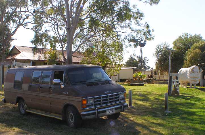
Two Rams. One ram is a merino, the other by Dodge. The woolgrowing industry once supported all of these Western Queensland towns.
�to photograph two rams together. And then it was time to call in at the motel, located opposite the golf course:

Blackall Motel. This was an older-style motel and also had fuel bowsers out the front, they�ve had it for many years and are looking to sell out before they�re too old to enjoy retirement.
The time spent with Sandra�s cousin and her husband was pleasant, discussing my travels and their life in the motel, while the bacon and eggs was much appreciated. They had a quick look at my van and then I departed�
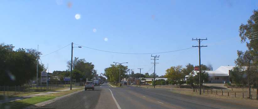
Blackall�s main street. Back past the Ram Park, to the left here is the �Queensland Government Agency� which takes care of car registrations, land dealings and other things where people have to deal with the state. Ahead is the broad main street with trees in the median strip.
�through the balance of the town. Almost 1,500 hundred live in Blackall (Barcaldine is the same) and so it has its own thriving populace serving the surrounding farming country and providing �home� for retirees from both the farms and the town itself.
A similar distance � around sixty miles � was to be covered before the next town, Tambo. It�s a much smaller place (population just 350) but it�s obvious there�s a very willing community spirit there. My first stop was a Rest Area just off the highway, which was very well-appointed�

Tambo Rest Area. Catering well to travelling public, this is one of two Rest Areas in the small town that is Tambo.
�with this pic showing the covered picnic table and benches and the electric barbecues provided. Just across the road�

Neat newer homes. While most country towns have very few newer houses, these appear to have been built fairly recently and are well-kept.
�are small homes which appear to be the dwelling place of elderly couples. Looking back up the street towards the highway shows more neatness:
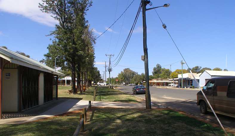
More of the Rest Area. A row of trees with �park benches� below them and a nice new toilet block complete the picture.
Further to the interests of drawing tourists to their town, the creation of attractions large and small has been successful. There are things such as the Grasslands Art Gallery in the main street, while two adjacent old weatherboard shops are Tambo Teddies and Fanny Mae�s Cafe, ready to sell teddy bears and snacks respectively to people who take a break on their journey here.
Further down there are two buildings which have been preserved. The original Court House is now a museum, while beside the Shire Hall�
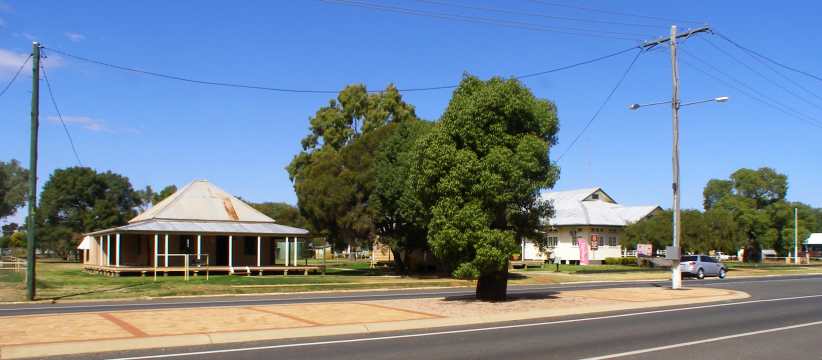
Old Post Office. The Shire Hall and the original Post Office are also in the main street, as is a Boab tree in the median strip.
�which is no doubt the setting for local events of all kinds.
Art seems to have played a big part in recent history in the town, so further along we find the Tambo Truck:

Tambo Truck. A work of art of a different kind, this was created for a competition in 2014 for a public artwork representing the district�s history. The result was this �road train� with a load representing the wool produced by local shearing.
You just have to love the �smoke� coming out of the stack behind the cabin of the International Harvester prime mover � a truck provided by local transport operator Gerald Johnson � and something which seems to be common in the works of artist Christopher Trotter:
https://experiencetamborinemountain....rotter-artist/
I like the use of an old tractor or implement seat at the end of the �smoke�. And just across the road is the entry to the local Caravan Park, the second Rest Area and a small lake with an island which provides waterbirds a safe home and encourages bird-watching.

Second Rest Area. This one is a drive-through type and gives truck drivers a place to stop and rest as well, again with amenities and shade.
That pic also shows the highway as it turns towards the South for a while after many miles of heading South-East. That was where I was going and it was now nearing morning tea time and I had no hot water. This was nagging at me as I drove past more of these towers�
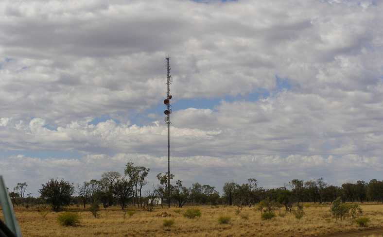
Another communications tower. These came and went as I drove so I definitely wanted to get a better shot of one. This is the result of that desire.
�and thought about the many uses they have in areas like this.
And I also kept thinking about my morning tea (coffee, actually). I had on board the coffee, the milk, the cup and the water, but I wasn�t keen to spend the time setting up the stove (with its dodgy method of operation, regulated by the tap on the gas bottle) to boil the water. So I concluded that my best approach was to make an approach.
A caravanner stopped for the same purpose at a Rest Area would have their stove out and operating, or ready to do so. Unless they�re ready to leave again, such people are always on for a discussion about where they�ve been and where I�ve been � just as I found most people in America. I decided I would look for a Rest Area with a caravan parked in there.
The drive from Tambo to the next town was seventy miles (117kms) and there should be at least a couple of Rest Areas in that distance. The first came up on the left at Yandarlo but was deserted, but right on fifty miles out there were signs of another at Nive, this one on the right.
As I drove up it looked promising, with a couple of vehicles visible through the screen of trees, but what a surprise I got when I wheeled the van in around one of those trees:

Police! No caravans, but the Queensland Police were conducting a Public Relations exercise � and I was a member of the public to whom they wanted to relate.
They had an urn with steam rising from it, coffee, tea, milk and biscuits for all to enjoy. For once I was pleased to be pulled up by the police. Of course, we all � the police, myself and other travellers � had some conversation before I struck out on the next twenty miles to Augathella. Their message to those stopping was that they should make regular rest stops.
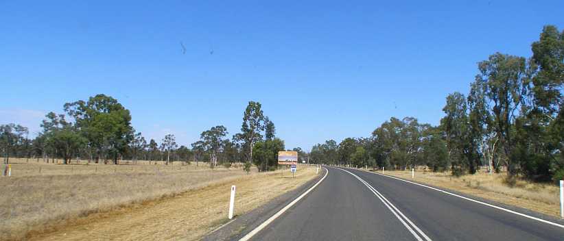
Trees and signs of Augathella. I�d been travelling into country with more serious trees than the scrubby stuff further West. This is the first sign pointing to Augathella.
The Augathella area is reputed to be the place where there are more kangaroo strikes than any other. The town itself is located off the highway�

Straight past Augathella. Augathella is where the highway briefly widens climbing the distant hill on this straight stretch.
�with just a service station at the turnoff. With only about 150 people living there, it�s not a big place. Nevertheless, my curiosity was aroused and I drove on into the town:

Augathella�s main street. Once again a broad street with trees in the median strip. There are a few shops, a hotel and other necessities.
Right in the middle of town, unseen by me on this trip, there�s a �Big Meat Ant� in the way we Australians tend to feature �Big� things in various towns. This one is found climbing a pole in a park where, once again, electric barbecues and picnic facilities are located. The town has adopted the meat ant as its mascot and its football team are named for this biting insect as well. Here�s a Google sphere view of the park and the ant:
https://www.google.com/maps/@-25.795...i5632?hl=en-GB
And this one concentrates on the ant:
https://www.atlasobscura.com/places/big-meat-ant
Driving back towards the highway I got a snap of these homes�

Typical homes. Homes like these abound in the Australian �bush� towns, clad with either timber weatherboards or (as are these) asbestos cement sheeting. Many hundreds of thousands live in such dwellings.
�and just up the road on the other side was the local �go-to� man:
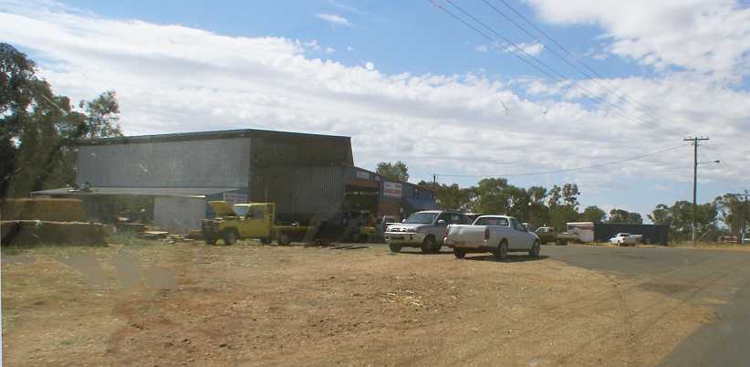
Typical �garage�. The place where you go to get a tyre fixed or a gearbox fitted, weld up a bracket on your tractor or a multitude of other jobs.
Most small �bush� towns have many of these things in common, though the meat ants are usually ant-sized � up to maybe �� in length.
Rejoining the highway I found I was seeing a few more hills . . .

Hill country. Breaking up the blacksoil flat country for a while were hills such as this one.
�and from time to time I�d see a paddock which had been plowed in the hope that the drought might break in the coming Spring and Summer days:

Plowed in hope. There�s a lot of hope in the work farmers do in a drought, not knowing with any certainty whatever whether or not it will rain enough to produce for them.
The 58 miles/93kms to Morven slipped away with things like this to look at. This is yet another very small town, about 200 people, with the highway as its main street. The first thing to come into sight is the school:

Modern school. The state schools in Queensland now have air conditioning because of the hot weather we experience. This probably accounts for the vast array of solar panels on the roof, while the exposure of young skin to the sun is recognised as risky and therefore many play and eating areas have coverings to shade them.
Once again I stopped to look around. One thing that caught my attention was the railway station�
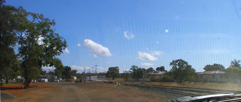
Morven railway station. I don�t know if passenger services are seen here any more, but the railway is still in use and the platform remains usable too.
�and its empty surroundings.
The most visible transport is on the road parallel to the railway, with trucks rolling through frequently.
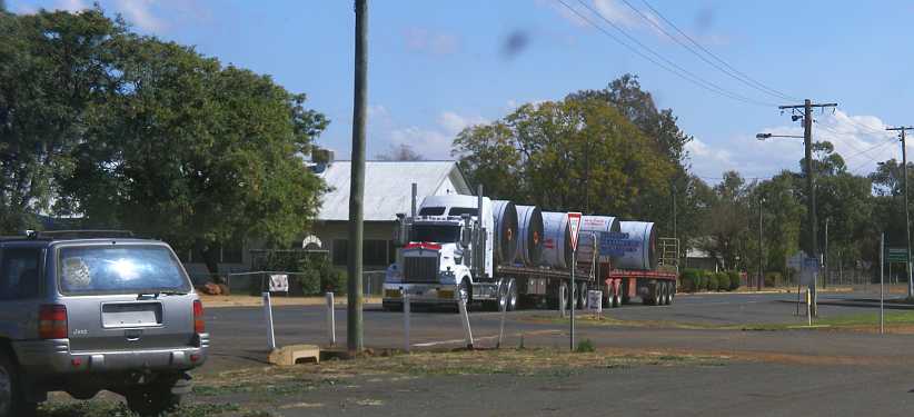
Road train through Morven. Only a small road train, but a road train nonetheless. I don�t understand the load here as it�s heading East, whereas most manufactured goods are heading west away from the city and ports.
As I looked around, noting that there�d been some rain recently, I nearly slipped in some mud and had some trouble cleaning it off my shoes. This shot shows that some of the mud got carried onto the roadway:
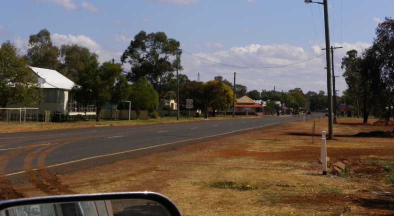
Wet ground. Some dust-settling rain must have fallen in the preceding days and there was still some slippery mud around. We�re still looking West here, with some everyday houses in an everyday small bush town enjoying a quiet midday.
Yes, this was about midday, maybe a little later. Not much human activity is visible and that road towards home was still calling me. But there was no point in hurrying as I had the regular weekend work to do in Dalby on my way, and that would be easily reached with sightseeing along the way.
So what would the balance of the afternoon bring?
At this stage my trip home was getting a bit �cruisy� as I wasn�t hurrying at all, so although I made it to Chinchilla that night, the number of things seen in my pics for the day mean that once again the day will be broken into two parts. Part one is to Morven:
But first I found myself going the wrong way at Barcaldine for some reason or other. Just for a mile or so, then I turned back and headed in the right direction. I did hit the road as soon as I was awake and it was still very early�
Another sunrise on the road. Just out of Barcaldine and heading South, the sun sat on the horizon to my left, but only briefly. In my mirror a local courier driver is seen out early on his inter-town rounds.
�but quickly turning light to expose the path to Blackall. I was keenly looking out for kangaroos, this being one of their prime times of the day to be moving about, but the road was well-cleared off to the sides and I had no problems there.
In this vast country with its small population, telecommunications are a vital part of living in this land, so there are visible signs from time to time of use of the airwaves:
Long shadows. The trees are throwing their long shadows here, but not as long as the tower on the adjacent paddock does. Through the morning these towers would catch a lot of my attention.
Blackall soon came up. The first thing I did was find a public facility so I could freshen up a bit and make a good impression on Sandra�s cousin and her husband. Mid-town there was a brick building which provided a nice clean place for me to take care of these things, but my Mount Isa haircut was still a burden to bear but now I was at least clean-shaven.
As the cousin�s motel is one of the first things seen on entry to the town, I then turned back to head in that direction. Along the way I passed the �Ram Park� in which there is a statue of a large ram:
Ram Park. The ram can be seen in the far corner while the bullock wagon represents what was the main form of transport in these places prior to mechanisation.
Just sneaking in to the right in that picture is a railway signal which is alongside a concrete path which leads to the old Blackall railway station. This has been moved bodily into the park as another memento of the past used to display items used in those early times.
I drove up into the side street so I could park as closely as I could to the ram�
Two Rams. One ram is a merino, the other by Dodge. The woolgrowing industry once supported all of these Western Queensland towns.
�to photograph two rams together. And then it was time to call in at the motel, located opposite the golf course:
Blackall Motel. This was an older-style motel and also had fuel bowsers out the front, they�ve had it for many years and are looking to sell out before they�re too old to enjoy retirement.
The time spent with Sandra�s cousin and her husband was pleasant, discussing my travels and their life in the motel, while the bacon and eggs was much appreciated. They had a quick look at my van and then I departed�
Blackall�s main street. Back past the Ram Park, to the left here is the �Queensland Government Agency� which takes care of car registrations, land dealings and other things where people have to deal with the state. Ahead is the broad main street with trees in the median strip.
�through the balance of the town. Almost 1,500 hundred live in Blackall (Barcaldine is the same) and so it has its own thriving populace serving the surrounding farming country and providing �home� for retirees from both the farms and the town itself.
A similar distance � around sixty miles � was to be covered before the next town, Tambo. It�s a much smaller place (population just 350) but it�s obvious there�s a very willing community spirit there. My first stop was a Rest Area just off the highway, which was very well-appointed�
Tambo Rest Area. Catering well to travelling public, this is one of two Rest Areas in the small town that is Tambo.
�with this pic showing the covered picnic table and benches and the electric barbecues provided. Just across the road�
Neat newer homes. While most country towns have very few newer houses, these appear to have been built fairly recently and are well-kept.
�are small homes which appear to be the dwelling place of elderly couples. Looking back up the street towards the highway shows more neatness:
More of the Rest Area. A row of trees with �park benches� below them and a nice new toilet block complete the picture.
Further to the interests of drawing tourists to their town, the creation of attractions large and small has been successful. There are things such as the Grasslands Art Gallery in the main street, while two adjacent old weatherboard shops are Tambo Teddies and Fanny Mae�s Cafe, ready to sell teddy bears and snacks respectively to people who take a break on their journey here.
Further down there are two buildings which have been preserved. The original Court House is now a museum, while beside the Shire Hall�
Old Post Office. The Shire Hall and the original Post Office are also in the main street, as is a Boab tree in the median strip.
�which is no doubt the setting for local events of all kinds.
Art seems to have played a big part in recent history in the town, so further along we find the Tambo Truck:
Tambo Truck. A work of art of a different kind, this was created for a competition in 2014 for a public artwork representing the district�s history. The result was this �road train� with a load representing the wool produced by local shearing.
You just have to love the �smoke� coming out of the stack behind the cabin of the International Harvester prime mover � a truck provided by local transport operator Gerald Johnson � and something which seems to be common in the works of artist Christopher Trotter:
https://experiencetamborinemountain....rotter-artist/
I like the use of an old tractor or implement seat at the end of the �smoke�. And just across the road is the entry to the local Caravan Park, the second Rest Area and a small lake with an island which provides waterbirds a safe home and encourages bird-watching.
Second Rest Area. This one is a drive-through type and gives truck drivers a place to stop and rest as well, again with amenities and shade.
That pic also shows the highway as it turns towards the South for a while after many miles of heading South-East. That was where I was going and it was now nearing morning tea time and I had no hot water. This was nagging at me as I drove past more of these towers�
Another communications tower. These came and went as I drove so I definitely wanted to get a better shot of one. This is the result of that desire.
�and thought about the many uses they have in areas like this.
And I also kept thinking about my morning tea (coffee, actually). I had on board the coffee, the milk, the cup and the water, but I wasn�t keen to spend the time setting up the stove (with its dodgy method of operation, regulated by the tap on the gas bottle) to boil the water. So I concluded that my best approach was to make an approach.
A caravanner stopped for the same purpose at a Rest Area would have their stove out and operating, or ready to do so. Unless they�re ready to leave again, such people are always on for a discussion about where they�ve been and where I�ve been � just as I found most people in America. I decided I would look for a Rest Area with a caravan parked in there.
The drive from Tambo to the next town was seventy miles (117kms) and there should be at least a couple of Rest Areas in that distance. The first came up on the left at Yandarlo but was deserted, but right on fifty miles out there were signs of another at Nive, this one on the right.
As I drove up it looked promising, with a couple of vehicles visible through the screen of trees, but what a surprise I got when I wheeled the van in around one of those trees:
Police! No caravans, but the Queensland Police were conducting a Public Relations exercise � and I was a member of the public to whom they wanted to relate.
They had an urn with steam rising from it, coffee, tea, milk and biscuits for all to enjoy. For once I was pleased to be pulled up by the police. Of course, we all � the police, myself and other travellers � had some conversation before I struck out on the next twenty miles to Augathella. Their message to those stopping was that they should make regular rest stops.
Trees and signs of Augathella. I�d been travelling into country with more serious trees than the scrubby stuff further West. This is the first sign pointing to Augathella.
The Augathella area is reputed to be the place where there are more kangaroo strikes than any other. The town itself is located off the highway�
Straight past Augathella. Augathella is where the highway briefly widens climbing the distant hill on this straight stretch.
�with just a service station at the turnoff. With only about 150 people living there, it�s not a big place. Nevertheless, my curiosity was aroused and I drove on into the town:
Augathella�s main street. Once again a broad street with trees in the median strip. There are a few shops, a hotel and other necessities.
Right in the middle of town, unseen by me on this trip, there�s a �Big Meat Ant� in the way we Australians tend to feature �Big� things in various towns. This one is found climbing a pole in a park where, once again, electric barbecues and picnic facilities are located. The town has adopted the meat ant as its mascot and its football team are named for this biting insect as well. Here�s a Google sphere view of the park and the ant:
https://www.google.com/maps/@-25.795...i5632?hl=en-GB
And this one concentrates on the ant:
https://www.atlasobscura.com/places/big-meat-ant
Driving back towards the highway I got a snap of these homes�
Typical homes. Homes like these abound in the Australian �bush� towns, clad with either timber weatherboards or (as are these) asbestos cement sheeting. Many hundreds of thousands live in such dwellings.
�and just up the road on the other side was the local �go-to� man:
Typical �garage�. The place where you go to get a tyre fixed or a gearbox fitted, weld up a bracket on your tractor or a multitude of other jobs.
Most small �bush� towns have many of these things in common, though the meat ants are usually ant-sized � up to maybe �� in length.
Rejoining the highway I found I was seeing a few more hills . . .
Hill country. Breaking up the blacksoil flat country for a while were hills such as this one.
�and from time to time I�d see a paddock which had been plowed in the hope that the drought might break in the coming Spring and Summer days:
Plowed in hope. There�s a lot of hope in the work farmers do in a drought, not knowing with any certainty whatever whether or not it will rain enough to produce for them.
The 58 miles/93kms to Morven slipped away with things like this to look at. This is yet another very small town, about 200 people, with the highway as its main street. The first thing to come into sight is the school:
Modern school. The state schools in Queensland now have air conditioning because of the hot weather we experience. This probably accounts for the vast array of solar panels on the roof, while the exposure of young skin to the sun is recognised as risky and therefore many play and eating areas have coverings to shade them.
Once again I stopped to look around. One thing that caught my attention was the railway station�
Morven railway station. I don�t know if passenger services are seen here any more, but the railway is still in use and the platform remains usable too.
�and its empty surroundings.
The most visible transport is on the road parallel to the railway, with trucks rolling through frequently.
Road train through Morven. Only a small road train, but a road train nonetheless. I don�t understand the load here as it�s heading East, whereas most manufactured goods are heading west away from the city and ports.
As I looked around, noting that there�d been some rain recently, I nearly slipped in some mud and had some trouble cleaning it off my shoes. This shot shows that some of the mud got carried onto the roadway:
Wet ground. Some dust-settling rain must have fallen in the preceding days and there was still some slippery mud around. We�re still looking West here, with some everyday houses in an everyday small bush town enjoying a quiet midday.
Yes, this was about midday, maybe a little later. Not much human activity is visible and that road towards home was still calling me. But there was no point in hurrying as I had the regular weekend work to do in Dalby on my way, and that would be easily reached with sightseeing along the way.
So what would the balance of the afternoon bring?
Thread Starter
|
Captain
Joined: Oct 2005
Posts: 568
Likes: 8
From: The Summit, Queensland, Australia
I really wasn’t sure how far I’d get by the end of the day, but I was keen to be within striking distance of Dalby so I could roll in there before the morning was too old to get some breakfast at McDonalds before starting work.
As it happened, Chinchilla was the logical place to stop. At a little more than fifty miles from Dalby, it would mean about an hour’s driving to get to my destination on Saturday morning.
Before departing Morven I snapped this (blurry) picture:

Relic on display. I don’t know what the significance of this relic is, but I think it’s a Chev 4 from the mid-twenties.
So I left Morven and soon the 360 drove me up to speed, while the warning signs kept me alert to the prospects ahead…
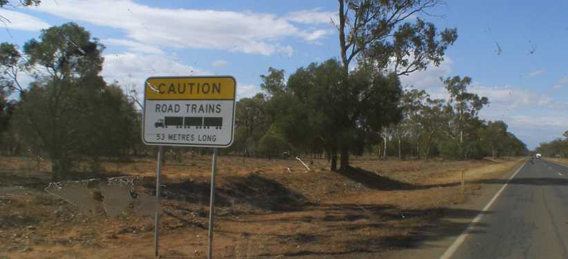
Road Train lengths. Road trains are commonplace, as we’ve seen, but different areas allow different lengths and so other road users have to be informed.
…on this never-ending strip of 2-lane bitumen between the trees and the scrub. 53 metres, by the way, is close to 174 feet or 58 yards. As they keep up their speed, they take a while to overtake and you have to allow for that when checking to see how much room you have.
The next ‘whistle stop’ town along had the tongue-twisting name of Mungallala, another which has no doubt shrunk since its glory days…

Mungallala. Another bridge across a frequently-dry creek leads into the town, there’s a nicely-shaded Rest Area on the right just over the bridge.
…but today is home to very few people and offers few amenities. Still, living in the bush has its advantages and it’s definitely ‘in the bush’:

Bigger gum trees. A typical roadside scene with gum trees at the roadside and cleared ground behind it where farmers graze livestock.
Mitchell came next, a decent-sized town of just over 1,000 residents:
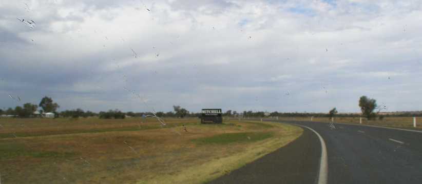
Mitchell. Another town with its roots in agriculture, a supply centre for farmers and a stopping point for travellers.
The water tower on the right, the State School (years one to seven) on the left and along the wide main street the shopping and business centre lazily sprawls itself…
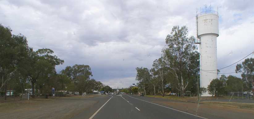
Water tower. Unlike most in America, the water tower is cylindrical and carries no identification. But there are many antennae on the top for communication services.
…and failed to attract my attention to any degree. Driving out of town we cross the Maranoa River…

Maranoa River. Looking to the North we can clearly see that the river is not at full depth. The stand of gum trees on the Eastern side is thick as it benefits by the river’s presence.
…and check both ways to see the water level:

More Maranoa. The river is held back by a weir and is not indicative of flow levels in this drought-stricken land.
Another 25kms on there was a major bend in the road at a little place called Amby. This did attract my attention as I felt it was time for a bit of a snack.

Amby in the afternoon. This is the Rest Area at Amby and the buff-coloured shed is open at the front with a picnic table for travellers. There are toilets in the light-coloured building seen beneath the trees.
A handy stopping point and I spent a short time there. But the road still beckoned and the afternoon was drifting on. A further 23kms I went through Muckadilla, where I could see somebody’s dreams had been shattered…

Motel for sale. Businesses like this in the bush can take a long time to sell, but most of them survive for a new owner.
…by a fire just a few weeks before my passage through the town. Here’s how Google Earth Street View captured it when intact:

Muckadilla Hotel-Motel. With a large boab tree out the front and a swimming pool, not to mention beer (Carlton Mid-Strength on the sign) on tap, it must have been a popular spot.
Here’s a contemporary report on the fire:
https://www.abc.net.au/news/2019-08-...sland/11397488
Readers will have noticed clouds in the sky in most pictures, and these continued to darken as I drove. Between Muckadilla and Roma the threat over the long straight roads grew…

The skies darken. Local farmers would have been praying for rain here and it seems their prayers might get some kind of an answer.
…and I was to strike a little light rain as I headed towards the much larger centre of Roma.
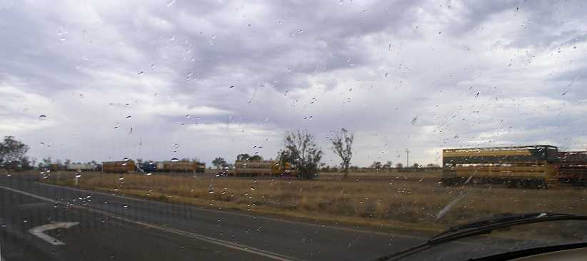
Road Train parking. Through a windscreen dotted with raindrops we see trailers from Road Trains parked in an area allotted for their use.
Note that most of the trailers are for livestock transport, used heavily during the drought to move cattle to ‘greener pastures’ or simply to take cattle from near-barren farms to market.
This was right on the outskirts of Roma, but before the welcoming sign the town has out for visitors:
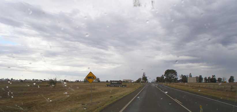
Roma’s welcoming sign. Roma spreads out to both sides on the black-soil plains as we enter under a still-threatening sky.
With nearly 7,000 residents, the town is sizeable. Its name comes from the wife of an early Queensland Governor, Sir George Bowen. Diamantina di Roma was born on the Ionian Islands of Greece and her Christian name was also to become the name of one of Queensland’s major inland rivers.
Boab trees are plentiful through the town, even in areas where industry occupies the land:

Boabs and pumps. The boab tree is a bit of an icon in Roma, while a business selling pumps and windmills should be doing good business.
I took a bit of a drive through the town when I missed my turn…
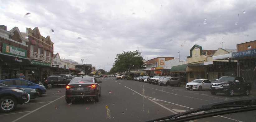
Old shops and traffic. It was near the end of the business day by now and people were on the move. Many of the shops are of an older style, showing that the town has been established for a long time.
In fact, Roma was established in 1867, so these shopfronts would likely be second generation structures. And the turn I missed was to McDonalds, but I ultimately decided I would wait for a meal. I also wanted to get another pic of the boab trees - locally called 'bottle trees' - and the sun came through the clouds at just the right time:

Boabs and sunshine. The long shadows of the afternoon sun are on the ground, showing that the highway runs North-South in Roma. The bend ahead is where there’s a little playground and picnic area – and toilets.
I met a young couple here who were out entertaining their children on the playground equipment and sat there a while to enjoy their company.
I made the mistake of going up another wrong road out of town and added a few kilometres to my trip before I woke up to it. I hadn’t been using my Garmin for some time, maybe I should have?
Nevertheless, I got back onto the Warrego Highway and pointed the van to the East. The sun, of course, was setting behind me in the West:

Silhouettes in the sun. My mirror was full of the sunset and it reflected on the side of the van soon after I left Roma. It would soon be a drive in the dark.Note also there that the clouds have gone away. It would be another hour and a half before I stopped again, this time to indulge in some dinner at Miles – a town of about 1,800 which was at the centre of Coal Seam Gas mining. A roadhouse was looking right at me as I entered the town:
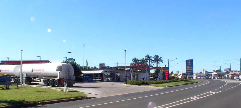
Caltex Miles. As one rounds the bend into the town, the Caltex Roadhouse is right there beckoning the passing motorist. I succumbed quite readily.
I got myself a seafood basket for a bit of a change and sat in the dining section…

Dining area. Plenty of glass for a view of the passing traffic, comfortable seating and clean tables enable pleasant dining in the Roadhouse.
…with a small number of other patrons. Both of these pics were taken at a later date. Outside, however…

Darkness outside. The bright signs and well-lit forecourt ensure that highway traffic is aware of the presence of the Roadhouse.(Mark Coombes)
…the hours of darkness were advancing. Chinchilla was, however, less than thirty miles down the road. As I drove there I thought back to the last time I’d been in the town – about 53 years earlier.
I had driven my parents to see dad’s eldest brother, my Uncle Ron…
Uncle Ron. I had taken this photo of uncle Ron in the dairy at the property where he share-farmed on that trip in early 1966.
…and we spent a few days at the old farm at Cadarga. I remembered getting onto the tractor and helping feed the pigs, but mostly I remembered that we drove home from there and I met my first wife the next day.
But Chinchilla, as one would have to expect, had changed a lot. There was a small parking area adjacent to a public toilet near where the main street crossed the railway line, now a bridge rather than the level crossing of the sixties:
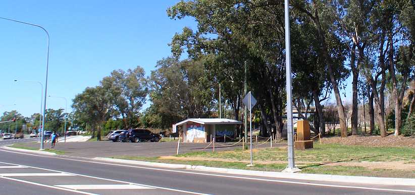
Chinchilla parking spot. I drove the van in and parked near that monument on the right. Note the bridge over the railway through the trees, it curves onto the main street which once crossed the line here at street level.
This was a convenient place to pull up and sleep. A couple of times during the night I woke up because of the intrusion of light into the van. Not the street light in that last pic, but the lights from McDonalds, just across the street:
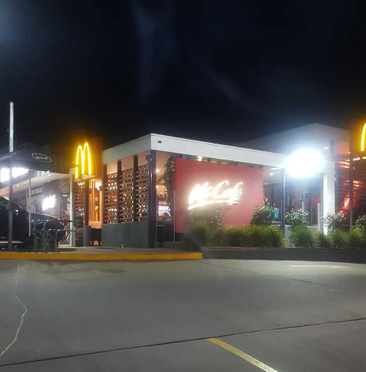
McDonalds all lit up. There was no McDonalds anywhere in Australia the last time I’d been in this town. Everything changes over time.
And so the day ended. In the morning I would wake up and drive straight to Dalby for another weekend’s work…
As it happened, Chinchilla was the logical place to stop. At a little more than fifty miles from Dalby, it would mean about an hour’s driving to get to my destination on Saturday morning.
Before departing Morven I snapped this (blurry) picture:
Relic on display. I don’t know what the significance of this relic is, but I think it’s a Chev 4 from the mid-twenties.
So I left Morven and soon the 360 drove me up to speed, while the warning signs kept me alert to the prospects ahead…
Road Train lengths. Road trains are commonplace, as we’ve seen, but different areas allow different lengths and so other road users have to be informed.
…on this never-ending strip of 2-lane bitumen between the trees and the scrub. 53 metres, by the way, is close to 174 feet or 58 yards. As they keep up their speed, they take a while to overtake and you have to allow for that when checking to see how much room you have.
The next ‘whistle stop’ town along had the tongue-twisting name of Mungallala, another which has no doubt shrunk since its glory days…
Mungallala. Another bridge across a frequently-dry creek leads into the town, there’s a nicely-shaded Rest Area on the right just over the bridge.
…but today is home to very few people and offers few amenities. Still, living in the bush has its advantages and it’s definitely ‘in the bush’:
Bigger gum trees. A typical roadside scene with gum trees at the roadside and cleared ground behind it where farmers graze livestock.
Mitchell came next, a decent-sized town of just over 1,000 residents:
Mitchell. Another town with its roots in agriculture, a supply centre for farmers and a stopping point for travellers.
The water tower on the right, the State School (years one to seven) on the left and along the wide main street the shopping and business centre lazily sprawls itself…
Water tower. Unlike most in America, the water tower is cylindrical and carries no identification. But there are many antennae on the top for communication services.
…and failed to attract my attention to any degree. Driving out of town we cross the Maranoa River…
Maranoa River. Looking to the North we can clearly see that the river is not at full depth. The stand of gum trees on the Eastern side is thick as it benefits by the river’s presence.
…and check both ways to see the water level:
More Maranoa. The river is held back by a weir and is not indicative of flow levels in this drought-stricken land.
Another 25kms on there was a major bend in the road at a little place called Amby. This did attract my attention as I felt it was time for a bit of a snack.
Amby in the afternoon. This is the Rest Area at Amby and the buff-coloured shed is open at the front with a picnic table for travellers. There are toilets in the light-coloured building seen beneath the trees.
A handy stopping point and I spent a short time there. But the road still beckoned and the afternoon was drifting on. A further 23kms I went through Muckadilla, where I could see somebody’s dreams had been shattered…
Motel for sale. Businesses like this in the bush can take a long time to sell, but most of them survive for a new owner.
…by a fire just a few weeks before my passage through the town. Here’s how Google Earth Street View captured it when intact:
Muckadilla Hotel-Motel. With a large boab tree out the front and a swimming pool, not to mention beer (Carlton Mid-Strength on the sign) on tap, it must have been a popular spot.
Here’s a contemporary report on the fire:
https://www.abc.net.au/news/2019-08-...sland/11397488
Readers will have noticed clouds in the sky in most pictures, and these continued to darken as I drove. Between Muckadilla and Roma the threat over the long straight roads grew…
The skies darken. Local farmers would have been praying for rain here and it seems their prayers might get some kind of an answer.
…and I was to strike a little light rain as I headed towards the much larger centre of Roma.
Road Train parking. Through a windscreen dotted with raindrops we see trailers from Road Trains parked in an area allotted for their use.
Note that most of the trailers are for livestock transport, used heavily during the drought to move cattle to ‘greener pastures’ or simply to take cattle from near-barren farms to market.
This was right on the outskirts of Roma, but before the welcoming sign the town has out for visitors:
Roma’s welcoming sign. Roma spreads out to both sides on the black-soil plains as we enter under a still-threatening sky.
With nearly 7,000 residents, the town is sizeable. Its name comes from the wife of an early Queensland Governor, Sir George Bowen. Diamantina di Roma was born on the Ionian Islands of Greece and her Christian name was also to become the name of one of Queensland’s major inland rivers.
Boab trees are plentiful through the town, even in areas where industry occupies the land:
Boabs and pumps. The boab tree is a bit of an icon in Roma, while a business selling pumps and windmills should be doing good business.
I took a bit of a drive through the town when I missed my turn…
Old shops and traffic. It was near the end of the business day by now and people were on the move. Many of the shops are of an older style, showing that the town has been established for a long time.
In fact, Roma was established in 1867, so these shopfronts would likely be second generation structures. And the turn I missed was to McDonalds, but I ultimately decided I would wait for a meal. I also wanted to get another pic of the boab trees - locally called 'bottle trees' - and the sun came through the clouds at just the right time:
Boabs and sunshine. The long shadows of the afternoon sun are on the ground, showing that the highway runs North-South in Roma. The bend ahead is where there’s a little playground and picnic area – and toilets.
I met a young couple here who were out entertaining their children on the playground equipment and sat there a while to enjoy their company.
I made the mistake of going up another wrong road out of town and added a few kilometres to my trip before I woke up to it. I hadn’t been using my Garmin for some time, maybe I should have?
Nevertheless, I got back onto the Warrego Highway and pointed the van to the East. The sun, of course, was setting behind me in the West:
Silhouettes in the sun. My mirror was full of the sunset and it reflected on the side of the van soon after I left Roma. It would soon be a drive in the dark.Note also there that the clouds have gone away. It would be another hour and a half before I stopped again, this time to indulge in some dinner at Miles – a town of about 1,800 which was at the centre of Coal Seam Gas mining. A roadhouse was looking right at me as I entered the town:
Caltex Miles. As one rounds the bend into the town, the Caltex Roadhouse is right there beckoning the passing motorist. I succumbed quite readily.
I got myself a seafood basket for a bit of a change and sat in the dining section…
Dining area. Plenty of glass for a view of the passing traffic, comfortable seating and clean tables enable pleasant dining in the Roadhouse.
…with a small number of other patrons. Both of these pics were taken at a later date. Outside, however…
Darkness outside. The bright signs and well-lit forecourt ensure that highway traffic is aware of the presence of the Roadhouse.(Mark Coombes)
…the hours of darkness were advancing. Chinchilla was, however, less than thirty miles down the road. As I drove there I thought back to the last time I’d been in the town – about 53 years earlier.
I had driven my parents to see dad’s eldest brother, my Uncle Ron…
Uncle Ron. I had taken this photo of uncle Ron in the dairy at the property where he share-farmed on that trip in early 1966.
…and we spent a few days at the old farm at Cadarga. I remembered getting onto the tractor and helping feed the pigs, but mostly I remembered that we drove home from there and I met my first wife the next day.
But Chinchilla, as one would have to expect, had changed a lot. There was a small parking area adjacent to a public toilet near where the main street crossed the railway line, now a bridge rather than the level crossing of the sixties:
Chinchilla parking spot. I drove the van in and parked near that monument on the right. Note the bridge over the railway through the trees, it curves onto the main street which once crossed the line here at street level.
This was a convenient place to pull up and sleep. A couple of times during the night I woke up because of the intrusion of light into the van. Not the street light in that last pic, but the lights from McDonalds, just across the street:
McDonalds all lit up. There was no McDonalds anywhere in Australia the last time I’d been in this town. Everything changes over time.
And so the day ended. In the morning I would wake up and drive straight to Dalby for another weekend’s work…
Last edited by Ray Bell; May 15, 2021 at 05:22 AM.
Thread Starter
|
Captain
Joined: Oct 2005
Posts: 568
Likes: 8
From: The Summit, Queensland, Australia
I simply cruised the fifty miles into Dalby in the morning…
…and got my breakfast before looking for the starting address. The Tourist Information Office in the park where I’d camped on the previous trip provided me with directions to the area, a slice of the edge of town on the South-Eastern corner. I soon learned that there was a big event in progress in town, just one street up from the Tourist Information Office…

School fete in Dalby. A lot of people were in attendance at this school event, which has filled the school grounds on the right and also occupied the park by the river on the left.
…at the Dalby State School. Fortunately, that was a little way away from where I’d be working:
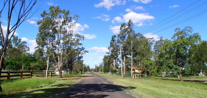
My work area. It was in streets like these where houses were well spread-out that I’d be going from house to house this day.
By Sunday evening I was done, but after discussions with Sandra we decided that I should wait until the next day to head home. So on Monday morning I did a bit of wandering around the local wrecking yards…

Dalby wreckers. There’s a few wrecking yards in Dalby, this one is the most prominent. Another one was further down this street while truck and machinery wreckers were on the highway.
…and reminded myself how foolish this might be when the weather’s been wet. But I did ultimately wipe the mud from my shoes and I still went home with only a couple of lousy headlight backing pressings.
Another fifty or so miles and I was back home…

…with some nice ‘welcome home’ presents from my wife. It was just a week and a half short of three months since I’d gone on my Central Australian adventure. The map continues on to The Summit because I would be trekking over to my shed there during the week I was at home.
Pretty soon I was getting into the swing of things, particularly with regard to providing myself with some workshop area. We’d decided that this area…
Working area. Originally intended as a place where people would shower after being in the pool, this section under the upstairs bathroom was in need of work.
…would have to suffice for that purpose. I’d already bought some roll-down clear acrylic curtains to put around it – it wasn’t to block off the light into the adjacent kitchen – and before I left I’d started filling the next section down with sand and bought some more (cheap) pavers to provide the base for the bench area.
I needed to get some timber to put around that, however, to retain the sand. And with a couple of other things necessary, it called for a trip over to my shed to obtain the necessary items. I got a bit of a surprise on the way when I encountered this incident climbing the hill at Braeside:

Corolla upended. The rear of a brown Corolla can be seen on the Armco here. It had been on a car trailer which must have been poorly balanced when loaded and when the trailer jack-knifed the Corolla went for a tumble.
It was actually a car I knew well. It had been a regular visitor to the bloke in the second house when I’d lived at Dalveen, it was an old clunker then. Now it had apparently reached its use-by date and either had been sold or was on its way to be scrapped.
I got a nice big slab of timber and I also bought some galvanised angle to make secure pegs to retain it all, then I got to work…

Restoring pavers. Some of my efforts can be seen here as the timber frame was propped up and pavers pulled back for resetting. Further down the bench area was taking shape.
…but time was precious and it wasn’t finished before I drove out again to head for a weekend assignment at Scone. This was on the way to Bathurst, where the Drug Survey had stalled and they were calling on me to spend several days there.
The van, however, would not go with me. By the time I got home the gearbox was grumbling again and I knew that the input shaft to mainshaft bearing, which takes a lot of load in the overdrive A833s, was nearing its end. It was all because of that clutch, but it also showed that the A833 overdrive box was marginal for use in this van and I had already decided that I’d be looking for a better solution for my purposes.
I was tossing a few ideas around. An NP435 with its granny-low first gear, but a taller rear axle ratio to make it more useful in low gear and closer to an overdrive in top? Or go all-out and get a more modern 5-speed with a lower first gear and an overdrive top gear. The NV3500 looked like it might also be marginal, especially considering the cost, the NV4500 was looking perfect for the job but also expensive.
Then again, this trip had provided me with some nice ‘vehicle expenses’ income and what better way to spend it?
Meanwhile, I’d put myself back into the silver Forester for this journey. But apart from Scone and Bathurst, I had no idea where I’d be sent. While they sorted out things beyond their Bathurst needs, and I expected it would be in Sydney, I planned to spend time with Bob Britton.
So the first step of the journey was to go to Scone, where Max and Christine Stahl had moved (from Brisbane) in my absence. I knew I’d be helpful there as Max’s books and so on needed sorting and both of them were struggling a bit.
Along the way, between Allora and Warwick, I saw the first train I’d ever seen on this stretch…

Old carriages. There are a couple of historical railway groups between Warwick and Toowoomba, one of them must have arranged for these old carriages to be moved along this line to Warwick.
…and it was an interesting one too. The diesel locomotive pulling it along isn’t one normally used in main line service, I’m sure.
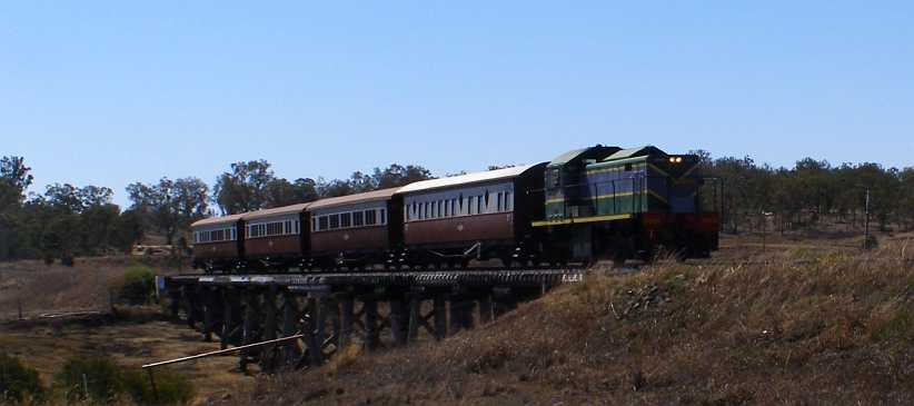
On the bridge. This bridge is a part of a crossing of a flood plain, some embankments and another timber structure or two like this stretch for over a mile.
While I’d been driving along prior to seeing the train I’d noticed that there was a large cloud of smoke rising some distance away. It seemed to me that it was more to the East, but by the time I got close to the New South Wales border I could see it was potentially going to impede my progress.
There was a very strong Westerly wind that day and clearly it was fanning the fire ahead of me…
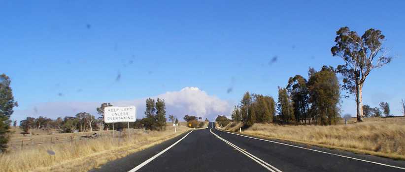
Smoke becomes ominous. Now I was 60 or 70 miles closer than when I first saw the smoke, I could clearly see it was in my path.
…though there’d been nothing on the radio about it. The problem there is that it was South of the border, the radio system (as well as the television channels with their news) are very parochial, which makes it hard when you’re close to the border and crossing it frequently.
About 12kms past the border comes the junction of the New England and Bruxner Highways and there was a crew there stopping traffic to advise them that the New England was blocked at the Southern end of Tenterfield. I took this photo from that point:
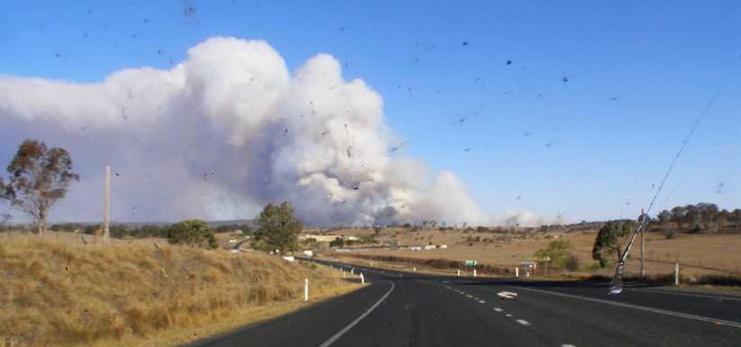
Tenterfield fire. That wind was whipping up the fire strongly and sending the smoke billowing. The town of Tenterfield is just over the next rise.
It was a young lady who came up to tell me and I asked if it was possible to get around the fire.
“You’d have to go out to Warialda to do that,” she told me. I then asked if the road through Torrington would be open, she’d never heard of it. Here’s the map, which shows the road through Torrington, while there’s another road from Bonshaw to Inverell a long way before the road down through Warialda.:
Of course, I knew all of this area quite well because I’d worked in so many locations, including four times at Torrington, over the past seven or eight years. But, as usual, I was optimistic that the road would be cleared some time soon. After all, the strength of the wind would mean that the fire would move on quickly, wouldn’t it?
I therefore drove through town to where the highway was blocked. This point is shown by the red arrow on this photo taken that afternoon by the Rural Fire Service:
Tenterfield at risk. With the drought, everything was tinder-dry. Tenterfield’s water-supply dam is seen at the right of this picture, but it had very little in it.
I joined a bunch of cars pulled up near the roadblock. One man there told me he’d been there for an hour, so I was heartened enough to think it might not be long at all. There was a whole flock of galahs picking up seed from the lawn in front of the house in the side street where I was parked. Later they were perched on the power lines out front…

Galahs on the wires. The distinctive pink and grey colours of the galahs identify them. This is a larger than usual flock.
…where they’d flown when a smaller flock of all-white Corellas came down to feed. A small number of galahs didn’t leave, however:
Corellas take over. Just five or six of the galahs remain among the corellas picking at the seed.
We stood around and talked about the fire and our prospects of getting past it. We watched as fire trucks and police vehicles came and went through the roadblock. There was assistance coming from many places to help with this fast-moving fire:
Narrabri crew helping. This crew must have left Narrabri (about 280kms away) when the fire was just a threat on Mount McKenzie, at Tenterfield’s West. (RFS)
Finally a police officer told us to be patient, that we’d be there for hours yet. So I decided I wouldn’t be and I headed back to the Bruxner Highway and took that path shown on the map. It would have been better if I’d done so earlier as it’s not a good road for travelling in the dark.
This was one of the earliest fires in the terrible 2019/2020 season that wreaked havoc over much of the Eastern part of Australia.

Beyond the roadblock. This is the entry to a relatively new subdivision off the highway about a mile from where I’d been held up by the roadblock. The blackened grass is one thing, but I wasn’t thinking of tree trunks like this burning for some time afterwards.(RFS)
Smoke was to reign here for days, and down the Bruxner to the East at Drake and many other places. For Tenterfield it was really bad because residents – already having been on strict water rationing for many months – had just been told to boil water before drinking it because their dam was so low and likely to be contaminated.

Saturday smoke. Somewhere just out of town this photo was taken of the still-billowing smoke on Saturday morning.(Bronwyn Petrie)
Here’s a Rural Fire Service map showing where fires were burning on that weekend:
Rural Fire Service map. A huge strain on resources, fires were springing up in many places in New South Wales.
This particular one caught out one of the local volunteers…

Volunteer badly burned. That Friday afternoon in the Tenterfield fire, 66-year-old local volunteer, Neville Smith, received burns to his hands, arm, leg, back, face and airways.
…who had to be stabilised at the local hospital before being flown to Brisbane for further treatment.
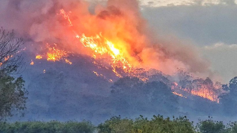
Mount McKenzie on Saturday. There was still fuel to burn on Saturday and flames reached high as the trees, scrub and rubbish – fallen tree limbs, dry grass, leaves etc – in the undergrowth fuelled them.
My belated decision to head through Silent Grove to Torrington and Deepwater was to enable me to save at least two hours compared to those who waited for the roadblock to be opened.
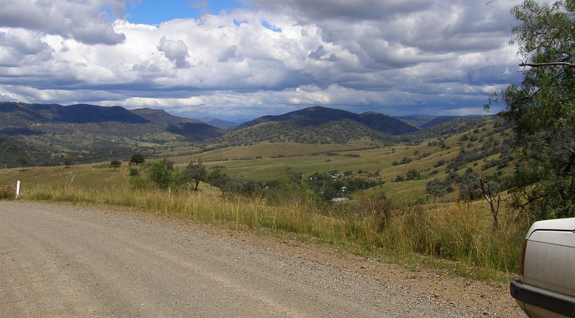
On the back road. Not far off the Bruxner this slippery gravel road climbs a tall hill. I took this photo back in 2011, it was nearing darkness when I reached here the afternoon of the fire and a gravel road through the forest in the dark doesn’t allow rapid progress.
I was finishing my dinner in McDonalds at Glen Innes when I heard that the traffic was finally being allowed to travel South from Tenterfield. Mind you, I was supposed to be at Max’s place by then.
As I drove on I heard that Stanthorpe was also being threatened. This picture is a dramatic one of the fire that raged through Applethorpe:
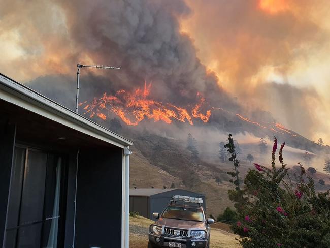
Applethorpe ablaze. Though the fire was bad and this pic looks like it’s really bad, these hills are almost all faced with granite and once the rubbish is gone the fire has to move on.(AAP)
There are still some You Tube clips of news reports with dramatic footage if anyone wants to access them, here’s one of them:
I was later to learn that the stately old (but neglected) home of the Stanbridge family, of whom I know Ross, was burned out in the fire that afternoon. It’s located by the yellow arrow on the aerial photo above. One of Ross’ vintage cars was also lost, it was in a shed adjacent to the house.
So I drove on to Max’s place, where the welcome mat was laid out for me. Having a bit of a look around their new abode…
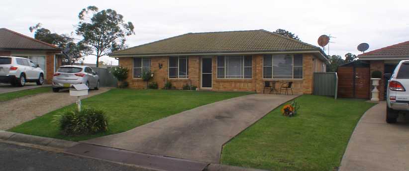
Max and Christine’s new home. This is the home Max and Christine had leased from the daughter of one of their old friends in Wingen, just up the road.
…would have to wait until morning. Then I’d be able to fit in some time helping move things around and get myself off to work in a local area. I would be here until Monday and then head off to Bathurst. I was guessing that I’d have some spare time there to get in a lap of the Mount Panorama circuit, but time alone would tell…
…and got my breakfast before looking for the starting address. The Tourist Information Office in the park where I’d camped on the previous trip provided me with directions to the area, a slice of the edge of town on the South-Eastern corner. I soon learned that there was a big event in progress in town, just one street up from the Tourist Information Office…
School fete in Dalby. A lot of people were in attendance at this school event, which has filled the school grounds on the right and also occupied the park by the river on the left.
…at the Dalby State School. Fortunately, that was a little way away from where I’d be working:
My work area. It was in streets like these where houses were well spread-out that I’d be going from house to house this day.
By Sunday evening I was done, but after discussions with Sandra we decided that I should wait until the next day to head home. So on Monday morning I did a bit of wandering around the local wrecking yards…
Dalby wreckers. There’s a few wrecking yards in Dalby, this one is the most prominent. Another one was further down this street while truck and machinery wreckers were on the highway.
…and reminded myself how foolish this might be when the weather’s been wet. But I did ultimately wipe the mud from my shoes and I still went home with only a couple of lousy headlight backing pressings.
Another fifty or so miles and I was back home…
…with some nice ‘welcome home’ presents from my wife. It was just a week and a half short of three months since I’d gone on my Central Australian adventure. The map continues on to The Summit because I would be trekking over to my shed there during the week I was at home.
Pretty soon I was getting into the swing of things, particularly with regard to providing myself with some workshop area. We’d decided that this area…
Working area. Originally intended as a place where people would shower after being in the pool, this section under the upstairs bathroom was in need of work.
…would have to suffice for that purpose. I’d already bought some roll-down clear acrylic curtains to put around it – it wasn’t to block off the light into the adjacent kitchen – and before I left I’d started filling the next section down with sand and bought some more (cheap) pavers to provide the base for the bench area.
I needed to get some timber to put around that, however, to retain the sand. And with a couple of other things necessary, it called for a trip over to my shed to obtain the necessary items. I got a bit of a surprise on the way when I encountered this incident climbing the hill at Braeside:
Corolla upended. The rear of a brown Corolla can be seen on the Armco here. It had been on a car trailer which must have been poorly balanced when loaded and when the trailer jack-knifed the Corolla went for a tumble.
It was actually a car I knew well. It had been a regular visitor to the bloke in the second house when I’d lived at Dalveen, it was an old clunker then. Now it had apparently reached its use-by date and either had been sold or was on its way to be scrapped.
I got a nice big slab of timber and I also bought some galvanised angle to make secure pegs to retain it all, then I got to work…
Restoring pavers. Some of my efforts can be seen here as the timber frame was propped up and pavers pulled back for resetting. Further down the bench area was taking shape.
…but time was precious and it wasn’t finished before I drove out again to head for a weekend assignment at Scone. This was on the way to Bathurst, where the Drug Survey had stalled and they were calling on me to spend several days there.
The van, however, would not go with me. By the time I got home the gearbox was grumbling again and I knew that the input shaft to mainshaft bearing, which takes a lot of load in the overdrive A833s, was nearing its end. It was all because of that clutch, but it also showed that the A833 overdrive box was marginal for use in this van and I had already decided that I’d be looking for a better solution for my purposes.
I was tossing a few ideas around. An NP435 with its granny-low first gear, but a taller rear axle ratio to make it more useful in low gear and closer to an overdrive in top? Or go all-out and get a more modern 5-speed with a lower first gear and an overdrive top gear. The NV3500 looked like it might also be marginal, especially considering the cost, the NV4500 was looking perfect for the job but also expensive.
Then again, this trip had provided me with some nice ‘vehicle expenses’ income and what better way to spend it?
Meanwhile, I’d put myself back into the silver Forester for this journey. But apart from Scone and Bathurst, I had no idea where I’d be sent. While they sorted out things beyond their Bathurst needs, and I expected it would be in Sydney, I planned to spend time with Bob Britton.
So the first step of the journey was to go to Scone, where Max and Christine Stahl had moved (from Brisbane) in my absence. I knew I’d be helpful there as Max’s books and so on needed sorting and both of them were struggling a bit.
Along the way, between Allora and Warwick, I saw the first train I’d ever seen on this stretch…
Old carriages. There are a couple of historical railway groups between Warwick and Toowoomba, one of them must have arranged for these old carriages to be moved along this line to Warwick.
…and it was an interesting one too. The diesel locomotive pulling it along isn’t one normally used in main line service, I’m sure.
On the bridge. This bridge is a part of a crossing of a flood plain, some embankments and another timber structure or two like this stretch for over a mile.
While I’d been driving along prior to seeing the train I’d noticed that there was a large cloud of smoke rising some distance away. It seemed to me that it was more to the East, but by the time I got close to the New South Wales border I could see it was potentially going to impede my progress.
There was a very strong Westerly wind that day and clearly it was fanning the fire ahead of me…
Smoke becomes ominous. Now I was 60 or 70 miles closer than when I first saw the smoke, I could clearly see it was in my path.
…though there’d been nothing on the radio about it. The problem there is that it was South of the border, the radio system (as well as the television channels with their news) are very parochial, which makes it hard when you’re close to the border and crossing it frequently.
About 12kms past the border comes the junction of the New England and Bruxner Highways and there was a crew there stopping traffic to advise them that the New England was blocked at the Southern end of Tenterfield. I took this photo from that point:
Tenterfield fire. That wind was whipping up the fire strongly and sending the smoke billowing. The town of Tenterfield is just over the next rise.
It was a young lady who came up to tell me and I asked if it was possible to get around the fire.
“You’d have to go out to Warialda to do that,” she told me. I then asked if the road through Torrington would be open, she’d never heard of it. Here’s the map, which shows the road through Torrington, while there’s another road from Bonshaw to Inverell a long way before the road down through Warialda.:
Of course, I knew all of this area quite well because I’d worked in so many locations, including four times at Torrington, over the past seven or eight years. But, as usual, I was optimistic that the road would be cleared some time soon. After all, the strength of the wind would mean that the fire would move on quickly, wouldn’t it?
I therefore drove through town to where the highway was blocked. This point is shown by the red arrow on this photo taken that afternoon by the Rural Fire Service:
Tenterfield at risk. With the drought, everything was tinder-dry. Tenterfield’s water-supply dam is seen at the right of this picture, but it had very little in it.
I joined a bunch of cars pulled up near the roadblock. One man there told me he’d been there for an hour, so I was heartened enough to think it might not be long at all. There was a whole flock of galahs picking up seed from the lawn in front of the house in the side street where I was parked. Later they were perched on the power lines out front…
Galahs on the wires. The distinctive pink and grey colours of the galahs identify them. This is a larger than usual flock.
…where they’d flown when a smaller flock of all-white Corellas came down to feed. A small number of galahs didn’t leave, however:
Corellas take over. Just five or six of the galahs remain among the corellas picking at the seed.
We stood around and talked about the fire and our prospects of getting past it. We watched as fire trucks and police vehicles came and went through the roadblock. There was assistance coming from many places to help with this fast-moving fire:
Narrabri crew helping. This crew must have left Narrabri (about 280kms away) when the fire was just a threat on Mount McKenzie, at Tenterfield’s West. (RFS)
Finally a police officer told us to be patient, that we’d be there for hours yet. So I decided I wouldn’t be and I headed back to the Bruxner Highway and took that path shown on the map. It would have been better if I’d done so earlier as it’s not a good road for travelling in the dark.
This was one of the earliest fires in the terrible 2019/2020 season that wreaked havoc over much of the Eastern part of Australia.
Beyond the roadblock. This is the entry to a relatively new subdivision off the highway about a mile from where I’d been held up by the roadblock. The blackened grass is one thing, but I wasn’t thinking of tree trunks like this burning for some time afterwards.(RFS)
Smoke was to reign here for days, and down the Bruxner to the East at Drake and many other places. For Tenterfield it was really bad because residents – already having been on strict water rationing for many months – had just been told to boil water before drinking it because their dam was so low and likely to be contaminated.
Saturday smoke. Somewhere just out of town this photo was taken of the still-billowing smoke on Saturday morning.(Bronwyn Petrie)
Here’s a Rural Fire Service map showing where fires were burning on that weekend:
Rural Fire Service map. A huge strain on resources, fires were springing up in many places in New South Wales.
This particular one caught out one of the local volunteers…
Volunteer badly burned. That Friday afternoon in the Tenterfield fire, 66-year-old local volunteer, Neville Smith, received burns to his hands, arm, leg, back, face and airways.
…who had to be stabilised at the local hospital before being flown to Brisbane for further treatment.
Mount McKenzie on Saturday. There was still fuel to burn on Saturday and flames reached high as the trees, scrub and rubbish – fallen tree limbs, dry grass, leaves etc – in the undergrowth fuelled them.
My belated decision to head through Silent Grove to Torrington and Deepwater was to enable me to save at least two hours compared to those who waited for the roadblock to be opened.
On the back road. Not far off the Bruxner this slippery gravel road climbs a tall hill. I took this photo back in 2011, it was nearing darkness when I reached here the afternoon of the fire and a gravel road through the forest in the dark doesn’t allow rapid progress.
I was finishing my dinner in McDonalds at Glen Innes when I heard that the traffic was finally being allowed to travel South from Tenterfield. Mind you, I was supposed to be at Max’s place by then.
As I drove on I heard that Stanthorpe was also being threatened. This picture is a dramatic one of the fire that raged through Applethorpe:
Applethorpe ablaze. Though the fire was bad and this pic looks like it’s really bad, these hills are almost all faced with granite and once the rubbish is gone the fire has to move on.(AAP)
There are still some You Tube clips of news reports with dramatic footage if anyone wants to access them, here’s one of them:
I was later to learn that the stately old (but neglected) home of the Stanbridge family, of whom I know Ross, was burned out in the fire that afternoon. It’s located by the yellow arrow on the aerial photo above. One of Ross’ vintage cars was also lost, it was in a shed adjacent to the house.
So I drove on to Max’s place, where the welcome mat was laid out for me. Having a bit of a look around their new abode…
Max and Christine’s new home. This is the home Max and Christine had leased from the daughter of one of their old friends in Wingen, just up the road.
…would have to wait until morning. Then I’d be able to fit in some time helping move things around and get myself off to work in a local area. I would be here until Monday and then head off to Bathurst. I was guessing that I’d have some spare time there to get in a lap of the Mount Panorama circuit, but time alone would tell…
Last edited by Ray Bell; May 16, 2021 at 05:14 AM.
Thread Starter
|
Captain
Joined: Oct 2005
Posts: 568
Likes: 8
From: The Summit, Queensland, Australia
After a full weekend at Max’s place, working the regular weekend work in Scone and helping sort out some of the boxes of books and magazines to stack them in the garden shed, I left there on Monday morning for the drive to Bathurst. It was only about 275kms and apart from the first 30 or so it was on the kind of back roads I really enjoy driving…
…and once I was out there in the hills I was able to drive as I wished with the road virtually all mine:

All alone with the road and the view. This is all sandstone country with plenty of hills, the roads follow the contours by necessity.
There were times, of course, when the sandstone was more evident than others. Here the cliffs surround narrow valleys which settlers two hundred years ago struggled to turn into farms.

Sandstone and die-back. The valley floors between the sandstone hills were still in drought, while any grass which had grown had suffered from die-back with the frosts of Winter.
One of the nice things about many parts of Australia is that August and September bring firm indicators that Spring is once again taking over after Winter’s cruel cold. This is shown in the yellow of the wattle…
Wattle’s wisdom. The wattle knows when the warmer days are coming and puts on its display in many parts of this country.
…which inspired Henry Kendall to write:
The fruits of the men who tamed this area are better displayed in areas where the valleys open out. Here’s one such place, where it looks like irrigation has been possible too:
More open valleys. The green on the distant farm indicates that more water has been available for what is likely a summer crop recently germinated.
Nearing Rylstone there is more indication that we are actually on the Western side of the Blue Mountains. The high cliffs that dominate much of this area – the Bylong Valley – are an extension of the ragged plateau which is time-worn in the very best tradition. There’s no irrigation here…
Taller cliffs. A dry field in the foreground and sandstone cliffs in the background paint a picture (to me, anyway) of hard days spent trying to make this country prosper.
…and we’re heading into one of the oldest pastoral districts in Australia. I had forebears who lived in this country, but even they weren’t there when the first settlers struggled over the mountains from Sydney and took up ‘selections’ from which they hoped to eke out a living.
Of course, towns had to spring up and the first major one I came to was Rylstone:
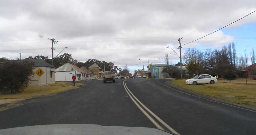
Rylstone. Some older-style homes in need of maintenance, a Mitsubishi Lancer for sale, the green building ahead on the right is the Home Hardware store and the 2-storey one to the left is a museum occupying an old Inn.
Shortly afterwards came Kandos, both of them towns which now attract tourists from Sydney and elsewhere, then a brief stint on the highway led me to the road through Sofala and Gold Fever country to Bathurst. The first thing I had to do there, of course, was turn up at the motel which had been booked for me and put my gear in my room.
Explorers Motel.My room was downstairs, the second one back from the staircase. There was a communal kitchen just back from the other set of stairs. Upstairs, of course.(GE)
I had the better part of five days now to do four areas of the Drug Survey. This would require swift work getting the questionnaires out so I’d have a decent chance of picking them up again before the time ran out.
I set out to do the area on the ‘other side of the tracks’ first, crossing the railway line and finding my starting address in amongst some older homes. This area finished up being quite interesting, with one bloke being a bit of a car collector and with the working pattern taking me out amongst farms and then dragging me back into the built-up area.
Farms and all.A couple of very nice people I met were or rural properties. One was a doctor and the other, in this place, operated trucks. Google Earth took this photo just one month before I was there.
There was an area right near the centre of town, it included older homes and newer flats where old homes had been replaced and the large backyards they fronted turned into a place where many could live.
Right in town.Being an older city – in fact, the first inland city in Australia – Bathurst as laid out to cater for homes having horses. Hence large backyards. Which in turn lend themselves to redevelopment for town houses and ground-level blocks of flats. This in one such here, while alongside are several older homes.(GE)
Finding people at home could still be a bother and so I moved on to the next area for a while:

Eglinton. Essentially a suburb of Bathurst, developed in boom times when some government offices moved to the area, Eglinton is neat, tidy and newer all round.(GE)
The fourth area was nearer to the racing circuit, mostly sixties homes and mostly with some kind of view of the fabled Mount Panorama…
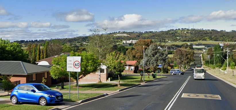
Famous mountain in view. I worked along this street with the taunting view of the famous ‘scenic drive’ which forms the racing circuit. ‘Mount Panorama Bathurst’ is spelled out by the large white letters just below the skyline.(GE)
It was just a few weeks before the annual 1,000 kilometre race would be held, which was the reason many of the rooms in the motel in which I was staying were being refreshed. Of course, I eventually found the opportunity to go for a drive around the roads which form the circuit…

On the circuit. The uphill approach to the finish line is surrounded these days by concrete walls and advertising, a far cry from what it was like the first time I drove around here.
…and see the changes which had been made since my last visit, perhaps twelve or so years earlier. The start line is some distance forward of the finish line and the sight of a grid-full of cars roaring off there to pour into the first corner is always worth seeing.
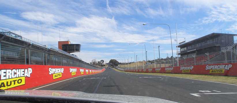
Start to Hell Corner. The first corner is a 90� climbing left-hander, the grid position markings on the road show how far up the start line is.
Mountain Straight follows, uphill until it reaches this crest…

Mountain Straight. A little over halfway up Mountain Straight is this crest, a short drop and then it climbs again to the steep approach to Tomlins Bend.
…by which time the cars are going very quickly. The concrete walls and the modern homes which adjoin the circuit here are additions which have come along in the 30 or so years since I was a regular visitor to the place.
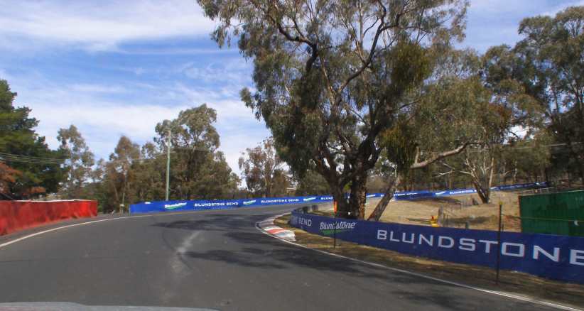
Tomlins Bend. Climbing steeply as it turns through more than ninety degrees, this one is important for speed up the following climb.
There is often debate about the proper name for this corner. Some say it is ‘Quarry Bend’ and with changes in sponsorship it changes its title regularly anyway. The road here is built up to provide a smooth climb to the next straight…
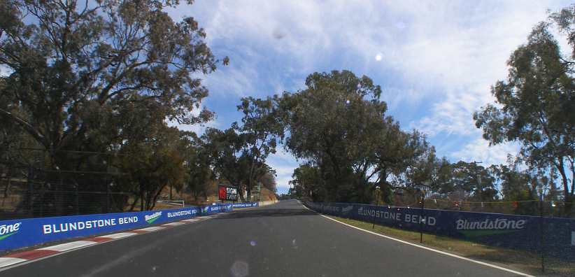
Climb to The Cutting. Here it’s evident that it’s a serious climb. But there’s more serious to come.
…which for many years was free of fences.
The Cutting is a two-part corner, the early part quite fast, then tightening to a virtual hairpin:
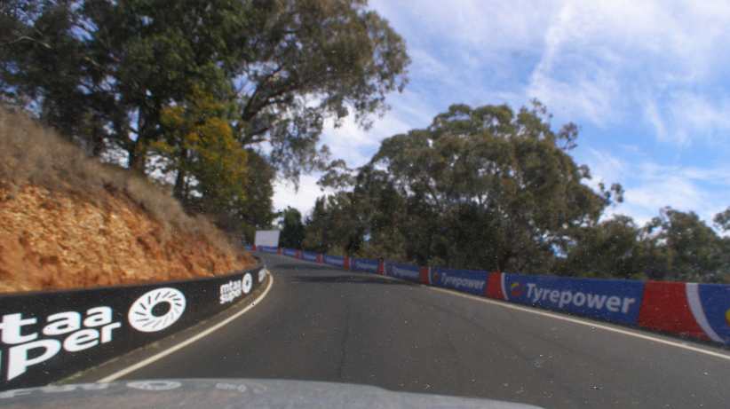
Approach to The cutting. A fast rush through here and then careful lining up and braking is necessary for the tighter section.
This is the entry to the steepest climb on the circuit…

Into The Cutting. The tightness makes it important for a clean exit for the climb to come, a tricky part of the circuit.
…which is these days overlooked by that new house up on the hill.

Steepest pinch. This photo shows clearly how steep the climb out of The Cutting is.
Just over the wall a little further up one can look down into the old quarry which undoubtedly provided fill for when the road was built in the late ‘30s. There was a lot of work going on around the circuit in preparation for the 2019 race when I was there, naturally enough. The distant view also shows the drought which had gripped much of the country for a couple of years.
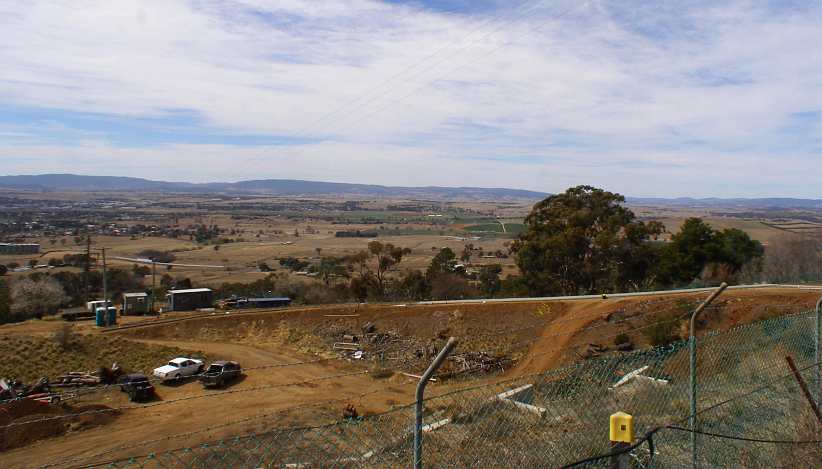
View over the quarry. Stopping to take a look over the fence gave me this view of the quarry and the plains and mountains in the distance.
While it’s steep, the cars best known for racing here have about 650 horsepower available to them and so climb it pretty quickly. Hence this curve rushes up at them:
Still climbing. Following the natural face of the hill and looking for the shortest way up the mountain, this bend comes next.
Then follows…
Climb to Reid Park. With all that power this short straight between the bends is quickly covered.
…and then this:

Griffin Mount. This may or may not be the correct name for this part of the circuit, but it’s the one used by motorcycle people when the bikes used to race here.
And so the climb is over. To the right is the gateway to the camping area (known as Sulman Park) while this part of the hill is known as Reid Park.
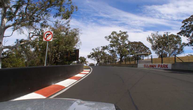
Reid Park gate. When they’ve passed this gate the drivers are ready for the really fast section across the top of ‘The Mountain.’
And so the high point is reached, over a mile and a half from the start line and about 650’ higher in altitude. They say, of course, what goes up must come down, and that’s altogether true here as well. But before the descent comes the most marvelous set of fast curves in Australian motor racing.
Together with the downhill ess-bends which are famous around the world, the coming mile requires a lot of the driver – from precision to daring – and is the ‘make or break’ part of his lap time.
That roller coaster ride will follow in the next post…
* From the poem, “Bell Birds” – a poem which was required learning when I was at school in NSW.
…and once I was out there in the hills I was able to drive as I wished with the road virtually all mine:
All alone with the road and the view. This is all sandstone country with plenty of hills, the roads follow the contours by necessity.
There were times, of course, when the sandstone was more evident than others. Here the cliffs surround narrow valleys which settlers two hundred years ago struggled to turn into farms.
Sandstone and die-back. The valley floors between the sandstone hills were still in drought, while any grass which had grown had suffered from die-back with the frosts of Winter.
One of the nice things about many parts of Australia is that August and September bring firm indicators that Spring is once again taking over after Winter’s cruel cold. This is shown in the yellow of the wattle…
Wattle’s wisdom. The wattle knows when the warmer days are coming and puts on its display in many parts of this country.
…which inspired Henry Kendall to write:
October, the maiden in bright yellow tresses,
Loiters to love in these cool wildernesses.
Loiters knee-deep in the grasses to listen
Where dripping rocks gleam and leafy pools glisten.
Then is the time when the water-moons splendid
Break with their gold, and are scattered and blended
Over the creeks till the woodlands have warning
Of songs of the Bell Birds and wings of the morning.*
More open valleys. The green on the distant farm indicates that more water has been available for what is likely a summer crop recently germinated.
Nearing Rylstone there is more indication that we are actually on the Western side of the Blue Mountains. The high cliffs that dominate much of this area – the Bylong Valley – are an extension of the ragged plateau which is time-worn in the very best tradition. There’s no irrigation here…
Taller cliffs. A dry field in the foreground and sandstone cliffs in the background paint a picture (to me, anyway) of hard days spent trying to make this country prosper.
…and we’re heading into one of the oldest pastoral districts in Australia. I had forebears who lived in this country, but even they weren’t there when the first settlers struggled over the mountains from Sydney and took up ‘selections’ from which they hoped to eke out a living.
Of course, towns had to spring up and the first major one I came to was Rylstone:
Rylstone. Some older-style homes in need of maintenance, a Mitsubishi Lancer for sale, the green building ahead on the right is the Home Hardware store and the 2-storey one to the left is a museum occupying an old Inn.
Shortly afterwards came Kandos, both of them towns which now attract tourists from Sydney and elsewhere, then a brief stint on the highway led me to the road through Sofala and Gold Fever country to Bathurst. The first thing I had to do there, of course, was turn up at the motel which had been booked for me and put my gear in my room.
Explorers Motel.My room was downstairs, the second one back from the staircase. There was a communal kitchen just back from the other set of stairs. Upstairs, of course.(GE)
I had the better part of five days now to do four areas of the Drug Survey. This would require swift work getting the questionnaires out so I’d have a decent chance of picking them up again before the time ran out.
I set out to do the area on the ‘other side of the tracks’ first, crossing the railway line and finding my starting address in amongst some older homes. This area finished up being quite interesting, with one bloke being a bit of a car collector and with the working pattern taking me out amongst farms and then dragging me back into the built-up area.
Farms and all.A couple of very nice people I met were or rural properties. One was a doctor and the other, in this place, operated trucks. Google Earth took this photo just one month before I was there.
There was an area right near the centre of town, it included older homes and newer flats where old homes had been replaced and the large backyards they fronted turned into a place where many could live.
Right in town.Being an older city – in fact, the first inland city in Australia – Bathurst as laid out to cater for homes having horses. Hence large backyards. Which in turn lend themselves to redevelopment for town houses and ground-level blocks of flats. This in one such here, while alongside are several older homes.(GE)
Finding people at home could still be a bother and so I moved on to the next area for a while:
Eglinton. Essentially a suburb of Bathurst, developed in boom times when some government offices moved to the area, Eglinton is neat, tidy and newer all round.(GE)
The fourth area was nearer to the racing circuit, mostly sixties homes and mostly with some kind of view of the fabled Mount Panorama…
Famous mountain in view. I worked along this street with the taunting view of the famous ‘scenic drive’ which forms the racing circuit. ‘Mount Panorama Bathurst’ is spelled out by the large white letters just below the skyline.(GE)
It was just a few weeks before the annual 1,000 kilometre race would be held, which was the reason many of the rooms in the motel in which I was staying were being refreshed. Of course, I eventually found the opportunity to go for a drive around the roads which form the circuit…
On the circuit. The uphill approach to the finish line is surrounded these days by concrete walls and advertising, a far cry from what it was like the first time I drove around here.
…and see the changes which had been made since my last visit, perhaps twelve or so years earlier. The start line is some distance forward of the finish line and the sight of a grid-full of cars roaring off there to pour into the first corner is always worth seeing.
Start to Hell Corner. The first corner is a 90� climbing left-hander, the grid position markings on the road show how far up the start line is.
Mountain Straight follows, uphill until it reaches this crest…
Mountain Straight. A little over halfway up Mountain Straight is this crest, a short drop and then it climbs again to the steep approach to Tomlins Bend.
…by which time the cars are going very quickly. The concrete walls and the modern homes which adjoin the circuit here are additions which have come along in the 30 or so years since I was a regular visitor to the place.
Tomlins Bend. Climbing steeply as it turns through more than ninety degrees, this one is important for speed up the following climb.
There is often debate about the proper name for this corner. Some say it is ‘Quarry Bend’ and with changes in sponsorship it changes its title regularly anyway. The road here is built up to provide a smooth climb to the next straight…
Climb to The Cutting. Here it’s evident that it’s a serious climb. But there’s more serious to come.
…which for many years was free of fences.
The Cutting is a two-part corner, the early part quite fast, then tightening to a virtual hairpin:
Approach to The cutting. A fast rush through here and then careful lining up and braking is necessary for the tighter section.
This is the entry to the steepest climb on the circuit…
Into The Cutting. The tightness makes it important for a clean exit for the climb to come, a tricky part of the circuit.
…which is these days overlooked by that new house up on the hill.
Steepest pinch. This photo shows clearly how steep the climb out of The Cutting is.
Just over the wall a little further up one can look down into the old quarry which undoubtedly provided fill for when the road was built in the late ‘30s. There was a lot of work going on around the circuit in preparation for the 2019 race when I was there, naturally enough. The distant view also shows the drought which had gripped much of the country for a couple of years.
View over the quarry. Stopping to take a look over the fence gave me this view of the quarry and the plains and mountains in the distance.
While it’s steep, the cars best known for racing here have about 650 horsepower available to them and so climb it pretty quickly. Hence this curve rushes up at them:
Still climbing. Following the natural face of the hill and looking for the shortest way up the mountain, this bend comes next.
Then follows…
Climb to Reid Park. With all that power this short straight between the bends is quickly covered.
…and then this:
Griffin Mount. This may or may not be the correct name for this part of the circuit, but it’s the one used by motorcycle people when the bikes used to race here.
And so the climb is over. To the right is the gateway to the camping area (known as Sulman Park) while this part of the hill is known as Reid Park.
Reid Park gate. When they’ve passed this gate the drivers are ready for the really fast section across the top of ‘The Mountain.’
And so the high point is reached, over a mile and a half from the start line and about 650’ higher in altitude. They say, of course, what goes up must come down, and that’s altogether true here as well. But before the descent comes the most marvelous set of fast curves in Australian motor racing.
Together with the downhill ess-bends which are famous around the world, the coming mile requires a lot of the driver – from precision to daring – and is the ‘make or break’ part of his lap time.
That roller coaster ride will follow in the next post…
* From the poem, “Bell Birds” – a poem which was required learning when I was at school in NSW.
Last edited by Ray Bell; May 25, 2021 at 06:10 PM.